Carolsidehill Wood

Wood, Forest in Berwickshire

Scotland

Carolsidehill Wood

Woodland, Chapel on Leader Above a layby on the A86. Very green for November due to the very warm Autumn.
Woodland, Chapel on Leader Credit: Richard Webb

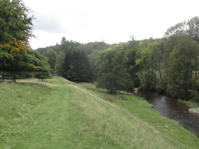
Carolsidehill Wood is a picturesque woodland located in Berwickshire, Scotland. Covering an area of approximately 50 acres, this enchanting forest is nestled between the rolling hills and provides a tranquil escape for nature enthusiasts and outdoor lovers.

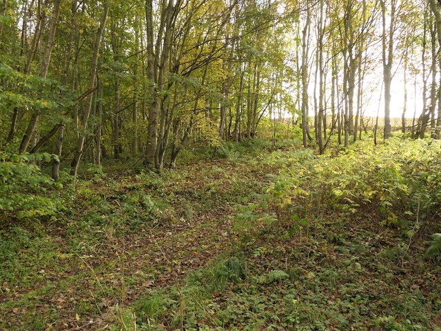
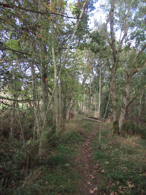
The wood is primarily composed of native broadleaf trees such as oak, beech, and birch, which create a diverse and rich ecosystem. The dense canopy of the trees creates a cool and shaded environment, perfect for exploring on hot summer days. The forest floor is adorned with a carpet of wildflowers, ferns, and mosses, adding to the natural beauty of the wood.

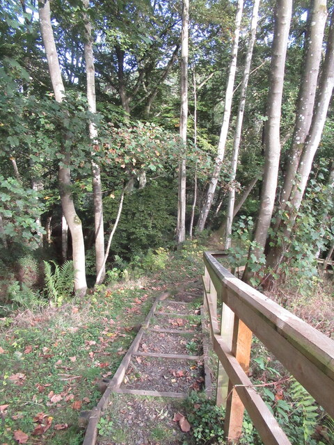
A network of well-maintained footpaths meanders through Carolsidehill Wood, allowing visitors to navigate easily and explore its hidden corners. These paths offer opportunities for leisurely strolls, jogging, and even mountain biking. The wood is also home to a variety of wildlife, including red squirrels, roe deer, and a myriad of bird species, making it a popular spot for birdwatching and wildlife photography.

In addition to its natural beauty, Carolsidehill Wood has historical significance. The remains of an Iron Age fort can be found within its boundaries, adding an extra layer of interest for history enthusiasts.

Overall, Carolsidehill Wood offers a serene and idyllic setting where visitors can immerse themselves in nature, take in the sights and sounds of the forest, and appreciate the beauty of this remarkable woodland in Berwickshire.

If you have any feedback on the listing, please let us know in the comments section below.

Carolsidehill Wood Images

Images are sourced within 2km of 55.651293/-2.690206 or Grid Reference NT5639. Thanks to Geograph Open Source API. All images are credited.
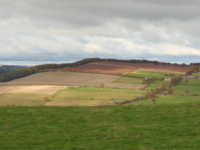
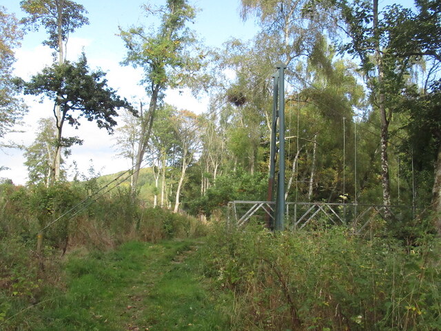
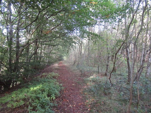
Woodland, Chapel on Leader Above a layby on the A86. Very green for November due to the very warm Autumn.
Woodland, Chapel on Leader
Above a layby on the A86. Very green for November due to the very warm Autumn.
Ploughed fields, Huntshaw Hill View from the summit of White Hill, over an hidden Earlston to arable land to the north.
Ploughed fields, Huntshaw Hill
View from the summit of White Hill, over an hidden Earlston to arable land to the north.
Waymarked path, Carolside About to descend steeply to a suspension bridge.
Waymarked path, Carolside
About to descend steeply to a suspension bridge.
Steps, Carolside A steep descent to the river and a suspension bridge on a well maintained path.
Steps, Carolside
A steep descent to the river and a suspension bridge on a well maintained path.
Suspension bridge, Carolside Built as part of a path network around Earlston.
Suspension bridge, Carolside
Built as part of a path network around Earlston.
Path and suspension bridge, Carolside
Young Covert
Young Covert
Suspension bridge, Carolside Built c.2004 as part of a local path network.
Suspension bridge, Carolside
Built c.2004 as part of a local path network.
Remember to shut the gate A gate has outlived a fence.
Remember to shut the gate
A gate has outlived a fence.
Leader Water, Carolside View from an oak bench overlooking the river.
Leader Water, Carolside
View from an oak bench overlooking the river.
Path above the Leader Water Climbing towards the A68.
Path above the Leader Water
Climbing towards the A68.
A68 north of Earlston It is possible to walk inside the Armco, which is a comfort.
A68 north of Earlston
It is possible to walk inside the Armco, which is a comfort.
Track across Legerwood Hill Heading 4km southeast from Birkenside to the Gordon-Earlston road [A6109]. A lot of timber cutting has been carried out, with piles of cut timber, waiting to be taken away, and huge piles of the rest of the woodland heaped up along the side of the track, the like of which I have not encountered before.
Track across Legerwood Hill
Heading 4km southeast from Birkenside to the Gordon-Earlston road [A6109]. A lot of timber cutting has been carried out, with piles of cut timber, waiting to be taken away, and huge piles of the rest of the woodland heaped up along the side of the track, the like of which I have not encountered before.
Heathery Poultry Farm In woodland, on the southwest slope of Legerwood Hill
Heathery Poultry Farm
In woodland, on the southwest slope of Legerwood Hill
Track to Birkenside With trackside Beeches and remains of forestry and a surviving Birch wood.
Track to Birkenside
With trackside Beeches and remains of forestry and a surviving Birch wood.
Track between Birkenside  and Morriston With the remains of forestry operations - one of several large dumps of bits of tree by the track-side along the road.
Track between Birkenside and Morriston
With the remains of forestry operations - one of several large dumps of bits of tree by the track-side along the road.
Track between Birkenside and Morriston With the remains of forestry operations - two of several large dumps of bits of tree by the track-side along the track.
Track between Birkenside and Morriston
With the remains of forestry operations - two of several large dumps of bits of tree by the track-side along the track.
Kedzlie Farm entrance With decorative gate pillars, and a small rookery in the trees above.
Kedzlie Farm entrance
With decorative gate pillars, and a small rookery in the trees above.
Show me another place!

Carolsidehill Wood is located at Grid Ref: NT5639 (Lat: 55.651293, Lng: -2.690206)

Unitary Authority: The Scottish Borders

Police Authority: The Lothians and Scottish Borders

What 3 Words

///shiny.differ.annual. Near Earlston, Scottish Borders

Related Wikis

Carolside, Scottish Borders

Carolside is an estate by the Leader Water, in the Scottish Borders. It is located one mile (1.6 km) north of Earlston, in the former county of Berwickshire...

A6105 road

The A6105 road is an A road in the Scottish Borders, Scotland and Northumberland, England. It runs from the village of Earlston to Berwick on Tweed going...

Earlston

Earlston (Scots: Yerlston; Scottish Gaelic: Dùn Airchill) is a civil parish and market town in the county of Berwickshire, within the Scottish Borders...

Rhymer's Tower

Rhymer's Tower, also known as Earlston Castle, is located near the village of Earlston, Scottish Borders, Scotland. The castle was the caput baroniae of...

Earlston railway station

Earlston railway station, in the Scottish Borders village of Earlston, was a station on the now disused Berwickshire Railway.There were two platforms...

Birkenside, Scottish Borders

Birkenside is a village in the Scottish Borders, Scotland.

Earlston High School

Earlston High School is a secondary school in Earlston, Scottish Borders. It serves Earlston, as well as the surrounding area. Since 2009, the school has...

Legerwood

Legerwood is a village by the Eden Water, in the Scottish Borders area of Scotland, near Lauder, near the Southern Upland Way. Legerwood Kirk is outside...

Nearby Amenities

Located within 500m of 55.651293,-2.690206
Bus Stop
Carolside
Bench: no
Bus: yes
Departures Board: no
Lit: no
Local Ref: opp
Naptan AtcoCode: 69001677
Naptan Bearing: S
Naptan CommonName: Carolside
Naptan Indicator: opp
Naptan Landmark: Carolside
Naptan NaptanCode: 72798934
Naptan Street: A68
Naptan Verified: yes
Public Transport: platform
Ref: 69001677
Shelter: no
Source: local knowledge;survey;NaPTAN
Lat/Long: 55.6480368/-2.691175
Bus Stop
Carolside
Bench: no
Bus: yes
Departures Board: no
Lit: no
Local Ref: at
Naptan AtcoCode: 69001678
Naptan Bearing: N
Naptan CommonName: Carolside
Naptan Indicator: at
Naptan Landmark: Carolside
Naptan NaptanCode: 72798935
Naptan Street: A68
Naptan Verified: yes
Public Transport: platform
Ref: 69001678
Shelter: no
Source: local knowledge;survey;NaPTAN
Lat/Long: 55.6484022/-2.6914665
Huntshaw Hill
Ele: 247
Natural: peak
Lat/Long: 55.6519051/-2.6876342
Carolside
Place: isolated_dwelling
Wikidata: Q5045291
Wikipedia: en:Carolside, Scottish Borders
Lat/Long: 55.6504415/-2.6963319
Carolside
Place: hamlet
Lat/Long: 55.6528679/-2.6957756
Carolside Gardens
Opening Hours: Jul: We,Fr,Su
Tourism: attraction
Lat/Long: 55.651529/-2.6973082
Power: pole
Lat/Long: 55.6529546/-2.6969198
Power: pole
Lat/Long: 55.652602/-2.6970195
Power: pole
Lat/Long: 55.652246/-2.6973587
The data included in this document is from www.openstreetmap.org. The data is made available under ODbL.

Have you been to Carolsidehill Wood?

Leave your review of Carolsidehill Wood below (or comments, questions and feedback).