Cairncortie Wood

Wood, Forest in Angus

Scotland

Cairncortie Wood

Minor road approaching the B961 at Newtonbank Looking eastward.
Minor road approaching the B961 at Newtonbank Credit: Peter Wood

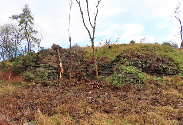
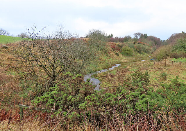
Cairncortie Wood, located in Angus, Scotland, is a picturesque forest that covers an area of approximately 200 hectares. This woodland is nestled in the rolling hills of the Angus Glens, offering visitors a serene and tranquil environment. The forest is predominantly composed of native broadleaf trees, including oak, birch, and rowan, which create a diverse and vibrant ecosystem.

The woodland boasts an extensive network of well-maintained walking trails, making it a popular destination for hikers, nature enthusiasts, and families. The paths wind through the forest, providing breathtaking views of the surrounding countryside and glimpses of local wildlife, such as red squirrels, deer, and various bird species.

Cairncortie Wood is also home to a rich variety of flora, with carpets of bluebells and wild garlic covering the forest floor during the spring months. The woodlands provide a habitat for numerous plant species, including wood sorrel, wood anemone, and primrose.

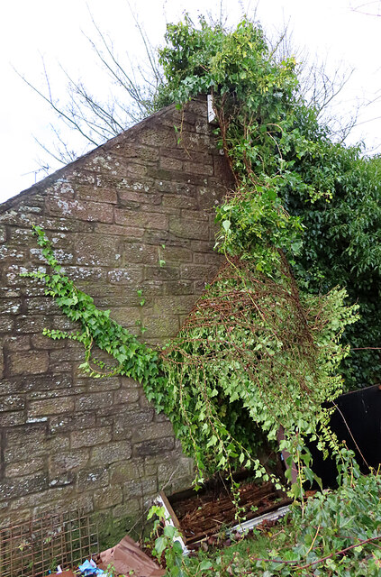
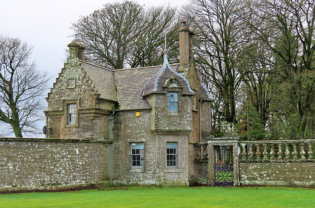
In addition to its natural beauty, the forest has historical significance. The ruins of Cairncortie Castle, a 16th-century tower house, can be found within the woodland, offering visitors a glimpse into the region's past.

Access to Cairncortie Wood is free, and there is ample parking available. The forest is open year-round, with each season offering its own unique charm. Whether it is a leisurely stroll, a picnic, or a more challenging hike, Cairncortie Wood provides a peaceful retreat for those seeking to immerse themselves in nature's beauty.

If you have any feedback on the listing, please let us know in the comments section below.

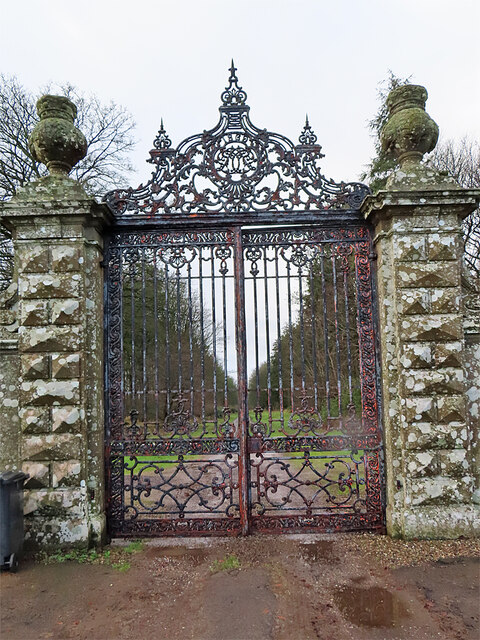
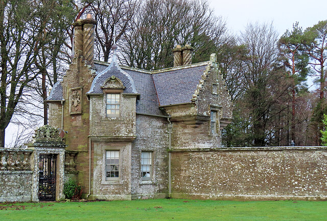
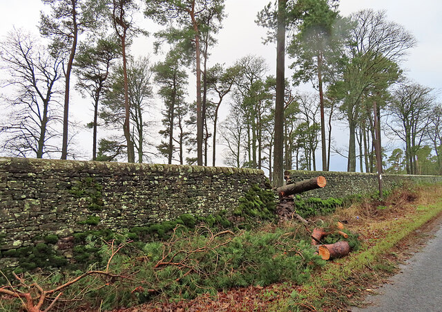
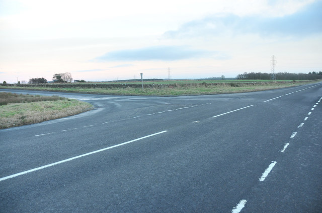
Cairncortie Wood Images

Images are sourced within 2km of 56.554246/-2.7368497 or Grid Reference NO5440. Thanks to Geograph Open Source API. All images are credited.

Minor road approaching the B961 at Newtonbank Looking eastward.
Minor road approaching the B961 at Newtonbank
Looking eastward.
Rocky Outcrop Most of the land around here is covered by a blanket of glacial deposits, but this outcrop has been exposed by the action of the Crombie Burn, which has carved out the nearby Crombie Den. The strata are mudstones and siltstones of the Dundee Flagstone Formation, formed about 400 million years ago.
Rocky Outcrop
Most of the land around here is covered by a blanket of glacial deposits, but this outcrop has been exposed by the action of the Crombie Burn, which has carved out the nearby Crombie Den. The strata are mudstones and siltstones of the Dundee Flagstone Formation, formed about 400 million years ago.
Crombie Den A den is a valley, usually but not always steep-sided, carved into relatively soft rock by the action of a small watercourse. They are very common in Old Red Sandstone areas like this. This is looking downstream from the road bridge.
Crombie Den
A den is a valley, usually but not always steep-sided, carved into relatively soft rock by the action of a small watercourse. They are very common in Old Red Sandstone areas like this. This is looking downstream from the road bridge.
Crombie Den A den is a valley, usually but not always steep-sided, carved into relatively soft rock by the action of a small watercourse. They are very common in Old Red Sandstone areas like this. This is looking upstream from the road bridge.
Crombie Den
A den is a valley, usually but not always steep-sided, carved into relatively soft rock by the action of a small watercourse. They are very common in Old Red Sandstone areas like this. This is looking upstream from the road bridge.
Peeling Ivy I presume that it was recent stormy winds that have peeled most of the ivy off the gable of this building.
Peeling Ivy
I presume that it was recent stormy winds that have peeled most of the ivy off the gable of this building.
Crombie Den A den is a valley, usually but not always steep-sided, carved into relatively soft rock by the action of a small watercourse. They are very common in Old Red Sandstone areas like this.
Crombie Den
A den is a valley, usually but not always steep-sided, carved into relatively soft rock by the action of a small watercourse. They are very common in Old Red Sandstone areas like this.
Drainage Ditch The ditch drains the south-eastern corner of Crombie Country Park into the Crombie Burn.
Drainage Ditch
The ditch drains the south-eastern corner of Crombie Country Park into the Crombie Burn.
Woodland Path This is one of the minor paths in Crombie Country Park. The mossy dykes are the parapets of a bridge over a drainage channel.
Woodland Path
This is one of the minor paths in Crombie Country Park. The mossy dykes are the parapets of a bridge over a drainage channel.
Panmure East Gate Lodge South This is the more southerly of a mirror-image pair of gate lodges at the entrance to the main drive to Panmure House. The two lodges and the gate between them are Category B Listed. They were designed by David Bryce and erected in 1852.
Panmure East Gate Lodge South
This is the more southerly of a mirror-image pair of gate lodges at the entrance to the main drive to Panmure House. The two lodges and the gate between them are Category B Listed. They were designed by David Bryce and erected in 1852.
Panmure House East Gate The gate stands between a pair of mirror-image gate lodges at the east entrance to Panmure House. The two lodges and the gate between them are Category B Listed. They were designed by David Bryce and erected in 1852.
Panmure House East Gate
The gate stands between a pair of mirror-image gate lodges at the east entrance to Panmure House. The two lodges and the gate between them are Category B Listed. They were designed by David Bryce and erected in 1852.
Panmure East Gate Lodge North This is the more northerly of a mirror-image pair of gate lodges at the entrance to the main drive to Panmure House. The two lodges and the gate between them are Category B Listed. They were designed by David Bryce and erected in 1852.
Panmure East Gate Lodge North
This is the more northerly of a mirror-image pair of gate lodges at the entrance to the main drive to Panmure House. The two lodges and the gate between them are Category B Listed. They were designed by David Bryce and erected in 1852.
Breach in the Dyke A recently fallen tree has caused the dyke surrounding the policies of Panmure House to be breached.
Breach in the Dyke
A recently fallen tree has caused the dyke surrounding the policies of Panmure House to be breached.
Clear Fell at Clearie Woods A forest harvesting machine stands beside a recently felled block of forest.
Clear Fell at Clearie Woods
A forest harvesting machine stands beside a recently felled block of forest.
Clear Fell at Clearie Woods A temporary scene of devastation, until the vegetation regenerates where the forest has been felled.
Clear Fell at Clearie Woods
A temporary scene of devastation, until the vegetation regenerates where the forest has been felled.
Road junction near Crombie Mill
B961 near Montquhir
B961 near Montquhir
B9127 near Carmyllie
Drainage stream near Carmyllie
Show me another place!

Cairncortie Wood is located at Grid Ref: NO5440 (Lat: 56.554246, Lng: -2.7368497)

Unitary Authority: Angus

Police Authority: Tayside

What 3 Words

///theory.lime.give. Near Carnoustie, Angus

Nearby Locations

Cairncortie Wood

Related Wikis

Carnegie Castle

Carnegie Castle was a castle that was located in Angus, Scotland. The Carnegies owned the property between the 15th-18th century. The site of the castle...

Carmyllie

Carmyllie (Gaelic: Càrn Mhoillidh) is a rural parish in Angus, Scotland. It is situated on high ground between Arbroath, on the coast, and the inland county...
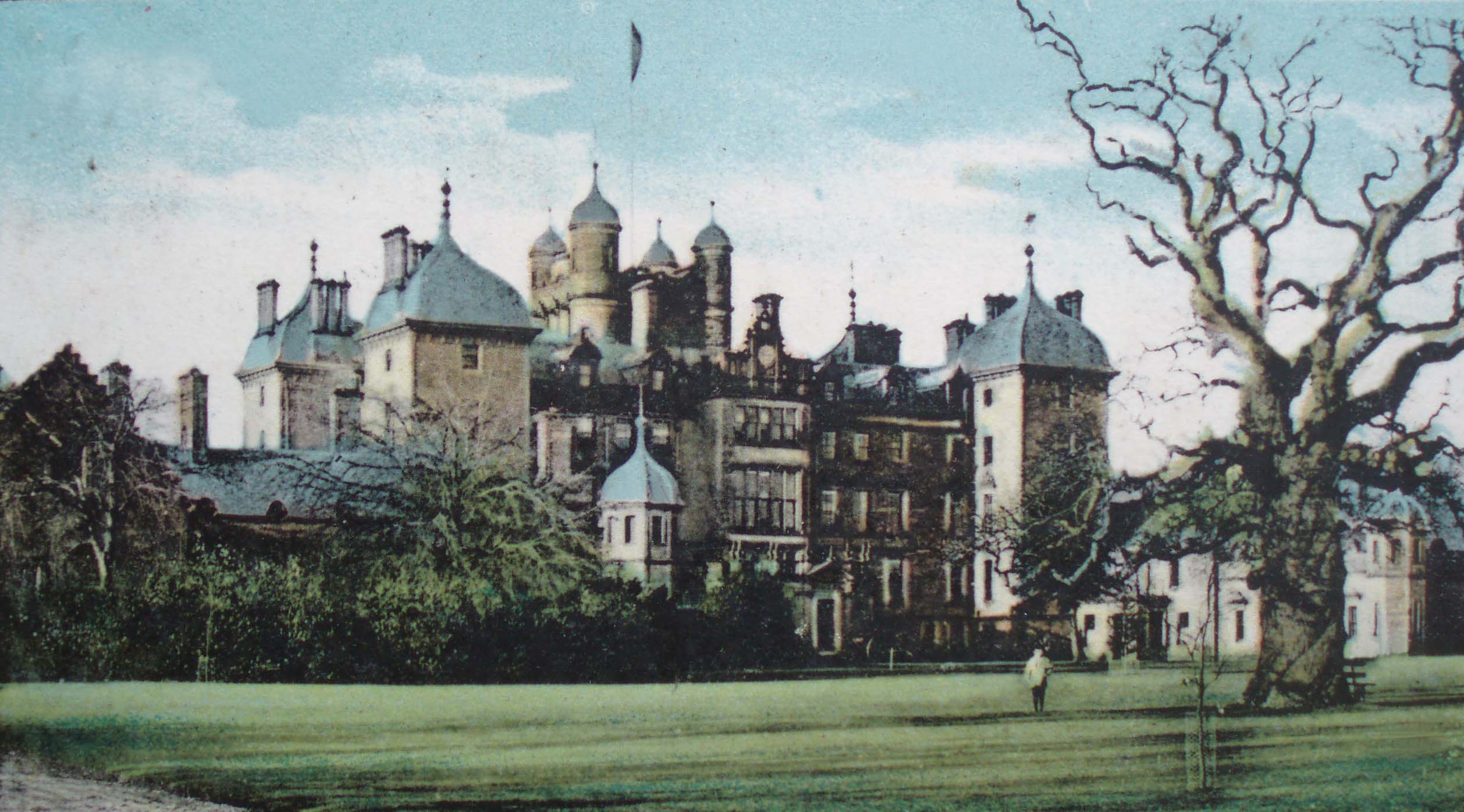
Panmure House

Panmure House was a 17th-century country house in the Parish of Panbride, Angus, Scotland, 4 miles (6 km) to the north of Carnoustie. It was the seat of...
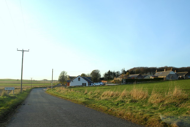
Greystone, Angus

Greystone is a hamlet in Angus, Scotland. It lies between the towns of Carnoustie and Forfar in the parish of Carmyllie. == References ==

Nearby Amenities

Located within 500m of 56.554246,-2.7368497
Design: barrel
Power: tower
Lat/Long: 56.5561707/-2.7354112
Design: barrel
Power: tower
Lat/Long: 56.5544434/-2.7437771
Design: barrel
Power: tower
Lat/Long: 56.5553089/-2.7395681
Design: barrel
Power: tower
Lat/Long: 56.5569036/-2.7305044
Cairncortie
Place: isolated_dwelling
Lat/Long: 56.5528941/-2.7410825
Power: pole
Lat/Long: 56.5517035/-2.7385267
Power: pole
Lat/Long: 56.5519931/-2.7390391
Power: pole
Lat/Long: 56.5522922/-2.7395968
Power: pole
Lat/Long: 56.5525877/-2.7401265
Power: pole
Lat/Long: 56.55282/-2.7405459
Power: pole
Lat/Long: 56.5530655/-2.7418863
Power: pole
Lat/Long: 56.5535409/-2.7427749
Power: pole
Lat/Long: 56.5539067/-2.7434451
The data included in this document is from www.openstreetmap.org. The data is made available under ODbL.

Have you been to Cairncortie Wood?

Leave your review of Cairncortie Wood below (or comments, questions and feedback).