Chapel o' Cross Plantation

Wood, Forest in Roxburghshire

Scotland

Chapel o' Cross Plantation

A minor road near Earlside Farm This is looking northeast up the minor road between the B6399 Hawick to Newcastleton road and the A6088 Hawick to Bonchester Bridge road. Farm traffic has caused the muddy conditions in the foreground.
A minor road near Earlside Farm Credit: Walter Baxter

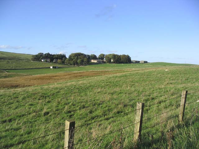
Chapel o' Cross Plantation is a stunning woodland located in Roxburghshire, Scotland. Spanning over a vast area, this plantation is renowned for its natural beauty and rich biodiversity. The woodland is situated near the village of Wood and is easily accessible, making it a popular destination for nature lovers and outdoor enthusiasts.

The plantation is characterized by its dense forest cover, primarily consisting of native tree species such as oak, birch, and beech. These tall and majestic trees create a striking canopy that provides shade and shelter to a variety of flora and fauna. The forest floor is lined with a carpet of wildflowers, including bluebells and primroses, adding charm and color to the landscape during the spring season.

Chapel o' Cross Plantation is home to a diverse range of wildlife, making it an ideal spot for birdwatching and animal spotting. Visitors may have the chance to spot different bird species, such as woodpeckers, thrushes, and owls, as well as mammals like red squirrels, deer, and badgers. The plantation is also known for its rich insect life, with butterflies, bees, and beetles being commonly observed.

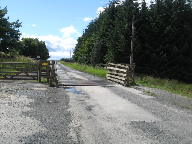
In addition to its natural beauty, the plantation offers various walking trails and paths that allow visitors to explore the woodland at their own pace. These well-maintained trails offer stunning views of the surrounding countryside and provide opportunities for peaceful walks and picnics amidst nature.

Overall, Chapel o' Cross Plantation is a true gem, offering a tranquil escape from the hustle and bustle of everyday life. Whether it's for a leisurely stroll, wildlife observation, or simply to enjoy the serenity of nature, this woodland plantation promises an unforgettable experience for all nature enthusiasts.

If you have any feedback on the listing, please let us know in the comments section below.

Chapel o' Cross Plantation Images

Images are sourced within 2km of 55.387252/-2.7150214 or Grid Reference NT5410. Thanks to Geograph Open Source API. All images are credited.

A minor road near Earlside Farm This is looking northeast up the minor road between the B6399 Hawick to Newcastleton road and the A6088 Hawick to Bonchester Bridge road. Farm traffic has caused the muddy conditions in the foreground.
A minor road near Earlside Farm
This is looking northeast up the minor road between the B6399 Hawick to Newcastleton road and the A6088 Hawick to Bonchester Bridge road. Farm traffic has caused the muddy conditions in the foreground.
Road signs near Earlside Farm The lower sign is a warning to motorists to watch out for sheep straying onto the road from open grazing areas. For a full view of the signs by the road, see <a href="https://www.geograph.org.uk/photo/2341162">NT5409 : A minor road near Earlside Farm</a>.
Road signs near Earlside Farm
The lower sign is a warning to motorists to watch out for sheep straying onto the road from open grazing areas. For a full view of the signs by the road, see NT5409 : A minor road near Earlside Farm.
Cattle grid on the road near Earlside in Roxburghshire
Houses at Earlside Below White Hill in Roxburghshire.
Houses at Earlside
Below White Hill in Roxburghshire.
Earlside Farm
Earlside Farm
Minor road near Earlside
Triangulation pillar on Hawthornside Hill Sited at 287 metres above sea level, it is reached by an easy walk from the nearby minor road.  The vista is extensive; the Eildon Hills can be noted in the distance, right of shot.

This photograph was taken during the Coronavirus (COVID-19) pandemic of 2020/21/22.
Triangulation pillar on Hawthornside Hill
Sited at 287 metres above sea level, it is reached by an easy walk from the nearby minor road. The vista is extensive; the Eildon Hills can be noted in the distance, right of shot. This photograph was taken during the Coronavirus (COVID-19) pandemic of 2020/21/22.
Three HF/DF tower bases at the former Hawthornside Radio Station The remains of three HF/DF tower bases can be noted at Hawthornside Hill, the demolished example in the foreground together with two others to the left and right of shot in the distance.  Hawthornside Hill triangulation pillar can be noted to the far left of this image.

This photograph was taken during the Coronavirus (COVID-19) pandemic of 2020/21/22.
Three HF/DF tower bases at the former Hawthornside Radio Station
The remains of three HF/DF tower bases can be noted at Hawthornside Hill, the demolished example in the foreground together with two others to the left and right of shot in the distance. Hawthornside Hill triangulation pillar can be noted to the far left of this image. This photograph was taken during the Coronavirus (COVID-19) pandemic of 2020/21/22.
Standing HF/DF tower bases at Hawthornside Hill A view of the two standing HF/DF tower bases at the Hawthornside Hill site.  The base in the foreground is in better condition.  The Eildon Hills are conspicuous in the distance.

This photograph was taken during the Coronavirus (COVID-19) pandemic of 2020/21/22.
Standing HF/DF tower bases at Hawthornside Hill
A view of the two standing HF/DF tower bases at the Hawthornside Hill site. The base in the foreground is in better condition. The Eildon Hills are conspicuous in the distance. This photograph was taken during the Coronavirus (COVID-19) pandemic of 2020/21/22.
Building remains, Hawthornside Hill Radio Station These remains are located within an area in the shape of '+' which is depicted on the 1:25k mapping and is evident in aerial photography of the site.  This appears to be a ditched enclosure, the ditch perhaps acting as a firebreak.  One of the three HF/DF tower bases can be seen left of centre in the middle distance.  Rubers Law is conspicuous to the far right of the image.

This photograph was taken during the Coronavirus (COVID-19) pandemic of 2020/21/22.
Building remains, Hawthornside Hill Radio Station
These remains are located within an area in the shape of '+' which is depicted on the 1:25k mapping and is evident in aerial photography of the site. This appears to be a ditched enclosure, the ditch perhaps acting as a firebreak. One of the three HF/DF tower bases can be seen left of centre in the middle distance. Rubers Law is conspicuous to the far right of the image. This photograph was taken during the Coronavirus (COVID-19) pandemic of 2020/21/22.
A former Hawthornside Hill Radio Station building Now serving as storage and a shelter for sheep, there is evidence that equipment was mounted on concrete blocks on the floor within this building.  There may have been other structures adjoining the far side of the building, the remnants of which, including safety glass, can be found.

This photograph was taken during the Coronavirus (COVID-19) pandemic of 2020/21/22.
A former Hawthornside Hill Radio Station building
Now serving as storage and a shelter for sheep, there is evidence that equipment was mounted on concrete blocks on the floor within this building. There may have been other structures adjoining the far side of the building, the remnants of which, including safety glass, can be found. This photograph was taken during the Coronavirus (COVID-19) pandemic of 2020/21/22.
The northernmost HF/DF tower base, Hawthornside Hill Of the two bases still standing, this one is in poorest condition, as can be discerned in this shot which displays ample evidence of dislodged brickwork.  Rubers Law is in the background to the right.

This photograph was taken during the Coronavirus (COVID-19) pandemic of 2020/21/22.
The northernmost HF/DF tower base, Hawthornside Hill
Of the two bases still standing, this one is in poorest condition, as can be discerned in this shot which displays ample evidence of dislodged brickwork. Rubers Law is in the background to the right. This photograph was taken during the Coronavirus (COVID-19) pandemic of 2020/21/22.
Within a HF/DF tower base, Hawthornside Hill Note the remaining woodwork on the far wall and the anchoring bolts in the concrete base.

This photograph was taken during the Coronavirus (COVID-19) pandemic of 2020/21/22.
Within a HF/DF tower base, Hawthornside Hill
Note the remaining woodwork on the far wall and the anchoring bolts in the concrete base. This photograph was taken during the Coronavirus (COVID-19) pandemic of 2020/21/22.
Deteriorating brickwork in the HF/DF tower base The brickwork of this base on Hawthornside Hill is rapidly deteriorating due to eight decades of bombardment by the weather at this exposed location.

This photograph was taken during the Coronavirus (COVID-19) pandemic of 2020/21/22.
Deteriorating brickwork in the HF/DF tower base
The brickwork of this base on Hawthornside Hill is rapidly deteriorating due to eight decades of bombardment by the weather at this exposed location. This photograph was taken during the Coronavirus (COVID-19) pandemic of 2020/21/22.
HF/DF tower base at Hawthornside Hill Hawthornside Hill is an exposed site overlooking the undulating Roxburghshire countryside.  Note the entrance to the base at the right side of the structure.

This photograph was taken during the Coronavirus (COVID-19) pandemic of 2020/21/22.
HF/DF tower base at Hawthornside Hill
Hawthornside Hill is an exposed site overlooking the undulating Roxburghshire countryside. Note the entrance to the base at the right side of the structure. This photograph was taken during the Coronavirus (COVID-19) pandemic of 2020/21/22.
Earlside Farm
Earlside Farm
Rough grazing near Earlside Farm
Livestock field at Howahill Farm
Show me another place!

Chapel o' Cross Plantation is located at Grid Ref: NT5410 (Lat: 55.387252, Lng: -2.7150214)

Unitary Authority: The Scottish Borders

Police Authority: The Lothians and Scottish Borders

What 3 Words

///aboard.rebounds.alongside. Near Hawick, Scottish Borders

Nearby Locations

Chapel o' Cross Plantation

Related Wikis

Kirkton, Scottish Borders

Kirkton is a village in the Scottish Borders area of Scotland, off the A6088, near Hawick. Grid Ref. NT5413. It is a former parish, amalgamated into the...

Hobkirk

Hobkirk (Scottish Gaelic: Eaglais Ruail) is a village and civil parish in the Scottish Borders area of Scotland, by the Rule Water, south-west of Jedburgh...

Bonchester Bridge

Bonchester Bridge (Scots Binster Brig) is a village in Roxburghshire, within the Scottish Borders area of Scotland, lying on the Rule Water, six miles...

Wauchope, Scottish Borders

Wauchope is a hamlet in the Scottish Borders council area of Scotland, near Southdean. Wauchope House was demolished in 1932. == See also == Wauchope Forest...

Have you been to Chapel o' Cross Plantation?

Leave your review of Chapel o' Cross Plantation below (or comments, questions and feedback).