Newcastleton Forest

Wood, Forest in Roxburghshire

Scotland

Newcastleton Forest

Tweedenhead Cottage The derelict cottage of Tweedenhead within Newcastleton Forest.There are many miles of forest tracks within the forest used by cyclists and walkers.
Tweedenhead Cottage Credit: ronnie leask

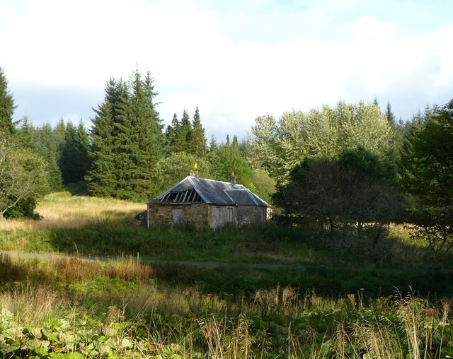
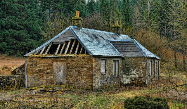
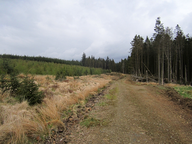
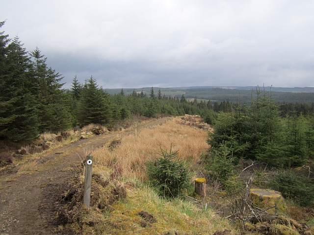
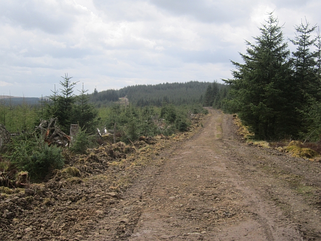
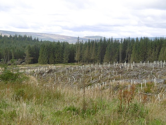
Newcastleton Forest is a picturesque woodland located in Roxburghshire, Scotland. Covering an area of approximately 1,500 hectares, it is a popular destination for nature lovers and outdoor enthusiasts. The forest is situated in the heart of the Scottish Borders, surrounded by rolling hills and breathtaking landscapes.

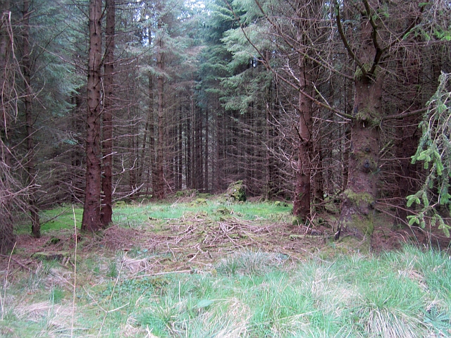
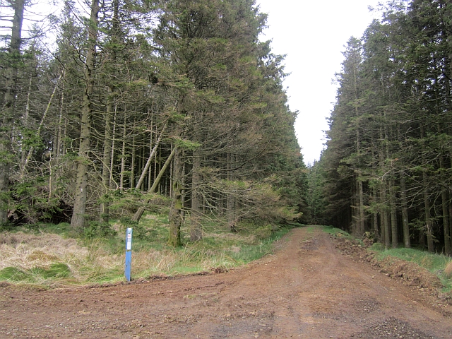
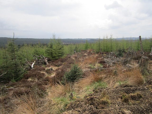
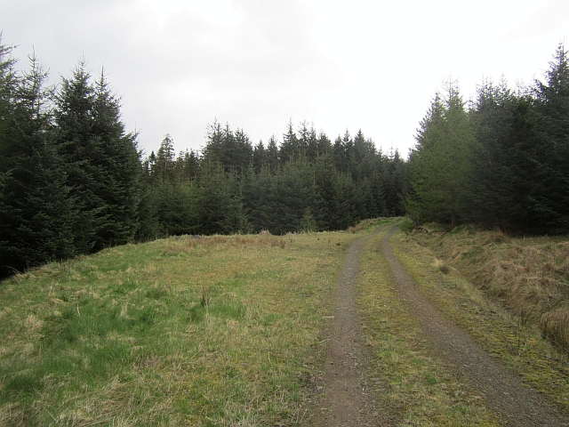
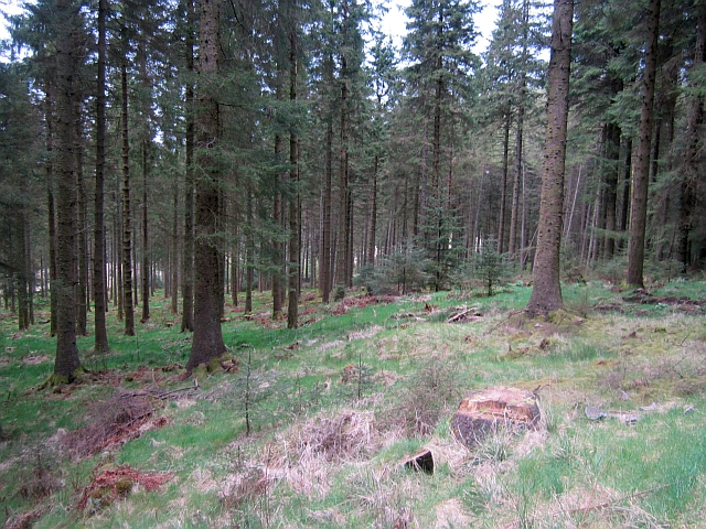
The forest is predominantly composed of coniferous trees, such as spruce and pine, with some areas featuring mixed broadleaf trees, including oak and birch. These diverse tree species create a rich and vibrant ecosystem, providing habitats for a wide range of wildlife.

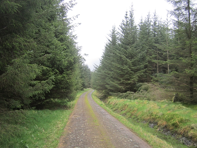
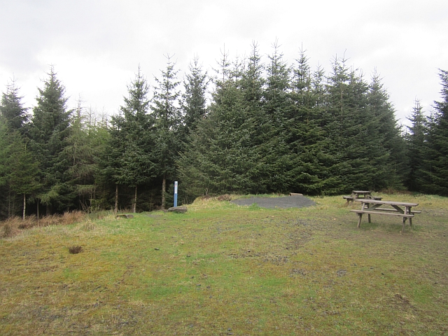
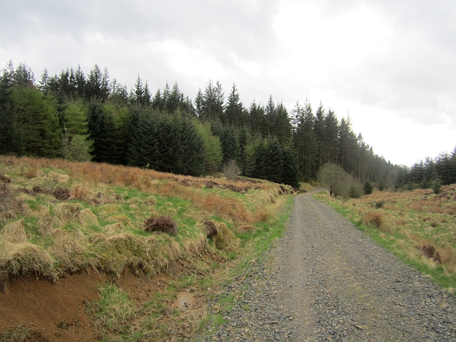
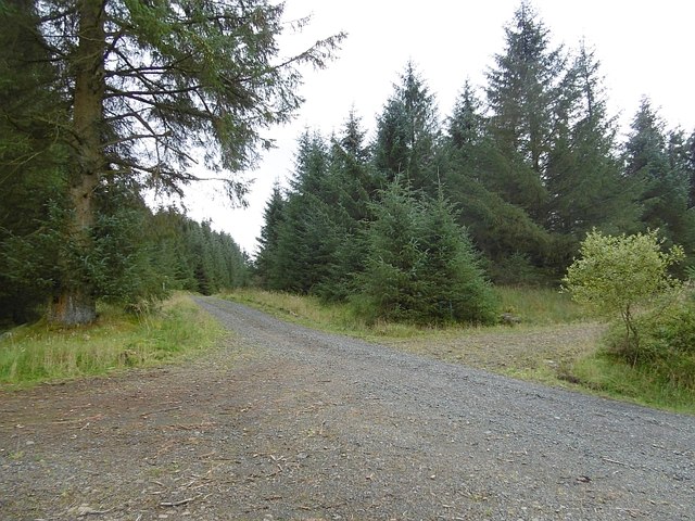
Visitors to Newcastleton Forest can explore a network of well-maintained trails that wind through the woodland. These trails cater to different abilities and interests, ranging from leisurely strolls to more challenging hikes. Along the way, visitors may encounter various wildlife species, such as red squirrels, roe deer, and a variety of bird species.

The forest also offers several recreational activities, including mountain biking, horse riding, and orienteering. Mountain biking enthusiasts can enjoy a dedicated mountain bike trail network, featuring a range of routes suitable for different skill levels. Horse riders can explore bridleways that traverse the forest, providing a unique opportunity to experience the beauty of the surroundings from horseback.

Overall, Newcastleton Forest is a haven for nature enthusiasts, offering an abundance of natural beauty, wildlife, and outdoor activities. Whether visitors seek a peaceful walk in nature or an adrenaline-filled adventure, this forest provides a memorable experience for all who explore its enchanting trails.

If you have any feedback on the listing, please let us know in the comments section below.

Newcastleton Forest Images

Images are sourced within 2km of 55.190637/-2.740804 or Grid Reference NY5288. Thanks to Geograph Open Source API. All images are credited.

Tweedenhead Cottage The derelict cottage of Tweedenhead within Newcastleton Forest.There are many miles of forest tracks within the forest used by cyclists and walkers.
Tweedenhead Cottage
The derelict cottage of Tweedenhead within Newcastleton Forest.There are many miles of forest tracks within the forest used by cyclists and walkers.
Tweedenhead Disused farmhouse at Tweedenhead in Newcastleton Forest.
Tweedenhead
Disused farmhouse at Tweedenhead in Newcastleton Forest.
Ruined stell, Newcastleton Forest A remnant from the days before the conifers. I visited part of Newcastleton Forest when it was still farmland in 1980, but the woods here were planted before that.
Ruined stell, Newcastleton Forest
A remnant from the days before the conifers. I visited part of Newcastleton Forest when it was still farmland in 1980, but the woods here were planted before that.
Logging road, Tweedenhead There is some windthrow in this part of the forest.
Logging road, Tweedenhead
There is some windthrow in this part of the forest.
Logging road, Newcastleton Forest The road runs on the northern side of the Tweeden Burn and is used for a short length by the red mountain bike route.
Logging road, Newcastleton Forest
The road runs on the northern side of the Tweeden Burn and is used for a short length by the red mountain bike route.
Logging roads, Newcastleton Forest A junction of roads undergoing regrading and resurfacing. The red mountain bike route climbs away to the left on the way to Swarf Hill and more singletrack. Straight on leads gently to Tweedhopefoot and a meeting with this road:<a href="https://www.geograph.org.uk/photo/3470212">NY5287 : Logging road, Tweedenhead</a>
Logging roads, Newcastleton Forest
A junction of roads undergoing regrading and resurfacing. The red mountain bike route climbs away to the left on the way to Swarf Hill and more singletrack. Straight on leads gently to Tweedhopefoot and a meeting with this road:NY5287 : Logging road, Tweedenhead
Swarf Trail, Newcastleton Forest The Swarf Trail waymarked walking route shares some of its length with uphill sections of the red mountain bike route. Newcastleton is quiet so the arrangement is quite reasonable. Doubt it would go down well in Glenstress though.

At the top of a modest climb there is a view of endless conifers stretching into England (with the exception of Glendhu Hill which is notoriously rough moorland.)
Swarf Trail, Newcastleton Forest
The Swarf Trail waymarked walking route shares some of its length with uphill sections of the red mountain bike route. Newcastleton is quiet so the arrangement is quite reasonable. Doubt it would go down well in Glenstress though. At the top of a modest climb there is a view of endless conifers stretching into England (with the exception of Glendhu Hill which is notoriously rough moorland.)
Young larches, Stell Hill A replanted block of Newcastleton Forest with the roots of the previous generation of trees still visible.
Young larches, Stell Hill
A replanted block of Newcastleton Forest with the roots of the previous generation of trees still visible.
Logging road, Newcastleton Forest A gentle climb on the blue mountain bike route.
Logging road, Newcastleton Forest
A gentle climb on the blue mountain bike route.
Mature conifers, Newcastleton Forest Some trees have been left to grow while most of the bank here has been felled and replanted. The hillside has many cleuchs and reentrants and is used by the blue mountain bike trail.
Mature conifers, Newcastleton Forest
Some trees have been left to grow while most of the bank here has been felled and replanted. The hillside has many cleuchs and reentrants and is used by the blue mountain bike trail.
Picnic tables, Newcastleton  Forest The end of the road slog on the blue mountain bike route. The return to Dykecrofts is mostly singletrack.
Picnic tables, Newcastleton Forest
The end of the road slog on the blue mountain bike route. The return to Dykecrofts is mostly singletrack.
Logging road, Newcastleton Forest At the foot of The Caddrouns singletrack descent on the blue route. The route uses the road before resuming as singletrack in the mature woods on the skyline.
Logging road, Newcastleton Forest
At the foot of The Caddrouns singletrack descent on the blue route. The route uses the road before resuming as singletrack in the mature woods on the skyline.
Blue route, Newcastleton A singletrack section leaves the logging road beside the Priesthill Burn. The singletrack section is named Pouter Lampert after a long abandoned farm on this hillside.
Blue route, Newcastleton
A singletrack section leaves the logging road beside the Priesthill Burn. The singletrack section is named Pouter Lampert after a long abandoned farm on this hillside.
Swarf Hill Logging road and young trees in Newcastleton Forest.
Swarf Hill
Logging road and young trees in Newcastleton Forest.
Blue route, Newcastleton Raised timber walkway on the rather fun singletrack return from Priesthill. Well worth the slog up the forest road to get to it.
Blue route, Newcastleton
Raised timber walkway on the rather fun singletrack return from Priesthill. Well worth the slog up the forest road to get to it.
Blue route, Newcastleton Towards the end of the last bit of singletrack.
Blue route, Newcastleton
Towards the end of the last bit of singletrack.
Tuley tubes, Little Hind Becks Replanted woodland in Newcastleton Forest.
Tuley tubes, Little Hind Becks
Replanted woodland in Newcastleton Forest.
Crossroads, Newcastleton Forest Road junction above Little Hind Becks.
Crossroads, Newcastleton Forest
Road junction above Little Hind Becks.
Show me another place!

Newcastleton Forest is located at Grid Ref: NY5288 (Lat: 55.190637, Lng: -2.740804)

Unitary Authority: The Scottish Borders

Police Authority: The Lothians and Scottish Borders

What 3 Words

///refuses.jolt.vouch. Near Langholm, Dumfries & Galloway

Related Wikis

Liddel Castle

Liddel Castle is a ruined castle in Liddesdale, by the Liddel Water, near Castleton in the Scottish Borders area of Scotland, in the former county of Roxburghshire...

Dinlabyre

Dinlabyre is a village on the B6357 in Liddesdale, on the edge of the Newcastleton Forest, close to Castleton, in the Scottish Borders area of Scotland...

Scottish Marches

Scottish Marches was the term used for the Anglo-Scottish border during the late medieval and early modern eras, characterised by violence and cross-border...

Steele Road railway station

Steele Road railway station served the hamlet of Steele Road, Scottish Borders, Scotland, from 1862 to 1969 on the Border Union Railway. == History... ==

Have you been to Newcastleton Forest?

Leave your review of Newcastleton Forest below (or comments, questions and feedback).