Shunters Wud

Wood, Forest in Roxburghshire

Scotland

Shunters Wud

Footbridge across the River Tweed
Footbridge across the River Tweed Credit: Les Hull

Shunters Wud is a picturesque woodland located in Roxburghshire, Scotland. Covering an area of approximately 100 acres, this enchanting forest is nestled within the beautiful countryside, offering a serene and peaceful retreat for nature lovers and outdoor enthusiasts alike.

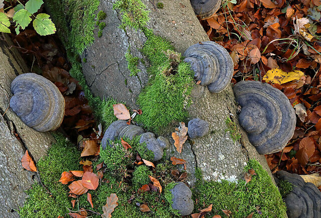
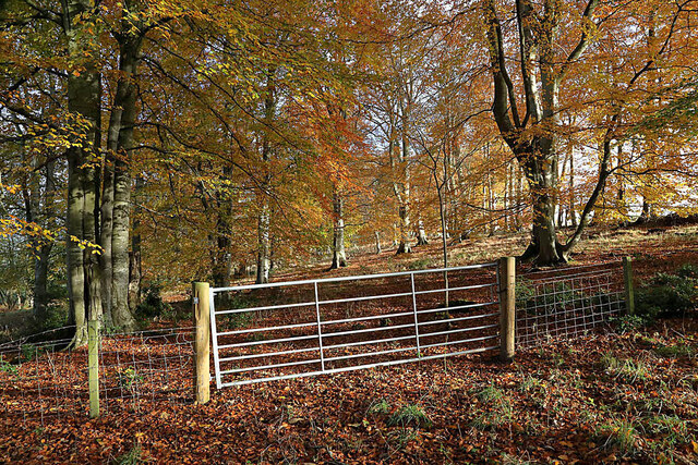
The woodland is predominantly composed of native Scottish trees such as oak, birch, and rowan, creating a diverse and vibrant ecosystem. The dense canopy provides a sheltered habitat for a variety of wildlife, including red squirrels, roe deer, and a multitude of bird species.

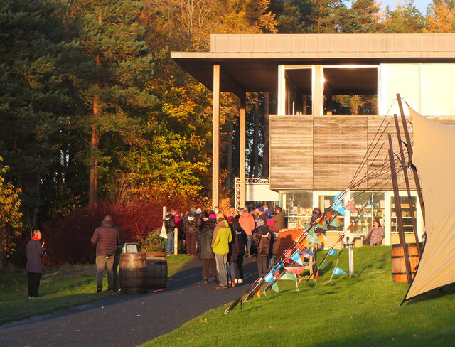
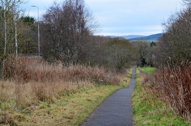
Shunters Wud is crisscrossed with a network of well-maintained footpaths, allowing visitors to explore the area and immerse themselves in its natural beauty. The trails wind through the woodland, meandering alongside babbling brooks and meadows adorned with wildflowers. The tranquil atmosphere makes it an ideal spot for leisurely walks, birdwatching, or simply enjoying a picnic surrounded by nature.

In addition to its natural charm, Shunters Wud also boasts historical significance. The forest is believed to have ancient origins, with remnants of prehistoric settlements and burial cairns scattered throughout the area. These archaeological features add an intriguing layer of interest for those fascinated by the region's history.

Shunters Wud is easily accessible by car, with ample parking available nearby. The woodland is open to the public year-round and is managed by the local authorities, ensuring its preservation for future generations to enjoy. Whether seeking tranquility, wildlife encounters, or a glimpse into Scotland's past, Shunters Wud offers a truly captivating experience for all who venture into its leafy embrace.

If you have any feedback on the listing, please let us know in the comments section below.
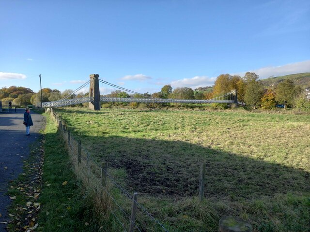
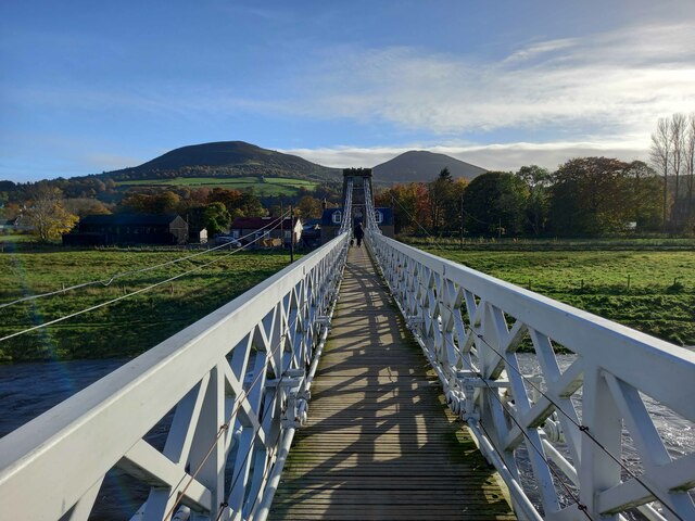
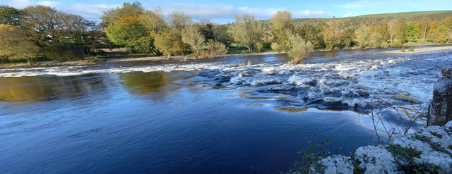
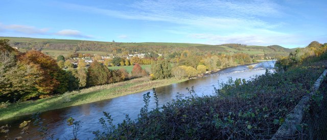
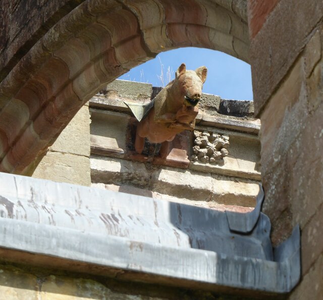
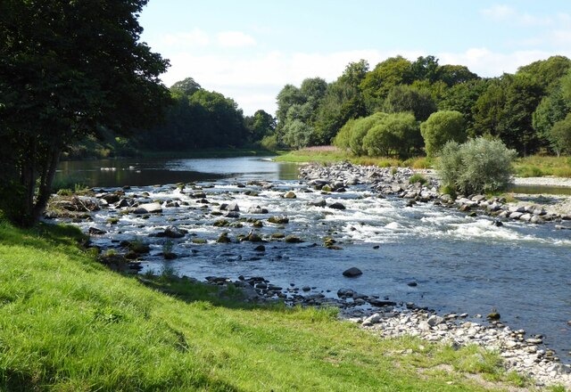
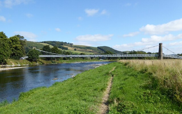
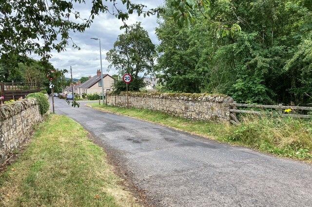
Shunters Wud Images

Images are sourced within 2km of 55.601926/-2.7484904 or Grid Reference NT5234. Thanks to Geograph Open Source API. All images are credited.

Footbridge across the River Tweed
Footbridge across the River Tweed Eildon Hill in the background
Footbridge across the River Tweed
Eildon Hill in the background
River Tweed at Melrose Site of a weir which I think might have  been damaged.
River Tweed at Melrose
Site of a weir which I think might have been damaged.
View of River Tweed Village of Gattonside and distant hills.
View of River Tweed
Village of Gattonside and distant hills.
Melrose Rugby Union Ground
Melrose Abbey Pig playing a bagpipe, as a gargoyle, viewed under a flying buttress.
Melrose Abbey
Pig playing a bagpipe, as a gargoyle, viewed under a flying buttress.
Derelict weir on River Tweed A lade, just to the left of the image, carried water to the abbey some 500 m to the east.
Derelict weir on River Tweed
A lade, just to the left of the image, carried water to the abbey some 500 m to the east.
Melrose, Gattonside Suspension Footbridge Tolls had to be paid to cross the new bridge over the River Tweed, which joined the communities of Melrose and Gattonside. Constructed in 1826, it is a footbridge with iron-link suspension chains, iron rods as vertical suspenders and a wooden deck.
Melrose, Gattonside Suspension Footbridge
Tolls had to be paid to cross the new bridge over the River Tweed, which joined the communities of Melrose and Gattonside. Constructed in 1826, it is a footbridge with iron-link suspension chains, iron rods as vertical suspenders and a wooden deck.
Tweedbank station An aerial view over Tweedbank station looking towards Melrose.

Forms part of Railway Routes Blogpost <span class="nowrap"><a title="https://tinyurl.com/e94tw557" rel="nofollow ugc noopener" href="https://tinyurl.com/e94tw557">Link</a><img style="margin-left:2px;" alt="External link" title="External link - shift click to open in new window" src="https://s1.geograph.org.uk/img/external.png" width="10" height="10"/></span>
Tweedbank station
An aerial view over Tweedbank station looking towards Melrose. Forms part of Railway Routes Blogpost LinkExternal link
Tweedbank station Aerial view of Tweedbank station which forms part of "Railway Routes" BlogPost <span class="nowrap"><a title="https://tinyurl.com/e94tw557" rel="nofollow ugc noopener" href="https://tinyurl.com/e94tw557">Link</a><img style="margin-left:2px;" alt="External link" title="External link - shift click to open in new window" src="https://s1.geograph.org.uk/img/external.png" width="10" height="10"/></span>
Tweedbank station
Aerial view of Tweedbank station which forms part of "Railway Routes" BlogPost LinkExternal link
Broomilees Road. Infilled Railway cutting At this point was an over bridge on the Waverley Line, now infilled.


<span class="nowrap"><a title="https://tinyurl.com/e94tw557" rel="nofollow ugc noopener" href="https://tinyurl.com/e94tw557">Link</a><img style="margin-left:2px;" alt="External link" title="External link - shift click to open in new window" src="https://s1.geograph.org.uk/img/external.png" width="10" height="10"/></span>
Broomilees Road. Infilled Railway cutting
At this point was an over bridge on the Waverley Line, now infilled. LinkExternal link
Borders Book Festival 2021, Abbotsford Normally the Borders Book Festival is held in early summer at Harmony House, Melrose. The 2020 event was cancelled due to the Covid-19 pandemic, but this year's festival took place between 2nd and 7th November in the grounds of Abbotsford House.
Borders Book Festival 2021, Abbotsford
Normally the Borders Book Festival is held in early summer at Harmony House, Melrose. The 2020 event was cancelled due to the Covid-19 pandemic, but this year's festival took place between 2nd and 7th November in the grounds of Abbotsford House.
Borders Book Festival 2021, Abbotsford (3) Queueing at the visitor centre before entrance to the marquee to hear Hilary Mantel, winner of the 2021 Walter Scott Prize for historical fiction, for her novel 'The Mirror and the Light'.
Borders Book Festival 2021, Abbotsford (3)
Queueing at the visitor centre before entrance to the marquee to hear Hilary Mantel, winner of the 2021 Walter Scott Prize for historical fiction, for her novel 'The Mirror and the Light'.
Feeding time for hungry cows The cows posed briefly for the camera as I walked past a cattle shed by the minor road to Kaeside Farm.
Feeding time for hungry cows
The cows posed briefly for the camera as I walked past a cattle shed by the minor road to Kaeside Farm.
Hoof fungus (Fomes fomentarius) This grey bracket fungus was growing on a fallen beech tree in Broomyknowe Plantation.
Hoof fungus (Fomes fomentarius)
This grey bracket fungus was growing on a fallen beech tree in Broomyknowe Plantation.
A gateway to a beech wood Most of the trees in Broomyknowe Plantation are beech.
A gateway to a beech wood
Most of the trees in Broomyknowe Plantation are beech.
Cyclepath alongside Melrose By-Pass A path by the A6091 east of the Borders General Hospital.
Cyclepath alongside Melrose By-Pass
A path by the A6091 east of the Borders General Hospital.
Underpass near Borders General Hospital The underpass carries the Dingleton road and the Huntly Burn below the A6091 Melrose By-Pass.
Underpass near Borders General Hospital
The underpass carries the Dingleton road and the Huntly Burn below the A6091 Melrose By-Pass.
Show me another place!

Shunters Wud is located at Grid Ref: NT5234 (Lat: 55.601926, Lng: -2.7484904)

Unitary Authority: The Scottish Borders

Police Authority: The Lothians and Scottish Borders

What 3 Words

///crust.machine.commander. Near Tweedbank, Scottish Borders

Related Wikis

Darnick

Darnick is a village near Melrose in the Scottish Borders area of Scotland, in the former Roxburghshire. The name was first recorded in 1124, and has changed...

Tweedbank railway station

Tweedbank is a railway station on the Borders Railway, which runs between Edinburgh Waverley and Tweedbank. The station, situated 35 miles 34 chains (57...

Borders General Hospital

Borders General Hospital (BGH) is a district general hospital on the outskirts of Melrose, Scotland. It is managed by NHS Borders. == History == The hospital...

Tweedbank

Tweedbank is a large village south-east of Galashiels in the Scottish Borders, Scotland. It is part of the county of Roxburghshire. It is an outer suburb...

Melrose, Scottish Borders

Melrose (Scottish Gaelic: Maolros, "bald moor") is a town and civil parish in the Scottish Borders, historically in Roxburghshire. It lies within the Eildon...

St. Mary's School, Melrose

St. Mary's School is a private, co-educational, day and boarding prep school in Melrose, Scotland. As of 2015 there are 190 pupils; 97 boys and 93 girls...

Gattonside

Gattonside is a small village in the Scottish Borders. It is located 1 kilometre (0.62 mi) north of Melrose, on the north side of the River Tweed. In 1143...

Greenyards

The Greenyards is a sports ground in Melrose, Scottish Borders. It has been the home of Melrose RFC for rugby union matches and the annual Melrose Sevens...

Nearby Amenities

Located within 500m of 55.601926,-2.7484904
Traffic Signals
Source: survey
Lat/Long: 55.6046328/-2.7504744
Traffic Signals
Source: survey
Lat/Long: 55.6054222/-2.7495111
Bus Stop
Gattonside Toll
Bench: no
Bin: no
Bus: yes
Departures Board: no
Lit: no
Local Ref: adj
Naptan AtcoCode: 6900225
Naptan Bearing: NW
Naptan CommonName: Toll
Naptan Indicator: adj
Naptan Landmark: Lowood Bridge
Naptan NaptanCode: 72723897
Naptan Street: B6374
Naptan Verified: yes
Public Transport: platform
Ref: 6900225
Shelter: no
Source: local knowledge;survey;NaPTAN
Tactile Paving: no
Lat/Long: 55.6061425/-2.7500791
Bus Stop
Lowood Nurseries Road End
Bench: no
Bus: yes
Departures Board: no
Lit: no
Local Ref: opp
Naptan AtcoCode: 6900634
Naptan Bearing: E
Naptan CommonName: Lowood Nurseries Rd End
Naptan Indicator: opp
Naptan Landmark: Lowood Bridge
Naptan NaptanCode: 72723868
Naptan Street: B6374
Naptan Verified: yes
Note: No bus stop sign
Public Transport: platform
Ref: 6900634
Shelter: no
Source: local knowledge;survey;NaPTAN
Lat/Long: 55.6039937/-2.7484243
Bus Stop
Lowood Nurseries Rd End
Bench: no
Bus: yes
Departures Board: no
Lit: no
Local Ref: at
Naptan AtcoCode: 6900635
Naptan Bearing: W
Naptan CommonName: Lowood Nurseries Rd End
Naptan Indicator: at
Naptan Landmark: Lowood Bridge
Naptan NaptanCode: 72723865
Naptan Street: B6374
Naptan Verified: yes
Public Transport: platform
Ref: 6900635
Shelter: yes
Source: local knowledge;survey;NaPTAN
Lat/Long: 55.6039641/-2.7487688
Bus Stop
Gattonside Toll
Bench: no
Bin: no
Bus: yes
Departures Board: no
Lit: no
Local Ref: opp
Naptan AtcoCode: 6900636
Naptan Bearing: S
Naptan CommonName: Toll
Naptan Indicator: opp
Naptan Landmark: Lowood Bridge
Naptan NaptanCode: 72723895
Naptan Street: B6374
Naptan Verified: yes
Public Transport: platform
Ref: 6900636
Shelter: no
Source: local knowledge;survey;NaPTAN
Lat/Long: 55.6060267/-2.7494212
Bus Stop
Smiths Road
Bench: yes
Bus: yes
Departures Board: no
Lit: yes
Local Ref: at
Naptan AtcoCode: 6900993
Naptan Bearing: N
Naptan CommonName: Smiths Road
Naptan Indicator: at
Naptan NaptanCode: 72725843
Naptan Street: Abbotsford Road
Operator: Scottish Borders Council
Public Transport: platform
Ref: 6900993
Shelter: no
Source: local knowledge;survey;NaPTAN
Lat/Long: 55.5995534/-2.7445891
Bus Stop
Tower Road
Bench: no
Bus: yes
Departures Board: yes
Lit: yes
Local Ref: at
Naptan AtcoCode: 6900994
Naptan Bearing: S
Naptan CommonName: Tower Road
Naptan Indicator: at
Naptan Landmark: Tower Road
Naptan NaptanCode: 72726542
Naptan Street: Abbotsford Road
Naptan Verified: no
Operator: Scottish Borders Council
Public Transport: platform
Ref: 6900994
Shelter: no
Source: local knowledge;survey;NaPTAN
Lat/Long: 55.6003257/-2.7443585
Bus Stop
Darnlee
Bench: yes
Bus: yes
Departures Board: timetable
Lit: yes
Local Ref: opp
Naptan AtcoCode: 6900995
Naptan Bearing: S
Naptan CommonName: Darnlee
Naptan Indicator: opp
Naptan Landmark: Waverley Castle Hotel
Naptan NaptanCode: 72725837
Operator: Scottish Borders Council
Public Transport: platform
Ref: 6900995
Shelter: yes
Source: local knowledge;survey;NaPTAN
Lat/Long: 55.6022753/-2.7446284
Bus Stop
Darnlee
Bench: no
Bus: yes
Departures Board: timetable
Lit: yes
Local Ref: adj
Naptan AtcoCode: 6900996
Naptan Bearing: N
Naptan CommonName: Darnlee
Naptan Indicator: adj
Naptan NaptanCode: 72725838
Naptan Street: Abbotsford Road
Operator: Scottish Borders Council
Public Transport: platform
Ref: 6900996
Shelter: yes
Source: local knowledge;survey;NaPTAN
Lat/Long: 55.6026329/-2.7450284
Darnick
Name Gd: Drochaid Eadaraig
Place: village
Population: 397
Wikidata: Q15059215
Wikipedia: en:Darnick
Lat/Long: 55.6002886/-2.7442942
Noexit: yes
Lat/Long: 55.604139/-2.7532708
Noexit: yes
Lat/Long: 55.6042874/-2.753461
Noexit: yes
Lat/Long: 55.6049116/-2.7517728
Noexit: yes
Lat/Long: 55.6049277/-2.7529996
Noexit: yes
Lat/Long: 55.6050408/-2.7527614
Give Way
Direction: forward
Lat/Long: 55.5982849/-2.7446718
Post Box
Ref: TD6 63
Lat/Long: 55.6002904/-2.7448944
Traffic Signals
Traffic Signals: signal
Traffic Signals Direction: forward
Lat/Long: 55.5983901/-2.7449732
Crossing
Crossing: unmarked
Tactile Paving: yes
Lat/Long: 55.6016202/-2.7520411
Give Way
Direction: forward
Lat/Long: 55.6006158/-2.7449464
Give Way
Direction: forward
Lat/Long: 55.6058693/-2.749349
Information: board
Tourism: information
Lat/Long: 55.6041696/-2.7477241
Information: map
Tourism: information
Lat/Long: 55.6039079/-2.749614
Barrier: bollard
Lat/Long: 55.6037713/-2.7504467
Crossing
Crossing: unmarked
Tactile Paving: yes
Lat/Long: 55.6013964/-2.7519852
Power: pole
Lat/Long: 55.5989322/-2.7521691
Power: pole
Lat/Long: 55.5980366/-2.752279
Noexit: yes
Lat/Long: 55.6042191/-2.7523676
Power: pole
Lat/Long: 55.6052636/-2.7439803
Power: pole
Lat/Long: 55.6062591/-2.746975
Power: pole
Lat/Long: 55.6062365/-2.7482352
Power: pole
Lat/Long: 55.6062034/-2.7497418
Generator Method: photovoltaic
Generator Output Electricity: yes
Generator Solar Modules: 16
Generator Source: solar
Generator Type: solar_photovoltaic_panel
Power: generator
Lat/Long: 55.599173/-2.7423052
Generator Method: photovoltaic
Generator Output Electricity: yes
Generator Source: solar
Generator Type: solar_photovoltaic_panel
Power: generator
Lat/Long: 55.5996351/-2.7416796
Tempest Brewing Co
Addr City: Galashiels
Addr Postcode: TD1 3RS
Addr Suburb: Tweedbank
Craft: brewery
Phone: +44 1896 759 500
Product: beer
Website: https://www.tempestbrewco.com/
Lat/Long: 55.6019274/-2.7561427
Information: board
Survey Date: 2021-07-04
Tourism: information
Lat/Long: 55.6041578/-2.7478228
Noexit: yes
Lat/Long: 55.6014735/-2.7408971
Noexit: yes
Lat/Long: 55.6016546/-2.7415743
Generator Method: photovoltaic
Generator Output Electricity: yes
Generator Solar Modules: 12
Generator Source: solar
Generator Type: solar_photovoltaic_panel
Power: generator
Lat/Long: 55.6022001/-2.7406959
Give Way
Direction: forward
Lat/Long: 55.6040234/-2.7490971
Give Way
Direction: forward
Lat/Long: 55.5988466/-2.7433842
Give Way
Direction: forward
Lat/Long: 55.6002544/-2.7442674
Give Way
Direction: backward
Lat/Long: 55.5994043/-2.7444788
Give Way
Direction: backward
Lat/Long: 55.5993623/-2.7447047
Generator Method: photovoltaic
Generator Output Electricity: yes
Generator Solar Modules: 12
Generator Source: solar
Generator Type: solar_photovoltaic_panel
Power: generator
Lat/Long: 55.6014492/-2.7418023
Noexit: yes
Lat/Long: 55.6011333/-2.7422798
Noexit: yes
Lat/Long: 55.6011826/-2.7420612
Generator Method: photovoltaic
Generator Output Electricity: yes
Generator Source: solar
Generator Type: solar_photovoltaic_panel
Power: generator
Lat/Long: 55.6028509/-2.7553582
Generator Method: photovoltaic
Generator Output Electricity: yes
Generator Source: solar
Generator Type: solar_photovoltaic_panel
Power: generator
Lat/Long: 55.6037024/-2.7553582
Generator Method: photovoltaic
Generator Output Electricity: yes
Generator Source: solar
Generator Type: solar_photovoltaic_panel
Power: generator
Lat/Long: 55.6040328/-2.7528343
Power: pole
Lat/Long: 55.5997871/-2.7521262
Power: pole
Lat/Long: 55.6037634/-2.7441168
Crossing
Lat/Long: 55.6027245/-2.7519495
Barrier: kerb
Lat/Long: 55.6026728/-2.7518982
Barrier: kerb
Lat/Long: 55.6027539/-2.7519786
Traffic Signals
Traffic Signals: signal
Traffic Signals Direction: backward
Lat/Long: 55.5983529/-2.7448389
Traffic Signals
Traffic Signals: signal
Traffic Signals Direction: forward
Lat/Long: 55.5983246/-2.7446238
Traffic Signals
Traffic Signals: signal
Traffic Signals Direction: forward
Lat/Long: 55.5986205/-2.7451799
Noexit: yes
Lat/Long: 55.602799/-2.752987
Noexit: yes
Lat/Long: 55.6019195/-2.7524477
Fast Food
Greggs
Brand: Greggs
Brand Wikidata: Q3403981
Cuisine: sandwich;bakery
Takeaway: yes
Lat/Long: 55.6023398/-2.7520331
Noexit: yes
Lat/Long: 55.6047893/-2.7530952
The data included in this document is from www.openstreetmap.org. The data is made available under ODbL.

Have you been to Shunters Wud?

Leave your review of Shunters Wud below (or comments, questions and feedback).