Sandyrigs Wood

Wood, Forest in Fife

Scotland

Sandyrigs Wood

Newark Castle The remains date from the 17th century, but are on the site of much a older castle. Bass Rock can be seen to the left.
Newark Castle Credit: Jim Barton

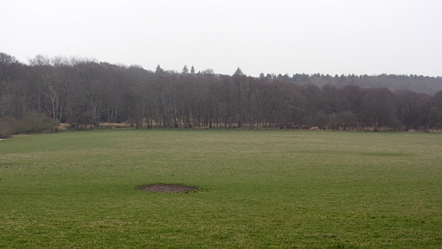
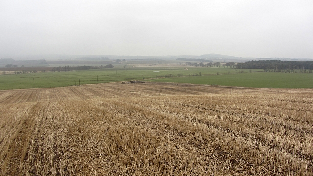
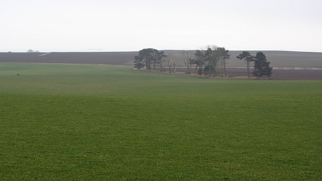
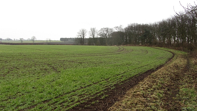
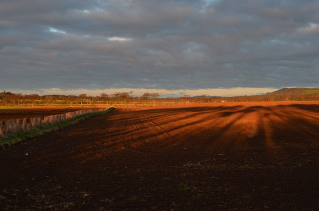
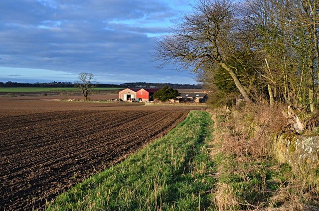
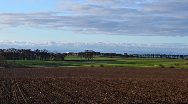
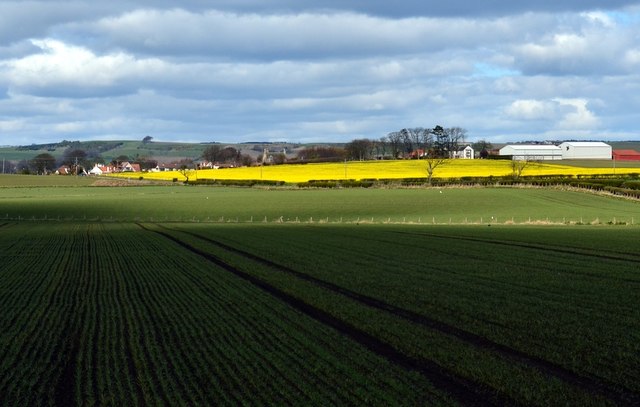
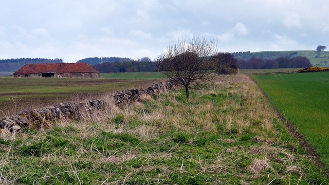
Sandyrigs Wood is a picturesque woodland located in Fife, Scotland. Set amidst the rolling countryside, this enchanting forest covers an area of approximately 50 hectares. The wood is named after the nearby Sandyrigs Farm, which adds to its historical charm.

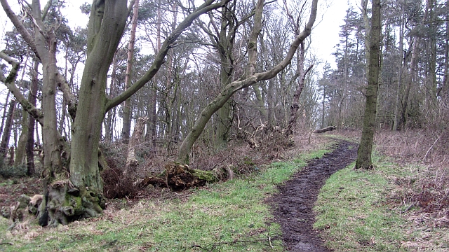
The woodland is primarily composed of native broadleaf trees, with a rich tapestry of species including oak, birch, and beech. The dense canopy provides a haven for a diverse range of flora and fauna, making it a popular spot for nature enthusiasts and wildlife photographers. Bluebells carpet the forest floor in spring, creating a breathtaking display of vibrant colors.

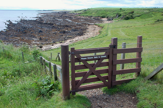
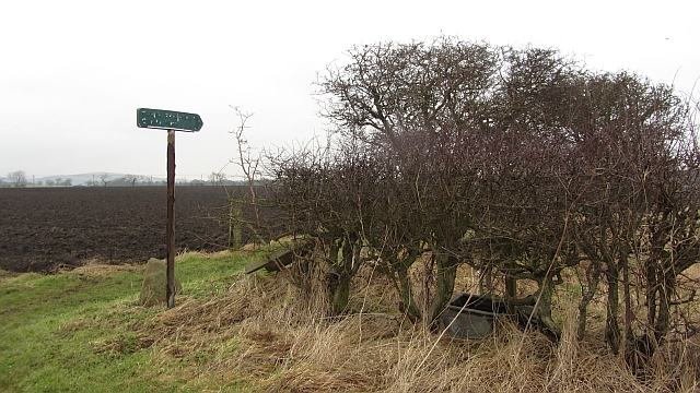
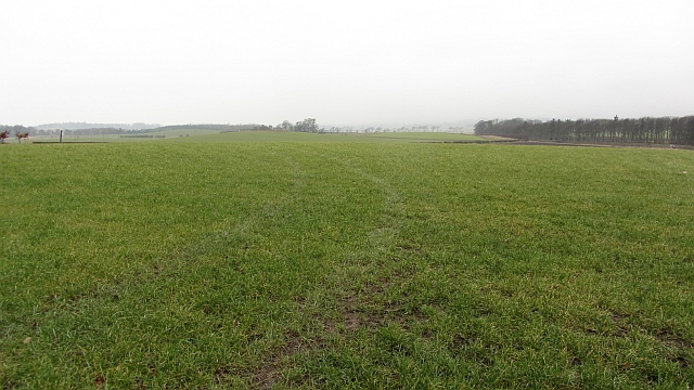
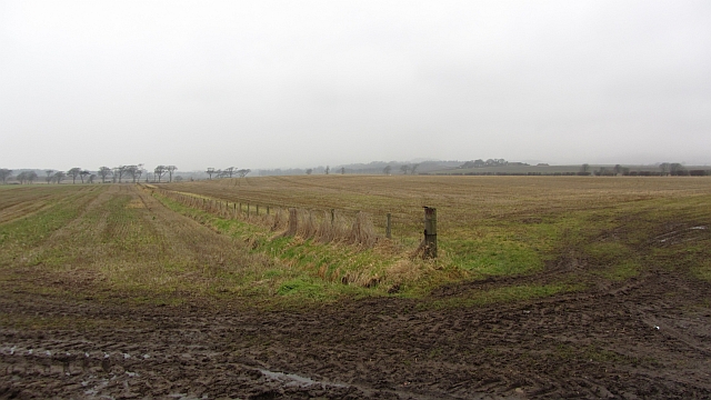
Numerous walking trails wind their way through Sandyrigs Wood, offering visitors the opportunity to explore its hidden treasures. The paths are well-maintained, making it accessible to all, including families with young children and those with limited mobility. Wildlife sightings are common, with deer, squirrels, and a variety of bird species frequently spotted in the area.

The wood is also home to a small pond, which adds to the tranquility of the surroundings. It provides a peaceful spot for visitors to relax and enjoy the sounds of nature. The pond is teeming with aquatic life, including frogs, newts, and dragonflies.

Overall, Sandyrigs Wood is a haven of natural beauty and tranquility, providing visitors with the opportunity to immerse themselves in the wonders of Scotland's countryside.

If you have any feedback on the listing, please let us know in the comments section below.

Sandyrigs Wood Images

Images are sourced within 2km of 56.215024/-2.7973531 or Grid Reference NO5002. Thanks to Geograph Open Source API. All images are credited.

Newark Castle The remains date from the 17th century, but are on the site of much a older castle. Bass Rock can be seen to the left.
Newark Castle
The remains date from the 17th century, but are on the site of much a older castle. Bass Rock can be seen to the left.
Fife Coast path at Newark The path passes close by Newark Castle at this point.
Fife Coast path at Newark
The path passes close by Newark Castle at this point.
Woodland path, Kilconquhar A path near Kilconquhar Castle, it appears to be mainly used by horses.
Woodland path, Kilconquhar
A path near Kilconquhar Castle, it appears to be mainly used by horses.
Field and Carr, Kilconquhar The field was hosting grazing geese. The woodland suggests that the loch was once much larger in area and is changing to a succession woodland.
Field and Carr, Kilconquhar
The field was hosting grazing geese. The woodland suggests that the loch was once much larger in area and is changing to a succession woodland.
Scuddie Hill Stubble on a low ridge near Kilconquhar.  Muck was being spread prior to ploughing.
Scuddie Hill
Stubble on a low ridge near Kilconquhar. Muck was being spread prior to ploughing.
Grass field, Balbuthie A large field, currently under grass.
Grass field, Balbuthie
A large field, currently under grass.
End of Sandy Kirn path There is a galvanised trough in the hedge, a reminder of a recent change in land use. The area is arable now, and there is no longer any stockproof hedges.
End of Sandy Kirn path
There is a galvanised trough in the hedge, a reminder of a recent change in land use. The area is arable now, and there is no longer any stockproof hedges.
Farmland, Abercrombie A dreary day enlivened by the larks starting singing again.
Farmland, Abercrombie
A dreary day enlivened by the larks starting singing again.
Field, Balcaskie Arable field, like most in the area with the West Strip woodland on the right.
Field, Balcaskie
Arable field, like most in the area with the West Strip woodland on the right.
Fields by Stenton There has been a lot of tractor movement as land is prepared for ploughing or ploughed. There has been some amalgamation but the fields are still big on 19th century maps.
Fields by Stenton
There has been a lot of tractor movement as land is prepared for ploughing or ploughed. There has been some amalgamation but the fields are still big on 19th century maps.
Woodland, Pitcorthie Steeper ground is wooded. These are part of the woodlands around Pitcorthie  House.
Woodland, Pitcorthie
Steeper ground is wooded. These are part of the woodlands around Pitcorthie House.
Newark Castle The substantial remains of the castle seen from the Fife Coastal Path.
Newark Castle
The substantial remains of the castle seen from the Fife Coastal Path.
Stenton Farm Stenton farm from the east.
Stenton Farm
Stenton farm from the east.
Farmland Farmland between Easter Pitcorthie to the right and Stenton to the left.
Farmland
Farmland between Easter Pitcorthie to the right and Stenton to the left.
Balcormo farm Balcormo farm from the east
Balcormo farm
Balcormo farm from the east
Towards Abercrombie From Balcormo farm house towards Abercrombie.
Towards Abercrombie
From Balcormo farm house towards Abercrombie.
Abercrombie Abercrombie and farmland around Craigiewells from the coast road by St Monans Manse.
Abercrombie
Abercrombie and farmland around Craigiewells from the coast road by St Monans Manse.
By Easter Pitcorthie
Show me another place!

Sandyrigs Wood is located at Grid Ref: NO5002 (Lat: 56.215024, Lng: -2.7973531)

Unitary Authority: Fife

Police Authority: Fife

What 3 Words

///vintages.fatigued.withdraw. Near St Monans, Fife

Nearby Locations

Balbuthie Sandyrigs Wood

Related Wikis

Abercrombie, Fife

Abercrombie (Gaelic: Obar Chrombaidh) is a village in Fife , Scotland. Abercrombie, recorded in 1157-60 as Abercrumbin, means 'mouth of the river Crombie...

Arncroach

Arncroach is a small village situated in the east of Fife, four miles inland of the fishing village of Pittenweem and around 10 miles away from St Andrews...

St. Monance railway station

St. Monance railway station served the village of St Monans, Fife, Scotland from 1863 to 1965 on the Fife Coast Railway. == History == The station was...
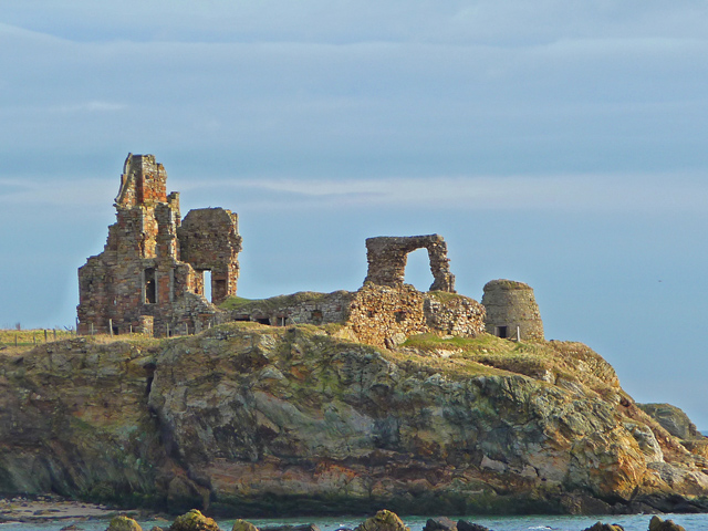
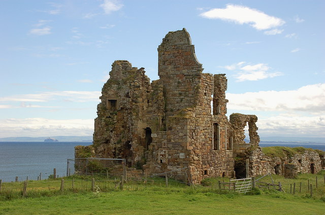
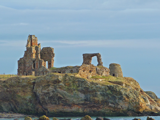
Newark Castle, Fife

Newark Castle is a ruin located just west of St Monans, on the east coast of Fife, Scotland. The building, built in the 15th century, stands in a dramatic...

Kilconquhar

Kilconquhar ( ki-NYUKH-ər or ; Scots: also Kinneuchar, from the Scottish Gaelic: Cill Dhúnchadha or Scottish Gaelic: Cill Chonchaidh, Church of (St)...

Ardross Castle, Fife

Ardross Castle was a c.14th century castle that was located in Elie and Earlsferry, Fife, Scotland, near the sea. == History == The Dishington family built...

St Monans

St Monans ( , locally ), sometimes spelt St Monance, is a village and parish in the East Neuk of Fife and is named after the legendary Saint Monan. Situated...
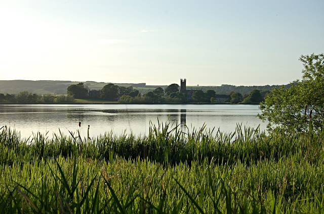
Kilconquhar Loch

Kilconquhar Loch is a Scottish freshwater loch. This small shallow loch is a Site of Special Scientific Interest (SSSI) and is located beside the village...

Related Videos

St Monans drone video, St Monans Kirk, St Monans Holiday Park, St Monans Windmill, Fife.

Robert Wilson retraces his footsteps on a visit to St Monans, 60 years after holidaying in the East Neuk of Fife village as a child.

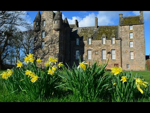
Spring Easter Holiday Weekend Daffodils On History Visit To Kellie Castle East Neuk Of Fife Scotland

Tour Scotland 4K Spring Easter Holiday Weekend travel video of daffodils flowers at Kellie Castle on ancestry, genealogy, family ...

St Monans drone video, St Monans Windmill, St Monans tidal pool, St Monans Holiday Park, Fife.

Robert Wilson retraces his footsteps on a visit to St Monans, 60 years after holidaying in the East Neuk of Fife village as a child.

Spring Road Trip With Music From Kilconquhar On History Visit To St Monans East Neuk Fife Scotland

Tour Scotland 4K travel video, with Scottish music, of a road trip drive through Kilconquhar then East on the Balbuthie road then ...

Nearby Amenities

Located within 500m of 56.215024,-2.7973531
Material: wood
Power: pole
Lat/Long: 56.2181298/-2.8017229
Material: wood
Power: pole
Lat/Long: 56.2178852/-2.8004301
Material: wood
Power: pole
Lat/Long: 56.2175809/-2.7990085
Material: wood
Power: pole
Lat/Long: 56.2173423/-2.7977479
Material: wood
Power: pole
Lat/Long: 56.2170231/-2.7963048
Material: wood
Power: pole
Lat/Long: 56.2167607/-2.7948993
Material: wood
Power: pole
Lat/Long: 56.2164803/-2.7935046
Material: wood
Power: pole
Lat/Long: 56.2161745/-2.7920187
Material: wood
Power: pole
Lat/Long: 56.2159463/-2.7909029
Material: wood
Power: pole
Lat/Long: 56.2157107/-2.7896476
Material: wood
Power: pole
Lat/Long: 56.2158986/-2.7894276
Power: pole
Lat/Long: 56.2161499/-2.7906618
Power: pole
Lat/Long: 56.2164731/-2.7922972
Power: pole
Lat/Long: 56.2167347/-2.7935887
Power: pole
Lat/Long: 56.2170032/-2.7948654
Power: pole
Lat/Long: 56.2172865/-2.7962441
Power: pole
Lat/Long: 56.217561/-2.7976066
Power: pole
Lat/Long: 56.2178234/-2.7989531
Power: pole
Lat/Long: 56.2181098/-2.8002728
Power: pole
Lat/Long: 56.2184737/-2.8018392
The data included in this document is from www.openstreetmap.org. The data is made available under ODbL.

Have you been to Sandyrigs Wood?

Leave your review of Sandyrigs Wood below (or comments, questions and feedback).