Big Wood

Wood, Forest in Roxburghshire

Scotland

Big Wood

Hareshawhead Plantation This bit of the wood  <a href="https://www.geograph.org.uk/photo/4202787">NT4842 : Clear felled area,  Hareshawhead Plantation</a> nearly five years on. A new crop of trees is getting established.
Hareshawhead Plantation Credit: Richard Webb

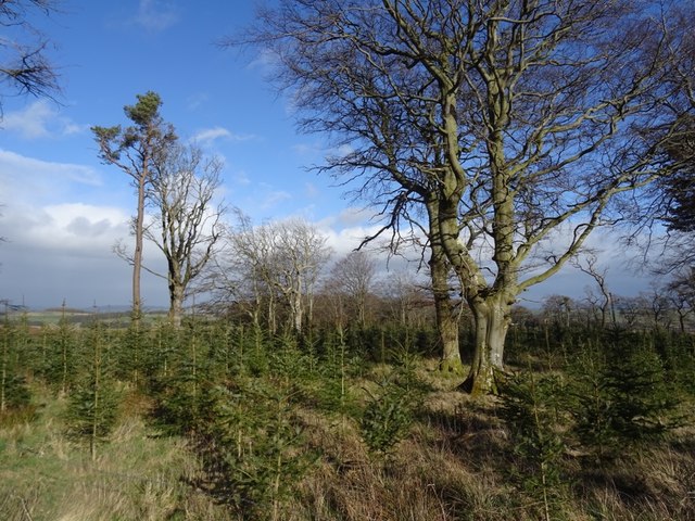
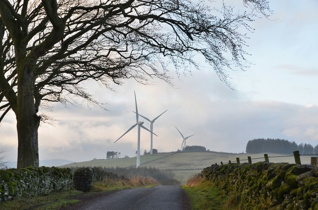
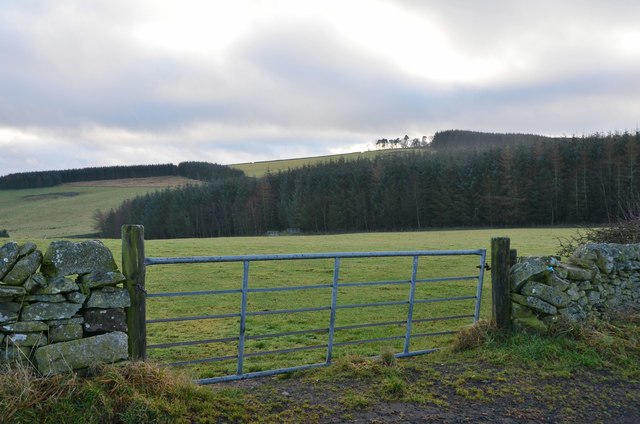
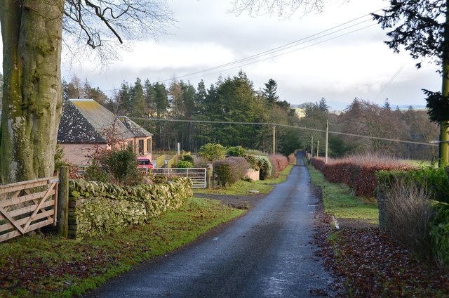
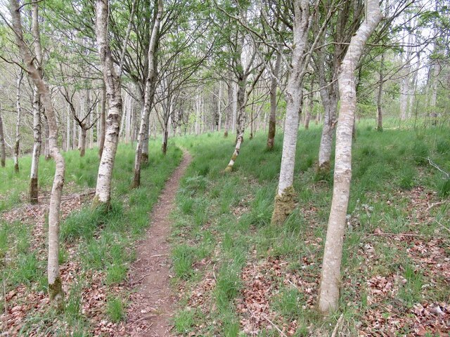
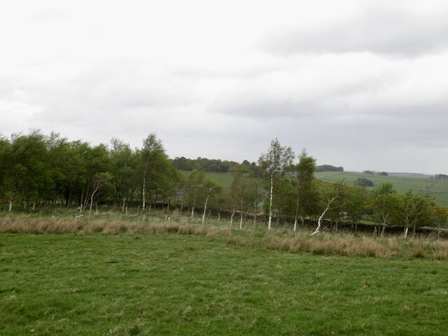
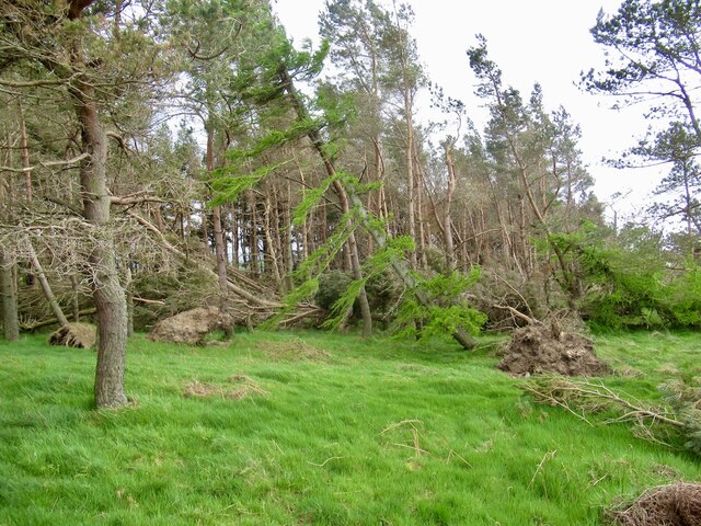
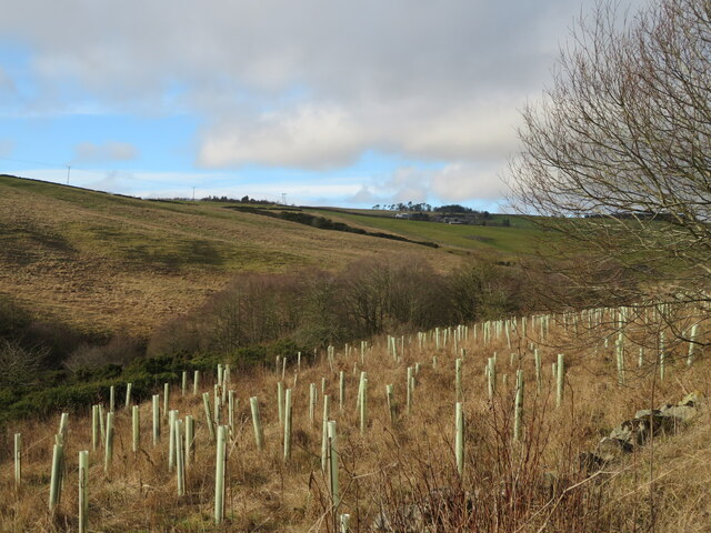
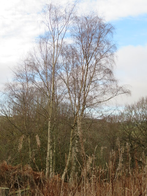
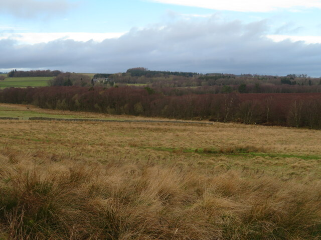
Big Wood, located in Roxburghshire, is a sprawling forest that covers an area of approximately 500 hectares. Situated in the southern part of Scotland, this woodland is renowned for its rich biodiversity and stunning natural beauty. The forest is composed predominantly of mature broadleaf trees, including oak, beech, and birch, which create a dense canopy that provides shade and shelter for a wide range of wildlife.

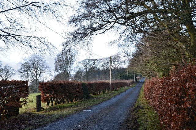
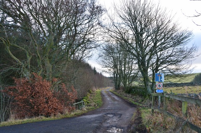
The wood is crisscrossed with a network of well-maintained footpaths, making it a popular destination for outdoor enthusiasts and nature lovers alike. These paths offer visitors the opportunity to explore the forest at their own pace, soaking in the tranquility and immersing themselves in the sights and sounds of nature. Along the way, hikers may come across a variety of native wildlife, including red squirrels, roe deer, and a plethora of bird species.

Big Wood also boasts a diverse range of plant life, with a striking display of wildflowers in the spring and summer months. Bluebells, primroses, and wood anemones carpet the forest floor, creating a colorful and vibrant landscape. The wood is also home to several ancient trees, some of which are believed to be hundreds of years old, adding to the area's sense of history and natural heritage.

Due to its proximity to nearby towns and villages, Big Wood is a popular spot for picnics, family outings, and even educational visits. Its accessibility and natural beauty make it an ideal location for people of all ages to enjoy and appreciate the wonders of the natural world.

If you have any feedback on the listing, please let us know in the comments section below.

Big Wood Images

Images are sourced within 2km of 55.670411/-2.7904512 or Grid Reference NT5042. Thanks to Geograph Open Source API. All images are credited.

Hareshawhead Plantation This bit of the wood  <a href="https://www.geograph.org.uk/photo/4202787">NT4842 : Clear felled area,  Hareshawhead Plantation</a> nearly five years on. A new crop of trees is getting established.
Hareshawhead Plantation
This bit of the wood NT4842 : Clear felled area, Hareshawhead Plantation nearly five years on. A new crop of trees is getting established.
Longpark Wind Farm On the ridge southeast of Stow.
Longpark Wind Farm
On the ridge southeast of Stow.
Road from Allanshaws near Lauder in the Scottish Borders
Allanshaws above Lauder in the Scottish Borders
Woodland on Allanshaws near Lauder in the Scottish Borders
Road to Stow, Wooplaw The minor road through farmland bordering Longpark windfarm.
Road to Stow, Wooplaw
The minor road through farmland bordering Longpark windfarm.
Crest of the road at Wooplaw The road to Stow reaches 316m by the farm, here giving a view to the southernmost row of turbines in the Longpark wind farm.
Crest of the road at Wooplaw
The road to Stow reaches 316m by the farm, here giving a view to the southernmost row of turbines in the Longpark wind farm.
Farmland and plantations near Wooplaw Fields to the south of the minor road to Stow.
Farmland and plantations near Wooplaw
Fields to the south of the minor road to Stow.
Track to Hawksnest and Ladhopemuir The track passes Hawksnest farm and crosses farmland SSE to meet a minor road at Ladhopemuir north of Galashiels.
Track to Hawksnest and Ladhopemuir
The track passes Hawksnest farm and crosses farmland SSE to meet a minor road at Ladhopemuir north of Galashiels.
Wooplaw farm The name comes from the Norse 'uplaw' meaning a shallow valley at the top of a hill (from the information board at the Community Woodland). It is certainly on top of a hill as the land here is around 310m.
Wooplaw farm
The name comes from the Norse 'uplaw' meaning a shallow valley at the top of a hill (from the information board at the Community Woodland). It is certainly on top of a hill as the land here is around 310m.
Road east of Wooplaw The road meets the Langlee to Lauder road about 1km E of here.
Road east of Wooplaw
The road meets the Langlee to Lauder road about 1km E of here.
Path, Gullet Wood
Path, Gullet Wood
Stripwood, Blackcock Hill
Windthrow, Blackcock Plantation After the stormy Winter of 2021/2022 there were a lot of trees strewn about on the ground. Hilltop plantations like this were particularly vulnerable.
Windthrow, Blackcock Plantation
After the stormy Winter of 2021/2022 there were a lot of trees strewn about on the ground. Hilltop plantations like this were particularly vulnerable.
Shooting range in an old quarry The Joint Services Pistol Club range at Colmslie. It has had a makeover since Richard Webb visited in 2006 <a href="https://www.geograph.org.uk/photo/114684">NT5040 : Quarry on the Allan Water</a>.
Shooting range in an old quarry
The Joint Services Pistol Club range at Colmslie. It has had a makeover since Richard Webb visited in 2006 NT5040 : Quarry on the Allan Water.
Trees by the Allan Water A fairly steep sided valley of the Allan Water a tributary of the River Tweed, which it joins at Langlee, near Tweedbank, with new planting on the east bank.
Trees by the Allan Water
A fairly steep sided valley of the Allan Water a tributary of the River Tweed, which it joins at Langlee, near Tweedbank, with new planting on the east bank.
Birch tree in Gullet Wood Part of the Wooplaw Community Woodland.
Birch tree in Gullet Wood
Part of the Wooplaw Community Woodland.
Rough grassland near Threepwood With Birch woodland along the course of the Moss Burn.
Rough grassland near Threepwood
With Birch woodland along the course of the Moss Burn.
Show me another place!

Big Wood is located at Grid Ref: NT5042 (Lat: 55.670411, Lng: -2.7904512)

Unitary Authority: The Scottish Borders

Police Authority: The Lothians and Scottish Borders

What 3 Words

///glow.gashes.greyhound. Near Lauder, Scottish Borders

Related Wikis

Allanshaws

Allanshaws is a place and farm off the B6362, in Lauderdale, by the Allan Water, in the parish of Melrose in the Scottish Borders area of Scotland, formerly...

Buckholm

Buckholm is a farm near to the A7, in the Scottish Borders, Galashiels area of Scotland. Places nearby include Abbotsford, the Bow Castle Broch, Clovenfords...

Bow Castle Broch

Bow Castle is the remains of an iron-age broch near the Gala Water, in the Scottish Borders area of Scotland, in the parish of Stow. It is a scheduled...

Stow of Wedale Town Hall

Stow of Wedale Town Hall is a municipal building in Earlston Road, Stow of Wedale, Scottish Borders, Scotland. The structure, which serves as a community...

Stow of Wedale

Stow of Wedale, or more often Stow, is a village in the Scottish Borders area of Scotland (historically Midlothian), 7 miles (11 kilometres) north of...

Bowland railway station

Bowland railway station (Bowland Bridge between May 1849 and July 1862) was a railway station in the village of Bowland, near Galashiels, Scotland. Located...
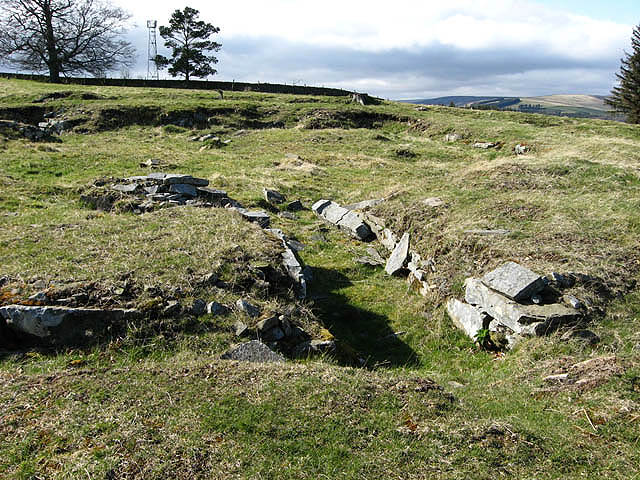
Torwoodlee Broch

Torwoodlee Broch is the remains of an iron-age broch located near the town of Galashiels in the Scottish Borders. == Description == Torwoodlee Broch...

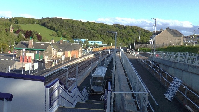
Stow railway station

Stow is a railway station on the Borders Railway, which runs between Edinburgh Waverley and Tweedbank. The station, situated 26 miles 45 chains (43 km...

Nearby Amenities

Located within 500m of 55.670411,-2.7904512
Barrier: stile
Lat/Long: 55.6689684/-2.786092
Bench
Lat/Long: 55.6700778/-2.7872027
Bench
Lat/Long: 55.6686661/-2.7902578
Tim Stead
Historic: memorial
Material: wood
Memorial: statue
Lat/Long: 55.6686465/-2.7900378
Tim Stead
Cemetery: grave
Lat/Long: 55.6686329/-2.7900834
Bench
Lat/Long: 55.6706383/-2.7949651
Leisure: picnic_table
Lat/Long: 55.6716858/-2.7930164
Bench
Lat/Long: 55.6718468/-2.793001
Leisure: picnic_table
Lat/Long: 55.6704651/-2.7927127
Leisure: picnic_table
Lat/Long: 55.6704586/-2.7928226
Leisure: picnic_table
Lat/Long: 55.6703694/-2.7929943
Leisure: picnic_table
Lat/Long: 55.6703505/-2.7930969
The data included in this document is from www.openstreetmap.org. The data is made available under ODbL.

Have you been to Big Wood?

Leave your review of Big Wood below (or comments, questions and feedback).