Alwoodley Park

Settlement in Yorkshire

England

Alwoodley Park

Eccup Reservoir Eccup reservoir has a viewing platform where many people enjoy watching the Red Kites
Eccup Reservoir Credit: Mick Melvin

Alwoodley Park is a picturesque suburb and a hidden gem located in the north of Leeds, Yorkshire, England. Known for its leafy streets, manicured gardens, and lush green spaces, this residential area offers a tranquil and idyllic setting, making it a highly sought-after place to live.

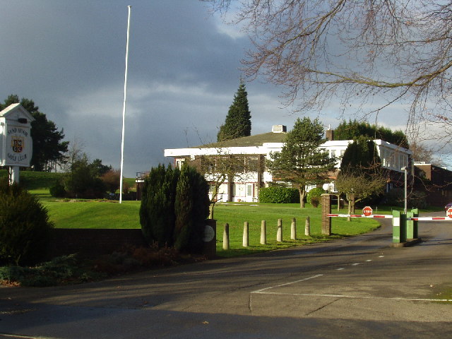
Nestled in the heart of Alwoodley Park is the Alwoodley Park Golf Club, a renowned and prestigious golf course that attracts enthusiasts from all over the region. This beautifully maintained 18-hole course is set against a backdrop of rolling hills and mature trees, providing a challenging yet enjoyable experience for golfers of all skill levels.

Aside from its natural beauty and recreational opportunities, Alwoodley Park also boasts excellent amenities. The area is home to a variety of shops, restaurants, and cafes, providing residents with convenient access to everyday essentials and a vibrant local scene. Additionally, nearby schools are highly regarded, making Alwoodley Park an attractive location for families.

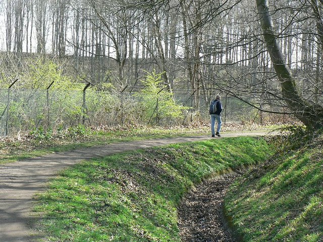
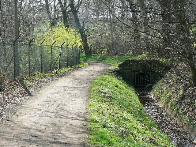
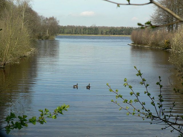
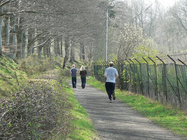
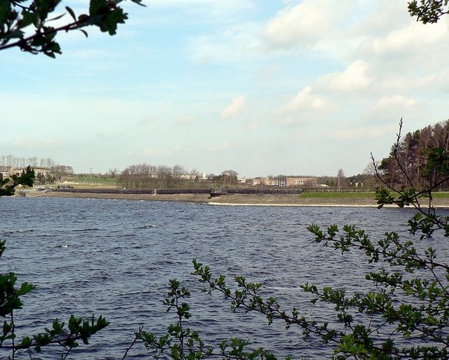
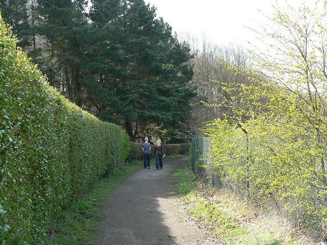
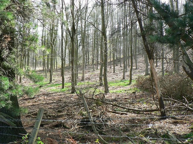
For outdoor enthusiasts, Alwoodley Park offers numerous opportunities to explore nature. The area is surrounded by stunning countryside, with access to scenic walking and cycling trails. Eccup Reservoir, a popular spot for water-based activities and picnics, is just a short distance away.

Alwoodley Park benefits from excellent transport links, with easy access to the A61 and A6120, connecting it to the rest of Yorkshire and beyond. Leeds city center is approximately 6 miles away, providing residents with a wide range of cultural, shopping, and entertainment options.

In summary, Alwoodley Park is a charming residential area in Yorkshire, offering a peaceful and picturesque lifestyle surrounded by natural beauty, excellent amenities, and convenient transport links.

If you have any feedback on the listing, please let us know in the comments section below.

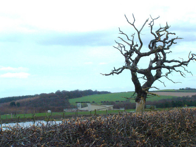
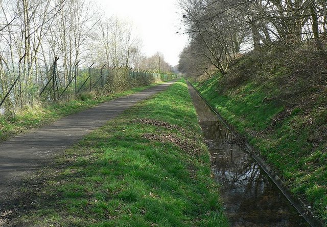
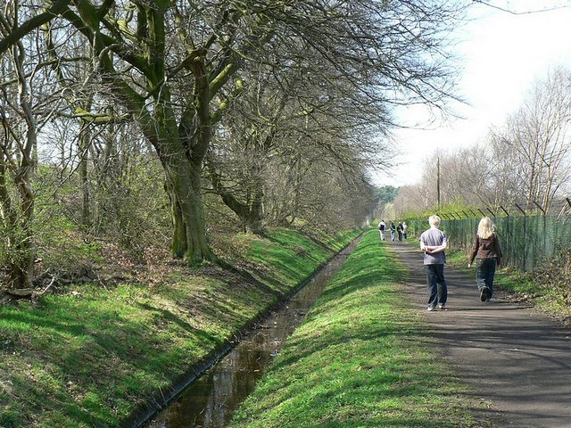
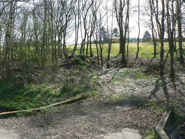
Alwoodley Park Images

Images are sourced within 2km of 53.859978/-1.552952 or Grid Reference SE2940. Thanks to Geograph Open Source API. All images are credited.

Eccup Reservoir Eccup reservoir has a viewing platform where many people enjoy watching the Red Kites
Eccup Reservoir
Eccup reservoir has a viewing platform where many people enjoy watching the Red Kites
Entrance to Leeds Grammar School, Alwoodley Gates The beginning of the drive from the school gate, Leeds Grammar School, Alwoodley Gates, Leeds looking east towards the buildings which are in the next square.
Entrance to Leeds Grammar School, Alwoodley Gates
The beginning of the drive from the school gate, Leeds Grammar School, Alwoodley Gates, Leeds looking east towards the buildings which are in the next square.
Sandmoor Golf Club, Alwoodley Lane, Leeds The main entrance, on the north side of Alwoodley Lane.
Sandmoor Golf Club, Alwoodley Lane, Leeds
The main entrance, on the north side of Alwoodley Lane.
Eccup Reservoir
Eccup Reservoir
Eccup Reservoir (?) Don't dive from the board
Eccup Reservoir (?)
Don't dive from the board
Dead tree Backed up by the water works at Eccup Reservoir
Dead tree
Backed up by the water works at Eccup Reservoir
Path and ditch by Eccup Reservoir The reservoir is on the left behind the fence which runs all along the southern side. On the right is Sandmoor Golf Club and the former site of Alwoodley Old Hall, which was demolished in 1969. A picture from 1950 is on the Leodis archive <span class="nowrap"><a title="http://www.leodis.net/display.aspx?resourceIdentifier=20021010_98472232" rel="nofollow ugc noopener" href="http://www.leodis.net/display.aspx?resourceIdentifier=20021010_98472232">Link</a><img style="margin-left:2px;" alt="External link" title="External link - shift click to open in new window" src="https://s1.geograph.org.uk/img/external.png" width="10" height="10"/></span>

Turn round and continue the walk round the reservoir with <a href="https://www.geograph.org.uk/photo/394603">SE2941 : Eccup Reservoir in spring</a>
Path and ditch by Eccup Reservoir
The reservoir is on the left behind the fence which runs all along the southern side. On the right is Sandmoor Golf Club and the former site of Alwoodley Old Hall, which was demolished in 1969. A picture from 1950 is on the Leodis archive LinkExternal link Turn round and continue the walk round the reservoir with SE2941 : Eccup Reservoir in spring
Path between the Golf Course and Reservoir A long straight (and rather boring) stretch of the path. When you get to the corner look back at <a href="https://www.geograph.org.uk/photo/394611">SE3041 : Path and ditch by Eccup Reservoir</a>
Path between the Golf Course and Reservoir
A long straight (and rather boring) stretch of the path. When you get to the corner look back at SE3041 : Path and ditch by Eccup Reservoir
Bridge to Sandmoor Golf Course Over the ditch from the footpath by Eccup Reservoir. Don't cross it, but follow <a href="https://www.geograph.org.uk/photo/394616">SE3041 : Path between the Golf Course and Reservoir</a>
Bridge to Sandmoor Golf Course
Over the ditch from the footpath by Eccup Reservoir. Don't cross it, but follow SE3041 : Path between the Golf Course and Reservoir
Going round the corner Looking back along the path as it rounds the corner to go round the inlet between Sandmoor Golf Course (this side) and Wigton Knowle (far side).
Turn round to follow the path to <a href="https://www.geograph.org.uk/photo/394622">SE3041 : Bridge to Sandmoor Golf Course</a>
Going round the corner
Looking back along the path as it rounds the corner to go round the inlet between Sandmoor Golf Course (this side) and Wigton Knowle (far side). Turn round to follow the path to SE3041 : Bridge to Sandmoor Golf Course
End of the drain The drain along the south side of Eccup Reservoir goes into a pipe here. Carry on the circuit of Eccup Reservoir at <a href="https://www.geograph.org.uk/photo/394631">SE3041 : Going round the corner</a>
End of the drain
The drain along the south side of Eccup Reservoir goes into a pipe here. Carry on the circuit of Eccup Reservoir at SE3041 : Going round the corner
Inlet by Wigton Knowle, Eccup Reservoir A calm corner on a windy day.
Follow the circuit of Eccup Reservoir. Next is <a href="https://www.geograph.org.uk/photo/394637">SE3041 : End of the drain</a>
Inlet by Wigton Knowle, Eccup Reservoir
A calm corner on a windy day. Follow the circuit of Eccup Reservoir. Next is SE3041 : End of the drain
Path near the end of an inlet, Eccup Reservoir This runs into a small valley by Wigton Knowle, and I was expecting to a see a stream running into the reservoir, but didn't. It's probably been diverted to avoid   undesirable stuff getting into the water supply.
Continue the circuit of Eccup Reservoir at <a href="https://www.geograph.org.uk/photo/394641">SE3041 : Inlet by Wigton Knowle, Eccup Reservoir</a>.
Path near the end of an inlet, Eccup Reservoir
This runs into a small valley by Wigton Knowle, and I was expecting to a see a stream running into the reservoir, but didn't. It's probably been diverted to avoid undesirable stuff getting into the water supply. Continue the circuit of Eccup Reservoir at SE3041 : Inlet by Wigton Knowle, Eccup Reservoir.
Footpath between Wigton Knowle and Eccup Reservoir Much of the south side of the reservoir is a bit hidden by the fence, bushes and saplings.
Next on the circuit of Eccup Reservoir is <a href="https://www.geograph.org.uk/photo/394850">SE3041 : Path near the end of an inlet, Eccup Reservoir</a>
Footpath between Wigton Knowle and Eccup Reservoir
Much of the south side of the reservoir is a bit hidden by the fence, bushes and saplings. Next on the circuit of Eccup Reservoir is SE3041 : Path near the end of an inlet, Eccup Reservoir
Looking across Eccup Reservoir at the dam From the path alongside Wigton Knowle. The wire fence and bushes made it necessary to hold the camera above my head for this one.
Next go to <a href="https://www.geograph.org.uk/photo/394850">SE3041 : Path near the end of an inlet, Eccup Reservoir</a>
Looking across Eccup Reservoir at the dam
From the path alongside Wigton Knowle. The wire fence and bushes made it necessary to hold the camera above my head for this one. Next go to SE3041 : Path near the end of an inlet, Eccup Reservoir
Path by The Lodge and Wigton Knowle The lodge is at the end of the dam, by Yorkshire Water's road that comes in from the A61 Harrogate Road.
Continue round the reservoir at <a href="https://www.geograph.org.uk/photo/394887">SE3041 : Wigton Knowle</a>
Path by The Lodge and Wigton Knowle
The lodge is at the end of the dam, by Yorkshire Water's road that comes in from the A61 Harrogate Road. Continue round the reservoir at SE3041 : Wigton Knowle
Wigton Knowle Woodland by the lodge at the east end of Eccup reservoir.

Continue on the circuit of Eccup Reservoir with <a href="https://www.geograph.org.uk/photo/394870">SE3041 : Looking across Eccup Reservoir at the dam</a>
Wigton Knowle
Woodland by the lodge at the east end of Eccup reservoir. Continue on the circuit of Eccup Reservoir with SE3041 : Looking across Eccup Reservoir at the dam
Never Go In Reservoirs A sign at the south end of the dam at Eccup Reservoir, and a view west along the length of the reservoir.

For a drier view of the jetty see <a href="https://www.geograph.org.uk/photo/141854">SE3041 : Eccup Reservoir (?)</a>

To continue on the walk round the reservoir go to <a href="https://www.geograph.org.uk/photo/394878">SE3041 : Path by The Lodge and Wigton Knowle</a>
Never Go In Reservoirs
A sign at the south end of the dam at Eccup Reservoir, and a view west along the length of the reservoir. For a drier view of the jetty see SE3041 : Eccup Reservoir (?) To continue on the walk round the reservoir go to SE3041 : Path by The Lodge and Wigton Knowle
Show me another place!

Alwoodley Park is located at Grid Ref: SE2940 (Lat: 53.859978, Lng: -1.552952)

Division: West Riding

Unitary Authority: Leeds

Police Authority: West Yorkshire

What 3 Words

///plan.hooks.brass. Near Chapel Allerton, West Yorkshire

Nearby Locations

Alwoodley Park Adel Head

Related Wikis

1929 Ryder Cup

The 2nd Ryder Cup Matches were held at the Moortown Golf Club in Leeds, England. It was very cold, with hail and at one point heavy snow on the greens...

Sand Moor Golf Club

Sand Moor Golf Club is a golf club located in Alwoodley, North Leeds, West Yorkshire, England. It was founded in 1925. The 18-hole golf course was designed...

Allerton High School

Allerton High School is a coeducational secondary school and sixth form located in Alwoodley, Leeds, West Yorkshire, England. It is situated around 500...
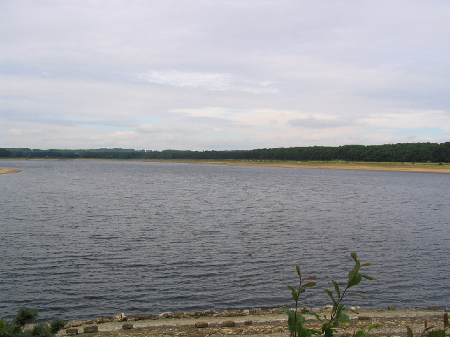
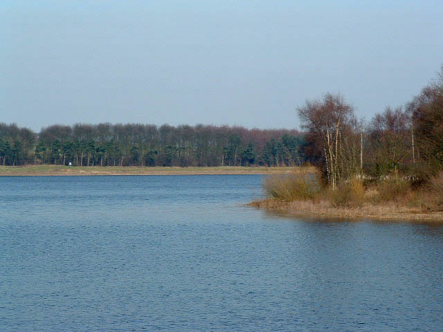
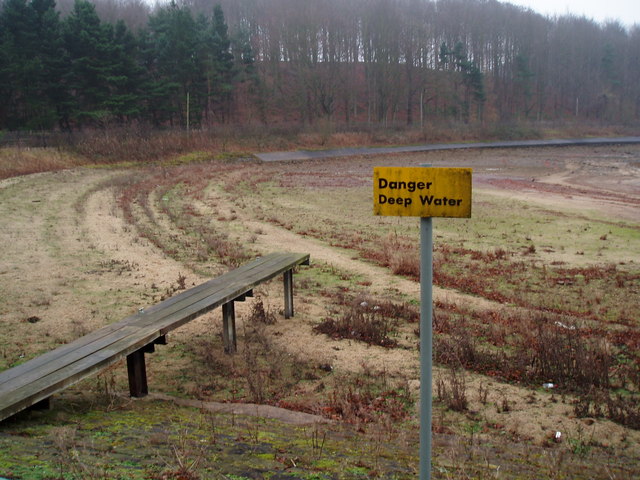
Eccup Reservoir

Eccup Reservoir is a reservoir in Alwoodley, a suburb of Leeds, West Yorkshire, England, near the village of Eccup. It was first constructed in 1843, and...

Related Videos

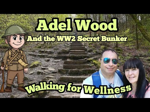
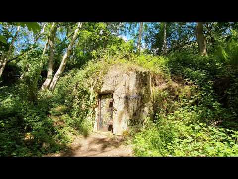
#woodland #walking #adventure #ww2 #nature What's that in the woods? Adel Wood, North Leeds

A walk through the lovely Adel Wood to the pre WW2 bunker and the Devil's Rock. Free car parking is available on King Lane and ...

4k Woodland Walk - Adel Woods, Leeds

A walk around Adel Woods, Leeds, UK.

Snow time Leeds | Travel Vlog

nice scenery with a lot of serenity , and peace of mind. ======================== "Music provided by http://spoti.fi/NCS"

Nearby Amenities

Located within 500m of 53.859978,-1.552952
Turning Circle
Lat/Long: 53.8600975/-1.5560552
Turning Circle
Lat/Long: 53.8610747/-1.5574378
Turning Circle
Lat/Long: 53.8594728/-1.5598629
Bus Stop
Alwoodley Lane The Avenue
Bus: yes
Local Ref: 45012672
Naptan AtcoCode: 450012672
Naptan Bearing: W
Naptan CommonName: Alwoodley Lane The Avenue
Naptan Crossing: The Avenue
Naptan Indicator: Stop 45012672
Naptan Notes: New TF shelter fitted awaiting survey - not at this site confirmed with P.Roche 25/10/07 put on in error
Naptan PlusbusZoneRef: LEEDS
Naptan ShortCommonName: The Avenue
Naptan Street: Alwoodley Lane
Naptan Verified: no
Public Transport: platform
Source: naptan_import
Lat/Long: 53.8627542/-1.5535457
Bus Stop
Alwoodley Lane The Avenue
Bus: yes
Local Ref: 45012673
Naptan AtcoCode: 450012673
Naptan Bearing: E
Naptan CommonName: Alwoodley Lane The Avenue
Naptan Crossing: The Avenue
Naptan Indicator: Stop 45012673
Naptan PlusbusZoneRef: LEEDS
Naptan ShortCommonName: The Avenue
Naptan Street: Alwoodley Lane
Naptan Verified: no
Public Transport: platform
Source: naptan_import
Lat/Long: 53.8628795/-1.5534075
Bus Stop
Alwoodley Lane Mount Drive
Bus: yes
Local Ref: 45012675
Naptan AtcoCode: 450012675
Naptan Bearing: W
Naptan CommonName: Alwoodley Lane Mount Drive
Naptan Crossing: Mount Drive
Naptan Indicator: Stop 45012675
Naptan Notes: On L/C-4
Naptan PlusbusZoneRef: LEEDS
Naptan ShortCommonName: Mount Drive
Naptan Street: Alwoodley Lane
Naptan Verified: no
Public Transport: platform
Source: naptan_import
Lat/Long: 53.8624608/-1.547208
Bus Stop
The Avenue The Quarry
Bus: yes
Naptan AtcoCode: 450015871
Naptan Bearing: NE
Naptan CommonName: The Avenue The Quarry
Naptan Crossing: The Quarry
Naptan Landmark: Unknown
Naptan Notes: Pending political issue
Naptan ShortCommonName: The Avenue
Naptan Street: The Avenue
Naptan Verified: no
Public Transport: platform
Source: naptan_import
Lat/Long: 53.8599283/-1.5549898
Bus Stop
The Avenue The Lane
Bus: yes
Local Ref: 45025245
Naptan AtcoCode: 450025245
Naptan Bearing: NE
Naptan CommonName: The Avenue The Lane
Naptan Crossing: The Lane
Naptan Indicator: Stop 45025245
Naptan Landmark: Surgery
Naptan PlusbusZoneRef: LEEDS
Naptan ShortCommonName: The Lane
Naptan Street: The Avenue
Naptan Verified: no
Public Transport: platform
Source: naptan_import
Lat/Long: 53.8581513/-1.5581407
Bus Stop
The Avenue The Drive
Bus: yes
Local Ref: 45025246
Naptan AtcoCode: 450025246
Naptan Bearing: NE
Naptan CommonName: The Avenue The Drive
Naptan Crossing: The Drive
Naptan Indicator: Stop 45025246
Naptan PlusbusZoneRef: LEEDS
Naptan ShortCommonName: The Drive
Naptan Street: The Avenue
Naptan Verified: no
Public Transport: platform
Shelter: yes
Source: naptan_import
Lat/Long: 53.8616769/-1.5534734
Turning Circle
Lat/Long: 53.8591214/-1.5541426
Turning Circle
Lat/Long: 53.8620995/-1.5513778
Turning Circle
Lat/Long: 53.8618272/-1.5491458
Turning Circle
Lat/Long: 53.8572061/-1.5529993
Turning Circle
Lat/Long: 53.8568119/-1.5558934
Turning Circle
Lat/Long: 53.8580475/-1.5562425
Turning Circle
Lat/Long: 53.8609973/-1.5585105
Restaurant
Marinellas
Addr City: Leeds
Addr Housenumber: 139
Addr Postcode: LS17 7PA
Addr Street: The Avenue
Addr Suburb: Alwoodley
Cuisine: italian
Fhrs Id: 871569
Lat/Long: 53.8615367/-1.5538225
Alwoodley Park News
Addr City: Leeds
Addr Housenumber: 143
Addr Postcode: LS17 7PA
Addr Street: The Avenue
Addr Suburb: Alwoodley
Fhrs Id: 1439585
Shop: newsagent
Lat/Long: 53.8616285/-1.5537541
Fast Food
The Avenue Fish Bar
Addr City: Leeds
Addr Housenumber: 147
Addr Postcode: LS17 7PA
Addr Street: The Avenue
Addr Suburb: Alwoodley
Cuisine: fish_and_chips
Fhrs Id: 650655
Takeaway: yes
Lat/Long: 53.8617352/-1.553691
Post Box
Operator: Royal Mail
Post Box Type: pillar
Ref: LS17 835
Lat/Long: 53.8627428/-1.5546352
Post Box
Operator: Royal Mail
Post Box Type: pillar
Ref: LS17 931
Lat/Long: 53.8601265/-1.5545842
Post Box
Operator: Royal Mail
Post Box Type: pillar
Ref: LS17 804
Lat/Long: 53.8581816/-1.5580617
Waste Basket
Ref UK Leedscc Bin: 3187
Lat/Long: 53.858212/-1.554159
Waste Basket
Ref UK Leedscc Bin: 3186
Lat/Long: 53.861332/-1.553776
Waste Basket
Ref UK Leedscc Bin: 3185
Lat/Long: 53.861619/-1.553521
Bus: yes
Public Transport: stop_position
Lat/Long: 53.8616742/-1.5533836
Community Centre
Alwoodley Community Association
Addr City: Leeds
Addr Street: The Avenue
Lat/Long: 53.85871/-1.5552333
Alwoodley Park
Place: suburb
Lat/Long: 53.8600502/-1.5594634
The data included in this document is from www.openstreetmap.org. The data is made available under ODbL.

Have you been to Alwoodley Park?

Leave your review of Alwoodley Park below (or comments, questions and feedback).