Smithy Plantation

Wood, Forest in Roxburghshire

Scotland

Smithy Plantation

Longpark Wind Farm This telephoto shot was taken from the summit of Eildon Mid Hill on a calm November morning when valley fog persisted for most of the day.
Longpark Wind Farm Credit: Walter Baxter

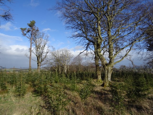
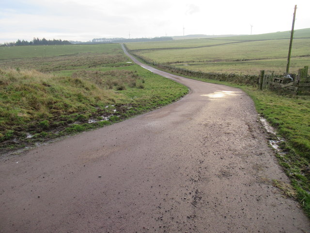
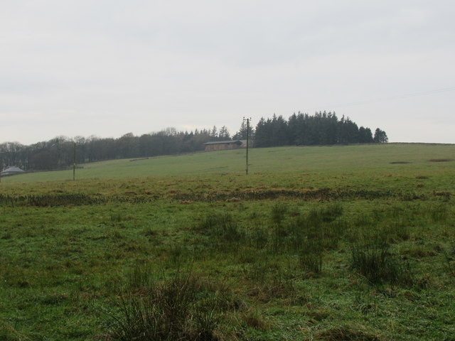
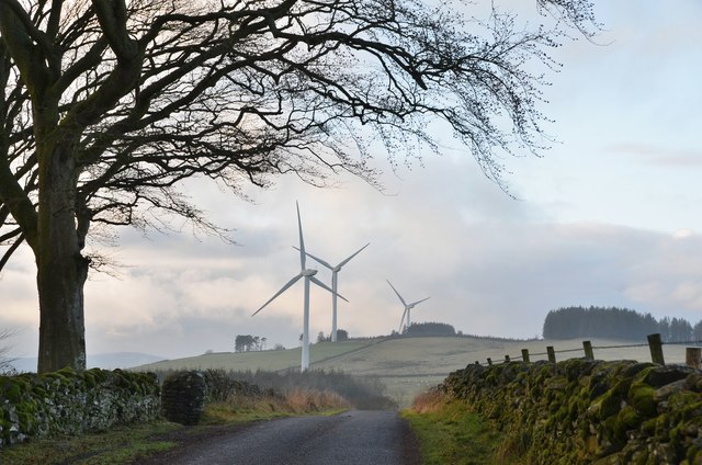
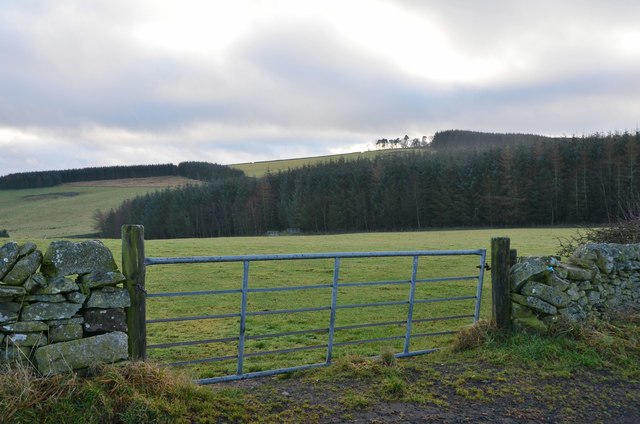
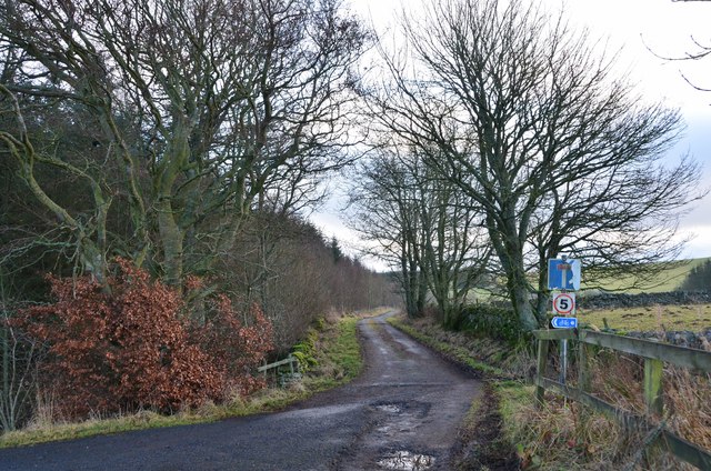
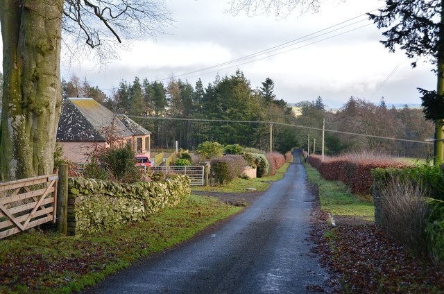
Smithy Plantation is a scenic woodland located in Roxburghshire, a historic county in the Scottish Borders region of Scotland. Covering an area of approximately 200 acres, this forested area is a haven for nature enthusiasts and outdoor adventurers alike.

The plantation is primarily composed of various species of native trees, including oak, beech, and birch. These majestic trees create a dense canopy that provides shelter and food for a wide array of wildlife. Visitors to the plantation can expect to spot a variety of bird species, such as woodpeckers, owls, and thrushes. Mammals like red squirrels, badgers, and deer also call this woodland home.

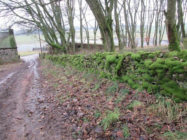
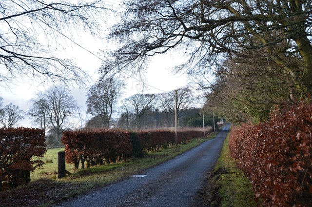
A network of well-maintained trails crisscrosses the plantation, offering visitors the opportunity to explore its natural beauty. The paths wind through the forest, taking visitors past bubbling streams, tranquil ponds, and picturesque clearings. The plantation is particularly popular during the springtime when the forest floor is carpeted with wildflowers, creating a vibrant and colorful spectacle.

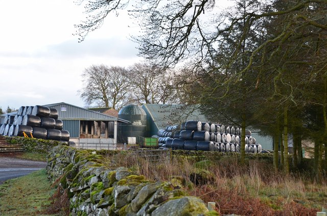
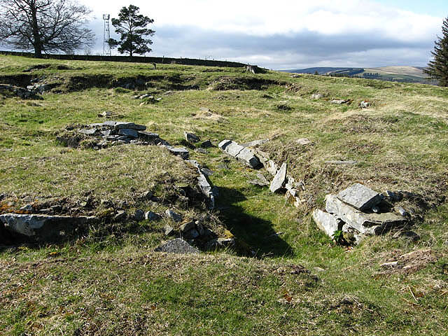
In addition to its natural attractions, Smithy Plantation also has historical significance. The remains of an old smithy, which once served as a blacksmith's workshop, can be found in the heart of the woodland. This relic from a bygone era adds an intriguing element to the plantation, allowing visitors to imagine the bustling activity that once took place in this serene setting.

Overall, Smithy Plantation is a captivating destination for those seeking a tranquil escape in the heart of nature. Its diverse flora and fauna, combined with its historical charm, make it a must-visit location for anyone exploring Roxburghshire.

If you have any feedback on the listing, please let us know in the comments section below.

Smithy Plantation Images

Images are sourced within 2km of 55.668956/-2.8069562 or Grid Reference NT4942. Thanks to Geograph Open Source API. All images are credited.

Longpark Wind Farm This telephoto shot was taken from the summit of Eildon Mid Hill on a calm November morning when valley fog persisted for most of the day.
Longpark Wind Farm
This telephoto shot was taken from the summit of Eildon Mid Hill on a calm November morning when valley fog persisted for most of the day.
Hareshawhead Plantation This bit of the wood  <a href="https://www.geograph.org.uk/photo/4202787">NT4842 : Clear felled area,  Hareshawhead Plantation</a> nearly five years on. A new crop of trees is getting established.
Hareshawhead Plantation
This bit of the wood NT4842 : Clear felled area, Hareshawhead Plantation nearly five years on. A new crop of trees is getting established.
Longpark Wind Farm On the ridge southeast of Stow.
Longpark Wind Farm
On the ridge southeast of Stow.
Turbine, Longpark Wind Farm With Meigle Hill in the background.
Turbine, Longpark Wind Farm
With Meigle Hill in the background.
Stow to Wooplaw road Passing the Longpark Wind Farm and Hareshawhead Plantation.
Stow to Wooplaw road
Passing the Longpark Wind Farm and Hareshawhead Plantation.
Road from Allanshaws near Lauder in the Scottish Borders
Allanshaws above Lauder in the Scottish Borders
Woodland above Allanshaws near Lauder in the Scottish Borders
Woodland on Allanshaws near Lauder in the Scottish Borders
Mossed-over wall on Allanshaws near Lauder
Steep farm track on Allanshaws near Lauder in the Scottish Borders
Mature woodland strip on Allanshaws near Lauder in the Scottish Borders
Road to Stow, Wooplaw The minor road through farmland bordering Longpark windfarm.
Road to Stow, Wooplaw
The minor road through farmland bordering Longpark windfarm.
Crest of the road at Wooplaw The road to Stow reaches 316m by the farm, here giving a view to the southernmost row of turbines in the Longpark wind farm.
Crest of the road at Wooplaw
The road to Stow reaches 316m by the farm, here giving a view to the southernmost row of turbines in the Longpark wind farm.
Farmland and plantations near Wooplaw Fields to the south of the minor road to Stow.
Farmland and plantations near Wooplaw
Fields to the south of the minor road to Stow.
Track to Hawksnest and Ladhopemuir The track passes Hawksnest farm and crosses farmland SSE to meet a minor road at Ladhopemuir north of Galashiels.
Track to Hawksnest and Ladhopemuir
The track passes Hawksnest farm and crosses farmland SSE to meet a minor road at Ladhopemuir north of Galashiels.
Wooplaw farm The name comes from the Norse 'uplaw' meaning a shallow valley at the top of a hill (from the information board at the Community Woodland). It is certainly on top of a hill as the land here is around 310m.
Wooplaw farm
The name comes from the Norse 'uplaw' meaning a shallow valley at the top of a hill (from the information board at the Community Woodland). It is certainly on top of a hill as the land here is around 310m.
Road east of Wooplaw The road meets the Langlee to Lauder road about 1km E of here.
Road east of Wooplaw
The road meets the Langlee to Lauder road about 1km E of here.
Show me another place!

Smithy Plantation is located at Grid Ref: NT4942 (Lat: 55.668956, Lng: -2.8069562)

Unitary Authority: The Scottish Borders

Police Authority: The Lothians and Scottish Borders

What 3 Words

///sprayer.racing.seated. Near Galashiels, Scottish Borders

Related Wikis

Allanshaws

Allanshaws is a place and farm off the B6362, in Lauderdale, by the Allan Water, in the parish of Melrose in the Scottish Borders area of Scotland, formerly...

Bow Castle Broch

Bow Castle is the remains of an iron-age broch near the Gala Water, in the Scottish Borders area of Scotland, in the parish of Stow. It is a scheduled...

Buckholm

Buckholm is a farm near to the A7, in the Scottish Borders, Galashiels area of Scotland. Places nearby include Abbotsford, the Bow Castle Broch, Clovenfords...

Stow of Wedale Town Hall

Stow of Wedale Town Hall is a municipal building in Earlston Road, Stow of Wedale, Scottish Borders, Scotland. The structure, which serves as a community...

Bowland railway station

Bowland railway station (Bowland Bridge between May 1849 and July 1862) was a railway station in the village of Bowland, near Galashiels, Scotland. Located...

Stow of Wedale

Stow of Wedale, or more often Stow, is a village in the Scottish Borders area of Scotland (historically Midlothian), 7 miles (11 kilometres) north of...

Bowshank

Bowshank is a village in the Scottish Borders area of Scotland, close to the A7, beside the Gala Water. Nearby are Bow Castle Broch, as well as Buckholm...

Torwoodlee Broch

Torwoodlee Broch is the remains of an iron-age broch located near the town of Galashiels in the Scottish Borders. == Description == Torwoodlee Broch...

Nearby Amenities

Located within 500m of 55.668956,-2.8069562
Wooplaw
Place: hamlet
Lat/Long: 55.6695064/-2.8049224
Power: pole
Lat/Long: 55.6663006/-2.8008056
Power: pole
Lat/Long: 55.6670176/-2.8011596
Power: pole
Lat/Long: 55.6676953/-2.8015512
Power: pole
Lat/Long: 55.6682793/-2.8018248
Power: pole
Lat/Long: 55.668966/-2.8021359
Power: pole
Lat/Long: 55.6695923/-2.8024417
Power: pole
Lat/Long: 55.6703214/-2.8028065
Power: pole
Lat/Long: 55.6719157/-2.8036434
Power: pole
Lat/Long: 55.6727234/-2.8040028
Power: pole
Lat/Long: 55.6711509/-2.8032419
The data included in this document is from www.openstreetmap.org. The data is made available under ODbL.

Have you been to Smithy Plantation?

Leave your review of Smithy Plantation below (or comments, questions and feedback).