Clash Wood

Wood, Forest in Fife

Scotland

Clash Wood

A915 - turn off to Cameron Kirk
A915 - turn off to Cameron Kirk Credit: Becky Williamson

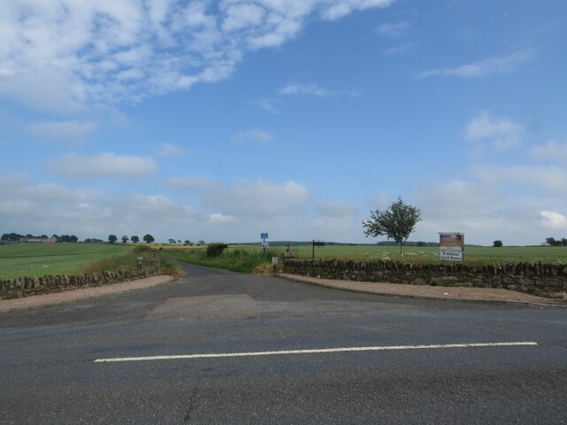
Clash Wood is a picturesque forest located in the region of Fife, Scotland. Covering an expansive area, it is a popular destination for nature enthusiasts and hikers alike. The wood is situated near the village of Colliston, providing easy access for visitors.

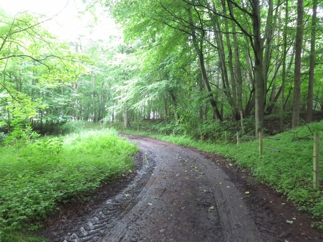
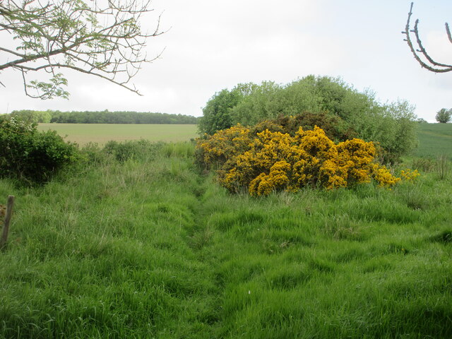
The woodland is primarily composed of native Scottish trees such as oak, birch, and beech, creating a diverse and vibrant ecosystem. The dense canopy of foliage provides a serene and peaceful atmosphere, making it an ideal spot for relaxation and escapism.

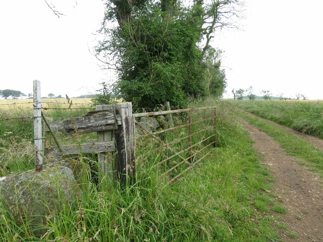
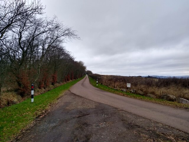
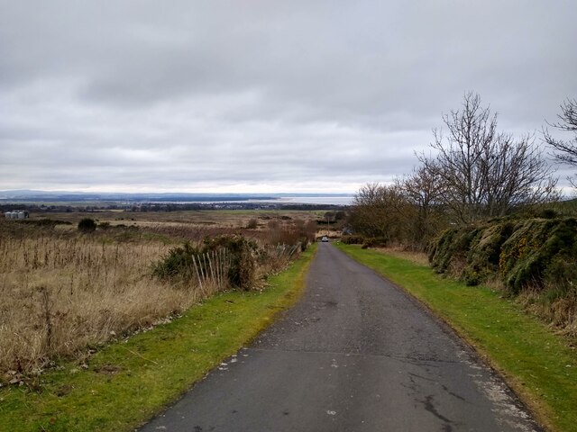
Clash Wood is renowned for its well-maintained trails and pathways, allowing visitors to explore the forest and its surroundings. The network of paths caters to all levels of fitness, from beginner to experienced hikers. Along the trails, walkers can discover an array of wildlife, including various bird species, rabbits, foxes, and deer. Nature enthusiasts will appreciate the diverse flora and fauna that call Clash Wood their home.

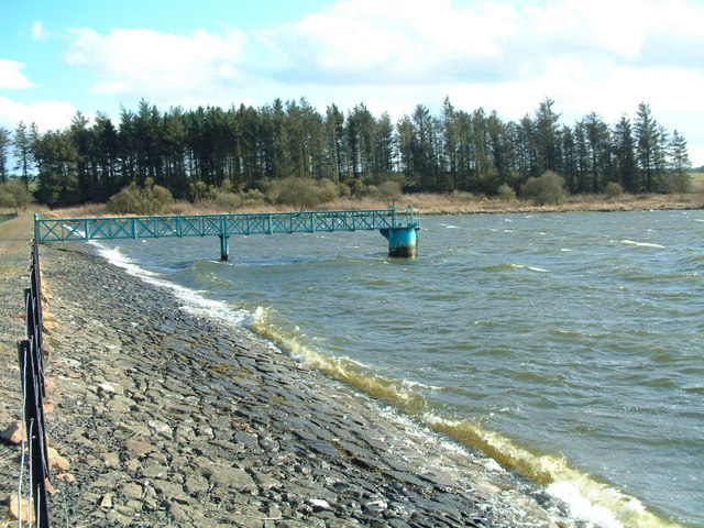
The wood is also home to Clash Wood Reservoir, a small body of water that adds to the beauty of the landscape. The reservoir attracts a variety of waterfowl, making it a popular spot for bird watching.

Clash Wood offers more than just natural beauty. It is steeped in history, with remnants of ancient settlements and archaeological sites scattered throughout the area. These historical features add an extra layer of intrigue and fascination to the woodland experience.

In summary, Clash Wood in Fife is a captivating forest that combines natural beauty, diverse wildlife, and historical significance. Whether visitors seek tranquility, exercise, or a deeper connection with nature, Clash Wood provides a truly enchanting experience.

If you have any feedback on the listing, please let us know in the comments section below.

Clash Wood Images

Images are sourced within 2km of 56.298465/-2.8315049 or Grid Reference NO4812. Thanks to Geograph Open Source API. All images are credited.

A915 - turn off to Cameron Kirk
Track to Winthank Farm The almost illegible sign reads: Private, No Entry.
Track to Winthank Farm
The almost illegible sign reads: Private, No Entry.
Priorletham Farm House
Track through Winthank Woods There are some disused lime works in this wood.
Track through Winthank Woods
There are some disused lime works in this wood.
Road to Priorletham T junction on the A915 south of St Andrews.
Road to Priorletham
T junction on the A915 south of St Andrews.
Private road to Feddinch Feddinch itself, in the next square, needs to be explored on foot.
Private road to Feddinch
Feddinch itself, in the next square, needs to be explored on foot.
Feddinch towards A915 This private road runs parallel to the A915 for a bit. Coming down from Feddinch, the views across St Andrews are marvellous.
Feddinch towards A915
This private road runs parallel to the A915 for a bit. Coming down from Feddinch, the views across St Andrews are marvellous.
Site entrance to nothing This is the entrance to Feddinch Mains, a golf course that has been 'under construction' for a long long time. Despite what the signs say, there is absolutely no construction going on on the entire site. The project originates from the late 1990s, and the last promises were made in 2020. But that last iteration seems to have hit a dead end in 2022, again.
Site entrance to nothing
This is the entrance to Feddinch Mains, a golf course that has been 'under construction' for a long long time. Despite what the signs say, there is absolutely no construction going on on the entire site. The project originates from the late 1990s, and the last promises were made in 2020. But that last iteration seems to have hit a dead end in 2022, again.
Feddinch Mains The farm Feddinch Mains, now mostly derelict, and surrounded by wasteland. An air of 'Texas Chainsaw Massacre'.
Feddinch Mains
The farm Feddinch Mains, now mostly derelict, and surrounded by wasteland. An air of 'Texas Chainsaw Massacre'.
Deep in no-man's land Apart from the private settlement Feddinch, this square is wasteland - abandoned by developers of the planned Feddinch golf course. It's not wasted though - it is inhabited by a lot of interesting creatures, including badgers, foxes, deer, ground-nesting birds, and feeding places for more birds. In an area dominated by actual golf courses and farmland, the derelict site is an oasis.
Deep in no-man's land
Apart from the private settlement Feddinch, this square is wasteland - abandoned by developers of the planned Feddinch golf course. It's not wasted though - it is inhabited by a lot of interesting creatures, including badgers, foxes, deer, ground-nesting birds, and feeding places for more birds. In an area dominated by actual golf courses and farmland, the derelict site is an oasis.
Ruins at Feddinch This is close to the western end of the undeveloped Feddinch golf course, about a kilometre west of the road, where the mud and short grass turns into more natural grassland. From here, a bit of improvisation leads to Craigtoun Country Park, just a short hop away, but a different world entirely.
Ruins at Feddinch
This is close to the western end of the undeveloped Feddinch golf course, about a kilometre west of the road, where the mud and short grass turns into more natural grassland. From here, a bit of improvisation leads to Craigtoun Country Park, just a short hop away, but a different world entirely.
Track from Cameron to Denhead Track heading through the woods near the disused Winthank Lime Works.
Track from Cameron to Denhead
Track heading through the woods near the disused Winthank Lime Works.
Faint path from Cameron to Denhead Section of path from Cameron heading north through an overgrown section of scrub.
Faint path from Cameron to Denhead
Section of path from Cameron heading north through an overgrown section of scrub.
Scrubland south of Cameron Reservoir Gorse and scrub near a burn south of Cameron Reservoir.
Scrubland south of Cameron Reservoir
Gorse and scrub near a burn south of Cameron Reservoir.
Cameron Reservoir Looking over Cameron Reservoir from the eastern end.
Cameron Reservoir
Looking over Cameron Reservoir from the eastern end.
Cameron Kirk Looking to the church at Cameron from the south-eastern corner of the kirkyard.
Cameron Kirk
Looking to the church at Cameron from the south-eastern corner of the kirkyard.
A915 Milestone Milestone with rusting cast-iron cap in the undergrowth by the A915 six miles south of St Andrews.
A915 Milestone
Milestone with rusting cast-iron cap in the undergrowth by the A915 six miles south of St Andrews.
C41 and A915 junction The C41 (Fife) road meeting the A915 near Lathockar.
C41 and A915 junction
The C41 (Fife) road meeting the A915 near Lathockar.
Show me another place!

Clash Wood is located at Grid Ref: NO4812 (Lat: 56.298465, Lng: -2.8315049)

Unitary Authority: Fife

Police Authority: Fife

What 3 Words

///guidebook.deaf.amplifier. Near St Andrews, Fife

Nearby Locations

Waterless Wood Clash Wood

Related Wikis

Cameron, Fife

Cameron is a parish in east Fife, Scotland, 3½ miles south-west of St Andrews.It is bounded on the north by the parish of St Andrews, on the east by Dunino...

Cameron Reservoir

Cameron Reservoir is an artificial loch in the parish of Cameron in east Fife, Scotland. Covering an area of 69 hectares, it serves as a domestic water...

Craigtoun Miniature Railway

The Craigtoun Park Railway is a 15 in (381 mm) gauge railway operating on a circular track around part of the Craigtoun Country Park in St Andrews, Fife...

Craigtoun Country Park

Craigtoun Country Park is a country park located approximately 4 miles to the south-west of St Andrews in the county of Fife, Scotland. The site is currently...

Mount Melville railway station

Mount Melville railway station served the Mount Melville estate outside St Andrews, Fife, Scotland from 1887 to 1930 on the Anstruther and St Andrews Railway...

Riggin o Fife

The Riggin o Fife is an upland area of Fife, Scotland which runs eastward from the Markinch Gap and the Howe of Fife to form the elevated hinterland to...

Bogward Dovecot

Bogward Doocot is a rare early beehive-type doocot, or dovecote, in the Scottish town of St Andrews, Fife. In 1971, it was designated as a Category A listed...

St Andrews Community Hospital

St Andrews Community Hospital is a small hospital to the south of the university town of St Andrews in Fife, Scotland. The hospital serves the town of...

Have you been to Clash Wood?

Leave your review of Clash Wood below (or comments, questions and feedback).