Foutysike Wood

Wood, Forest in Roxburghshire

Scotland

Foutysike Wood

A poignant gravestone at Ettleton Cemetery The main inscription reads:

SACRED
TO THE
MEMORY
OF
JANET SCOTT
DAUGHTER OF
HELEN SCOTT
WHO DIED AT
NEWCASTLETON
14TH MARCH
1863
AGED 2 YEARS
AND 
8 MONTHS.

The inscription above with a hand holding open the Holy Bible reads:

Suffer little
Children,
and forbid
them not,
to come
unto me;
for of 
such 
is the
kingdom 
of Heaven.
A poignant gravestone at Ettleton Cemetery Credit: Walter Baxter

Foutysike Wood, located in Roxburghshire, Scotland, is a picturesque forest that covers an area of approximately 200 acres. It is surrounded by stunning countryside and lies in close proximity to the village of Jedburgh. The wood is a popular destination for nature enthusiasts, hikers, and wildlife lovers.

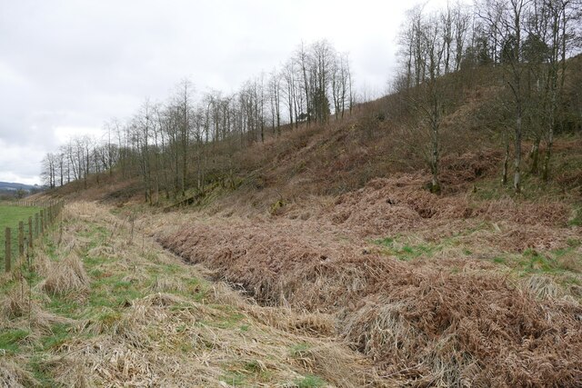
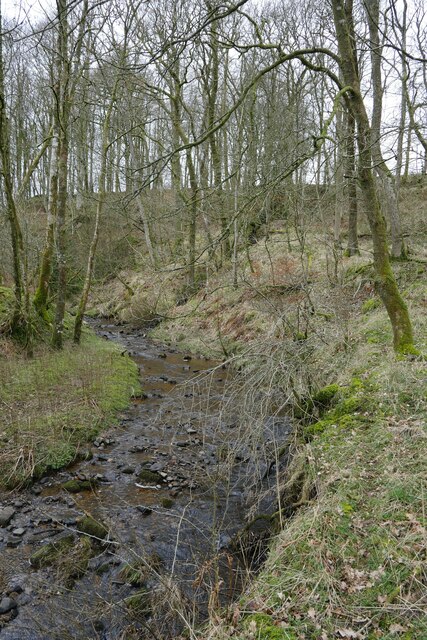
The woodland comprises a mix of broadleaf and coniferous trees, creating a diverse and vibrant ecosystem. Ancient oaks, towering pines, and beech trees are just some of the species that can be found in Foutysike Wood. The trees provide a habitat for a wide range of bird species, including woodpeckers, owls, and various songbirds.

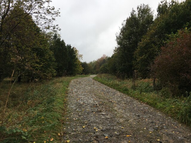
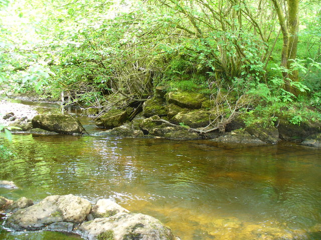
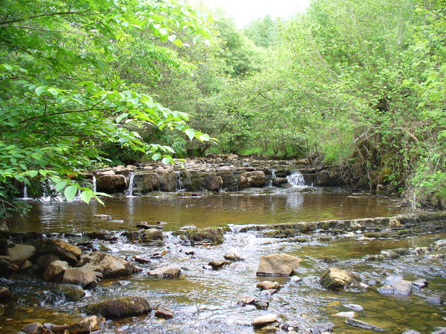
Trails and paths wind their way through the forest, offering visitors the opportunity to explore and immerse themselves in the tranquil surroundings. The well-maintained paths are suitable for both leisurely strolls and more challenging hikes. Along the way, visitors may come across babbling brooks, hidden ponds, and beautiful wildflowers that add to the natural beauty of the wood.

Foutysike Wood is also home to an abundance of wildlife. Red squirrels, badgers, and deer are commonly spotted within the forest, making it a haven for nature photographers and wildlife enthusiasts. The wood is carefully managed to ensure the preservation of its biodiversity and the protection of its inhabitants.

In addition to its natural beauty, Foutysike Wood offers visitors the opportunity to engage in outdoor activities such as picnicking, birdwatching, and nature photography. The peaceful and serene atmosphere of the wood makes it an ideal location for relaxation and reconnecting with nature.

If you have any feedback on the listing, please let us know in the comments section below.

Foutysike Wood Images

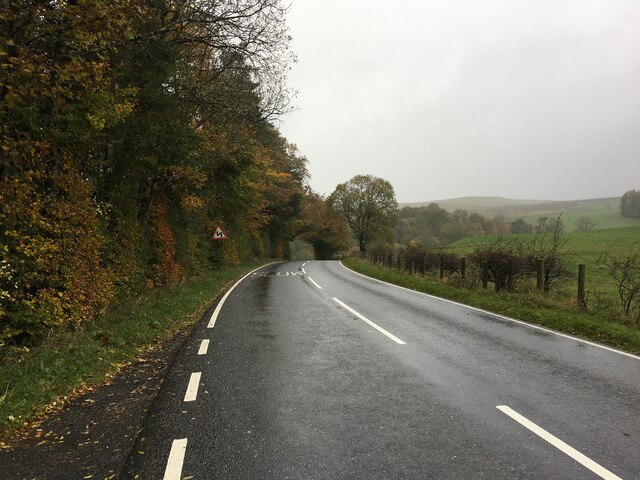
Images are sourced within 2km of 55.156444/-2.8142605 or Grid Reference NY4884. Thanks to Geograph Open Source API. All images are credited.

A poignant gravestone at Ettleton Cemetery The main inscription reads:

SACRED
TO THE
MEMORY
OF
JANET SCOTT
DAUGHTER OF
HELEN SCOTT
WHO DIED AT
NEWCASTLETON
14TH MARCH
1863
AGED 2 YEARS
AND 
8 MONTHS.

The inscription above with a hand holding open the Holy Bible reads:

Suffer little
Children,
and forbid
them not,
to come
unto me;
for of 
such 
is the
kingdom 
of Heaven.
A poignant gravestone at Ettleton Cemetery
The main inscription reads: SACRED TO THE MEMORY OF JANET SCOTT DAUGHTER OF HELEN SCOTT WHO DIED AT NEWCASTLETON 14TH MARCH 1863 AGED 2 YEARS AND 8 MONTHS. The inscription above with a hand holding open the Holy Bible reads: Suffer little Children, and forbid them not, to come unto me; for of such is the kingdom of Heaven.
B6357 near Kershopefoot
Road into Thistlesike Plantation
Above the Liddel Water floodplain near Gilside Open woodland above the Liddel Water floodplain south of Newcastleton.
Above the Liddel Water floodplain near Gilside
Open woodland above the Liddel Water floodplain south of Newcastleton.
A sike near Gilside This sike is just about to flow in to the Liddel Water and is the combined water of the Kenneth Sike and Foulwood Sike which drain moorland and forestry above the valley.
A sike near Gilside
This sike is just about to flow in to the Liddel Water and is the combined water of the Kenneth Sike and Foulwood Sike which drain moorland and forestry above the valley.
A view of the Liddesdale from Gilbraehead The meandering Liddel Water and adjacent sheep and cattle pasture predominate this view from just south of Gilbraehead.
A view of the Liddesdale from Gilbraehead
The meandering Liddel Water and adjacent sheep and cattle pasture predominate this view from just south of Gilbraehead.
Fields beside the Liddel Water
Millholm Cross The oldest relic of the Armstrongs', and erected to commemorate Alexander Armstrong, the 2nd  Laird who was, the story goes, treacherously killed around 1300 at Hermitage Castle by Lord de Soules. NB 'Millholm' on the OS maps, but 'Milnholm' on the Reiver Trail information board.
Millholm Cross
The oldest relic of the Armstrongs', and erected to commemorate Alexander Armstrong, the 2nd Laird who was, the story goes, treacherously killed around 1300 at Hermitage Castle by Lord de Soules. NB 'Millholm' on the OS maps, but 'Milnholm' on the Reiver Trail information board.
Ettleton Sike Looking up the sike from the northern side of the cemetery. There was a cuckoo in the tree, but it flew before I could record it.
Ettleton Sike
Looking up the sike from the northern side of the cemetery. There was a cuckoo in the tree, but it flew before I could record it.
Liddesdale from Ettleton Cemetery Looking across the valley towards Newcastleton Forest.
Liddesdale from Ettleton Cemetery
Looking across the valley towards Newcastleton Forest.
Liddesdale from Ettleton Cemetery Looking down the valley towards Carby Hill, which has an ancient settlement at its summit.
Liddesdale from Ettleton Cemetery
Looking down the valley towards Carby Hill, which has an ancient settlement at its summit.
The Reiver Trail at the Millholm Cross Information board about the cross and trail <span class="nowrap"><a title="www.thereivertrail.com" rel="nofollow ugc noopener" href="http://www.thereivertrail.com">Link</a><img style="margin-left:2px;" alt="External link" title="External link - shift click to open in new window" src="https://s1.geograph.org.uk/img/external.png" width="10" height="10"/></span> [spelled Milnholm on the board, Millholm on the OS map], on the B6357 just south of Newcastleton or Copshaw Holm.
The Reiver Trail at the Millholm Cross
Information board about the cross and trail LinkExternal link [spelled Milnholm on the board, Millholm on the OS map], on the B6357 just south of Newcastleton or Copshaw Holm.
The road to Newcastleton or Copshaw Holm Looking north in Liddesdale along the B6357 from the Millholm Cross.
The road to Newcastleton or Copshaw Holm
Looking north in Liddesdale along the B6357 from the Millholm Cross.
Ettleton Cemetery Looking across to the north; the cemetery is the burial ground of many of the Armstrongs, and the obelisk commemorates William Armstrong, who was shot by the Rev. Joseph Smith in 1852. Walter Baxter's description <a href="https://www.geograph.org.uk/photo/809486">NY4786 : The William Armstrong Obelisk</a> transcribes the inscriptions on three faces, two of which are seen in <a href="https://www.geograph.org.uk/photo/2373683">NY4786 : Inscription on the Armstrong Obelisk</a> and <a href="https://www.geograph.org.uk/photo/2373690">NY4786 : The Armstrong Obelisk at Ettleton</a>.
Ettleton Cemetery
Looking across to the north; the cemetery is the burial ground of many of the Armstrongs, and the obelisk commemorates William Armstrong, who was shot by the Rev. Joseph Smith in 1852. Walter Baxter's description NY4786 : The William Armstrong Obelisk transcribes the inscriptions on three faces, two of which are seen in NY4786 : Inscription on the Armstrong Obelisk and NY4786 : The Armstrong Obelisk at Ettleton.
Inscription on the Armstrong Obelisk The northwestern face of the plinth <a href="https://www.geograph.org.uk/photo/2373668">NY4786 : Ettleton Cemetery</a>.
Inscription on the Armstrong Obelisk
The northwestern face of the plinth NY4786 : Ettleton Cemetery.
The Armstrong Obelisk at Ettleton The inscription on the western face of the plinth <a href="https://www.geograph.org.uk/photo/2373668">NY4786 : Ettleton Cemetery</a>.
The Armstrong Obelisk at Ettleton
The inscription on the western face of the plinth NY4786 : Ettleton Cemetery.
The Black Pool
The Black Pool
Tweeden Burn
Tweeden Burn
Show me another place!

Foutysike Wood is located at Grid Ref: NY4884 (Lat: 55.156444, Lng: -2.8142605)

Unitary Authority: The Scottish Borders

Police Authority: The Lothians and Scottish Borders

What 3 Words

///approvals.cheetahs.veal. Near Langholm, Dumfries & Galloway

Related Wikis

Nearby Amenities

Located within 500m of 55.156444,-2.8142605
Sorbietrees
Naptan AtcoCode: 69001468
Naptan Bearing: N
Naptan BusStopType: CUS
Naptan CommonName: Sorbietrees
Naptan Indicator: o/s Farm
Naptan Landmark: Farm
Naptan NaptanCode: 72725847
Naptan Street: Sorbietrees
Naptan Verified: no
Source: naptan_import
Lat/Long: 55.1531665/-2.8109979
Sorbietrees
Naptan AtcoCode: 69001469
Naptan Bearing: S
Naptan BusStopType: CUS
Naptan CommonName: Sorbietrees
Naptan Indicator: opp Farm
Naptan Landmark: Farm
Naptan NaptanCode: 72725856
Naptan Street: Sorbietrees
Naptan Verified: no
Source: naptan_import
Lat/Long: 55.1531683/-2.8107311
Power: pole
Lat/Long: 55.1550229/-2.8216017
Power: pole
Lat/Long: 55.1562458/-2.8212552
Power: pole
Lat/Long: 55.1574069/-2.8209334
Power: pole
Lat/Long: 55.1586456/-2.8205785
Power: pole
Lat/Long: 55.1521603/-2.8123962
Power: pole
Lat/Long: 55.1528945/-2.8132768
Power: pole
Lat/Long: 55.1533138/-2.8137686
Power: pole
Lat/Long: 55.1534021/-2.8124322
Power: pole
Lat/Long: 55.1534448/-2.8116108
Power: pole
Lat/Long: 55.1541289/-2.8113044
Power: pole
Lat/Long: 55.1575744/-2.8217175
Power: pole
Lat/Long: 55.1574494/-2.8202549
Power: pole
Lat/Long: 55.1567778/-2.8197695
Power: pole
Lat/Long: 55.156104/-2.8192211
Power: pole
Lat/Long: 55.155617/-2.8188735
The data included in this document is from www.openstreetmap.org. The data is made available under ODbL.

Have you been to Foutysike Wood?

Leave your review of Foutysike Wood below (or comments, questions and feedback).