Abbotshaws Strip

Wood, Forest in Roxburghshire

Scotland

Abbotshaws Strip

Hair ice on a fallen branch A very particular set of conditions are required for the formation of hair ice, caused by the actions of a specific fungus: 'To form, moist rotting wood from a broadleaf tree is required with the presence of moist air and a temperature slightly below 0°C. It is generally confined to latitudes between 45°N and 55°N' according to the Met Office <span class="nowrap"><a title="https://www.metoffice.gov.uk/weather/learn-about/weather/types-of-weather/frost-and-ice/hair-ice" rel="nofollow ugc noopener" href="https://www.metoffice.gov.uk/weather/learn-about/weather/types-of-weather/frost-and-ice/hair-ice">Link</a><img style="margin-left:2px;" alt="External link" title="External link - shift click to open in new window" src="https://s1.geograph.org.uk/img/external.png" width="10" height="10"/></span>.
Hair ice on a fallen branch Credit: James T M Towill

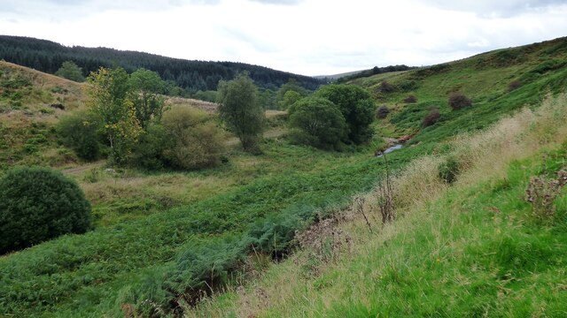
Abbotshaws Strip is a picturesque woodland located in Roxburghshire, a region in the Scottish Borders of Scotland. This enchanting forest is renowned for its stunning natural beauty and rich biodiversity, attracting nature enthusiasts and adventurers alike.

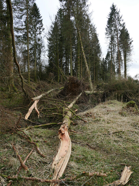
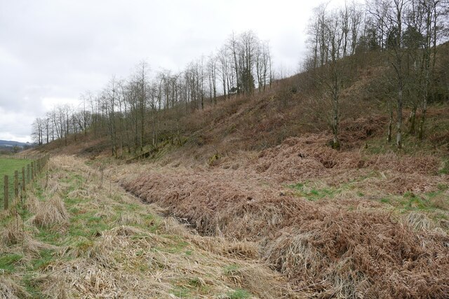
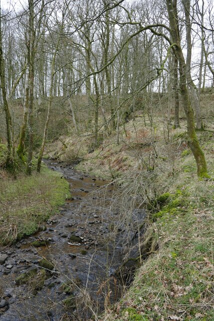
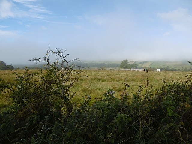
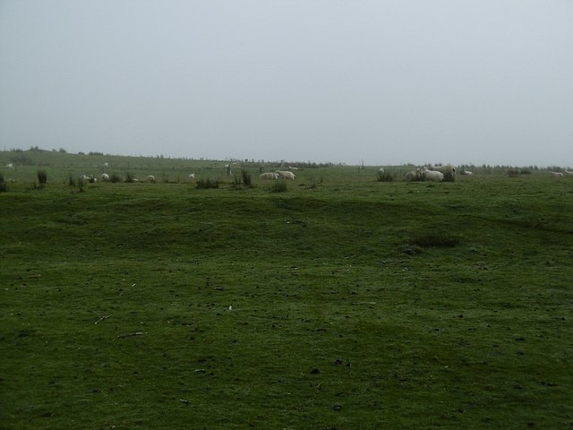
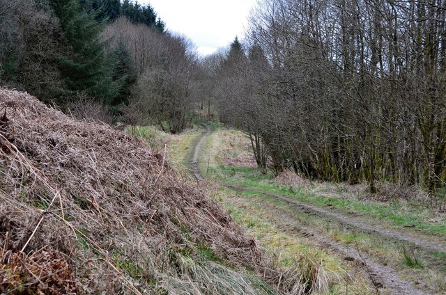
Covering an area of approximately 100 acres, Abbotshaws Strip is characterized by its dense foliage, towering trees, and a diverse range of flora and fauna. The woodland is predominantly made up of native species such as oak, birch, and pine, creating a serene and tranquil atmosphere. The forest floor is carpeted with a variety of wildflowers, adding splashes of color to the landscape.

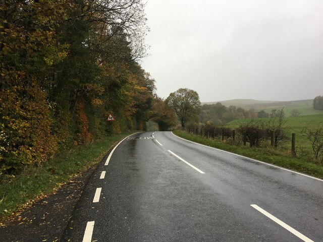
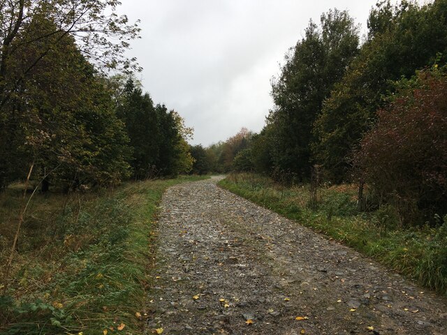
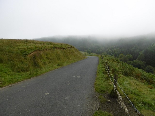
A network of walking trails and paths meanders through the forest, offering visitors the opportunity to explore its hidden treasures. These trails cater to different skill levels, providing options for both leisurely strolls and more challenging hikes. Along the way, visitors may encounter a range of wildlife, including deer, rabbits, squirrels, and a variety of bird species.

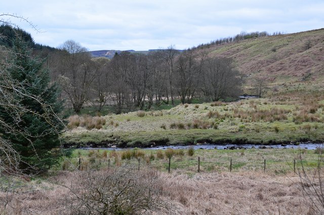
Abbotshaws Strip also boasts a small river that meanders through the woodland, adding to its natural charm. The river provides a habitat for various aquatic creatures and creates opportunities for fishing or simply enjoying the soothing sound of flowing water.

With its idyllic setting and diverse ecosystem, Abbotshaws Strip is not only a haven for nature lovers but also a valuable resource for scientific research and education. It serves as an important site for studying woodland ecology and conservation efforts.

Overall, Abbotshaws Strip in Roxburghshire is a captivating woodland that offers visitors a chance to immerse themselves in nature and experience the tranquility of the Scottish Borders.

If you have any feedback on the listing, please let us know in the comments section below.

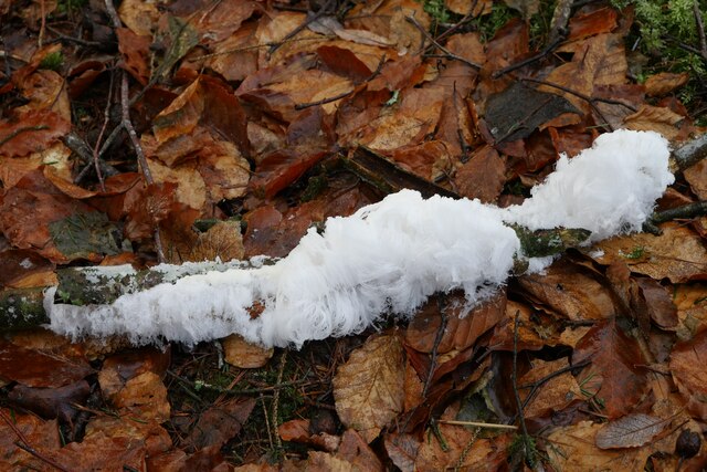
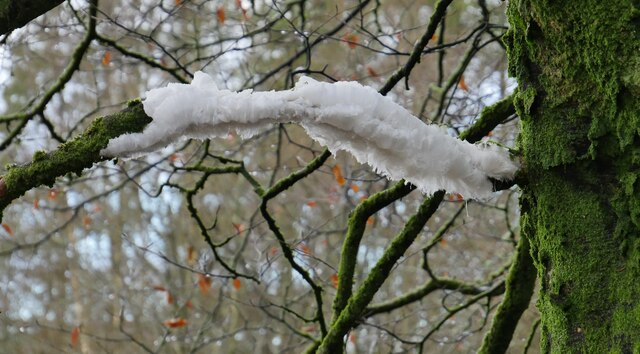
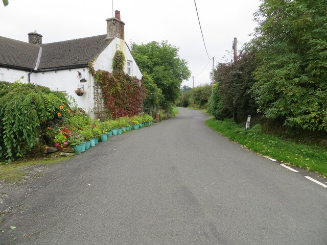
Abbotshaws Strip Images

Images are sourced within 2km of 55.147949/-2.8174296 or Grid Reference NY4884. Thanks to Geograph Open Source API. All images are credited.

Hair ice on a fallen branch A very particular set of conditions are required for the formation of hair ice, caused by the actions of a specific fungus: 'To form, moist rotting wood from a broadleaf tree is required with the presence of moist air and a temperature slightly below 0°C. It is generally confined to latitudes between 45°N and 55°N' according to the Met Office <span class="nowrap"><a title="https://www.metoffice.gov.uk/weather/learn-about/weather/types-of-weather/frost-and-ice/hair-ice" rel="nofollow ugc noopener" href="https://www.metoffice.gov.uk/weather/learn-about/weather/types-of-weather/frost-and-ice/hair-ice">Link</a><img style="margin-left:2px;" alt="External link" title="External link - shift click to open in new window" src="https://s1.geograph.org.uk/img/external.png" width="10" height="10"/></span>.
Hair ice on a fallen branch
A very particular set of conditions are required for the formation of hair ice, caused by the actions of a specific fungus: 'To form, moist rotting wood from a broadleaf tree is required with the presence of moist air and a temperature slightly below 0°C. It is generally confined to latitudes between 45°N and 55°N' according to the Met Office LinkExternal link.
Hair ice on a tree branch at Kershopefoot A very particular set of conditions are required for the formation of hair ice, caused by the actions of a specific fungus: 'To form, moist rotting wood from a broadleaf tree is required with the presence of moist air and a temperature slightly below 0°C. It is generally confined to latitudes between 45°N and 55°N' according to the Met Office <span class="nowrap"><a title="https://www.metoffice.gov.uk/weather/learn-about/weather/types-of-weather/frost-and-ice/hair-ice" rel="nofollow ugc noopener" href="https://www.metoffice.gov.uk/weather/learn-about/weather/types-of-weather/frost-and-ice/hair-ice">Link</a><img style="margin-left:2px;" alt="External link" title="External link - shift click to open in new window" src="https://s1.geograph.org.uk/img/external.png" width="10" height="10"/></span>.
Hair ice on a tree branch at Kershopefoot
A very particular set of conditions are required for the formation of hair ice, caused by the actions of a specific fungus: 'To form, moist rotting wood from a broadleaf tree is required with the presence of moist air and a temperature slightly below 0°C. It is generally confined to latitudes between 45°N and 55°N' according to the Met Office LinkExternal link.
Kershope Valley The border between England on the left and Scotland on the right.
Kershope Valley
The border between England on the left and Scotland on the right.
Minor road between Stonegarthside Hall and Kershope House Looking north-eastward.
Minor road between Stonegarthside Hall and Kershope House
Looking north-eastward.
Minor road at Kershopefoot Looking south-eastward.
Minor road at Kershopefoot
Looking south-eastward.
Kershopefoot tree nursery: Storm Arwen damage Storm Arwen (26/27 November 2021) damage at the tree nursery near Kershopefoot.  For further information on the nursery, refer to <a href="https://www.geograph.org.uk/photo/6784123">NY4782 : Track through the tree nursery</a>

This photograph was taken during the Coronavirus (COVID-19) pandemic of 2020/21/22.
Kershopefoot tree nursery: Storm Arwen damage
Storm Arwen (26/27 November 2021) damage at the tree nursery near Kershopefoot. For further information on the nursery, refer to NY4782 : Track through the tree nursery This photograph was taken during the Coronavirus (COVID-19) pandemic of 2020/21/22.
B6357 near Kershopefoot
Road into Thistlesike Plantation
Above the Liddel Water floodplain near Gilside Open woodland above the Liddel Water floodplain south of Newcastleton.
Above the Liddel Water floodplain near Gilside
Open woodland above the Liddel Water floodplain south of Newcastleton.
A sike near Gilside This sike is just about to flow in to the Liddel Water and is the combined water of the Kenneth Sike and Foulwood Sike which drain moorland and forestry above the valley.
A sike near Gilside
This sike is just about to flow in to the Liddel Water and is the combined water of the Kenneth Sike and Foulwood Sike which drain moorland and forestry above the valley.
A view of the Liddesdale from Gilbraehead The meandering Liddel Water and adjacent sheep and cattle pasture predominate this view from just south of Gilbraehead.
A view of the Liddesdale from Gilbraehead
The meandering Liddel Water and adjacent sheep and cattle pasture predominate this view from just south of Gilbraehead.
Damp pasture, Liddesdale Morning fog lifts from Liddesdale, downstream from Newcastleton.
Damp pasture, Liddesdale
Morning fog lifts from Liddesdale, downstream from Newcastleton.
Autumn morning, Liddesdale Mist clears from Carby Hill. Fog had filled the low ground around the Solway Firth and had moved up Liddesdale, rising as the Sun warmed the air.
Autumn morning, Liddesdale
Mist clears from Carby Hill. Fog had filled the low ground around the Solway Firth and had moved up Liddesdale, rising as the Sun warmed the air.
Lifting fog, Sorbietrees Morning fog lifting in Liddesdale and revealing Carby Hill.
Lifting fog, Sorbietrees
Morning fog lifting in Liddesdale and revealing Carby Hill.
Hill grazings, Carby Hill Off the unfenced road from Newcastleton to Kershope Bridge and England.
Hill grazings, Carby Hill
Off the unfenced road from Newcastleton to Kershope Bridge and England.
Newcastleton to Kershope road On the descent from a shoulder of Carby Hill towards the border at Kershope Bridge.
Newcastleton to Kershope road
On the descent from a shoulder of Carby Hill towards the border at Kershope Bridge.
Kershope Burn downstream of the bridge The burn winds its way down a grassy valley with Kershope Forest on the south side.
Kershope Burn downstream of the bridge
The burn winds its way down a grassy valley with Kershope Forest on the south side.
Path to Kershopefoot A path through woodland above the bank of the burn.
Path to Kershopefoot
A path through woodland above the bank of the burn.
Show me another place!

Abbotshaws Strip is located at Grid Ref: NY4884 (Lat: 55.147949, Lng: -2.8174296)

Unitary Authority: The Scottish Borders

Police Authority: The Lothians and Scottish Borders

What 3 Words

///enough.talked.snuck. Near Langholm, Dumfries & Galloway

Related Wikis

Nearby Amenities

Located within 500m of 55.147949,-2.8174296
Power: pole
Lat/Long: 55.146092/-2.8244277
Power: pole
Lat/Long: 55.1470278/-2.8240118
Power: pole
Lat/Long: 55.1479625/-2.8235934
Power: pole
Lat/Long: 55.1491685/-2.8232454
Power: pole
Lat/Long: 55.1503272/-2.8229208
Power: pole
Lat/Long: 55.1465483/-2.8228865
Power: pole
Lat/Long: 55.1468191/-2.8219647
Power: pole
Lat/Long: 55.1460568/-2.8207776
Power: pole
Lat/Long: 55.1453107/-2.8196344
Power: pole
Lat/Long: 55.144625/-2.8185864
Power: pole
Lat/Long: 55.1449046/-2.817474
Power: pole
Lat/Long: 55.1451665/-2.8164105
Power: pole
Lat/Long: 55.145714/-2.8155042
Power: pole
Lat/Long: 55.1462511/-2.8146081
Power: pole
Lat/Long: 55.1467808/-2.8137403
Power: pole
Lat/Long: 55.1475313/-2.8132511
Power: pole
Lat/Long: 55.1482641/-2.812767
Power: pole
Lat/Long: 55.1489836/-2.8123061
Power: pole
Lat/Long: 55.1496899/-2.811858
Power: pole
Lat/Long: 55.1504168/-2.8113714
Power: pole
Lat/Long: 55.1493839/-2.8243105
The data included in this document is from www.openstreetmap.org. The data is made available under ODbL.

Have you been to Abbotshaws Strip?

Leave your review of Abbotshaws Strip below (or comments, questions and feedback).