Woodfoot Plantation

Wood, Forest in Roxburghshire

Scotland

Woodfoot Plantation

Lane to Wiltonburn farm Junction with the minor road to Wilton Dean. The sign advertises Country Cashmeres and Farmhouse B&B at Wiltonburn.
Lane to Wiltonburn farm Credit: Jim Barton

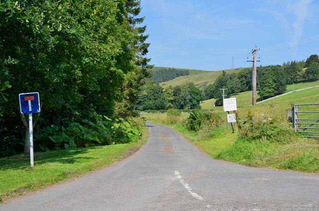
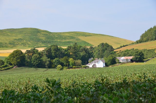
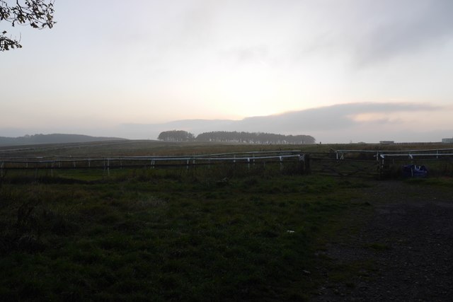
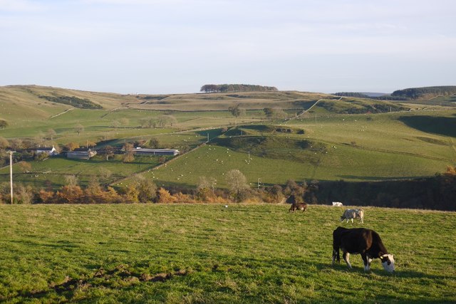
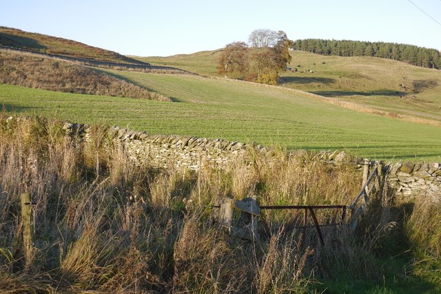
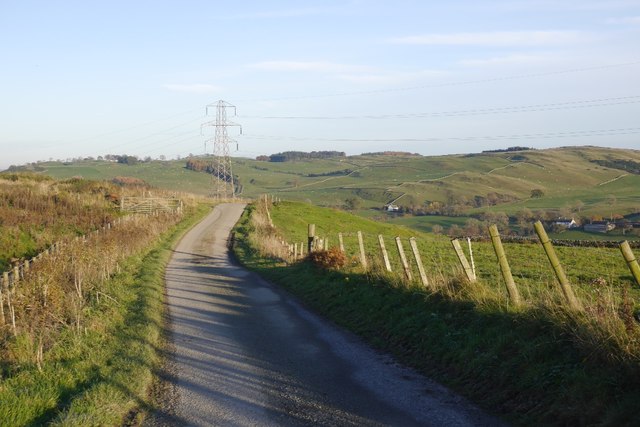
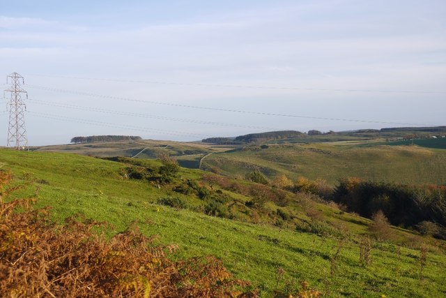
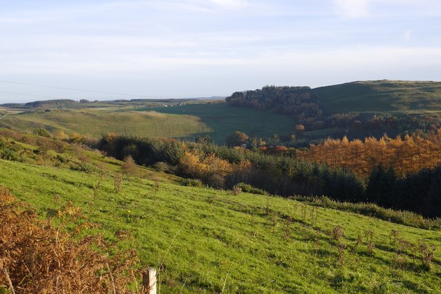
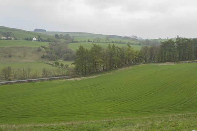
Woodfoot Plantation is a picturesque estate located in Roxburghshire, Scotland. Situated amidst rolling hills and lush forests, the plantation covers a vast expanse of land, making it a haven for nature enthusiasts and outdoor adventurers alike.

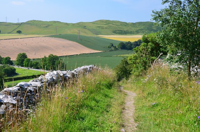
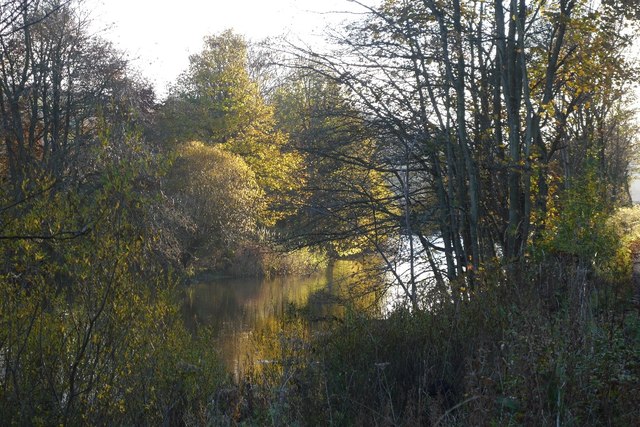
The plantation is renowned for its dense woodlands, which are dominated by a variety of towering trees including oak, beech, and pine. These woodlands offer a serene and tranquil atmosphere, providing the perfect setting for leisurely walks and peaceful picnics. The forest floor is adorned with a rich carpet of wildflowers, creating a colorful display during the spring and summer months.

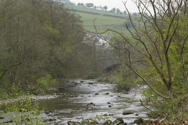
In addition to its natural beauty, Woodfoot Plantation is home to a diverse array of wildlife. Visitors can spot a range of woodland creatures such as deer, foxes, and squirrels, as well as a variety of bird species including woodpeckers and owls. The plantation also boasts several freshwater streams and ponds, which attract an abundance of aquatic life including frogs, newts, and waterfowl.

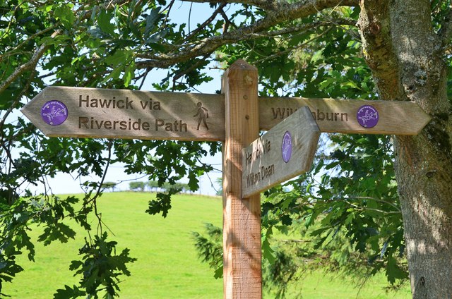
For those seeking more active pursuits, Woodfoot Plantation offers a network of well-maintained trails and paths, perfect for hiking, cycling, and horseback riding. The plantation also provides facilities for camping, allowing visitors to fully immerse themselves in the natural surroundings.

With its enchanting woodlands, diverse wildlife, and recreational opportunities, Woodfoot Plantation is a true gem in Roxburghshire. Whether one seeks relaxation or adventure, this idyllic estate offers something for everyone.

If you have any feedback on the listing, please let us know in the comments section below.

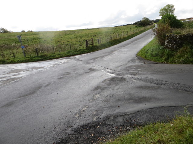
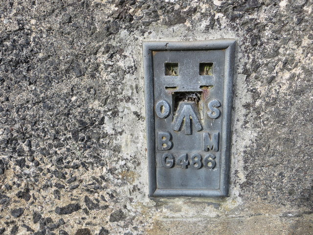
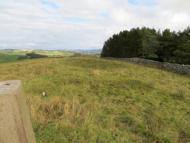
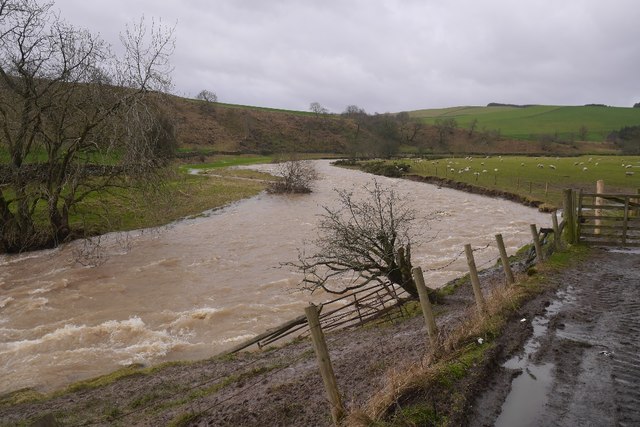
Woodfoot Plantation Images

Images are sourced within 2km of 55.409412/-2.8340501 or Grid Reference NT4713. Thanks to Geograph Open Source API. All images are credited.

Lane to Wiltonburn farm Junction with the minor road to Wilton Dean. The sign advertises Country Cashmeres and Farmhouse B&B at Wiltonburn.
Lane to Wiltonburn farm
Junction with the minor road to Wilton Dean. The sign advertises Country Cashmeres and Farmhouse B&B at Wiltonburn.
Footpath signpost near Wilton Burn The purple badges mark the Romans and Reivers Route.
Footpath signpost near Wilton Burn
The purple badges mark the Romans and Reivers Route.
Wiltonburn farm Seen from the path near Brieryhill.
Wiltonburn farm
Seen from the path near Brieryhill.
Cross Borders Drove Road Quite narrow for a drove road, the path runs between stone walls on the E side of Wiltonburn Hill.
Cross Borders Drove Road
Quite narrow for a drove road, the path runs between stone walls on the E side of Wiltonburn Hill.
St Leonard's Park The racecourse plays a big part in the Common Riding.
St Leonard's Park
The racecourse plays a big part in the Common Riding.
River Teviot Downstream of Martin's Bridge.
River Teviot
Downstream of Martin's Bridge.
Grazing, Branxholme A view across Teviotdale.
Grazing, Branxholme
A view across Teviotdale.
Branxholmpark Hill Grass fields above the Teviot, upstream of Hawick.
Branxholmpark Hill
Grass fields above the Teviot, upstream of Hawick.
Narrow road, Branxholme A scenic road with a couple of gates.
Narrow road, Branxholme
A scenic road with a couple of gates.
Branxholme Knowe A scrubby steep piece of hillside amongst improved fields.
Branxholme Knowe
A scrubby steep piece of hillside amongst improved fields.
Branxholm Glen Wooded slopes above the Teviot.
Branxholm Glen
Wooded slopes above the Teviot.
Ordnance Survey Fundamental Bench Mark - Hawick This can be found hidden in the grass on the roadside verge of the cross-roads near Nipknowes Quarry.
For more detail see : <span class="nowrap"><a title="http://www.bench-marks.org.uk/bm1079" rel="nofollow ugc noopener" href="http://www.bench-marks.org.uk/bm1079">Link</a><img style="margin-left:2px;" alt="External link" title="External link - shift click to open in new window" src="https://s1.geograph.org.uk/img/external.png" width="10" height="10"/></span>
Ordnance Survey Fundamental Bench Mark - Hawick
This can be found hidden in the grass on the roadside verge of the cross-roads near Nipknowes Quarry. For more detail see : LinkExternal link
Cross Roads near Nipknowes Quarry Looking westward.
Cross Roads near Nipknowes Quarry
Looking westward.
Ordnance Survey Flush Bracket G486 This can be found on the retaining wall of Branxholm Bridge.
For more detail see : <span class="nowrap"><a title="http://www.bench-marks.org.uk/bm20289" rel="nofollow ugc noopener" href="http://www.bench-marks.org.uk/bm20289">Link</a><img style="margin-left:2px;" alt="External link" title="External link - shift click to open in new window" src="https://s1.geograph.org.uk/img/external.png" width="10" height="10"/></span>
Ordnance Survey Flush Bracket G486
This can be found on the retaining wall of Branxholm Bridge. For more detail see : LinkExternal link
Wall-side view from Branxholmpark Hill Triangulation Pillar Looking north-eastward.
Wall-side view from Branxholmpark Hill Triangulation Pillar
Looking north-eastward.
Spate, Borthwick Water For the last couple of months the Teviot and its tributaries had been running high with occasional damaging flooding.
Spate, Borthwick Water
For the last couple of months the Teviot and its tributaries had been running high with occasional damaging flooding.
Improved pasture Looking down across improved pasture to the A7 road. This is close to Branxholm Bridge.
Improved pasture
Looking down across improved pasture to the A7 road. This is close to Branxholm Bridge.
Martin's Bridge The bridge carries the A7 across the River Teviot. We walked along the river from the middle of Hawick and werepleased to see Goosander, Dipper, many Wagtail Pied and Grey and a Bullfinch as well as many other more common birds.
Martin's Bridge
The bridge carries the A7 across the River Teviot. We walked along the river from the middle of Hawick and werepleased to see Goosander, Dipper, many Wagtail Pied and Grey and a Bullfinch as well as many other more common birds.
Show me another place!

Woodfoot Plantation is located at Grid Ref: NT4713 (Lat: 55.409412, Lng: -2.8340501)

Unitary Authority: The Scottish Borders

Police Authority: The Lothians and Scottish Borders

What 3 Words

///armed.much.transmits. Near Hawick, Scottish Borders

Related Wikis

Borthwick Water

The Borthwick Water (Border Scots: Borthwick Witter) is a river in the Scottish Borders area of Scotland, and a tributary of the River Teviot. The Aithouse...

Branxholme Castle

Branxholme Castle is a five-storey tower at Branxholme, about 3 miles south-west of Hawick in the Borders region of Scotland. == History == The present...

Branxholme

Branxholme is a hamlet in the Scottish Borders area of Scotland, overlooking the River Teviot, three miles southwest of Hawick, on the A7 road to Langholm...

Wilton Dean

Wilton Dean is a village in the Scottish Borders area of Scotland, on the Cala Burn, and close to the River Teviot. Along with Stirches and...

Hawick Cottage Hospital

Hawick Cottage Hospital was a health facility at Buccleuch Road in Hawick, Scotland. It was managed by NHS Borders. It is a Category B listed building...

Hawick High School

Hawick High School is a non-denominational secondary school in Hawick, in the Scottish Borders. As well as serving the town, it also takes in pupils from...

Harden Castle

Harden Castle is a 16th century tower house, about 3.5 miles (5.6 km) west of Hawick, Scottish Borders. It is alternatively known as Harden House or Harden...

Hawick Community Hospital

Hawick Community Hospital is a health facility at Victoria Road in Hawick, Scotland. It is managed by NHS Borders. == History == The hospital was commissioned...

Nearby Amenities

Located within 500m of 55.409412,-2.8340501
Bus Stop
Haysike Road End
Alt Name: Goldielands
Bus: yes
Naptan AtcoCode: 69001250
Naptan Bearing: S
Naptan CommonName: Haysike Rd End
Naptan Indicator: nr
Naptan NaptanCode: 72726476
Naptan Street: A7
Operator: Scottish Borders Council
Public Transport: platform
Ref: 69001250
Source: NaPTAN
Lat/Long: 55.4073191/-2.8294933
Branxholme Bridgend
Alt Name: Goldielands
Naptan AltCommonName: Goldielands
Naptan AltIndicator: northbound
Naptan AltLandmark: Haysike Road
Naptan AltShortCommonName: Goldielands
Naptan AltStreet: A7
Naptan AtcoCode: 69001251
Naptan Bearing: N
Naptan BusStopType: CUS
Naptan CommonName: Branxholme Bridgend
Naptan Indicator: opp road end
Naptan Landmark: Haysike Road End
Naptan NaptanCode: 72726493
Naptan Street: A7
Naptan Verified: no
Source: naptan_import
Lat/Long: 55.407661/-2.8294372
Borthaugh
Place: hamlet
Lat/Long: 55.4118779/-2.8284191
Branxholm Woodfoot
Place: hamlet
Lat/Long: 55.4098093/-2.8303559
Ford: yes
Lat/Long: 55.4105161/-2.8317877
Power: tower
Lat/Long: 55.4058088/-2.8386336
Power: tower
Lat/Long: 55.4137655/-2.8340094
Power: tower
Lat/Long: 55.4120764/-2.8349985
Power: tower
Lat/Long: 55.4070119/-2.8379308
Power: tower
Lat/Long: 55.408224/-2.8372226
Give Way
Direction: backward
Lat/Long: 55.4076037/-2.8292717
Power: pole
Lat/Long: 55.4054937/-2.837179
Power: pole
Lat/Long: 55.4060374/-2.8361973
Power: pole
Lat/Long: 55.4066998/-2.8350171
Power: pole
Lat/Long: 55.4071247/-2.8342366
Power: pole
Lat/Long: 55.4077361/-2.8331275
Power: pole
Lat/Long: 55.4081777/-2.8323363
Power: pole
Lat/Long: 55.4086505/-2.831486
Power: pole
Lat/Long: 55.4092272/-2.8304084
Power: pole
Lat/Long: 55.4120415/-2.8286281
Power: pole
Lat/Long: 55.4113426/-2.8288507
Power: pole
Lat/Long: 55.410729/-2.8290707
Power: pole
Lat/Long: 55.4098002/-2.8293952
Power: pole
Lat/Long: 55.4119209/-2.8289495
Power: pole
Lat/Long: 55.4117571/-2.829431
Power: pole
Lat/Long: 55.411494/-2.8308241
Power: pole
Lat/Long: 55.4113522/-2.8315245
Power: pole
Lat/Long: 55.4112075/-2.8322378
Power: pole
Lat/Long: 55.4076359/-2.8321609
Power: pole
Lat/Long: 55.4071836/-2.8313541
Power: pole
Lat/Long: 55.4066678/-2.8305346
Power: pole
Lat/Long: 55.4062372/-2.8298041
Power: pole
Lat/Long: 55.4106283/-2.8270968
The data included in this document is from www.openstreetmap.org. The data is made available under ODbL.

Have you been to Woodfoot Plantation?

Leave your review of Woodfoot Plantation below (or comments, questions and feedback).