Corsehope Plantation
Wood, Forest in East Lothian
Scotland
Corsehope Plantation

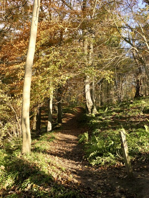
Corsehope Plantation is a picturesque woodland located in East Lothian, Scotland. Spread over a vast area, this plantation is known for its dense forest and captivating natural beauty.
The plantation is home to a variety of trees, including oak, beech, and pine, which create a lush green canopy that stretches as far as the eye can see. The trees in Corsehope Plantation are of significant ecological importance, providing a habitat for various bird species, small mammals, and insects.
The woodland is crisscrossed by a network of trails, making it a popular destination for hikers, nature enthusiasts, and dog walkers. These well-maintained paths offer visitors the opportunity to explore the plantation's hidden corners and discover its hidden gems.
Corsehope Plantation also holds historical significance. It is said to have been used as a hunting ground by the ancient Picts, a Celtic people who once inhabited the area. Remnants of their presence, such as ancient stone structures, can still be found within the woodland.
The plantation is also a haven for wildlife, with sightings of red squirrels, deer, and various bird species being common. The serene atmosphere and peaceful surroundings make it an ideal place for birdwatching and wildlife photography.
In summary, Corsehope Plantation in East Lothian is a captivating woodland that offers visitors the chance to immerse themselves in nature. With its diverse range of trees, well-maintained trails, and rich history, it is a must-visit destination for anyone seeking tranquility and natural beauty.
If you have any feedback on the listing, please let us know in the comments section below.
Corsehope Plantation Images
Images are sourced within 2km of 55.858629/-2.8441939 or Grid Reference NT4763. Thanks to Geograph Open Source API. All images are credited.


Corsehope Plantation is located at Grid Ref: NT4763 (Lat: 55.858629, Lng: -2.8441939)
Unitary Authority: East Lothian
Police Authority: The Lothians and Scottish Borders
What 3 Words
///measure.wink.fiery. Near Pencaitland, East Lothian
Nearby Locations
Related Wikis
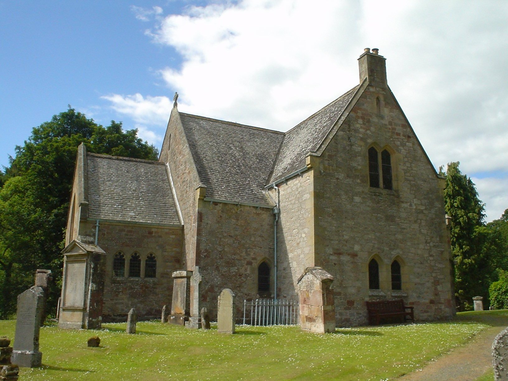
Humbie Parish Church
Humbie Parish Church is a church in the small village of Humbie, East Lothian, Scotland. It is part of the Church of Scotland, and is a linked charge which...

Humbie
Humbie is a hamlet and rural parish in East Lothian, Scotland lying in south-east of the county, approximately 10 miles (16 km) south-west of Haddington...

Humbie railway station
Humbie railway station served the civil parish of Humbie, East Lothian, Scotland, from 1901 to 1933 on the Macmerry Branch. == History == The station was...
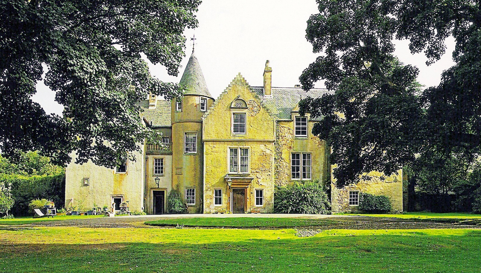
Keith Marischal
Keith Marischal is a Scottish Baronial Country house lying in the parish of Humbie, East Lothian, Scotland. The original building was an "L-shaped" Tower...
Nearby Amenities
Located within 500m of 55.858629,-2.8441939Have you been to Corsehope Plantation?
Leave your review of Corsehope Plantation below (or comments, questions and feedback).