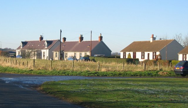
Hen Moss

Wood, Forest in East Lothian

Scotland

Hen Moss

A68 at Soutra The A68 southbound at the foot of Soutra Hill.
A68 at Soutra Credit: Scott Cormie

Hen Moss is a quaint woodland located in East Lothian, Scotland. Covering an area of approximately 200 acres, this forested area is known for its natural beauty and rich biodiversity. The Moss is situated near the village of Gifford, nestled amidst the rolling hills and lush green landscapes of the region.

The woodland is predominantly composed of native tree species, including oak, birch, and beech, which create a dense canopy overhead. This creates a tranquil and serene atmosphere, making it a popular destination for nature enthusiasts and walkers alike. The forest floor is adorned with a variety of wildflowers, ferns, and mosses, adding to its enchanting appeal.

Hen Moss is home to a diverse range of wildlife, including deer, badgers, foxes, and a multitude of bird species. Birdwatchers frequent the area to catch a glimpse of rare species such as the Eurasian sparrowhawk and the great spotted woodpecker. The forest also provides a habitat for numerous insects and small mammals, contributing to the overall ecological balance of the region.

Visitors can explore the woodland via a network of well-maintained trails and footpaths, allowing for leisurely walks and peaceful exploration. Interpretive signs along the way provide information about the flora, fauna, and history of the area. Additionally, there are picnic areas and viewpoints scattered throughout the forest, offering visitors the opportunity to relax and take in the breathtaking surroundings.

Overall, Hen Moss in East Lothian is a haven for nature lovers, providing an escape from the hustle and bustle of daily life and offering a glimpse into the natural wonders of Scotland's woodlands.

If you have any feedback on the listing, please let us know in the comments section below.

Hen Moss Images

Images are sourced within 2km of 55.817785/-2.8516716 or Grid Reference NT4658. Thanks to Geograph Open Source API. All images are credited.

A68 at Soutra The A68 southbound at the foot of Soutra Hill.
A68 at Soutra
The A68 southbound at the foot of Soutra Hill.
Layby on Soutra The turbines of Soutra Wind Farm East showing in the distance.
Layby on Soutra
The turbines of Soutra Wind Farm East showing in the distance.
Linn Dean Wildlife Reserve at Soutra The turbines of Soutra Wind Farm East showing in the distance.
Linn Dean Wildlife Reserve at Soutra
The turbines of Soutra Wind Farm East showing in the distance.
Huntershall - the decline continues The fourth photo of a house on the side of the A68  at Soutra, recording the progress of its dereliction See <a href="https://www.geograph.org.uk/photo/4110161">NT4758 : Huntershall - 2014</a> from 2014, <a href="https://www.geograph.org.uk/photo/2431558">NT4758 : Huntershall</a> from 2011, <a href="https://www.geograph.org.uk/photo/973873">NT4758 : Huntershall</a> from 2008.
Huntershall - the decline continues
The fourth photo of a house on the side of the A68 at Soutra, recording the progress of its dereliction See NT4758 : Huntershall - 2014 from 2014, NT4758 : Huntershall from 2011, NT4758 : Huntershall from 2008.
Gate near Dun Law
Gate near Dun Law
Lay-by on the A68 near Dun Law
Gated access to Dun Law wind farm
B6368 near Soutra Aisle
B6368 near Soutra
B6368 near Soutra
B6368 near Soutra
B6368 near Soutra
One Man's Mission to Replant Soutra Main Wood
Pogbie Wind Farm Some of the younger Soutra turbines.
Pogbie Wind Farm
Some of the younger Soutra turbines.
A68, Soutra Hill It's not unusual to find snow and ice here.
A68, Soutra Hill
It's not unusual to find snow and ice here.
Misty view
Misty view
Misty A68 lay-by
Misty A68 lay-by
Dun Law (West) Cause for celebration - the Sun is still up after 17:00, days are getting longer.
Dun Law (West)
Cause for celebration - the Sun is still up after 17:00, days are getting longer.
A68, Soutra Around sunset on a cold afternoon.
A68, Soutra
Around sunset on a cold afternoon.
On the A68 Access to a new coffee shop with a view.
On the A68
Access to a new coffee shop with a view.
Show me another place!

Hen Moss is located at Grid Ref: NT4658 (Lat: 55.817785, Lng: -2.8516716)

Unitary Authority: The Scottish Borders

Police Authority: The Lothians and Scottish Borders

What 3 Words

///monkeys.clouding.robe. Near Pencaitland, East Lothian

Nearby Locations

Hen Moss

Related Wikis

Soutra Aisle

Soutra Aisle, (the present structure lies just within the boundary of the Scottish Borders from Midlothian) not far from Fala, is the remains of the House...

Fala, Midlothian

Fala is a hamlet in the south-eastern corner of Midlothian, Scotland, and about 15 miles from Edinburgh. == Location == The parish of the same name is...

Fala Flow

Fala Flow is an area of upland blanket bog on the edge of the Lammermuir Hills, in Midlothian, Scotland. Located north of the village of Fala, around 15...

Humbie

Humbie is a hamlet and rural parish in East Lothian, Scotland lying in south-east of the county, approximately 10 miles (16 km) south-west of Haddington...

Nearby Amenities

Located within 500m of 55.817785,-2.8516716
Power: tower
Lat/Long: 55.8152221/-2.8483971
Give Way
Direction: forward
Lat/Long: 55.8153413/-2.8450997
Natural: spring
Lat/Long: 55.8170071/-2.8451469
Power: tower
Lat/Long: 55.8160164/-2.8521217
Power: tower
Lat/Long: 55.8167374/-2.8556894
Power: tower
Lat/Long: 55.8175195/-2.8595511
Camera Mount: pole
Camera Type: fixed
Man Made: surveillance
Surveillance: outdoor
Surveillance Type: camera
Surveillance Zone: traffic
Lat/Long: 55.8168138/-2.8461584
Give Way
Direction: forward
Lat/Long: 55.8184854/-2.8478542
Man Made: monitoring_station
Monitoring Weather: yes
Weather Anemometer: yes
Weather Rain Gauge: yes
Weather Thermometer: yes
Weather Transmissometer: yes
Lat/Long: 55.8167984/-2.8461429
Power: pole
Lat/Long: 55.817805/-2.8594068
Power: pole
Lat/Long: 55.817702/-2.8581295
Power: pole
Lat/Long: 55.8175978/-2.8568845
Power: pole
Lat/Long: 55.817496/-2.8556114
Power: pole
Lat/Long: 55.8173883/-2.8542705
Power: pole
Lat/Long: 55.8172747/-2.8529786
Power: pole
Lat/Long: 55.8171735/-2.8517076
Power: pole
Lat/Long: 55.8170669/-2.8504011
Power: pole
Lat/Long: 55.8169815/-2.8493634
Power: pole
Lat/Long: 55.8168591/-2.8478674
Power: pole
Lat/Long: 55.8167427/-2.8464473
Power: pole
Lat/Long: 55.8166759/-2.8455993
The data included in this document is from www.openstreetmap.org. The data is made available under ODbL.

Have you been to Hen Moss?

Leave your review of Hen Moss below (or comments, questions and feedback).