Nursery Wood

Wood, Forest in East Lothian

Scotland

Nursery Wood

Bridge, Nisbet An easy crossing of the Tyne on a route between Nisbet and Middlemains, Saltoun.
Bridge, Nisbet Credit: Richard Webb

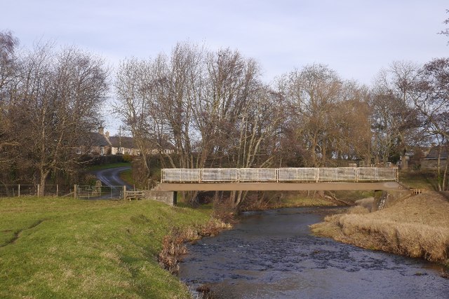
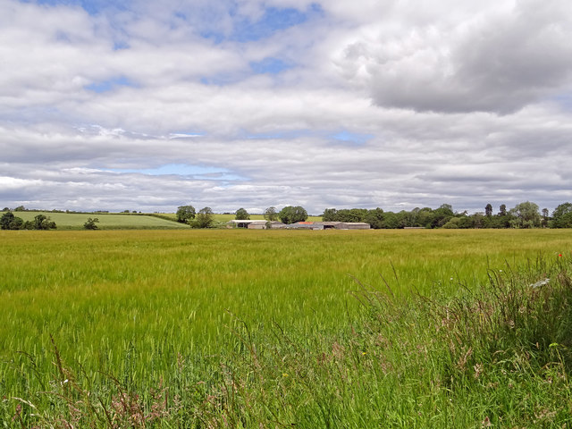
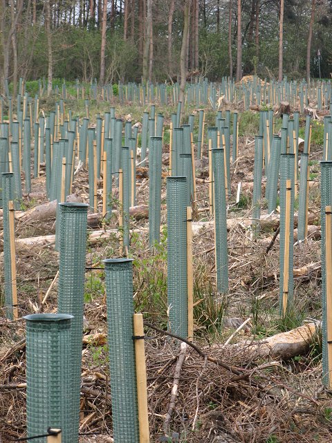
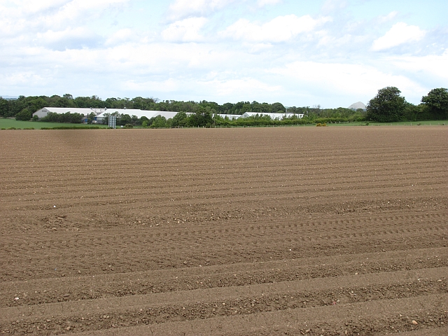
Nursery Wood is a picturesque forest located in East Lothian, Scotland. Covering an area of approximately 100 acres, this wood is known for its abundant natural beauty and diverse ecosystem. The wood is situated near the town of Haddington and is easily accessible by both car and foot.

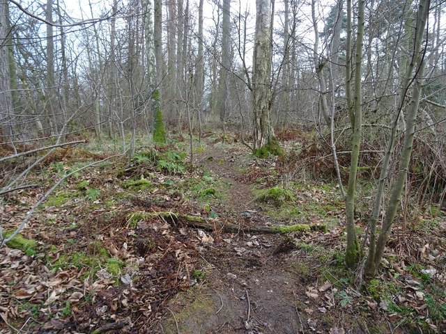
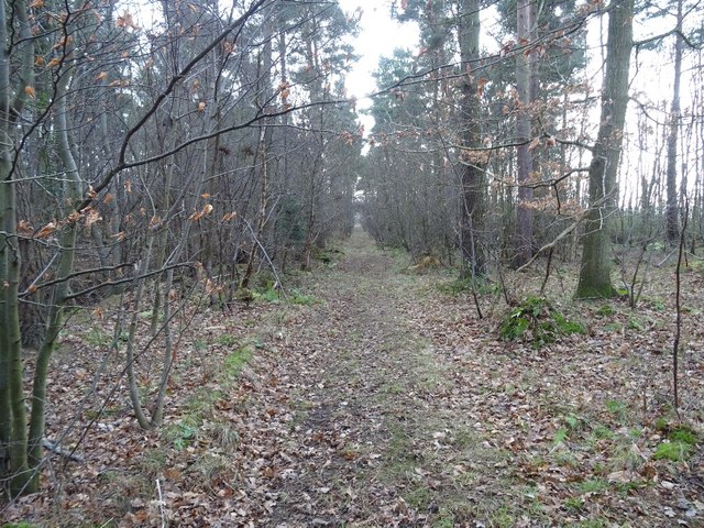
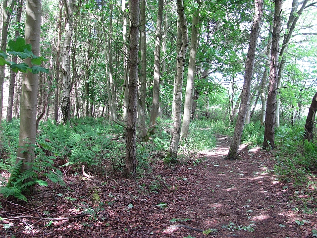
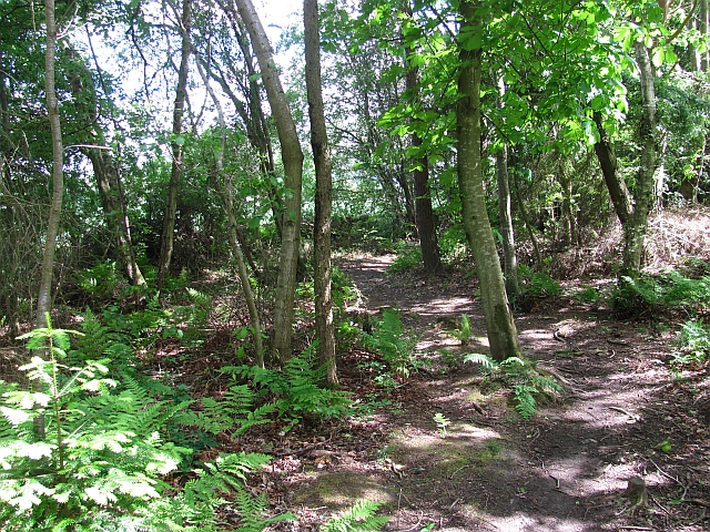
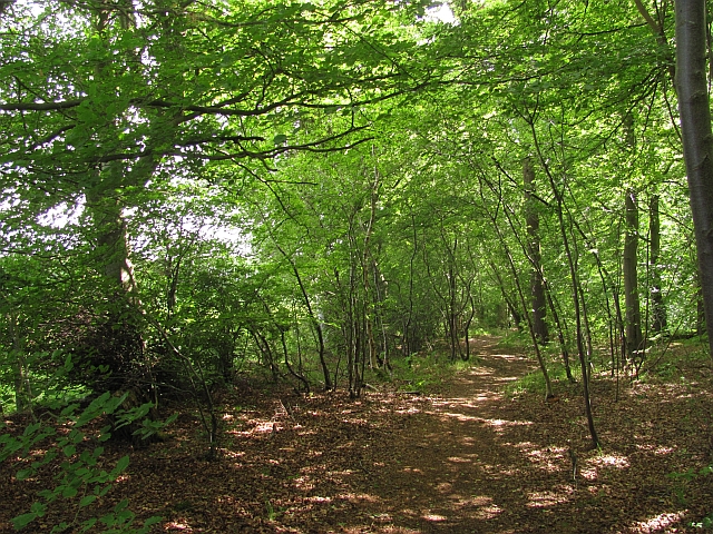
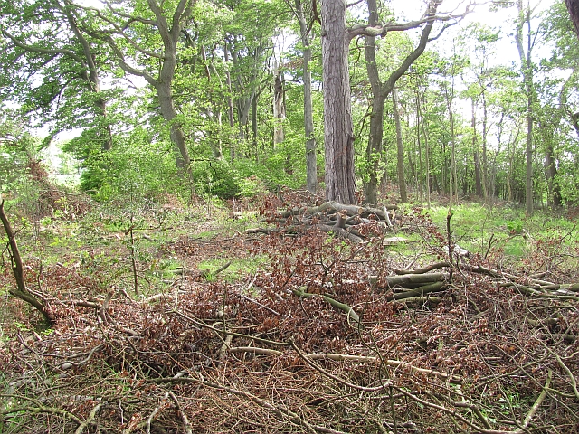
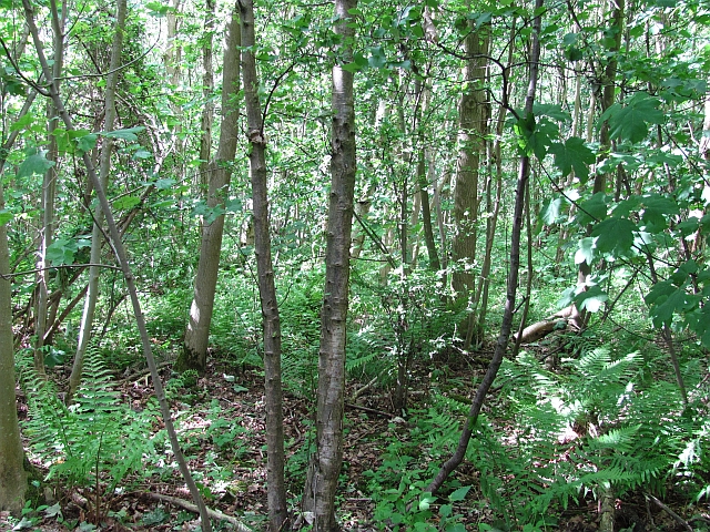
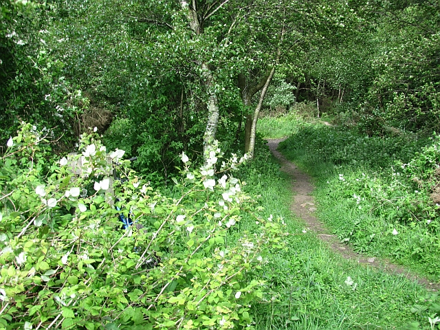
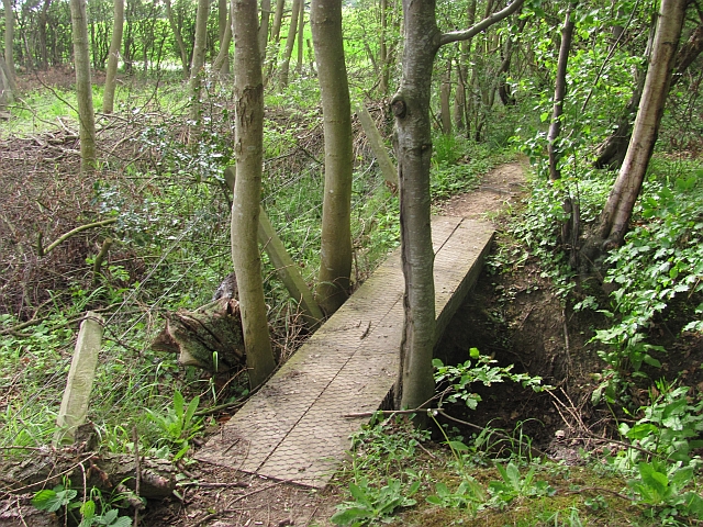
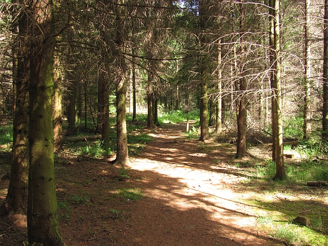
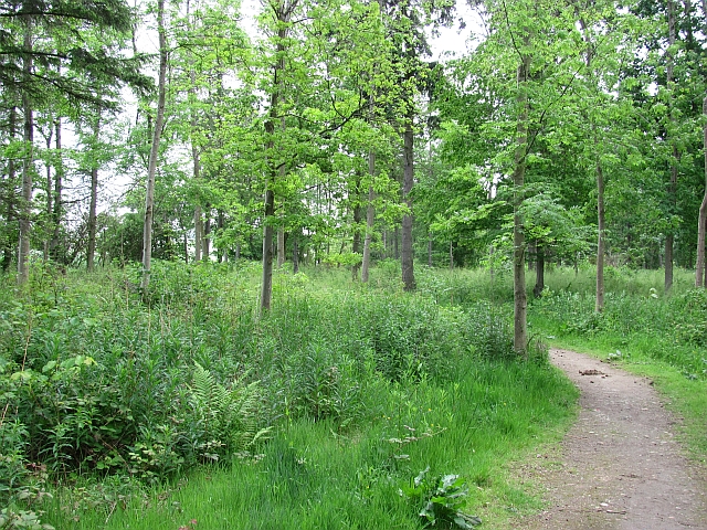
As visitors enter Nursery Wood, they are greeted by a dense canopy of towering trees, including oak, beech, and birch. The forest floor is covered with a lush carpet of ferns, mosses, and wildflowers, creating a vibrant and enchanting atmosphere. The wood is also home to a variety of wildlife, including deer, rabbits, and a multitude of bird species.

Trails wind their way through the wood, providing visitors with the opportunity to explore its many hidden treasures. These paths are well-maintained and suitable for both leisurely strolls and more adventurous hikes. Along the way, visitors can enjoy breathtaking views of the surrounding countryside and may even stumble upon a hidden waterfall or tranquil stream.

Nursery Wood is a popular destination for nature enthusiasts, photographers, and families seeking a peaceful retreat. It offers ample space for picnics, birdwatching, and nature walks. The wood is also a designated Site of Special Scientific Interest (SSSI), due to its rich biodiversity and rare plant species.

Overall, Nursery Wood in East Lothian is a haven for those seeking to immerse themselves in nature's beauty. Its tranquil ambiance, diverse ecosystem, and stunning landscapes make it a must-visit destination for anyone in the area.

If you have any feedback on the listing, please let us know in the comments section below.
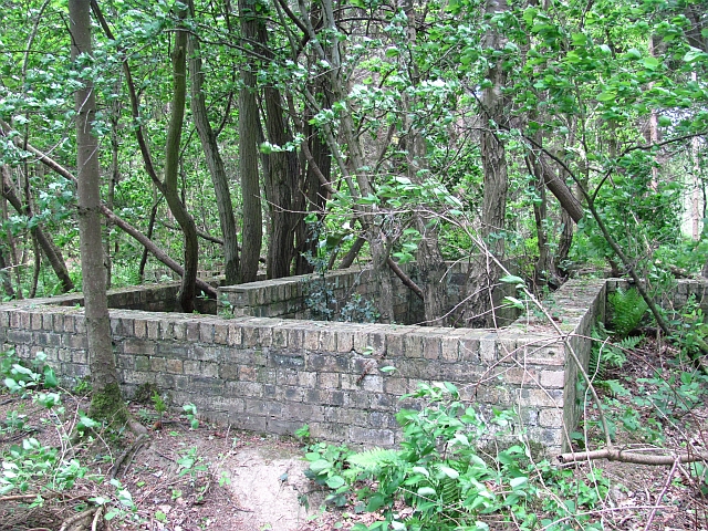
Nursery Wood Images

Images are sourced within 2km of 55.934168/-2.8725838 or Grid Reference NT4571. Thanks to Geograph Open Source API. All images are credited.

Bridge, Nisbet An easy crossing of the Tyne on a route between Nisbet and Middlemains, Saltoun.
Bridge, Nisbet
An easy crossing of the Tyne on a route between Nisbet and Middlemains, Saltoun.
Woodland, Boggs Holdings
Woodland, Boggs Holdings The path emerges on the B6093.
Woodland, Boggs Holdings
The path emerges on the B6093.
Nisbet from the Tyne Nisbet Farm from a little footpath by the River Tyne. Nisbet seems to have been a common name for many centuries hereabouts with mention of a William Nisbet marrying Mary Hamilton in 1747 who owned Winton Estate at that time.:-
<span class="nowrap"><a title="https://www.wintoncastle.co.uk/winton-estate/winton-history/lawyers-turn-lairds/" rel="nofollow ugc noopener" href="https://www.wintoncastle.co.uk/winton-estate/winton-history/lawyers-turn-lairds/">Link</a><img style="margin-left:2px;" alt="External link" title="External link - shift click to open in new window" src="https://s1.geograph.org.uk/img/external.png" width="10" height="10"/></span>
Nisbet from the Tyne
Nisbet Farm from a little footpath by the River Tyne. Nisbet seems to have been a common name for many centuries hereabouts with mention of a William Nisbet marrying Mary Hamilton in 1747 who owned Winton Estate at that time.:- LinkExternal link
Replanting A woodland being replanted with deciduous trees.
Replanting
A woodland being replanted with deciduous trees.
Newly cultivated field, Gladsmuir A field between the old and new A1 roads.
Newly cultivated field, Gladsmuir
A field between the old and new A1 roads.
Butterdean Woods A path runs around the perimeter of the wood.
Butterdean Woods
A path runs around the perimeter of the wood.
Butterdean Wood Path running around the perimeter of the woodland.
Butterdean Wood
Path running around the perimeter of the woodland.
Path, Butterdean Wood A path which runs around the perimeter of the wood.
Path, Butterdean Wood
A path which runs around the perimeter of the wood.
Strip wood, Butterdean A strip joins Cuddie Wood and Butterdean Wood.
Strip wood, Butterdean
A strip joins Cuddie Wood and Butterdean Wood.
Butterdean Woods Dense deciduous woodland in the care of the Woodland Trust.
Butterdean Woods
Dense deciduous woodland in the care of the Woodland Trust.
Depression, Butterdean Woods A fenced off hole. There is a history of coal mining in the area and this is probably a mineshaft.
--
2022
I have seen a Coal Authority Secured Site notice on a nearby fenced depression, so definitely mine shafts. No maps show any colliery infrastructure here so I suspect that these were trials>
Depression, Butterdean Woods
A fenced off hole. There is a history of coal mining in the area and this is probably a mineshaft. -- 2022 I have seen a Coal Authority Secured Site notice on a nearby fenced depression, so definitely mine shafts. No maps show any colliery infrastructure here so I suspect that these were trials>
Path, Butterdean Wood - core path 113 A path leads from a gate in the wood's perimeter fence.
Path, Butterdean Wood - core path 113
A path leads from a gate in the wood's perimeter fence.
Footbridge, Butterdean Woods On the perimeter path.
Footbridge, Butterdean Woods
On the perimeter path.
Butterdean Wood A coniferous area of the woods which are largely broadleaved.
Butterdean Wood
A coniferous area of the woods which are largely broadleaved.
Farmland, Penston Looking out of Butterdean Wood.
Farmland, Penston
Looking out of Butterdean Wood.
Ruin, Butterdean Wood A brick structure with a baffled design which suggests a military origin. A relic of the air base at Macmerry.
Ruin, Butterdean Wood
A brick structure with a baffled design which suggests a military origin. A relic of the air base at Macmerry.
Walk Plantation Path in a stripwood, Winton Estate. My last visit was on skis <a href="https://www.geograph.org.uk/photo/2190483">NT4471 : Walk Plantation</a>. East Lothian core path no. 124.
Walk Plantation
Path in a stripwood, Winton Estate. My last visit was on skis NT4471 : Walk Plantation. East Lothian core path no. 124.
Show me another place!

Nursery Wood is located at Grid Ref: NT4571 (Lat: 55.934168, Lng: -2.8725838)

Unitary Authority: East Lothian

Police Authority: The Lothians and Scottish Borders

What 3 Words

///extremely.dissolve.butlers. Near Macmerry, East Lothian

Nearby Locations

Nursery Wood

Related Wikis

Gladsmuir

Gladsmuir is a village and parish in East Lothian, Scotland, situated on the A199 and near Tranent and Prestonpans. == Description == Gladsmuir's principal...

Macmerry

Macmerry is a village located on the old A1 (now renumbered the A199) just east of Tranent. The village has a primary school with a roll of around 100...

RAF Macmerry

Royal Air Force Macmerry or more simply RAF Macmerry is a former Royal Air Force satellite station located 4.5 miles (7.2 km) west of Haddington, East...

Herdmanston House

Herdmanston House was a castle and later tower house located in the parish of Saltoun, East Lothian in Scotland.The lands of Herdmanston were held by the...

Nearby Amenities

Located within 500m of 55.934168,-2.8725838
Barrier: entrance
Lat/Long: 55.9328338/-2.8730167
Barrier: entrance
Lat/Long: 55.9327569/-2.8732227
Star Pups Doggy Daycare
Leisure: dog_park
Source Name: survey
Lat/Long: 55.9362041/-2.872343
Historic: mine_shaft
Lat/Long: 55.9366478/-2.8748126
Power: pole
Lat/Long: 55.9300884/-2.8731559
Power: pole
Lat/Long: 55.930958/-2.873256
Power: pole
Lat/Long: 55.9314121/-2.8736894
Power: pole
Lat/Long: 55.9319373/-2.874229
Power: pole
Lat/Long: 55.9324696/-2.8747333
The data included in this document is from www.openstreetmap.org. The data is made available under ODbL.

Have you been to Nursery Wood?

Leave your review of Nursery Wood below (or comments, questions and feedback).