Mill Wood

Wood, Forest in Banffshire

Scotland

Mill Wood

Fly Agaric (Amanita muscaria) The classic toadstool. See <a href="https://www.geograph.org.uk/photo/3689145">SP9207 : Fly Agaric (Amanita muscaria) group</a> for additional information about this species.
Fly Agaric (Amanita muscaria) Credit: Anne Burgess

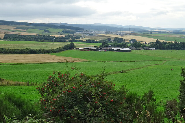
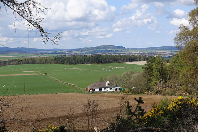
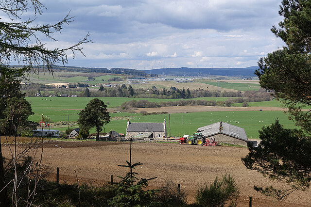
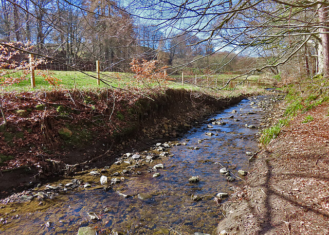
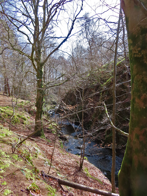
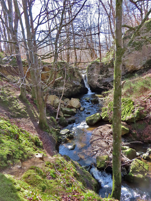
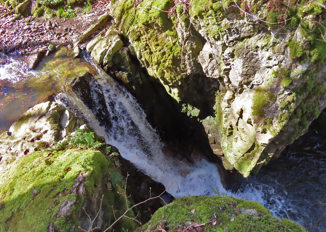
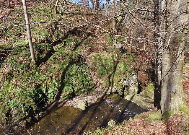
Mill Wood is a picturesque forest located in Banffshire, Scotland. Spread across an area of approximately 100 acres, it is known for its stunning natural beauty and diverse range of flora and fauna. The wood is situated in a rural area, surrounded by rolling hills and meandering streams, creating a tranquil and serene environment.

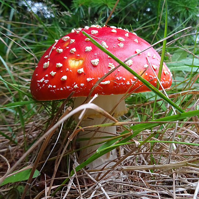
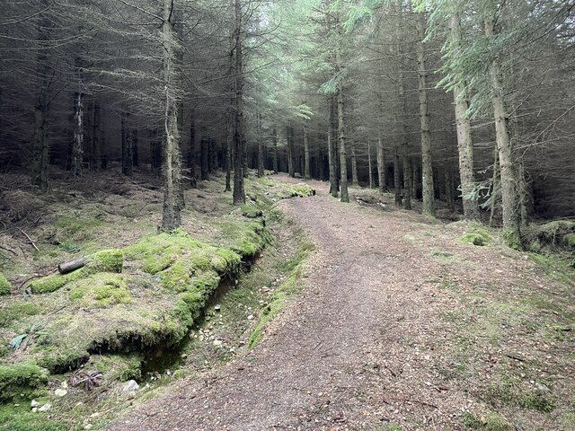
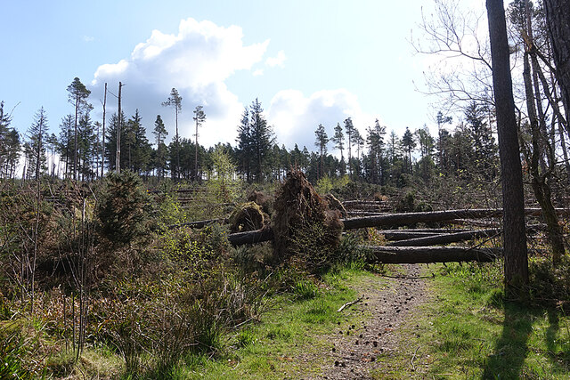
The wood is primarily composed of native tree species, including oak, birch, and pine, which provide a dense canopy and shelter for a variety of wildlife. The forest floor is covered in a thick carpet of moss and ferns, creating a lush undergrowth. Additionally, the wood is home to numerous species of birds, such as woodpeckers, owls, and robins, making it a popular spot for birdwatching enthusiasts.

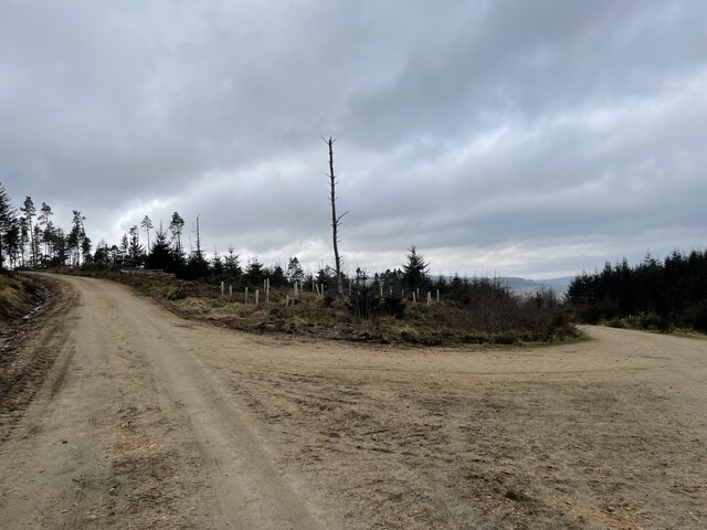
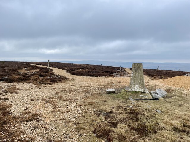
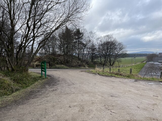
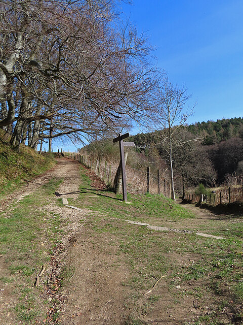
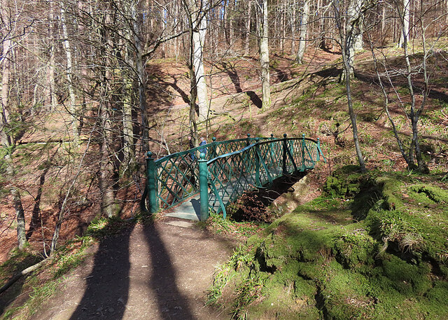
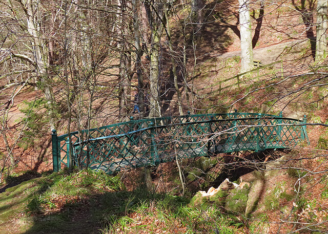
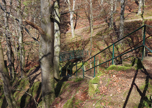
A network of well-maintained trails winds through Mill Wood, offering visitors the opportunity to explore the woodland and enjoy its natural beauty. The trails are suitable for both leisurely strolls and more adventurous hikes, providing options for visitors of all ages and fitness levels.

Mill Wood also has a rich history, with evidence of ancient settlements and archaeological sites dating back thousands of years. The wood has been used for various purposes throughout history, including timber production and as a source of fuel.

Overall, Mill Wood is a hidden gem in Banffshire, offering visitors a chance to immerse themselves in nature, observe local wildlife, and appreciate the tranquility and beauty of a Scottish woodland.

If you have any feedback on the listing, please let us know in the comments section below.

Mill Wood Images

Images are sourced within 2km of 57.540383/-2.9109127 or Grid Reference NJ4550. Thanks to Geograph Open Source API. All images are credited.

Fly Agaric (Amanita muscaria) The classic toadstool. See <a href="https://www.geograph.org.uk/photo/3689145">SP9207 : Fly Agaric (Amanita muscaria) group</a> for additional information about this species.
Fly Agaric (Amanita muscaria)
The classic toadstool. See SP9207 : Fly Agaric (Amanita muscaria) group for additional information about this species.
Birkenburn Farm Looking across its fields to the buildings at Birkenburn and the Blackhillock electricity substation beyond.
Birkenburn Farm
Looking across its fields to the buildings at Birkenburn and the Blackhillock electricity substation beyond.
View of a junction A simple junction taking you to either the car or the hill
View of a junction
A simple junction taking you to either the car or the hill
Meikle Balloch Hill Summit A Marilyn of 366m
Meikle Balloch Hill Summit
A Marilyn of 366m
Twisty path through the forest The path back down from the Summit.
Beware mountain bikes.
Twisty path through the forest
The path back down from the Summit. Beware mountain bikes.
Entrance to Balloch Car Park A good size car park for the Balloch
Entrance to Balloch Car Park
A good size car park for the Balloch
No Way! The path up from the car park is comprehensively obstructed by trees blown down during Storm Arwen. Fortunately this is just a popular short cut, and the slightly longer way round by road is clear of fallen trees. No doubt Forest and Land Scotland will eventually get round to clearing it, once the higher priority work has been done.
No Way!
The path up from the car park is comprehensively obstructed by trees blown down during Storm Arwen. Fortunately this is just a popular short cut, and the slightly longer way round by road is clear of fallen trees. No doubt Forest and Land Scotland will eventually get round to clearing it, once the higher priority work has been done.
Dwarick House The house stands in an elevated position with a broad view across Strath Isla and Keith, which is towards the right.
Dwarick House
The house stands in an elevated position with a broad view across Strath Isla and Keith, which is towards the right.
Wester Herricks A farm with a view, on the slope of The Balloch. These day the view takes in the pale scar of Blackhillock Quarry, on the left; the vast Blackhillock electricity transformer in the middle distance, with its attendant power lines; and the wind turbines in the Drummuir wind farm on the skyline.
Wester Herricks
A farm with a view, on the slope of The Balloch. These day the view takes in the pale scar of Blackhillock Quarry, on the left; the vast Blackhillock electricity transformer in the middle distance, with its attendant power lines; and the wind turbines in the Drummuir wind farm on the skyline.
Den Burn The Den Burn rises in damp ground on the outskirts of Keith and flows south-eastwards, eventually conbining with the Burn of Tarnash to form the Burn of Drum.
Den Burn
The Den Burn rises in damp ground on the outskirts of Keith and flows south-eastwards, eventually conbining with the Burn of Tarnash to form the Burn of Drum.
Waymarker The right-hand path goes to the Falls of Tarnash, and the left-hand one returns to Keith.
Waymarker
The right-hand path goes to the Falls of Tarnash, and the left-hand one returns to Keith.
Burn of Tarnash The lower reach of the Burn of Tarnash before it meets the Den Burn.
Burn of Tarnash
The lower reach of the Burn of Tarnash before it meets the Den Burn.
Falls of Tarnash Between the trees getting in the way, and the sun being in the wrong direction, the Falls of Tarnash are not easy to photograph well. They are the result of the Burn of Tarnash encountering a small outcrop of hard and very resistant metadolomite. The surrounding country rock is mostly phyllite, psammite and semipelite.
Falls of Tarnash
Between the trees getting in the way, and the sun being in the wrong direction, the Falls of Tarnash are not easy to photograph well. They are the result of the Burn of Tarnash encountering a small outcrop of hard and very resistant metadolomite. The surrounding country rock is mostly phyllite, psammite and semipelite.
Footbridge The bridge spans the Burn of Herricks and gives access to [<a href="https://www.geograph.org.uk/photo/7449251">NJ4449 : Falls of Tarnash</a>.
Footbridge
The bridge spans the Burn of Herricks and gives access to [NJ4449 : Falls of Tarnash.
Iron Bridge The iron lattice footbridge links the Falls of Tarnash to the Den of Keith, crossing high above the Burn of Herricks.
Iron Bridge
The iron lattice footbridge links the Falls of Tarnash to the Den of Keith, crossing high above the Burn of Herricks.
Falls of Tar The modest but picturesque waterfall plunges through a narrow gap in an outcrop of hard and erosion-resistant metadolomite.
Falls of Tar
The modest but picturesque waterfall plunges through a narrow gap in an outcrop of hard and erosion-resistant metadolomite.
Above the Falls of Tarnash At right of centre you can see where the water disappears over the lip of the falls into a small gorge.
Above the Falls of Tarnash
At right of centre you can see where the water disappears over the lip of the falls into a small gorge.
Stepped Path The path climbs from the bridge over the Burn of Herricks up a series of steps to reach the top of the Falls of Tarnash.
Stepped Path
The path climbs from the bridge over the Burn of Herricks up a series of steps to reach the top of the Falls of Tarnash.
Show me another place!

Mill Wood is located at Grid Ref: NJ4550 (Lat: 57.540383, Lng: -2.9109127)

Unitary Authority: Moray

Police Authority: North East

What 3 Words

///vision.sleepers.believer. Near Keith, Moray

Nearby Locations

Mill Wood

Related Wikis

Kynoch Park

Kynoch Park is a football ground in Keith in north-east Scotland, which is the home ground of Highland Football League side Keith F.C. It is located on...

Keith Grammar School

Keith Grammar School is a secondary school in, Moray, Scotland. It was built in 1965 by the Educational Committee of Banffshire County Council. As of September...

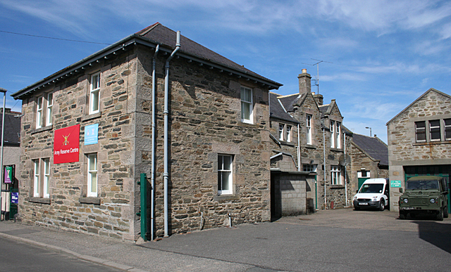
Union Street drill hall, Keith, Moray

The Union Street drill hall is a military installation in Keith, Scotland. == History == The building was designed as the headquarters of the 6th (Banff...

Keith, Moray

Keith (Scottish Gaelic: Baile Chèith, or Cèith Mhaol Rubha (archaic)) is a small town in the Moray council area in north east Scotland. It has a population...

Nearby Amenities

Located within 500m of 57.540383,-2.9109127
Power: pole
Lat/Long: 57.5407053/-2.9030138
Power: pole
Lat/Long: 57.5409215/-2.9044446
Power: pole
Lat/Long: 57.5411646/-2.9059755
Power: pole
Lat/Long: 57.5413962/-2.9074725
Power: pole
Lat/Long: 57.5415796/-2.9086683
Power: pole
Lat/Long: 57.5420235/-2.9097023
Power: pole
Lat/Long: 57.5427762/-2.910507
Power: pole
Lat/Long: 57.5432121/-2.9109656
Power: pole
Lat/Long: 57.5436231/-2.9125325
Power: pole
Lat/Long: 57.5440281/-2.9141296
Power: pole
Lat/Long: 57.5437556/-2.9157557
Generator Method: wind_turbine
Generator Source: wind
Power: generator
Lat/Long: 57.5430392/-2.9057901
Power: pole
Lat/Long: 57.5433739/-2.9115826
Power: pole
Lat/Long: 57.5434299/-2.911796
Power: pole
Lat/Long: 57.537593/-2.9047757
Power: pole
Lat/Long: 57.5382157/-2.9043122
Power: pole
Lat/Long: 57.5388052/-2.9038693
Power: pole
Lat/Long: 57.5393439/-2.903459
Power: pole
Lat/Long: 57.5400142/-2.902963
The data included in this document is from www.openstreetmap.org. The data is made available under ODbL.

Have you been to Mill Wood?

Leave your review of Mill Wood below (or comments, questions and feedback).