Masters Wood

Wood, Forest in East Lothian

Scotland

Masters Wood

Field, Keith, East  Lothian Taken 16 years after <a href="https://www.geograph.org.uk/photo/76088">NT4465 : Cattle near Keith Mains</a> and arable this time.
Field, Keith, East Lothian Credit: Richard Webb

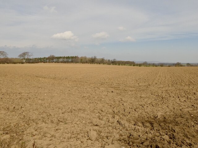
Masters Wood is an enchanting forest located in East Lothian, Scotland. Spread across a sprawling area of approximately 100 acres, this wood is a haven for nature enthusiasts and those seeking tranquility amidst the beauty of the great outdoors.

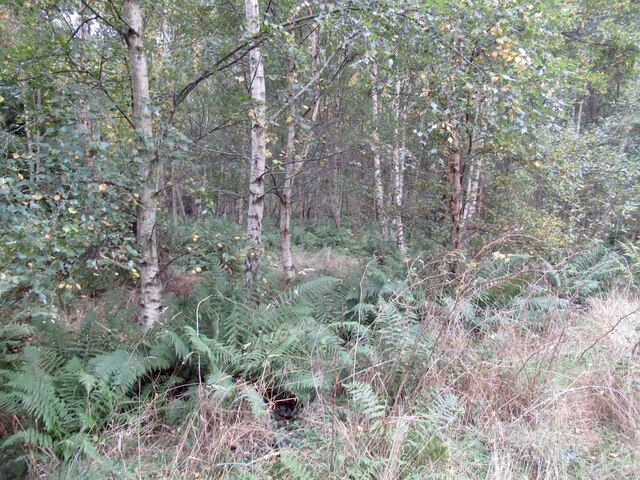
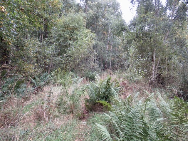
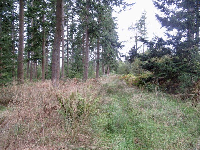
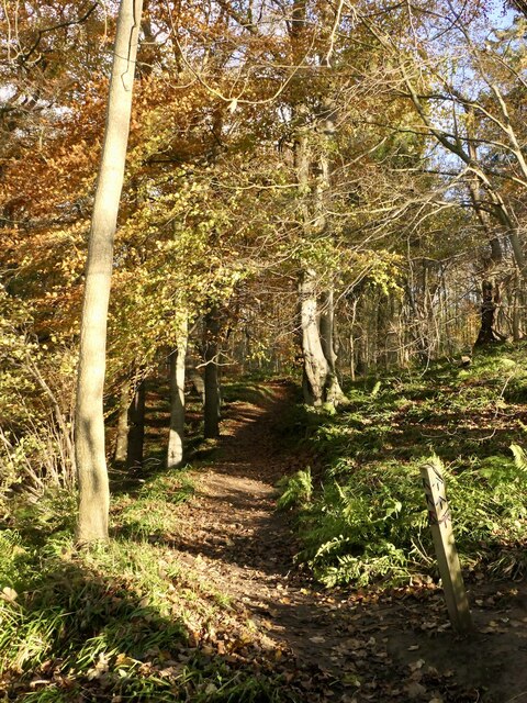
The wood is primarily comprised of a mix of deciduous and coniferous trees, which create a diverse and picturesque landscape. Towering oak, beech, and ash trees dominate the canopy, providing shade and shelter to the various flora and fauna that call this wood their home. The forest floor is adorned with a vibrant carpet of wildflowers and ferns, adding a splash of color to the surroundings.

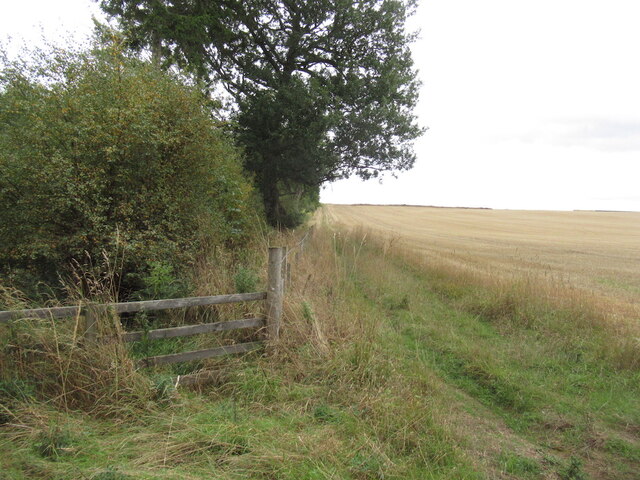
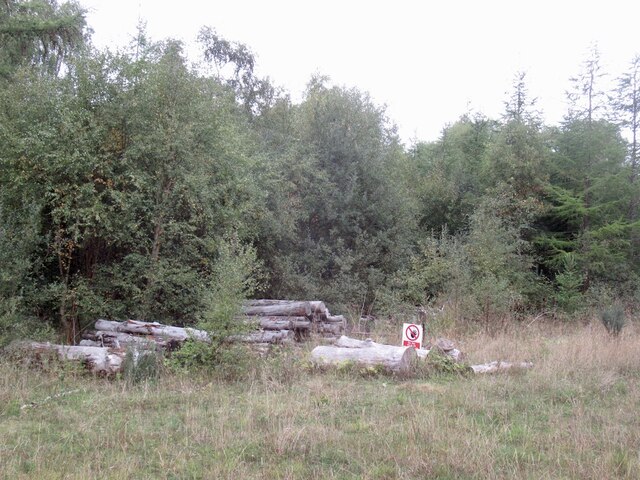
A network of well-maintained trails crisscrosses the wood, allowing visitors to explore its hidden treasures. These trails cater to hikers of all abilities, offering both gentle strolls and more challenging routes that lead to breathtaking viewpoints. Along the way, visitors may encounter a variety of wildlife, including squirrels, foxes, and a rich assortment of bird species.

Masters Wood is not only a natural gem but also holds historical significance. It is believed to have been part of an ancient hunting ground and has remnants of old stone walls that once enclosed the area. These remnants serve as a reminder of the wood's past and add an air of mystique to the already captivating atmosphere.

Overall, Masters Wood is a captivating destination that showcases the beauty of East Lothian's natural landscapes. Whether one seeks a leisurely walk, a chance to spot wildlife, or simply a serene place to connect with nature, this wood offers an unforgettable experience.

If you have any feedback on the listing, please let us know in the comments section below.

Masters Wood Images

Images are sourced within 2km of 55.878765/-2.8713243 or Grid Reference NT4565. Thanks to Geograph Open Source API. All images are credited.

Field, Keith, East  Lothian Taken 16 years after <a href="https://www.geograph.org.uk/photo/76088">NT4465 : Cattle near Keith Mains</a> and arable this time.
Field, Keith, East Lothian
Taken 16 years after NT4465 : Cattle near Keith Mains and arable this time.
Edge of Saltoun Big Wood
Young birch wood, Saltoun Big Wood Saltoun Big Wood is fast growing and the place changes rapidly.
Young birch wood, Saltoun Big Wood
Saltoun Big Wood is fast growing and the place changes rapidly.
New path, Saltoun Big Wood The vegetation soon moves in and there is now just a narrow path. See <a href="https://www.geograph.org.uk/photo/6802358">NT4766 : New path, Saltoun Big Wood</a>
New path, Saltoun Big Wood
The vegetation soon moves in and there is now just a narrow path. See NT4766 : New path, Saltoun Big Wood
Saltoun Big Wood
Saltoun Big Wood
Road, Saltoun Big Wood
Decaying log pile, Saltoun Big Wood
Road, Saltoun Big Wood Passing one of the ponds.
Road, Saltoun Big Wood
Passing one of the ponds.
Road, Saltoun Big Wood It is noticeable that there is less traffic in the wood now, and the plants are taking advantage.
Road, Saltoun Big Wood
It is noticeable that there is less traffic in the wood now, and the plants are taking advantage.
Road, Saltoun Big Wood It has not been driven much of late, so there is some plant growth.
Road, Saltoun Big Wood
It has not been driven much of late, so there is some plant growth.
Road, Saltoun Big Wood It has not been driven much of late, so there is some plant growth. Not so many visitors either since the loss of the car park.
Road, Saltoun Big Wood
It has not been driven much of late, so there is some plant growth. Not so many visitors either since the loss of the car park.
Humbie Water seen from Kirk Bridge The main course of the East Lothian Tyne, it changes names quite often.
Humbie Water seen from Kirk Bridge
The main course of the East Lothian Tyne, it changes names quite often.
Track, The Roundle Wood, Humbie Climbing away from Kirk Bridge.
Track, The Roundle Wood, Humbie
Climbing away from Kirk Bridge.
Path, Church Wood, Humbie Part of a series of waymarked paths in the wood.
Path, Church Wood, Humbie
Part of a series of waymarked paths in the wood.
Church Wood, Humbie Waymarked paths from Humbie Kirk.
Church Wood, Humbie
Waymarked paths from Humbie Kirk.
Path, Church Wood, Humbie
Burn crossing, Church Wood The bridge shown by the Ordnance Survey is no longer there. The burn drops sharply to the Humbie Water here and there is a waterfall just downstream.
Burn crossing, Church Wood
The bridge shown by the Ordnance Survey is no longer there. The burn drops sharply to the Humbie Water here and there is a waterfall just downstream.
Burn, Church Wood On the waymarked paths, there is no bridge.
Burn, Church Wood
On the waymarked paths, there is no bridge.
Show me another place!

Masters Wood is located at Grid Ref: NT4565 (Lat: 55.878765, Lng: -2.8713243)

Unitary Authority: East Lothian

Police Authority: The Lothians and Scottish Borders

What 3 Words

///pockets.fewest.variances. Near Pencaitland, East Lothian

Nearby Locations

Masters Wood Humbie Wood

Related Wikis

Saltoun railway station

Saltoun railway station served the villages of East Saltoun and West Saltoun in East Lothian, Scotland, from 1901 to 1933 on the Macmerry Branch. ��2...

Keith Marischal

Keith Marischal is a Scottish Baronial Country house lying in the parish of Humbie, East Lothian, Scotland. The original building was an "L-shaped" Tower...

Humbie Parish Church

Humbie Parish Church is a church in the small village of Humbie, East Lothian, Scotland. It is part of the Church of Scotland, and is a linked charge which...

Glenkinchie distillery

Glenkinchie distillery is a Scotch single malt whisky distillery in East Lothian, Scotland. It is one of the six distilleries in the Lowland region. It...

Nearby Amenities

Located within 500m of 55.878765,-2.8713243
Old Duncrahill
Place: locality
Lat/Long: 55.8820605/-2.8724905
Power: pole
Lat/Long: 55.8806411/-2.8748476
Power: pole
Lat/Long: 55.881066/-2.8740788
Power: pole
Lat/Long: 55.8814821/-2.8733193
Power: pole
Lat/Long: 55.8817234/-2.8728754
The data included in this document is from www.openstreetmap.org. The data is made available under ODbL.

Have you been to Masters Wood?

Leave your review of Masters Wood below (or comments, questions and feedback).