Hillside Woods

Wood, Forest in Aberdeenshire

Scotland

Hillside Woods

Deer on heather moor on south side of Clayhooter Hill Deer, mainly hinds but with at least one buck stand on the heather slope below the estate road crossing the south side of Clayhooter Hill. The fields and tree plantings below lie to the west of the village of Lumsden.
Deer on heather moor on south side of Clayhooter Hill Credit: Trevor Littlewood

Hillside Woods is a picturesque woodland located in Aberdeenshire, Scotland. This enchanting forest covers an area of approximately 500 acres and is renowned for its natural beauty and diverse ecosystem. It is situated on the slopes of a hillside, hence its name, providing visitors with breathtaking views of the surrounding countryside.

The woods are predominantly composed of native tree species such as Scots pine, birch, and oak, creating a rich tapestry of colors throughout the year. The dense canopy of the trees provides a cool and shaded environment, making it a perfect retreat during the hot summer months.

Hillside Woods is home to a wide range of wildlife, including red squirrels, roe deer, and a variety of bird species. The presence of these animals adds to the charm and tranquility of the forest, allowing visitors to observe and appreciate the wonders of nature.

The woods offer numerous walking trails and paths, allowing visitors to explore its hidden treasures. These well-maintained paths meander through the forest, leading to secluded spots and stunning viewpoints. Nature enthusiasts can immerse themselves in the beauty of the woodland, while outdoor adventurers can enjoy activities such as hiking, birdwatching, and photography.

Hillside Woods is also a designated Site of Special Scientific Interest (SSSI), due to its importance for conservation and biodiversity. As a result, there are strict guidelines in place to protect the delicate ecosystem and preserve the natural habitat.

Overall, Hillside Woods in Aberdeenshire is a haven for nature lovers, offering a unique and unforgettable experience for those seeking solace in the beauty of the Scottish countryside.

If you have any feedback on the listing, please let us know in the comments section below.

Hillside Woods Images

Images are sourced within 2km of 57.289931/-2.9175057 or Grid Reference NJ4422. Thanks to Geograph Open Source API. All images are credited.

Deer on heather moor on south side of Clayhooter Hill Deer, mainly hinds but with at least one buck stand on the heather slope below the estate road crossing the south side of Clayhooter Hill. The fields and tree plantings below lie to the west of the village of Lumsden.
Deer on heather moor on south side of Clayhooter Hill
Deer, mainly hinds but with at least one buck stand on the heather slope below the estate road crossing the south side of Clayhooter Hill. The fields and tree plantings below lie to the west of the village of Lumsden.
Auchinleith Auchinleith is reached by an access road leaving a minor, public road from which the image was taken. There's at least one dwelling there that in 2007 at least <a title="https://www.geograph.org.uk/photo/439682" href="https://www.geograph.org.uk/photo/439682">Link</a> was unoccupied. The heather slopes beyond Auchinleith rise to the Hill of Towanreef.
Auchinleith
Auchinleith is reached by an access road leaving a minor, public road from which the image was taken. There's at least one dwelling there that in 2007 at least Link was unoccupied. The heather slopes beyond Auchinleith rise to the Hill of Towanreef.
Todstone The ruin of Todstone lies south of the minor stream, Burn of Glenny.
Todstone
The ruin of Todstone lies south of the minor stream, Burn of Glenny.
Lochan on Clayhooter Hill A jewel of a lochan to the north-east of Clayhooter Hill's summit.
Lochan on Clayhooter Hill
A jewel of a lochan to the north-east of Clayhooter Hill's summit.
Moorland dome south of Peddie's Hill An expanse of fairly nondescript moorland lies between the minor hill tops of  Clayhooter Hill and Hill of Towanreef; this minor dome is itself nameless on OS maps. The distant shadowed conical hill is Tap o' Noth.
Moorland dome south of Peddie's Hill
An expanse of fairly nondescript moorland lies between the minor hill tops of Clayhooter Hill and Hill of Towanreef; this minor dome is itself nameless on OS maps. The distant shadowed conical hill is Tap o' Noth.
Heather moorland with trig point on Hill of Towanreef The Hill of Towanreef lies to the east of The Buck; its summit trig point is seen here with the surroundings a blanket of blooming heather.
Heather moorland with trig point on Hill of Towanreef
The Hill of Towanreef lies to the east of The Buck; its summit trig point is seen here with the surroundings a blanket of blooming heather.
New Planting New planting on Muir of the Woods looking over the Corchinnan Burn to more new planting at Hillside Woods
New Planting
New planting on Muir of the Woods looking over the Corchinnan Burn to more new planting at Hillside Woods
Whoops that's careless A fire has been out of control in Clova Estates' forestry.
Whoops that's careless
A fire has been out of control in Clova Estates' forestry.
Why? The cottage at Auchinleith stands semi-derelict and local people can't get affordable housing, why?
Why?
The cottage at Auchinleith stands semi-derelict and local people can't get affordable housing, why?
Driveway to Clova A copper beech tree lined driveway up to Clova Estate.
Driveway to Clova
A copper beech tree lined driveway up to Clova Estate.
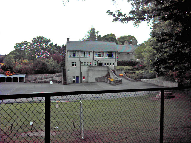
Clova House & Garden Clova House & Garden taken from the drive.
Clova House & Garden
Clova House & Garden taken from the drive.
Grouse moor on slopes of Scad Hill As can be seen, some of this heather moorland has recently been burnt to encourage new growth for the grouse.
Grouse moor on slopes of Scad Hill
As can be seen, some of this heather moorland has recently been burnt to encourage new growth for the grouse.
Picnic huts for shooters Two huts on Clova Hill used for parties of Grouse Shooters. They have tables inside or if the weather is fine, no doubt they use the large picnic table outside.
Picnic huts for shooters
Two huts on Clova Hill used for parties of Grouse Shooters. They have tables inside or if the weather is fine, no doubt they use the large picnic table outside.
Braeside Woods Looking across the top of Braeside Woods with Grampian farmland beyond.
Braeside Woods
Looking across the top of Braeside Woods with Grampian farmland beyond.
Track to Clova House The track leads down off the hill past pheasant breeding woods to Clova House.
Track to Clova House
The track leads down off the hill past pheasant breeding woods to Clova House.
Road to Auchinleith From the east entrance to Clova Estate.
Road to Auchinleith
From the east entrance to Clova Estate.
The minor public road northeast of Clova
Nearing the end of the public road
Show me another place!

Hillside Woods is located at Grid Ref: NJ4422 (Lat: 57.289931, Lng: -2.9175057)

Unitary Authority: Aberdeenshire

Police Authority: North East

What 3 Words

///exhale.ruffling.crazy. Near Alford, Aberdeenshire

Related Wikis

Clova Monastery

Clova Monastery (also called Cloveth) was a medieval Culdee monastery in Kildrummy, Aberdeenshire, Scotland. == Founding == Clova was founded in the late...

Lumsden, Aberdeenshire

Lumsden is an inland village in Aberdeenshire, Scotland on the A97 road. == Location == It crowns a rising-ground 227 m (745 ft) above sea level amid a...

St Mary's Kirk, Auchindoir

St Mary's Kirk at Auchindoir, between Rhynie and Lumsden, in Aberdeenshire, Scotland, is one of the country's finest surviving medieval parish kirks. The...

Mossat

Mossat is a settlement in Aberdeenshire, Scotland on the A97 road near Glenkindie and Lumsden, between Bridge of Alford and Strathdon, and is situated...

Have you been to Hillside Woods?

Leave your review of Hillside Woods below (or comments, questions and feedback).