Montrose Plantation

Wood, Forest in Selkirkshire

Scotland

Montrose Plantation

B7009 The Ettrick road passing beneath the steep and wooded Howden Bank. There is a lade amongst the alders on the flat side of the road.
B7009 Credit: Richard Webb

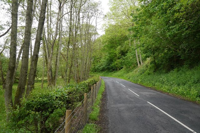
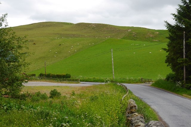
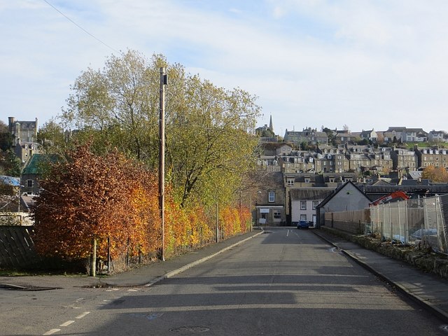
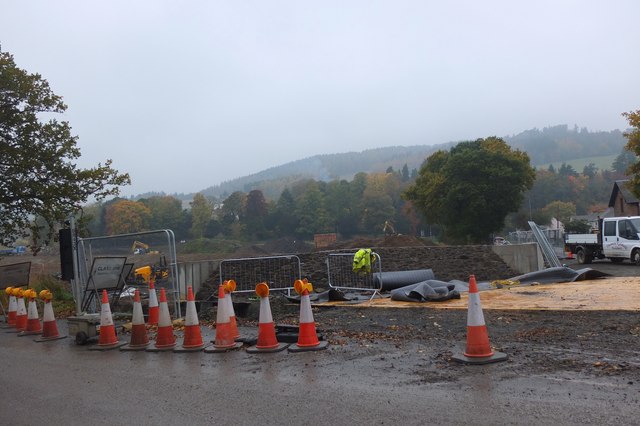
Montrose Plantation is a historic estate located in Selkirkshire, Scotland. Situated in a picturesque woodland area, the plantation is renowned for its natural beauty and rich history. The estate covers a vast area of land, primarily consisting of dense forests and woodlands.

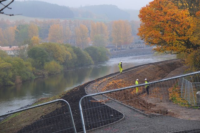
The plantation is known for its diverse range of tree species, including oak, birch, pine, and beech, creating a vibrant and lush landscape. The woodland not only provides a delightful sight for visitors but also serves as a habitat for various wildlife species, making it an ideal destination for nature enthusiasts.

Montrose Plantation has a long and fascinating history. Dating back to the 18th century, the estate was originally owned by wealthy landowners who utilized the woodland for timber production and hunting. Over the years, the plantation has seen several changes in ownership, each leaving their mark on the landscape.

Today, Montrose Plantation offers a range of recreational activities for visitors to enjoy. Walking trails wind their way through the forest, providing an opportunity to explore the natural surroundings and immerse oneself in the peaceful ambiance. The estate also features picnic areas and designated spots for wildlife observation, allowing visitors to relax and appreciate the natural beauty of the area.

Montrose Plantation in Selkirkshire is a haven for those seeking tranquility and immersion in nature. With its stunning woodland scenery and rich historical significance, it continues to captivate all who visit.

If you have any feedback on the listing, please let us know in the comments section below.

Montrose Plantation Images

Images are sourced within 2km of 55.550376/-2.8796081 or Grid Reference NT4428. Thanks to Geograph Open Source API. All images are credited.

B7009 The Ettrick road passing beneath the steep and wooded Howden Bank. There is a lade amongst the alders on the flat side of the road.
B7009
The Ettrick road passing beneath the steep and wooded Howden Bank. There is a lade amongst the alders on the flat side of the road.
Howden Hill A small steep hill with thin soils above Howden.
Howden Hill
A small steep hill with thin soils above Howden.
The A707 on Selkirk Bridge The railings on the right have been adorned with knitted street art. A group of over 40 knitters called the Selkirk Yarn Bombers, including one aged 104, have covered landmarks in Selkirk and Ettrickbridge with colourful knitted street art which has attracted visitors to admire their handiwork. It was done to promote the Yarrow, Ettrick and Selkirk Festival of Contemporary Arts.
The A707 on Selkirk Bridge
The railings on the right have been adorned with knitted street art. A group of over 40 knitters called the Selkirk Yarn Bombers, including one aged 104, have covered landmarks in Selkirk and Ettrickbridge with colourful knitted street art which has attracted visitors to admire their handiwork. It was done to promote the Yarrow, Ettrick and Selkirk Festival of Contemporary Arts.
The Selkirk Yarn Bombers handiwork on Selkirk Bridge A group of over 40 knitters called the Selkirk Yarn Bombers, including one aged 104, have covered landmarks in Selkirk and Ettrickbridge with colourful knitted street art which has attracted visitors to admire their handiwork. It was done to promote the Yarrow, Ettrick and Selkirk Festival of Contemporary Arts. For a wider view of the bridge, see <a href="https://www.geograph.org.uk/photo/4664154">NT4628 : The A707 on Selkirk Bridge</a>.
The Selkirk Yarn Bombers handiwork on Selkirk Bridge
A group of over 40 knitters called the Selkirk Yarn Bombers, including one aged 104, have covered landmarks in Selkirk and Ettrickbridge with colourful knitted street art which has attracted visitors to admire their handiwork. It was done to promote the Yarrow, Ettrick and Selkirk Festival of Contemporary Arts. For a wider view of the bridge, see NT4628 : The A707 on Selkirk Bridge.
South Bridge Street, Selkirk Looking up from an industrial area towards the town centre.
South Bridge Street, Selkirk
Looking up from an industrial area towards the town centre.
Selkirk Flood Protection Scheme, Linglie Road Extensive ground works in the area where the Long Philip Burn nears the Ettrick Water. Some traffic diversions are in force as Linglie Road is closed at present.
Selkirk Flood Protection Scheme, Linglie Road
Extensive ground works in the area where the Long Philip Burn nears the Ettrick Water. Some traffic diversions are in force as Linglie Road is closed at present.
Sign for Selkirk Flood Protection Scheme On Linglie Road near Selkirk Bridge.
Sign for Selkirk Flood Protection Scheme
On Linglie Road near Selkirk Bridge.
Selkirk Flood Protection Scheme Work in progress near the bridge over Long Philip Burn on Linglie Road.
Selkirk Flood Protection Scheme
Work in progress near the bridge over Long Philip Burn on Linglie Road.
Construction work on the Philiphaugh mill lade, Selkirk The lade has been dammed temporarily while a concrete wall is being built as part of the Selkirk Flood Protection Scheme, where the lade borders houses before it meets the Ettrick Water. Compare with <a href="https://www.geograph.org.uk/photo/1949963">NT4628 : The mill lade from Selkirk Bridge</a> showing the lade before this work began.
Construction work on the Philiphaugh mill lade, Selkirk
The lade has been dammed temporarily while a concrete wall is being built as part of the Selkirk Flood Protection Scheme, where the lade borders houses before it meets the Ettrick Water. Compare with NT4628 : The mill lade from Selkirk Bridge showing the lade before this work began.
New footpath and embankment, Selkirk Work for the flood protection scheme on the riverbank bordering Victoria Park.
New footpath and embankment, Selkirk
Work for the flood protection scheme on the riverbank bordering Victoria Park.
Footbridge removed, Philiphaugh mill lade The footbridge from Ettrickhaugh Road over the mill lade has been removed during the flood protection work. The lade has been temporarily dammed a short distance upstream, and there is a new bridge nearby awaiting installation. 

See <a href="https://www.geograph.org.uk/photo/1949976">NT4528 : Footbridge over the mill lade, Selkirk</a> for the original bridge in 2010.
Footbridge removed, Philiphaugh mill lade
The footbridge from Ettrickhaugh Road over the mill lade has been removed during the flood protection work. The lade has been temporarily dammed a short distance upstream, and there is a new bridge nearby awaiting installation. See NT4528 : Footbridge over the mill lade, Selkirk for the original bridge in 2010.
Flood defence wall construction, Philiphaugh mill lade A wall under construction to protect the houses on Ettrickhaugh Road.
Flood defence wall construction, Philiphaugh mill lade
A wall under construction to protect the houses on Ettrickhaugh Road.
Footbridge-in-waiting, Ettrickhaugh The new footbridge, built by a Dutch company, in a compound near the Philiphaugh mill lade. It is part of the works for the Selkirk Flood Protection Scheme. See <a href="https://www.geograph.org.uk/photo/4720148">NT4528 : Footbridge removed, Philiphaugh mill lade</a> for the site of the bridge on the path from Selkirk to Philiphaugh.
Footbridge-in-waiting, Ettrickhaugh
The new footbridge, built by a Dutch company, in a compound near the Philiphaugh mill lade. It is part of the works for the Selkirk Flood Protection Scheme. See NT4528 : Footbridge removed, Philiphaugh mill lade for the site of the bridge on the path from Selkirk to Philiphaugh.
New path and temporary dam, Philiphaugh mill lade A new tarmac path has been made along the embankment built as part of the Flood Protection Scheme. The lade has been dammed here to permit construction of new flood defence walls downstream, before the lade joins the Ettrick Water.
New path and temporary dam, Philiphaugh mill lade
A new tarmac path has been made along the embankment built as part of the Flood Protection Scheme. The lade has been dammed here to permit construction of new flood defence walls downstream, before the lade joins the Ettrick Water.
Do not excavate the flood wall, Philiphaugh An instruction on the flood defence wall by the mill lade.
Do not excavate the flood wall, Philiphaugh
An instruction on the flood defence wall by the mill lade.
Show me another place!

Montrose Plantation is located at Grid Ref: NT4428 (Lat: 55.550376, Lng: -2.8796081)

Unitary Authority: The Scottish Borders

Police Authority: The Lothians and Scottish Borders

What 3 Words

///float.buildings.outwards. Near Selkirk, Scottish Borders

Related Wikis

Battle of Philiphaugh

The Battle of Philiphaugh was fought on 13 September 1645 during the Wars of the Three Kingdoms near Selkirk in the Scottish Borders. The Royalist army...

Philiphaugh

Philiphaugh is a village by the Yarrow Water, on the outskirts of Selkirk, in the Scottish Borders. Places nearby include Bowhill, Broadmeadows, the Ettrick...

Philiphaugh Stadium

Philiphaugh is a rugby union ground in the Royal Burgh of Selkirk, Scotland with a capacity of approximately 6,000. It is the home of Selkirk Rugby Football...

Selkirk railway station

Selkirk railway station served the town of Selkirk, Scottish Borders, Scotland, from 1856 to 1964 on the Selkirk and Galashiels Railway. == History... ==

Have you been to Montrose Plantation?

Leave your review of Montrose Plantation below (or comments, questions and feedback).