Shaw Plantation

Wood, Forest in Selkirkshire

Scotland

Shaw Plantation

Hillside above the Caddon Water Down the slope to the left is the Oak Burn, a feeder stream for the Caddon Water. The summit R of centre is Tittin Law.
Hillside above the Caddon Water Credit: Jim Barton

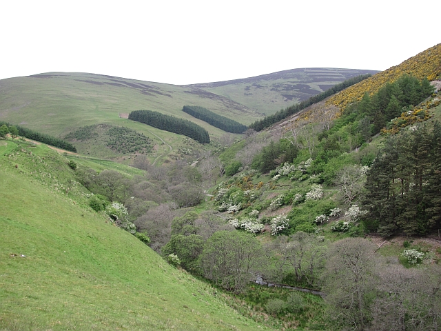
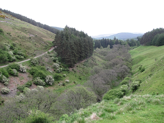
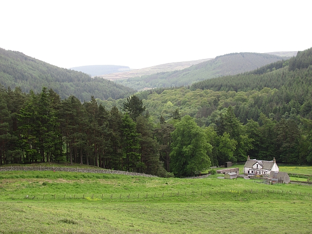
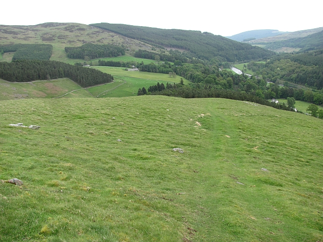
Shaw Plantation, located in Selkirkshire, is a scenic woodland area renowned for its natural beauty and rich biodiversity. Spanning approximately 200 acres, the plantation is nestled in the heart of the Scottish Borders region, offering visitors a tranquil escape into nature.

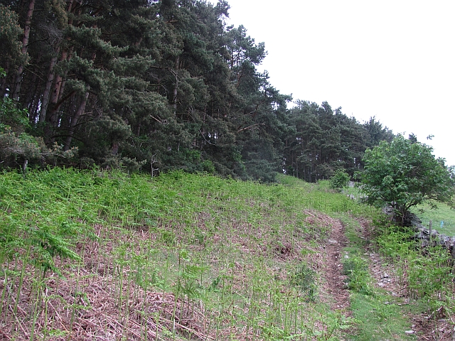
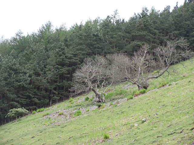
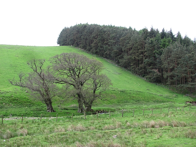
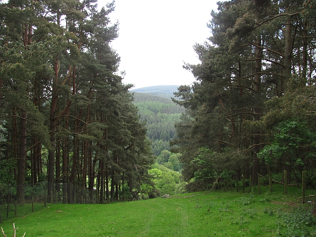
The woodland is predominantly composed of native tree species, including oak, birch, and Scots pine, which create a diverse and vibrant ecosystem. The dense canopy provides a sanctuary for a wide array of wildlife, such as red squirrels, roe deer, and various species of birds, making it a popular spot for nature enthusiasts and birdwatchers.

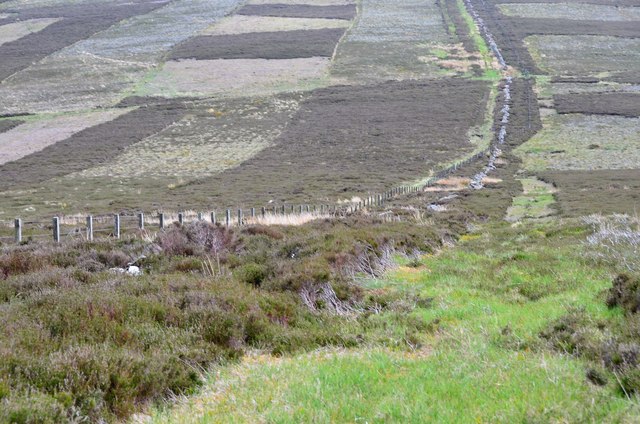
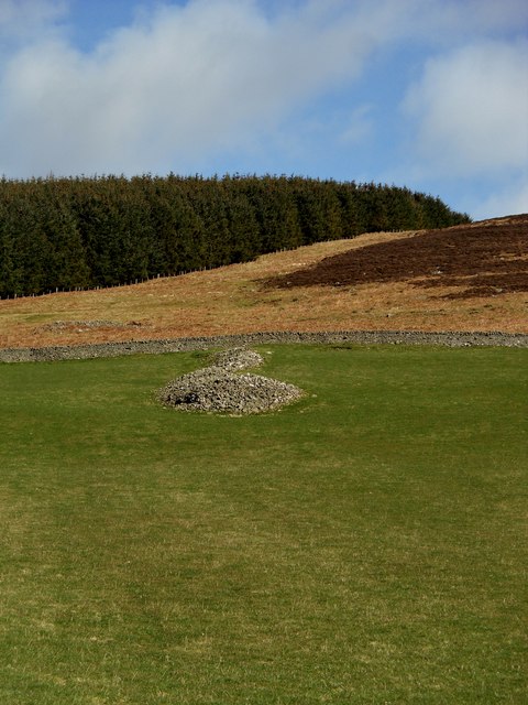
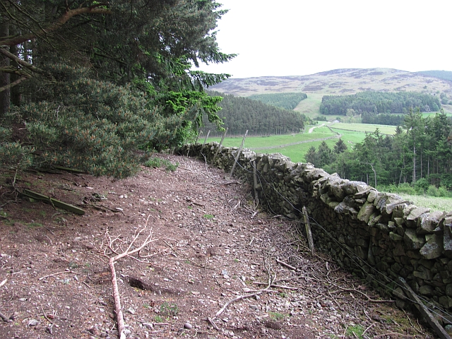
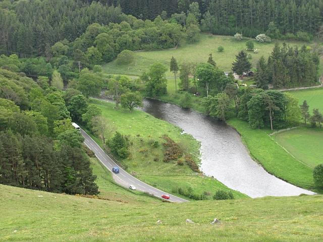
Shaw Plantation is crisscrossed by a network of well-maintained walking trails, allowing visitors to explore the area at their own pace. These trails offer breathtaking views of the surrounding countryside, with glimpses of the nearby Ettrick Valley and the rolling hills of the Southern Uplands.

In addition to its natural beauty, Shaw Plantation also holds historical significance. It is believed that the area has been used for timber production since the medieval times, and remnants of old sawpits can still be found within the woodland. These historical features add an extra layer of charm to the plantation, making it a place of interest for history enthusiasts.

Overall, Shaw Plantation in Selkirkshire is a captivating destination that seamlessly blends natural beauty, biodiversity, and historical significance. Whether one wishes to immerse themselves in the tranquility of nature or delve into the area's rich past, this woodland offers a memorable experience for all who visit.

If you have any feedback on the listing, please let us know in the comments section below.

Shaw Plantation Images

Images are sourced within 2km of 55.633515/-2.9629563 or Grid Reference NT3938. Thanks to Geograph Open Source API. All images are credited.

Hillside above the Caddon Water Down the slope to the left is the Oak Burn, a feeder stream for the Caddon Water. The summit R of centre is Tittin Law.
Hillside above the Caddon Water
Down the slope to the left is the Oak Burn, a feeder stream for the Caddon Water. The summit R of centre is Tittin Law.
Descent from Seathope Law Descending to the col towards Stony Knowe.
Descent from Seathope Law
Descending to the col towards Stony Knowe.
Marker Posts, Toll Wood
Pile of Stones, Thornylee
Fields, Thornylee Farm
Looking North over the Batta to Thornylee
Quad bike track, Gatehopeknowe It runs up Pyat Hill and is a very useful way on to the hill or to Gate Hope avoiding the houses.
Quad bike track, Gatehopeknowe
It runs up Pyat Hill and is a very useful way on to the hill or to Gate Hope avoiding the houses.
Woodland edge, Gatehopeknowe A useful way into Gate Hope, but watch the rabbit holes. This is death to ankles. There must be some well fed buzzards hereabouts.
Woodland edge, Gatehopeknowe
A useful way into Gate Hope, but watch the rabbit holes. This is death to ankles. There must be some well fed buzzards hereabouts.
Gate Hope A very beautiful glen, north of the Tweed.  I spend a lot of time on Windlestraw Law and this has to be the best way up I have yet found.
Gate Hope
A very beautiful glen, north of the Tweed. I spend a lot of time on Windlestraw Law and this has to be the best way up I have yet found.
Gate Hope A well wooded, hidden glen north of the Tweed. A grassy track runs up the west side and the main estate and house access road runs up the eastern side.
Gate Hope
A well wooded, hidden glen north of the Tweed. A grassy track runs up the west side and the main estate and house access road runs up the eastern side.
Kill Brae It would be a Killer Brae if you tried to run up it. Ashes on a steep scree slope on the east side of Gate Hope.
Hope is word in common usage along both of England's borders and in Northwest England. Usually it means a steep sided and often blind valley.
Kill Brae
It would be a Killer Brae if you tried to run up it. Ashes on a steep scree slope on the east side of Gate Hope. Hope is word in common usage along both of England's borders and in Northwest England. Usually it means a steep sided and often blind valley.
Trees, Gatehopeknowe Burn Look like the same trees as here: <a href="https://www.geograph.org.uk/photo/162214">NT3738 : Trees, Gatehopeknowe Burn</a>
Summer is here, but alders are late coming to leaf.  Gate Hope has some extensive alder woods along the burn.
Trees, Gatehopeknowe Burn
Look like the same trees as here: NT3738 : Trees, Gatehopeknowe Burn Summer is here, but alders are late coming to leaf. Gate Hope has some extensive alder woods along the burn.
Gatehopeknowe View down a well wooded stretch of Tweeddale past Gatehopeknowe.
Gatehopeknowe
View down a well wooded stretch of Tweeddale past Gatehopeknowe.
Track, Gate Hope A grassy track runs up the western side of Gate Hope. The main access to the glen is by a bigger, well surfaced road from Holylee on the eastern side.
Track, Gate Hope
A grassy track runs up the western side of Gate Hope. The main access to the glen is by a bigger, well surfaced road from Holylee on the eastern side.
Back Burn A wooded section of Gate Hope where the Back Burn meets the Gatehopeburn.
Back Burn
A wooded section of Gate Hope where the Back Burn meets the Gatehopeburn.
Pyat Hill A quad bike track descends Pyat Hill. There is a very good view down Tweeddale from here.
Pyat Hill
A quad bike track descends Pyat Hill. There is a very good view down Tweeddale from here.
River Tweed Looking down on the Tweed and A72 from Pyat Hill.
River Tweed
Looking down on the Tweed and A72 from Pyat Hill.
Gap in woodland A quad bike track to release pens and Pyat Hill passes up this gap between two conifer blocks.
Gap in woodland
A quad bike track to release pens and Pyat Hill passes up this gap between two conifer blocks.
Show me another place!

Shaw Plantation is located at Grid Ref: NT3938 (Lat: 55.633515, Lng: -2.9629563)

Unitary Authority: The Scottish Borders

Police Authority: The Lothians and Scottish Borders

What 3 Words

///deny.fixated.collision. Near Innerleithen, Scottish Borders

Related Wikis

Thornielee railway station

Thornielee railway station served the smallholding of Thornielee, Scottish Borders, Scotland from 1866 to 1950 on the Peebles Railway. == History == The...

Walkerburn

Walkerburn (Scottish Gaelic: Allt an Fhùcadair) is a small village in the Scottish Borders area of Scotland, on the A72 about 8 miles (13 km) from Peebles...

Walkerburn railway station

Walkerburn railway station served the village of Walkerburn, Scottish Borders, Scotland from 1867 to 1962 on the Peebles Railway. == History == The station...

The Kirna

The Kirna, known locally as Kirna House (previously also as Grangehill), is a Category A listed villa in Walkerburn, Peeblesshire, Scotland. It is one...

Nearby Amenities

Located within 500m of 55.633515,-2.9629563
The data included in this document is from www.openstreetmap.org. The data is made available under ODbL.

Have you been to Shaw Plantation?

Leave your review of Shaw Plantation below (or comments, questions and feedback).