Constance Plantation

Wood, Forest in Midlothian

Scotland

Constance Plantation

Road to Roughsware Wood
Road to Roughsware Wood Credit: Richard Webb

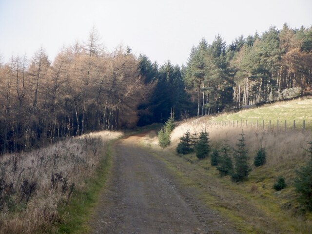
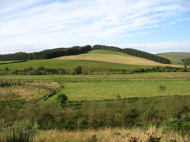
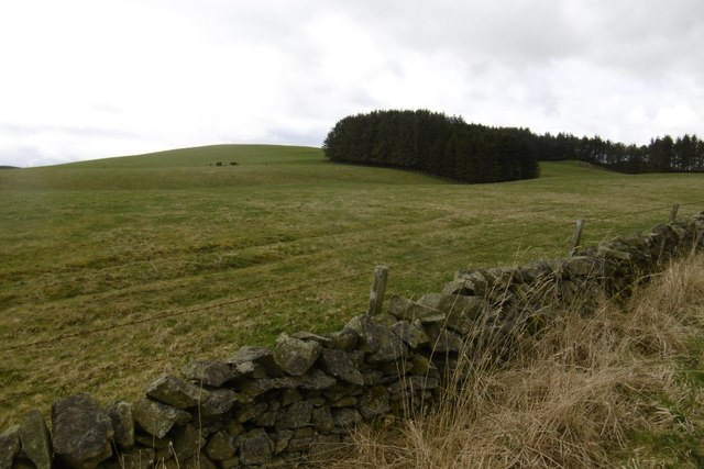
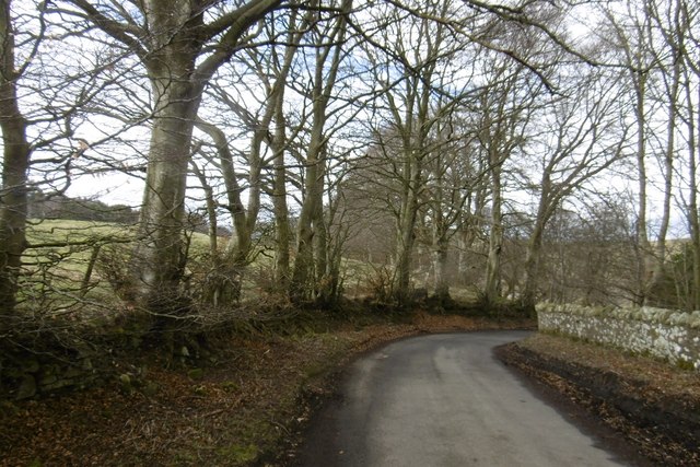
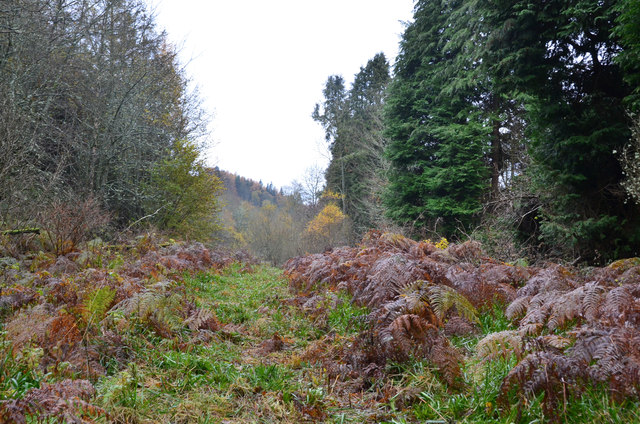
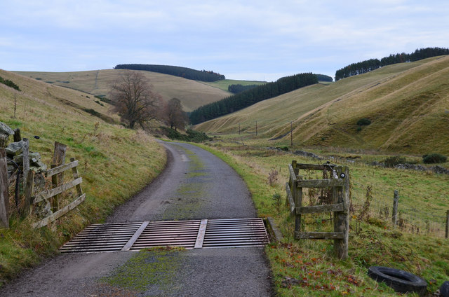
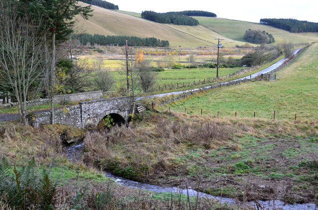
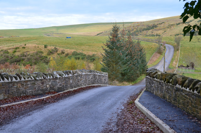
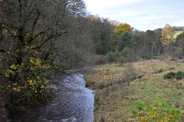
Constance Plantation is a historic site located in Midlothian, Scotland. Situated amidst a beautiful wood and forest area, the plantation is renowned for its picturesque landscape and rich history.

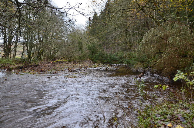
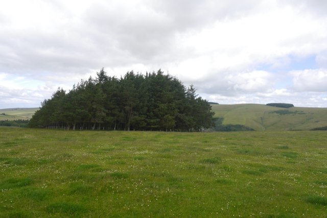
The plantation dates back to the 17th century when it was established as a timber production center. It played a significant role in the local economy by providing a steady supply of timber for various industries. The surrounding forest area is characterized by a diverse range of trees, including oak, beech, and pine, adding to the plantation's natural beauty.

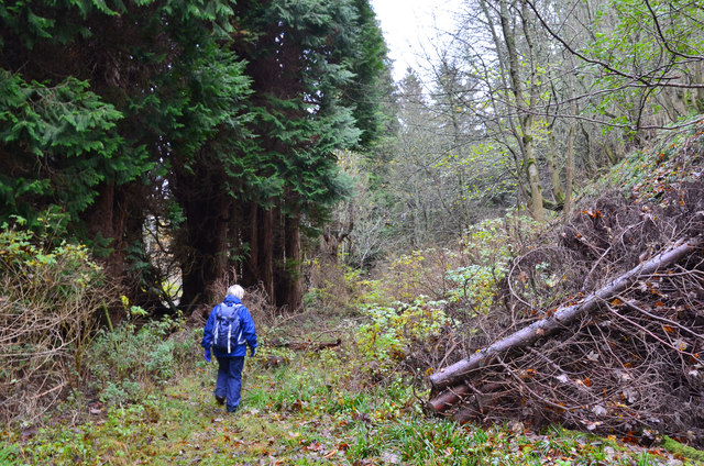
Over the years, Constance Plantation has evolved into a popular destination for nature enthusiasts and history buffs. It offers numerous walking trails, allowing visitors to explore the enchanting woodland and immerse themselves in the tranquility of nature. The plantation also features well-maintained picnic areas, making it an idyllic spot for families and friends to enjoy a leisurely day out.

Besides its natural charm, Constance Plantation boasts a rich historical heritage. The site is home to several ancient ruins, including a 17th-century mill and remnants of old timber structures. These remnants serve as a reminder of the plantation's past as a thriving hub of timber production.

Whether you are interested in nature, history, or simply seeking a peaceful retreat, Constance Plantation offers a unique experience. Its combination of stunning natural surroundings and historical significance make it a must-visit destination in Midlothian.

If you have any feedback on the listing, please let us know in the comments section below.

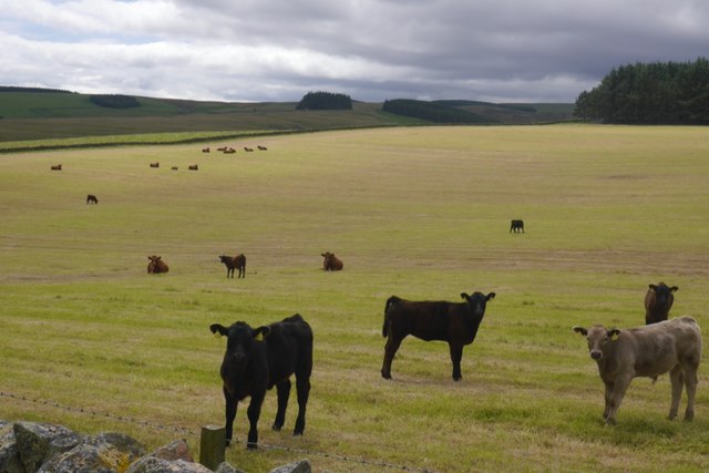
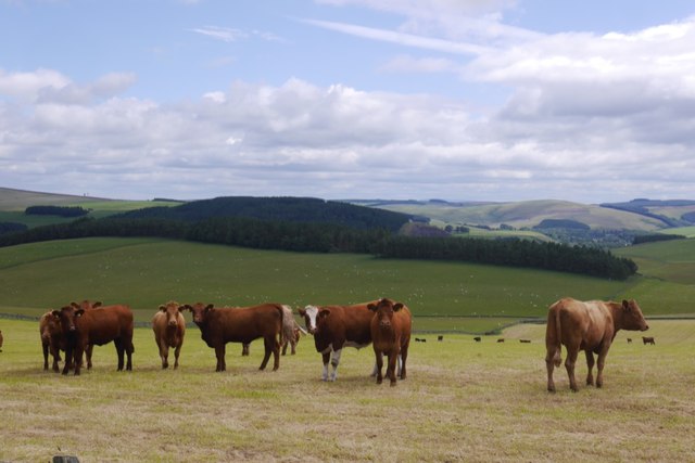
Constance Plantation Images

Images are sourced within 2km of 55.755425/-2.9660382 or Grid Reference NT3951. Thanks to Geograph Open Source API. All images are credited.

Road to Roughsware Wood
Chapel Hill The recently reopened Borders Railway crosses the centre of this picture.
Chapel Hill
The recently reopened Borders Railway crosses the centre of this picture.
Hillside above Halltree
Yellow road, Kilcoulter Approach to Kilcoulter Bridge, heading northwards.
Yellow road, Kilcoulter
Approach to Kilcoulter Bridge, heading northwards.
Between Heriot and Fountainhall Plantations and upland pastures to the west of the Gala Water valley. The A7 runs in the valley across the  top of the picture.
Between Heriot and Fountainhall
Plantations and upland pastures to the west of the Gala Water valley. The A7 runs in the valley across the top of the picture.
Rough path near White Bridge, Heriot The path shown running ENE from White Bridge cannot be recommended. The section shown here looks straightforward but led here through a flooded ditch, avoided by taking to the undergrowth on the right.
Rough path near White Bridge, Heriot
The path shown running ENE from White Bridge cannot be recommended. The section shown here looks straightforward but led here through a flooded ditch, avoided by taking to the undergrowth on the right.
A forlorn hope, Heriot On an abortive attempt to follow the path shown on the S bank of the Heriot Water between White Bridge and Kilcoulter Bridge. Beyond this point the route was heavily overgrown with fallen trees, swampland and barbed wire adding to the fun.
A forlorn hope, Heriot
On an abortive attempt to follow the path shown on the S bank of the Heriot Water between White Bridge and Kilcoulter Bridge. Beyond this point the route was heavily overgrown with fallen trees, swampland and barbed wire adding to the fun.
Heriot Water at Kilcoulter Wood The furthest point reached on the attempt to follow the path from White Bridge to Kilcoulter Bridge.
Heriot Water at Kilcoulter Wood
The furthest point reached on the attempt to follow the path from White Bridge to Kilcoulter Bridge.
Corsehope glen On the access road to Corsehope House from the minor road at Kilcoulter.
Corsehope glen
On the access road to Corsehope House from the minor road at Kilcoulter.
Chapel Bridge, Kilcoulter Old maps (e.g. OS 6" Edinburghshire sheet XXI.SW 1895) show Halltree Chapel a short distance to the south on Chapel Hill. The bridge carries the Fountainhall road across the Corsehope Burn.
Chapel Bridge, Kilcoulter
Old maps (e.g. OS 6" Edinburghshire sheet XXI.SW 1895) show Halltree Chapel a short distance to the south on Chapel Hill. The bridge carries the Fountainhall road across the Corsehope Burn.
Refurbished Kilcoulter Bridge The stone bridge carries the Heriot to Fountainhall road over the Heriot Water and has clearly undergone maintenance work recently. Compare with Mike Richardson's photograph <a href="https://www.geograph.org.uk/photo/3946067">NT4052 : Kilcoulter Bridge</a>.
Refurbished Kilcoulter Bridge
The stone bridge carries the Heriot to Fountainhall road over the Heriot Water and has clearly undergone maintenance work recently. Compare with Mike Richardson's photograph NT4052 : Kilcoulter Bridge.
Heriot Water from Kilcoulter Bridge Looking upstream past Kilcoulter Wood.
Heriot Water from Kilcoulter Bridge
Looking upstream past Kilcoulter Wood.
Field, Halltree
Field, Halltree
Road up the Spittal Burn, Halltree
White Hill, Halltree
Cattle, Halltree
Cattle, Halltree
On Chapel Hill, Heriot
Cattle, Halltree
Cattle, Halltree
Show me another place!

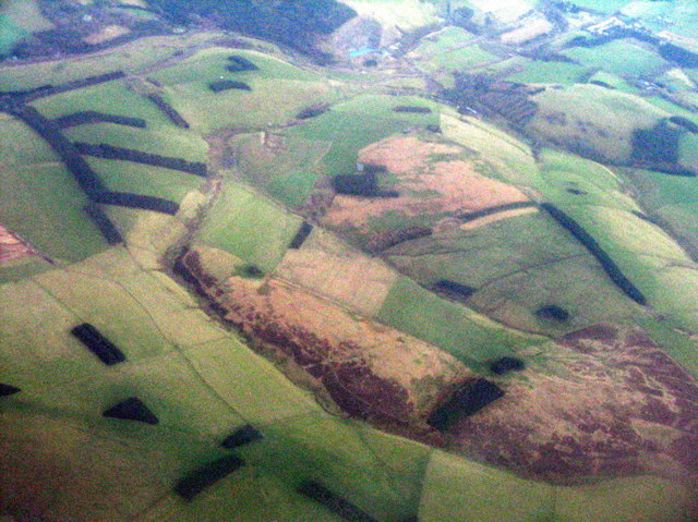
Constance Plantation is located at Grid Ref: NT3951 (Lat: 55.755425, Lng: -2.9660382)

Unitary Authority: The Scottish Borders

Police Authority: The Lothians and Scottish Borders

What 3 Words

///daring.gold.beanbag. Near Gorebridge, Midlothian

Related Wikis

Heriot, Scottish Borders

Heriot is a small village in the Moorfoot Hills southeast of Edinburgh, Scotland, within Eildon (part of the Scottish Borders council area, though historically...

Halltree

Halltree is a hamlet in the Scottish Borders. == Etymology == The etymology of Halltree is debated, but the second element is likely to be a Cumbric word...

Borders Railway

The Borders Railway connects the city of Edinburgh with Galashiels and Tweedbank in the Scottish Borders. The railway follows most of the alignment of...

Heriot railway station

Heriot railway station served the village of Heriot, Scottish Borders, Scotland from 1848 to 1969 on the Waverley Route. == History == The station opened...

Nearby Amenities

Located within 500m of 55.755425,-2.9660382
Mid Hill
Ele: 404
Natural: peak
Lat/Long: 55.7565831/-2.9694032
Barrier: cattle_grid
Lat/Long: 55.7520022/-2.969001
Power: pole
Lat/Long: 55.757996/-2.9613298
Power: pole
Lat/Long: 55.7568474/-2.96205
Power: pole
Lat/Long: 55.7559308/-2.9623045
Power: pole
Lat/Long: 55.7549885/-2.9625794
Power: pole
Lat/Long: 55.7539086/-2.9629306
Power: pole
Lat/Long: 55.753244/-2.9645391
Power: pole
Lat/Long: 55.7525923/-2.9661731
Power: pole
Lat/Long: 55.7519363/-2.9678579
Barrier: cattle_grid
Lat/Long: 55.7529094/-2.9666649
The data included in this document is from www.openstreetmap.org. The data is made available under ODbL.

Have you been to Constance Plantation?

Leave your review of Constance Plantation below (or comments, questions and feedback).