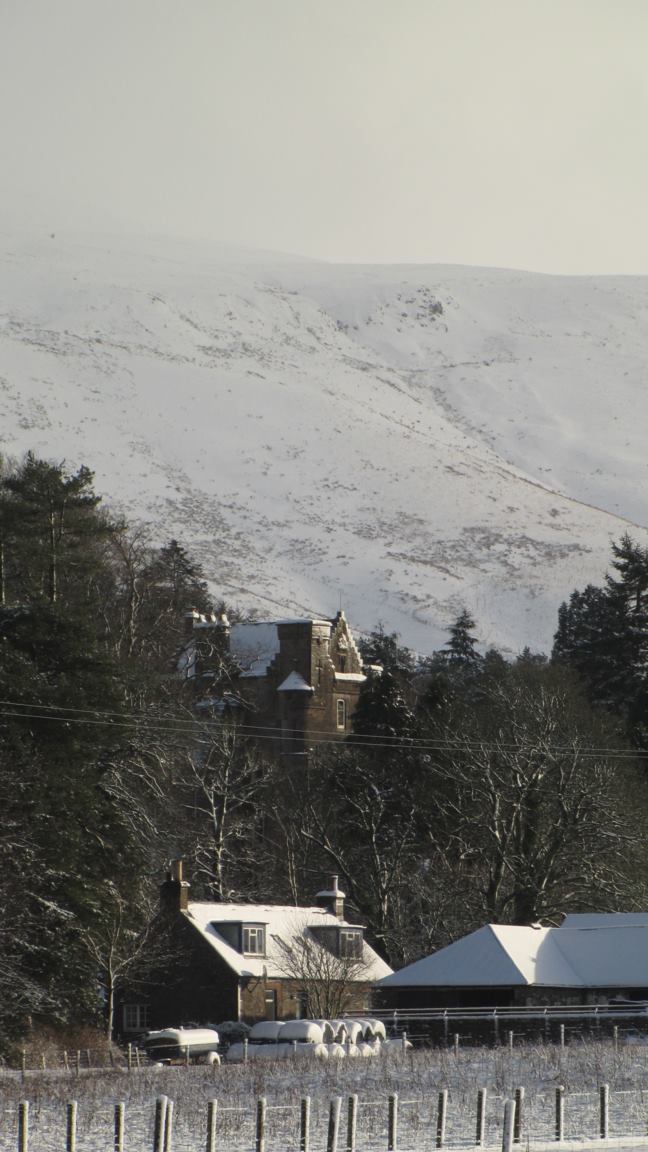
Bittleston Wood

Wood, Forest in Dumfriesshire

Scotland

Bittleston Wood

Ewes Hall A few years on from <a href="https://www.geograph.org.uk/photo/1250695">NY3792 : Ewes Hall</a>.  The telephone box is still there.
Ewes Hall Credit: Richard Webb

Bittleston Wood is a picturesque woodland located in Dumfriesshire, Scotland. Spanning over a vast area, the wood is a captivating blend of natural beauty, dense foliage, and diverse wildlife. It is situated in a rural area, providing a serene and tranquil environment for visitors to immerse themselves in nature.

The wood is predominantly composed of broadleaf trees, including oak, beech, and birch, which create a lush and vibrant canopy. As visitors venture deeper into the forest, they are greeted by a symphony of bird songs and the rustling of leaves underfoot. The woodland floor is adorned with a carpet of wildflowers, adding a splash of color to the already scenic landscape.

Bittleston Wood is a haven for wildlife enthusiasts, offering glimpses of various species. Red squirrels are a common sight, playfully darting among the branches, while deer roam freely in the undergrowth. The wood is also home to a variety of bird species, including woodpeckers, owls, and numerous songbirds.

Visitors can explore the wood through a network of well-maintained trails, allowing them to fully appreciate its natural wonders. These paths wind through the enchanting forest, offering stunning panoramic views and opportunities for peaceful contemplation. The wood is also intersected by a small stream, adding to its charm.

Bittleston Wood is a cherished destination for nature lovers, providing a serene escape from the hustle and bustle of everyday life. Its beauty and biodiversity make it a truly remarkable woodland that captures the essence of Dumfriesshire's natural landscape.

If you have any feedback on the listing, please let us know in the comments section below.

Bittleston Wood Images

Images are sourced within 2km of 55.210082/-2.9736694 or Grid Reference NY3891. Thanks to Geograph Open Source API. All images are credited.

Ewes Hall A few years on from <a href="https://www.geograph.org.uk/photo/1250695">NY3792 : Ewes Hall</a>.  The telephone box is still there.
Ewes Hall
A few years on from NY3792 : Ewes Hall. The telephone box is still there.
Eweshaugh/Sandyhaugh road Off the A7 opposite Ewes Hall.
Eweshaugh/Sandyhaugh road
Off the A7 opposite Ewes Hall.
Briery Bank Pasture, Ewesdale.
Briery Bank
Pasture, Ewesdale.
A7 layby Near Brieryshaw, Ewesdale.  Dumfries and Galloway Council still have layby bins.
A7 layby
Near Brieryshaw, Ewesdale. Dumfries and Galloway Council still have layby bins.
Loch Hill East side of Ewesdale.
Loch Hill
East side of Ewesdale.
Farm road, Brieryshaw Leads from the A7 to the hill grazing.
Farm road, Brieryshaw
Leads from the A7 to the hill grazing.
Ewes Parish Church Ewes Parish Church is an attractive rural stone-built Gothic style church dating from 1867. Some of the graves are much older than the church, dating from the 17th to 20th centuries. There is a monthly service on the 3rd Sunday of each month at 6.00 pm. The church is a Category B listed building. <span class="nowrap"><a title="https://www.britishlistedbuildings.co.uk/200342034-ewes-parish-church-and-churchyard-ewes#.WwlfMDGWzwo" rel="nofollow ugc noopener" href="https://www.britishlistedbuildings.co.uk/200342034-ewes-parish-church-and-churchyard-ewes#.WwlfMDGWzwo">Link</a><img style="margin-left:2px;" alt="External link" title="External link - shift click to open in new window" src="https://s1.geograph.org.uk/img/external.png" width="10" height="10"/></span>
Ewes Parish Church
Ewes Parish Church is an attractive rural stone-built Gothic style church dating from 1867. Some of the graves are much older than the church, dating from the 17th to 20th centuries. There is a monthly service on the 3rd Sunday of each month at 6.00 pm. The church is a Category B listed building. LinkExternal link
Kirkton, in the valley of the Ewes Water Looking up to the valley of Hare Hope.
Kirkton, in the valley of the Ewes Water
Looking up to the valley of Hare Hope.
Pasture at Ewes Looking across the track to Kirkton, to Brieryshaw Hill
Pasture at Ewes
Looking across the track to Kirkton, to Brieryshaw Hill
Glendivan farm at Brieryshaw Brittleston Height is beyond, and the trees across the centre of the image, in a dip beyond the nearest field, mark the course of the Ewes Water.
Glendivan farm at Brieryshaw
Brittleston Height is beyond, and the trees across the centre of the image, in a dip beyond the nearest field, mark the course of the Ewes Water.
Blackthorn at Brieryshaw The Blackthorn [Prunus spinosa] has been magnificent this Spring - a bumper year for sloe gin; return in October/November. Beyond is Brittleston Height.
Blackthorn at Brieryshaw
The Blackthorn [Prunus spinosa] has been magnificent this Spring - a bumper year for sloe gin; return in October/November. Beyond is Brittleston Height.
Ewes Parish Church And burial ground - just hanging on, with one service a month.
Ewes Parish Church
And burial ground - just hanging on, with one service a month.
Ewes Parish Church
Ewes Parish Church
Ewes War Memorial, and church details The details indicate that it is a part-time church, with one service a month.
Ewes War Memorial, and church details
The details indicate that it is a part-time church, with one service a month.
A7 near Brieryshaw
A7 near Brieryshaw
Steps to Ewes Schoolhouse
Grassland, Ewes
Grassland, Ewes
Ewes Parish Church
Ewes Parish Church
Show me another place!

Bittleston Wood is located at Grid Ref: NY3891 (Lat: 55.210082, Lng: -2.9736694)

Unitary Authority: Dumfries and Galloway

Police Authority: Dumfries and Galloway

What 3 Words

///ratio.elbowing.rivers. Near Langholm, Dumfries & Galloway

Nearby Locations

Bittleston Wood

Related Wikis

Arkleton

Arkleton is a mansion and estate in the civil parish of Ewes, in Dumfries and Galloway, Scotland. Arkleton House was built in 1860/1884 and incorporates...

Ewesdale

Ewesdale is a glen and former lordship in Dumfries and Galloway, Scotland. The Ewes Water runs through the valley from its source at Mosspaul, until it...

Unthank, Dumfries and Galloway

Unthank is a village in Dumfries and Galloway, Scotland. == References == The geographic coordinates are from the Ordnance Survey.

Barntalloch Castle

Barntalloch Castle was a castle located at Staplegorton, in Dumfries and Galloway, Scotland. The castle was built in the 12th century by Galfrid de Coninsburgh...

Nearby Amenities

Located within 500m of 55.210082,-2.9736694
Arkleton
Place: village
Wikidata: Q4792016
Wikipedia: en:Arkleton
Lat/Long: 55.2136683/-2.9769108
Waterway: waterfall
Lat/Long: 55.2119467/-2.9684873
Waterway: waterfall
Lat/Long: 55.2119478/-2.9686021
Barrier: stile
Lat/Long: 55.2118895/-2.9694063
Power: pole
Lat/Long: 55.2126805/-2.9786576
Power: pole
Lat/Long: 55.2127848/-2.9767805
The data included in this document is from www.openstreetmap.org. The data is made available under ODbL.

Have you been to Bittleston Wood?

Leave your review of Bittleston Wood below (or comments, questions and feedback).