Cavers Carre

Settlement in Roxburghshire

Scotland

Cavers Carre

Lilliesleaf Parish Church The first church on this site was said to be built in 1110 and replaced in 1430. The present church was built in 1771 and extended in 1883 and 1910 with the addition of a bell tower. This photo was taken at 11.50 on Christmas Day.
Lilliesleaf Parish Church Credit: Walter Baxter

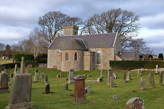
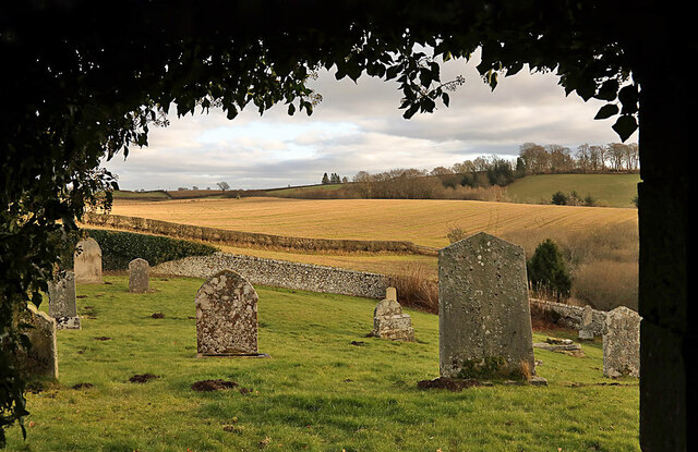
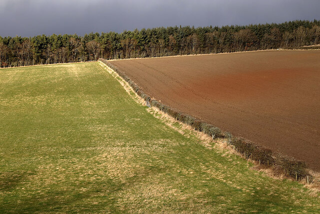
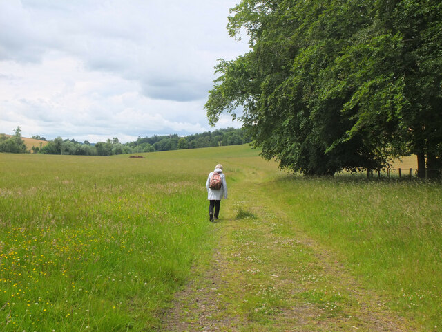
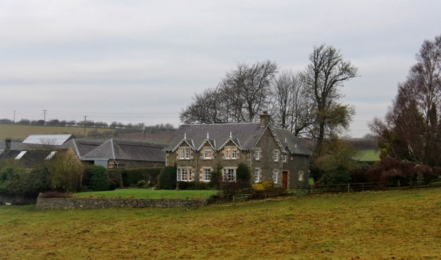
Cavers Carre is a small rural settlement situated in Roxburghshire, a historic county in the Scottish Borders region of Scotland. Nestled in the picturesque countryside, Cavers Carre is surrounded by rolling hills and lush green fields, providing a tranquil and scenic environment for its residents.

The settlement is characterized by its quaint and traditional architecture, with charming stone-built houses and cottages dotting the landscape. The community maintains a close-knit atmosphere, fostering a strong sense of community spirit among its inhabitants.

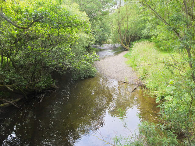
Cavers Carre is located a short distance from the town of Hawick, which offers a range of amenities and services, including shops, schools, and healthcare facilities. The settlement benefits from its proximity to the River Teviot, which runs nearby, providing opportunities for fishing and water-based activities.

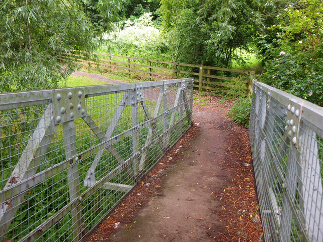
For nature lovers and outdoor enthusiasts, Cavers Carre offers easy access to the stunning natural beauty of the Scottish Borders. The surrounding area boasts numerous walking and hiking trails, allowing residents to explore the breathtaking scenery and enjoy the peace and tranquility of the countryside.

While Cavers Carre may be a small and quiet settlement, it offers a peaceful and idyllic lifestyle for those seeking a retreat from the hustle and bustle of urban living. With its scenic location and strong community spirit, Cavers Carre is a charming place to call home.

If you have any feedback on the listing, please let us know in the comments section below.
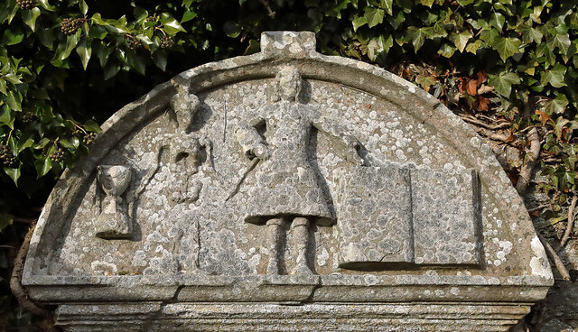
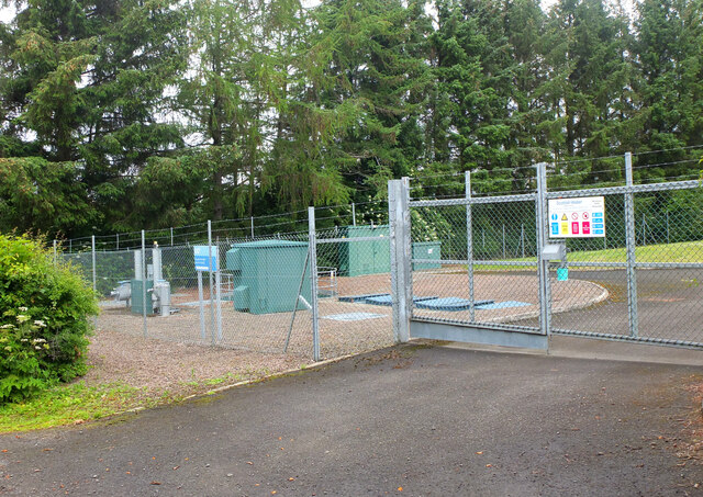
Cavers Carre Images

Images are sourced within 2km of 55.525654/-2.7143623 or Grid Reference NT5526. Thanks to Geograph Open Source API. All images are credited.

Lilliesleaf Parish Church The first church on this site was said to be built in 1110 and replaced in 1430. The present church was built in 1771 and extended in 1883 and 1910 with the addition of a bell tower. This photo was taken at 11.50 on Christmas Day.
Lilliesleaf Parish Church
The first church on this site was said to be built in 1110 and replaced in 1430. The present church was built in 1771 and extended in 1883 and 1910 with the addition of a bell tower. This photo was taken at 11.50 on Christmas Day.
Lilliesleaf Churchyard This view of the southeast part of the churchyard was taken from the entrance to the Riddell burial aisle.
Lilliesleaf Churchyard
This view of the southeast part of the churchyard was taken from the entrance to the Riddell burial aisle.
A symbolic gravestone at Lilliesleaf Churchyard The head of the winged soul on this lichen-covered portrait headstone is missing.
A symbolic gravestone at Lilliesleaf Churchyard
The head of the winged soul on this lichen-covered portrait headstone is missing.
Mixed farmland at Lilliesleaf The fields were viewed from the B6400 opposite Lilliesleaf Parish Church.
Mixed farmland at Lilliesleaf
The fields were viewed from the B6400 opposite Lilliesleaf Parish Church.
A gravestone detail at Lilliesleaf This is the top part of an 18th century wall monument gravestone in an enclosure at Lilliesleaf Parish Churchyard. The portrait figure represents the deceased holding a book to show religious devotion, while the menacing figure on the left is a symbol of mortality, a crown-wearing skeleton, the King of Terrors, holding an hourglass and a dart. It was difficult to make anything out on the inscription below.
There is an almost identical stone at Roberton Cemetery <a href="https://www.geograph.org.uk/photo/2551444">NT4314 : A gravestone detail at Roberton</a>.
A gravestone detail at Lilliesleaf
This is the top part of an 18th century wall monument gravestone in an enclosure at Lilliesleaf Parish Churchyard. The portrait figure represents the deceased holding a book to show religious devotion, while the menacing figure on the left is a symbol of mortality, a crown-wearing skeleton, the King of Terrors, holding an hourglass and a dart. It was difficult to make anything out on the inscription below. There is an almost identical stone at Roberton Cemetery NT4314 : A gravestone detail at Roberton.
Sewage treatment plant, Lilliesleaf Near the east end of the village on the lane down to the Ale Water.
Sewage treatment plant, Lilliesleaf
Near the east end of the village on the lane down to the Ale Water.
Ale Water at Lilliesleaf Looking upstream from the Jubilee footbridge.
Ale Water at Lilliesleaf
Looking upstream from the Jubilee footbridge.
Jubilee Bridge, Lilliesleaf The bridge carries a path over the Ale Water with access westwards to a field track to Riddell or eastwards to meet the B6453 road to Midlem.
Jubilee Bridge, Lilliesleaf
The bridge carries a path over the Ale Water with access westwards to a field track to Riddell or eastwards to meet the B6453 road to Midlem.
Field track to Riddell A track through farmland to the estate at Riddell. Compare with <a href="https://www.geograph.org.uk/photo/3035817">NT5325 : Field track, Lilliesleaf</a> taken here on my previous visit in the soggy July of 2012.
Field track to Riddell
A track through farmland to the estate at Riddell. Compare with NT5325 : Field track, Lilliesleaf taken here on my previous visit in the soggy July of 2012.
Lilliesleaf main street The bulk of the village is along one street on the B6359, though there is a back road on the south side.
Lilliesleaf main street
The bulk of the village is along one street on the B6359, though there is a back road on the south side.
Village hall, Lilliesleaf The inscription below the clock reads 'Currie Memorial Public Hall'. For a closer view please see Walter Baxter's photograph <a href="https://www.geograph.org.uk/photo/770155">NT5325 : Clock on Lilliesleaf Village Hall</a>.
Village hall, Lilliesleaf
The inscription below the clock reads 'Currie Memorial Public Hall'. For a closer view please see Walter Baxter's photograph NT5325 : Clock on Lilliesleaf Village Hall.
Minor road near Netherraw It got a bit muddy further on where the Christmas tree traffic was moving.
Minor road near Netherraw
It got a bit muddy further on where the Christmas tree traffic was moving.
Christmas trees, Netherraw
Muddy road, Netherraw Christmas tree harvest season.
Muddy road, Netherraw
Christmas tree harvest season.
Rolling farmland on the B6400
B6400-B6359 junction
Shawburn, a large farmhouse
Arable land, Lillesleaf
Show me another place!

Cavers Carre is located at Grid Ref: NT5526 (Lat: 55.525654, Lng: -2.7143623)

Unitary Authority: The Scottish Borders

Police Authority: The Lothians and Scottish Borders

What 3 Words

///slung.napkins.prominent. Near Newtown St Boswells, Scottish Borders

Nearby Locations

Cavers Carre

Related Wikis

Lilliesleaf

Lilliesleaf is a small village and civil parish 7 miles (11 km) south east of Selkirk in the Roxburghshire area of Scottish Borders of Scotland. Other...

Belses

Belses is a village on the Ale Water, in the Scottish Borders area of Scotland the former Selkirkshire. It is situated close to Old Belses, and lies south...

Old Belses

Old Belses is a village by the Ale Water, in the Parish of Ancrum, in the Scottish Borders of Scotland, in the historic county of Roxburghshire. Other...

Lothian and Borders

Lothian and Borders is an area in Scotland consisting of the East Lothian, City of Edinburgh, Midlothian, West Lothian council areas (collectively known...

Belses railway station

Belses railway station served the village of Belses, Scottish Borders, Scotland from 1849 to 1969 on the Waverley Route. == History == The station opened...

Charlesfield Halt railway station

Charlesfield Halt railway station served the village of Charlesfield, Melrose, Scotland, from 1942 to 1961 on the Waverley Route. == History == The station...

Castle Holydean

Holydean Castle (pronounced "hollydeen") was a castle sited near Melrose in Bowden, 1.25 miles SW of the village, in the Scottish Borders region of Scotland...

Bowden, Scottish Borders

Bowden is a village in the Roxburghshire area of the Scottish Borders, situated 3 miles (5 kilometres) south of Melrose, 2 miles (3 kilometres) west of...

Nearby Amenities

Located within 500m of 55.525654,-2.7143623
Chapel Farm
Place: hamlet
Lat/Long: 55.5222033/-2.7191665
Linthill Stables
Lat/Long: 55.5271673/-2.7211699
Power: pole
Lat/Long: 55.5217018/-2.7160642
Power: pole
Lat/Long: 55.5214569/-2.7149571
Power: pole
Lat/Long: 55.5222767/-2.7173164
Power: pole
Lat/Long: 55.5225072/-2.7181665
Power: pole
Lat/Long: 55.5224784/-2.7188613
Power: pole
Lat/Long: 55.522719/-2.7195968
Power: pole
Lat/Long: 55.5229567/-2.7202942
Power: pole
Lat/Long: 55.523193/-2.7209661
Power: pole
Lat/Long: 55.5282913/-2.7207663
The data included in this document is from www.openstreetmap.org. The data is made available under ODbL.

Have you been to Cavers Carre?

Leave your review of Cavers Carre below (or comments, questions and feedback).