Cavendish Bridge

Settlement in Leicestershire North West Leicestershire

England

Cavendish Bridge

The three Plumtree Cottages, Cavendish Bridge These appear to be the same homes that were mapped here in 1880, but then there were four smaller cottages at this end and a larger one at the far end, making five in all.
The three Plumtree Cottages, Cavendish Bridge Credit: Christine Johnstone

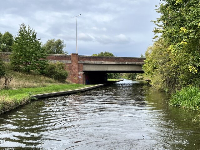
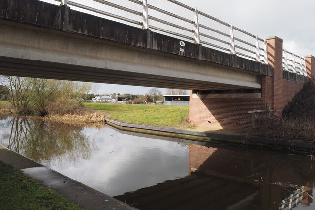
Cavendish Bridge is a historic landmark located in the county of Leicestershire, England. Situated near the village of Shardlow, the bridge spans across the River Trent, connecting the counties of Leicestershire and Derbyshire. It is considered one of the most significant and impressive examples of early 19th-century canal engineering.

The bridge was constructed between 1807 and 1809 as part of the Trent and Mersey Canal, designed by the renowned engineer, James Brindley. It was commissioned by the Duke of Bridgewater, Francis Egerton, and named after his title, the Duke of Cavendish. The purpose of the bridge was to allow the passage of canal boats beneath while providing a crossing point for road traffic.

Cavendish Bridge is a prime example of a humpback bridge, characterized by its elegant curved shape and brick construction. It features three arches, each spanning approximately 18 meters, supported by massive stone abutments. The bridge's design allows for a smooth and uninterrupted flow of water beneath, ensuring the continued navigation of canal boats.

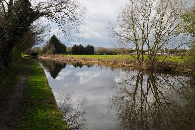
The bridge played a crucial role in the transportation of goods and materials during the Industrial Revolution. It facilitated the movement of coal, pottery, and other commodities between the Midlands and the rest of the country, contributing to the growth of the local economy.

Today, Cavendish Bridge stands as a testament to the engineering prowess of its era and serves as a popular attraction for tourists and history enthusiasts. Its picturesque setting, surrounded by scenic countryside, offers visitors a glimpse into the region's rich industrial past.

If you have any feedback on the listing, please let us know in the comments section below.

Cavendish Bridge Images

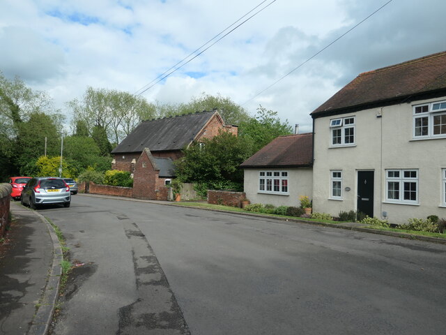
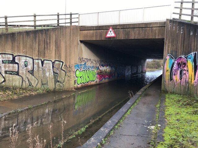
Images are sourced within 2km of 52.862913/-1.337489 or Grid Reference SK4429. Thanks to Geograph Open Source API. All images are credited.

The three Plumtree Cottages, Cavendish Bridge These appear to be the same homes that were mapped here in 1880, but then there were four smaller cottages at this end and a larger one at the far end, making five in all.
The three Plumtree Cottages, Cavendish Bridge
These appear to be the same homes that were mapped here in 1880, but then there were four smaller cottages at this end and a larger one at the far end, making five in all.
The centre of Cavendish Bridge Opposite the site of the south end of original bridge across the Trent. Before the Trent & Mersey canal opened, with its inland port at Shardlow, boats from the Cromford Canal used the wharf at Cavendish Bridge.
The centre of Cavendish Bridge
Opposite the site of the south end of original bridge across the Trent. Before the Trent & Mersey canal opened, with its inland port at Shardlow, boats from the Cromford Canal used the wharf at Cavendish Bridge.
Former school, Cavendish Bridge Shown as such on the large-scale OS maps surveyed around 1880. Now converted to a house called Cavendish House.
Former school, Cavendish Bridge
Shown as such on the large-scale OS maps surveyed around 1880. Now converted to a house called Cavendish House.
Hicken's Bridge The A50 bridge over the Trent and Mersey Canal.
Hicken's Bridge
The A50 bridge over the Trent and Mersey Canal.
Back Lane is flooded Thankfully a raised path at the side of the carriageway is provided.  This is a gated lane with only foot and cycle traffic possible.  The bridge carries the A50.
Back Lane is flooded
Thankfully a raised path at the side of the carriageway is provided. This is a gated lane with only foot and cycle traffic possible. The bridge carries the A50.
Erroneous sign still here Fifteen years since <a href="https://www.geograph.org.uk/photo/689661">SK4429 : Erroneous A Road sign</a> and this still hasn't been removed.
Erroneous sign still here
Fifteen years since SK4429 : Erroneous A Road sign and this still hasn't been removed.
Old Crown Inn, Cavendish Bridge
The sign of the Old Crown Inn See <a href="https://www.geograph.org.uk/photo/7433278">SK4429 : Old Crown Inn, Cavendish Bridge</a>.
The sign of the Old Crown Inn
Bridge 3A Trent & Mersey Canal (1997) This seems to be an expensive looking bridge for what appears to be just a farm track running across it.

The date is probably the big clue as this is the time that the nearby A50 was finished.  Presumably therefore this was needed to restore access to the farm visible behind destroyed by the new road.
Bridge 3A Trent & Mersey Canal (1997)
This seems to be an expensive looking bridge for what appears to be just a farm track running across it. The date is probably the big clue as this is the time that the nearby A50 was finished. Presumably therefore this was needed to restore access to the farm visible behind destroyed by the new road.
The Trent & Mersey Canal Hicken's Bridge carrying the A50 visible in the distance.
The Trent & Mersey Canal
Hicken's Bridge carrying the A50 visible in the distance.
Canal Milepost Shardlow 1 Mile Preston Brook 91 Miles.

Grade II listed List Entry Number:1088357 <span class="nowrap"><a title="https://historicengland.org.uk/listing/the-list/list-entry/1088357?section=official-list-entry" rel="nofollow ugc noopener" href="https://historicengland.org.uk/listing/the-list/list-entry/1088357?section=official-list-entry">Link</a><img style="margin-left:2px;" alt="External link" title="External link - shift click to open in new window" src="https://s1.geograph.org.uk/img/external.png" width="10" height="10"/></span>

Originally at SK429 298.

See also <a href="https://www.geograph.org.uk/photo/6897993">SK4329 : A canal milepost</a> <a href="https://www.geograph.org.uk/photo/5700633">SK4329 : Shardlow 1 mile</a>.
Canal Milepost
Shardlow 1 Mile Preston Brook 91 Miles. Grade II listed List Entry Number:1088357 LinkExternal link Originally at SK429 298. See also SK4329 : A canal milepost SK4329 : Shardlow 1 mile.
Play space, Hemington
13 Main Street, Hemington The part closest to the camera dates from the seventeenth century. The cross wing on the right is significantly older <span class="nowrap"><a title="https://historicengland.org.uk/listing/the-list/list-entry/1359392?section=official-list-entry" rel="nofollow ugc noopener" href="https://historicengland.org.uk/listing/the-list/list-entry/1359392?section=official-list-entry">Link</a><img style="margin-left:2px;" alt="External link" title="External link - shift click to open in new window" src="https://s1.geograph.org.uk/img/external.png" width="10" height="10"/></span>
13 Main Street, Hemington
The part closest to the camera dates from the seventeenth century. The cross wing on the right is significantly older LinkExternal link
Thatched Cottage, Hemington Over-restored seventeenth-century cottage <span class="nowrap"><a title="https://historicengland.org.uk/listing/the-list/list-entry/1359383?section=official-list-entry" rel="nofollow ugc noopener" href="https://historicengland.org.uk/listing/the-list/list-entry/1359383?section=official-list-entry">Link</a><img style="margin-left:2px;" alt="External link" title="External link - shift click to open in new window" src="https://s1.geograph.org.uk/img/external.png" width="10" height="10"/></span>
Thatched Cottage, Hemington
Over-restored seventeenth-century cottage LinkExternal link
New sports facilities under construction, Hemington
Old Milepost by the B5010, London Road, near Cavendish Bridge Cast iron post by the B5010 (former A6), in parish of LOCKINGTON HEMINGTON (NORTH WEST LEICESTERSHIRE District), London Road; junction with the former A453, by Golden Dragon PH, in pavement, back to low garden wall, on South side of road. Gamble iron casting, erected by the Loughborough to Cavendish Bridge turnpike trust in the 19th century. 

Inscription reads:-
: DERBY / 8 : : TO / LONDON / 118 : : LOUGH / BRO / 9 :
: PARISH : : OF HEM / INGTON : 

Grade II listed. 
List Entry Number: 1074175 <span class="nowrap"><a title="https://historicengland.org.uk/listing/the-list/list-entry/1074175" rel="nofollow ugc noopener" href="https://historicengland.org.uk/listing/the-list/list-entry/1074175">Link</a><img style="margin-left:2px;" alt="External link" title="External link - shift click to open in new window" src="https://s1.geograph.org.uk/img/external.png" width="10" height="10"/></span>

Milestone Society National ID: LE_LM118.
Old Milepost by the B5010, London Road, near Cavendish Bridge
Cast iron post by the B5010 (former A6), in parish of LOCKINGTON HEMINGTON (NORTH WEST LEICESTERSHIRE District), London Road; junction with the former A453, by Golden Dragon PH, in pavement, back to low garden wall, on South side of road. Gamble iron casting, erected by the Loughborough to Cavendish Bridge turnpike trust in the 19th century. Inscription reads:- : DERBY / 8 : : TO / LONDON / 118 : : LOUGH / BRO / 9 : : PARISH : : OF HEM / INGTON : Grade II listed. List Entry Number: 1074175 LinkExternal link Milestone Society National ID: LE_LM118.
The former Lady in Grey Fine Grade II listed building.  Sadly still vacant and decaying See <a href="https://www.geograph.org.uk/photo/5659790">SK4430 : The Lady in Grey</a>.

List Entry Number: 1205393 <span class="nowrap"><a title="https://historicengland.org.uk/listing/the-list/list-entry/1205393" rel="nofollow ugc noopener" href="https://historicengland.org.uk/listing/the-list/list-entry/1205393">Link</a><img style="margin-left:2px;" alt="External link" title="External link - shift click to open in new window" src="https://s1.geograph.org.uk/img/external.png" width="10" height="10"/></span>
The former Lady in Grey
Fine Grade II listed building. Sadly still vacant and decaying See SK4430 : The Lady in Grey. List Entry Number: 1205393 LinkExternal link
The former Lady in Grey Looked to have been closed a year or two when this was taken.  After realising that I have not got a picture of the decaying sign on this visit I planned to return to rectify that omission.  Unfortunately I never did and it is now long gone.  See also <a href="https://www.geograph.org.uk/photo/5659790">SK4430 : The Lady in Grey</a> and <a href="https://www.geograph.org.uk/photo/7019925">SK4430 : The former Lady in Grey</a>.

The building is Grade II listed List Entry Number: 1205393 <span class="nowrap"><a title="https://historicengland.org.uk/listing/the-list/list-entry/1205393" rel="nofollow ugc noopener" href="https://historicengland.org.uk/listing/the-list/list-entry/1205393">Link</a><img style="margin-left:2px;" alt="External link" title="External link - shift click to open in new window" src="https://s1.geograph.org.uk/img/external.png" width="10" height="10"/></span>
The former Lady in Grey
Looked to have been closed a year or two when this was taken. After realising that I have not got a picture of the decaying sign on this visit I planned to return to rectify that omission. Unfortunately I never did and it is now long gone. See also SK4430 : The Lady in Grey and SK4430 : The former Lady in Grey. The building is Grade II listed List Entry Number: 1205393 LinkExternal link
Show me another place!

Cavendish Bridge is located at Grid Ref: SK4429 (Lat: 52.862913, Lng: -1.337489)

Administrative County: Leicestershire

District: North West Leicestershire

Police Authority: Leicestershire

What 3 Words

///twisting.marshes.instincts. Near Castle Donington, Leicestershire

Nearby Locations

Cavendish Bridge

Related Wikis

Cavendish Bridge

Cavendish Bridge is a bridge over the River Trent, connecting the counties of Leicestershire and Derbyshire; it is also the name of a hamlet on the Leicestershire...

Shardlow and Great Wilne

Shardlow and Great Wilne is a civil parish in the South Derbyshire district of the English county of Derbyshire. The population of the civil parish taken...

Shardlow Hall (school)

Shardlow Hall was a school in Shardlow, a village seven miles south of Derby in the English Midlands. It was founded by B.O.Corbett, who had played football...

St James' Church, Shardlow

St James’ Church, Shardlow is a Grade II listed parish church in the Church of England in Shardlow, Derbyshire. == History == The foundation stone was...

Nearby Amenities

Located within 500m of 52.862913,-1.337489
Motorway Junction
Sawley Junction
Destination: Long Eaton
Destination Ref: B6540
Ref: 1
Lat/Long: 52.8604792/-1.3357488
Traffic Signals
Lat/Long: 52.8647447/-1.3365834
Traffic Signals
Lat/Long: 52.8652954/-1.3379056
Bus Stop
Old Crown Inn
Bus: yes
Naptan AtcoCode: 260013624
Naptan Bearing: NW
Naptan CommonName: Cavendish Bridge
Naptan Indicator: 30 Southeast
Naptan Landmark: to bridge (old A6 to Shardlow)
Naptan NaptanCode: leidmawd
Naptan Notes: Hourly - County
Naptan Street: London Road
Naptan Verified: yes
Old Name: Cavendish Bridge
Public Transport: platform
Shelter: yes
Source: naptan_import
Lat/Long: 52.8643772/-1.3359492
Post Box
Collection Times: Mo-Fr 17:00; Sa 10:30
Operator: Royal Mail
Post Box Type: wall
Ref: DE72 48
Royal Cypher: GR
Royal Cypher Wikidata: Q33102273
Source: survey
Lat/Long: 52.8639796/-1.3391358
Entrance: main
Lat/Long: 52.8640367/-1.3392098
Maxheight: 13'6"
Lat/Long: 52.8604612/-1.3418031
Barrier: stile
Lat/Long: 52.8642896/-1.3345207
Cavendish Bridge
Place: hamlet
Source Name: local_knowledge
Lat/Long: 52.8641947/-1.3389537
Addr City: Derby
Addr Housename: 1 Cavendish Cottages
Addr Place: Cavendish Bridge
Addr Postcode: DE72 2HL
Addr Suburb: Shardlow
Entrance: main
Source Addr Postcode: OS Open Data Codepoint; interpolation
Steps: yes
Lat/Long: 52.8641125/-1.3393331
Addr City: Derby
Addr Housename: 2 Cavendish Cottages
Addr Place: Cavendish Bridge
Addr Postcode: DE72 2HL
Addr Suburb: Shardlow
Entrance: main
Source Addr Postcode: OS Open Data Codepoint; interpolation
Steps: yes
Lat/Long: 52.8641253/-1.3393526
Addr City: Derby
Addr Housename: 3 Cavendish Cottages
Addr Place: Cavendish Bridge
Addr Postcode: DE72 2HL
Addr Suburb: Shardlow
Entrance: main
Source Addr Postcode: OS Open Data Codepoint; interpolation
Lat/Long: 52.8641626/-1.3394562
Addr City: Derby
Addr Housename: 4 Cavendish Cottages
Addr Place: Cavendish Bridge
Addr Postcode: DE72 2HL
Addr Suburb: Shardlow
Entrance: main
Source Addr Postcode: OS Open Data Codepoint; interpolation
Lat/Long: 52.8641791/-1.3395279
Addr City: Derby
Addr Housename: 5-6 Cavendish Cottages
Addr Place: Cavendish Bridge
Addr Postcode: DE72 2HL
Addr Suburb: Shardlow
Entrance: main
Source Addr Postcode: OS Open Data Codepoint; interpolation
Lat/Long: 52.8642019/-1.3396288
HE Ref: 1074175
Historic: milepost
Inscription: To London 118 / Loughbro 9 / Derby 8 / Parish Hemington
Listed Status: Grade II
Source: survey
Source Listed Status: Historic England
Lat/Long: 52.8628184/-1.3307228
Entrance: yes
Lat/Long: 52.8641449/-1.3385393
Entrance: yes
Lat/Long: 52.8641898/-1.3384363
Entrance: yes
Note: Flat 1
Lat/Long: 52.8642409/-1.3383189
Bus Stop
Cavendish Bridge
Bus: yes
Naptan AtcoCode: 100000022069
Naptan NaptanCode: dbsgptda
Public Transport: platform
Shelter: no
Source: survey
Lat/Long: 52.8658246/-1.3392826
Bus Stop
Cavendish Bridge
Bus: yes
Naptan AtcoCode: 100000022068
Naptan NaptanCode: dbsgptaw
Public Transport: platform
Shelter: no
Source: survey
Lat/Long: 52.8658505/-1.3391355
Barrier: block
Description: Pile of rubble
Lat/Long: 52.8655389/-1.3397103
Historic: memorial
Inscription: Scale of charges taken from the toll house of the Old Cavendish Bridge built 1758 & washed away in 1947. Re-erected in this position by the county councils of Derby and Leicester in 1960.
Memorial: plaque
Source: survey
Lat/Long: 52.866089/-1.3401948
Derby Access
Addr Place: British Waterways Yard
Addr Suburb: Cavendish Bridge
Industrial: scaffolding
Source: survey
Lat/Long: 52.8650924/-1.3353085
LE Scoobies
Addr Place: British Waterways Yard
Addr Suburb: Cavendish Bridge
Source: survey
Lat/Long: 52.8651007/-1.3350378
PH Sports Cars Ltd
Addr Place: British Waterways Yard
Addr Suburb: Cavendish Bridge
Brand: Porsche
Shop: car_repair
Source: survey
Lat/Long: 52.8648365/-1.3362889
The data included in this document is from www.openstreetmap.org. The data is made available under ODbL.

Have you been to Cavendish Bridge?

Leave your review of Cavendish Bridge below (or comments, questions and feedback).