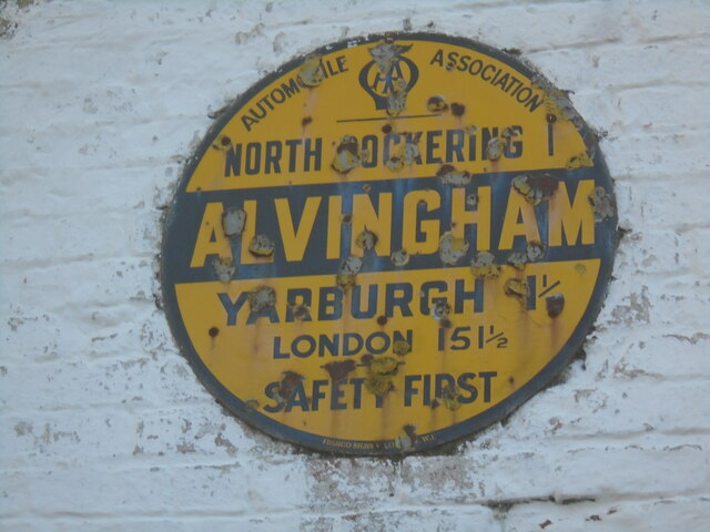
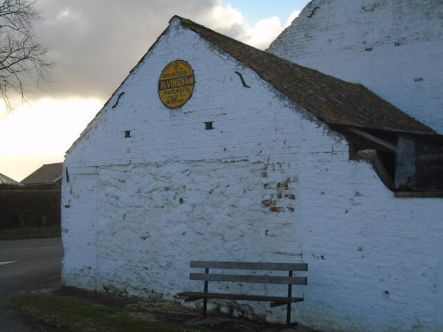
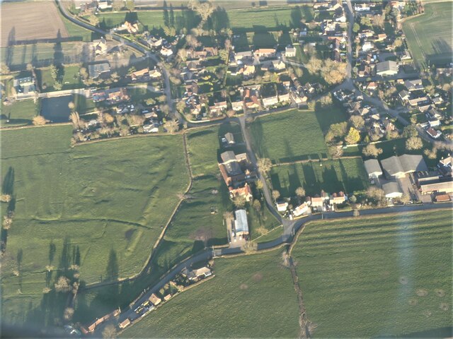
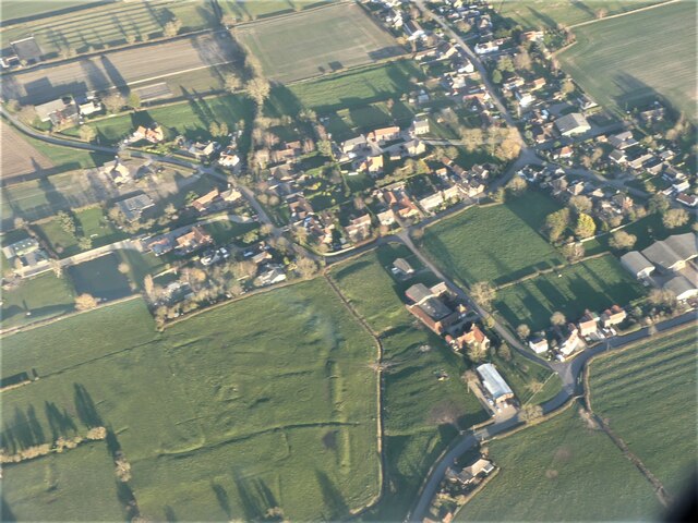
Alvingham

Settlement in Lincolnshire East Lindsey

England

Alvingham

Settlement of North Cockerington: aerial 2021 The settlement of North Cockerington (also known as Cockerington St Mary) is first documented in the Domesday Book, and therefore probably has its origins in the Anglo-Saxon period. See: <span class="nowrap"><a title="https://www.heritagegateway.org.uk/Gateway/Results_Single.aspx?uid=MLI83365&resourceID=1006" rel="nofollow ugc noopener" href="https://www.heritagegateway.org.uk/Gateway/Results_Single.aspx?uid=MLI83365&resourceID=1006">Link</a><img style="margin-left:2px;" alt="External link" title="External link - shift click to open in new window" src="https://s1.geograph.org.uk/img/external.png" width="10" height="10"/></span>

Included is the moated site of North Cockerington Hall, top left: <span class="nowrap"><a title="https://www.heritagegateway.org.uk/Gateway/Results_Single.aspx?uid=836a927c-5934-4ece-8686-5cfd98bd67fe&resourceID=19191" rel="nofollow ugc noopener" href="https://www.heritagegateway.org.uk/Gateway/Results_Single.aspx?uid=836a927c-5934-4ece-8686-5cfd98bd67fe&resourceID=19191">Link</a><img style="margin-left:2px;" alt="External link" title="External link - shift click to open in new window" src="https://s1.geograph.org.uk/img/external.png" width="10" height="10"/></span>

Very unfortunately, the brown field to the right do the moated site used also to contain earthworks, but these have now been completely ploughed out.
Settlement of North Cockerington: aerial 2021 Credit: Simon Tomson

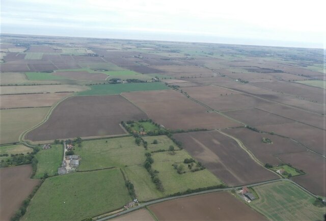
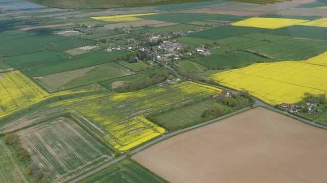
Alvingham is a small village located in the East Lindsey district of Lincolnshire, England. Situated approximately 5 miles north-west of the market town of Louth, it is nestled in the picturesque Lincolnshire Wolds, an Area of Outstanding Natural Beauty.

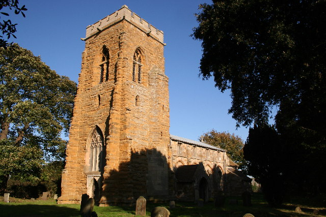
With a population of around 300 people, Alvingham is known for its peaceful and rural atmosphere. The village is characterized by its charming cottages and traditional buildings, many of which date back several centuries. The local parish church, St. Adelwold's, is a prominent landmark and its historic architecture attracts visitors from nearby areas.

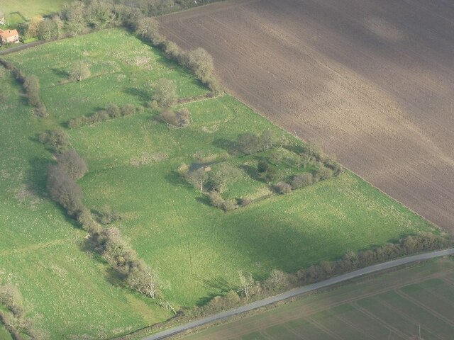
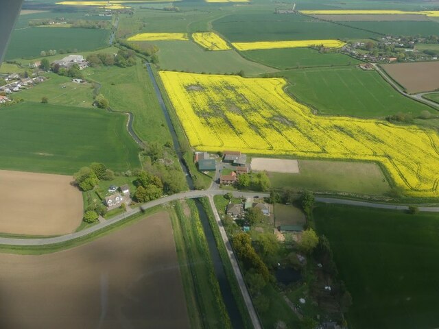
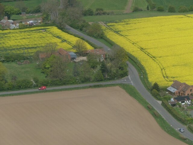
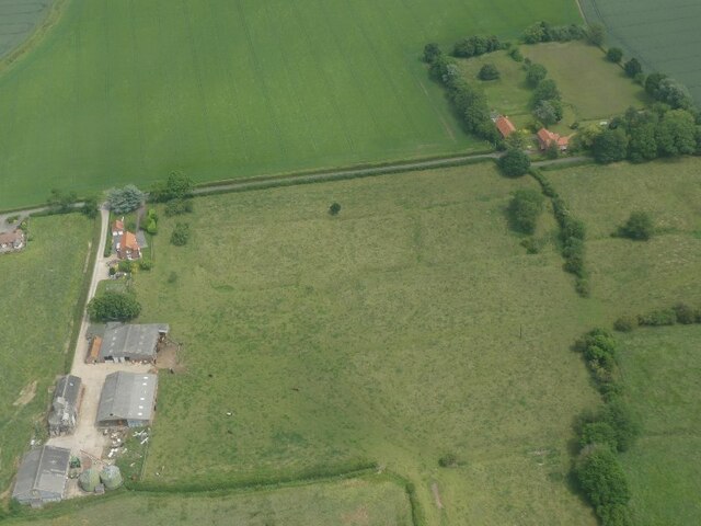
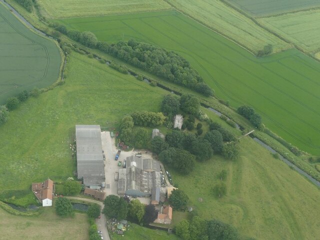
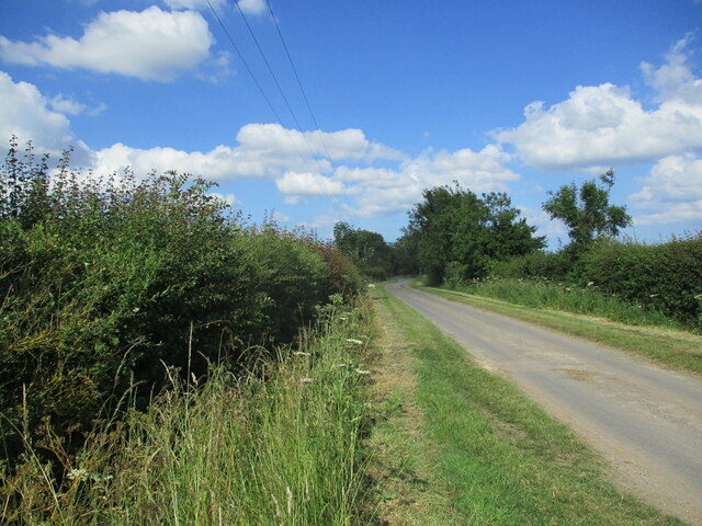
The village is surrounded by beautiful countryside, making it an ideal location for outdoor enthusiasts. There are several walking and cycling routes in the vicinity, allowing visitors to explore the rolling hills and scenic landscapes of the Lincolnshire Wolds. Wildlife enthusiasts will also find ample opportunities to spot a variety of bird species and other animals that inhabit the area.

Although primarily a residential village, Alvingham does have a few amenities to cater to its residents. These include a village hall, a community center, and a local pub, providing a gathering place for locals and visitors alike. Additionally, the nearby town of Louth offers a wider range of services, including shops, supermarkets, and leisure facilities.

In summary, Alvingham is a tranquil and picturesque village in Lincolnshire, offering a peaceful retreat in the heart of the Lincolnshire Wolds. Its idyllic countryside and historic charm make it a popular destination for those seeking a slower pace of life and a connection with nature.

If you have any feedback on the listing, please let us know in the comments section below.
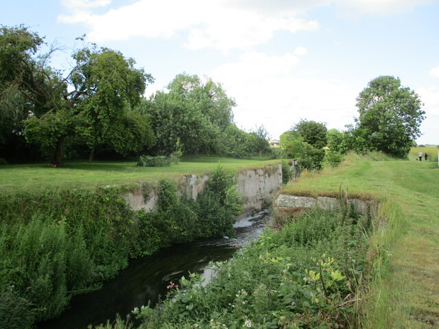
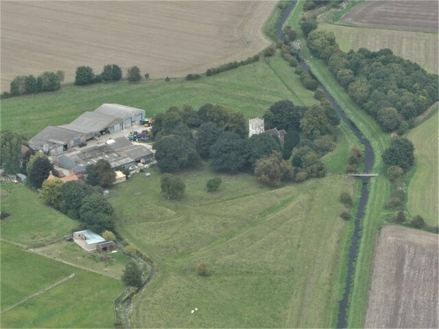
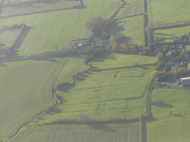
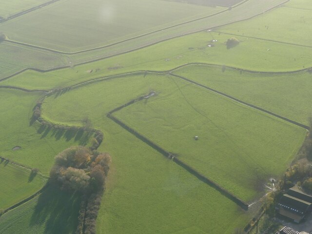
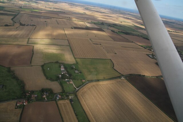
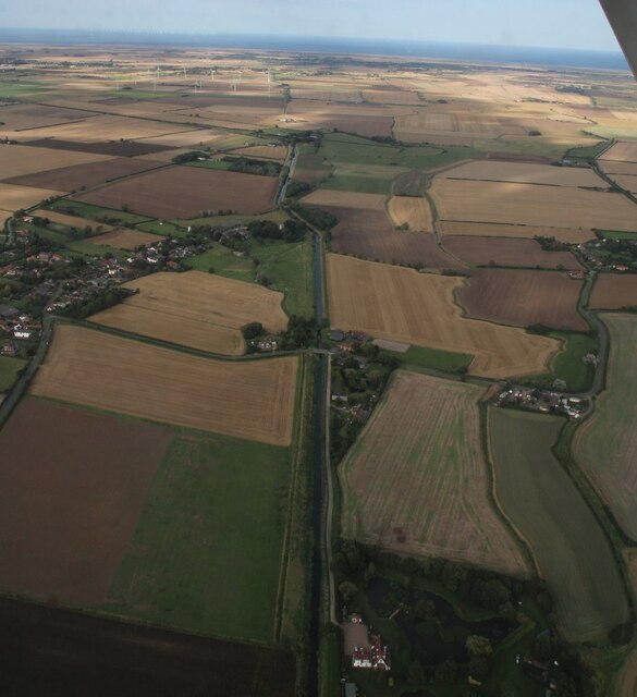
Alvingham Images

Images are sourced within 2km of 53.40125/0.048134 or Grid Reference TF3691. Thanks to Geograph Open Source API. All images are credited.

Settlement of North Cockerington: aerial 2021 The settlement of North Cockerington (also known as Cockerington St Mary) is first documented in the Domesday Book, and therefore probably has its origins in the Anglo-Saxon period. See: <span class="nowrap"><a title="https://www.heritagegateway.org.uk/Gateway/Results_Single.aspx?uid=MLI83365&resourceID=1006" rel="nofollow ugc noopener" href="https://www.heritagegateway.org.uk/Gateway/Results_Single.aspx?uid=MLI83365&resourceID=1006">Link</a><img style="margin-left:2px;" alt="External link" title="External link - shift click to open in new window" src="https://s1.geograph.org.uk/img/external.png" width="10" height="10"/></span>

Included is the moated site of North Cockerington Hall, top left: <span class="nowrap"><a title="https://www.heritagegateway.org.uk/Gateway/Results_Single.aspx?uid=836a927c-5934-4ece-8686-5cfd98bd67fe&resourceID=19191" rel="nofollow ugc noopener" href="https://www.heritagegateway.org.uk/Gateway/Results_Single.aspx?uid=836a927c-5934-4ece-8686-5cfd98bd67fe&resourceID=19191">Link</a><img style="margin-left:2px;" alt="External link" title="External link - shift click to open in new window" src="https://s1.geograph.org.uk/img/external.png" width="10" height="10"/></span>

Very unfortunately, the brown field to the right do the moated site used also to contain earthworks, but these have now been completely ploughed out.
Settlement of North Cockerington: aerial 2021
The settlement of North Cockerington (also known as Cockerington St Mary) is first documented in the Domesday Book, and therefore probably has its origins in the Anglo-Saxon period. See: LinkExternal link Included is the moated site of North Cockerington Hall, top left: LinkExternal link Very unfortunately, the brown field to the right do the moated site used also to contain earthworks, but these have now been completely ploughed out.
Old AA sign This style of AA village sign was made by Franco Signs NW1 from 1923 through to the 1930s.  Made of metal, the inevitable rusting has taken place especially where stones have been thrown at them.  These signs were taken down, together with other road signs and milestones, in 1940.  Some villages saved their signs and have re-erected them.  Others are in museums and private collections.
Old AA sign
This style of AA village sign was made by Franco Signs NW1 from 1923 through to the 1930s. Made of metal, the inevitable rusting has taken place especially where stones have been thrown at them. These signs were taken down, together with other road signs and milestones, in 1940. Some villages saved their signs and have re-erected them. Others are in museums and private collections.
Old AA sign The AA village sign high up on the end of the barn at White Barn Farm.  This is at the SW end of the village at the junction of the road into the village and the one northwards towards Yarburgh.
Old AA sign
The AA village sign high up on the end of the barn at White Barn Farm. This is at the SW end of the village at the junction of the road into the village and the one northwards towards Yarburgh.
Moated site and boundary ditches, North Cockerington: aerial 2022
Alvingham: aerial 2022 (1)  Extensive earthworks have been noted in and around the village of Alvingham. Evidence for tofts, crofts and strip fields seen from aerial photographs spreading out from present village area.

See: <span class="nowrap"><a title="https://www.heritagegateway.org.uk/Gateway/Results_Single.aspx?uid=MLI41254&resourceID=1006" rel="nofollow ugc noopener" href="https://www.heritagegateway.org.uk/Gateway/Results_Single.aspx?uid=MLI41254&resourceID=1006">Link</a><img style="margin-left:2px;" alt="External link" title="External link - shift click to open in new window" src="https://s1.geograph.org.uk/img/external.png" width="10" height="10"/></span>
Alvingham: aerial 2022 (1)
Extensive earthworks have been noted in and around the village of Alvingham. Evidence for tofts, crofts and strip fields seen from aerial photographs spreading out from present village area. See: LinkExternal link
Alvingham: aerial 2022 Extensive earthworks have been noted in and around the village of Alvingham. Evidence for tofts, crofts and strip fields seen from aerial photographs spreading out from present village area.

See: <span class="nowrap"><a title="https://www.heritagegateway.org.uk/Gateway/Results_Single.aspx?uid=MLI41254&resourceID=1006" rel="nofollow ugc noopener" href="https://www.heritagegateway.org.uk/Gateway/Results_Single.aspx?uid=MLI41254&resourceID=1006">Link</a><img style="margin-left:2px;" alt="External link" title="External link - shift click to open in new window" src="https://s1.geograph.org.uk/img/external.png" width="10" height="10"/></span>
Alvingham: aerial 2022
Extensive earthworks have been noted in and around the village of Alvingham. Evidence for tofts, crofts and strip fields seen from aerial photographs spreading out from present village area. See: LinkExternal link
Barrel Lock on Louth Navigation, Alvingham: aerial 2022
Corner of Westfield Road, Yarburgh: aerial 2022
Yarburgh: aerial 2022 (1)
North Cockerington: aerial 2022
Alvingham's 2 churches: aerial 2022
Grange Lane near Grange Farm
Remains of a lock on the former Louth Canal
Site of Alvingham Gilbertine Priory: aerial 2022 See: <span class="nowrap"><a title="https://www.british-history.ac.uk/vch/lincs/vol2/pp192-194" rel="nofollow ugc noopener" href="https://www.british-history.ac.uk/vch/lincs/vol2/pp192-194">Link</a><img style="margin-left:2px;" alt="External link" title="External link - shift click to open in new window" src="https://s1.geograph.org.uk/img/external.png" width="10" height="10"/></span>
Site of Alvingham Gilbertine Priory: aerial 2022
See: LinkExternal link
Earthworks, Settlement of Yarburgh: aerial 2022 See: <span class="nowrap"><a title="https://www.heritagegateway.org.uk/Gateway/Results_Single.aspx?uid=MLI41248&resourceID=1006" rel="nofollow ugc noopener" href="https://www.heritagegateway.org.uk/Gateway/Results_Single.aspx?uid=MLI41248&resourceID=1006">Link</a><img style="margin-left:2px;" alt="External link" title="External link - shift click to open in new window" src="https://s1.geograph.org.uk/img/external.png" width="10" height="10"/></span>
Earthworks, Settlement of Yarburgh: aerial 2022
See: LinkExternal link
Meanders on field at Highbridge, Alvingham: aerial 2022
Medieval Settlement of North End Alvingham: aerial 2023 See: <span class="nowrap"><a title="https://www.heritagegateway.org.uk/Gateway/Results_Single.aspx?uid=MLI87878&resourceID=1006" rel="nofollow ugc noopener" href="https://www.heritagegateway.org.uk/Gateway/Results_Single.aspx?uid=MLI87878&resourceID=1006">Link</a><img style="margin-left:2px;" alt="External link" title="External link - shift click to open in new window" src="https://s1.geograph.org.uk/img/external.png" width="10" height="10"/></span>
Medieval Settlement of North End Alvingham: aerial 2023
See: LinkExternal link
Lock Farm on the Louth Navigation at Alvingham: aerial 2023 The rare barrel lock can just be made out.
Lock Farm on the Louth Navigation at Alvingham: aerial 2023
The rare barrel lock can just be made out.
Show me another place!

Alvingham is located at Grid Ref: TF3691 (Lat: 53.40125, Lng: 0.048134)

Division: Parts of Lindsey

Administrative County: Lincolnshire

District: East Lindsey

Police Authority: Lincolnshire

What 3 Words

///stroke.repaying.creatures. Near Louth, Lincolnshire

Nearby Locations

Alvingham Alvingham

Related Wikis

Alvingham

Alvingham is a village and civil parish in the East Lindsey district of Lincolnshire, England. It is situated 3 miles (5 km) north-east from the market...

St Mary's Church, North Cockerington

St Mary's Church is a redundant Anglican church in the village of Alvingham, adjacent to the village of North Cockerington, Lincolnshire, England. It...

Alvingham Priory

Alvingham Priory was a Gilbertine priory in St. Mary, Alvingham, Lincolnshire, England. The Priory, established between 1148 and 1154, was a "double house...
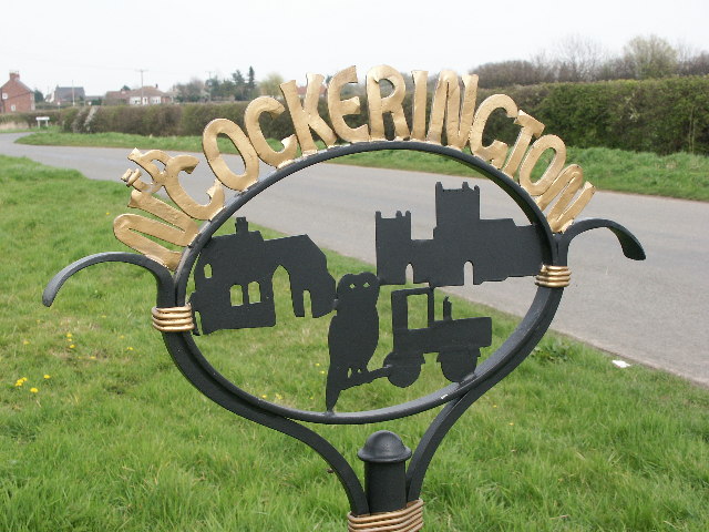
North Cockerington

North Cockerington is a small village and civil parish in the East Lindsey district of Lincolnshire, England. It is situated approximately 3 miles (5 km...

St John the Baptist's Church, Yarburgh

St John the Baptist's Church is a redundant Anglican church in the village of Yarburgh, Lincolnshire, England. It is recorded in the National Heritage...

Yarburgh

Yarburgh is a village and civil parish in the East Lindsey district of Lincolnshire, England, and situated approximately 4 miles (6 km) north-east from...

Louth Rural District

Louth was a rural district in Lincolnshire, Parts of Lindsey from 1894 to 1974. It was created in 1894 from Louth rural sanitary district. It did not...

South Cockerington

South Cockerington is a village and civil parish in the East Lindsey district of Lincolnshire, England. It is situated approximately 4 miles (6 km) east...

Nearby Amenities

Located within 500m of 53.40125,0.048134
Alvingham
Is In: Lincolnshire, England, UK
Place: village
Source: npe
Lat/Long: 53.4010513/0.048733
White Barn Farm
Naptan AtcoCode: 270000008003
Naptan Bearing: SW
Naptan BusStopType: CUS
Naptan CommonName: White Barn Farm
Naptan Indicator: opp
Naptan Landmark: White Barn Farm
Naptan NaptanCode: lingmtam
Naptan Street: Yarburgh Road
Naptan Verified: no
Source: naptan_import
Lat/Long: 53.3985376/0.0475651
White Barn Farm
Naptan AtcoCode: 270000008004
Naptan Bearing: NE
Naptan BusStopType: CUS
Naptan CommonName: White Barn Farm
Naptan Indicator: adj
Naptan Landmark: White Barn Farm
Naptan NaptanCode: lingmtap
Naptan Street: Yarburgh Road
Naptan Verified: no
Source: naptan_import
Lat/Long: 53.3986467/0.0474951
Pottery
Naptan AtcoCode: 270000010489
Naptan Bearing: N
Naptan BusStopType: CUS
Naptan CommonName: Pottery
Naptan Indicator: opp
Naptan Landmark: Pottery
Naptan NaptanCode: linjmtpj
Naptan Street: Yarburgh Road
Naptan Verified: no
Source: naptan_import
Lat/Long: 53.4001431/0.0462131
Pottery
Naptan AtcoCode: 270000014160
Naptan Bearing: S
Naptan BusStopType: CUS
Naptan CommonName: Pottery
Naptan Indicator: adj
Naptan Landmark: Pottery
Naptan NaptanCode: linjpdap
Naptan Street: Yarburgh Road
Naptan Verified: no
Source: naptan_import
Lat/Long: 53.4002491/0.0463235
Source: Bing
Lat/Long: 53.4014296/0.0541144
Alvingham Lock
Place: locality
Source: Bing
Lat/Long: 53.3974076/0.0518517
High Bridge Farm
Place: farm
Source: Bing
Lat/Long: 53.4040253/0.0482074
Highbridge Farm
Place: farm
Source: Bing
Lat/Long: 53.403842/0.0505636
Manor Farm
Place: farm
Source: Bing
Lat/Long: 53.3997635/0.0499892
The Grange
Place: farm
Source: Bing
Lat/Long: 53.4033646/0.0433748
Generator Method: photovoltaic
Generator Output Electricity: yes
Generator Source: solar
Generator Type: solar_photovoltaic_panel
Location: roof
Power: generator
Lat/Long: 53.4021072/0.047719
Generator Method: photovoltaic
Generator Output Electricity: yes
Generator Source: solar
Generator Type: solar_photovoltaic_panel
Location: roof
Power: generator
Lat/Long: 53.4020209/0.0476171
Generator Method: photovoltaic
Generator Output Electricity: yes
Generator Source: solar
Generator Type: solar_photovoltaic_panel
Location: roof
Power: generator
Lat/Long: 53.4019825/0.0475018
Generator Method: photovoltaic
Generator Output Electricity: yes
Generator Source: solar
Generator Type: solar_photovoltaic_panel
Location: roof
Power: generator
Lat/Long: 53.4006419/0.0502376
Generator Method: photovoltaic
Generator Output Electricity: yes
Generator Source: solar
Generator Type: solar_photovoltaic_panel
Location: roof
Power: generator
Lat/Long: 53.4006259/0.0505702
Generator Method: photovoltaic
Generator Output Electricity: yes
Generator Source: solar
Generator Type: solar_photovoltaic_panel
Location: roof
Power: generator
Lat/Long: 53.4004308/0.0506936
Generator Method: photovoltaic
Generator Output Electricity: yes
Generator Source: solar
Generator Type: solar_photovoltaic_panel
Location: roof
Power: generator
Lat/Long: 53.4003733/0.0508063
Generator Method: photovoltaic
Generator Output Electricity: yes
Generator Source: solar
Generator Type: solar_photovoltaic_panel
Location: roof
Power: generator
Lat/Long: 53.4007619/0.0528984
Generator Method: photovoltaic
Generator Output Electricity: yes
Generator Source: solar
Generator Type: solar_photovoltaic_panel
Location: roof
Power: generator
Lat/Long: 53.4007666/0.0531827
Generator Method: photovoltaic
Generator Output Electricity: yes
Generator Source: solar
Generator Type: solar_photovoltaic_panel
Location: roof
Power: generator
Lat/Long: 53.4007938/0.0532739
Telephone
Booth: K6
Covered: booth
Man Made: telephone_box
Old Phone: +44 1507 327212
Lat/Long: 53.4009841/0.0484738
Place Of Worship
Alvingham Methodist Church
Addr City: Alvingham
Denomination: methodist
Religion: christian
Lat/Long: 53.4007741/0.0487823
Advertising: board
Lit: no
Operator: Parish Council
Lat/Long: 53.4004655/0.0494117
Historic: stocks
Lat/Long: 53.4005022/0.0493536
Post Box
Collection Times: Mo-Fr 09:00; Sa 07:00
Operator: Royal Mail
Operator Wikidata: Q638098
Post Box Type: lamp
Ref: LN11 54
Royal Cypher: EIIR
Royal Cypher Wikidata: Q33102113
Lat/Long: 53.400538/0.0492731
Give Way
Direction: backward
Lat/Long: 53.4004145/0.0493288
Defibrillator
Defibrillator Location: outside Alvingham Village Hall and Social Club
Emergency: defibrillator
Indoor: no
Lat/Long: 53.4007263/0.0456665
Entrance: main
Lat/Long: 53.4007785/0.0456299
The data included in this document is from www.openstreetmap.org. The data is made available under ODbL.

Have you been to Alvingham?

Leave your review of Alvingham below (or comments, questions and feedback).