Nut Wood

Wood, Forest in Peeblesshire

Scotland

Nut Wood

Angle in the wall, Mill Rig On the ridge with Lee Burn Head in view.
Angle in the wall, Mill Rig Credit: Jim Barton

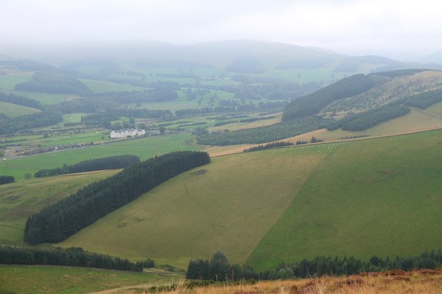
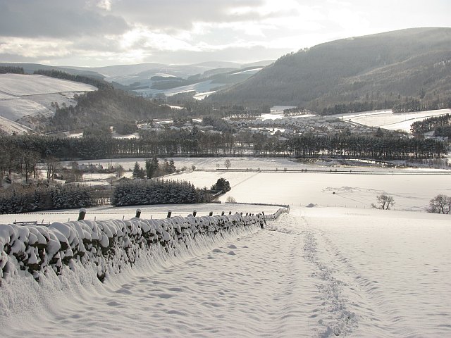
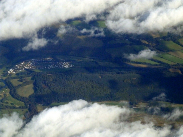
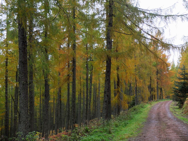
Nut Wood is a picturesque forest located in Peeblesshire, Scotland. Covering an area of approximately 500 acres, it is known for its breathtaking landscapes and diverse flora and fauna. The forest is situated near the town of Peebles, offering locals and tourists alike a tranquil retreat from the hustle and bustle of city life.

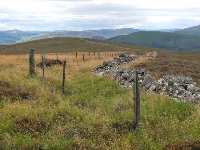
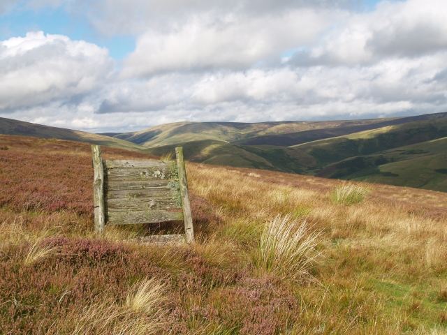
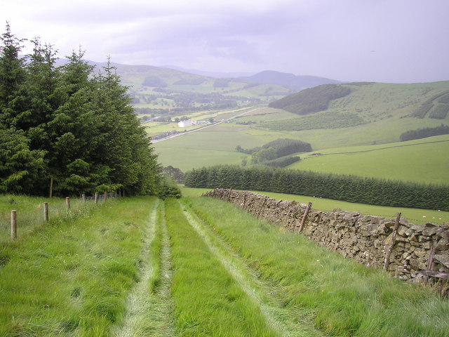
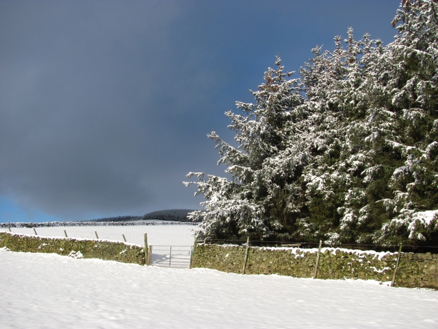
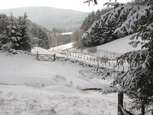
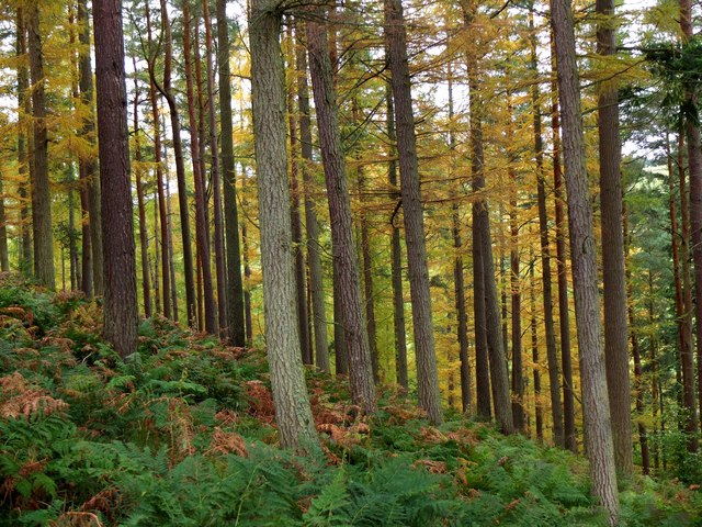
One of the notable features of Nut Wood is its dense woodland, primarily consisting of native trees such as oak, beech, and birch. These tall, majestic trees create a lush canopy that provides shade and shelter for a variety of wildlife species. The forest floor is adorned with an array of wildflowers, adding bursts of color to the verdant scenery.

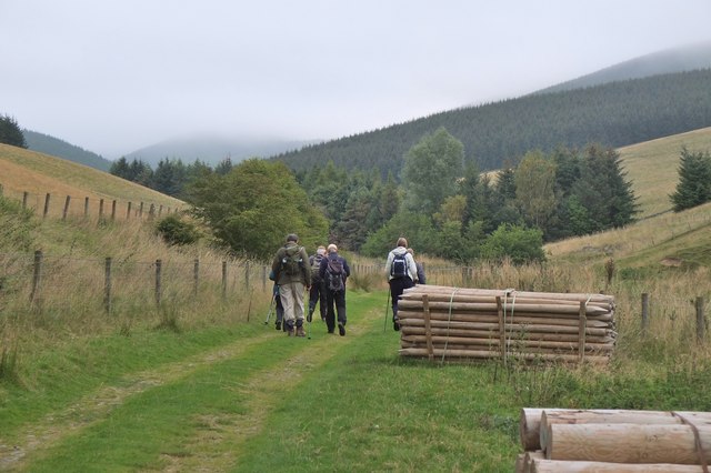
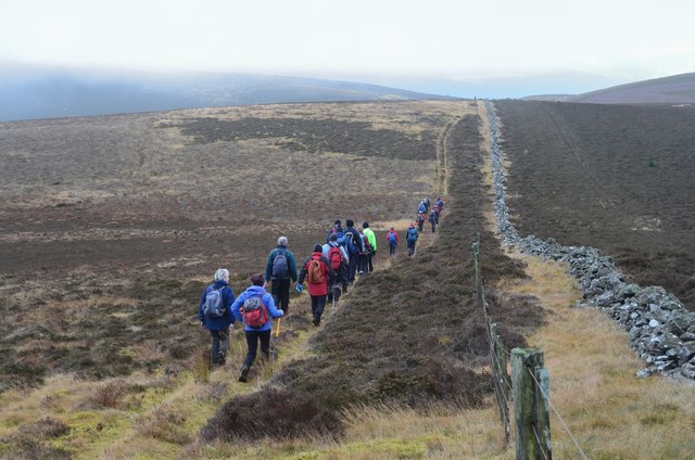
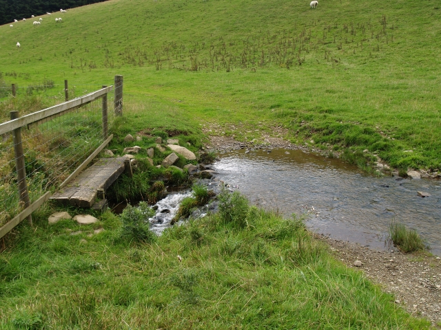
Walking trails wind their way through Nut Wood, allowing visitors to explore its natural beauty. The paths are well-maintained, making it accessible for walkers of all abilities. Along the way, hikers may encounter wildlife such as red squirrels, roe deer, and a plethora of bird species, including woodpeckers and tawny owls.

Nut Wood is not only a haven for nature lovers but also a popular spot for outdoor activities. It offers opportunities for birdwatching, photography, and picnicking amidst the serene surroundings. Additionally, the forest is a favored location for educational field trips, providing students with hands-on experiences in ecology and environmental studies.

In conclusion, Nut Wood in Peeblesshire is a captivating forest with its enchanting woodland, diverse wildlife, and well-maintained walking trails. It is a place that allows visitors to immerse themselves in nature, providing a much-needed respite from the demands of modern life.

If you have any feedback on the listing, please let us know in the comments section below.

Nut Wood Images

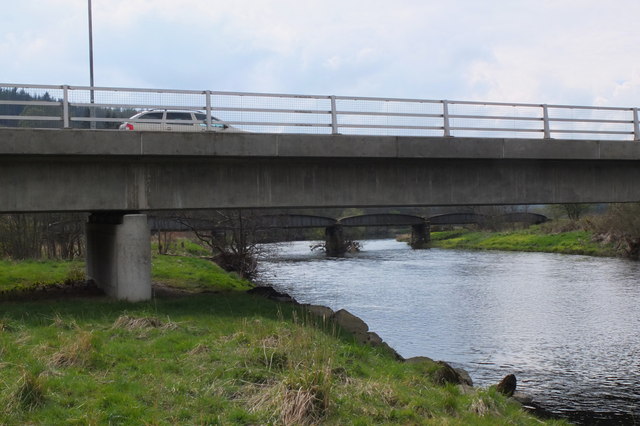
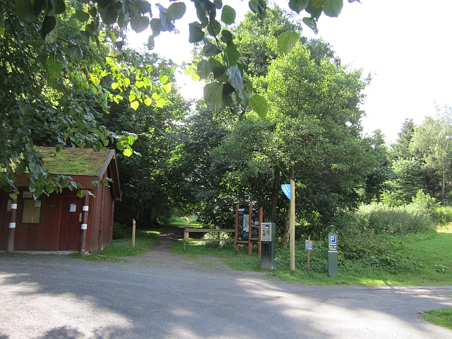
Images are sourced within 2km of 55.635076/-3.0979696 or Grid Reference NT3038. Thanks to Geograph Open Source API. All images are credited.

Angle in the wall, Mill Rig On the ridge with Lee Burn Head in view.
Angle in the wall, Mill Rig
On the ridge with Lee Burn Head in view.
Track by the Hope Burn Bundles of fence posts by the track on the way up by Hope Burn towards the plantations of Glentress Forest.
Track by the Hope Burn
Bundles of fence posts by the track on the way up by Hope Burn towards the plantations of Glentress Forest.
Bught Hill from Habs Cleuch Shank Much of the land in the middle foreground will be planted by the Forestry Commission over the next few years. The white building in the valley is the Macdonald Cardrona Hotel.
Bught Hill from Habs Cleuch Shank
Much of the land in the middle foreground will be planted by the Forestry Commission over the next few years. The white building in the valley is the Macdonald Cardrona Hotel.
All clear on Mill Rig Walkers en route to Innerleithen enjoying the views again, having dropped below cloud base on the ridge walk from Peebles. Compare with <a href="https://www.geograph.org.uk/photo/6018821">NT3141 : Descending Clog Knowe</a>.
All clear on Mill Rig
Walkers en route to Innerleithen enjoying the views again, having dropped below cloud base on the ridge walk from Peebles. Compare with NT3141 : Descending Clog Knowe.
Grouse Butt, Mill Rig This seem to have been here for some time and is now quite rickerty.
Grouse Butt, Mill Rig
This seem to have been here for some time and is now quite rickerty.
Footbridge and ford, Horsburgh Hope Burn. Living at the end of this track might be the one valid reason for owning a SUV.
Footbridge and ford, Horsburgh Hope Burn.
Living at the end of this track might be the one valid reason for owning a SUV.
On Mill Rig
On Mill Rig
End of the Strip The butt of a shelterbelt rising up from the Hope.
End of the Strip
The butt of a shelterbelt rising up from the Hope.
Farm track, Nether Horsburgh Looking downhill along a trackway towards the new village of Cardrona on the floor of Tweeddale.
Farm track, Nether Horsburgh
Looking downhill along a trackway towards the new village of Cardrona on the floor of Tweeddale.
Horseburgh Hope Looking downstream towards where sheep had just been fed.
Horseburgh Hope
Looking downstream towards where sheep had just been fed.
MacDonalds Cardrona Hotel This exclusive hotel, golf and country club has an idyllic location  on the north bank of the river Tweed. A glimpse of the river can be seen to the left of the picture. Between the hotel and the river is the golf course and a row of golf buggies are parked adjacent to a large bunker in front of the hotel.
MacDonalds Cardrona Hotel
This exclusive hotel, golf and country club has an idyllic location on the north bank of the river Tweed. A glimpse of the river can be seen to the left of the picture. Between the hotel and the river is the golf course and a row of golf buggies are parked adjacent to a large bunker in front of the hotel.
Old railway bridge, Cardrona The bridge over the Tweed, looking back to Cardrona and the site of the former station. The line is now a path and cycleway to Peebles. The golf course surrounds the nearby hotel and extends E along the riverside.
Old railway bridge, Cardrona
The bridge over the Tweed, looking back to Cardrona and the site of the former station. The line is now a path and cycleway to Peebles. The golf course surrounds the nearby hotel and extends E along the riverside.
Cardrona from Lee Burn Head On the right is the A72 to Peebles passing the Macdonald Cardrona Hotel with its associated golf course, the old railway line crosses the Tweed to follow its E bank and in the foreground are some houses at Cardrona with the 62 bus at the stop outside the old railway station, now the village shop. The houses at the SE side of Peebles are in view in the distance.
Cardrona from Lee Burn Head
On the right is the A72 to Peebles passing the Macdonald Cardrona Hotel with its associated golf course, the old railway line crosses the Tweed to follow its E bank and in the foreground are some houses at Cardrona with the 62 bus at the stop outside the old railway station, now the village shop. The houses at the SE side of Peebles are in view in the distance.
Bridges over the Tweed at Cardrona The road bridge links the village with the A72 and the old railway bridge beyond is now used for the Cardrona to Peebles path and cycleway.
Bridges over the Tweed at Cardrona
The road bridge links the village with the A72 and the old railway bridge beyond is now used for the Cardrona to Peebles path and cycleway.
Forestry Commission car park, Kirk Burn Parking bandits have now appeared here - avoided today by riding in from Peebles.
Forestry Commission car park, Kirk Burn
Parking bandits have now appeared here - avoided today by riding in from Peebles.
Cardrona from the air Viewed over the wooded Cardrona Hill from a Prague bound flight from Edinburgh.
Cardrona from the air
Viewed over the wooded Cardrona Hill from a Prague bound flight from Edinburgh.
Larches in Cardrona Forest Cardrona Forest is on the S side of the Tweed Valley at heights ranging from 180m to 420m. The trees here are on the slope above the car park at Kirkburn.
Larches in Cardrona Forest
Cardrona Forest is on the S side of the Tweed Valley at heights ranging from 180m to 420m. The trees here are on the slope above the car park at Kirkburn.
Larches in Cardrona Forest Larches in this area have been selected as sources of seed for new plantings, as described by foresters in an interesting walk around the forest as part of Tweed Valley Forest Festival.
Larches in Cardrona Forest
Larches in this area have been selected as sources of seed for new plantings, as described by foresters in an interesting walk around the forest as part of Tweed Valley Forest Festival.
Show me another place!

Nut Wood is located at Grid Ref: NT3038 (Lat: 55.635076, Lng: -3.0979696)

Unitary Authority: The Scottish Borders

Police Authority: The Lothians and Scottish Borders

What 3 Words

///gossip.duties.belly. Near Innerleithen, Scottish Borders

Related Wikis

Cardrona, Scottish Borders

Cardrona is a village on the A72 and B7062, between Peebles and Innerleithen, in the Scottish Borders area of Scotland. Places nearby include Glentress...

Cardrona railway station

Cardrona railway station served the village of Cardrona, Scottish Borders, Scotland from 1864 to 1962 on the Peebles Railway. == History == The station...

Nether Horsburgh Castle

Nether Horsburgh Castle is a ruined tower house near Cardrona, in the Scottish Borders, in the former county of Peebleshire. It is situated at the back...

Kirkburn, Scottish Borders

Kirkburn is a village on the B7062, close to Peebles and the River Tweed, in the Scottish Borders area of Scotland, at the edge of the Cardrona Forest...

Nearby Amenities

Located within 500m of 55.635076,-3.0979696
Whitewater: put_in
Lat/Long: 55.6342876/-3.098967
Give Way
Direction: forward
Lat/Long: 55.6380526/-3.1031522
Turning Circle
Source: bing
Lat/Long: 55.6376938/-3.1023583
Waste Basket
Lat/Long: 55.6330289/-3.1013734
Information: board
Tourism: information
Lat/Long: 55.6330652/-3.10147
Waste Basket
Check Date: 2023-10-10
Lat/Long: 55.6349277/-3.102575
Waste Basket
Lat/Long: 55.6310454/-3.1005205
Noexit: yes
Lat/Long: 55.6360364/-3.1034626
Noexit: yes
Lat/Long: 55.636313/-3.1038614
Noexit: yes
Lat/Long: 55.6369492/-3.101831
Noexit: yes
Lat/Long: 55.6360024/-3.1026679
Noexit: yes
Lat/Long: 55.635856/-3.1048316
Generator Method: photovoltaic
Generator Output Electricity: yes
Generator Source: solar
Generator Type: solar_photovoltaic_panel
Power: generator
Lat/Long: 55.6375024/-3.103754
Noexit: yes
Lat/Long: 55.636988/-3.104393
Generator Method: photovoltaic
Generator Output Electricity: yes
Generator Source: solar
Generator Type: solar_photovoltaic_panel
Power: generator
Lat/Long: 55.6347169/-3.1048582
Generator Method: photovoltaic
Generator Output Electricity: yes
Generator Source: solar
Generator Type: solar_photovoltaic_panel
Power: generator
Lat/Long: 55.6348306/-3.1055314
Noexit: yes
Lat/Long: 55.6354664/-3.1047761
Generator Method: photovoltaic
Generator Output Electricity: yes
Generator Source: solar
Generator Type: solar_photovoltaic_panel
Power: generator
Lat/Long: 55.6380063/-3.1022201
Generator Method: photovoltaic
Generator Output Electricity: yes
Generator Source: solar
Generator Type: solar_photovoltaic_panel
Power: generator
Lat/Long: 55.6343062/-3.1055515
Power: pole
Lat/Long: 55.6334898/-3.1052639
The data included in this document is from www.openstreetmap.org. The data is made available under ODbL.

Have you been to Nut Wood?

Leave your review of Nut Wood below (or comments, questions and feedback).