Smiddy Hill Strip

Wood, Forest in Peeblesshire

Scotland

Smiddy Hill Strip

Track by the Hope Burn Bundles of fence posts by the track on the way up by Hope Burn towards the plantations of Glentress Forest.
Track by the Hope Burn Credit: Jim Barton

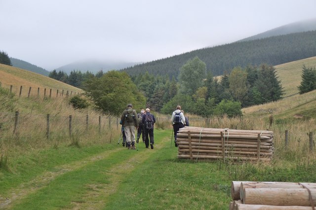
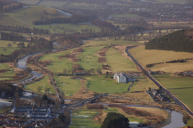
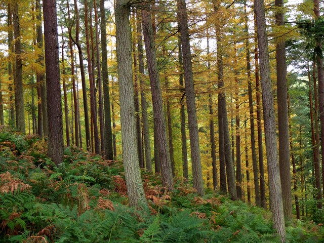
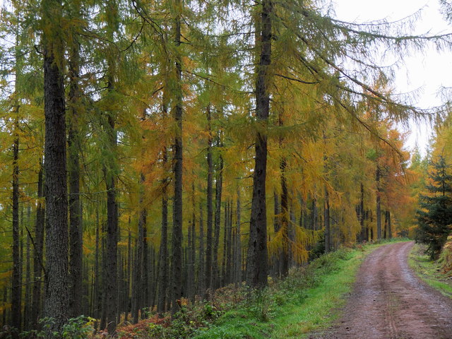
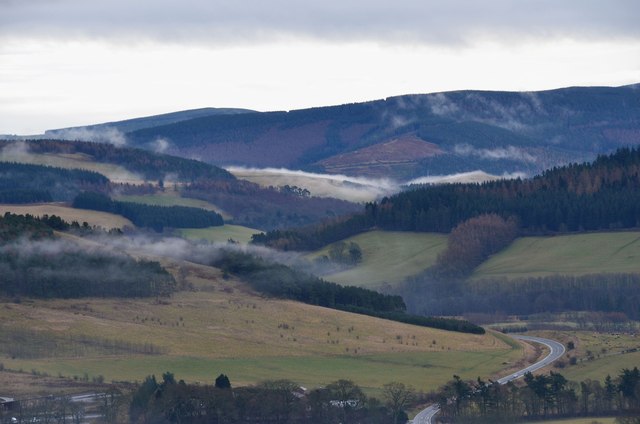
Smiddy Hill Strip is a picturesque woodland area located in Peeblesshire, Scotland. Nestled in the scenic Scottish Borders region, this forested haven spans an approximate area of several acres. The woodland is characterized by its dense coverage of native trees, creating a lush and vibrant environment.

The forest is home to a variety of tree species, including oak, birch, and pine. These trees provide a rich habitat for a diverse range of wildlife, such as red squirrels, roe deer, and a multitude of bird species. The forest floor is adorned with an array of wildflowers and ferns, further enhancing the natural beauty of the area.

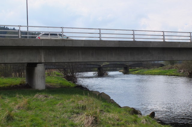
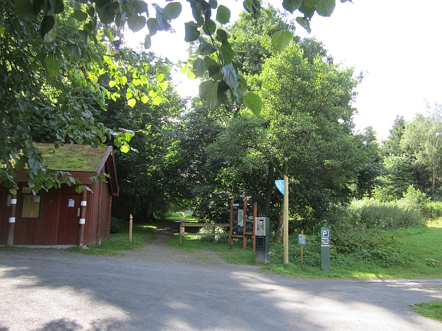
Visitors to Smiddy Hill Strip can explore the woodland through a network of well-maintained trails that offer breathtaking views of the surrounding countryside. The paths wind through the forest, leading visitors to hidden gems, such as a small stream and a charming picnic area. The tranquil atmosphere makes Smiddy Hill Strip an ideal destination for nature enthusiasts, hikers, and families alike.

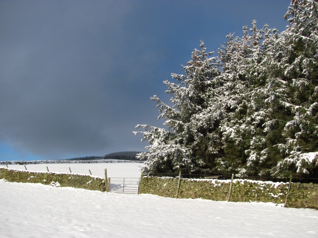
Additionally, the woodland serves as an important ecological site, contributing to the overall biodiversity of the region. Efforts have been made to preserve and protect the forest, ensuring its long-term sustainability and the preservation of its natural inhabitants.

Overall, Smiddy Hill Strip in Peeblesshire is a captivating forested area that showcases the beauty and tranquility of the Scottish countryside. Its rich biodiversity and well-maintained trails make it an ideal destination for those seeking a peaceful retreat in nature.

If you have any feedback on the listing, please let us know in the comments section below.

Smiddy Hill Strip Images

Images are sourced within 2km of 55.632742/-3.0977772 or Grid Reference NT3038. Thanks to Geograph Open Source API. All images are credited.

Track by the Hope Burn Bundles of fence posts by the track on the way up by Hope Burn towards the plantations of Glentress Forest.
Track by the Hope Burn
Bundles of fence posts by the track on the way up by Hope Burn towards the plantations of Glentress Forest.
End of the Strip The butt of a shelterbelt rising up from the Hope.
End of the Strip
The butt of a shelterbelt rising up from the Hope.
Farm track, Nether Horsburgh Looking downhill along a trackway towards the new village of Cardrona on the floor of Tweeddale.
Farm track, Nether Horsburgh
Looking downhill along a trackway towards the new village of Cardrona on the floor of Tweeddale.
MacDonalds Cardrona Hotel This exclusive hotel, golf and country club has an idyllic location  on the north bank of the river Tweed. A glimpse of the river can be seen to the left of the picture. Between the hotel and the river is the golf course and a row of golf buggies are parked adjacent to a large bunker in front of the hotel.
MacDonalds Cardrona Hotel
This exclusive hotel, golf and country club has an idyllic location on the north bank of the river Tweed. A glimpse of the river can be seen to the left of the picture. Between the hotel and the river is the golf course and a row of golf buggies are parked adjacent to a large bunker in front of the hotel.
Old railway bridge, Cardrona The bridge over the Tweed, looking back to Cardrona and the site of the former station. The line is now a path and cycleway to Peebles. The golf course surrounds the nearby hotel and extends E along the riverside.
Old railway bridge, Cardrona
The bridge over the Tweed, looking back to Cardrona and the site of the former station. The line is now a path and cycleway to Peebles. The golf course surrounds the nearby hotel and extends E along the riverside.
Cardrona from Lee Burn Head On the right is the A72 to Peebles passing the Macdonald Cardrona Hotel with its associated golf course, the old railway line crosses the Tweed to follow its E bank and in the foreground are some houses at Cardrona with the 62 bus at the stop outside the old railway station, now the village shop. The houses at the SE side of Peebles are in view in the distance.
Cardrona from Lee Burn Head
On the right is the A72 to Peebles passing the Macdonald Cardrona Hotel with its associated golf course, the old railway line crosses the Tweed to follow its E bank and in the foreground are some houses at Cardrona with the 62 bus at the stop outside the old railway station, now the village shop. The houses at the SE side of Peebles are in view in the distance.
Bridges over the Tweed at Cardrona The road bridge links the village with the A72 and the old railway bridge beyond is now used for the Cardrona to Peebles path and cycleway.
Bridges over the Tweed at Cardrona
The road bridge links the village with the A72 and the old railway bridge beyond is now used for the Cardrona to Peebles path and cycleway.
Forestry Commission car park, Kirk Burn Parking bandits have now appeared here - avoided today by riding in from Peebles.
Forestry Commission car park, Kirk Burn
Parking bandits have now appeared here - avoided today by riding in from Peebles.
Cardrona from the air Viewed over the wooded Cardrona Hill from a Prague bound flight from Edinburgh.
Cardrona from the air
Viewed over the wooded Cardrona Hill from a Prague bound flight from Edinburgh.
Larches in Cardrona Forest Cardrona Forest is on the S side of the Tweed Valley at heights ranging from 180m to 420m. The trees here are on the slope above the car park at Kirkburn.
Larches in Cardrona Forest
Cardrona Forest is on the S side of the Tweed Valley at heights ranging from 180m to 420m. The trees here are on the slope above the car park at Kirkburn.
Larches in Cardrona Forest Larches in this area have been selected as sources of seed for new plantings, as described by foresters in an interesting walk around the forest as part of Tweed Valley Forest Festival.
Larches in Cardrona Forest
Larches in this area have been selected as sources of seed for new plantings, as described by foresters in an interesting walk around the forest as part of Tweed Valley Forest Festival.
Cardrona Hotel View of the hotel from near the River Tweed.
Cardrona Hotel
View of the hotel from near the River Tweed.
Cardrona Bridges crossing the Tweed Bridge carrying the slip road from the A72 serving the village of Cardrona and the old railway bridge carrying the defunct Peebles - Innerleithen line.
Cardrona Bridges crossing the Tweed
Bridge carrying the slip road from the A72 serving the village of Cardrona and the old railway bridge carrying the defunct Peebles - Innerleithen line.
Not such a twee bridge across the Tweed After the Peebles to Galashiels railway closed in 1962, a local landowner purchased a stretch of the trackbed including Cardrona Station, which he used as a hay store, and this bridge across the River Tweed as an access between his fields either side of the river.  A couple of decades later, planning permission was obtained for the present hotel, golf course and new village.  The station was refurbished as a cafe and village shop and the river bridge continued as an access between two halves of the golf course. It seems ironic that the bridge once carried heavy trains but rather lighter cars had to keep 20 metres apart.  More recently the bridge has also become a formal part of the Peebles to Innerleithen cycleway
Not such a twee bridge across the Tweed
After the Peebles to Galashiels railway closed in 1962, a local landowner purchased a stretch of the trackbed including Cardrona Station, which he used as a hay store, and this bridge across the River Tweed as an access between his fields either side of the river. A couple of decades later, planning permission was obtained for the present hotel, golf course and new village. The station was refurbished as a cafe and village shop and the river bridge continued as an access between two halves of the golf course. It seems ironic that the bridge once carried heavy trains but rather lighter cars had to keep 20 metres apart. More recently the bridge has also become a formal part of the Peebles to Innerleithen cycleway
Misty hillsides near Cardrona on Christmas Day A thin layer of mist was creeping over some of the ridges amongst the plantations in the Tweed valley; below is the A72 road to Innerleithen and Galashiels. The viewpoint is Janet's (or Jenny's) Brae above Peebles.
Misty hillsides near Cardrona on Christmas Day
A thin layer of mist was creeping over some of the ridges amongst the plantations in the Tweed valley; below is the A72 road to Innerleithen and Galashiels. The viewpoint is Janet's (or Jenny's) Brae above Peebles.
The site of Our Lady's Chapel, or better known as Kailzie Parish Church Section of the lower courses are thought to be of the old church which was suppressed in the 17th century. The ruins were built up using the broken stones of the old kirk and converted in to a series of burial vaults. The families interred include local notables such as the Scotlands, Kennedys and the ancient and illustrious Horsbrugh family, Kailzie or Hopkailzie Church is situated in the tiny hamlet of Kirkburn on the right bank of the Tweed near Cardrona.
The site of Our Lady's Chapel, or better known as Kailzie Parish Church
Section of the lower courses are thought to be of the old church which was suppressed in the 17th century. The ruins were built up using the broken stones of the old kirk and converted in to a series of burial vaults. The families interred include local notables such as the Scotlands, Kennedys and the ancient and illustrious Horsbrugh family, Kailzie or Hopkailzie Church is situated in the tiny hamlet of Kirkburn on the right bank of the Tweed near Cardrona.
The Scotland family burial ground In Kailzie Parish Kirkyard.
The Scotland family burial ground
In Kailzie Parish Kirkyard.
One of the memorial stones to the Horsbrugh family Situated in the most easterly vault of the old church of Hopkailzie. The Horsbrugha are among the very oldest and most illustrious in all of Peeblesshire.
One of the memorial stones to the Horsbrugh family
Situated in the most easterly vault of the old church of Hopkailzie. The Horsbrugha are among the very oldest and most illustrious in all of Peeblesshire.
Show me another place!

Smiddy Hill Strip is located at Grid Ref: NT3038 (Lat: 55.632742, Lng: -3.0977772)

Unitary Authority: The Scottish Borders

Police Authority: The Lothians and Scottish Borders

What 3 Words

///impeached.fresh.these. Near Innerleithen, Scottish Borders

Related Wikis

Cardrona, Scottish Borders

Cardrona is a village on the A72 and B7062, between Peebles and Innerleithen, in the Scottish Borders area of Scotland. Places nearby include Glentress...

Cardrona railway station

Cardrona railway station served the village of Cardrona, Scottish Borders, Scotland from 1864 to 1962 on the Peebles Railway. == History == The station...

Nether Horsburgh Castle

Nether Horsburgh Castle is a ruined tower house near Cardrona, in the Scottish Borders, in the former county of Peebleshire. It is situated at the back...

Cardrona Forest

The Cardrona Forest is a forest in the Scottish Borders area of Scotland, on the B7062, near Peebles. OS Grid Reference: NT292385. Cardrona Forest consists...

Nearby Amenities

Located within 500m of 55.632742,-3.0977772
Whitewater: put_in
Lat/Long: 55.6342876/-3.098967
Waste Basket
Lat/Long: 55.6330289/-3.1013734
Information: board
Tourism: information
Lat/Long: 55.6330652/-3.10147
Waste Basket
Check Date: 2023-10-10
Lat/Long: 55.6349277/-3.102575
Information: guidepost
Tourism: information
Lat/Long: 55.6299582/-3.1002576
Waste Basket
Lat/Long: 55.6310454/-3.1005205
Information: board
Tourism: information
Lat/Long: 55.6298977/-3.1002439
Noexit: yes
Lat/Long: 55.6360024/-3.1026679
Material: wood
Power: pole
Lat/Long: 55.6306088/-3.1009756
Material: wood
Power: pole
Lat/Long: 55.630181/-3.0998826
Material: wood
Power: pole
Lat/Long: 55.6294481/-3.1000516
Material: wood
Power: pole
Lat/Long: 55.6287788/-3.100242
Generator Method: photovoltaic
Generator Output Electricity: yes
Generator Source: solar
Generator Type: solar_photovoltaic_panel
Power: generator
Lat/Long: 55.6347169/-3.1048582
Power: pole
Lat/Long: 55.6305272/-3.1022094
Power: pole
Lat/Long: 55.6304317/-3.1035336
Power: pole
Lat/Long: 55.6334898/-3.1052639
The data included in this document is from www.openstreetmap.org. The data is made available under ODbL.

Have you been to Smiddy Hill Strip?

Leave your review of Smiddy Hill Strip below (or comments, questions and feedback).