Wood of Gauldwell

Wood, Forest in Banffshire

Scotland

Wood of Gauldwell

Railway Bridge The bridge carried the Strathspey Railway over a minor burn.
Railway Bridge Credit: Anne Burgess

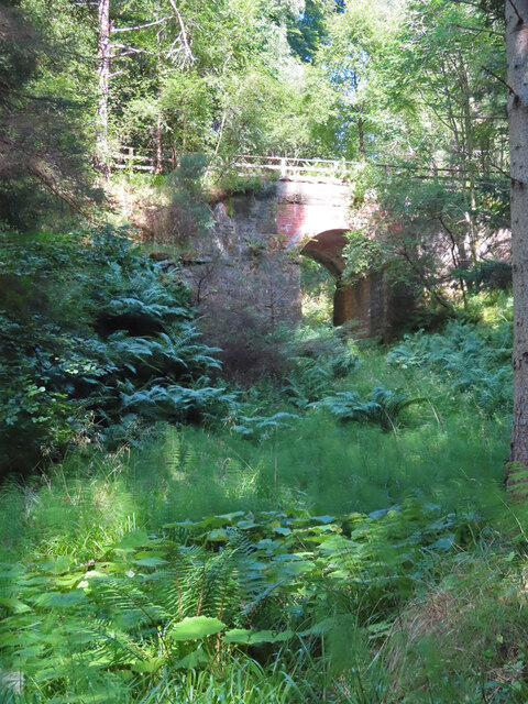
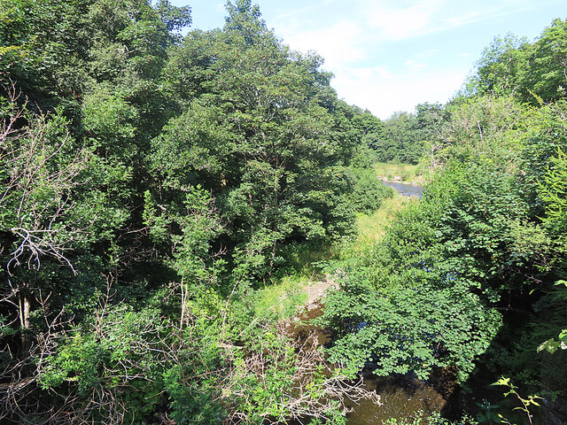
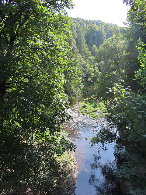
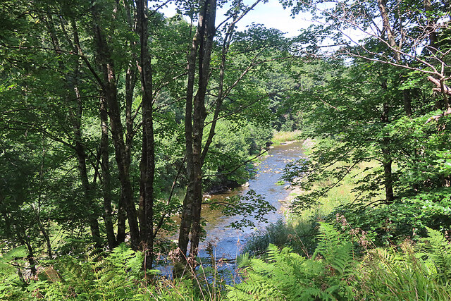
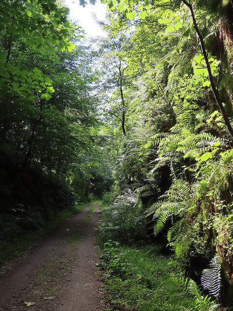
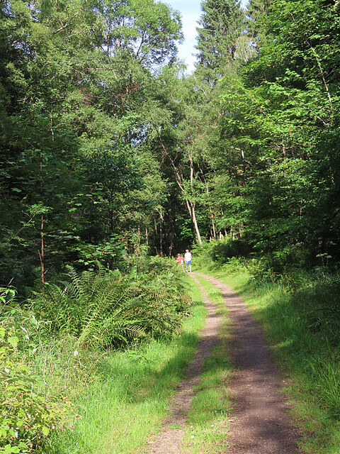
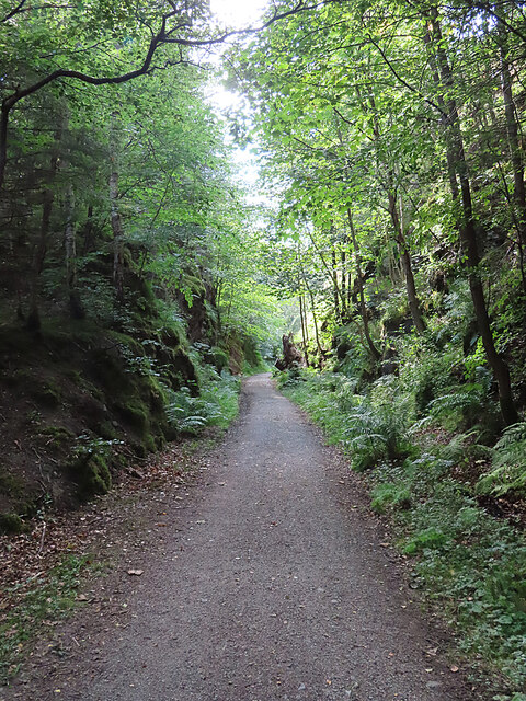
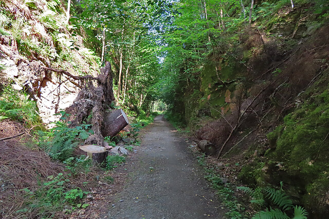
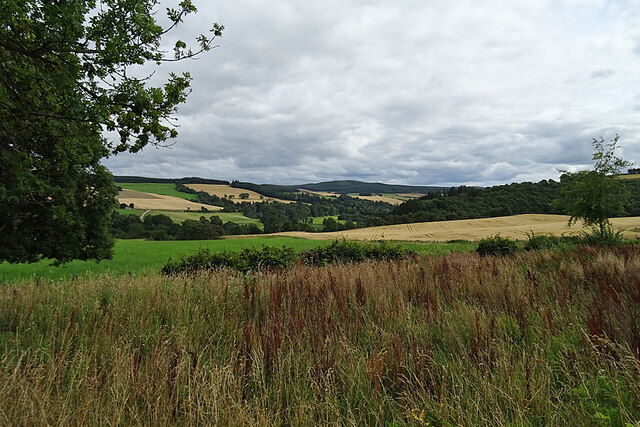
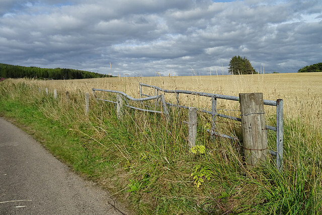
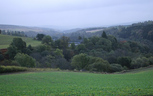
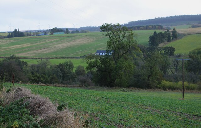
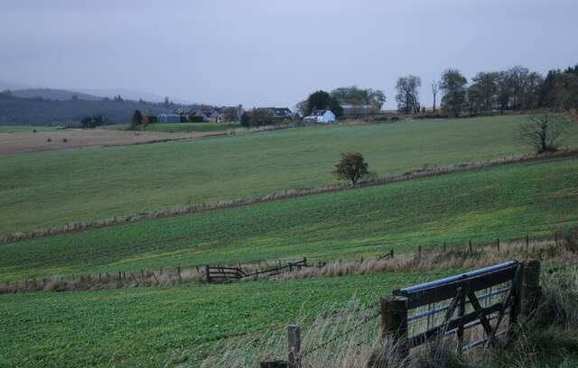
Wood of Gauldwell is a picturesque forest located in Banffshire, Scotland. Covering an area of approximately 50 acres, this woodland is renowned for its natural beauty, diverse flora and fauna, and tranquil atmosphere. Situated near the village of Gauldwell, the forest offers a serene escape from the hustle and bustle of urban life.

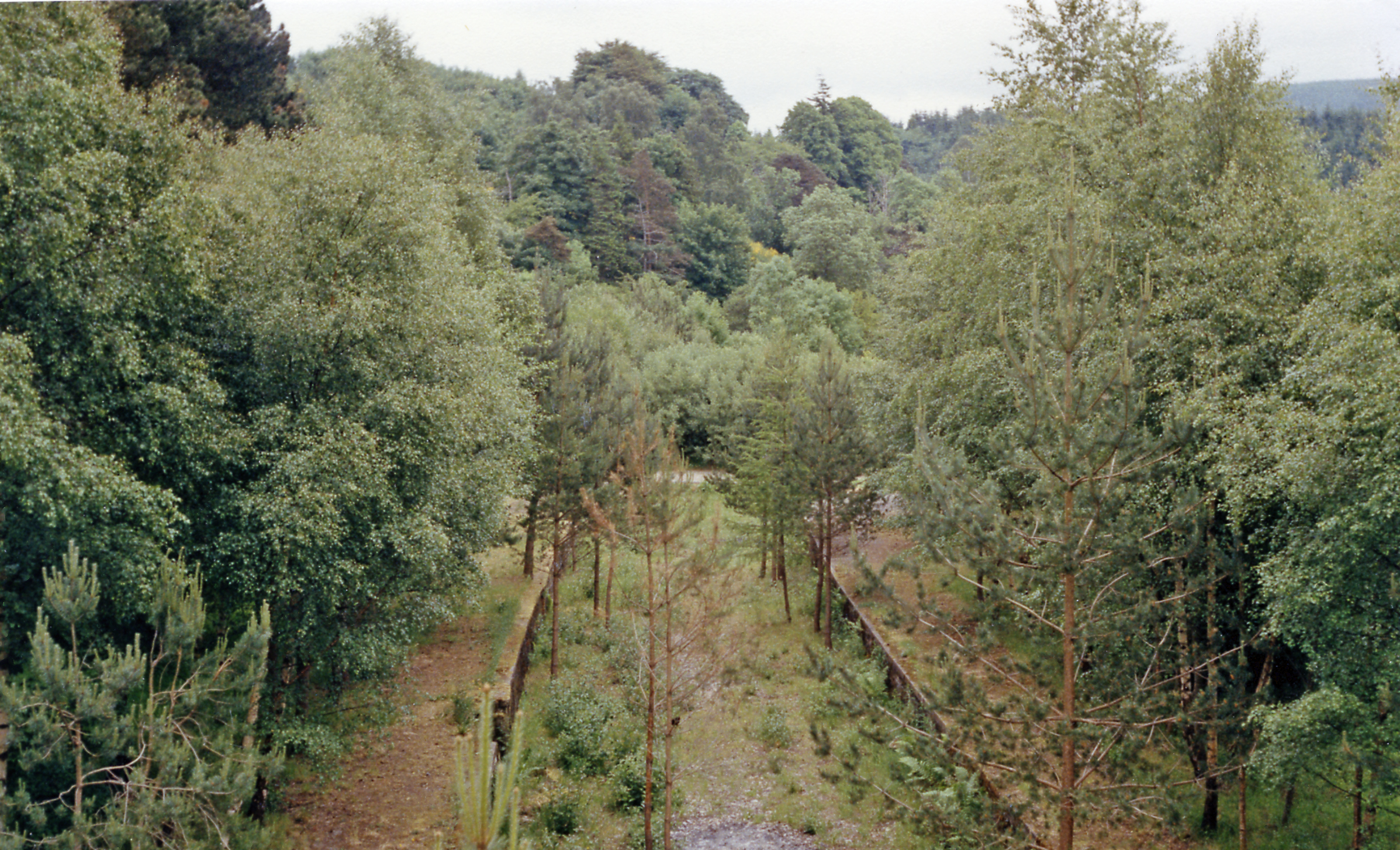
The Wood of Gauldwell boasts a rich variety of trees, including native species such as Scots pine, birch, and oak. These trees form a dense canopy, providing ample shade and creating a cool and refreshing ambiance. The forest floor is adorned with a colorful carpet of wildflowers and moss, adding to its natural charm.

The woodland is home to a plethora of wildlife, making it a haven for nature enthusiasts and birdwatchers. Visitors may spot red squirrels, roe deer, and a wide array of bird species, including woodpeckers, owls, and various songbirds. The forest is also inhabited by numerous insects, reptiles, and small mammals, further enriching its ecological diversity.

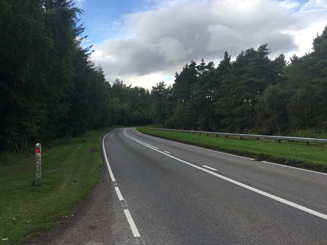
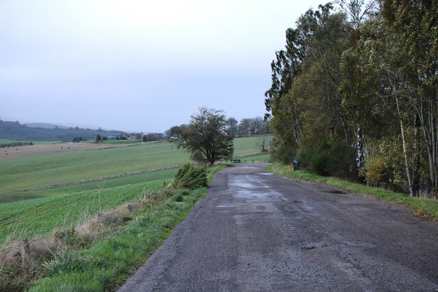
Wood of Gauldwell offers a range of walking trails and paths, allowing visitors to explore its beauty at their own pace. Whether taking a leisurely stroll or embarking on a more challenging hike, one can revel in the peaceful ambiance while immersing themselves in the sights and sounds of nature. The forest is also equipped with picnic areas, making it an ideal spot for a family outing or a peaceful picnic amidst the serene surroundings.

Overall, Wood of Gauldwell is a captivating woodland that offers a delightful escape into nature. With its breathtaking landscapes, abundant wildlife, and recreational opportunities, it is an enchanting destination for all nature lovers to visit and explore.

If you have any feedback on the listing, please let us know in the comments section below.

Wood of Gauldwell Images

Images are sourced within 2km of 57.488782/-3.1714092 or Grid Reference NJ2944. Thanks to Geograph Open Source API. All images are credited.

Railway Bridge The bridge carried the Strathspey Railway over a minor burn.
Railway Bridge
The bridge carried the Strathspey Railway over a minor burn.
River Fiddich Looking upriver from the former Strathspey Railway bridge.
River Fiddich
Looking upriver from the former Strathspey Railway bridge.
River Fiddich Looking downriver from the former Strathspey Railway bridge near Gauldwell Braes.
River Fiddich
Looking downriver from the former Strathspey Railway bridge near Gauldwell Braes.
River Fiddich Looking upriver from the former Strathspey Railway line near the bridge at Gauldwell.
River Fiddich
Looking upriver from the former Strathspey Railway line near the bridge at Gauldwell.
Old Railway Cutting The cutting is part of the route of the former Strathspey Railway.
Old Railway Cutting
The cutting is part of the route of the former Strathspey Railway.
Former Strathspey Railway The route of the former Strathspey Railway is now a popular path and cycle track.
Former Strathspey Railway
The route of the former Strathspey Railway is now a popular path and cycle track.
Old Railway Cutting One of several deep cuttings on the route of the former Strathspey Railway that provide a pleasant shady walk on a hot day.
Old Railway Cutting
One of several deep cuttings on the route of the former Strathspey Railway that provide a pleasant shady walk on a hot day.
Fallen Tree The stump of a large tree sticks out at an angle into the former Strathspey Railway cutting. It must have obstructed the path significantly before being sawn into lengths which have been left lying on both sides of the path. The large one on the left gives some idea of the diameter of the trunk.
Fallen Tree
The stump of a large tree sticks out at an angle into the former Strathspey Railway cutting. It must have obstructed the path significantly before being sawn into lengths which have been left lying on both sides of the path. The large one on the left gives some idea of the diameter of the trunk.
Looking towards Glen Fiddich The view of Glen Fiddich from beside Wester Gauldwell. All the nearer fields are in this square.
Looking towards Glen Fiddich
The view of Glen Fiddich from beside Wester Gauldwell. All the nearer fields are in this square.
Wester Gauldwell House An 18th century house with a relatively recent extension making it look lop-sided.
Wester Gauldwell House
An 18th century house with a relatively recent extension making it look lop-sided.
Harvesting at Wester Gauldwell A combine harvester cutting the barley south of Parkneuk.
Harvesting at Wester Gauldwell
A combine harvester cutting the barley south of Parkneuk.
New Pond This is shown on some of the maps as a boggy area fed by Meg Proctor's Well to the north-east. The owners have dug it out to form two ponds with the intention of attracting wildlife.
New Pond
This is shown on some of the maps as a boggy area fed by Meg Proctor's Well to the north-east. The owners have dug it out to form two ponds with the intention of attracting wildlife.
Field Gates It looks as if one of the gates has met with a mishap, and neither gate has been much used recently.
Field Gates
It looks as if one of the gates has met with a mishap, and neither gate has been much used recently.
A941 towards Craigellachie
Lay-by off the A95 Part of the old road.
Lay-by off the A95
Part of the old road.
Mains of Newton Seen from a lay-by off the A95.
Mains of Newton
Seen from a lay-by off the A95.
Cottage at Bridge of Little Newton The property is new. It was built about 2020/2021. Seen from a lay-by off the A95.
Cottage at Bridge of Little Newton
The property is new. It was built about 2020/2021. Seen from a lay-by off the A95.
Wester Gauldwell Seen from a lay-by off the A95.
Wester Gauldwell
Seen from a lay-by off the A95.
Show me another place!

Wood of Gauldwell is located at Grid Ref: NJ2944 (Lat: 57.488782, Lng: -3.1714092)

Unitary Authority: Moray

Police Authority: North East

What 3 Words

///dunk.acclaimed.mount. Near Charlestown of Aberlour, Moray

Related Wikis

Strathspey, Scotland

Strathspey (Scottish Gaelic: Srath Spè, [s̪t̪ɾa ˈs̪peː]) is the region around the strath of the River Spey, Scotland, split between the Moray council area...

Craigellachie railway station

Craigellachie railway station served the village of Craigellachie, Moray, Scotland from 1863 to 1968 on the Morayshire Railway and the Strathspey Railway...

Craigellachie distillery

Craigellachie distillery is a single malt Scotch whisky distillery in the village of Craigellachie at the centre of the Speyside whisky producing area...

Speyside Cooperage

The Speyside Cooperage is a cooperage located in Craigellachie, Aberlour, Scotland. Its visitor centre, the only such in Britain, is part of the Malt Whisky...

Craigellachie, Moray

Craigellachie (Scottish Gaelic: Creag Eileachaidh) is a small village in Moray, Scotland, at the confluence of the River Spey and River Fiddich (whose...

Dandaleith stone

The Dandaleith stone is a Class I Pictish stone from Craigellachie, Scotland. It was discovered in May 2013 during ploughing. == Location == The exact...

Gauldwell Castle

Gauldwell Castle was a 13th-century castle, about 3.5 miles (5.6 km) north-west of Dufftown, Moray, Scotland, north of the River Fiddich. Alternative names...

Craigellachie Bridge

Craigellachie Bridge is a cast iron arch bridge across the River Spey at Craigellachie, near to the village of Aberlour in Moray, Scotland. It was designed...

Nearby Amenities

Located within 500m of 57.488782,-3.1714092
Power: pole
Lat/Long: 57.4877453/-3.1666925
Power: pole
Lat/Long: 57.4881972/-3.1669296
Power: pole
Lat/Long: 57.4886139/-3.1671381
Power: pole
Lat/Long: 57.4889998/-3.1673298
Power: pole
Lat/Long: 57.489431/-3.1678007
Power: pole
Lat/Long: 57.4897012/-3.1683994
Power: pole
Lat/Long: 57.4899913/-3.1688299
Power: pole
Lat/Long: 57.490295/-3.1692688
Power: pole
Lat/Long: 57.490671/-3.1695008
Power: pole
Lat/Long: 57.4908689/-3.1682497
Power: pole
Lat/Long: 57.4910686/-3.1669767
Power: pole
Lat/Long: 57.4912575/-3.1656919
Power: pole
Lat/Long: 57.4918278/-3.1729835
Power: pole
Lat/Long: 57.4913642/-3.1736377
Power: pole
Lat/Long: 57.4925417/-3.1728288
The data included in this document is from www.openstreetmap.org. The data is made available under ODbL.

Have you been to Wood of Gauldwell?

Leave your review of Wood of Gauldwell below (or comments, questions and feedback).