Crooked Pot

Lake, Pool, Pond, Freshwater Marsh in Banffshire

Scotland

Crooked Pot

Railway Bridge The bridge carried the Strathspey Railway over a minor burn.
Railway Bridge Credit: Anne Burgess

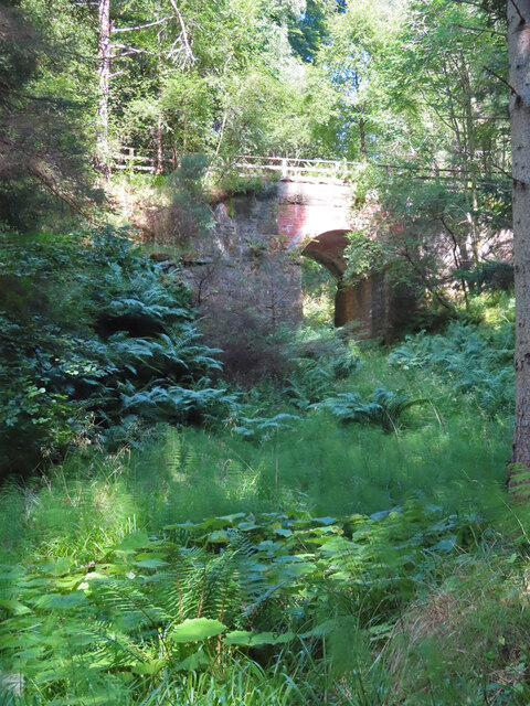
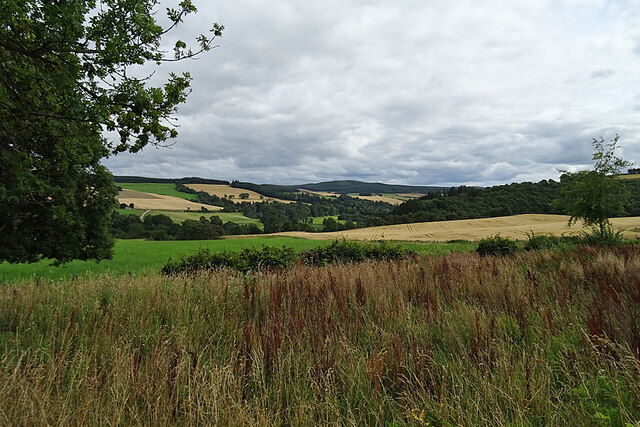
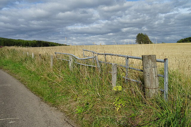
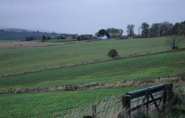
Crooked Pot, located in Banffshire, is a picturesque freshwater marsh that encompasses a lake, a pool, a pond, and abundant wildlife. This natural formation is nestled amidst the scenic landscape of the Scottish Highlands, offering visitors a serene and captivating experience.

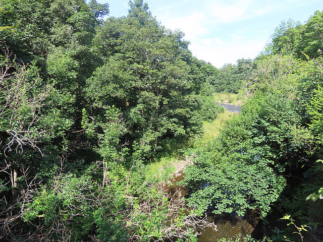
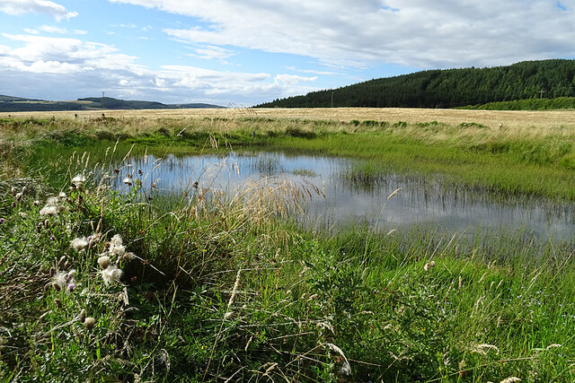
The centerpiece of Crooked Pot is its expansive lake, which stretches across a significant portion of the marsh. The lake is bordered by lush vegetation, including reeds, sedges, and water lilies, creating a vibrant and diverse ecosystem. Its calm waters provide a perfect habitat for various aquatic species, such as fish, amphibians, and waterfowl.

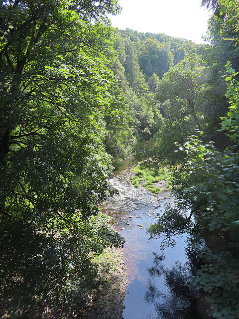
Adjacent to the lake is a smaller but equally enchanting pool. This pool is characterized by its crystal-clear waters, reflecting the surrounding flora and fauna. It serves as a breeding ground for numerous water insects, including dragonflies and water beetles, which contribute to the ecosystem's biodiversity.

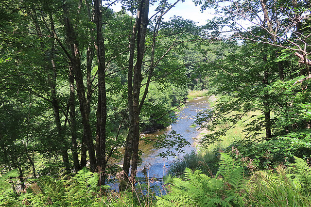
Tucked away in a secluded corner of Crooked Pot is a peaceful pond. This smaller body of water is home to an array of aquatic plants, such as pondweed and water milfoil. It attracts a variety of bird species, including ducks, swans, and herons, that come to feed and nest in its tranquil surroundings.

The entire marshland of Crooked Pot is teeming with life. Visitors can spot an assortment of wildlife, including otters, frogs, and even rare species of birds. This diverse ecosystem offers a wonderful opportunity for nature enthusiasts and photographers to observe and capture the beauty of the Scottish Highlands.

In summary, Crooked Pot in Banffshire is a captivating freshwater marsh, featuring a pristine lake, a reflective pool, and a serene pond. Its abundant wildlife and breathtaking scenery make it an ideal destination for those seeking a tranquil and immersive nature experience.

If you have any feedback on the listing, please let us know in the comments section below.
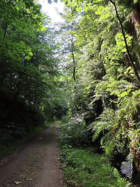
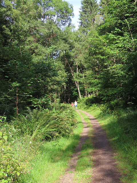
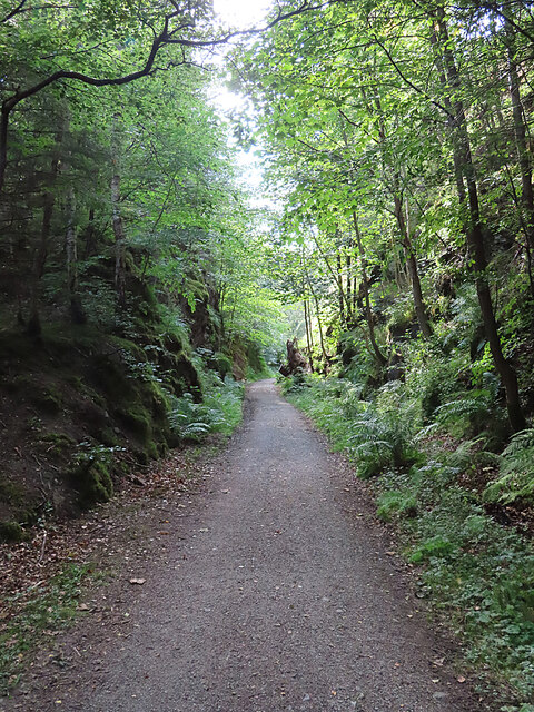
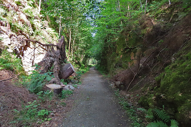
Crooked Pot Images

Images are sourced within 2km of 57.487352/-3.1802378 or Grid Reference NJ2944. Thanks to Geograph Open Source API. All images are credited.

Railway Bridge The bridge carried the Strathspey Railway over a minor burn.
Railway Bridge
The bridge carried the Strathspey Railway over a minor burn.
River Fiddich Looking upriver from the former Strathspey Railway bridge.
River Fiddich
Looking upriver from the former Strathspey Railway bridge.
River Fiddich Looking downriver from the former Strathspey Railway bridge near Gauldwell Braes.
River Fiddich
Looking downriver from the former Strathspey Railway bridge near Gauldwell Braes.
River Fiddich Looking upriver from the former Strathspey Railway line near the bridge at Gauldwell.
River Fiddich
Looking upriver from the former Strathspey Railway line near the bridge at Gauldwell.
Old Railway Cutting The cutting is part of the route of the former Strathspey Railway.
Old Railway Cutting
The cutting is part of the route of the former Strathspey Railway.
Former Strathspey Railway The route of the former Strathspey Railway is now a popular path and cycle track.
Former Strathspey Railway
The route of the former Strathspey Railway is now a popular path and cycle track.
Old Railway Cutting One of several deep cuttings on the route of the former Strathspey Railway that provide a pleasant shady walk on a hot day.
Old Railway Cutting
One of several deep cuttings on the route of the former Strathspey Railway that provide a pleasant shady walk on a hot day.
Fallen Tree The stump of a large tree sticks out at an angle into the former Strathspey Railway cutting. It must have obstructed the path significantly before being sawn into lengths which have been left lying on both sides of the path. The large one on the left gives some idea of the diameter of the trunk.
Fallen Tree
The stump of a large tree sticks out at an angle into the former Strathspey Railway cutting. It must have obstructed the path significantly before being sawn into lengths which have been left lying on both sides of the path. The large one on the left gives some idea of the diameter of the trunk.
Looking towards Glen Fiddich The view of Glen Fiddich from beside Wester Gauldwell. All the nearer fields are in this square.
Looking towards Glen Fiddich
The view of Glen Fiddich from beside Wester Gauldwell. All the nearer fields are in this square.
Wester Gauldwell House An 18th century house with a relatively recent extension making it look lop-sided.
Wester Gauldwell House
An 18th century house with a relatively recent extension making it look lop-sided.
Harvesting at Wester Gauldwell A combine harvester cutting the barley south of Parkneuk.
Harvesting at Wester Gauldwell
A combine harvester cutting the barley south of Parkneuk.
New Pond This is shown on some of the maps as a boggy area fed by Meg Proctor's Well to the north-east. The owners have dug it out to form two ponds with the intention of attracting wildlife.
New Pond
This is shown on some of the maps as a boggy area fed by Meg Proctor's Well to the north-east. The owners have dug it out to form two ponds with the intention of attracting wildlife.
Field Gates It looks as if one of the gates has met with a mishap, and neither gate has been much used recently.
Field Gates
It looks as if one of the gates has met with a mishap, and neither gate has been much used recently.
A941 towards Craigellachie
Lay-by off the A95 Part of the old road.
Lay-by off the A95
Part of the old road.
Mains of Newton Seen from a lay-by off the A95.
Mains of Newton
Seen from a lay-by off the A95.
Wester Gauldwell Seen from a lay-by off the A95.
Wester Gauldwell
Seen from a lay-by off the A95.
B9102/A941 junction The B road climbs hard away from the Spey, soon passing the Macallan distillery.
B9102/A941 junction
The B road climbs hard away from the Spey, soon passing the Macallan distillery.
Show me another place!

Crooked Pot is located at Grid Ref: NJ2944 (Lat: 57.487352, Lng: -3.1802378)

Unitary Authority: Moray

Police Authority: North East

What 3 Words

///named.peroxide.rivals. Near Charlestown of Aberlour, Moray

Related Wikis

Craigellachie distillery

Craigellachie distillery is a single malt Scotch whisky distillery in the village of Craigellachie at the centre of the Speyside whisky producing area...

Craigellachie railway station

Craigellachie railway station served the village of Craigellachie, Moray, Scotland from 1863 to 1968 on the Morayshire Railway and the Strathspey Railway...

Craigellachie, Moray

Craigellachie (Scottish Gaelic: Creag Eileachaidh) is a small village in Moray, Scotland, at the confluence of the River Spey and River Fiddich (whose...

Dandaleith stone

The Dandaleith stone is a Class I Pictish stone from Craigellachie, Scotland. It was discovered in May 2013 during ploughing. == Location == The exact...
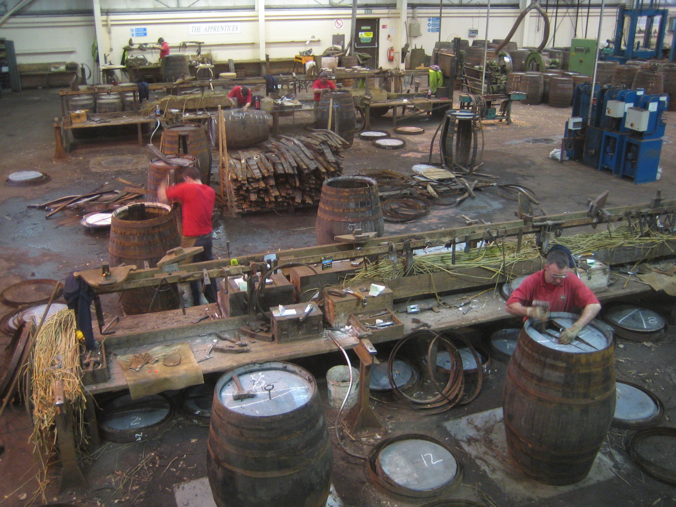
Speyside Cooperage

The Speyside Cooperage is a cooperage located in Craigellachie, Aberlour, Scotland. Its visitor centre, the only such in Britain, is part of the Malt Whisky...

Strathspey, Scotland

Strathspey (Scottish Gaelic: Srath Spè, [s̪t̪ɾa ˈs̪peː]) is the region around the strath of the River Spey, Scotland, split between the Moray council area...

Craigellachie Bridge

Craigellachie Bridge is a cast iron arch bridge across the River Spey at Craigellachie, near to the village of Aberlour in Moray, Scotland. It was designed...

Dandaleith railway station

Dandaleith railway station served the village of Craigellachie, Moray, Scotland from 1858 to 1965 on the Morayshire Railway. == History == The station...

Nearby Amenities

Located within 500m of 57.487352,-3.1802378
Parking
Parking: surface
Lat/Long: 57.491245/-3.1825573
Turning Circle
Lat/Long: 57.4852207/-3.1816941
Fiddichside Inn
Addr City: Craigellachie
Addr Housename: Fiddichside Inn
Addr Postcode: AB38 9RR
Fhrs Id: 17788
Tourism: hotel
Lat/Long: 57.490869/-3.1803057
Turning Circle
Lat/Long: 57.486464/-3.1817392
Historic Railway: junction
Wikidata: Q106041460
Lat/Long: 57.489387/-3.180896
The Whiskey Room
Tourism: guest_house
Lat/Long: 57.489568/-3.1871831
Craigellachie
Historic Railway: station
Old Name: Strathspey Junction
Railway: site
Wikidata: Q68377048
Wikipedia: en:Craigellachie railway station
Lat/Long: 57.4909668/-3.1818188
Post Box
Brand: Royal Mail
Brand Wikidata: Q638098
Check Date: 2022-10-09
Collection Times: Mo-Sa 09:00; Su off
Manufacturer: Carron Company
Operator: Royal Mail
Operator Wikidata: Q638098
Post Box Type: lamp
Ref: AB38 61
Royal Cypher: scottish_crown
Source: survey
Lat/Long: 57.4873546/-3.1832582
Post Box
Brand: Royal Mail
Brand Wikidata: Q638098
Check Date: 2022-10-09
Collection Times: Mo-Sa 09:00; Su off
Manufacturer: none
Operator: Royal Mail
Operator Wikidata: Q638098
Post Box Type: lamp
Ref: AB38 108
Royal Cypher: scottish_crown
Source: survey
Lat/Long: 57.489591/-3.1832536
Man Made: flagpole
Lat/Long: 57.4833902/-3.179787
Man Made: flagpole
Lat/Long: 57.483362/-3.1798621
Man Made: flagpole
Lat/Long: 57.4833974/-3.1798433
Advertising: billboard
Inscription: Speyside Cooperage
Lat/Long: 57.4833765/-3.1797829
Barrier: lift_gate
Lat/Long: 57.4833188/-3.1796488
Defibrillator
Access: yes
Defibrillator Location: outside Craigellachie Village Hall
Emergency: defibrillator
Indoor: no
Lat/Long: 57.4893832/-3.1857698
The data included in this document is from www.openstreetmap.org. The data is made available under ODbL.

Have you been to Crooked Pot?

Leave your review of Crooked Pot below (or comments, questions and feedback).