Wood of Edinvillie

Wood, Forest in Banffshire

Scotland

Wood of Edinvillie

Craighead The house and farm buildings in the middle distance are Craighead. This is the Craighead in the parish of Edinvillie, not to be confused with any number of similarly named farms in other parishes. The hill on the skyline is Meikle Conval.
Craighead Credit: Anne Burgess

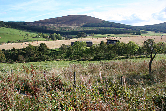
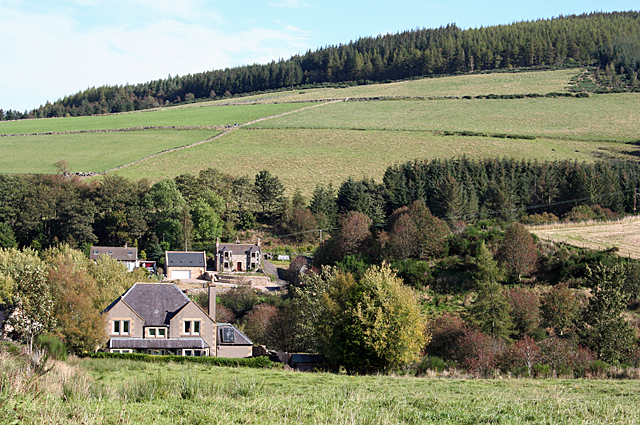
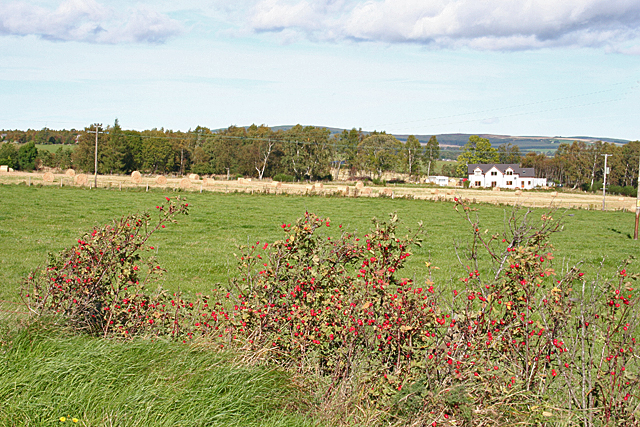
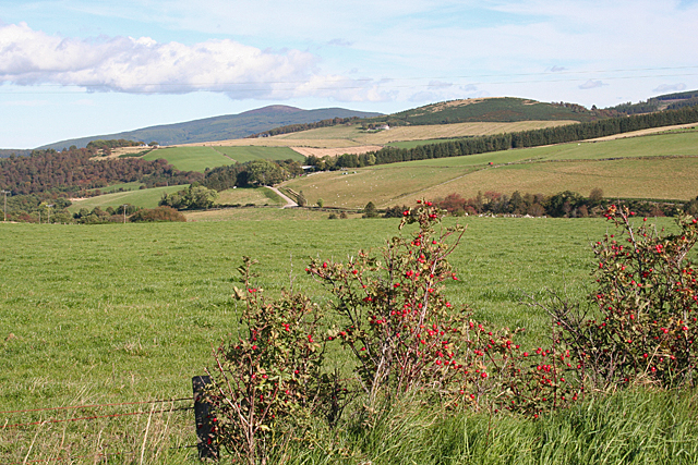
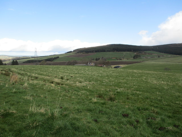
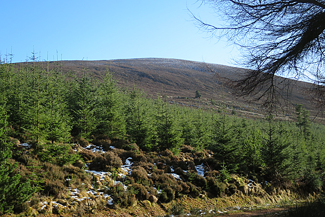
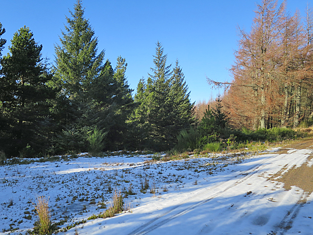
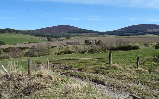
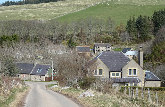
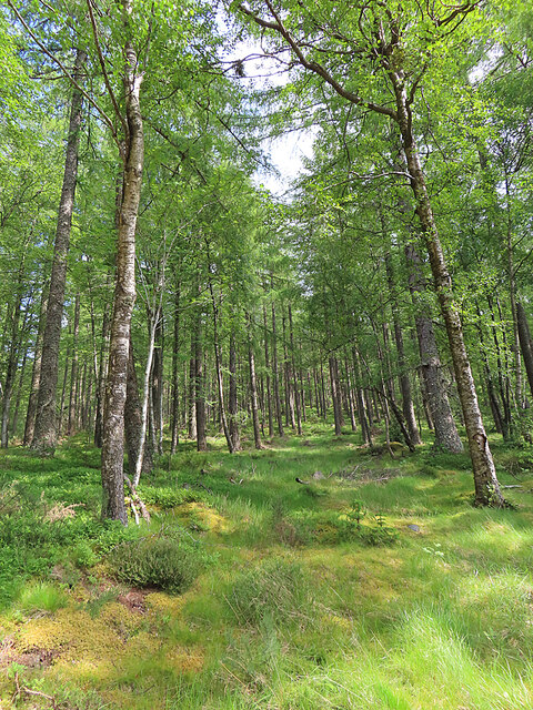
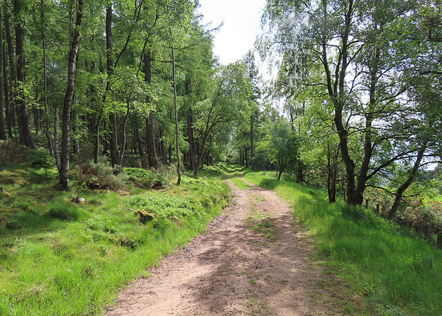
The Wood of Edinvillie is a picturesque forest located in Banffshire, Scotland. Covering an area of approximately 200 acres, it is a popular destination for nature enthusiasts and hikers. The wood is situated near the small village of Edinvillie, surrounded by rolling hills and stunning landscapes.

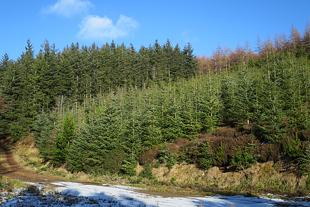
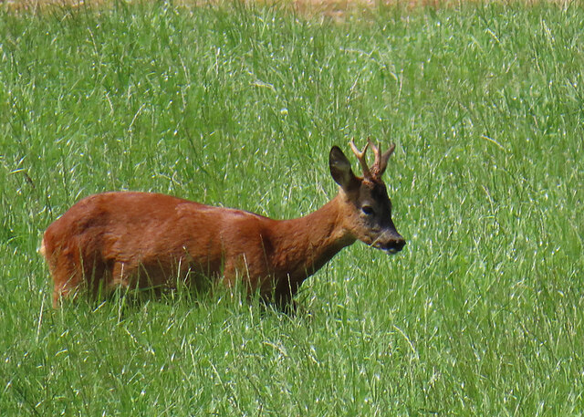
Comprising a diverse range of tree species, including oak, birch, beech, and pine, the Wood of Edinvillie offers a rich and vibrant habitat for numerous wildlife species. It is home to various birds, such as woodpeckers, owls, and songbirds, making it a paradise for birdwatchers. Additionally, the forest provides a haven for mammals such as red squirrels, foxes, and deer, which can often be spotted during walks or hikes.

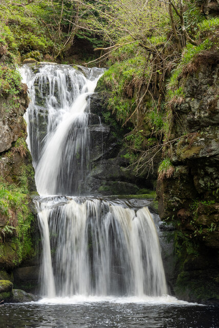
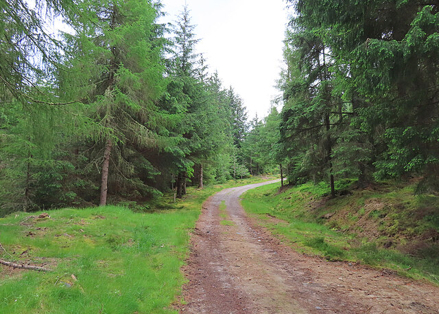
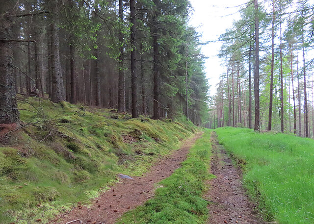
The wood features well-maintained trails, allowing visitors to explore its natural beauty at their own pace. There are also designated picnic areas and viewpoints, offering opportunities for relaxation and stunning views of the surrounding countryside. The forest is particularly enchanting in autumn when the leaves change color, creating a breathtaking display of vibrant hues.

The Wood of Edinvillie is managed by local authorities who strive to preserve its ecological importance and promote sustainable practices. The forest serves as an educational resource for schools and community groups, offering guided tours and workshops on conservation and the natural environment.

Overall, the Wood of Edinvillie is a captivating woodland retreat that provides a serene and idyllic experience for those seeking solace in nature's embrace.

If you have any feedback on the listing, please let us know in the comments section below.

Wood of Edinvillie Images

Images are sourced within 2km of 57.450749/-3.2044548 or Grid Reference NJ2740. Thanks to Geograph Open Source API. All images are credited.

Craighead The house and farm buildings in the middle distance are Craighead. This is the Craighead in the parish of Edinvillie, not to be confused with any number of similarly named farms in other parishes. The hill on the skyline is Meikle Conval.
Craighead
The house and farm buildings in the middle distance are Craighead. This is the Craighead in the parish of Edinvillie, not to be confused with any number of similarly named farms in other parishes. The hill on the skyline is Meikle Conval.
Milltown of Edinvillie The Milltown is at the foot of the slopes leading up to Little Conval.
Milltown of Edinvillie
The Milltown is at the foot of the slopes leading up to Little Conval.
Rose Hips A row of bushes bearing scarlet rose hips lines the roadside near Benrinnes Distillery. The house in the distance is so new that it isn't yet on the maps.
Rose Hips
A row of bushes bearing scarlet rose hips lines the roadside near Benrinnes Distillery. The house in the distance is so new that it isn't yet on the maps.
Fields at Edinvillie The foreground fields are all in square, but the more distant parts of this view, including Ben Aigan on the skyline, are out of square.
Fields at Edinvillie
The foreground fields are all in square, but the more distant parts of this view, including Ben Aigan on the skyline, are out of square.
Field near Edinvillie
The Lower Slopes of Little Conval This track is one of several that cross the slopes of Little Conval (552 metres), the summit of which is in the next square. You can see one of the higher tracks just above the trees.
The Lower Slopes of Little Conval
This track is one of several that cross the slopes of Little Conval (552 metres), the summit of which is in the next square. You can see one of the higher tracks just above the trees.
Forest Pond Whether this started out as a pond, or is a small quarry that has become flooded, I do not know. It was frozen over but the ice wasn't thick enough to stand on, to judge by the state of the ice on nearby shallow puddles.
Forest Pond
Whether this started out as a pond, or is a small quarry that has become flooded, I do not know. It was frozen over but the ice wasn't thick enough to stand on, to judge by the state of the ice on nearby shallow puddles.
Three Types of Tree I think the dark trees on the left are Sitka Spruce. The lighter, shorter ones are Norway Spruce, and on the skyline are Larch.
Three Types of Tree
I think the dark trees on the left are Sitka Spruce. The lighter, shorter ones are Norway Spruce, and on the skyline are Larch.
Track Junction This is a fork in the track, where one track goes downhill to the left. If I had been carrying an up-to-date 1:25,000 map instead of a 1:50,000, I would have realised that this whole forest is very densely criss-crossed with tracks, and I would have varied my route instead of sticking to what is shown on the smaller scale.
Track Junction
This is a fork in the track, where one track goes downhill to the left. If I had been carrying an up-to-date 1:25,000 map instead of a 1:50,000, I would have realised that this whole forest is very densely criss-crossed with tracks, and I would have varied my route instead of sticking to what is shown on the smaller scale.
Salt Encrustation This is a pile of sand and salt by the roadside, put there by the roads department for use in wintry weather. The salt has leached out and then crystallised on top of the sand.
Salt Encrustation
This is a pile of sand and salt by the roadside, put there by the roads department for use in wintry weather. The salt has leached out and then crystallised on top of the sand.
Craighead Craighead Farm is on the far side of the Burn of Aberlour, the course of which is in a gully at the far side of the foreground field. On the skyline are Little Conval on the left and Meikle Conval on the right.
Craighead
Craighead Farm is on the far side of the Burn of Aberlour, the course of which is in a gully at the far side of the foreground field. On the skyline are Little Conval on the left and Meikle Conval on the right.
Milltown of Edinvillie The roads on both sides of Milltown descend steeply to the bridge over the Burn of Aberlour. This is the approach from the south-east.
Milltown of Edinvillie
The roads on both sides of Milltown descend steeply to the bridge over the Burn of Aberlour. This is the approach from the south-east.
Falls of Linn Well worth the walk from Aberlour
Falls of Linn
Well worth the walk from Aberlour
Forest Track Part of a dense network of tracks in the Wood of Edinvillie.
Forest Track
Part of a dense network of tracks in the Wood of Edinvillie.
Wood of Edinvillie One of the many forest tracks through the Wood of Edinvillie.
Wood of Edinvillie
One of the many forest tracks through the Wood of Edinvillie.
Roe Deer The deer was grazing almost at the far side of a field, so was unaware of our presence. The advantage of a telephoto lens!
Roe Deer
The deer was grazing almost at the far side of a field, so was unaware of our presence. The advantage of a telephoto lens!
Wood of Edinvillie There's something very pleasant about an open woodland, especially when it's native broadleaved trees rather than alien conifers.
Wood of Edinvillie
There's something very pleasant about an open woodland, especially when it's native broadleaved trees rather than alien conifers.
Wood of Edinvillie A sunlit track on the west edge of the Wood of Edinvillie, near Upperton.
Wood of Edinvillie
A sunlit track on the west edge of the Wood of Edinvillie, near Upperton.
Show me another place!

Wood of Edinvillie is located at Grid Ref: NJ2740 (Lat: 57.450749, Lng: -3.2044548)

Unitary Authority: Moray

Police Authority: North East

What 3 Words

///estate.behalf.diverts. Near Charlestown of Aberlour, Moray

Related Wikis

Glenallachie distillery

GlenAllachie distillery is a Speyside, single malt whisky distillery at Aberlour founded in 1967, which sits at the foot of Ben Rinnes. Previously, the...

Benrinnes distillery

Benrinnes distillery is a malt whisky distillery in Aberlour producing an eponymous whisky. It was founded in 1826, and is still active. The distillery...

Fleming Cottage Hospital

Fleming Hospital is a UK National Health Service hospital in Aberlour, Morayshire, Scotland. It is administered by NHS Grampian. == History == The hospital...

Aberlour distillery

Aberlour distillery is a Speyside single malt Scotch whisky distillery, in Aberlour, Strathspey, Scotland, at the confluence of the Lour Burn and River...

Nearby Amenities

Located within 500m of 57.450749,-3.2044548
Daugh of Edinvillie
Ele: 331
Natural: peak
Lat/Long: 57.4483145/-3.2030002
The data included in this document is from www.openstreetmap.org. The data is made available under ODbL.

Have you been to Wood of Edinvillie?

Leave your review of Wood of Edinvillie below (or comments, questions and feedback).