Auchmuty Plantation

Wood, Forest in Fife

Scotland

Auchmuty Plantation

Leslie Railway Company marker From 1861 the Leslie Railway Company was responsible for a short section of railway connecting the town of Leslie to the Edinburgh, Perth and Dundee railway. In 1872 the company and the line became part of the North British Railway <span class="nowrap"><a title="https://www.scripoworld.com/records/united-kingdom/scotland/leslie-railway-company/" rel="nofollow ugc noopener" href="https://www.scripoworld.com/records/united-kingdom/scotland/leslie-railway-company/">Link</a><img style="margin-left:2px;" alt="External link" title="External link - shift click to open in new window" src="https://s1.geograph.org.uk/img/external.png" width="10" height="10"/></span>
This marker is at one end of Balbirnie Railway Viaduct which is a 'B' listed structure <span class="nowrap"><a title="http://www.forgottenrelics.co.uk/bridges/gallery/balbirnie.html" rel="nofollow ugc noopener" href="http://www.forgottenrelics.co.uk/bridges/gallery/balbirnie.html">Link</a><img style="margin-left:2px;" alt="External link" title="External link - shift click to open in new window" src="https://s1.geograph.org.uk/img/external.png" width="10" height="10"/></span>
Leslie Railway Company marker Credit: Bill Kasman

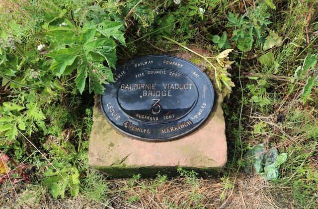
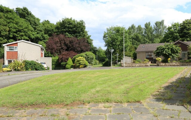
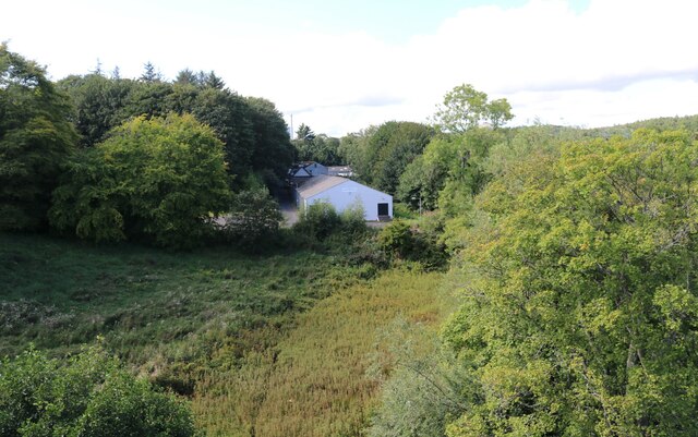
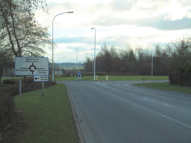
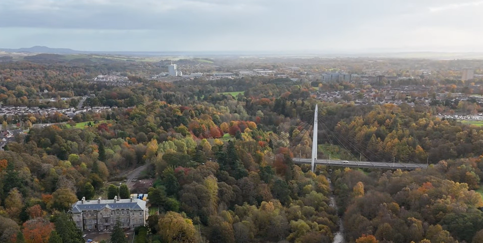
Auchmuty Plantation is a picturesque woodland located in Fife, Scotland. Covering an area of approximately 100 hectares, it is a diverse and thriving forest with a rich history. The plantation is situated in the southeastern part of Fife, near the town of Glenrothes, and is easily accessible to visitors.

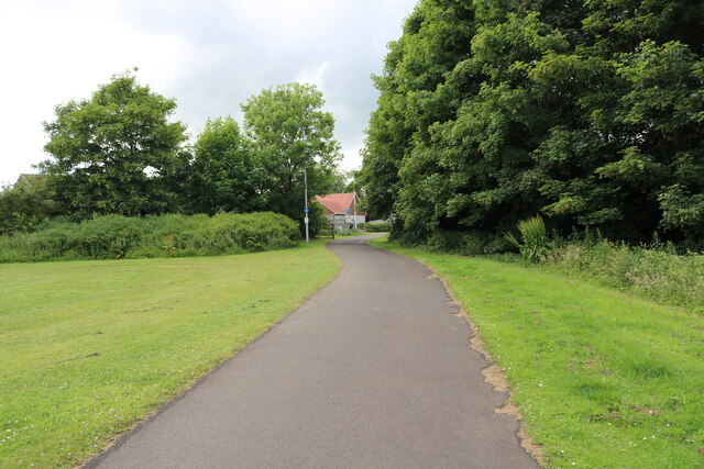
The woodland is predominantly composed of native broadleaf trees such as oak, birch, and beech, creating a lush and verdant landscape. It also features an array of coniferous trees, including Scots pine and Douglas fir. The varied tree species provide a habitat for a wide range of wildlife, making it a haven for nature enthusiasts and birdwatchers.

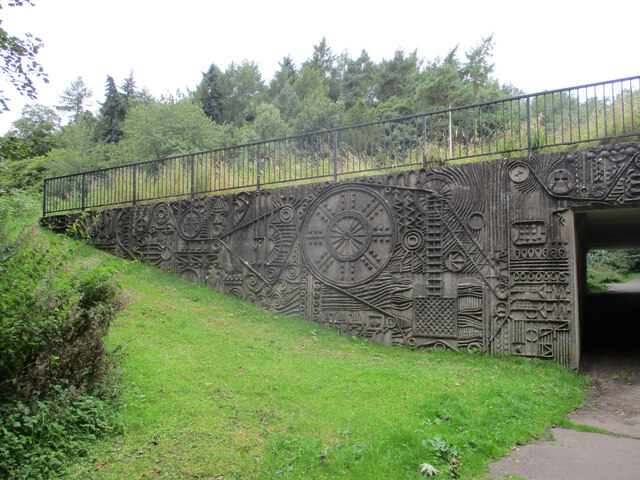
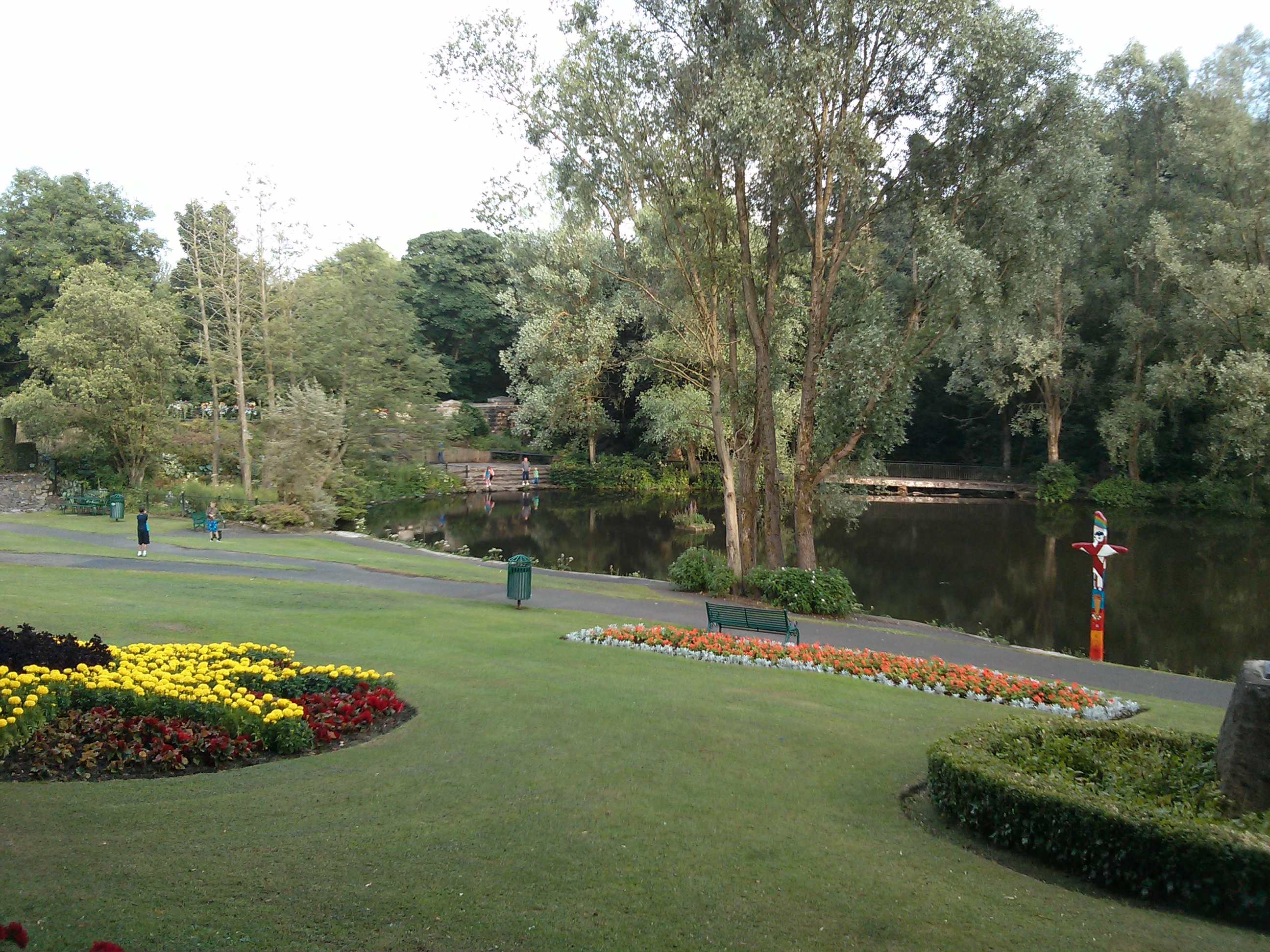
The plantation offers several well-maintained trails and paths, allowing visitors to explore the woodland at their own pace. These paths lead to scenic viewpoints, tranquil ponds, and enchanting clearings, offering a peaceful retreat from the hustle and bustle of everyday life.

In addition to its natural beauty, Auchmuty Plantation holds historical significance. The land was once part of the Auchmuty Estate, which dates back to the 17th century. The estate and its surrounding woodland have witnessed centuries of change and development, providing a glimpse into the area's past.

Overall, Auchmuty Plantation is a captivating and ecologically important woodland in Fife. Its combination of diverse flora, abundant fauna, and historical charm make it a must-visit destination for those seeking a tranquil escape into nature.

If you have any feedback on the listing, please let us know in the comments section below.

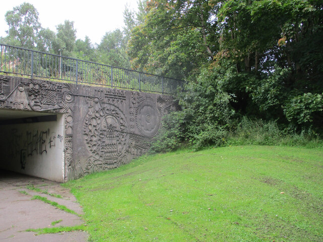
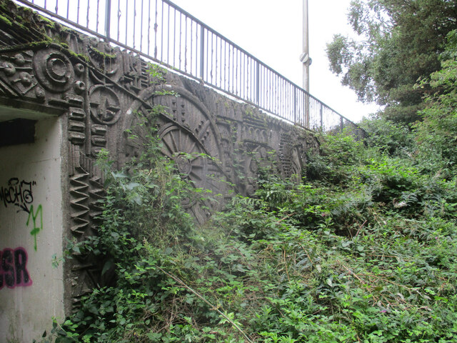
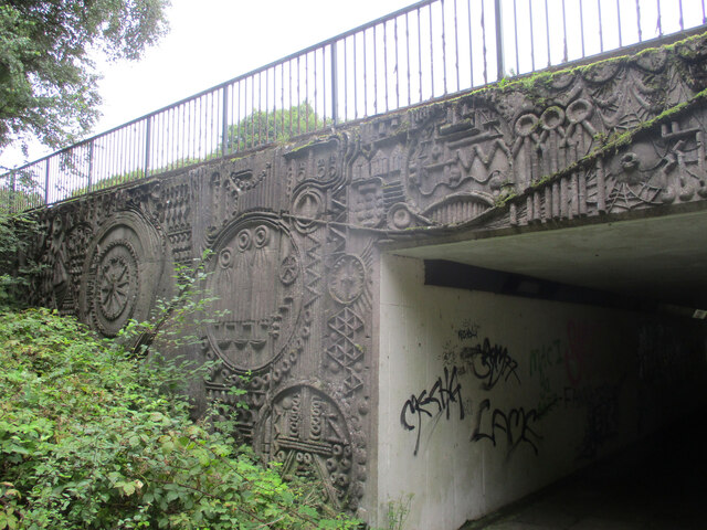
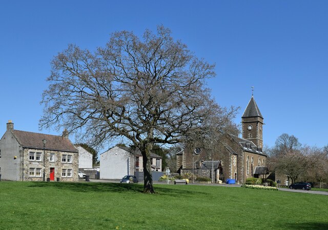
Auchmuty Plantation Images

Images are sourced within 2km of 56.199813/-3.1785895 or Grid Reference NO2601. Thanks to Geograph Open Source API. All images are credited.

Leslie Railway Company marker From 1861 the Leslie Railway Company was responsible for a short section of railway connecting the town of Leslie to the Edinburgh, Perth and Dundee railway. In 1872 the company and the line became part of the North British Railway <span class="nowrap"><a title="https://www.scripoworld.com/records/united-kingdom/scotland/leslie-railway-company/" rel="nofollow ugc noopener" href="https://www.scripoworld.com/records/united-kingdom/scotland/leslie-railway-company/">Link</a><img style="margin-left:2px;" alt="External link" title="External link - shift click to open in new window" src="https://s1.geograph.org.uk/img/external.png" width="10" height="10"/></span>
This marker is at one end of Balbirnie Railway Viaduct which is a 'B' listed structure <span class="nowrap"><a title="http://www.forgottenrelics.co.uk/bridges/gallery/balbirnie.html" rel="nofollow ugc noopener" href="http://www.forgottenrelics.co.uk/bridges/gallery/balbirnie.html">Link</a><img style="margin-left:2px;" alt="External link" title="External link - shift click to open in new window" src="https://s1.geograph.org.uk/img/external.png" width="10" height="10"/></span>
Leslie Railway Company marker
From 1861 the Leslie Railway Company was responsible for a short section of railway connecting the town of Leslie to the Edinburgh, Perth and Dundee railway. In 1872 the company and the line became part of the North British Railway LinkExternal link This marker is at one end of Balbirnie Railway Viaduct which is a 'B' listed structure LinkExternal link
Balbirnie Viaduct Path This is Alburne Crescent. In centre image is the start of Balbirnie Viaduct Path.
Balbirnie Viaduct Path
This is Alburne Crescent. In centre image is the start of Balbirnie Viaduct Path.
Balbirnie Viaduct Path The path emerges from the wooded area heading towards Alburne Park.
Balbirnie Viaduct Path
The path emerges from the wooded area heading towards Alburne Park.
Balbirnie Viaduct Path The path approaches its starting point at Alburne Crescent <a href="https://www.geograph.org.uk/photo/7220551">NO2801 : Balbirnie Viaduct Path</a>
Balbirnie Viaduct Path
The path approaches its starting point at Alburne Crescent NO2801 : Balbirnie Viaduct Path
Western Avenue underpass artworks The west side of the south portal, with the A92 Western Avenue above.
Western Avenue underpass artworks
The west side of the south portal, with the A92 Western Avenue above.
Western Avenue underpass artworks The east side of the south portal, with the A92 Western Avenue above.
Western Avenue underpass artworks
The east side of the south portal, with the A92 Western Avenue above.
Western Avenue underpass artworks The west side of the north portal, with the A92 Western Avenue above.
Western Avenue underpass artworks
The west side of the north portal, with the A92 Western Avenue above.
Western Avenue underpass artworks The east side of the north portal, with the A92 Western Avenue above.
Western Avenue underpass artworks
The east side of the north portal, with the A92 Western Avenue above.
Western Avenue underpass artworks The south portal, with the A92 Western Avenue above.
Western Avenue underpass artworks
The south portal, with the A92 Western Avenue above.
Western Avenue underpass artworks The north portal, with the A92 Western Avenue above.
Western Avenue underpass artworks
The north portal, with the A92 Western Avenue above.
Greenside scene, Leslie A very attractive public green space at the east end of the village.  From left-to-right we see: 20 Greenside, a C-listed cottage from ca. 1824: LB37288 <span class="nowrap"><a title="https://portal.historicenvironment.scot/designation/LB37288" rel="nofollow ugc noopener" href="https://portal.historicenvironment.scot/designation/LB37288">Link</a><img style="margin-left:2px;" alt="External link" title="External link - shift click to open in new window" src="https://s1.geograph.org.uk/img/external.png" width="10" height="10"/></span> ; note the 'bipartite' doubled windows; just to the left of the tree and in front of the car, the bull stone (C-listed LB37289 <span class="nowrap"><a title="https://portal.historicenvironment.scot/designation/LB37289" rel="nofollow ugc noopener" href="https://portal.historicenvironment.scot/designation/LB37289">Link</a><img style="margin-left:2px;" alt="External link" title="External link - shift click to open in new window" src="https://s1.geograph.org.uk/img/external.png" width="10" height="10"/></span> ), of 17th Century or earlier, where a bull was tethered in the savage 'sport' of bull baiting; Christ's Kirk on the Green (Leslie Parish Church), dating from 1869 and replacing earlier churches on the site (B-listed LB37291 <span class="nowrap"><a title="https://portal.historicenvironment.scot/designation/LB37291" rel="nofollow ugc noopener" href="https://portal.historicenvironment.scot/designation/LB37291">Link</a><img style="margin-left:2px;" alt="External link" title="External link - shift click to open in new window" src="https://s1.geograph.org.uk/img/external.png" width="10" height="10"/></span> ).  The kirk is now out of use.
Greenside scene, Leslie
A very attractive public green space at the east end of the village. From left-to-right we see: 20 Greenside, a C-listed cottage from ca. 1824: LB37288 LinkExternal link ; note the 'bipartite' doubled windows; just to the left of the tree and in front of the car, the bull stone (C-listed LB37289 LinkExternal link ), of 17th Century or earlier, where a bull was tethered in the savage 'sport' of bull baiting; Christ's Kirk on the Green (Leslie Parish Church), dating from 1869 and replacing earlier churches on the site (B-listed LB37291 LinkExternal link ). The kirk is now out of use.
Glenrothes Martial Arts Centre This Judo club is Situated in Woodmill Road, Markinch.
Glenrothes Martial Arts Centre
This Judo club is Situated in Woodmill Road, Markinch.
Glamis roundabout On the south west edge of the Pitteuchar area of Glenrothes
Glamis roundabout
On the south west edge of the Pitteuchar area of Glenrothes
New houses, south of Viewfield Glenrothes
Overstenton Park Home of Glenrothes Strollers F.C.  Unlike Livingston and Cumbernauld, Glenrothes has not tempted a local big city, wee team to set up home in the new town.
Overstenton Park
Home of Glenrothes Strollers F.C. Unlike Livingston and Cumbernauld, Glenrothes has not tempted a local big city, wee team to set up home in the new town.
Fife Constabulary Headquarters Viewed here from its entrance from in Detroit Road.
Fife Constabulary Headquarters
Viewed here from its entrance from in Detroit Road.
Wetherlodge, Glenrothes Lodge accommodation in the town centre of Glenrothes, Fife.
Wetherlodge, Glenrothes
Lodge accommodation in the town centre of Glenrothes, Fife.
Glenrothes Town Centre, Fife
Show me another place!

Auchmuty Plantation is located at Grid Ref: NO2601 (Lat: 56.199813, Lng: -3.1785895)

Unitary Authority: Fife

Police Authority: Fife

What 3 Words

///accent.cook.care. Near Glenrothes, Fife

Related Wikis

Glenrothes

Glenrothes (; , glen-ROTH-iss; Scots: Glenrothes; Scottish Gaelic: Gleann Rathais, pronounced [kʲlən̪ˠˈrˠahɪʃ]) is a town situated in the heart of Fife...

Fife House, Glenrothes

Fife House, formerly Glenrothes House, is a large office development on North Street in Glenrothes, Fife, Scotland. It was built for Glenrothes Development...

Riverside Park, Glenrothes

Riverside Park is a large town park situated in Glenrothes, Fife. The park straddles the River Leven valley riparian corridor, comprising significant...

Glenrothes (UK Parliament constituency)

Glenrothes () is a constituency in Scotland represented in the House of Commons of the UK Parliament since 2005. The seat has been held since the 2015...

Nearby Amenities

Located within 500m of 56.199813,-3.1785895
Mini Roundabout
Napier Road
Direction: clockwise
Lat/Long: 56.1981402/-3.184978
Crossing
Crossing: unmarked
Crossing Island: no
Kerb: lowered
Tactile Paving: no
Lat/Long: 56.1964037/-3.1808928
Crossing
Button Operated: yes
Crossing: traffic_signals
Tactile Paving: yes
Traffic Signals Sound: no
Traffic Signals Vibration: yes
Lat/Long: 56.1977078/-3.1781916
Barrier: bollard
Bicycle: yes
Bollard: fixed
Foot: yes
Motor Vehicle: no
Lat/Long: 56.2015499/-3.1844241
Library
Rothes Halls Library
Opening Hours: Mo,Tu,We,Fr,Sa 09:30-17:00; Th 09:30-19:00
Source: OS_OpenData_StreetView
Wikidata: Q62783269
Lat/Long: 56.1958063/-3.1760846
Crossing
Crossing: marked
Lat/Long: 56.1964282/-3.1733387
Crossing
Button Operated: yes
Crossing: traffic_signals
Tactile Paving: yes
Traffic Signals Sound: no
Traffic Signals Vibration: yes
Lat/Long: 56.1977183/-3.1784097
Crossing
Crossing: unmarked
Kerb: lowered
Tactile Paving: no
Lat/Long: 56.198538/-3.1767991
Crossing
Crossing: unmarked
Crossing Island: yes
Tactile Paving: yes
Lat/Long: 56.2009469/-3.1820463
Crossing
Button Operated: yes
Crossing: traffic_signals
Tactile Paving: yes
Traffic Signals Sound: no
Traffic Signals Vibration: yes
Lat/Long: 56.1981671/-3.1749165
Crossing
Button Operated: yes
Crossing: traffic_signals
Tactile Paving: yes
Traffic Signals Sound: no
Traffic Signals Vibration: yes
Lat/Long: 56.1982983/-3.1748355
Crossing
Crossing: unmarked
Kerb: lowered
Tactile Paving: no
Lat/Long: 56.1988266/-3.1770452
Crossing
Crossing: unmarked
Kerb: lowered
Tactile Paving: no
Lat/Long: 56.1988972/-3.1777683
Parking Entrance
Maxheight: 2
Parking: multi-storey
Lat/Long: 56.1963134/-3.1769051
Parking Entrance
Maxheight: 2
Parking: multi-storey
Lat/Long: 56.1963283/-3.1775971
Parking Entrance
Maxheight: 2
Parking: multi-storey
Lat/Long: 56.1957302/-3.1769386
Parking Entrance
Maxheight: 2
Parking: multi-storey
Lat/Long: 56.1957479/-3.1776473
Access: yes
Entrance: yes
Lat/Long: 56.1955332/-3.176259
Access: yes
Entrance: yes
Lat/Long: 56.1963154/-3.1749644
Crossing
Crossing: marked
Crossing Island: no
Kerb: flush
Source: Survey Feb 2019
Tactile Paving: yes
Lat/Long: 56.1971108/-3.1721731
The Defenceless One
Artist Name: Rudolf Christian Baisch
Artwork Type: sculpture
Source: Historic Scotland
Tourism: artwork
Lat/Long: 56.2019207/-3.1855034
Crossing
Crossing: marked
Tactile Paving: yes
Lat/Long: 56.1964162/-3.1749564
Traffic Calming: cushion
Lat/Long: 56.1981326/-3.1846999
Access: yes
Entrance: yes
Lat/Long: 56.1957125/-3.1765488
Theatre
Rothes Halls
Opening Hours: Mo,Tu,We,Fr,Sa 10:00-16:00; Th 10:00-18:00
Wikidata: Q32828602
Lat/Long: 56.1960274/-3.1761532
Post Box
Collection Times: Mo-Fr 17:00, Sa 12:00
Operator: Royal Mail
Ref: KY6 133
Royal Cypher: scottish_crown
Source: survey
Lat/Long: 56.198084/-3.1841599
Barnardo's
Brand: Barnardo's
Brand Wikidata: Q2884670
Brand Wikipedia: en:Barnardo's
Shop: charity
Lat/Long: 56.1966852/-3.1768286
Bicycle Parking
Bicycle Parking: stands
Capacity: 8
Covered: yes
Lat/Long: 56.1956213/-3.1764501
Shop: mobile_phone
Lat/Long: 56.1957031/-3.1759981
Cafe
Café Alfresco
Lat/Long: 56.1960036/-3.175468
Pep&Co
Brand: Pep&Co
Brand Wikidata: Q24908166
Brand Wikipedia: en:Pep&Co
Shop: clothes
Lat/Long: 56.1956915/-3.1754729
Shop: pet
Lat/Long: 56.1957653/-3.1753224
O2
Brand: O2
Brand Wikidata: Q1759255
Brand Wikipedia: en:Telefónica Europe
Shop: mobile_phone
Website: https://stores.o2.co.uk/o2-store-glenrothes
Lat/Long: 56.1958686/-3.1751116
Danjo Hair
Female: yes
Male: yes
Shop: hairdresser
Lat/Long: 56.1962591/-3.1750976
Watch Repair Centre
Craft: watchmaker
Shop: watches
Lat/Long: 56.1962179/-3.1748573
Shop: art
Lat/Long: 56.1961278/-3.17484
Disused Shop: yes
Lat/Long: 56.1959734/-3.1748977
Disused Shop: yes
Lat/Long: 56.195973/-3.1747041
Savers
Brand: Savers
Brand Wikidata: Q7428189
Brand Wikipedia: en:Savers (UK retailer)
Official Name: Savers Health & Beauty
Shop: chemist
Lat/Long: 56.1959692/-3.174513
Shop: vacant
Lat/Long: 56.1961203/-3.1746164
Castle Furniture
Shop: furniture
Lat/Long: 56.1961163/-3.1744981
Three.
Brand: Three
Brand Wikidata: Q407009
Brand Wikipedia: en:3 (telecommunications)
Contact Website: https://locator.three.co.uk/north/glenrothes/unicorn-way
Shop: mobile_phone
Lat/Long: 56.1961119/-3.1743678
KCC Vinyl Records
Shop: music
Lat/Long: 56.1961077/-3.1742418
Ryman
Brand: Ryman
Brand Wikidata: Q7385188
Brand Wikipedia: en:Ryman
Shop: stationery
Lat/Long: 56.1961034/-3.1741148
Farmfoods
Addr Housenumber: 2
Addr Parentstreet: North Street
Addr Postcode: KY7 5BH
Addr Street: Henge Retail And Leisure Park
Brand: Farmfoods
Brand Wikidata: Q5435841
Brand Wikipedia: en:Farmfoods
Fhrs Id: 1338145
Opening Hours Url: https://www.farmfoods.co.uk/store-finder.php?branch_code=085
Shop: frozen_food
Source Addr: FHRS Open Data
Website: https://www.farmfoods.co.uk/store-finder.php?branch_code=085
Lat/Long: 56.1977417/-3.1729634
Fast Food
Greggs
Brand: Greggs
Brand Wikidata: Q3403981
Brand Wikipedia: en:Greggs
Contact Website: https://www.greggs.co.uk/shop-finder?shop-code=2373
Cuisine: sandwich;bakery
Shop: bakery
Takeaway: yes
Lat/Long: 56.1986454/-3.1732477
Cafe
Paul's Fish & Chicken Bar
Addr City: Glenrothes
Addr Housenumber: 380
Addr Postcode: KY7 5PA
Addr Street: South Street
Cuisine: fish_and_chips
Internet Access: no
Lat/Long: 56.1959061/-3.1779345
Mini Roundabout
Direction: clockwise
Lat/Long: 56.1976904/-3.1771396
Bus Stop
Rothesay House
Bench: yes
Bin: yes
Lit: yes
Naptan AtcoCode: 6500K0709
Naptan NaptanCode: 34329264
Shelter: yes
Tactile Paving: no
Lat/Long: 56.1968385/-3.1791337
Bus Stop
Rothesay House
Bench: yes
Bin: yes
Lit: yes
Shelter: yes
Tactile Paving: no
Lat/Long: 56.1959209/-3.1792541
Access: no
Barrier: lift_gate
Lat/Long: 56.1986285/-3.1709133
Crossing
Crossing: unmarked
Crossing Island: yes
Kerb: lowered
Tactile Paving: yes
Lat/Long: 56.1965421/-3.1792249
Crossing
Button Operated: yes
Crossing: traffic_signals
Crossing Island: no
Tactile Paving: yes
Traffic Signals Sound: yes
Traffic Signals Vibration: yes
Lat/Long: 56.2023539/-3.1843119
Crossing
Crossing: unmarked
Kerb: lowered
Tactile Paving: no
Lat/Long: 56.198789/-3.1778501
Crossing
Crossing: unmarked
Kerb: flush
Tactile Paving: yes
Lat/Long: 56.1979362/-3.1743059
Crossing
Check Date Tactile Paving: 2023-03-19
Crossing: unmarked
Kerb: flush
Tactile Paving: yes
Lat/Long: 56.1979407/-3.17455
Bicycle Parking
Capacity: 15
Covered: yes
Lat/Long: 56.1969684/-3.1778931
Bicycle Parking
Capacity: 8
Covered: yes
Lat/Long: 56.1975732/-3.1760463
Crossing
Button Operated: yes
Crossing: traffic_signals
Crossing Island: no
Tactile Paving: yes
Traffic Signals Sound: yes
Traffic Signals Vibration: yes
Lat/Long: 56.1957775/-3.179342
Crossing
Button Operated: yes
Crossing: traffic_signals
Crossing Island: no
Tactile Paving: yes
Traffic Signals Sound: yes
Lat/Long: 56.1979876/-3.1732877
Entrance: yes
Lat/Long: 56.1981644/-3.1734569
Crossing
Crossing: unmarked
Crossing Island: no
Kerb: lowered
Tactile Paving: no
Lat/Long: 56.1959305/-3.1794615
Entrance: yes
Lat/Long: 56.1969673/-3.1780866
Entrance: yes
Lat/Long: 56.1974693/-3.1758996
Access: no
Barrier: lift_gate
Lat/Long: 56.1986589/-3.1708942
Crossing
Crossing: unmarked
Kerb: lowered
Tactile Paving: no
Lat/Long: 56.1973298/-3.1777216
Crossing
Crossing: unmarked
Kerb: lowered
Tactile Paving: no
Lat/Long: 56.19727/-3.1777364
Crossing
Crossing: unmarked
Kerb: lowered
Tactile Paving: no
Lat/Long: 56.1989029/-3.177217
Crossing
Crossing: unmarked
Kerb: lowered
Tactile Paving: no
Lat/Long: 56.1986293/-3.1767305
Crossing
Crossing: unmarked
Kerb: flush
Tactile Paving: no
Lat/Long: 56.1970806/-3.1731212
M1 Clothing
Shop: clothes
Lat/Long: 56.1959249/-3.1749966
Shoe Zone
Brand: Shoe Zone
Brand Wikidata: Q7500016
Brand Wikipedia: en:Shoe Zone
Contact Website: https://www.shoezone.com/Stores/Glenrothes-1583
Shop: shoes
Lat/Long: 56.1958275/-3.1751954
Crossing
Crossing: unmarked
Crossing Island: no
Kerb: lowered
Tactile Paving: no
Lat/Long: 56.1956704/-3.1791985
Columns
Artwork Type: sculpture
Tourism: artwork
Lat/Long: 56.1990693/-3.1739363
Birds
Artist Name: Malcolm Robertson
Artwork Type: sculpture
Source: Fife Council
Tourism: artwork
Lat/Long: 56.1972983/-3.1747982
Horse and Chariot
Artist Name: Keith Donnelly
Artwork Type: sculpture
Source: Fife Council
Tourism: artwork
Lat/Long: 56.1981543/-3.1742531
Crossing
Crossing: unmarked
Crossing Island: no
Kerb: lowered
Tactile Paving: no
Lat/Long: 56.1984323/-3.1849938
Parking
Access: customers
Fee: no
Parking: surface
Lat/Long: 56.1982849/-3.1808153
Barrier: block
Lat/Long: 56.1983187/-3.1794523
Crossing
Button Operated: yes
Crossing: traffic_signals
Tactile Paving: yes
Traffic Signals Sound: no
Traffic Signals Vibration: yes
Lat/Long: 56.1976925/-3.178111
Entrance: yes
Lat/Long: 56.1971972/-3.1720332
The Food Warehouse
Brand: The Food Warehouse
Brand Wikidata: Q87263899
Operator: Iceland
Shop: supermarket
Source: Survey Feb 2019
Website: https://www.thefoodwarehouse.com/store-locator/glenrothes
Lat/Long: 56.1973004/-3.1727959
Indigo Sun
Beauty: tanning
Brand: Indigo Sun
Brand Wikidata: Q63436906
Shop: beauty
Source: Survey Feb 2019
Lat/Long: 56.1975672/-3.1729656
Crossing
Crossing: marked
Crossing Island: no
Kerb: flush
Source: Survey Feb 2019
Tactile Paving: no
Lat/Long: 56.1971232/-3.1726997
Pub
CISWO
Alt Name: Coal Industry Social Welfare Organisation club
Source: https://www.facebook.com/pages/Ciswo-Glenrothes-Fife/229777683709713
Lat/Long: 56.195413/-3.1777456
Indigo Sun
Beauty: tanning
Brand: Indigo Sun
Brand Wikidata: Q63436906
Shop: beauty
Lat/Long: 56.1966905/-3.1769839
Power: substation
Substation: yes
Lat/Long: 56.1987741/-3.1844711
Bus Stop
Willow crescent
Bench: yes
Bin: no
Bus: yes
Lit: yes
Naptan AtcoCode: 6500K0706
Naptan NaptanCode: 34329329
Public Transport: platform
Shelter: yes
Tactile Paving: no
Lat/Long: 56.1981957/-3.1845273
Bus Stop
Riverside Park
Bench: no
Bin: no
Bus: yes
Lit: yes
Naptan AtcoCode: 6500K1520
Naptan NaptanCode: 34345789
Public Transport: platform
Shelter: no
Tactile Paving: no
Lat/Long: 56.2021979/-3.1839278
Bus Stop
Riverside Park
Bench: no
Bin: no
Bus: yes
Lit: yes
Public Transport: platform
Shelter: no
Tactile Paving: no
Lat/Long: 56.2025012/-3.184648
Crossing
Crossing: zebra
Crossing Island: no
Tactile Paving: yes
Lat/Long: 56.1988034/-3.1730618
Crossing
Crossing: zebra
Crossing Island: no
Tactile Paving: yes
Lat/Long: 56.1988975/-3.1742635
Direction: 315
Tourism: viewpoint
Lat/Long: 56.1992265/-3.174196
Bench
Backrest: yes
Lat/Long: 56.1989841/-3.173487
Bench
Backrest: yes
Lat/Long: 56.1990373/-3.1737659
Bbq
Access: yes
Covered: no
Fuel: charcoal
Lat/Long: 56.199806/-3.1752902
Hippos
Artwork Type: sculpture
Material: concrete
Tourism: artwork
Lat/Long: 56.1999836/-3.1748942
Crossing
Crossing: unmarked
Crossing Island: no
Tactile Paving: yes
Lat/Long: 56.200893/-3.1818009
Waste Basket
Waste: trash
Lat/Long: 56.2011672/-3.1813335
Bench
Backrest: yes
Colour: brown
Material: wood
Seats: 2
Lat/Long: 56.2007454/-3.1823537
Bench
Backrest: yes
Colour: brown
Material: wood
Seats: 2
Lat/Long: 56.2008349/-3.1825012
Riverside Mosaic
Artist Name: Kerry Wilson
Artwork Type: mural
Source: Friends of Riverside Park
Tourism: artwork
Lat/Long: 56.2016155/-3.1831376
Traffic Calming: cushion
Lat/Long: 56.198115/-3.1809846
Generator Method: photovoltaic
Generator Output Electricity: yes
Generator Source: solar
Generator Type: solar_photovoltaic_panel
Power: generator
Lat/Long: 56.198875/-3.1837164
Crossing
Crossing: unmarked
Kerb: flush
Tactile Paving: yes
Lat/Long: 56.1973494/-3.1745594
Crossing
Crossing: unmarked
Kerb: flush
Tactile Paving: yes
Lat/Long: 56.1973425/-3.1744845
Mini Roundabout
Lat/Long: 56.1975538/-3.1734406
Traffic Calming: cushion
Lat/Long: 56.2021353/-3.1735782
Traffic Calming: cushion
Lat/Long: 56.2024661/-3.1739791
Traffic Calming: cushion
Lat/Long: 56.2039184/-3.1761415
Party Empire
Shop: party
Lat/Long: 56.1961199/-3.1751275
Community Centre
YMCA
Community Centre: youth_centre
Lat/Long: 56.1972596/-3.1720862
Glenrothes and Area Heritage Centre
Tourism: museum
Lat/Long: 56.1955974/-3.176194
British Red Cross
Brand: British Red Cross
Brand Wikidata: Q4970966
Shop: charity
Lat/Long: 56.1960757/-3.1752947
Cafe
Lat/Long: 56.196021/-3.1757778
Office: estate_agent
Lat/Long: 56.1956562/-3.176085
The Gym Group
Brand: The Gym
Brand Wikidata: Q48815022
Leisure: fitness_centre
Lat/Long: 56.1967353/-3.176361
Fast Food
Iggy's
Lat/Long: 56.1969827/-3.1763428
Seeds of Change
Healthcare: alternative
Healthcare Speciality: naturopathy
Lat/Long: 56.1988084/-3.1715965
A&N Custom Gifts
Shop: gift
Lat/Long: 56.1988289/-3.1719652
CSC Motors
Shop: car_parts
Lat/Long: 56.1988791/-3.1723431
SM Roofing and Building
Craft: roofer
Lat/Long: 56.1988463/-3.1720973
Computer Problems Repaired
Shop: computer
Lat/Long: 56.1987913/-3.1714409
Spittal
Opening Hours: Mo-Fr 08:00-17:00; Sa 10:00-15:00
Shop: interior_decoration
Lat/Long: 56.1992019/-3.1712349
First Stop
Shop: convenience
Lat/Long: 56.1962812/-3.1748255
Shop: vacant
Lat/Long: 56.1961195/-3.1747203
Information: map
Tourism: information
Lat/Long: 56.1973914/-3.1776816
Waste Basket
Lat/Long: 56.1957235/-3.1765899
Waste Basket
Lat/Long: 56.1954937/-3.1764444
Grit Bin
Lat/Long: 56.1956556/-3.176677
Bench
Backrest: yes
Lat/Long: 56.1974144/-3.1777353
Bench
Backrest: yes
Lat/Long: 56.1955783/-3.1763968
Bench
Backrest: yes
Lat/Long: 56.1955345/-3.1763886
Waste Basket
Lat/Long: 56.1977972/-3.1785855
Bench
Backrest: yes
Lat/Long: 56.2011691/-3.1843191
Information: route_marker
Tourism: information
Lat/Long: 56.2010833/-3.1843209
Waste Basket
Lat/Long: 56.2004741/-3.1847272
Waste Basket
Waste: dog_excrement
Lat/Long: 56.2041131/-3.1776852
Bench
Backrest: no
Lat/Long: 56.2005135/-3.185153
Bench
Backrest: yes
Lat/Long: 56.2003939/-3.1844359
Waste Basket
Lat/Long: 56.2010812/-3.1844709
Covered: no
Leisure: picnic_table
Lat/Long: 56.2005236/-3.1846625
The data included in this document is from www.openstreetmap.org. The data is made available under ODbL.

Have you been to Auchmuty Plantation?

Leave your review of Auchmuty Plantation below (or comments, questions and feedback).