Black Wood

Wood, Forest in Midlothian

Scotland

Black Wood

Junction of A703 with A701
Junction of A703 with A701 Credit: Anthony Parkes

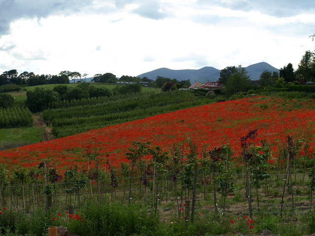
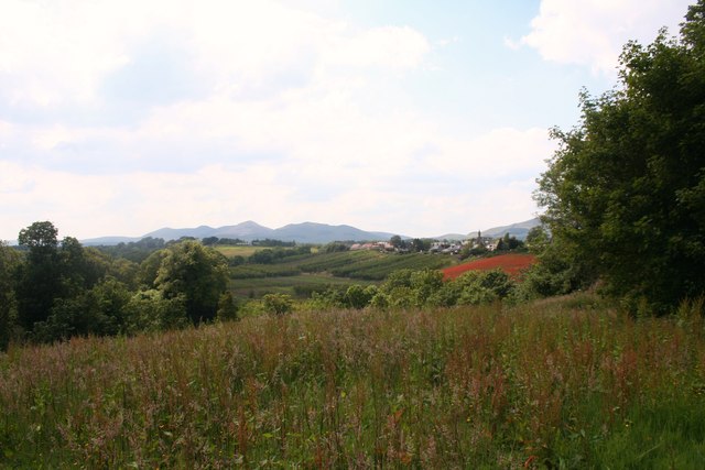
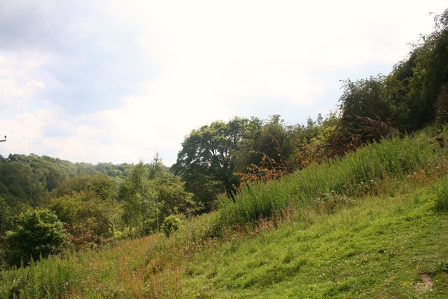
Black Wood is a picturesque forest located in the county of Midlothian, Scotland. It is nestled in the southern part of the country, near the town of Penicuik. Covering an area of approximately 400 hectares, this woodland area is known for its natural beauty and diverse wildlife.

The forest is predominantly made up of native trees, including oak, birch, and Scots pine, which create a rich and varied ecosystem. The dense canopy of trees provides shelter for an array of bird species, such as woodpeckers, owls, and songbirds. Additionally, the forest floor is home to various mammals, including red squirrels, deer, and foxes.

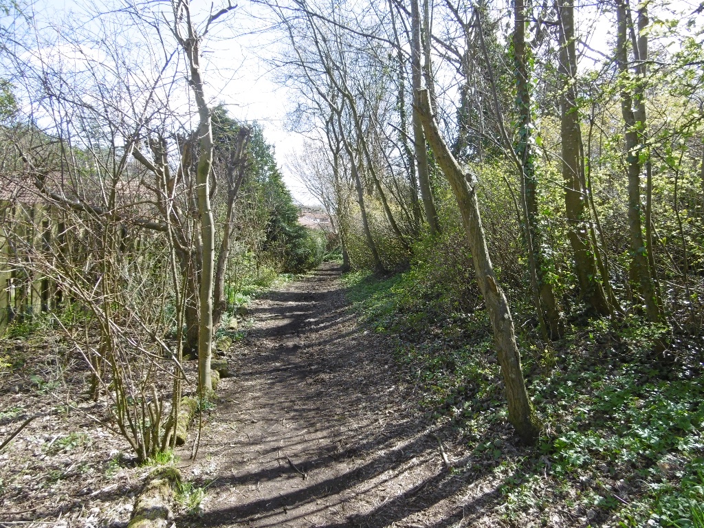
Black Wood offers a range of recreational activities for visitors to enjoy. There are well-maintained walking trails that meander through the forest, allowing visitors to explore its enchanting surroundings. These trails are suitable for all levels of fitness and offer opportunities to spot wildlife and admire the natural scenery.

For nature enthusiasts, Black Wood provides an excellent opportunity to engage in birdwatching or wildlife photography. The tranquil atmosphere and abundant flora and fauna make it an ideal location for capturing stunning images of nature.

The forest is managed by the Forestry and Land Scotland, ensuring its preservation and accessibility for future generations. Black Wood is a popular destination for locals and tourists alike, offering a serene escape from the hustle and bustle of everyday life and providing a chance to immerse oneself in the beauty of Scotland's natural landscape.

If you have any feedback on the listing, please let us know in the comments section below.
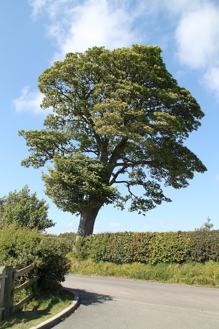
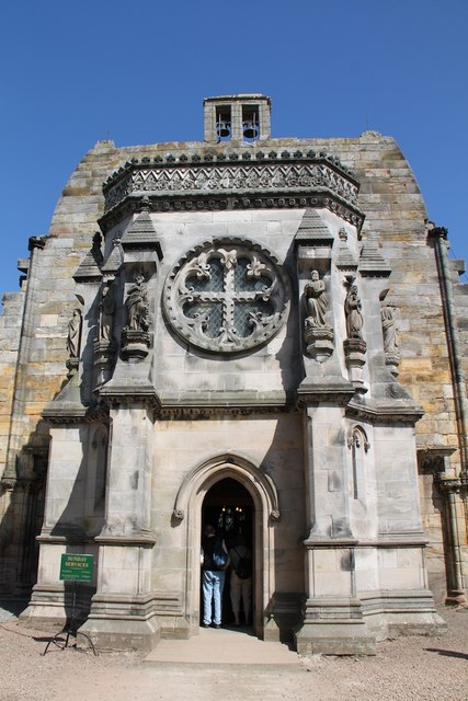
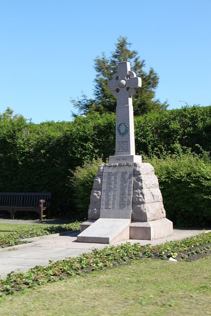
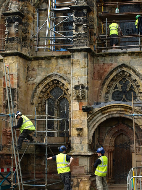
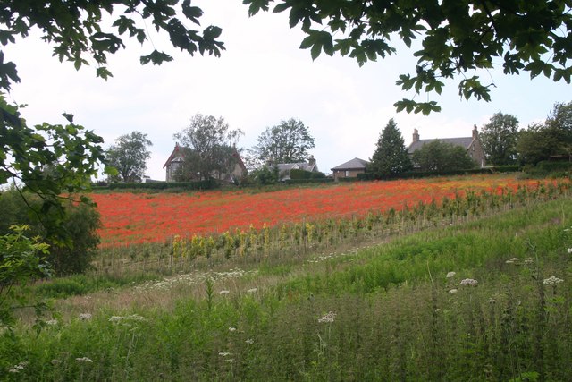
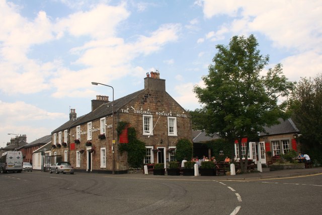
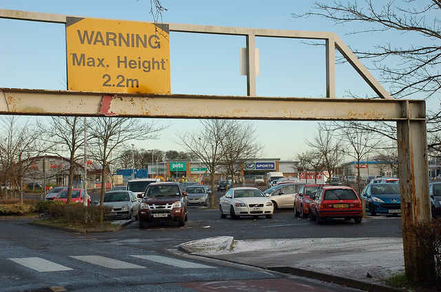
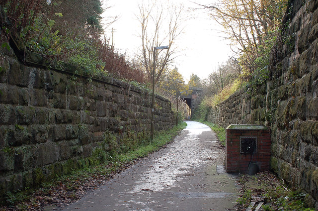
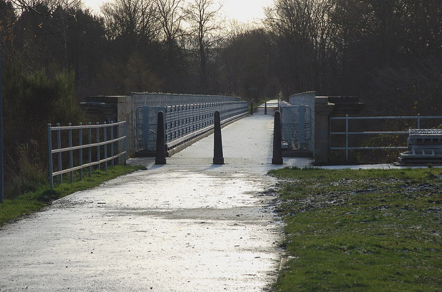
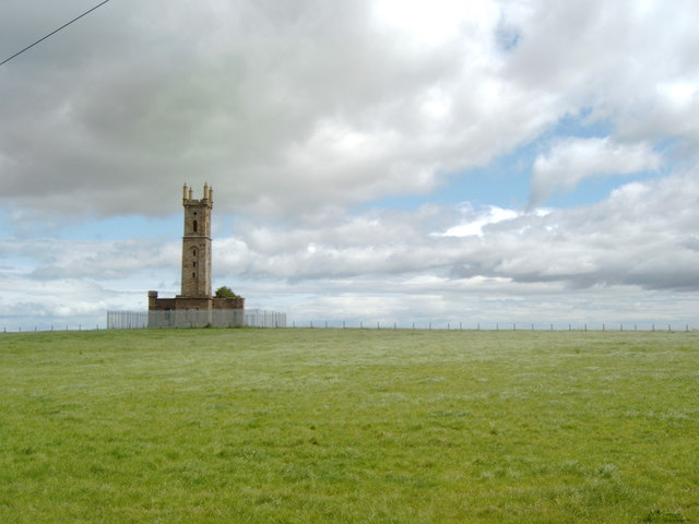
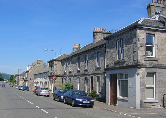
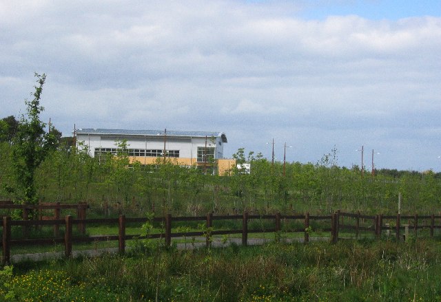
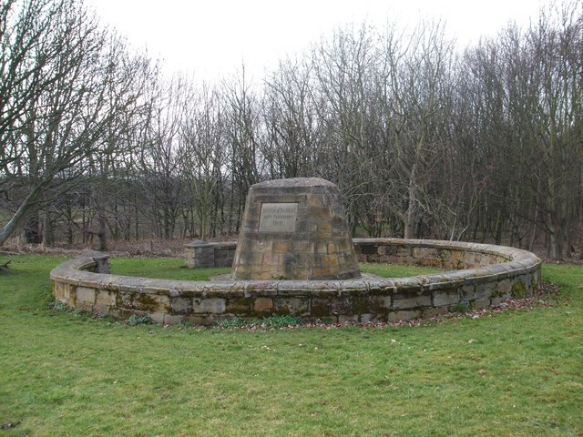
Black Wood Images

Images are sourced within 2km of 55.868244/-3.173 or Grid Reference NT2664. Thanks to Geograph Open Source API. All images are credited.

Junction of A703 with A701
Sunny Tree A beautiful tree by the car park for Roslyn Chapel
Sunny Tree
A beautiful tree by the car park for Roslyn Chapel
Roslyn Chapel The entrance to Roslyn Chapel
Roslyn Chapel
The entrance to Roslyn Chapel
Roslin Memorial War memorial in Roslin village
Roslin Memorial
War memorial in Roslin village
Men at work Stonemasons conducting restoration work at Roslyn Chapel, in their own time it appears.
Men at work
Stonemasons conducting restoration work at Roslyn Chapel, in their own time it appears.
Poppy fields Field of poppies growing near Roslyn Chapel.  Pentland Hills in the background.
Poppy fields
Field of poppies growing near Roslyn Chapel. Pentland Hills in the background.
Entrance and Car Park IKEA
Rosslyn Scaffolded Rosslyn Chapel with restoration work ongoing.
Rosslyn Scaffolded
Rosslyn Chapel with restoration work ongoing.
Pentland View Woodland by Rosslyn Chapel and a view to the Pentlands.
Pentland View
Woodland by Rosslyn Chapel and a view to the Pentlands.
Roslin Glen Woodland in Roslin Glen.
Roslin Glen
Woodland in Roslin Glen.
Roslin Poppies A poppy field by Roslin village.
Roslin Poppies
A poppy field by Roslin village.
The Original The Original Rosslyn Hotel in Roslin.
The Original
The Original Rosslyn Hotel in Roslin.
Sainsbury's at Straiton retail park One of several large stores in the area, including IKEA and a recently-opened Asda.
Sainsbury's at Straiton retail park
One of several large stores in the area, including IKEA and a recently-opened Asda.
Car park, Straiton retail park Part of the retail park on the S side of Edinburgh close to the City By-Pass.
Car park, Straiton retail park
Part of the retail park on the S side of Edinburgh close to the City By-Pass.
Retail perspective, Straiton The units at the far end of this block are being modernised.
Retail perspective, Straiton
The units at the far end of this block are being modernised.
Old railway tunnel under Loanhead The path and cycleway of the Tyne Esk Trail here passes effortlessly beneath the traffic in the centre of Loanhead.
Old railway tunnel under Loanhead
The path and cycleway of the Tyne Esk Trail here passes effortlessly beneath the traffic in the centre of Loanhead.
Old railway cutting in Loanhead Seen from the exit of the short tunnel shown in <a href="https://www.geograph.org.uk/photo/2723297">NT2865 : Old railway tunnel under Loanhead</a>. For a reciprocal view, see <a href="https://www.geograph.org.uk/photo/2173247">NT2865 : The Tyne Esk Trail goes under Loanhead</a>.
Old railway cutting in Loanhead
Seen from the exit of the short tunnel shown in NT2865 : Old railway tunnel under Loanhead. For a reciprocal view, see NT2865 : The Tyne Esk Trail goes under Loanhead.
Approaching Bilston Viaduct The viaduct carried the railways to the coal mines not far to the south and was the longest span of the latticework type bridge in Scotland, according to the plaque shown in <a href="https://www.geograph.org.uk/photo/2173442">NT2864 : Bilston Viaduct plaque</a>. It was refurbished in 1999 as part of the Tyne Esk Trail path and cycleway.
Approaching Bilston Viaduct
The viaduct carried the railways to the coal mines not far to the south and was the longest span of the latticework type bridge in Scotland, according to the plaque shown in NT2864 : Bilston Viaduct plaque. It was refurbished in 1999 as part of the Tyne Esk Trail path and cycleway.
Show me another place!

Black Wood is located at Grid Ref: NT2664 (Lat: 55.868244, Lng: -3.173)

Unitary Authority: Midlothian

Police Authority: The Lothians and Scottish Borders

What 3 Words

///unloading.plank.boil. Near Bilston, Midlothian

Related Wikis

Bilston, Midlothian

Bilston is a small village in Midlothian, Scotland. It is located on the edge of Edinburgh, just south of Loanhead on the A701. The Bilston Burn Site of...

Stewart Brewing

Stewart Brewing is an independent craft brewery based on the outskirts of Edinburgh in Loanhead, Midlothian, Scotland. It was established in 2004 by Steve...

Roslin railway station

Roslin railway station served the village of Roslin, Midlothian, Scotland, from 1874 to 1959 on the Edinburgh, Loanhead and Roslin Railway. == History... ==

Roslin, Midlothian

Roslin (formerly spelt Rosslyn or Roslyn; Scottish Gaelic: Riasg Linne) is a village in Midlothian, Scotland, 11 kilometres (7 mi) to the south of the...

BioCampus

The Biocampus is an enterprise area in Midlothian, Scotland. It is part of the larger Edinburgh Science Triangle, which includes the Edinburgh BioQuarter...

Battle of Roslin

The Battle of Roslin on 24 February 1303 was a Scottish victory in the First War of Scottish Independence. It took place near the village of Roslin, where...

Roslin Institute

The Roslin Institute is an animal sciences research institute at Easter Bush, Midlothian, Scotland, part of the University of Edinburgh, and is funded...
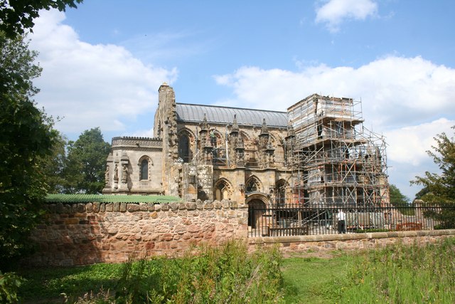
Rosslyn Chapel

Rosslyn Chapel, formerly known as the Collegiate Chapel of St Matthew, is a 15th-century chapel located in the village of Roslin, Midlothian, Scotland...

Nearby Amenities

Located within 500m of 55.868244,-3.173
Bilston
Place: village
Wikidata: Q3421561
Lat/Long: 55.8687362/-3.1798758
Traffic Calming: cushion
Lat/Long: 55.8703083/-3.1793366
Traffic Calming: cushion
Lat/Long: 55.8698659/-3.1801301
Turning Circle
Lat/Long: 55.8715918/-3.1780481
Crossing
Crossing: unmarked
Crossing Island: yes
Mapillary: 1920420501456247
Survey Date: 2020-08-13
Tactile Paving: yes
Lat/Long: 55.8711787/-3.177134
Barrier: bollard
Lat/Long: 55.8678437/-3.1805401
Bus Stop
Moorfoot View
Bench: yes
Bin: yes
Bus: yes
Naptan AdministrativeAreaCode: 130
Naptan Area Name: Midlothian
Naptan AtcoAreaCode: 628
Naptan AtcoCode: 6280325690
Naptan Bearing: NE
Naptan CommonName: Moorfoot View
Naptan Indicator: at
Naptan Landmark: B7006 roundabout
Naptan LocalityName: Bilston
Naptan NaptanCode: 64323238
Naptan NptgLocalityCode: ES000354
Naptan QualifierName: Midlothian
Naptan ShortCommonName: Moorfoot View
Naptan SourceLocalityType: Lo
Naptan StopAreaCode: 628G325690
Naptan StopAreaType: GPBS
Naptan StopArea Name: Moorfoot View
Naptan Street: A701
Naptan Verified: yes
Public Transport: platform
Shelter: yes
Source: NaPTAN + Survey
Lat/Long: 55.8688529/-3.1790417
Addr Housenumber: 4
Lat/Long: 55.8721949/-3.1698568
Addr Housenumber: 8
Lat/Long: 55.8726523/-3.1717709
Addr Housenumber: 5
Lat/Long: 55.8726716/-3.1725004
Power: pole
Lat/Long: 55.8665443/-3.1763463
Power: pole
Lat/Long: 55.8673772/-3.1774629
Power: pole
Lat/Long: 55.8645025/-3.1755585
Power: pole
Lat/Long: 55.8659737/-3.1787274
Power: pole
Lat/Long: 55.8666548/-3.1780288
Power: pole
Lat/Long: 55.8670611/-3.1735603
Power: pole
Lat/Long: 55.8665464/-3.1760386
Power: pole
Lat/Long: 55.8671033/-3.1749148
Power: pole
Lat/Long: 55.8688114/-3.1760762
Power: pole
Lat/Long: 55.8696196/-3.1758696
Power: pole
Lat/Long: 55.8659302/-3.1785859
Power: pole
Lat/Long: 55.8689168/-3.1764275
Power: pole
Lat/Long: 55.8672327/-3.1757811
Power: pole
Lat/Long: 55.8673561/-3.1765912
Power: pole
Lat/Long: 55.8677348/-3.1773628
Power: pole
Lat/Long: 55.8659919/-3.1755604
Power: pole
Lat/Long: 55.8673901/-3.177623
Power: pole
Lat/Long: 55.8695127/-3.175529
Power: pole
Lat/Long: 55.8642918/-3.1753815
Power: pole
Lat/Long: 55.8695654/-3.175706
Power: pole
Lat/Long: 55.865681/-3.1792197
Power: pole
Lat/Long: 55.8674118/-3.1763846
Power: pole
Lat/Long: 55.8703308/-3.1753029
Power: pole
Lat/Long: 55.8681733/-3.1768057
Power: pole
Lat/Long: 55.8682426/-3.1769667
Power: pole
Lat/Long: 55.8667384/-3.1781434
Power: pole
Lat/Long: 55.8680809/-3.1766467
Power: pole
Lat/Long: 55.8657397/-3.1761191
Power: pole
Lat/Long: 55.8654056/-3.1750408
Power: pole
Lat/Long: 55.8668053/-3.1783802
Power: pole
Lat/Long: 55.868871/-3.1762685
Power: pole
Lat/Long: 55.8703925/-3.1748308
Power: pole
Lat/Long: 55.8647283/-3.1758267
Power: pole
Lat/Long: 55.8703143/-3.1750883
Power: pole
Lat/Long: 55.8677745/-3.1720234
Power: pole
Lat/Long: 55.8662063/-3.178812
Power: pole
Lat/Long: 55.8704632/-3.174922
Power: pole
Lat/Long: 55.864054/-3.1751347
Power: pole
Lat/Long: 55.8675322/-3.1777821
Addr Housenumber: 1
Addr Street: Seafield Close
Lat/Long: 55.8719459/-3.177355
Addr Housenumber: 3
Addr Street: Seafield Close
Lat/Long: 55.8720041/-3.1769604
Addr Housenumber: 4
Addr Street: Seafield Close
Lat/Long: 55.8717179/-3.1771231
Post Box
Collection Times: Mo-Fr 17:00; Sa 12:00
Operator: Royal Mail
Ref: EH25 74
Lat/Long: 55.8708267/-3.1784236
Bus Stop
Moorfoot View
Bench: yes
Bin: no
Bus: yes
Lit: no
Naptan AdministrativeAreaCode: 130
Naptan Area Name: Midlothian
Naptan AtcoAreaCode: 628
Naptan AtcoCode: 6280302000
Naptan Bearing: SW
Naptan CommonName: Moorfoot View
Naptan Indicator: opp
Naptan Landmark: -
Naptan LocalityName: Bilston
Naptan NaptanCode: 64323239
Naptan NptgLocalityCode: ES000354
Naptan QualifierName: Midlothian
Naptan SourceLocalityType: Lo
Naptan StopAreaCode: 628G325690
Naptan StopAreaType: GPBS
Naptan StopArea Name: Moorfoot View
Naptan Street: A701
Naptan Verified: yes
Passenger Information Display: yes
Public Transport: platform
Shelter: yes
Source: NaPTAN + Survey
Tactile Paving: no
Lat/Long: 55.8673828/-3.1799601
Bus Stop
Seafield Road
Bench: yes
Bin: yes
Bus: yes
Lit: no
Naptan AdministrativeAreaCode: 130
Naptan Area Name: Midlothian
Naptan AtcoAreaCode: 628
Naptan AtcoCode: 6280325710
Naptan Bearing: NE
Naptan CommonName: Seafield Road
Naptan Indicator: at
Naptan Landmark: Seafield Road
Naptan LocalityName: Bilston
Naptan NaptanCode: 64323247
Naptan NptgLocalityCode: ES000354
Naptan QualifierName: Midlothian
Naptan SourceLocalityType: Lo
Naptan StopAreaCode: 628G301980
Naptan StopAreaType: GPBS
Naptan StopArea Name: Seafield Road
Naptan Street: A701
Naptan Verified: yes
Public Transport: platform
Shelter: yes
Source: NaPTAN + Survey
Tactile Paving: no
Lat/Long: 55.8716455/-3.1768694
Bus Stop
Bilston Cottages
Bus: yes
Naptan AdministrativeAreaCode: 130
Naptan Area Name: Midlothian
Naptan AtcoAreaCode: 628
Naptan AtcoCode: 6280325665
Naptan Bearing: NW
Naptan CommonName: Bilston Cottages
Naptan Indicator: opp
Naptan Landmark: A701 Roundabout
Naptan LocalityName: Bilston
Naptan NaptanCode: 64324642
Naptan NptgLocalityCode: ES000354
Naptan QualifierName: Midlothian
Naptan SourceLocalityType: Lo
Naptan StopAreaCode: 628G302020
Naptan StopAreaType: GPBS
Naptan StopArea Name: Bilston Cottages
Naptan Street: B7006
Naptan Verified: yes
Public Transport: platform
Shelter: yes
Source: NaPTAN + Survey
Lat/Long: 55.868577/-3.1773533
Bus Stop
Roslin Road
Bench: yes
Bin: no
Bus: yes
Naptan AdministrativeAreaCode: 130
Naptan Area Name: Midlothian
Naptan AtcoAreaCode: 628
Naptan AtcoCode: 6280325700
Naptan Bearing: NE
Naptan CommonName: Roslin Road
Naptan Indicator: opp
Naptan Landmark: B7006 roundabout
Naptan LocalityName: Bilston
Naptan NaptanCode: 64323245
Naptan NptgLocalityCode: ES000354
Naptan QualifierName: Midlothian
Naptan SourceLocalityType: Lo
Naptan StopAreaCode: 628G301990
Naptan StopAreaType: GPBS
Naptan StopArea Name: Roslin Road
Naptan Street: A701
Naptan Verified: yes
Public Transport: platform
Shelter: yes
Source: NaPTAN + Survey
Tactile Paving: no
Lat/Long: 55.8702121/-3.178009
Bus Stop
Bilston Cottages
Bench: yes
Bin: no
Bus: yes
Naptan AdministrativeAreaCode: 130
Naptan Area Name: Midlothian
Naptan AtcoAreaCode: 628
Naptan AtcoCode: 6280302020
Naptan Bearing: SE
Naptan CommonName: Bilston Cottages
Naptan Indicator: at
Naptan Landmark: A701 roundabout
Naptan LocalityName: Bilston
Naptan NaptanCode: 64323237
Naptan NptgLocalityCode: ES000354
Naptan QualifierName: Midlothian
Naptan SourceLocalityType: Lo
Naptan StopAreaCode: 628G302020
Naptan StopAreaType: GPBS
Naptan StopArea Name: Bilston Cottages
Naptan Street: Roslin Road
Naptan Verified: yes
Public Transport: platform
Shelter: yes
Source: NaPTAN + Survey
Lat/Long: 55.8689733/-3.1778779
Bus Stop
Seafield Road
Bench: yes
Bin: no
Bus: yes
Naptan AdministrativeAreaCode: 130
Naptan Area Name: Midlothian
Naptan AtcoAreaCode: 628
Naptan AtcoCode: 6280301980
Naptan Bearing: SW
Naptan CommonName: Seafield Road
Naptan Indicator: opp
Naptan Landmark: Seafield Road
Naptan LocalityName: Bilston
Naptan NaptanCode: 64323248
Naptan NptgLocalityCode: ES000354
Naptan QualifierName: Midlothian
Naptan SourceLocalityType: Lo
Naptan StopAreaCode: 628G301980
Naptan StopAreaType: GPBS
Naptan StopArea Name: Seafield Road
Naptan Street: A701
Naptan Verified: yes
Public Transport: platform
Shelter: yes
Source: NaPTAN + Survey
Lat/Long: 55.8712828/-3.1769503
Bus Stop
Roslin Road
Bench: yes
Bin: no
Bus: yes
Naptan AdministrativeAreaCode: 130
Naptan Area Name: Midlothian
Naptan AtcoAreaCode: 628
Naptan AtcoCode: 6280301990
Naptan Bearing: SW
Naptan CommonName: Roslin Road
Naptan Indicator: at
Naptan Landmark: B7006 roundabout
Naptan LocalityName: Bilston
Naptan NaptanCode: 64323246
Naptan NptgLocalityCode: ES000354
Naptan QualifierName: Midlothian
Naptan SourceLocalityType: Lo
Naptan StopAreaCode: 628G301990
Naptan StopAreaType: GPBS
Naptan StopArea Name: Roslin Road
Naptan Street: A701
Naptan Verified: yes
Public Transport: platform
Shelter: yes
Source: NaPTAN + Survey
Lat/Long: 55.8698378/-3.1780935
Crossing
Bicycle: no
Button Operated: yes
Crossing: traffic_signals
Crossing Island: no
Crossing Ref: pelican
Mapillary: 1075683756290869
Survey Date: 2020-08-13
Tactile Paving: yes
Lat/Long: 55.8682422/-3.1794087
Crossing
Bicycle: no
Button Operated: yes
Crossing: traffic_signals
Crossing Island: no
Crossing Ref: pelican
Mapillary: 507239610411615
Survey Date: 2020-08-13
Tactile Paving: yes
Lat/Long: 55.8695952/-3.178368
Barrier: cycle_barrier
Bicycle: yes
Cycle Barrier: double
Cycle Barrier Installation: fixed
Foot: yes
Lat/Long: 55.8722035/-3.1765348
Bilston Glen Colliery
Historic: memorial
Memorial Type: plate
Lat/Long: 55.8694813/-3.1789853
Addr Housenumber: 1
Addr Street: Allermuir Avenue
Lat/Long: 55.8674154/-3.1803864
Addr Housenumber: 1
Addr Street: Caerketton Avenue
Lat/Long: 55.8683099/-3.179672
Addr Housenumber: 1
Addr Street: Moorfoot View
Lat/Long: 55.8691519/-3.1790314
Addr Housenumber: 10
Addr Street: Caerketton Avenue
Lat/Long: 55.86834/-3.1804462
Addr Housenumber: 10
Addr Street: Moorfoot View
Lat/Long: 55.8686662/-3.1794337
Addr Housenumber: 11
Addr Street: Caerketton Avenue
Lat/Long: 55.8686469/-3.1802963
Addr Housenumber: 11
Addr Street: Meadow Place
Lat/Long: 55.8708213/-3.1786118
Addr Housenumber: 11
Addr Street: Moorfoot View
Lat/Long: 55.8685332/-3.1796136
Addr Housenumber: 11
Addr Street: Myrtle Crescent
Lat/Long: 55.8712026/-3.1788183
Addr Housenumber: 12
Addr Street: Caerketton Avenue
Lat/Long: 55.8683123/-3.1804831
Addr Housenumber: 12
Addr Street: Moorfoot View
Lat/Long: 55.868515/-3.1795361
Addr Housenumber: 13
Addr Street: Caerketton Avenue
Lat/Long: 55.868678/-3.1804605
Addr Housenumber: 13
Addr Street: Meadow Place
Lat/Long: 55.8708775/-3.1793226
Addr Housenumber: 13
Addr Street: Moorfoot View
Lat/Long: 55.8684639/-3.1795809
Addr Housenumber: 13
Addr Street: Myrtle Crescent
Lat/Long: 55.8711467/-3.1787871
Addr Housenumber: 14
Addr Street: Caerketton Avenue
Lat/Long: 55.8683804/-3.1805135
Addr Housenumber: 14
Addr Street: Moorfoot View
Lat/Long: 55.8684796/-3.1796479
Addr Housenumber: 14
Addr Street: Myrtle Crescent
Lat/Long: 55.8707527/-3.1792314
Addr Housenumber: 15
Addr Street: Caerketton Avenue
Lat/Long: 55.8687084/-3.1804011
Addr Housenumber: 15
Addr Street: Meadow Place
Lat/Long: 55.870876/-3.1793995
Addr Housenumber: 15
Addr Street: Moorfoot View
Lat/Long: 55.8680206/-3.180008
Addr Housenumber: 15
Addr Street: Myrtle Crescent
Lat/Long: 55.8711043/-3.1787635
Addr Housenumber: 16
Addr Street: Caerketton Avenue
Lat/Long: 55.868353/-3.1805671
Addr Housenumber: 16
Addr Street: Moorfoot View
Lat/Long: 55.8680008/-3.1799241
Addr Housenumber: 16
Addr Street: Myrtle Crescent
Lat/Long: 55.8706266/-3.1793167
Addr Housenumber: 17
Addr Street: Caerketton Avenue
Lat/Long: 55.8688192/-3.1806836
Addr Housenumber: 17
Addr Street: Meadow Place
Lat/Long: 55.8708741/-3.179499
Addr Housenumber: 17
Addr Street: Moorfoot View
Lat/Long: 55.8679431/-3.1800587
Addr Housenumber: 18
Addr Street: Caerketton Avenue
Lat/Long: 55.8684725/-3.180785
Addr Housenumber: 18
Addr Street: Moorfoot View
Lat/Long: 55.8679283/-3.1799961
Addr Housenumber: 18
Addr Street: Myrtle Crescent
Lat/Long: 55.8705318/-3.1793141
Addr Housenumber: 19
Addr Street: Caerketton Avenue
Lat/Long: 55.8688499/-3.1806235
Addr Housenumber: 19
Addr Street: Moorfoot View
Lat/Long: 55.8677789/-3.1801061
Addr Housenumber: 2
Addr Street: Allermuir Avenue
Lat/Long: 55.8672827/-3.1805138
Addr Housenumber: 2
Addr Street: Caerketton Avenue
Lat/Long: 55.8681839/-3.1797917
Addr Housenumber: 2
Addr Street: Moorfoot View
Lat/Long: 55.869165/-3.179087
Addr Housenumber: 20
Addr Street: Caerketton Avenue
Lat/Long: 55.8685072/-3.1807172
Addr Housenumber: 20
Addr Street: Moorfoot View
Lat/Long: 55.8677935/-3.1801682
Addr Housenumber: 20
Addr Street: Myrtle Crescent
Lat/Long: 55.8704913/-3.1793542
Addr Housenumber: 21
Addr Street: Moorfoot View
Lat/Long: 55.8675763/-3.1803666
Addr Housenumber: 22
Addr Street: Caerketton Avenue
Lat/Long: 55.8685431/-3.1807622
Addr Housenumber: 22
Addr Street: Moorfoot View
Lat/Long: 55.8675607/-3.1803004
Addr Housenumber: 22
Addr Street: Myrtle Crescent
Lat/Long: 55.8704369/-3.1794081
Addr Housenumber: 23
Addr Street: Moorfoot View
Lat/Long: 55.8671412/-3.1806161
Addr Housenumber: 24
Addr Street: Caerketton Avenue
Lat/Long: 55.8685062/-3.1808342
Addr Housenumber: 24
Addr Street: Moorfoot View
Lat/Long: 55.867159/-3.1806919
Addr Housenumber: 24
Addr Street: Myrtle Crescent
Lat/Long: 55.8703868/-3.1794577
Addr Housenumber: 25
Addr Street: Moorfoot View
Lat/Long: 55.8670997/-3.1806892
Addr Housenumber: 26
Addr Street: Myrtle Crescent
Lat/Long: 55.8703021/-3.1795726
Addr Housenumber: 28
Addr Street: Caerketton Avenue
Lat/Long: 55.8686658/-3.180952
Addr Housenumber: 28
Addr Street: Myrtle Crescent
Lat/Long: 55.8702577/-3.1796426
Addr Housenumber: 3
Addr Street: Allermuir Avenue
Lat/Long: 55.8674337/-3.1804644
Addr Housenumber: 3
Addr Street: Caerketton Avenue
Lat/Long: 55.868328/-3.1797485
Addr Housenumber: 3
Addr Street: Moorfoot View
Lat/Long: 55.8690046/-3.1791505
Addr Housenumber: 30
Addr Street: Myrtle Crescent
Lat/Long: 55.8702231/-3.1796973
Addr Housenumber: 32
Addr Street: Myrtle Crescent
Lat/Long: 55.8701687/-3.1797833
Addr Housenumber: 34
Addr Street: Myrtle Crescent
Lat/Long: 55.8701364/-3.1798343
Addr Housenumber: 36
Addr Street: Myrtle Crescent
Lat/Long: 55.8701014/-3.1798895
Addr Housenumber: 38
Addr Street: Myrtle Crescent
Lat/Long: 55.870024/-3.1800333
Addr Housenumber: 4
Addr Street: Allermuir Avenue
Lat/Long: 55.8673004/-3.1805889
Addr Housenumber: 4
Addr Street: Caerketton Avenue
Lat/Long: 55.8681995/-3.1798578
Addr Housenumber: 4
Addr Street: Moorfoot View
Lat/Long: 55.8690177/-3.1792062
Addr Housenumber: 40
Addr Street: Myrtle Crescent
Lat/Long: 55.8699901/-3.1801129
Addr Housenumber: 41
Addr Street: Myrtle Crescent
Lat/Long: 55.8696392/-3.1806116
Addr Housenumber: 42
Addr Street: Myrtle Crescent
Lat/Long: 55.8699453/-3.1802178
Addr Housenumber: 44
Addr Street: Myrtle Crescent
Lat/Long: 55.8699205/-3.1802759
Addr Housenumber: 46
Addr Street: Myrtle Crescent
Lat/Long: 55.8698914/-3.1804225
Addr Housenumber: 5
Addr Street: Allermuir Avenue
Lat/Long: 55.8676177/-3.1808734
Addr Housenumber: 5
Addr Street: Caerketton Avenue
Lat/Long: 55.868496/-3.1801635
Addr Housenumber: 5
Addr Street: Moorfoot View
Lat/Long: 55.8689039/-3.1791803
Addr Housenumber: 6
Addr Street: Caerketton Avenue
Lat/Long: 55.8682167/-3.1802506
Addr Housenumber: 6
Addr Street: Moorfoot View
Lat/Long: 55.8688578/-3.1792147
Addr Housenumber: 7
Addr Street: Allermuir Avenue
Lat/Long: 55.8676194/-3.1807794
Addr Housenumber: 7
Addr Street: Caerketton Avenue
Lat/Long: 55.8685212/-3.1801142
Addr Housenumber: 7
Addr Street: Moorfoot View
Lat/Long: 55.8687964/-3.1792607
Addr Housenumber: 8
Addr Street: Caerketton Avenue
Lat/Long: 55.8682479/-3.1802092
Addr Housenumber: 8
Addr Street: Moorfoot View
Lat/Long: 55.8687462/-3.1792983
Addr Housenumber: 9
Addr Street: Caerketton Avenue
Lat/Long: 55.8686156/-3.1803575
Addr Housenumber: 9
Addr Street: Moorfoot View
Lat/Long: 55.8686806/-3.1794947
Addr Housenumber: 9
Addr Street: Myrtle Crescent
Lat/Long: 55.8712615/-3.1788511
John Montgomery
Shop: furniture
Lat/Long: 55.870816/-3.1785447
Lady Muck
Shop: beauty
Lat/Long: 55.870771/-3.1783185
Meadow Deli & Bakery
Shop: bakery
Lat/Long: 55.8707938/-3.1784211
Tourism: picnic_site
Lat/Long: 55.8691966/-3.1800332
Traffic Calming: cushion
Lat/Long: 55.8697485/-3.1805008
Power: pole
Lat/Long: 55.8675873/-3.1724267
Power: pole
Lat/Long: 55.8673682/-3.1660125
Power: pole
Lat/Long: 55.8687046/-3.1693894
Power: pole
Lat/Long: 55.8692855/-3.1694323
Power: pole
Lat/Long: 55.8698092/-3.1695959
Power: pole
Lat/Long: 55.870518/-3.1697059
Power: pole
Lat/Long: 55.8712103/-3.1698158
Power: pole
Lat/Long: 55.8720861/-3.169966
Power: pole
Lat/Long: 55.8720756/-3.1702101
Power: pole
Lat/Long: 55.8712163/-3.1700411
Power: pole
Lat/Long: 55.8705587/-3.1699231
Power: pole
Lat/Long: 55.869892/-3.16984
Power: pole
Lat/Long: 55.8691862/-3.1696844
Power: pole
Lat/Long: 55.8685556/-3.1695879
Power: pole
Lat/Long: 55.8672478/-3.1661922
Bus Stop
Langhill Farm
Bus: yes
Naptan AdministrativeAreaCode: 130
Naptan Area Name: Midlothian
Naptan AtcoAreaCode: 628
Naptan AtcoCode: 6280302025
Naptan Bearing: SE
Naptan CommonName: Langhill Farm
Naptan Indicator: at
Naptan Landmark: -
Naptan LocalityName: Roslin
Naptan NaptanCode: 64324532
Naptan NptgLocalityCode: ES003171
Naptan QualifierName: Midlothian
Naptan SourceLocalityType: Lo
Naptan StopAreaCode: 628G302025
Naptan StopAreaType: GPBS
Naptan StopArea Name: Langhill Farm
Naptan Street: Roslin Road
Naptan Verified: yes
Public Transport: platform
Source: NaPTAN + Survey
Lat/Long: 55.8657631/-3.1727526
Bus Stop
Langhill Farm
Bus: yes
Naptan AdministrativeAreaCode: 130
Naptan Area Name: Midlothian
Naptan AtcoAreaCode: 628
Naptan AtcoCode: 6280000043
Naptan Bearing: NW
Naptan CommonName: Langhill Farm
Naptan Indicator: opp
Naptan Landmark: -
Naptan LocalityName: Roslin
Naptan NaptanCode: 64324529
Naptan NptgLocalityCode: ES003171
Naptan QualifierName: Midlothian
Naptan SourceLocalityType: Lo
Naptan StopAreaCode: 628G302025
Naptan StopAreaType: GPBS
Naptan StopArea Name: Langhill Farm
Naptan Street: Roslin Road
Naptan Verified: yes
Note: Bus Stop unmarked
Public Transport: platform
Source: NaPTAN + Survey
Lat/Long: 55.8657318/-3.1728519
The data included in this document is from www.openstreetmap.org. The data is made available under ODbL.

Have you been to Black Wood?

Leave your review of Black Wood below (or comments, questions and feedback).