Auchendinny Wood

Wood, Forest in Midlothian

Scotland

Auchendinny Wood

River North Esk at Valleyfield, Penicuik Looking upstream where the river bends on its way alongside the housing development at Valleyfield, a former mill site.
River North Esk at Valleyfield, Penicuik Credit: Jim Barton

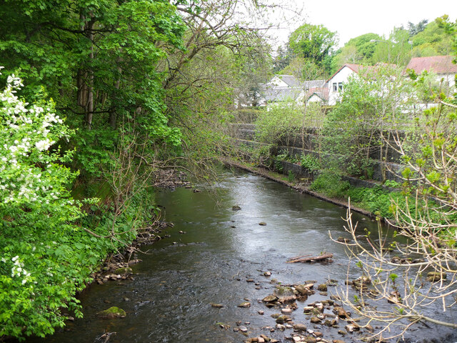
Auchendinny Wood is a picturesque woodland located in Midlothian, Scotland. Spread across an area of approximately 100 acres, this enchanting forest offers a tranquil and serene escape from the hustle and bustle of everyday life.

The wood is primarily composed of a mixture of broadleaf and coniferous trees, including oak, beech, pine, and spruce. These diverse tree species create a rich and varied habitat, supporting a wide array of flora and fauna. Walking through the forest, visitors can admire the vibrant colors of the changing leaves in autumn or enjoy the cool shade provided by the dense canopy during the summer months.

Auchendinny Wood is known for its well-maintained trails, making it a popular destination for walkers, hikers, and nature enthusiasts. The paths wind their way through the forest, offering stunning views of the surrounding countryside and glimpses of local wildlife, such as red squirrels, deer, and a variety of bird species.

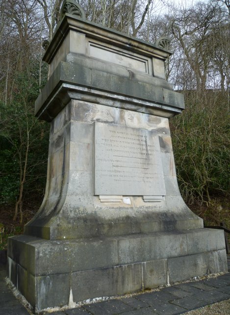
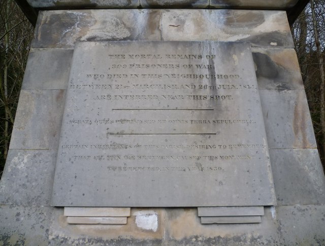
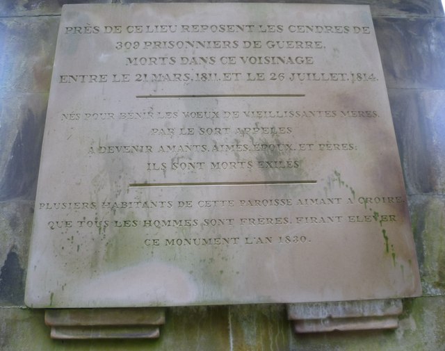
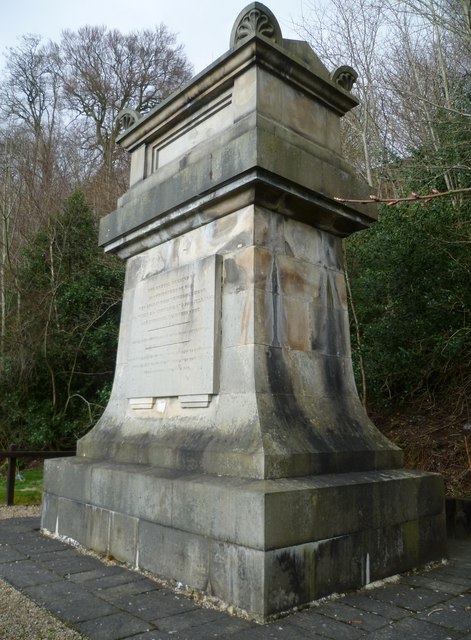
For those interested in history, Auchendinny Wood also holds cultural significance. The woodland is dotted with remnants of a former gunpowder mill, which operated here in the 19th century. These historical remnants add an intriguing element to the natural beauty of the forest.

Overall, Auchendinny Wood is a hidden gem in the heart of Midlothian, offering a peaceful and idyllic setting for outdoor activities, nature exploration, and a glimpse into the region's industrial past.

If you have any feedback on the listing, please let us know in the comments section below.

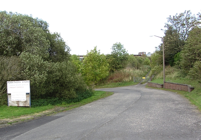
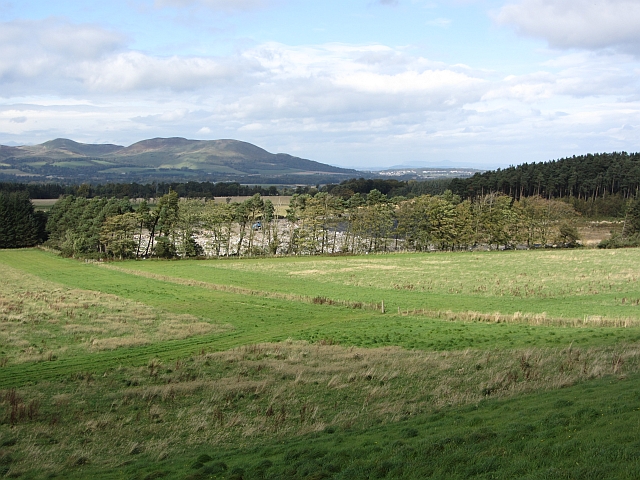
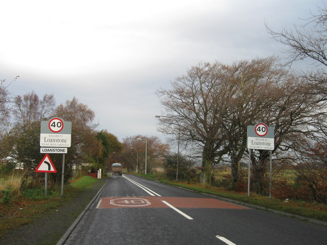
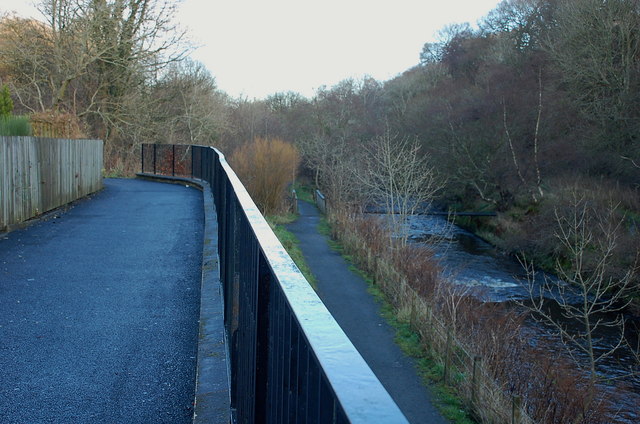
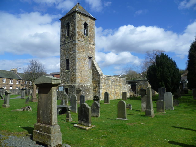
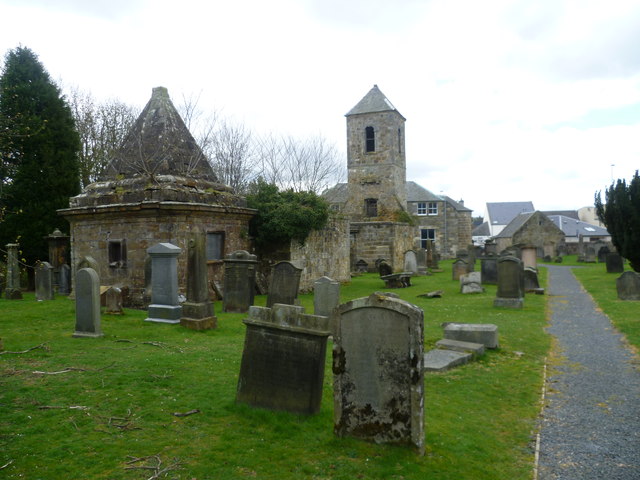
Auchendinny Wood Images

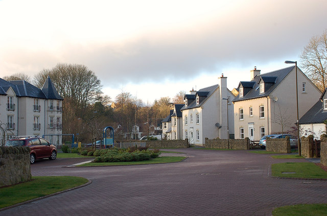
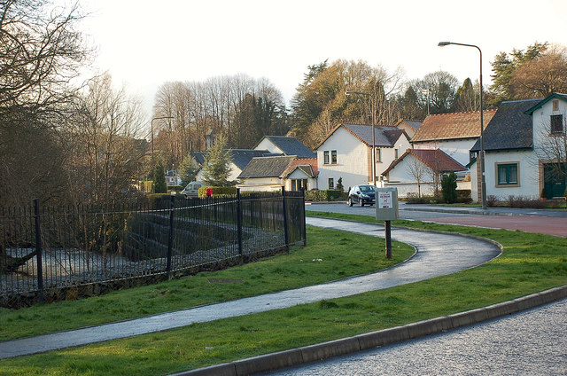
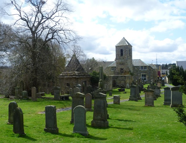
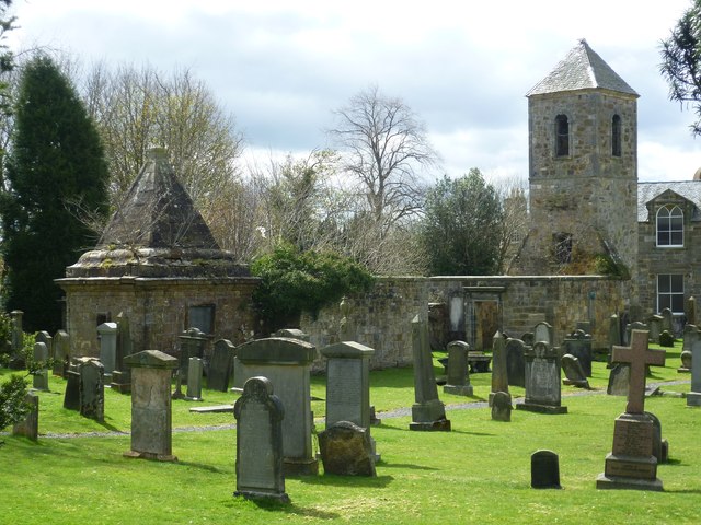
Images are sourced within 2km of 55.834167/-3.1911494 or Grid Reference NT2560. Thanks to Geograph Open Source API. All images are credited.

River North Esk at Valleyfield, Penicuik Looking upstream where the river bends on its way alongside the housing development at Valleyfield, a former mill site.
River North Esk at Valleyfield, Penicuik
Looking upstream where the river bends on its way alongside the housing development at Valleyfield, a former mill site.
Communication/TV masts near Howgate Doubled in number since Richard Webb's visit 5 years ago - <a href="https://www.geograph.org.uk/photo/108169">NT2559 : TV transmitter</a>.
Communication/TV masts near Howgate
Doubled in number since Richard Webb's visit 5 years ago - NT2559 : TV transmitter.
Sheep and pasture near Loanstone With the NE end of the Pentland Hills in the distance, about 7km away. The power supply going to ground here no doubt supplies the two communication masts that are just out of view to the right <a href="https://www.geograph.org.uk/photo/2320834">NT2559 : Communication/TV masts near Howgate</a>.
Sheep and pasture near Loanstone
With the NE end of the Pentland Hills in the distance, about 7km away. The power supply going to ground here no doubt supplies the two communication masts that are just out of view to the right NT2559 : Communication/TV masts near Howgate.
Farmland and plantation near Fallhills Rough and improved grassland on part of what might be part of Drummond Moor.
Farmland and plantation near Fallhills
Rough and improved grassland on part of what might be part of Drummond Moor.
French PoWs Memorial at Valleyfield A substantial monument built in 1830 to mark and commemorate the burial place of 309 French prisoners of war who died in captivity at Penicuik between 1811 and 1814. It was paid for by Alexander Cowan, owner of the Valleyfield Mill which was used as one of the 'prisoner depots' of the Napoleonic Wars and stood near the spot where the monument stands. A local watchmaker contributed five shillings, allowing the inscription to state that it had been erected by "certain inhabitants of this parish". Cowan was responsible for the inscribed sentiment that enjoins us to "Remember That All Men Are Brethren".

<a href="https://www.geograph.org.uk/photo/2326591">NT2359 : French PoWs Memorial at Valleyfield</a>
French PoWs Memorial at Valleyfield
A substantial monument built in 1830 to mark and commemorate the burial place of 309 French prisoners of war who died in captivity at Penicuik between 1811 and 1814. It was paid for by Alexander Cowan, owner of the Valleyfield Mill which was used as one of the 'prisoner depots' of the Napoleonic Wars and stood near the spot where the monument stands. A local watchmaker contributed five shillings, allowing the inscription to state that it had been erected by "certain inhabitants of this parish". Cowan was responsible for the inscribed sentiment that enjoins us to "Remember That All Men Are Brethren". NT2359 : French PoWs Memorial at Valleyfield
French PoWs Memorial - English inscription The Latin sentence is a quotation of the Roman poet Sannazarius, suggested by Sir Walter Scott:
"Pleasing it is to lie at rest in one's own country, but all the world is a tomb."
French PoWs Memorial - English inscription
The Latin sentence is a quotation of the Roman poet Sannazarius, suggested by Sir Walter Scott: "Pleasing it is to lie at rest in one's own country, but all the world is a tomb."
French PoWs Memorial - French inscription The French poet, Alphonse de Lamartine, contributed the lines:

"Born to bless the marriage vows of mothers growing old.
Called away by Fate,
To become lovers, loved, spouses and fathers,
They died in exile."
French PoWs Memorial - French inscription
The French poet, Alphonse de Lamartine, contributed the lines: "Born to bless the marriage vows of mothers growing old. Called away by Fate, To become lovers, loved, spouses and fathers, They died in exile."
French PoWs Memorial at Valleyfield "The uniform quiet of a country parish was, in the case of Penicuik, interrupted about the year 1810, by its extensive paper manufactories being turned by Government into depôts for prisoners of war, and the peaceful cottages attached to them into barracks for the military necessarily required. The paper-mills of Valleyfield were on that occasion fitted up for the reception of 6000 prisoners, whilst those of Eskmills, then used as a cotton manufactory, accommodated 1500 British soldiers. This occurrence could not fail to produce results very unfavourable to the social and religious well-being of the parishioners. The peaceful artisan gave place to the soldier; and the din of a camp, with its attendant irregularities, prevailed where formerly nothing had interrupted the orderly occupations and Sabbath solemnities of a Scottish village. This circumstance gave, however, unusual life and activity to the place, and enriched some of its inhabitants; but it may be doubted, if it proved in any way advantageous to their moral habits and religious feelings; nor perhaps, have the unfavourable effects then produced on these latter, even now quite disappeared. On the close of the war, however, in the year 1814, the mills happily returned to their former proprietors and purposes,—an event which was hailed by the inhabitants with a general illumination, and other demonstrations of their heartfelt joy. The only memory which now remains of the residence of so many warlike strangers, is a very chaste and appropriate monument erected by the proprietor of Valleyfield mill, over the remains of upwards of 300 prisoners of war, who were interred in a beautiful spot amidst his grounds. The design was furnished by Hamilton, and bears, after recording the purpose for which it was erected, the following line from the elegant but little known Sanazarius suggested by Sir Walter Scott: 'Grata quies patriæ, sed, et omnis terra sepulchrum.' Underneath is this simple addition, 'Certain inhabitants of this parish, desiring to remember that all men are brethren, caused this monument to be erected.' "
-- New Statistical Account, 1845

<a href="https://www.geograph.org.uk/photo/2326580">NT2359 : French PoWs Memorial at Valleyfield</a>
French PoWs Memorial at Valleyfield
"The uniform quiet of a country parish was, in the case of Penicuik, interrupted about the year 1810, by its extensive paper manufactories being turned by Government into depôts for prisoners of war, and the peaceful cottages attached to them into barracks for the military necessarily required. The paper-mills of Valleyfield were on that occasion fitted up for the reception of 6000 prisoners, whilst those of Eskmills, then used as a cotton manufactory, accommodated 1500 British soldiers. This occurrence could not fail to produce results very unfavourable to the social and religious well-being of the parishioners. The peaceful artisan gave place to the soldier; and the din of a camp, with its attendant irregularities, prevailed where formerly nothing had interrupted the orderly occupations and Sabbath solemnities of a Scottish village. This circumstance gave, however, unusual life and activity to the place, and enriched some of its inhabitants; but it may be doubted, if it proved in any way advantageous to their moral habits and religious feelings; nor perhaps, have the unfavourable effects then produced on these latter, even now quite disappeared. On the close of the war, however, in the year 1814, the mills happily returned to their former proprietors and purposes,—an event which was hailed by the inhabitants with a general illumination, and other demonstrations of their heartfelt joy. The only memory which now remains of the residence of so many warlike strangers, is a very chaste and appropriate monument erected by the proprietor of Valleyfield mill, over the remains of upwards of 300 prisoners of war, who were interred in a beautiful spot amidst his grounds. The design was furnished by Hamilton, and bears, after recording the purpose for which it was erected, the following line from the elegant but little known Sanazarius suggested by Sir Walter Scott: 'Grata quies patriæ, sed, et omnis terra sepulchrum.' Underneath is this simple addition, 'Certain inhabitants of this parish, desiring to remember that all men are brethren, caused this monument to be erected.' " -- New Statistical Account, 1845 NT2359 : French PoWs Memorial at Valleyfield
Pomathorn Store Industrial site next to where the Peebles Railway once ran.
Pomathorn Store
Industrial site next to where the Peebles Railway once ran.
Landfill, Drummond Moor Beyond grass fields is a lined pit, now being filled with rubbish.
Landfill, Drummond Moor
Beyond grass fields is a lined pit, now being filled with rubbish.
Entrance to Loanstone
Paths by the North Esk, Valleyfield The path and cycleway on the old Penicuik railway line has almost reached the terminus at Valleyfield, site of the old Penicuik station - see <span class="nowrap"><a title="http://www.disused-stations.org.uk/p/penicuik/index.shtml" rel="nofollow ugc noopener" href="http://www.disused-stations.org.uk/p/penicuik/index.shtml">Link</a><img style="margin-left:2px;" alt="External link" title="External link - shift click to open in new window" src="https://s1.geograph.org.uk/img/external.png" width="10" height="10"/></span> for much more detail of its history. 

The path to the right keeps closer to the North Esk, rejoining the railway route near the new housing development at Eskmill.
Paths by the North Esk, Valleyfield
The path and cycleway on the old Penicuik railway line has almost reached the terminus at Valleyfield, site of the old Penicuik station - see LinkExternal link for much more detail of its history. The path to the right keeps closer to the North Esk, rejoining the railway route near the new housing development at Eskmill.
Houses at Valleyfield, Penicuik Part of a recent development on the site of a former paper mill and the Penicuik railway station opened in 1872, closed in 1951 - see <span class="nowrap"><a title="http://www.disused-stations.org.uk/p/penicuik/index.shtml" rel="nofollow ugc noopener" href="http://www.disused-stations.org.uk/p/penicuik/index.shtml">Link</a><img style="margin-left:2px;" alt="External link" title="External link - shift click to open in new window" src="https://s1.geograph.org.uk/img/external.png" width="10" height="10"/></span> for more details.
Houses at Valleyfield, Penicuik
Part of a recent development on the site of a former paper mill and the Penicuik railway station opened in 1872, closed in 1951 - see LinkExternal link for more details.
Houses and the North Esk at Valleyfield, Penicuik Part of a housing development at Valleyfield, where once stood Penicuik's first paper mill, opened in 1779, and the Penicuik railway station, terminus of the line from Edinburgh Waverley - see <span class="nowrap"><a title="http://www.disused-stations.org.uk/p/penicuik/index.shtml" rel="nofollow ugc noopener" href="http://www.disused-stations.org.uk/p/penicuik/index.shtml">Link</a><img style="margin-left:2px;" alt="External link" title="External link - shift click to open in new window" src="https://s1.geograph.org.uk/img/external.png" width="10" height="10"/></span> for more background to the station and the line.
Houses and the North Esk at Valleyfield, Penicuik
Part of a housing development at Valleyfield, where once stood Penicuik's first paper mill, opened in 1779, and the Penicuik railway station, terminus of the line from Edinburgh Waverley - see LinkExternal link for more background to the station and the line.
Kirkyard of St. Mungo's Parish Church When Sir John Sinclair carried out his survey of Scotland's 938 parishes in the 1790s, he received many detailed descriptions from his respondents, but probably none expressed a universal truth more profoundly than the laconic minister of Penicuik, Thomas McCourty, who wrote,

"The people are of various sizes. They are like those of other parishes,
many of them good, and some of them bad."
Kirkyard of St. Mungo's Parish Church
When Sir John Sinclair carried out his survey of Scotland's 938 parishes in the 1790s, he received many detailed descriptions from his respondents, but probably none expressed a universal truth more profoundly than the laconic minister of Penicuik, Thomas McCourty, who wrote, "The people are of various sizes. They are like those of other parishes, many of them good, and some of them bad."
St. Mungo's Parish Church ruin The 18th-century ruin in the kirkyard stands behind the later Georgian church and appears in the official listing under the older name of St. Kentigern's.
St. Mungo's Parish Church ruin
The 18th-century ruin in the kirkyard stands behind the later Georgian church and appears in the official listing under the older name of St. Kentigern's.
Old St. Mungo's Parish Church <span class="nowrap"><a title="http://www.stmungos.freeuk.com/history.htm" rel="nofollow ugc noopener" href="http://www.stmungos.freeuk.com/history.htm">Link</a><img style="margin-left:2px;" alt="External link" title="External link - shift click to open in new window" src="https://s1.geograph.org.uk/img/external.png" width="10" height="10"/></span>
Old St. Mungo's Parish Church
Show me another place!

Auchendinny Wood is located at Grid Ref: NT2560 (Lat: 55.834167, Lng: -3.1911494)

Unitary Authority: Midlothian

Police Authority: The Lothians and Scottish Borders

What 3 Words

///opposing.innovator.outbid. Near Penicuik, Midlothian

Related Wikis

Woodhouselee

Woodhouselee is an estate in Midlothian in the parish of Glencorse. It has been owned by gentry including William Tytler and Alexander Fraser Tytler....

Oldwoodhouselee Castle

Old Woodhouselee Castle was a 16th-century tower house, about 1.5 miles (2.4 km) north east of Penicuik, Midlothian, Scotland, south of the river North...

Rosslynlee Hospital Halt railway station

Rosslynlee Hospital Halt railway station that served Rosslynlee Hospital, Midlothian, Scotland from 1958 to 1962 on the Peebles Railway. == History... ==

Esk Bridge railway station

Esk Bridge railway station served the settlement of Esk Bridge, Midlothian, Scotland from 1874 to 1930 on the Penicuik Railway. == History == The station...

Nearby Amenities

Located within 500m of 55.834167,-3.1911494
Power: pole
Lat/Long: 55.8359218/-3.1878696
Power: pole
Lat/Long: 55.8335343/-3.1949347
Power: pole
Lat/Long: 55.8324001/-3.1906269
Power: pole
Lat/Long: 55.8372412/-3.1864723
Power: pole
Lat/Long: 55.8318887/-3.1973265
Power: pole
Lat/Long: 55.8372413/-3.1862227
Power: pole
Lat/Long: 55.8319994/-3.1921558
Power: pole
Lat/Long: 55.8349428/-3.1904821
Power: pole
Lat/Long: 55.8308545/-3.1959967
Power: pole
Lat/Long: 55.8339997/-3.1936472
Power: pole
Lat/Long: 55.8330643/-3.1961765
Power: pole
Lat/Long: 55.8326983/-3.1894521
Power: pole
Lat/Long: 55.8360377/-3.1880414
Power: pole
Lat/Long: 55.8339667/-3.1845225
Power: pole
Lat/Long: 55.8355663/-3.1893235
Power: pole
Lat/Long: 55.8337016/-3.1855253
Power: pole
Lat/Long: 55.831662/-3.1935022
Power: pole
Lat/Long: 55.8354458/-3.1891517
Power: pole
Lat/Long: 55.831936/-3.1975981
Power: pole
Lat/Long: 55.8330478/-3.1881056
Power: pole
Lat/Long: 55.8322856/-3.1968496
Power: pole
Lat/Long: 55.8343463/-3.1921879
Power: pole
Lat/Long: 55.8347423/-3.191598
Power: pole
Lat/Long: 55.8323578/-3.1970321
Power: pole
Lat/Long: 55.834466/-3.1923564
Power: pole
Lat/Long: 55.8363865/-3.1865601
Power: pole
Lat/Long: 55.8329281/-3.1960337
Power: pole
Lat/Long: 55.8334041/-3.194757
Power: pole
Lat/Long: 55.8313102/-3.1948052
Power: pole
Lat/Long: 55.8338831/-3.1934856
Power: pole
Lat/Long: 55.8333943/-3.1867645
Power: pole
Lat/Long: 55.8364896/-3.1867727
Power: pole
Lat/Long: 55.8350866/-3.1906532
Power: pole
Lat/Long: 55.8321834/-3.1873162
Power: pole
Lat/Long: 55.8322959/-3.186889
Power: pole
Lat/Long: 55.8326817/-3.1861234
Power: pole
Lat/Long: 55.8326953/-3.1863182
Power: pole
Lat/Long: 55.8331364/-3.1850635
Power: pole
Lat/Long: 55.8332229/-3.1852393
Power: pole
Lat/Long: 55.8337427/-3.1843323
Power: pole
Lat/Long: 55.8338499/-3.184528
Power: pole
Lat/Long: 55.8343462/-3.1835717
Power: pole
Lat/Long: 55.8344551/-3.1837653
Power: pole
Lat/Long: 55.8299686/-3.1920701
Power: pole
Lat/Long: 55.8303362/-3.1910992
Power: pole
Lat/Long: 55.8307339/-3.1900585
Power: pole
Lat/Long: 55.8310322/-3.1892109
Power: pole
Lat/Long: 55.8314781/-3.1883633
Power: pole
Lat/Long: 55.8299957/-3.192443
Power: pole
Lat/Long: 55.8304296/-3.1913164
Power: pole
Lat/Long: 55.8308363/-3.1901792
Power: pole
Lat/Long: 55.8311361/-3.1893718
Power: pole
Lat/Long: 55.8316889/-3.1883258
Ford: yes
Lat/Long: 55.8360964/-3.1955731
The data included in this document is from www.openstreetmap.org. The data is made available under ODbL.

Have you been to Auchendinny Wood?

Leave your review of Auchendinny Wood below (or comments, questions and feedback).