The Grove

Wood, Forest in Peeblesshire

Scotland

The Grove

Woodland, Portmore Estate Morning sunlight in the woods west of the loch.
Woodland, Portmore Estate Credit: Jim Barton

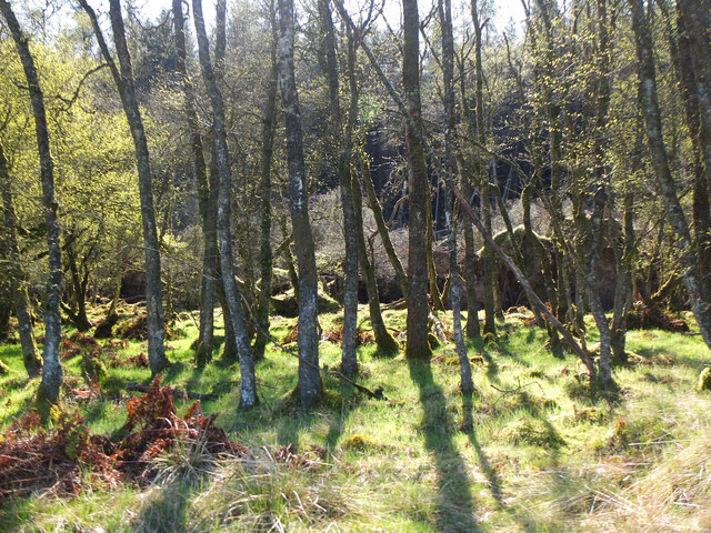
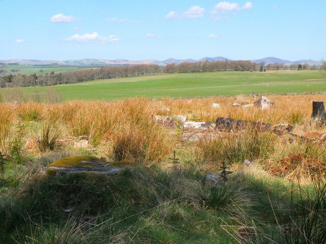
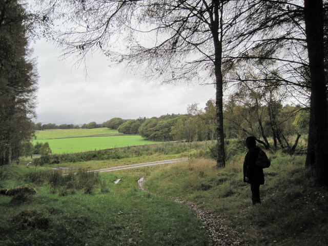
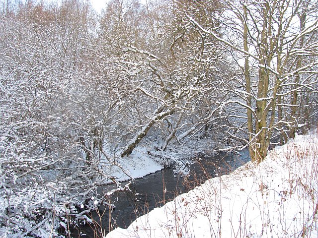
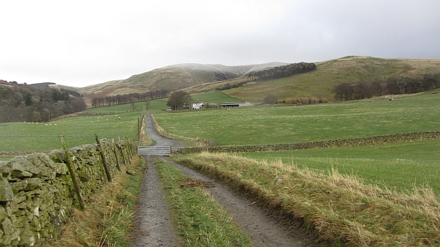
The Grove is a stunning woodland area located in Peeblesshire, Scotland. Stretching across a vast expanse, it is renowned for its picturesque beauty and tranquil atmosphere. The Grove is nestled amidst the breathtaking landscape of the Scottish Borders, with rolling hills and lush greenery surrounding the area.

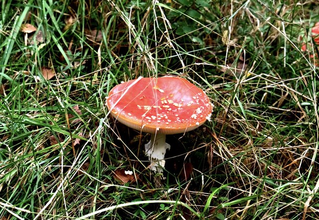
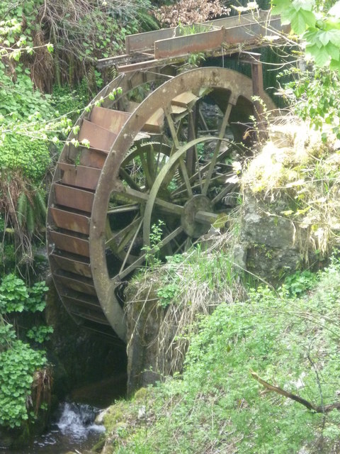
This woodland paradise is home to a diverse range of tree species, including oak, beech, and birch. The dense foliage creates a captivating canopy that provides shade and shelter for an abundance of wildlife. Visitors can expect to encounter a variety of animals such as deer, foxes, and a myriad of bird species.

The Grove is a haven for nature lovers and outdoor enthusiasts alike. It offers an extensive network of walking trails, allowing visitors to explore the woods at their own pace. These trails cater to different levels of difficulty, catering to both casual strollers and avid hikers. The forest also boasts a number of picnic areas, providing the perfect opportunity for visitors to relax and enjoy a meal amidst the serenity of nature.

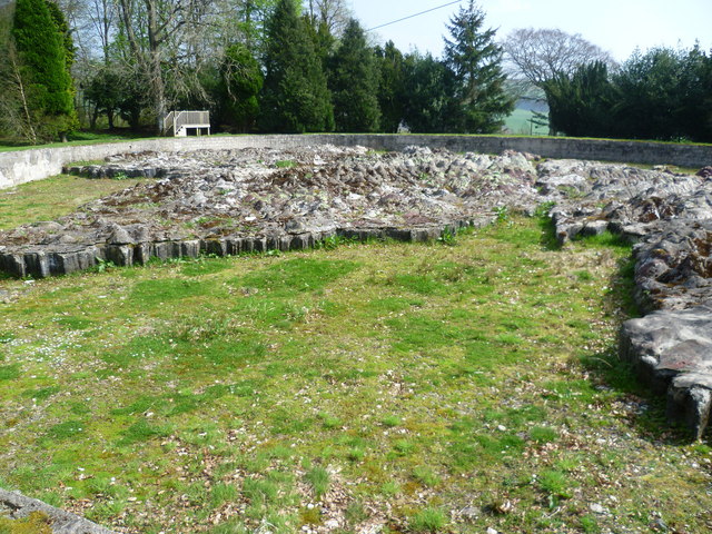
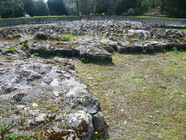
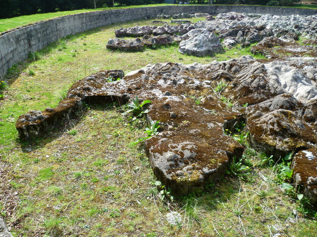
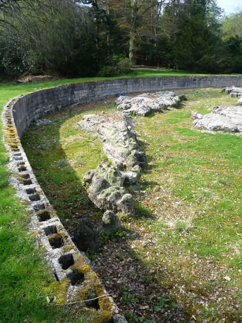
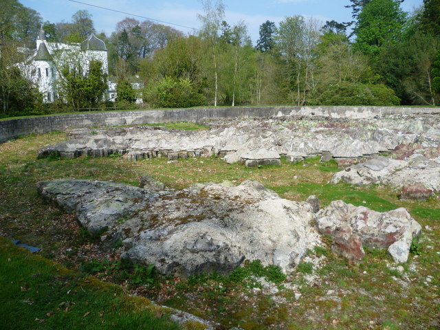
In addition to its natural beauty, The Grove also holds historical significance. It is believed to have been a popular hunting ground for ancient Scottish kings, and remnants of their activities can still be seen today. The area is dotted with archaeological sites, including ancient stone circles and burial mounds, offering a glimpse into its rich past.

Overall, The Grove is a sanctuary of natural beauty, offering visitors the chance to immerse themselves in the splendor of Peeblesshire's woodlands. Whether it's a leisurely stroll, a picnic, or a quest for historical discovery, The Grove is a must-visit destination for all nature enthusiasts.

If you have any feedback on the listing, please let us know in the comments section below.

The Grove Images

Images are sourced within 2km of 55.721429/-3.1961364 or Grid Reference NT2448. Thanks to Geograph Open Source API. All images are credited.

Woodland, Portmore Estate Morning sunlight in the woods west of the loch.
Woodland, Portmore Estate
Morning sunlight in the woods west of the loch.
Felled area, Portmore Estate A clearing by the track west of the loch. The Pentland Hills make up the skyline.
Felled area, Portmore Estate
A clearing by the track west of the loch. The Pentland Hills make up the skyline.
Peeblesshire Fungi (2) Portmore Estate
Peeblesshire Fungi (2)
Portmore Estate
Path and track junction, Portmore Estate The path from Northshield Rings meets the estate track heading south past Portmore House.
Path and track junction, Portmore Estate
The path from Northshield Rings meets the estate track heading south past Portmore House.
Forestry, Portmore Thinning work (suspended for the weekend) letting in light in a spruce plantation. Much of the woodland here is deciduous however.
Forestry, Portmore
Thinning work (suspended for the weekend) letting in light in a spruce plantation. Much of the woodland here is deciduous however.
Eddleston Water
Eddleston Water
Barony Castle Hotel, Eddleston
Waterwheel on the Dean Burn
Old waterwheel at Barony Castle
Barony Castle map of Scotland, Eddleston When I heard that a topographical map of Scotland, carved in stone by Polish army veterans, existed in the grounds of the Barony Castle Hotel, I expected to find something the size of a dining table. I was taken aback on discovering the scale of this massive sculpture which is in fact made of moulded concrete. The viewing platform cannot do it justice until it is raised by another thirty feet at least to gain a good overview of the whole. Those who want the bird's eye view can find it on GoogleEarth at NT 23656 47179. Ground-level photographs fail to deliver the overall visual impact of the map on the beholder. This one is taken standing east of Caithness, looking south across the Moray Firth. For more about this remarkablea artefact, see <span class="nowrap"><a title="http://www.mapascotland.org/" rel="nofollow ugc noopener" href="http://www.mapascotland.org/">Link</a><img style="margin-left:2px;" alt="External link" title="External link - shift click to open in new window" src="https://s1.geograph.org.uk/img/external.png" width="10" height="10"/></span>
Barony Castle map of Scotland, Eddleston
When I heard that a topographical map of Scotland, carved in stone by Polish army veterans, existed in the grounds of the Barony Castle Hotel, I expected to find something the size of a dining table. I was taken aback on discovering the scale of this massive sculpture which is in fact made of moulded concrete. The viewing platform cannot do it justice until it is raised by another thirty feet at least to gain a good overview of the whole. Those who want the bird's eye view can find it on GoogleEarth at NT 23656 47179. Ground-level photographs fail to deliver the overall visual impact of the map on the beholder. This one is taken standing east of Caithness, looking south across the Moray Firth. For more about this remarkablea artefact, see LinkExternal link
Barony Castle map of Scotland, Forth Estuary and Fife For an explanation of the map, see <span class="nowrap"><a title="https://en.wikipedia.org/wiki/Great_Polish_Map_of_Scotland" rel="nofollow ugc noopener" href="https://en.wikipedia.org/wiki/Great_Polish_Map_of_Scotland">Link</a><img style="margin-left:2px;" alt="External link" title="External link - shift click to open in new window" src="https://s1.geograph.org.uk/img/external.png" width="10" height="10"/></span>
Barony Castle map of Scotland, Forth Estuary and Fife
For an explanation of the map, see LinkExternal link
Barony Castle map of Scotland, Galloway
Barony Castle map of Scotland, Outer Hebrides
Barony Castle map of Scotland, Isle of Lewis
Row of Cottages at Harcus North of Eddleston in Peeblesshire.
Row of Cottages at Harcus
North of Eddleston in Peeblesshire.
The church, Eddleston Looking over what looks like the site of a demolished house towards the church.
The church, Eddleston
Looking over what looks like the site of a demolished house towards the church.
Boreland An untarred farm road soon joins the tarred main access for the farm. There is a dusting on Dundreich in the background.
Boreland
An untarred farm road soon joins the tarred main access for the farm. There is a dusting on Dundreich in the background.
Show me another place!

The Grove is located at Grid Ref: NT2448 (Lat: 55.721429, Lng: -3.1961364)

Unitary Authority: The Scottish Borders

Police Authority: The Lothians and Scottish Borders

What 3 Words

///sprouting.confused.wades. Near Peebles, Scottish Borders

Nearby Locations

The Grove Darnhall Mains

Related Wikis

Darnhall Mains

Darnhall Mains is a farm and settlement off the A703, near Eddleston and the Eddleston Water in the Scottish Borders area of Scotland, in the former Peeblesshire...

Eddleston

Eddleston (Scottish Gaelic: Baile Ghille Mhoire) is a small village and civil parish in the Scottish Borders area of Scotland. It lies 4 miles (6.4 km...

Northshield Rings

Northshield Rings is a prehistoric site, a hillfort near the village of Eddleston and about 6 miles (10 km) north of Peebles, in the Scottish Borders,...

Eddleston railway station

Eddleston railway station served the village of Eddleston, Scottish Borders, Scotland from 1855 to 1962 on the Peebles Railway. == History == The station...
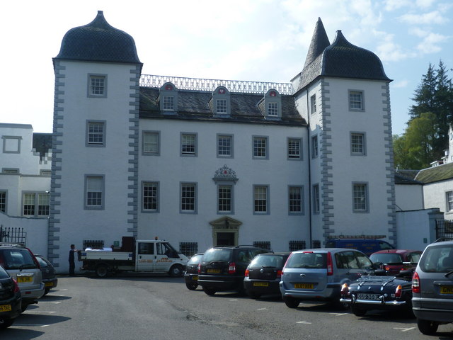
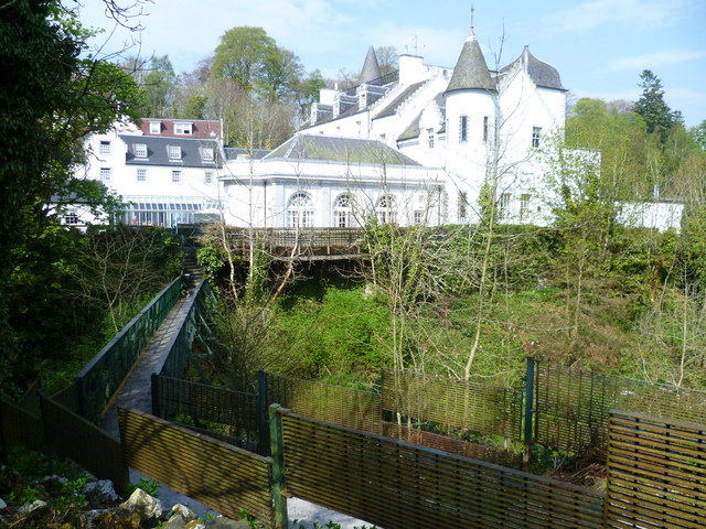
Black Barony

Barony Castle, also and formerly known as Black Barony, and Darnhall, is a historic house at Eddleston in the Scottish Borders area of Scotland. The house...

Great Polish Map of Scotland

The Great Polish Map of Scotland is a large (50 m x 40 m) three-dimensional, outdoor concrete scale model of Scotland, located in the grounds of the Barony...

Milkieston Rings

Milkieston Rings is a prehistoric site, a hillfort near the village of Eddleston and about 3 miles (5 km) north of Peebles, in the Scottish Borders, Scotland...

Earlyvale Gate railway station

Earlyvale Gate railway station served the Dundas family residence in Earlyvale, Scottish Borders, Scotland for 8 months (June 1856 - February 1857) on...

Nearby Amenities

Located within 500m of 55.721429,-3.1961364
Power: pole
Lat/Long: 55.7216367/-3.203135
Power: pole
Lat/Long: 55.7216841/-3.2020523
Power: pole
Lat/Long: 55.7219777/-3.2012113
Power: pole
Lat/Long: 55.7223981/-3.1991762
Power: pole
Lat/Long: 55.7226041/-3.1978286
Power: pole
Lat/Long: 55.7229605/-3.1969982
Power: pole
Lat/Long: 55.7233263/-3.196113
Power: pole
Lat/Long: 55.7234673/-3.1950724
Power: pole
Lat/Long: 55.7257453/-3.1970991
Power: pole
Lat/Long: 55.7241054/-3.1956106
Power: pole
Lat/Long: 55.722758/-3.1945005
Power: pole
Lat/Long: 55.7221612/-3.193813
Power: pole
Lat/Long: 55.721388/-3.1929742
Power: pole
Lat/Long: 55.7201471/-3.1916161
Power: pole
Lat/Long: 55.7193762/-3.191183
Power: pole
Lat/Long: 55.718957/-3.1909349
Power: pole
Lat/Long: 55.7183104/-3.1905922
Power: pole
Lat/Long: 55.7199055/-3.1896861
Power: pole
Lat/Long: 55.7204988/-3.1902327
The data included in this document is from www.openstreetmap.org. The data is made available under ODbL.

Have you been to The Grove?

Leave your review of The Grove below (or comments, questions and feedback).