White Haugh Plantation
Wood, Forest in Dumfriesshire
Scotland
White Haugh Plantation
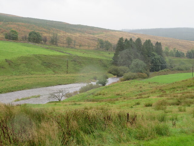
White Haugh Plantation is a picturesque woodland located in Dumfriesshire, Scotland. Situated near the charming village of Wanlockhead, the plantation covers an area of approximately 200 acres and is surrounded by stunning natural beauty.
The plantation is primarily composed of a mix of deciduous and coniferous trees, creating a diverse and vibrant ecosystem. Tall, majestic Scots pines dominate the landscape, interspersed with oak, beech, and birch trees. The rich variety of flora and fauna in the area makes it an ideal habitat for various wildlife species, including red squirrels, roe deer, and a wide range of bird species.
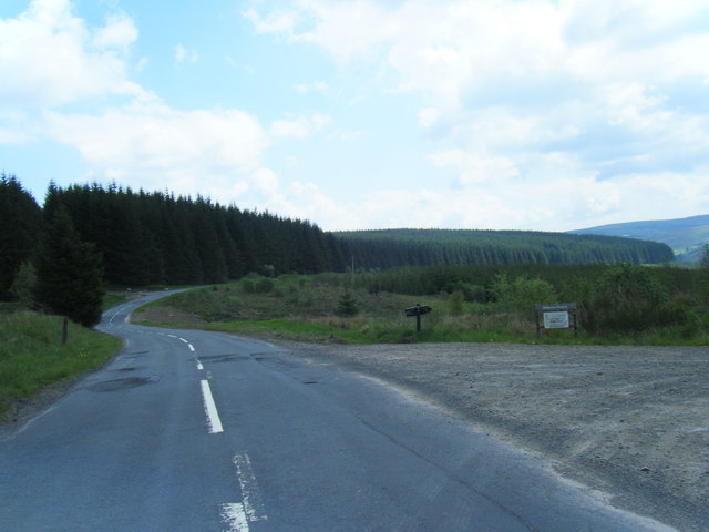
This woodland offers visitors a tranquil and serene environment, perfect for nature lovers and outdoor enthusiasts. There are numerous walking trails that wind their way through the plantation, allowing visitors to explore the beauty of the woodland at their own pace. These trails showcase the plantation's diverse array of trees and offer breathtaking views of the surrounding countryside.
White Haugh Plantation also holds historical significance, as it was once part of the Leadhills Estate, which played a vital role in the region's lead mining industry during the 18th and 19th centuries. Remnants of the mining activities, such as old mine shafts and ruins, can still be found within the plantation, serving as a reminder of the area's industrial past.
Overall, White Haugh Plantation is a haven of natural beauty, offering visitors the opportunity to immerse themselves in the tranquility of the Scottish countryside, explore diverse woodland ecosystems, and discover the fascinating history of the surrounding area.
If you have any feedback on the listing, please let us know in the comments section below.
White Haugh Plantation Images
Images are sourced within 2km of 55.232802/-3.1856229 or Grid Reference NY2493. Thanks to Geograph Open Source API. All images are credited.


White Haugh Plantation is located at Grid Ref: NY2493 (Lat: 55.232802, Lng: -3.1856229)
Unitary Authority: Dumfries and Galloway
Police Authority: Dumfries and Galloway
What 3 Words
///dignitary.shapes.butter. Near Bentpath, Dumfries & Galloway
Related Wikis

Castle O'er Forest
Castle O'er Forest is a forest south of Eskdalemuir, Dumfries and Galloway, in southern Scotland.It is bisected by the River Esk. Eskdalemuir Forest adjoins...

Girdle Stanes
The Girdle Stanes (grid reference NY 25351 96153) is a stone circle near Eskdalemuir, Dumfries and Galloway. The western portion of the circle has been...

Loupin Stanes
The Loupin Stanes (grid reference NY25709663) is a stone circle near Eskdalemuir, Dumfries and Galloway. Oval in shape, it consists of twelve stones set...

Holm, Inverness
Holm is a small residential area in the south of the city of Inverness, Scotland. The area lies east of the River Ness. The most prominent structure in...
Eskdalemuir
Eskdalemuir is a civil parish and small village in Dumfries and Galloway, Scotland, with a population of 265. It is around 10 miles (16 km) north-west...

Kagyu Samye Ling Monastery and Tibetan Centre
Kagyu Samye Ling Monastery and Tibetan Centre is a Tibetan Buddhist complex associated with the Karma Kagyu school located at Eskdalemuir, Scotland....

Whitcastles stone circle
Whitcastles or Little Hartfell (grid reference NY 2240 8806) is a stone circle 6½ miles NE of Lockerbie, Dumfries and Galloway. Nine fallen stones lie...

Bentpath
Bentpath is a small village between Eskdalemuir and Langholm in Dumfries and Galloway, Scotland. It is located on the River Esk and has a church and a...
Nearby Amenities
Located within 500m of 55.232802,-3.1856229Have you been to White Haugh Plantation?
Leave your review of White Haugh Plantation below (or comments, questions and feedback).