Bridge Pool Plantation

Wood, Forest in Dumfriesshire

Scotland

Bridge Pool Plantation

Minor road near to White Haugh Looking north-eastward.
Minor road near to White Haugh Credit: Peter Wood

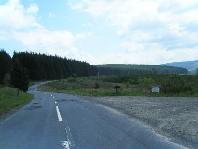
Bridge Pool Plantation is a picturesque woodland located in Dumfriesshire, Scotland. Covering an area of approximately 100 hectares, this plantation is known for its diverse and thriving ecosystem. The site is a mixture of coniferous and broadleaf trees, creating a rich and varied habitat for a wide range of plant and animal species.

The plantation features a variety of tree species, including Scots pine, Douglas fir, and Sitka spruce, providing a beautiful natural landscape. The trees are well-maintained, creating a dense and vibrant forest canopy that offers ample shade and shelter for the local wildlife.

Walking through Bridge Pool Plantation, visitors can enjoy peaceful trails that wind through the woods, offering stunning views of the surrounding countryside. The trails are well-maintained and easily accessible for visitors of all ages and abilities.

The plantation is home to a diverse array of wildlife, including red squirrels, roe deer, and a variety of bird species such as woodpeckers and owls. Birdwatching enthusiasts will be delighted by the opportunity to spot rare and migratory species that frequent the area.

Bridge Pool Plantation is not only a haven for wildlife but also a popular destination for outdoor enthusiasts. The woodland offers excellent opportunities for hiking, cycling, and nature photography. It is also a great spot for picnics, with designated areas equipped with picnic benches.

Overall, Bridge Pool Plantation is a stunning woodlands in Dumfriesshire, offering a tranquil escape into nature with its diverse flora and fauna, well-maintained trails, and picturesque views.

If you have any feedback on the listing, please let us know in the comments section below.

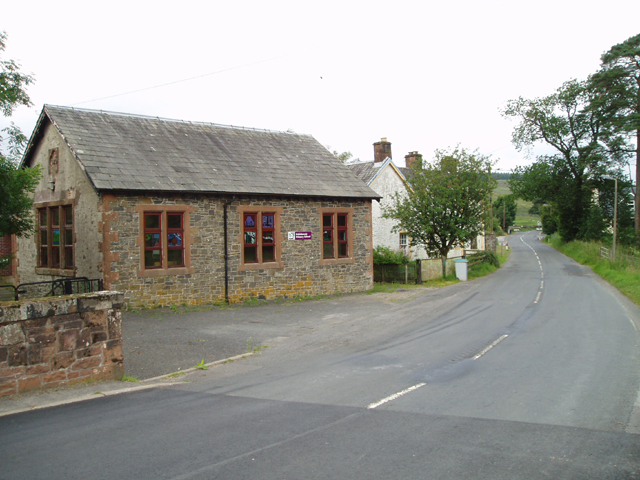
Bridge Pool Plantation Images

Images are sourced within 2km of 55.22553/-3.1858625 or Grid Reference NY2493. Thanks to Geograph Open Source API. All images are credited.

Minor road near to White Haugh Looking north-eastward.
Minor road near to White Haugh
Looking north-eastward.
Minor road approaching Castle O'er Looking southward from the car park entrance.
Minor road approaching Castle O'er
Looking southward from the car park entrance.
Minor road at Folds Plantation Looking south-westward.
Minor road at Folds Plantation
Looking south-westward.
Minor road near to King's Pool Car Park Looking north-westward.
Minor road near to King's Pool Car Park
Looking north-westward.
View from B709
View from B709
Minor road by Castle O'er
B709 south of Toothope Hill
Track from Road to Whiteyett Looking eastward towards the White Esk River.
Track from Road to Whiteyett
Looking eastward towards the White Esk River.
Ordnance Survey Flush Bracket 12099 This can be found on the wall of a private dwelling at Whiteyett.
For more detail see : <span class="nowrap"><a title="http://www.bench-marks.org.uk/bm22781" rel="nofollow ugc noopener" href="http://www.bench-marks.org.uk/bm22781">Link</a><img style="margin-left:2px;" alt="External link" title="External link - shift click to open in new window" src="https://s1.geograph.org.uk/img/external.png" width="10" height="10"/></span>
Ordnance Survey Flush Bracket 12099
This can be found on the wall of a private dwelling at Whiteyett. For more detail see : LinkExternal link
Cleared forest on the slope of the Knowe Willow herb commonly invades such sites.A couple of forlorn tree trunks still stand.
Cleared forest on the slope of the Knowe
Willow herb commonly invades such sites.A couple of forlorn tree trunks still stand.
Road above the White Esk This minor road follow the valley of the White Esk, whilst the main road takes the more direct route over the hill to the east.
Road above the White Esk
This minor road follow the valley of the White Esk, whilst the main road takes the more direct route over the hill to the east.
Cottage at Castle Oer
Water supply installation at Castle O'er The notice on the door reads "Scottish Water: White Esk SR Regulatory Final Sample Point".
Water supply installation at Castle O'er
The notice on the door reads "Scottish Water: White Esk SR Regulatory Final Sample Point".
Slippery Knowe Looking across the River White Esk to Slippery Knowe, a grassy hillside in the middle of Castle O'er Forest
Slippery Knowe
Looking across the River White Esk to Slippery Knowe, a grassy hillside in the middle of Castle O'er Forest
Slippery Knowe Looking across the River White Esk (hidden) to Slippery Knowe, a grassy hillside in the middle of Castle O'er Forest.
Slippery Knowe
Looking across the River White Esk (hidden) to Slippery Knowe, a grassy hillside in the middle of Castle O'er Forest.
Castlehill Cottage Isolated cottage on the minor road on the west bank of the River White Esk.
Castlehill Cottage
Isolated cottage on the minor road on the west bank of the River White Esk.
River White Esk Looking upstream at the River White Esk where it flows in a deeply incised valley through Castle O'er Forest.
River White Esk
Looking upstream at the River White Esk where it flows in a deeply incised valley through Castle O'er Forest.
Grass, trees and forest in Eskdale
Show me another place!

Bridge Pool Plantation is located at Grid Ref: NY2493 (Lat: 55.22553, Lng: -3.1858625)

Unitary Authority: Dumfries and Galloway

Police Authority: Dumfries and Galloway

What 3 Words

///beak.historic.mondays. Near Bentpath, Dumfries & Galloway

Related Wikis

Castle O'er Forest

Castle O'er Forest is a forest south of Eskdalemuir, Dumfries and Galloway, in southern Scotland.It is bisected by the River Esk. Eskdalemuir Forest adjoins...

Girdle Stanes

The Girdle Stanes (grid reference NY 25351 96153) is a stone circle near Eskdalemuir, Dumfries and Galloway. The western portion of the circle has been...

Loupin Stanes

The Loupin Stanes (grid reference NY25709663) is a stone circle near Eskdalemuir, Dumfries and Galloway. Oval in shape, it consists of twelve stones set...

Holm, Inverness

Holm is a small residential area in the south of the city of Inverness, Scotland. The area lies east of the River Ness. The most prominent structure in...

Eskdalemuir

Eskdalemuir is a civil parish and small village in Dumfries and Galloway, Scotland, with a population of 265. It is around 10 miles (16 km) north-west...

Whitcastles stone circle

Whitcastles or Little Hartfell (grid reference NY 2240 8806) is a stone circle 6½ miles NE of Lockerbie, Dumfries and Galloway. Nine fallen stones lie...

Kagyu Samye Ling Monastery and Tibetan Centre

Kagyu Samye Ling Monastery and Tibetan Centre is a Tibetan Buddhist complex associated with the Karma Kagyu school located at Eskdalemuir, Scotland....

Bentpath

Bentpath is a small village between Eskdalemuir and Langholm in Dumfries and Galloway, Scotland. It is located on the River Esk and has a church and a...

Nearby Amenities

Located within 500m of 55.22553,-3.1858625
Village
Naptan AtcoCode: 680000606111
Naptan Bearing: NW
Naptan BusStopType: CUS
Naptan CommonName: Village
Naptan Indicator: opp Houses
Naptan Landmark: Castle Oer
Naptan NaptanCode: 34238327
Naptan Notes: none
Naptan Street: C79
Naptan Verified: no
Source: naptan_import
Lat/Long: 55.2220637/-3.1848159
Village
Naptan AtcoCode: 680000606222
Naptan Bearing: SE
Naptan BusStopType: CUS
Naptan CommonName: Village
Naptan Indicator: Houses
Naptan Landmark: Castle Oer
Naptan NaptanCode: 34238328
Naptan Notes: none
Naptan Street: C79
Naptan Verified: no
Source: naptan_import
Lat/Long: 55.22203/-3.1845791
Parking
Castle O'er car park
Source: survey
Lat/Long: 55.2240653/-3.1861403
Power: pole
Lat/Long: 55.2220181/-3.1881434
Power: pole
Lat/Long: 55.2227051/-3.1875721
Power: pole
Lat/Long: 55.2233323/-3.1851259
Power: pole
Lat/Long: 55.2237133/-3.183707
Power: pole
Lat/Long: 55.2240407/-3.1824464
Power: pole
Lat/Long: 55.2242923/-3.1816672
Power: pole
Lat/Long: 55.2250259/-3.1794074
Power: pole
Lat/Long: 55.2253196/-3.1786215
Power: pole
Lat/Long: 55.2259086/-3.1786537
Power: pole
Lat/Long: 55.2264532/-3.1786752
The data included in this document is from www.openstreetmap.org. The data is made available under ODbL.

Have you been to Bridge Pool Plantation?

Leave your review of Bridge Pool Plantation below (or comments, questions and feedback).