Colin's Wood

Wood, Forest in Fife

Scotland

Colin's Wood

Low Road, Auchtermuchty At the junction with Crosshills.
Low Road, Auchtermuchty Credit: Mark Anderson

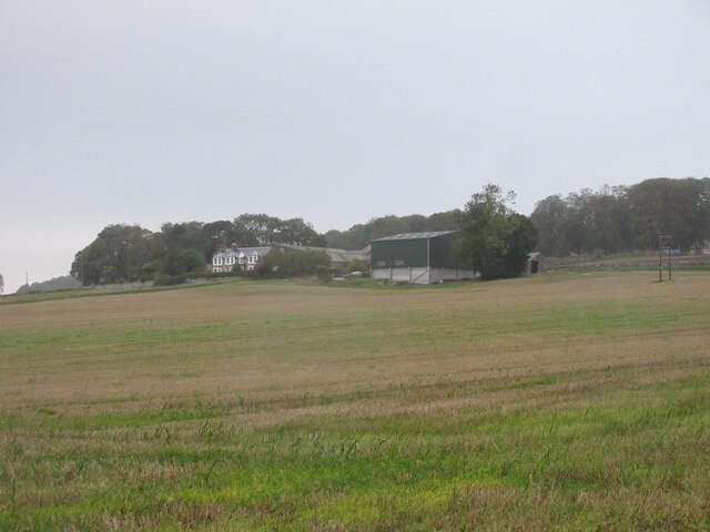
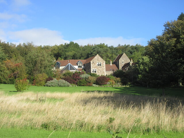
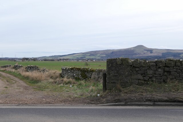
Colin's Wood, located in Fife, Scotland, is a picturesque forest area renowned for its natural beauty and tranquility. Spanning approximately 100 acres, this woodland is nestled within the scenic landscape of Fife, offering an idyllic retreat for nature lovers and outdoor enthusiasts alike.

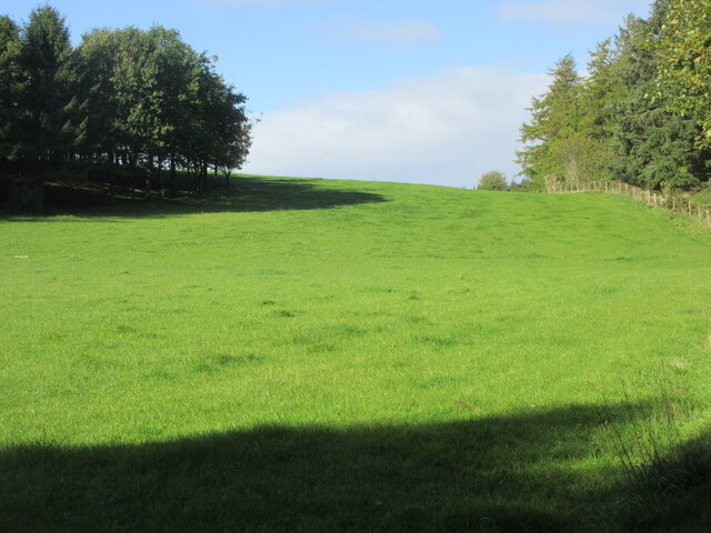
The woodland is characterized by a diverse range of tree species, including native Scots pine, birch, oak, and beech trees, which create a rich and vibrant canopy overhead. The forest floor is adorned with an array of wildflowers, ferns, and mosses, providing a haven for various plant and animal species.

Colin's Wood offers a network of well-maintained walking trails that wind through the forest, allowing visitors to explore its enchanting scenery at their own pace. These trails cater to different levels of fitness and provide opportunities for leisurely strolls or more challenging hikes. Along the way, visitors may encounter charming wildlife, such as red squirrels, rabbits, and a variety of bird species.

In addition to its natural beauty, Colin's Wood also boasts several amenities to enhance visitors' experiences. There are picnic areas and benches strategically placed throughout the woodland, providing perfect spots for relaxation and enjoying a packed lunch amidst the serenity of nature. Interpretive boards along the trails offer educational information about the forest's flora and fauna, adding an educational element to the visit.

Overall, Colin's Wood in Fife offers a captivating escape from the hustle and bustle of daily life, inviting individuals to immerse themselves in the peacefulness of nature while exploring the diverse ecosystem that thrives within its boundaries.

If you have any feedback on the listing, please let us know in the comments section below.
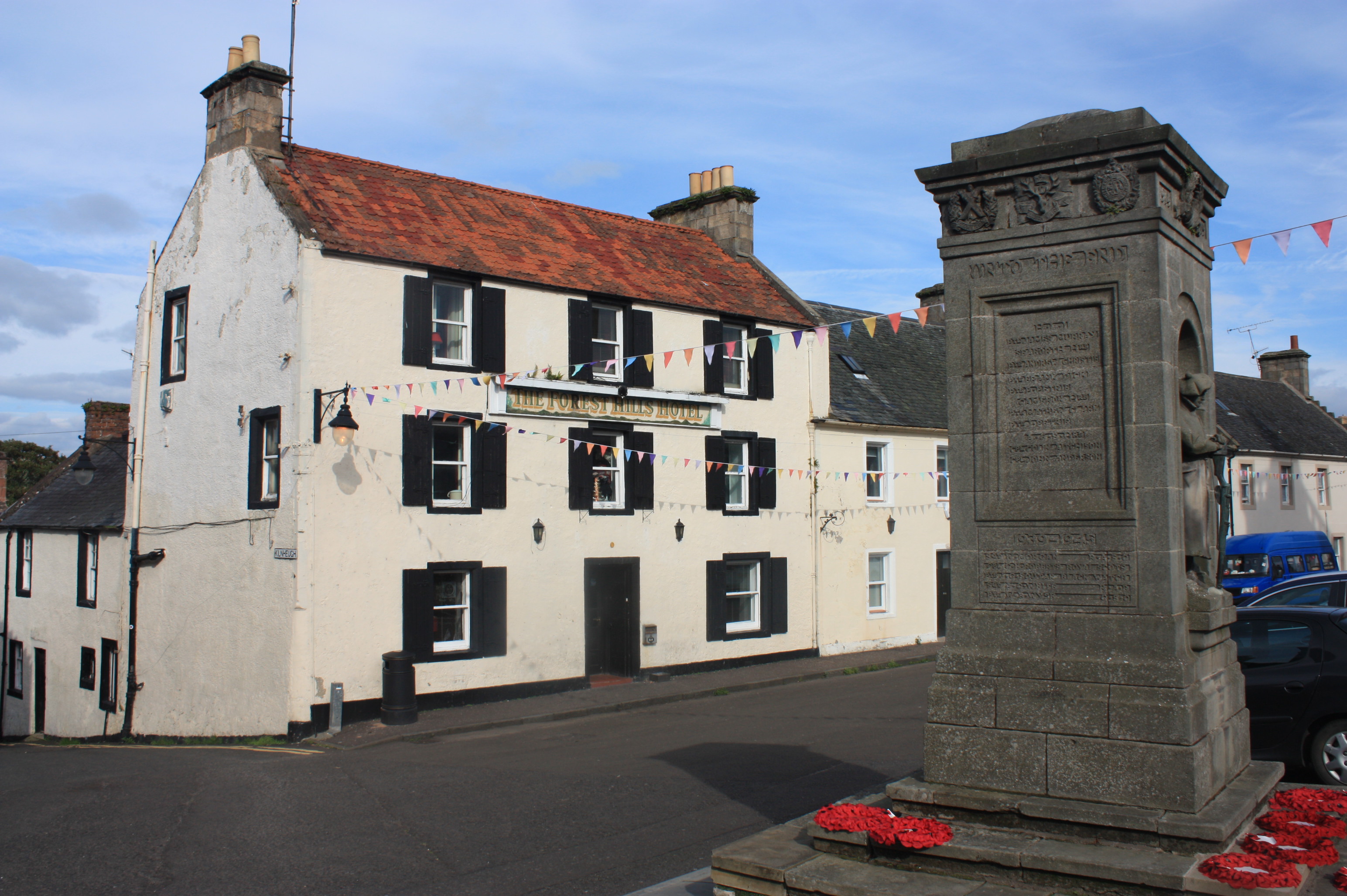
Colin's Wood Images

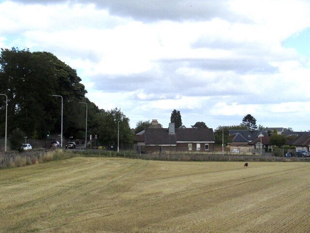
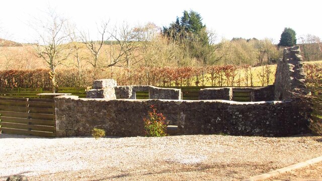
Images are sourced within 2km of 56.303415/-3.2379559 or Grid Reference NO2313. Thanks to Geograph Open Source API. All images are credited.

Low Road, Auchtermuchty At the junction with Crosshills.
Low Road, Auchtermuchty
At the junction with Crosshills.
A91 Low Road Milestone Milestone with cast-iron cap on the A91 Low Road in Auchtermuchty.
A91 Low Road Milestone
Milestone with cast-iron cap on the A91 Low Road in Auchtermuchty.
Demperston Farm Demperston viewed from the A91 to the south-east.
Demperston Farm
Demperston viewed from the A91 to the south-east.
Grass field near Newhill Grass field next to the minor road heading to Newhill from Auchtermuchty.
Grass field near Newhill
Grass field next to the minor road heading to Newhill from Auchtermuchty.
Converted dwelling at Newton Mains Steading converted into a house at Newton Mains, viewed from the road to the south.
Converted dwelling at Newton Mains
Steading converted into a house at Newton Mains, viewed from the road to the south.
Field, Auchtermuchty View from the new Co-op car park.
Field, Auchtermuchty
View from the new Co-op car park.
Location of Cut Mark - Auchtermuchty, #31 High Street
Remains of  Pitcairlie Toll House Hidden from the B936, but visible from the side road.  Close to the Fife / Perth boundary. Originally served the Pitcairley Turnpike Trust.

Milestone Society National ID: FF.PIT
Remains of Pitcairlie Toll House
Hidden from the B936, but visible from the side road. Close to the Fife / Perth boundary. Originally served the Pitcairley Turnpike Trust. Milestone Society National ID: FF.PIT
Benchmark, Rossieden Cottage, Auchtermuchty Ordnance Survey benchmark, described on database at <span class="nowrap"><a title="https://www.bench-marks.org.uk/bm44695" rel="nofollow ugc noopener" href="https://www.bench-marks.org.uk/bm44695">Link</a><img style="margin-left:2px;" alt="External link" title="External link - shift click to open in new window" src="https://s1.geograph.org.uk/img/external.png" width="10" height="10"/></span>. For context photo, see: <a href="https://www.geograph.org.uk/photo/7429948">NO2411 : Rossieden Cottage, Auchtermuchty</a>
Benchmark, Rossieden Cottage, Auchtermuchty
Ordnance Survey benchmark, described on database at LinkExternal link. For context photo, see: NO2411 : Rossieden Cottage, Auchtermuchty
Benchmark, Southfield, Auchtermuchty Ordnance Survey benchmark on wall, described on database at <span class="nowrap"><a title="https://www.bench-marks.org.uk/bm187337" rel="nofollow ugc noopener" href="https://www.bench-marks.org.uk/bm187337">Link</a><img style="margin-left:2px;" alt="External link" title="External link - shift click to open in new window" src="https://s1.geograph.org.uk/img/external.png" width="10" height="10"/></span>. See also <a href="https://www.geograph.org.uk/photo/7429980">NO2411 : Wall on A91 near Auchtermuchty</a>.
Benchmark, Southfield, Auchtermuchty
Ordnance Survey benchmark on wall, described on database at LinkExternal link. See also NO2411 : Wall on A91 near Auchtermuchty.
Leaving Auchtermuchty The B936 south from Auchtermuchty to Dunshalt.
Leaving Auchtermuchty
The B936 south from Auchtermuchty to Dunshalt.
Benchmark 1 Cupar Road, Auchtermuchty Ordnance  Survey benchmark on cottage, described on database at <span class="nowrap"><a title="https://www.bench-marks.org.uk/bm37589" rel="nofollow ugc noopener" href="https://www.bench-marks.org.uk/bm37589">Link</a><img style="margin-left:2px;" alt="External link" title="External link - shift click to open in new window" src="https://s1.geograph.org.uk/img/external.png" width="10" height="10"/></span>. See also <a href="https://www.geograph.org.uk/photo/7430048">NO2411 : 1 Cupar Road, Auchtermuchty</a>.
Benchmark 1 Cupar Road, Auchtermuchty
Ordnance Survey benchmark on cottage, described on database at LinkExternal link. See also NO2411 : 1 Cupar Road, Auchtermuchty.
Rossieden Cottage, Auchtermuchty There is an Ordnance Survey benchmark on this cottage. For photo, see: <a href="https://www.geograph.org.uk/photo/7429901">NO2411 : Benchmark, Rossieden Cottage, Auchtermuchty</a>
Rossieden Cottage, Auchtermuchty
There is an Ordnance Survey benchmark on this cottage. For photo, see: NO2411 : Benchmark, Rossieden Cottage, Auchtermuchty
House on Cupar Road/Middleflat, Auchtermuchty There is an Ordnance Survey benchmark on this building.
House on Cupar Road/Middleflat, Auchtermuchty
There is an Ordnance Survey benchmark on this building.
Wall on A91 near Auchtermuchty There is an Ordnance Survey benchmark on this wall, more or less directly below East Lomond. See also <a href="https://www.geograph.org.uk/photo/7429912">NO2411 : Benchmark, Southfield, Auchtermuchty</a>.
Wall on A91 near Auchtermuchty
There is an Ordnance Survey benchmark on this wall, more or less directly below East Lomond. See also NO2411 : Benchmark, Southfield, Auchtermuchty.
1 Cupar Road, Auchtermuchty There is an Ordnance Survey benchmark on this cottage, see <a href="https://www.geograph.org.uk/photo/7429941">NO2411 : Benchmark 1 Cupar Road, Auchtermuchty</a>.
1 Cupar Road, Auchtermuchty
There is an Ordnance Survey benchmark on this cottage, see NO2411 : Benchmark 1 Cupar Road, Auchtermuchty.
Damaged benchmark, Auchtermuchty Damaged Ordnance Survey benchmark on building at crossroads, Auchtermuchty. Described on database at <span class="nowrap"><a title="https://www.bench-marks.org.uk/bm37464" rel="nofollow ugc noopener" href="https://www.bench-marks.org.uk/bm37464">Link</a><img style="margin-left:2px;" alt="External link" title="External link - shift click to open in new window" src="https://s1.geograph.org.uk/img/external.png" width="10" height="10"/></span>.
Damaged benchmark, Auchtermuchty
Damaged Ordnance Survey benchmark on building at crossroads, Auchtermuchty. Described on database at LinkExternal link.
Wall on A91 near Auchtermuchty There is an Ordnance Survey benchmark on this wall. See <a href="https://www.geograph.org.uk/photo/7430081">NO2411 : Benchmark on wall, Southfield, Auchtermuchty</a>.
Wall on A91 near Auchtermuchty
There is an Ordnance Survey benchmark on this wall. See NO2411 : Benchmark on wall, Southfield, Auchtermuchty.
Show me another place!

Colin's Wood is located at Grid Ref: NO2313 (Lat: 56.303415, Lng: -3.2379559)

Unitary Authority: Fife

Police Authority: Fife

What 3 Words

///ramp.appealing.paying. Near Auchtermuchty, Fife

Related Wikis

Nearby Amenities

Located within 500m of 56.303415,-3.2379559
Source: survey
Tourism: picnic_site
Lat/Long: 56.3071338/-3.2352999
Auchtermuchty Common
Leisure: common
Source: survey
Lat/Long: 56.3069424/-3.2341299
Power: tower
Lat/Long: 56.3027237/-3.2313899
Power: tower
Lat/Long: 56.3045888/-3.2342733
Power: tower
Lat/Long: 56.3076995/-3.2390826
Leisure: picnic_table
Source: survey Aug 2016
Lat/Long: 56.3050084/-3.2312288
Bench
Source: survey Aug 2016
Lat/Long: 56.3048149/-3.2309633
Barrier: kissing_gate
Bicycle: yes
Foot: yes
Motor Vehicle: no
Source: survey Aug 2016
Lat/Long: 56.3045441/-3.2313388
Barrier: kissing_gate
Bicycle: yes
Foot: yes
Motor Vehicle: no
Source: survey Aug 2016
Lat/Long: 56.3072189/-3.2352891
Information: board
Source: survey Aug 2016
Tourism: information
Lat/Long: 56.3072555/-3.2350805
Information: board
Source: survey Aug 2016
Tourism: information
Lat/Long: 56.3049702/-3.2310548
Power: pole
Lat/Long: 56.3024886/-3.2308736
Power: pole
Lat/Long: 56.3022966/-3.2319492
Power: pole
Lat/Long: 56.3021046/-3.2330114
Power: pole
Lat/Long: 56.3018888/-3.2341057
Power: pole
Lat/Long: 56.3015183/-3.2353959
Power: pole
Lat/Long: 56.3011582/-3.2367316
Power: pole
Lat/Long: 56.3005912/-3.2372573
Power: pole
Lat/Long: 56.2999944/-3.2379198
Power: pole
Lat/Long: 56.2994586/-3.2384911
Power: pole
Lat/Long: 56.3021441/-3.2430579
Power: pole
Lat/Long: 56.3012742/-3.2432145
Power: pole
Lat/Long: 56.3002623/-3.2433835
Power: pole
Lat/Long: 56.3027911/-3.2433557
Power: pole
Lat/Long: 56.3028244/-3.2419642
Power: pole
Lat/Long: 56.3028369/-3.240868
Power: pole
Lat/Long: 56.3035027/-3.243681
Power: pole
Lat/Long: 56.3040026/-3.2439013
Power: pole
Lat/Long: 56.3048912/-3.2443092
Power: pole
Lat/Long: 56.305584/-3.2441615
The data included in this document is from www.openstreetmap.org. The data is made available under ODbL.

Have you been to Colin's Wood?

Leave your review of Colin's Wood below (or comments, questions and feedback).