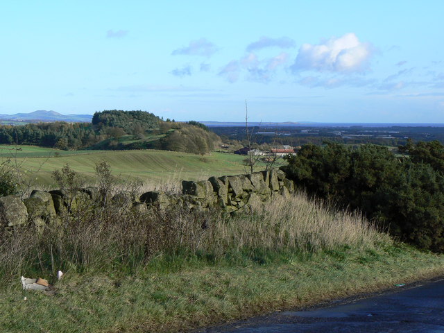
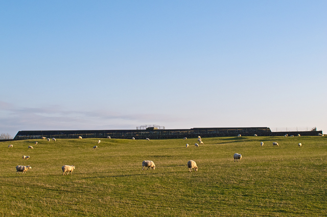
Den Plantation

Wood, Forest in Fife

Scotland

Den Plantation

Pasture, Auchmuir. Cattle graze beneath West Lomond, Fife's highest hill.
Pasture, Auchmuir. Credit: Richard Webb

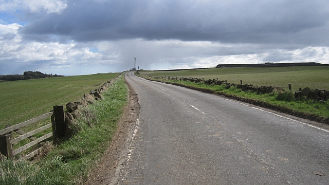
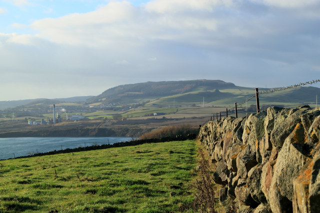
Den Plantation is a picturesque woodland located in Fife, Scotland. Covering an area of approximately 100 hectares, it is situated near the small village of Falkland. The plantation is predominantly composed of mixed broadleaf trees, including oak, beech, and birch, which create a diverse and vibrant ecosystem.

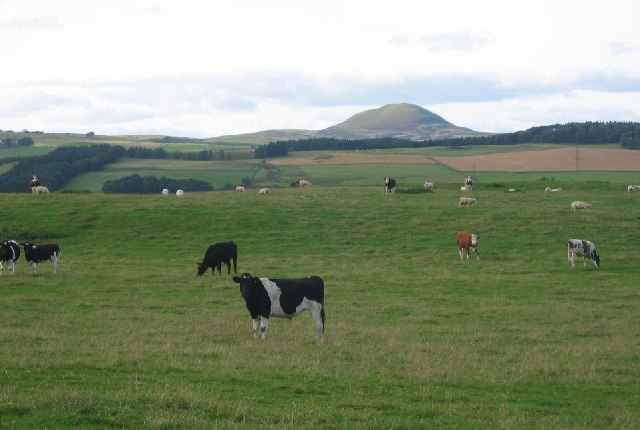
The woodland is a haven for wildlife, with numerous bird species such as woodpeckers, owls, and thrushes making it their home. Additionally, various mammals like red squirrels, foxes, and badgers can be spotted within the plantation. The dense vegetation and calm atmosphere make it an ideal habitat for these creatures.

Den Plantation offers a range of recreational activities for visitors. There are well-maintained walking trails that meander through the woodland, allowing visitors to explore and enjoy the natural beauty of the area. The paths are suitable for all levels of fitness and provide opportunities for both leisurely strolls and more challenging hikes.

The plantation also features a picnic area, offering a tranquil spot for families and friends to relax and enjoy a meal amidst the serene surroundings. Moreover, the plantation's proximity to the village of Falkland means that amenities such as parking, cafes, and restrooms are easily accessible.

Overall, Den Plantation in Fife is a delightful woodland retreat that offers a diverse range of flora and fauna, as well as opportunities for outdoor activities and relaxation. It is a cherished natural gem, attracting visitors from near and far who appreciate its beauty and tranquility.

If you have any feedback on the listing, please let us know in the comments section below.

Den Plantation Images

Images are sourced within 2km of 56.193193/-3.2372556 or Grid Reference NO2300. Thanks to Geograph Open Source API. All images are credited.

Pasture, Auchmuir. Cattle graze beneath West Lomond, Fife's highest hill.
Pasture, Auchmuir.
Cattle graze beneath West Lomond, Fife's highest hill.
Airfield Glenrothes airfield.
Airfield
Glenrothes airfield.
Blythes Tower
Blythes Tower
Reservoir wall Concrete reservoir tanks on Whitehill which hold water supplies for Glenrothes.
Reservoir wall
Concrete reservoir tanks on Whitehill which hold water supplies for Glenrothes.
Approach to Fife Airport The side road left leads to Fife Airport. The circular sign advertises the Airport restaurant, the 'Tipsy Nipper', named, not after an inebriated youngster, but after the first aeroplane owned by the flying club, a single-seat machine known as a Nipper, manufactured by the Belgian Tipsy aircraft company.
Approach to Fife Airport
The side road left leads to Fife Airport. The circular sign advertises the Airport restaurant, the 'Tipsy Nipper', named, not after an inebriated youngster, but after the first aeroplane owned by the flying club, a single-seat machine known as a Nipper, manufactured by the Belgian Tipsy aircraft company.
Goatmilk Hills Small rocky outcrops west of Glenrothes, just north of Fife Airport.
Goatmilk Hills
Small rocky outcrops west of Glenrothes, just north of Fife Airport.
White Hill A waterlogged field on White Hill - currently used as grazing land, with Blythe's Tower visible on the skyline.
White Hill
A waterlogged field on White Hill - currently used as grazing land, with Blythe's Tower visible on the skyline.
Grazing land near Finmont Farm Sheep grazing near Finmont Farm, with Whitehill reservoir visible on the skyline.
Grazing land near Finmont Farm
Sheep grazing near Finmont Farm, with Whitehill reservoir visible on the skyline.
Fife Airport An airstrip in Glenrothes, very handy for the big industrial zone on the southern flank of the town. There is a very fine view of the Bass Rock, now white with gannets.
Fife Airport
An airstrip in Glenrothes, very handy for the big industrial zone on the southern flank of the town. There is a very fine view of the Bass Rock, now white with gannets.
Closed road While not in the same league as death and taxes, a closed road is almost inevitable if going out after grid squares in Scotland. This one is by the Fife Airport by Glenrothes.
Closed road
While not in the same league as death and taxes, a closed road is almost inevitable if going out after grid squares in Scotland. This one is by the Fife Airport by Glenrothes.
Fife Airport A small airstrip outside Glenrothes.
Fife Airport
A small airstrip outside Glenrothes.
Goatmilk A farm and stubble, overlooking Fife Airport.
Goatmilk
A farm and stubble, overlooking Fife Airport.
White Hill A view over hilltop pasture towards Blythe's Tower, a folly.
White Hill
A view over hilltop pasture towards Blythe's Tower, a folly.
Hill top road A road over some Carboniferous igneous uplands near Glenrothes. There is a covered reservoir on the right.
Hill top road
A road over some Carboniferous igneous uplands near Glenrothes. There is a covered reservoir on the right.
Blythes Tower Kinglassie A square tower built in 1812 it was used by a linen merchant to view ships as they entered the River Forth and later used as a look-out tower by the Home Guard during World War Two.
Blythes Tower Kinglassie
A square tower built in 1812 it was used by a linen merchant to view ships as they entered the River Forth and later used as a look-out tower by the Home Guard during World War Two.
Blythes Tower Kinglassie Grazing land at Redwells Hill with the Blythe Tower in the background.
Blythes Tower Kinglassie
Grazing land at Redwells Hill with the Blythe Tower in the background.
Redwells Hill Kinglassie Grazing land at Redwells Hill viewed looking west towards Westfield with Benarty Hill in the background.
Redwells Hill Kinglassie
Grazing land at Redwells Hill viewed looking west towards Westfield with Benarty Hill in the background.
Finmont Farm Kinglassie Viewed from the Whitehill looking down onto Finmont Farm.
Finmont Farm Kinglassie
Viewed from the Whitehill looking down onto Finmont Farm.
Show me another place!

Den Plantation is located at Grid Ref: NO2300 (Lat: 56.193193, Lng: -3.2372556)

Unitary Authority: Fife

Police Authority: Fife

What 3 Words

///crouching.grandson.kilts. Near Leslie, Fife

Nearby Locations

Den Plantation

Related Wikis

Leslie railway station

Leslie railway station served the village of Leslie, Fife, Scotland, from 1861 to 1932 on the Leslie Railway. == History == The station was opened on 1...
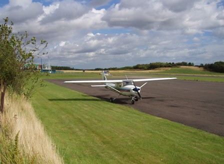
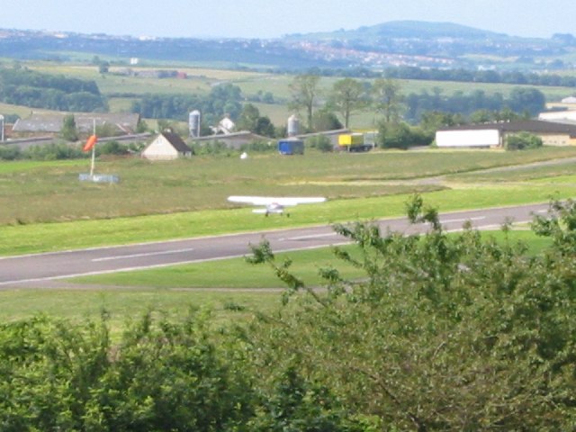
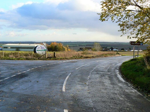
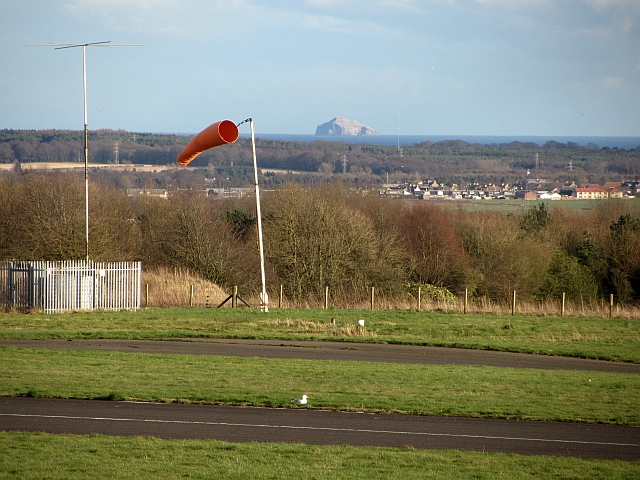
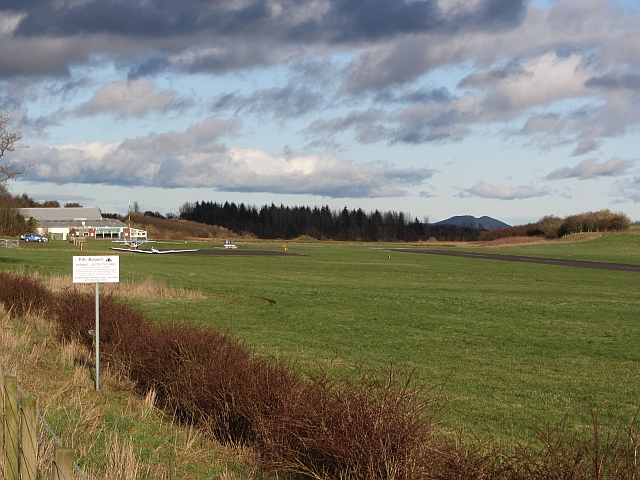
Fife Airport

Fife Airport (ICAO: EGPJ) (Scottish Gaelic: Port-adhair Fìobha) is an unlicensed aerodrome located 2 nautical miles (3.7 km; 2.3 mi) west of Glenrothes...

Leslie, Fife

Leslie (Scottish Gaelic: Fiodh Chill) is a large village and parish on the northern tip of the River Leven Valley, to the west of Glenrothes in Fife. According...

Glenwood High School, Glenrothes

Glenwood High School is a comprehensive, co-educational and non-denominational school serving the western part of the town of Glenrothes, Fife, Scotland...

Leslie House

Leslie House in Leslie, Fife — where several of the buildings are listed — is the largest and earliest Restoration house in Fife, Scotland, and was the...
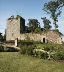
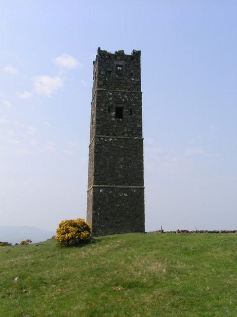
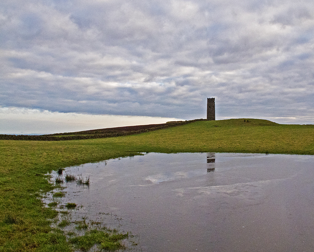
Arnot Tower

Arnot Tower is a ruined 16th-century castle located in the grounds of Arnot Tower House, less than 1 mile (1.6 km) from Scotlandwell, Perth and Kinross...

Glenrothes High School

Glenrothes High School is a six-year non-denominational secondary school of approximately 860 pupils located in Glenrothes, Fife, Scotland. The school...

Kinglassie

Kinglassie (Scottish Gaelic: Cill Ghlaise) is a small village and parish in central Fife, Scotland. It is located two miles southwest of Glenrothes. It...

Nearby Amenities

Located within 500m of 56.193193,-3.2372556
Walkerton
Place: locality
Lat/Long: 56.1968839/-3.2349003
Material: wood
Power: pole
Lat/Long: 56.1893693/-3.2343146
Material: wood
Power: pole
Lat/Long: 56.1901339/-3.234152
Material: wood
Power: pole
Lat/Long: 56.1908669/-3.2341276
Material: wood
Power: pole
Lat/Long: 56.1914143/-3.232977
Material: wood
Power: pole
Lat/Long: 56.191964/-3.2318672
Material: wood
Power: pole
Lat/Long: 56.1925091/-3.2307979
Material: wood
Power: pole
Lat/Long: 56.1929828/-3.2297379
Power: pole
Lat/Long: 56.1952253/-3.2436258
Power: pole
Lat/Long: 56.1949653/-3.2426997
Power: pole
Lat/Long: 56.1947173/-3.241778
Power: pole
Lat/Long: 56.1944332/-3.2407503
Power: pole
Lat/Long: 56.1945054/-3.2396317
Material: wood
Power: pole
Lat/Long: 56.1945776/-3.2384828
Material: wood
Power: pole
Lat/Long: 56.1949147/-3.2375091
Material: wood
Power: pole
Lat/Long: 56.1951458/-3.2368578
Material: wood
Power: pole
Lat/Long: 56.1954817/-3.2359275
Material: wood
Power: pole
Lat/Long: 56.1958212/-3.2349863
Material: wood
Power: pole
Lat/Long: 56.1961173/-3.2341792
Material: wood
Power: pole
Lat/Long: 56.1964808/-3.2331342
Material: wood
Power: pole
Lat/Long: 56.1948003/-3.2300055
Material: wood
Power: pole
Lat/Long: 56.1944404/-3.2305248
Material: wood
Power: pole
Lat/Long: 56.1940552/-3.2310614
The data included in this document is from www.openstreetmap.org. The data is made available under ODbL.

Have you been to Den Plantation?

Leave your review of Den Plantation below (or comments, questions and feedback).