Alverthorpe

Settlement in Yorkshire

England

Alverthorpe

Houses on George-A-Green Road
Houses on George-A-Green Road Credit: JThomas

Alverthorpe is a suburban area located in the county of West Yorkshire, England. It is situated approximately 2 miles southeast of the city of Wakefield and falls within the boundaries of the City of Wakefield Metropolitan District. With a population of around 8,000 residents, Alverthorpe offers a peaceful and friendly community atmosphere.

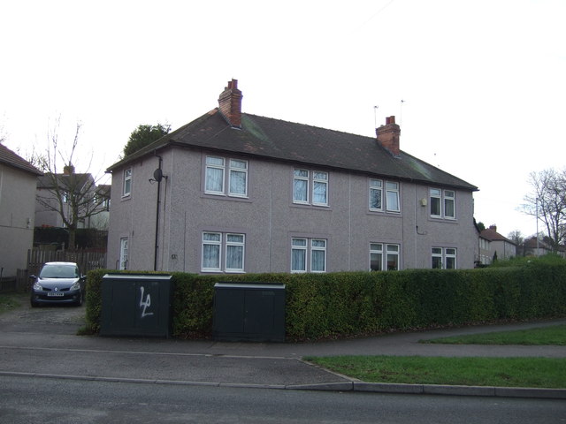
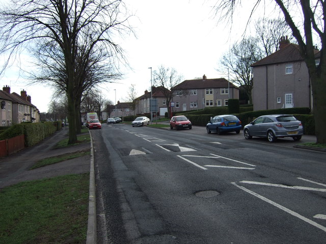
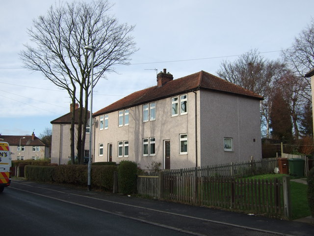
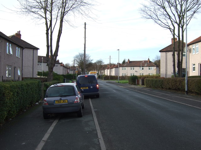
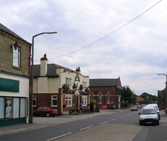
The area is characterized by its mix of residential and industrial development. Residentially, Alverthorpe primarily consists of semi-detached and terraced houses, catering to a diverse range of families and individuals. The neighborhood is known for its well-maintained streets, green spaces, and local amenities.

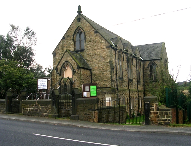
Alverthorpe is home to a number of shops, including convenience stores, pharmacies, and a variety of local businesses. The area also benefits from several parks and recreational facilities, providing residents with opportunities for outdoor activities and leisure. Notably, Alverthorpe Park offers picturesque walking trails, a children's play area, and a bowling green.

For education, Alverthorpe has a primary school, which serves the local community. Secondary education is easily accessible in the neighboring areas of Wakefield.

Transport links in Alverthorpe are excellent, with regular bus services connecting the area to Wakefield city center and surrounding towns. The nearby M1 motorway provides convenient access to Leeds, Sheffield, and other major cities in the region.

Overall, Alverthorpe offers a quiet and well-connected place to live, with a range of amenities and a strong sense of community.

If you have any feedback on the listing, please let us know in the comments section below.

Alverthorpe Images

Images are sourced within 2km of 53.690638/-1.529155 or Grid Reference SE3121. Thanks to Geograph Open Source API. All images are credited.

Houses on George-A-Green Road
George-A-Green Road
George-A-Green Road
Houses on Waterton Road
Waterton Road heading west
Chantry Road - looking towards Waterton Road
Bentley Road - Waterton Road
Waterton Road - viewed from Bentley Road
Potter Avenue - viewed from Bentley Road
Potter Avenue - looking towards George-A-Green Road
George-A-Green Fisheries - George-A-Green Road
Electricity Substation No 55026 - Esther Grove
Footpath - Esther Grove
Meltonfield Mews - Esther Grove
Electricity Substation No 55025 - Esther Grove
Esther Grove - looking towards Esther Avenue
Esther Avenue - viewed from Esther Grove
Show me another place!

Alverthorpe is located at Grid Ref: SE3121 (Lat: 53.690638, Lng: -1.529155)

Division: West Riding

Unitary Authority: Wakefield

Police Authority: West Yorkshire

What 3 Words

///blaze.damage.chairs. Near Wakefield, West Yorkshire

Related Wikis

Alverthorpe

Alverthorpe is a suburb of, and former village in Wakefield, West Yorkshire, England. == History == After the start of the Industrial Revolution woollen...

Alverthorpe railway station

Alverthorpe railway station served the village of Alverthorpe near Wakefield in the English county of West Yorkshire. == History == Opened by the Bradford...

Flanshaw

Flanshaw is a suburb of Wakefield in West Yorkshire, England. It is located to the west of the city centre and is administered by the City of Wakefield...

Wrenthorpe

Wrenthorpe is a village north-west of Wakefield, in West Yorkshire, England. It is located in the Rhubarb Triangle. == History == Although earlier remains...

Nearby Amenities

Located within 500m of 53.690638,-1.529155
Alverthorpe
Is In: Wakefield, West Yorkshire, United Kingdom
Place: suburb
Wikidata: Q4737993
Wikipedia: en:Alverthorpe
Lat/Long: 53.6895211/-1.5288673
Turning Circle
Lat/Long: 53.6862008/-1.5295312
Noexit: yes
Lat/Long: 53.688204/-1.5282569
Turning Circle
Lat/Long: 53.6904496/-1.5307265
Traffic Signals
Crossing: traffic_signals
Crossing Ref: pelican
Kerb: flush
Tactile Paving: yes
Lat/Long: 53.6896211/-1.531563
Post Box
Operator: Royal Mail
Post Box Type: lamp
Ref: WF2 261
Lat/Long: 53.6930147/-1.5340746
Bus Stop
Batley Road Pacaholme Road
Bus: yes
Local Ref: 45016321
Naptan AtcoCode: 450016321
Naptan Bearing: SE
Naptan CommonName: Batley Road Pacaholme Road
Naptan Crossing: Pacaholme Road
Naptan Indicator: Stop 45016321
Naptan PlusbusZoneRef: LEEDS
Naptan ShortCommonName: Pacaholme Road
Naptan Street: Batley Road
Naptan Verified: yes
Public Transport: platform
Shelter: yes
Source: naptan_import
Lat/Long: 53.6919852/-1.5360717
Bus Stop
Batley Road St Pauls Drive
Bus: yes
Local Ref: 45016322
Naptan AtcoCode: 450016322
Naptan Bearing: NW
Naptan CommonName: Batley Road St Pauls Drive
Naptan Crossing: St Pauls Drive
Naptan Indicator: Stop 45016322
Naptan PlusbusZoneRef: LEEDS
Naptan ShortCommonName: St. Pauls Drive
Naptan Street: Batley Road
Naptan Verified: yes
Public Transport: platform
Shelter: no
Source: naptan_import
Timetable: yes
Lat/Long: 53.6905717/-1.5335758
Bus Stop
Batley Road St Pauls Drive
Bench: yes
Bus: yes
Local Ref: 45016323
Naptan AtcoCode: 450016323
Naptan Bearing: SE
Naptan CommonName: Batley Road St Pauls Drive
Naptan Crossing: St Pauls Drive
Naptan Indicator: Stop 45016323
Naptan Landmark: Alverthorpe Church of England School
Naptan PlusbusZoneRef: LEEDS
Naptan ShortCommonName: St. Pauls Drive
Naptan Street: Batley Road
Naptan Verified: yes
Public Transport: platform
Shelter: yes
Source: naptan_import
Lat/Long: 53.6901987/-1.5325717
Bus Stop
Batley Road Highfield Rise
Bus: yes
Local Ref: 45016324
Naptan AtcoCode: 450016324
Naptan Bearing: SE
Naptan CommonName: Batley Road Highfield Rise
Naptan Crossing: Highfield Rise
Naptan Indicator: Stop 45016324
Naptan PlusbusZoneRef: LEEDS
Naptan ShortCommonName: Highfield Rise
Naptan Street: Batley Road
Naptan Verified: yes
Public Transport: platform
Shelter: no
Source: naptan_import
Timetable: yes
Towards: Wakefield
Lat/Long: 53.6891325/-1.530228
Bus Stop
Batley Road Flanshaw Lane
Bus: yes
Local Ref: 45016325
Naptan AtcoCode: 450016325
Naptan Bearing: NW
Naptan CommonName: Batley Road Flanshaw Lane
Naptan Crossing: Flanshaw Lane
Naptan Indicator: Stop 45016325
Naptan PlusbusZoneRef: LEEDS
Naptan ShortCommonName: Flanshaw Lane
Naptan Street: Batley Road
Naptan Verified: yes
Public Transport: platform
Source: naptan_import
Lat/Long: 53.6890977/-1.530501
Bus Stop
Wellington Street Batley Road
Bus: yes
Local Ref: 45016388
Naptan AtcoCode: 450016388
Naptan Bearing: E
Naptan CommonName: Wellington Street Batley Road
Naptan Crossing: Batley Road
Naptan Indicator: Stop 45016388
Naptan PlusbusZoneRef: LEEDS
Naptan ShortCommonName: Alverthorpe Sch
Naptan Street: Wellington Street
Naptan Verified: yes
Public Transport: platform
Source: naptan_import
Lat/Long: 53.6883842/-1.5292451
Bus Stop
Batley Road Larkspur Way
Bus: yes
Local Ref: 45022204
Naptan AtcoCode: 450022204
Naptan Bearing: NW
Naptan CommonName: Batley Road Larkspur Way
Naptan Crossing: Larkspur Way
Naptan Indicator: Stop 45022204
Naptan PlusbusZoneRef: LEEDS
Naptan ShortCommonName: Larkspur Way
Naptan Street: Batley Road
Naptan Verified: yes
Public Transport: platform
Source: naptan_import
Timetable: yes
Lat/Long: 53.6879921/-1.5282021
Bus Stop
Batley Road Larkspur Way
Bus: yes
Local Ref: 45022205
Naptan AtcoCode: 450022205
Naptan Bearing: SE
Naptan CommonName: Batley Road Larkspur Way
Naptan Crossing: Larkspur way
Naptan Indicator: Stop 45022205
Naptan PlusbusZoneRef: LEEDS
Naptan ShortCommonName: Larkspur Way
Naptan Street: Batley Road
Naptan Verified: yes
Public Transport: platform
Shelter: yes
Source: naptan_import
Lat/Long: 53.6881479/-1.528306
Bus Stop
Silcoates Lane Toll Bar Lane
Bus: yes
Local Ref: 45023611
Naptan AtcoCode: 450023611
Naptan Bearing: W
Naptan CommonName: Silcoates Lane Toll Bar Lane
Naptan Crossing: Toll Bar Lane
Naptan Indicator: Stop 45023611
Naptan Landmark: Adj Silcoates School
Naptan PlusbusZoneRef: LEEDS
Naptan ShortCommonName: Toll Bar Lane
Naptan Street: Silcoates Lane
Naptan Verified: yes
Public Transport: platform
Source: naptan_import
Lat/Long: 53.6948567/-1.5291384
Bus Stop
St Pauls Drive Alverthorpe
Bus: yes
Local Ref: 45024009
Naptan AtcoCode: 450024009
Naptan Bearing: N
Naptan CommonName: St Pauls Drive Alverthorpe
Naptan Crossing: Adj-At Batley Road
Naptan Indicator: Stop 45024009
Naptan Landmark: Alverthorpe Junior and Infant School
Naptan PlusbusZoneRef: LEEDS
Naptan ShortCommonName: Batley Road
Naptan Street: St Paul-s Drive
Naptan Verified: no
Public Transport: platform
Source: naptan_import
Lat/Long: 53.6911598/-1.5327835
Bus Stop
Childs Road St Pauls Drive
Bus: yes
Local Ref: 45024010
Naptan AtcoCode: 450024010
Naptan Bearing: W
Naptan CommonName: Childs Road St Pauls Drive
Naptan Crossing: St Pauls Drive
Naptan Indicator: Stop 45024010
Naptan Landmark: St Pauls Church
Naptan PlusbusZoneRef: LEEDS
Naptan ShortCommonName: St. Pauls Drive
Naptan Street: Childs Road
Naptan Verified: yes
Public Transport: platform
Source: naptan_import
Lat/Long: 53.6925779/-1.5324794
Bus Stop
Marion Avenue Pacaholme Road
Bus: yes
Local Ref: 45024011
Naptan AtcoCode: 450024011
Naptan Bearing: NW
Naptan CommonName: Marion Avenue Pacaholme Road
Naptan Crossing: Pacaholme Road
Naptan Indicator: Stop 45024011
Naptan PlusbusZoneRef: LEEDS
Naptan ShortCommonName: Pacaholme Road
Naptan Street: Marion Avenue
Naptan Verified: yes
Public Transport: platform
Source: naptan_import
Lat/Long: 53.6924449/-1.5355155
Bus Stop
Flanshaw Lane Bective Road
Bus: yes
Local Ref: 45026066
Naptan AtcoCode: 450026066
Naptan Bearing: SW
Naptan CommonName: Flanshaw Lane Bective Road
Naptan Crossing: Bective Road
Naptan Indicator: Stop 45026066
Naptan Notes: Mills no longer present here. New housing estate Bective Road, awaiting update mapping.
Naptan PlusbusZoneRef: LEEDS
Naptan ShortCommonName: Bective Road
Naptan Street: Flanshaw Lane
Naptan Verified: yes
Public Transport: platform
Source: naptan_import
Lat/Long: 53.6876679/-1.5320492
Bus Stop
Flanshaw Lane Heddle Rise
Bus: yes
Local Ref: 45026067
Naptan AtcoCode: 450026067
Naptan Bearing: NE
Naptan CommonName: Flanshaw Lane Heddle Rise
Naptan Crossing: Heddle Rise
Naptan Indicator: Stop 45026067
Naptan Notes: Mills no longer present here. New housing estate Heddle Rise, awaiting update mapping.
Naptan PlusbusZoneRef: LEEDS
Naptan ShortCommonName: Heddle Rise
Naptan Street: Flanshaw Lane
Naptan Verified: yes
Public Transport: platform
Source: naptan_import
Lat/Long: 53.6879381/-1.5318046
St Pauls Drive Alverthorpe
Local Ref: 45051373
Naptan AtcoCode: 450051373
Naptan Bearing: S
Naptan BusStopType: CUS
Naptan CommonName: St Pauls Drive Alverthorpe
Naptan Indicator: Stop 45051373
Naptan PlusbusZoneRef: LEEDS
Naptan ShortCommonName: Batley Road
Naptan Street: St Pauls Drive
Naptan Verified: no
Source: naptan_import
Lat/Long: 53.6911505/-1.5327079
Childs Road St. Pauls Drive
Local Ref: 45051374
Naptan AtcoCode: 450051374
Naptan Bearing: E
Naptan BusStopType: CUS
Naptan CommonName: Childs Road St. Pauls Drive
Naptan Indicator: Stop 45051374
Naptan PlusbusZoneRef: LEEDS
Naptan ShortCommonName: Childs Road
Naptan Street: Childs Road
Naptan Verified: yes
Source: naptan_import
Lat/Long: 53.6926676/-1.532433
Marion Avenue Alverthorpe
Local Ref: 45051375
Naptan AtcoCode: 450051375
Naptan Bearing: SE
Naptan BusStopType: CUS
Naptan CommonName: Marion Avenue Alverthorpe
Naptan Indicator: Stop 45051375
Naptan PlusbusZoneRef: LEEDS
Naptan ShortCommonName: Marion Avenue
Naptan Street: Marion Avenue
Naptan Verified: yes
Source: naptan_import
Lat/Long: 53.6925344/-1.5354085
Post Box
Operator: Royal Mail
Post Box Type: pillar
Ref: WF2 20
Lat/Long: 53.6885445/-1.5288554
Post Box
Operator: Royal Mail
Post Box Type: wall
Ref: WF2 174
Royal Cypher: GR
Royal Cypher Wikidata: Q33102273
Lat/Long: 53.690906/-1.5340632
Post Box
Operator: Royal Mail
Post Box Type: wall
Ref: WF2 219
Lat/Long: 53.6950553/-1.5303517
Cabinet: pstn
Operator: BT
Ref: 101
Utility: cabinet
Lat/Long: 53.6871639/-1.5330184
Traffic Signals
Crossing: traffic_signals
Kerb: flush
Tactile Paving: yes
Traffic Signals Direction: both
Lat/Long: 53.6888254/-1.529772
Telephone
Booth: KX100
Covered: booth
Lat/Long: 53.6878509/-1.5280403
Turning Circle
Lat/Long: 53.6944142/-1.5294948
Noexit: yes
Lat/Long: 53.6879925/-1.5277918
Fast Food
Blue Marlin Fisheries
Addr City: Wakefield
Addr Housenumber: 179b
Addr Postcode: WF2 0AH
Addr Street: Batley Road
Cuisine: fish_and_chips
Fhrs Id: 1383428
Lat/Long: 53.6892542/-1.5311107
Kindergarten
Batley Road Pre School
Addr City: Wakefield
Addr Housename: Phoenix Young People's Centre
Addr Postcode: WF2 0AH
Addr Street: Batley Road
Fhrs Id: 284425
Lat/Long: 53.6889022/-1.5302244
Barrier: bollard
Lat/Long: 53.6897217/-1.5316048
Crossing
Lat/Long: 53.6899293/-1.5320968
Crossing
Lat/Long: 53.6913752/-1.5325792
Noexit: yes
Lat/Long: 53.693968/-1.5322764
The data included in this document is from www.openstreetmap.org. The data is made available under ODbL.

Have you been to Alverthorpe?

Leave your review of Alverthorpe below (or comments, questions and feedback).