Black Wood

Wood, Forest in Midlothian

Scotland

Black Wood

A sad site/sight Property at Balerno, on the 'bends' on the A70, as one leaves Balerno, which has appeared to have been abandoned for some years, looks as if something is happening at last.
A sad site/sight Credit: M J Richardson

Black Wood is a dense forest located in Midlothian, Scotland. Stretching over an area of approximately 500 acres, it is a significant natural landmark in the region. The forest is primarily composed of ancient oak trees, with some areas also featuring beech and birch trees. The dense foliage creates a dark and mysterious atmosphere, hence the name "Black Wood."

The forest is home to a diverse range of wildlife, including several species of birds, mammals, and insects. Visitors may spot red squirrels, roe deer, and various species of owls among the tree branches. The forest floor is covered in a thick layer of moss and ferns, adding to its enchanting ambiance.

Black Wood offers numerous walking trails, allowing visitors to explore its picturesque surroundings. The paths wind through the forest, offering glimpses of the River North Esk and the surrounding countryside. Along the way, there are several viewpoints that offer stunning panoramic views of the area.

Due to its natural beauty and ecological importance, Black Wood is a protected area. It is managed by a local conservation organization, which ensures the preservation of its flora and fauna. The forest also plays a crucial role in maintaining the local ecosystem, providing habitat for a wide range of species.

Overall, Black Wood in Midlothian offers a serene and enchanting escape from the hustle and bustle of everyday life. Its ancient trees, diverse wildlife, and stunning views make it a must-visit destination for nature lovers and outdoor enthusiasts.

If you have any feedback on the listing, please let us know in the comments section below.

Black Wood Images

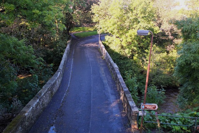
Images are sourced within 2km of 55.884073/-3.3264733 or Grid Reference NT1766. Thanks to Geograph Open Source API. All images are credited.
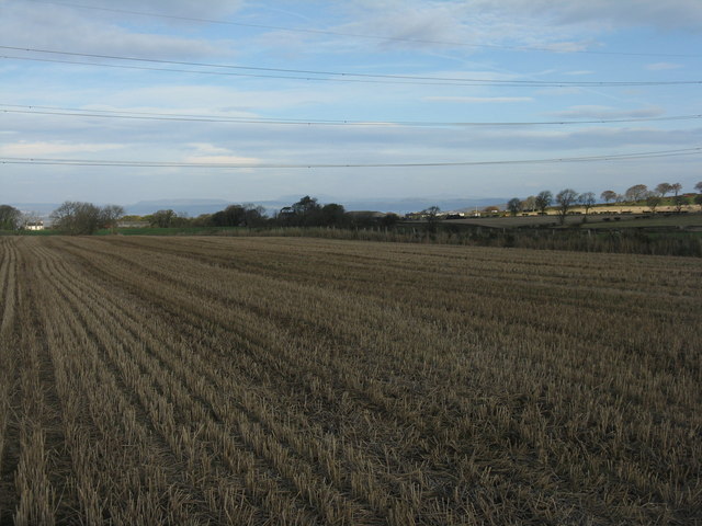
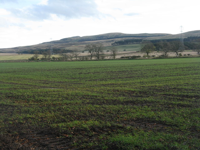
A sad site/sight Property at Balerno, on the 'bends' on the A70, as one leaves Balerno, which has appeared to have been abandoned for some years, looks as if something is happening at last.
A sad site/sight
Property at Balerno, on the 'bends' on the A70, as one leaves Balerno, which has appeared to have been abandoned for some years, looks as if something is happening at last.
Pine trees beside Harlaw Reservoir Black Hill <a href="https://www.geograph.org.uk/gridref/NT1863">NT1863</a> beyond.
Pine trees beside Harlaw Reservoir
Black Hill NT1863 beyond.
Path beside Harlaw Reservoir Showing the north-west corner of Harlaw Reservoir, a popular spot for anglers. The path round the Reservoir is frequented by walkers and cyclists.

Black Hill <a href="https://www.geograph.org.uk/gridref/NT1863">NT1863</a> beyond.
Path beside Harlaw Reservoir
Showing the north-west corner of Harlaw Reservoir, a popular spot for anglers. The path round the Reservoir is frequented by walkers and cyclists. Black Hill NT1863 beyond.
Control valve on Harlaw Reservoir Bridge out from  Harlaw Reservoir dam to the control mechanism.  An angler fishes from the foot of the dam.

West Kip <a href="https://www.geograph.org.uk/gridref/NT1760">NT1760</a> in the Pentland Hills can be seen on the skyline.
Control valve on Harlaw Reservoir
Bridge out from Harlaw Reservoir dam to the control mechanism. An angler fishes from the foot of the dam. West Kip NT1760 in the Pentland Hills can be seen on the skyline.
Gabions by Harlaw Reservoir Adjoining the eastern end of the dam.
Gabions by Harlaw Reservoir
Adjoining the eastern end of the dam.
28 Weaver's Knowe Crescent, Currie 1960s Wimpey private housing on an estate to the west of Edinburgh. Semi-detached, three bedrooms, two 'public' rooms and kitchen. Gas fire but no central heating. See <a href="https://www.geograph.org.uk/photo/479755">NT1768 : 1960s housing estate, Currie, suburban Edinburgh</a> for an aerial view of the estate; this house is the one to the left of the pylon visible in that picture. For information, it cost us £3650.
28 Weaver's Knowe Crescent, Currie
1960s Wimpey private housing on an estate to the west of Edinburgh. Semi-detached, three bedrooms, two 'public' rooms and kitchen. Gas fire but no central heating. See NT1768 : 1960s housing estate, Currie, suburban Edinburgh for an aerial view of the estate; this house is the one to the left of the pylon visible in that picture. For information, it cost us £3650.
Harlaw Reservoir outflows Banks supported by gabions.
Harlaw Reservoir outflows
Banks supported by gabions.
Through the trees to Harlaw Reservoir Threipmuir and Harlaw Reservoirs were completed in 1848 as a water supply for Edinburgh. Nowadays these reservoirs provide essential upstream flood storage to prevent flooding of the Water of Leith, but are no longer used for water supply.
Through the trees to Harlaw Reservoir
Threipmuir and Harlaw Reservoirs were completed in 1848 as a water supply for Edinburgh. Nowadays these reservoirs provide essential upstream flood storage to prevent flooding of the Water of Leith, but are no longer used for water supply.
Barley stubble at Easter Kinleith. Looking north to the Lomond Hills of Fife, just visible on the centre horizon 40km away.
Barley stubble at Easter Kinleith.
Looking north to the Lomond Hills of Fife, just visible on the centre horizon 40km away.
Winter wheat in the Pentland Hills A recently sown field where once there would only have been rough pasture. New cultivars allow winter cereals to be grown in quite severe conditions. This crop is not yet germinating, and there is evidence of erosion from rain run-off in the foreground. The long low hills in the distance are West and East Cairn Hills [10km to the southwest], the one on the left is Hare Hill, much nearer at 4km.
Winter wheat in the Pentland Hills
A recently sown field where once there would only have been rough pasture. New cultivars allow winter cereals to be grown in quite severe conditions. This crop is not yet germinating, and there is evidence of erosion from rain run-off in the foreground. The long low hills in the distance are West and East Cairn Hills [10km to the southwest], the one on the left is Hare Hill, much nearer at 4km.
Winter cereals at Kinleith Looking across the trees lining the Kinleith Burn towards Capelaw Hill.
Winter cereals at Kinleith
Looking across the trees lining the Kinleith Burn towards Capelaw Hill.
The view from the top of Currie Kirkgate A good viewpoint for the whole of western Edinburgh, with Currie in the valley of the Water of Leith beyond the field. Corstorphine Hill is the wooded hump on the right, and the Gyle and Hermiston Gait business and shopping areas provide most of the whiteness on the left.
The view from the top of Currie Kirkgate
A good viewpoint for the whole of western Edinburgh, with Currie in the valley of the Water of Leith beyond the field. Corstorphine Hill is the wooded hump on the right, and the Gyle and Hermiston Gait business and shopping areas provide most of the whiteness on the left.
Farmland at Kinleith Looking west across barley stubble to a gappy shelter belt.
Farmland at Kinleith
Looking west across barley stubble to a gappy shelter belt.
Fishermen, Harlaw Reservoir
Harlaw Reservoir Spillway
Currie Brig on the Water of Leith A bridge crossed by General Dalziel at the head of his dragoons on their way to crush the Covenanters at the battle of Rullion Green in 1666. <span class="nowrap"><a title="http://en.wikipedia.org/wiki/Battle_of_Rullion_Green" rel="nofollow ugc noopener" href="http://en.wikipedia.org/wiki/Battle_of_Rullion_Green">Link</a><img style="margin-left:2px;" alt="External link" title="External link - shift click to open in new window" src="https://s1.geograph.org.uk/img/external.png" width="10" height="10"/></span>
Currie Brig on the Water of Leith
A bridge crossed by General Dalziel at the head of his dragoons on their way to crush the Covenanters at the battle of Rullion Green in 1666. LinkExternal link
Kirkgate and bridge, Currie Currie Kirk is behind the photographer in this view to the bridge crossing the Water of Leith, taken from the path on the old railway line.
Kirkgate and bridge, Currie
Currie Kirk is behind the photographer in this view to the bridge crossing the Water of Leith, taken from the path on the old railway line.
The Riccarton Arms, Currie Inn by the A70 Lanark Road, named after the former Riccarton House, now the campus of Heriot Watt University.
The Riccarton Arms, Currie
Inn by the A70 Lanark Road, named after the former Riccarton House, now the campus of Heriot Watt University.
Show me another place!

Black Wood is located at Grid Ref: NT1766 (Lat: 55.884073, Lng: -3.3264733)

Unitary Authority: City of Edinburgh

Police Authority: Edinburgh

What 3 Words

///random.suffer.ocean. Near Balerno, Edinburgh

Nearby Locations

Black Wood Duncan's Belt

Related Wikis

Lennox Tower

Lennox Tower is a ruinous fifteenth-century tower house at Lymphoy, near the Water of Leith, between Balerno and Currie, 11 kilometres (6.8 mi) south-west...

Malleny House and Garden

The Malleny House and Garden is an historic house and garden owned by the National Trust for Scotland in Balerno, 6 mi (9.7 km) southwest of Edinburgh...

Balerno

Balerno (; Scottish Gaelic: Baile Àirneag, Scottish Gaelic pronunciation [ˈpaləˈaːrˠnək];; Scots: Balerno or Balernie) is a village on the outskirts of...

Balerno Community High School

Balerno High School is a six-year secondary school located in Balerno, a suburb of Edinburgh, Scotland. The school stands on the banks of the Water of...

Nearby Amenities

Located within 500m of 55.884073,-3.3264733
The data included in this document is from www.openstreetmap.org. The data is made available under ODbL.

Have you been to Black Wood?

Leave your review of Black Wood below (or comments, questions and feedback).