Clune Plantation

Wood, Forest in Fife

Scotland

Clune Plantation

A Meandering Path It is unusual to see a tarmac path with such a snakey profile. This is the most pronounced example I came across on a short walk at the West end of Lochore Meadows Country Park. It looks like they have just laid the tarmac on top of a former mud path. The country park sits on the site of a former mining area and usually the paths in these sites follow the routes of old railway or tram lines; this is far more eye-catching.
This country park, of which Scotland has 40, has the unusual distinction of being part of a larger regional park. Scotland has just three regional parks and this one - Lomond Hills Regional Park - is split into two discontiguous parts.
A Meandering Path Credit: Ian Dodds

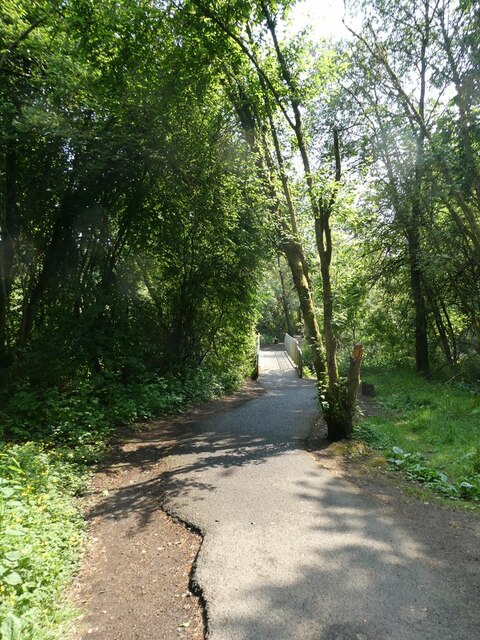
Clune Plantation, located in Fife, Scotland, is a woodland area known for its natural beauty and rich history. Spanning approximately 300 acres, the plantation is nestled within the picturesque landscape of the East Neuk of Fife.

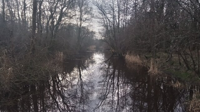
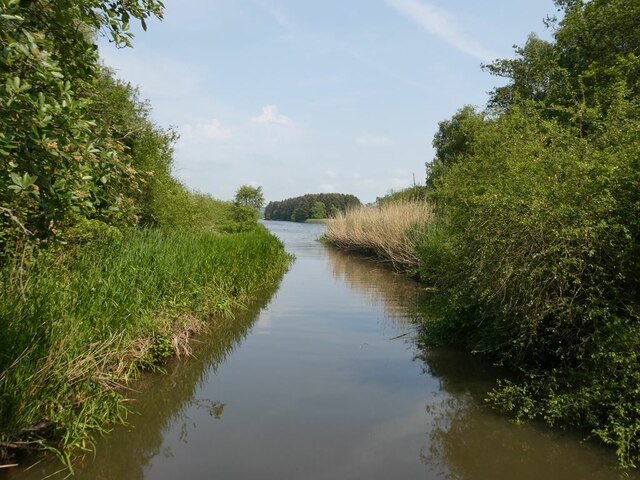
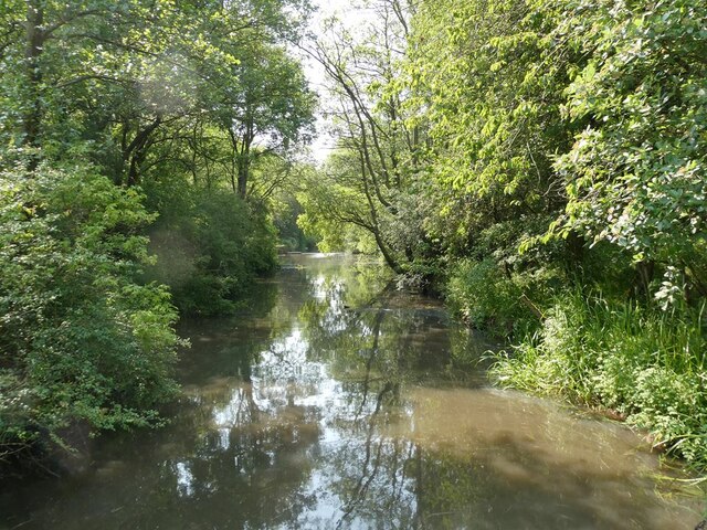
The plantation is predominantly composed of a diverse array of trees, including native species such as oak, birch, and beech. This mixture of deciduous and coniferous trees creates a stunning and varied woodland environment, offering visitors a peaceful retreat from the hustle and bustle of everyday life.

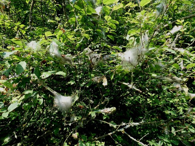
Clune Plantation is also home to a variety of wildlife, making it a popular spot for nature enthusiasts. Red squirrels, deer, and a wide range of bird species can often be spotted within the woodland, adding to its natural charm and allure.

In addition to its natural beauty, Clune Plantation holds historical significance. The site was once part of the larger estate of Earlshall Castle, which dates back to the 16th century. While the castle itself no longer stands, remnants of its former grandeur can still be seen in the form of ancient stone walls and ruins scattered throughout the plantation.

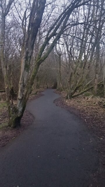
The plantation offers visitors a network of well-maintained trails, providing opportunities for leisurely walks, hiking, and wildlife observation. Whether it's a peaceful stroll among the trees or an exploration of the historical ruins, Clune Plantation offers a captivating experience for all who visit.

If you have any feedback on the listing, please let us know in the comments section below.

Clune Plantation Images

Images are sourced within 2km of 56.138471/-3.3358018 or Grid Reference NT1794. Thanks to Geograph Open Source API. All images are credited.

A Meandering Path It is unusual to see a tarmac path with such a snakey profile. This is the most pronounced example I came across on a short walk at the West end of Lochore Meadows Country Park. It looks like they have just laid the tarmac on top of a former mud path. The country park sits on the site of a former mining area and usually the paths in these sites follow the routes of old railway or tram lines; this is far more eye-catching.
This country park, of which Scotland has 40, has the unusual distinction of being part of a larger regional park. Scotland has just three regional parks and this one - Lomond Hills Regional Park - is split into two discontiguous parts.
A Meandering Path
It is unusual to see a tarmac path with such a snakey profile. This is the most pronounced example I came across on a short walk at the West end of Lochore Meadows Country Park. It looks like they have just laid the tarmac on top of a former mud path. The country park sits on the site of a former mining area and usually the paths in these sites follow the routes of old railway or tram lines; this is far more eye-catching. This country park, of which Scotland has 40, has the unusual distinction of being part of a larger regional park. Scotland has just three regional parks and this one - Lomond Hills Regional Park - is split into two discontiguous parts.
The River Ore This is a strange river, judging by the map. It is shown as beginning in marshland just a few hundred yards West of here. It is not shown as a normal headwater though; it is shown as already being quite wide and has its name right from its start. It then flows into a medium-sized pond, before reaching this short stretch, after which it reaches Loch Ore, which is basically a flooded collapsed former mine. It emerges from the other side of the loch as a thin blue line, then eventually widens again. After a few miles it reaches the River Leven, which shortly afterwards flows into the North Sea.
The picture was taken from a footbridge on the edge of Lochore Meadows Country Park.
The River Ore
This is a strange river, judging by the map. It is shown as beginning in marshland just a few hundred yards West of here. It is not shown as a normal headwater though; it is shown as already being quite wide and has its name right from its start. It then flows into a medium-sized pond, before reaching this short stretch, after which it reaches Loch Ore, which is basically a flooded collapsed former mine. It emerges from the other side of the loch as a thin blue line, then eventually widens again. After a few miles it reaches the River Leven, which shortly afterwards flows into the North Sea. The picture was taken from a footbridge on the edge of Lochore Meadows Country Park.
Mountain Bike Trail Feature This is the last - or possibly first, though I imagine the two cyclists I saw negotiating it with ease were travelling in their particular direction for obvious reasons - feature in one of a few small sections of Lochore Meadows Country Park set aside for mountain biking. This ramp thing sits on a trail called the 'Skills Loop'.
This Country Park is by far the busiest and best put together I have come across in Scotland so far, though I have only visited a handful of the 40 there are. Country Parks are designated as such by the local council (or councils if they straddle authority boundaries, though I have no idea whether this straddling occurs in any of them) and are non-statutory designations. This means that it is the council who decide what is allowed to go on in them, and what bye-laws they want to bring in to help with their operation. As is always the case with these things however, how much overall autonomy the local authorities have is a grey area. Whilst it is supposedly up to the councils to decide whether there is a need for them or not, considering that the Countryside (Scotland) Act 1967 goes so far as to give local authorities the power to carry out compulsory land purchases it seems likely that if a council managing an area the size of Fife, with so many areas of high population density, deemed such freely accessible recreational areas unnecessary they would fall foul of some higher governmental policies.
Next up from a Country Park is a Regional Park. These are far larger, and contain a far higher proportion of private land, and a far higher number of residential properties and business properties/operations. Whilst within a Country Park people can pretty much wander around wherever they like  and do as they please, a Regional Park's remit is essentially to give the public better access to private land for recreation than is afforded by Scotland's 'right to roam' legislation, generally by having waymarked routes and set-aside recreational areas within them.
Scotland currently has three of these, one of which is Lomond Hills Regional Park. The odd thing about the Lomond Hills one is that it is for some reason split into two sections. Futhermore, one of these contains, in its entirety, Lochore Meadows Country Park.
Mountain Bike Trail Feature
This is the last - or possibly first, though I imagine the two cyclists I saw negotiating it with ease were travelling in their particular direction for obvious reasons - feature in one of a few small sections of Lochore Meadows Country Park set aside for mountain biking. This ramp thing sits on a trail called the 'Skills Loop'. This Country Park is by far the busiest and best put together I have come across in Scotland so far, though I have only visited a handful of the 40 there are. Country Parks are designated as such by the local council (or councils if they straddle authority boundaries, though I have no idea whether this straddling occurs in any of them) and are non-statutory designations. This means that it is the council who decide what is allowed to go on in them, and what bye-laws they want to bring in to help with their operation. As is always the case with these things however, how much overall autonomy the local authorities have is a grey area. Whilst it is supposedly up to the councils to decide whether there is a need for them or not, considering that the Countryside (Scotland) Act 1967 goes so far as to give local authorities the power to carry out compulsory land purchases it seems likely that if a council managing an area the size of Fife, with so many areas of high population density, deemed such freely accessible recreational areas unnecessary they would fall foul of some higher governmental policies. Next up from a Country Park is a Regional Park. These are far larger, and contain a far higher proportion of private land, and a far higher number of residential properties and business properties/operations. Whilst within a Country Park people can pretty much wander around wherever they like and do as they please, a Regional Park's remit is essentially to give the public better access to private land for recreation than is afforded by Scotland's 'right to roam' legislation, generally by having waymarked routes and set-aside recreational areas within them. Scotland currently has three of these, one of which is Lomond Hills Regional Park. The odd thing about the Lomond Hills one is that it is for some reason split into two sections. Futhermore, one of these contains, in its entirety, Lochore Meadows Country Park.
Clune Craig A faint path - just visible in the picture - leads from the West of the main track that goes round Loch Ore to this hill, but it doesn't rejoin the track to the East. Since I approached the hill from the East, via another small stoney hillock, I'm not sure where it ends up, but it's surprising that curiosity hasn't beaten a path to the top from the other direction, considering the amount of paths there are leading off from the main track to other obscure places.
This 118 metre hill - not much higher than the loch - along with the nearby small plantation, takes its name from an old farm that used sit just East of the summit. How the farm got its name though is unclear.
Right now, due to a week-long hot spell and low rainfall over recent months, Scotland resembles Spain. There are very few green fields left around here.
Clune Craig
A faint path - just visible in the picture - leads from the West of the main track that goes round Loch Ore to this hill, but it doesn't rejoin the track to the East. Since I approached the hill from the East, via another small stoney hillock, I'm not sure where it ends up, but it's surprising that curiosity hasn't beaten a path to the top from the other direction, considering the amount of paths there are leading off from the main track to other obscure places. This 118 metre hill - not much higher than the loch - along with the nearby small plantation, takes its name from an old farm that used sit just East of the summit. How the farm got its name though is unclear. Right now, due to a week-long hot spell and low rainfall over recent months, Scotland resembles Spain. There are very few green fields left around here.
Closeup of Lochore Castle Apart from a couple of low sections of the outer wall, these four blocks are all that remain of Lochore Castle. All the blocks except the far-right one have been bolstered by brick supports at some point within their structure. Maybe my eyes were playing tricks on me, but the only one of these old corner pillars that appears not to have had any major remedial work is the one that looks like it is most likely to fall over!
These castle remains sit close to the edge, and just off one of the approach roads to Lochore Meadows Country Park. The decent sized loch, although pretty much man-made  as a result of mining subsidence, looks like a natural water body that has been around forever. On the other hand, this old castle, which you would assume - had you not read the noticeboards around it - had always been on land, was in fact once in the middle of a small loch.
Older Geograph pictures show a scruffy wooden fence around this site, and most of them give the impression of a fairly easy walk to the site once the fence has been crossed. Today, in reverse,  there is no fence but there is extremely high vegetation between the path that encircles the castle and the castle itself.  The easiest way up (discovered on my return) is a faint path just to the right of a rather grand  memorial plaque for a recently deceased local historian.
Closeup of Lochore Castle
Apart from a couple of low sections of the outer wall, these four blocks are all that remain of Lochore Castle. All the blocks except the far-right one have been bolstered by brick supports at some point within their structure. Maybe my eyes were playing tricks on me, but the only one of these old corner pillars that appears not to have had any major remedial work is the one that looks like it is most likely to fall over! These castle remains sit close to the edge, and just off one of the approach roads to Lochore Meadows Country Park. The decent sized loch, although pretty much man-made as a result of mining subsidence, looks like a natural water body that has been around forever. On the other hand, this old castle, which you would assume - had you not read the noticeboards around it - had always been on land, was in fact once in the middle of a small loch. Older Geograph pictures show a scruffy wooden fence around this site, and most of them give the impression of a fairly easy walk to the site once the fence has been crossed. Today, in reverse, there is no fence but there is extremely high vegetation between the path that encircles the castle and the castle itself. The easiest way up (discovered on my return) is a faint path just to the right of a rather grand memorial plaque for a recently deceased local historian.
River Ore Where it enters Loch Ore.
River Ore
Where it enters Loch Ore.
River Ore Looking upstream from the point where it enters Loch Ore.
River Ore
Looking upstream from the point where it enters Loch Ore.
Footbridge over the River Ore On the footpath which follows the shoreline of Loch Ore.
Footbridge over the River Ore
On the footpath which follows the shoreline of Loch Ore.
Insect cocoons Cocoons made by some insect unidentified beside the  footpath which follows the shoreline of Loch Ore.
Insect cocoons
Cocoons made by some insect unidentified beside the footpath which follows the shoreline of Loch Ore.
Lochore Meadows Country Park. On the footpath which follows the shoreline of Loch Ore.
Lochore Meadows Country Park.
On the footpath which follows the shoreline of Loch Ore.
Paddleboarders  on Loch Ore Alongside a well-wooded island.
Paddleboarders on Loch Ore
Alongside a well-wooded island.
Pit road on the north side of Loch Ore Within the Lochore Meadows Country Park. The signs indicate a route of the Kingdom of Fife Millennium Cycleways.
Pit road on the north side of Loch Ore
Within the Lochore Meadows Country Park. The signs indicate a route of the Kingdom of Fife Millennium Cycleways.
Field of cattle To the south of Loch Ore.
Field of cattle
To the south of Loch Ore.
Loch Ore Within the Lochore Meadows Country Park. Showing two of the islands in the loch. Benarty Hill <a href="https://www.geograph.org.uk/gridref/NT1597">NT1597</a> beyond.
Loch Ore
Within the Lochore Meadows Country Park. Showing two of the islands in the loch. Benarty Hill NT1597 beyond.
Loch Ore Within the Lochore Meadows Country Park. Looking across one of the islands towards the visitor centre.
Loch Ore
Within the Lochore Meadows Country Park. Looking across one of the islands towards the visitor centre.
Lochore Meadows Country Park On the footpath which follows the shoreline of Loch Ore.
Lochore Meadows Country Park
On the footpath which follows the shoreline of Loch Ore.
Boating on Loch Ore Within the Lochore Meadows Country Park.
Boating on Loch Ore
Within the Lochore Meadows Country Park.
Loch Ore On the footpath which follows the shoreline of Loch Ore.
Loch Ore
On the footpath which follows the shoreline of Loch Ore.
Show me another place!

Clune Plantation is located at Grid Ref: NT1794 (Lat: 56.138471, Lng: -3.3358018)

Unitary Authority: Fife

Police Authority: Fife

What 3 Words

///liquids.nobody.overlaps. Near Lochgelly, Fife

Nearby Locations

Clune Plantation

Related Wikis

Glencraig

Glencraig is a very small former mining village in Scotland, situated in the Benarty area of Fife, between Crosshill and Lochgelly. The village's population...

Loch Ore

Loch Ore is a loch situated in Fife, Scotland. It forms the core of Lochore Meadows Country Park. It is used mainly for leisure purposes, especially yachting...

Lochgelly High School

Lochgelly High School is a non-denominational secondary school located in Lochgelly, Fife. The school's catchment area covers Lochgelly and the surrounding...
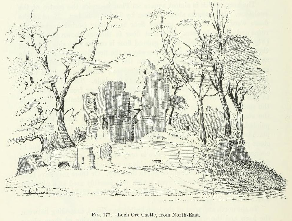
Lochore Castle

Lochore Castle is a ruined 14th-century tower house, about 3 miles (4.8 km) south east of Cowdenbeath, Fife, Scotland, and south of Lochore, east of Loch...

Nearby Amenities

Located within 500m of 56.138471,-3.3358018
Power: pole
Lat/Long: 56.1421137/-3.3326948
Power: pole
Lat/Long: 56.1414483/-3.3346245
Power: pole
Lat/Long: 56.1407499/-3.3381162
Power: pole
Lat/Long: 56.1409306/-3.3416315
Power: pole
Lat/Long: 56.1410104/-3.3368141
Power: pole
Lat/Long: 56.1412996/-3.3353683
Power: pole
Lat/Long: 56.1417969/-3.3336137
Power: pole
Lat/Long: 56.1408182/-3.3394428
Power: pole
Lat/Long: 56.1408859/-3.3407619
Power: pole
Lat/Long: 56.1412313/-3.3413982
Power: pole
Lat/Long: 56.1409163/-3.3381241
Power: pole
Lat/Long: 56.1415221/-3.3349448
Power: pole
Lat/Long: 56.1411064/-3.3371266
Power: pole
Lat/Long: 56.1413014/-3.3360952
Power: pole
Lat/Long: 56.1410223/-3.339226
Power: pole
Lat/Long: 56.1411338/-3.3403847
Power: pole
Lat/Long: 56.1423176/-3.3329729
Ford: yes
Lat/Long: 56.1407003/-3.3339552
Barrier: stile
Lat/Long: 56.1405651/-3.3343264
The data included in this document is from www.openstreetmap.org. The data is made available under ODbL.

Have you been to Clune Plantation?

Leave your review of Clune Plantation below (or comments, questions and feedback).