Dreva Wood

Wood, Forest in Peeblesshire

Scotland

Dreva Wood

Drumelzier Standing Stone The standing stone near Drumelzier.
Photo taken on the 2nd January 2022.
Drumelzier Standing Stone Credit: Rab McMurdo

Dreva Wood, located in Peeblesshire, Scotland, is a picturesque forest renowned for its natural beauty and rich biodiversity. Spanning an area of approximately 800 hectares, this woodland is a haven for nature lovers, hikers, and wildlife enthusiasts.

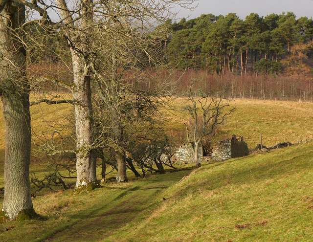
The wood is predominantly composed of native trees such as oak, birch, and Scots pine, creating a diverse and vibrant ecosystem. The dense canopy provides a cool and shaded environment, making it a perfect destination for those seeking respite from the summer heat. The forest floor is carpeted with a lush undergrowth, comprising ferns, mosses, and wildflowers, adding to the enchanting feel of the woodland.

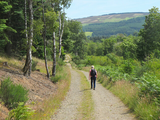
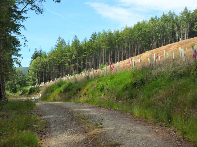
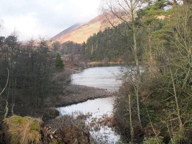
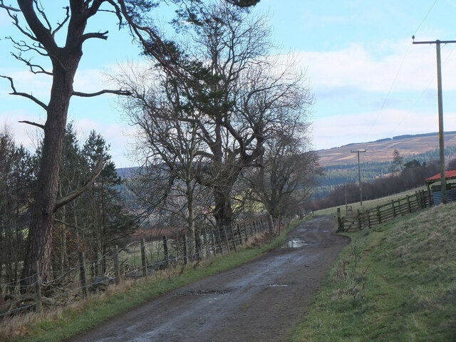
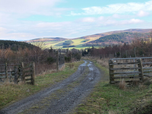
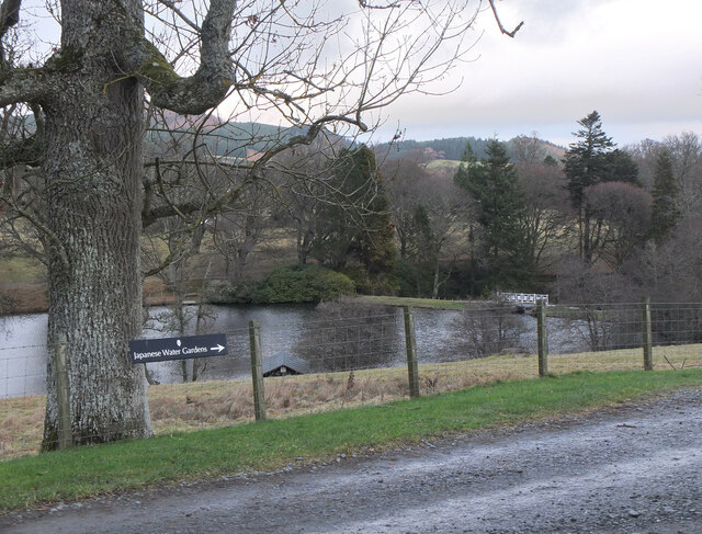
Dreva Wood is crisscrossed by well-maintained walking paths, allowing visitors to explore its beauty on foot. These trails lead to various points of interest, including captivating viewpoints that offer breathtaking panoramas of the surrounding landscape. The forest is also home to a number of small streams and ponds, which further enhance its natural charm.

Wildlife thrives in Dreva Wood, with numerous species finding sanctuary in its tranquil environment. Birdwatchers will find delight in spotting species like woodpeckers, jays, and tawny owls, while mammal enthusiasts may encounter red squirrels, badgers, and roe deer. The forest's diverse habitats also support a plethora of insects, making it a prime location for entomological enthusiasts.

Overall, Dreva Wood is a captivating destination that showcases the beauty of Scotland's natural landscapes. With its diverse flora and fauna, stunning views, and well-maintained trails, it offers a truly immersive experience for visitors seeking to connect with nature in the heart of Peeblesshire.

If you have any feedback on the listing, please let us know in the comments section below.
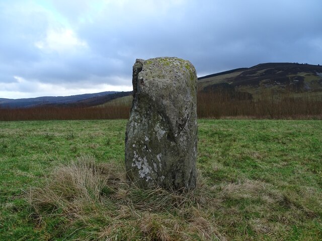
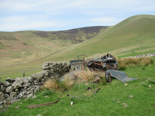
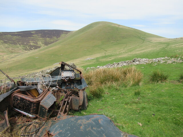
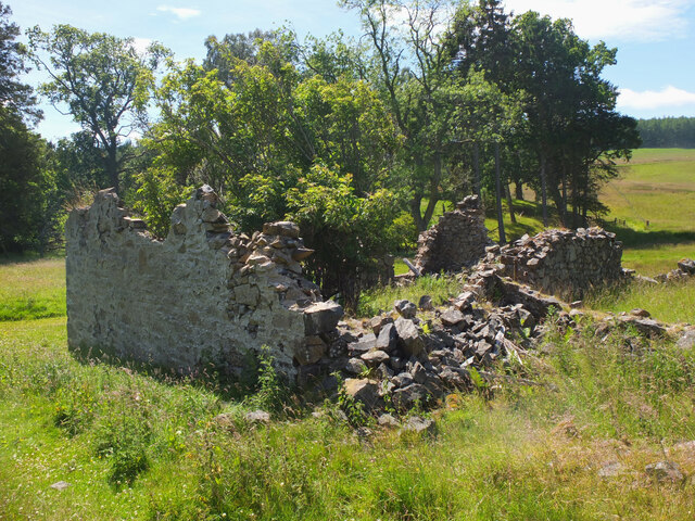
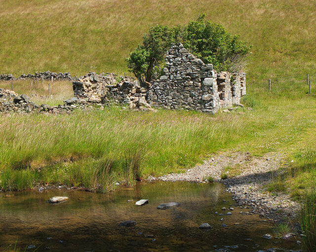
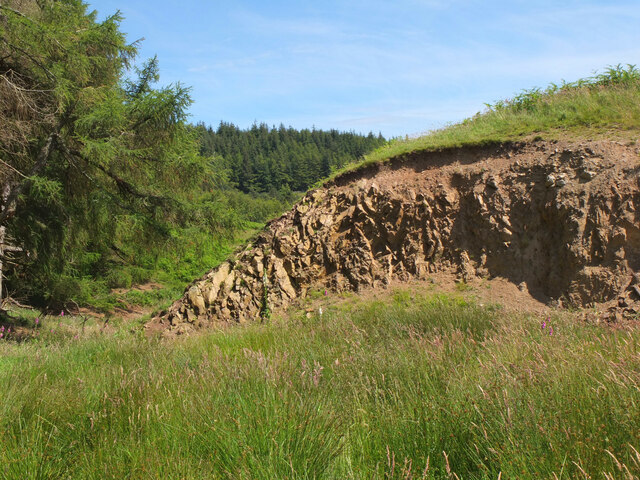
Dreva Wood Images

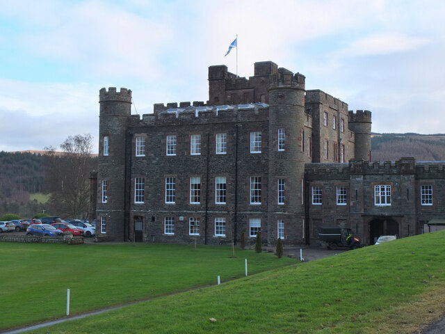
Images are sourced within 2km of 55.61726/-3.3448697 or Grid Reference NT1536. Thanks to Geograph Open Source API. All images are credited.

Drumelzier Standing Stone The standing stone near Drumelzier.
Photo taken on the 2nd January 2022.
Drumelzier Standing Stone
The standing stone near Drumelzier. Photo taken on the 2nd January 2022.
Trahenna Hill viewed from hillside above Dreva Hope Part of the Broughton Heights group of hills, Trahenna Hill rises to 549 metres above sea level.
Trahenna Hill viewed from hillside above Dreva Hope
Part of the Broughton Heights group of hills, Trahenna Hill rises to 549 metres above sea level.
Remains of a van below Trahenna Hill The old Bedford van/shed photographed by Richard Webb in 2005 (<a href="https://www.geograph.org.uk/photo/44843">NT1336 : Old van, Dreva</a>) has now completely fallen apart, leaving something of an eyesore.
Remains of a van below Trahenna Hill
The old Bedford van/shed photographed by Richard Webb in 2005 (NT1336 : Old van, Dreva) has now completely fallen apart, leaving something of an eyesore.
Remains of a van below Trahenna Hill The old Bedford van/shed photographed by Richard Webb in 2005 (<a href="https://www.geograph.org.uk/photo/44843">NT1336 : Old van, Dreva</a>) has now completely fallen apart, leaving something of an eyesore.

And all with only 80,000-odd miles on the clock – although it may have gone round the clock more than once.
Remains of a van below Trahenna Hill
The old Bedford van/shed photographed by Richard Webb in 2005 (NT1336 : Old van, Dreva) has now completely fallen apart, leaving something of an eyesore. And all with only 80,000-odd miles on the clock – although it may have gone round the clock more than once.
John Buchan Way near Harrowhope Summer grasses in the meadow alongside the Easton Burn.
John Buchan Way near Harrowhope
Summer grasses in the meadow alongside the Easton Burn.
Ruins at Harrowhope The back of the ruined cottage by the Easton Burn.
Ruins at Harrowhope
The back of the ruined cottage by the Easton Burn.
Ruins by the Easton Burn The roofless remains of the cottage. The John Buchan Way passes its front door.
Ruins by the Easton Burn
The roofless remains of the cottage. The John Buchan Way passes its front door.
Small quarry below Hammer Rig An old quarry by the track south of Hammer Rig. Exposed rock is rarely seen in this area.
Small quarry below Hammer Rig
An old quarry by the track south of Hammer Rig. Exposed rock is rarely seen in this area.
Woodland on Tarcreish Coniferous woodland on the north side of this hill on the Stobo estate.
Woodland on Tarcreish
Coniferous woodland on the north side of this hill on the Stobo estate.
On the track to Stobo An estate track following the course of the Weston Burn towards Home Farm.
On the track to Stobo
An estate track following the course of the Weston Burn towards Home Farm.
Tree planting on Harrow Hill Broadleaved trees have been planted around the edge of the clear-felled section shown in <a href="https://www.geograph.org.uk/photo/6789832">NT1637 : Clear-felled ground, Harrow Hill</a>.
Tree planting on Harrow Hill
Broadleaved trees have been planted around the edge of the clear-felled section shown in NT1637 : Clear-felled ground, Harrow Hill.
Ruined cottage, Harrowhope Only the walls are standing as a reminder of this cottage by the track from Stobo.
Ruined cottage, Harrowhope
Only the walls are standing as a reminder of this cottage by the track from Stobo.
Hill Loch, Stobo The loch on the Weston Burn with the slopes of Penvalla in the background.
Hill Loch, Stobo
The loch on the Weston Burn with the slopes of Penvalla in the background.
Track to Stobo The farm track from Stobohope along the southern side of the Weston Burn.
Track to Stobo
The farm track from Stobohope along the southern side of the Weston Burn.
Farm track from Stobohope The track to Stobo Castle and Home Farm. The dip in the skyline ahead is the route of the John Buchan Way over the ridge to Glack Hope and the Manor Valley.
Farm track from Stobohope
The track to Stobo Castle and Home Farm. The dip in the skyline ahead is the route of the John Buchan Way over the ridge to Glack Hope and the Manor Valley.
Stobo Castle The castle was completed in 1811, replacing an earlier house on the site. Now it is a hotel and health spa.
Stobo Castle
The castle was completed in 1811, replacing an earlier house on the site. Now it is a hotel and health spa.
Spa entrance, Stobo Castle Entrance to the swimming pool and spa next to the main castle building.
Spa entrance, Stobo Castle
Entrance to the swimming pool and spa next to the main castle building.
Stobo Loch The Japanese gardens were laid out in the early 20th century by a previous owner of the estate.
Stobo Loch
The Japanese gardens were laid out in the early 20th century by a previous owner of the estate.
Show me another place!

Dreva Wood is located at Grid Ref: NT1536 (Lat: 55.61726, Lng: -3.3448697)

Unitary Authority: The Scottish Borders

Police Authority: The Lothians and Scottish Borders

What 3 Words

///lift.swatted.installs. Near Peebles, Scottish Borders

Nearby Locations

Dreva Wood

Related Wikis

Bellspool

Bellspool is a village in the Scottish Borders area of Scotland, near to Drumelzier, Hopcarton and Kingledoors == See also == List of places in the Scottish...

Dreva on Tweed

Dreva on Tweed (or simply Dreva) is a hamlet in the Scottish Borders. It was historically in Peebles-shire. It is noted for the historical presence of...

Upper Tweeddale National Scenic Area

The Upper Tweeddale National Scenic Area lies in the Borders region of Scotland. It is one of 40 national scenic areas (NSA) in Scotland, which are defined...

Stobo Castle

Stobo Castle is located at Stobo in the Scottish Borders, in the former county of Peeblesshire. The Manor of Stobo was originally owned by the Balfour...

Nearby Amenities

Located within 500m of 55.61726,-3.3448697
Power: pole
Lat/Long: 55.6130916/-3.3431724
The data included in this document is from www.openstreetmap.org. The data is made available under ODbL.

Have you been to Dreva Wood?

Leave your review of Dreva Wood below (or comments, questions and feedback).