Bogend Wood

Wood, Forest in Fife

Scotland

Bogend Wood

Footpath to Forth Reach The footpath from the main road, Harbour Drive, to Forth Reach.
Footpath to Forth Reach Credit: Sandy Gemmill

Bogend Wood is a charming forest located in Fife, Scotland. Covering an area of approximately 100 acres, it is a haven for nature enthusiasts and provides a tranquil escape from the bustling city life. The wood is situated near the town of Glenrothes and is easily accessible by car or public transport.

The wood is primarily composed of native broadleaf trees such as oak, beech, and birch, which create a diverse and vibrant ecosystem. Walking through the forest, visitors can enjoy the serene atmosphere and admire the beauty of the trees, especially during the autumn months when the foliage turns into stunning shades of red, orange, and gold.

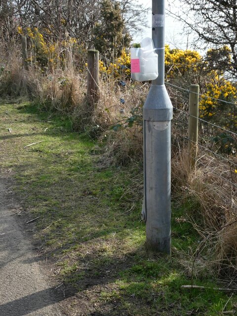
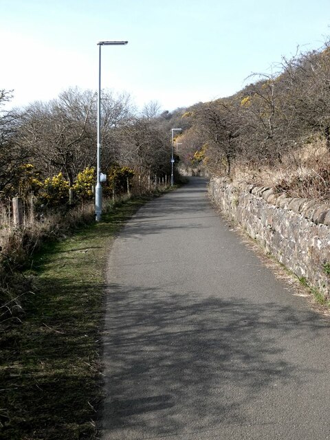
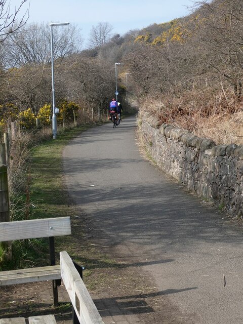
Bogend Wood is home to a variety of wildlife, providing a habitat for numerous bird species, including woodpeckers, owls, and various songbirds. Small mammals like squirrels and rabbits can also be spotted among the undergrowth. Additionally, the wood boasts a network of clear paths and trails, allowing visitors to explore the area while taking in the picturesque surroundings.

The forest is a popular destination for outdoor activities such as hiking, birdwatching, and photography. Its peaceful ambiance and well-maintained facilities make it an ideal spot for picnics or leisurely walks with family and friends. The wood is managed by the local council, ensuring its preservation and accessibility for generations to come.

Overall, Bogend Wood offers a delightful retreat for nature lovers, providing a slice of tranquility and a chance to immerse oneself in the natural splendor of Fife's woodlands.

If you have any feedback on the listing, please let us know in the comments section below.
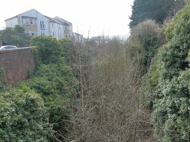
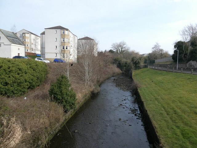
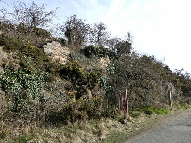
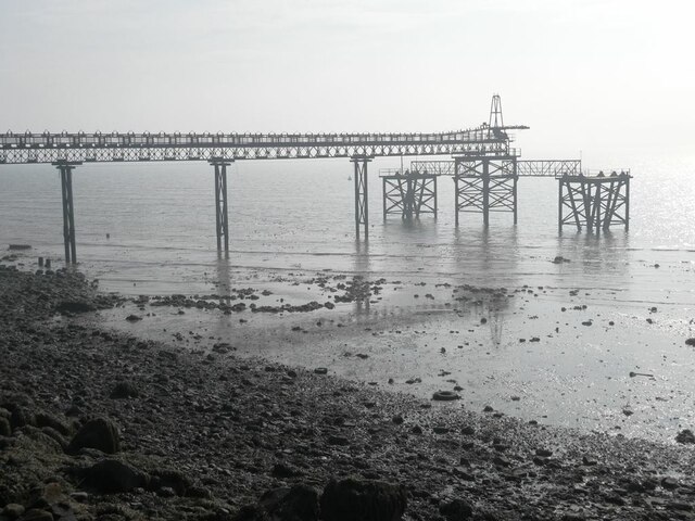
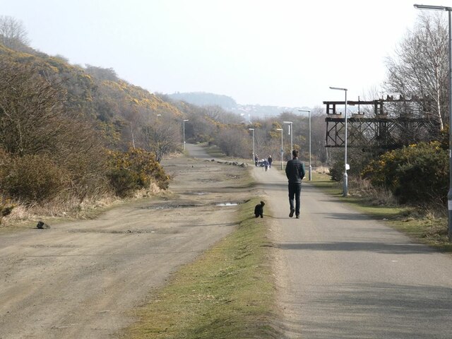
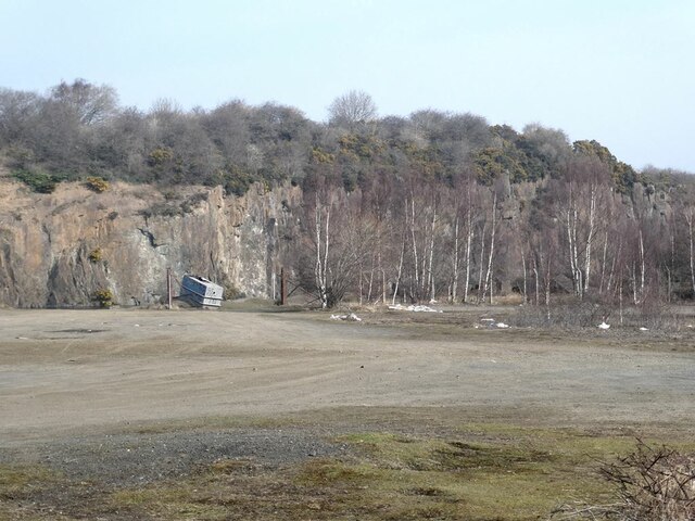
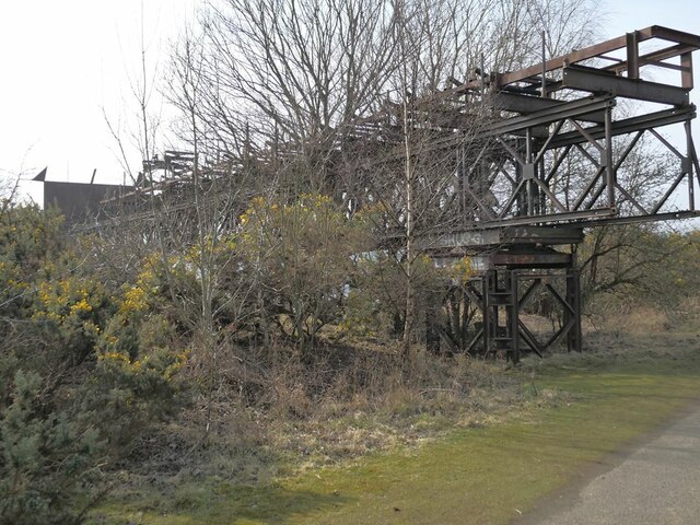
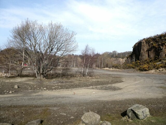
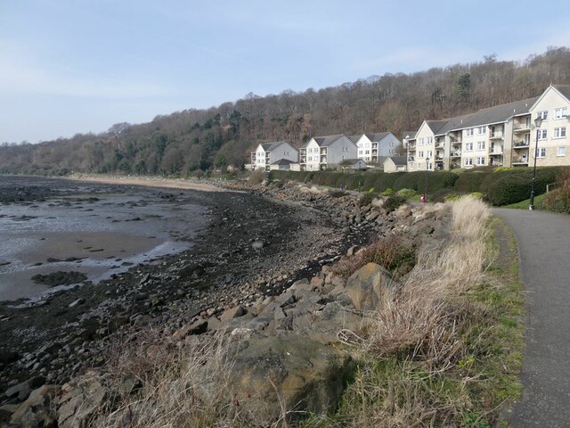
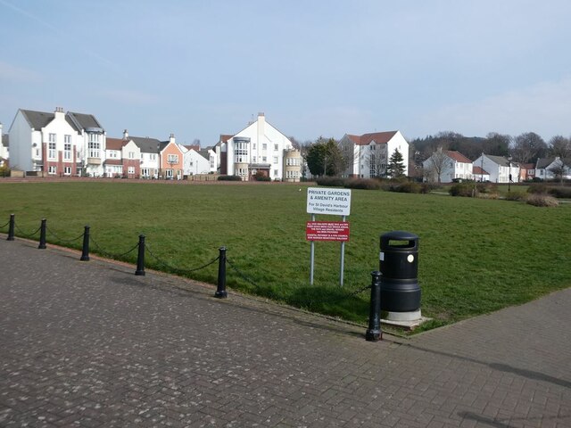
Bogend Wood Images

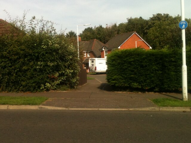
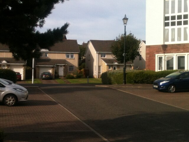
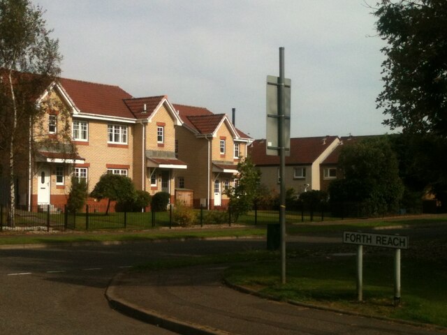
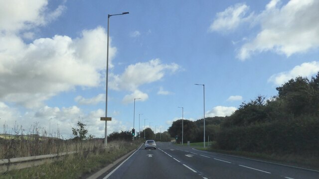
Images are sourced within 2km of 56.034702/-3.3640887 or Grid Reference NT1583. Thanks to Geograph Open Source API. All images are credited.

Footpath to Forth Reach The footpath from the main road, Harbour Drive, to Forth Reach.
Footpath to Forth Reach
The footpath from the main road, Harbour Drive, to Forth Reach.
Spinnaker Way and The Moorings junction The view of the junction with Spinnaker Way as seen from the Moorings.
Spinnaker Way and The Moorings junction
The view of the junction with Spinnaker Way as seen from the Moorings.
Junction between Link Road and Forth Reach The view of the junction with Link Road as seen from Forth Reach.
Junction between Link Road and Forth Reach
The view of the junction with Link Road as seen from Forth Reach.
A921 east of Inverkeithing
Rosyth Dockyard branch railway (as was) The line from Inverkeithing to the RN Dockyard, Rosyth, now long abandoned.
Rosyth Dockyard branch railway (as was)
The line from Inverkeithing to the RN Dockyard, Rosyth, now long abandoned.
The Keithing Burn Looking upstream
The Keithing Burn
Looking upstream
Wall by the Prestonhill Quarry Beside the Fife Coastal Path.
Wall by the Prestonhill Quarry
Beside the Fife Coastal Path.
Derelict pier on Inner Inverkeithing Bay
Fife Coastal Path near Inverkeithing The old Prestonhill Quarry to the left, part of a derelict pier to the right (see <a href="https://www.geograph.org.uk/photo/7126350">NT1382 : Derelict pier on Inner Inverkeithing Bay</a>).
Fife Coastal Path near Inverkeithing
The old Prestonhill Quarry to the left, part of a derelict pier to the right (see NT1382 : Derelict pier on Inner Inverkeithing Bay).
Prestonhill Quarry The Prestonhill Quarry extracted dolerite over the period 1890 to 1980 (approximately) before being abandoned. The derelict site includes a large lake. There are proposals to redevelop the site with the construction of 180 houses, a cafe, a park and community facilities.
Prestonhill Quarry
The Prestonhill Quarry extracted dolerite over the period 1890 to 1980 (approximately) before being abandoned. The derelict site includes a large lake. There are proposals to redevelop the site with the construction of 180 houses, a cafe, a park and community facilities.
Derelict pier on Inner Inverkeithing Bay The landward end of the pier seen in <a href="https://www.geograph.org.uk/photo/7126350">NT1382 : Derelict pier on Inner Inverkeithing Bay</a>.
Derelict pier on Inner Inverkeithing Bay
The landward end of the pier seen in NT1382 : Derelict pier on Inner Inverkeithing Bay.
Prestonhill Quarry The Prestonhill Quarry extracted dolerite over the period 1890 to 1980 (approximately) before being abandoned. The derelict site includes a large lake. There are proposals to redevelop the site with the construction of 180 houses, a cafe, a park and community facilities.
Prestonhill Quarry
The Prestonhill Quarry extracted dolerite over the period 1890 to 1980 (approximately) before being abandoned. The derelict site includes a large lake. There are proposals to redevelop the site with the construction of 180 houses, a cafe, a park and community facilities.
Improvised dog waste bin Some public-spirited soul has installed a number of these in the neighbourhood, fashioned out of old plastic bottles.
Improvised dog waste bin
Some public-spirited soul has installed a number of these in the neighbourhood, fashioned out of old plastic bottles.
Fife Coastal Path near Preston Hill At this point, the Fife Coastal Path doubles up as part of National Cycle Network route 76.
Fife Coastal Path near Preston Hill
At this point, the Fife Coastal Path doubles up as part of National Cycle Network route 76.
Taxi rank, Inverkeithing Station Inverkeithing is an important junction on the line running north from Edinburgh, one branch continuing north to Perth and Inverness, the other heading north-east through Fife to Dundee and Aberdeen.
Taxi rank, Inverkeithing Station
Inverkeithing is an important junction on the line running north from Edinburgh, one branch continuing north to Perth and Inverness, the other heading north-east through Fife to Dundee and Aberdeen.
Cyclists on the Fife Coastal Path Over this section just west of St David's Bay, the Fife Coastal Path doubles up as part of National Cycle Network, route 76. Note the dog waste bin strapped to the near lamppost (see <a href="https://www.geograph.org.uk/photo/7126370">NT1382 : Improvised dog waste bin</a>).
Cyclists on the Fife Coastal Path
Over this section just west of St David's Bay, the Fife Coastal Path doubles up as part of National Cycle Network, route 76. Note the dog waste bin strapped to the near lamppost (see NT1382 : Improvised dog waste bin).
Waterfront apartment blocks at St David's Harbour By the Fife Coastal Path (and National Cycle Network route 76).
Waterfront apartment blocks at St David's Harbour
By the Fife Coastal Path (and National Cycle Network route 76).
The Moorings, St David's Harbour Central green area by St David's Harbour ringed by apartment blocks. By the Fife Coastal Path (and National Cycle Network route 76)
The Moorings, St David's Harbour
Central green area by St David's Harbour ringed by apartment blocks. By the Fife Coastal Path (and National Cycle Network route 76)
Show me another place!

Bogend Wood is located at Grid Ref: NT1583 (Lat: 56.034702, Lng: -3.3640887)

Unitary Authority: Fife

Police Authority: Fife

What 3 Words

///amber.besotted.magma. Near Dalgety Bay, Fife

Nearby Locations

Dalgety Bay Bogend Wood

Related Wikis

Nearby Amenities

Located within 500m of 56.034702,-3.3640887
Bus Stop
Rosebery View
Bench: no
Bin: yes
Bus: yes
Lit: yes
Naptan AtcoCode: 6500D0730
Naptan Bearing: S
Naptan CommonName: Rosebery View
Naptan Indicator: opp
Naptan Landmark: Rosebery View
Naptan NaptanCode: 34323293
Naptan Street: Moray Way
Public Transport: platform
Ref: 34323293
Shelter: no
Source: naptan;bing
Tactile Paving: no
Lat/Long: 56.030378/-3.3644582
Post Box
Collection Times: Mo-Fr 09:00; Sa 07:00
Operator: Royal Mail
Post Box Type: lamp
Ref: KY11 206D
Royal Cypher: scottish_crown
Source: survey
Lat/Long: 56.033103/-3.363554
Bus Stop
Hillside Avenue
Bench: no
Bin: no
Bus: yes
Lit: yes
Naptan AtcoCode: 6500D0173
Naptan Bearing: SW
Naptan CommonName: Hillside Avenue
Naptan Indicator: adj
Naptan Landmark: Hillside Avenue
Naptan NaptanCode: 34323463
Naptan Street: Moray Way
Public Transport: platform
Ref: 34323463
Shelter: yes
Source: naptan;bing
Tactile Paving: no
Lat/Long: 56.0333024/-3.3632784
Bus Stop
St David's Court
Bench: yes
Bin: yes
Bus: yes
Lit: yes
Naptan AtcoCode: 6500D0175
Naptan Bearing: N
Naptan CommonName: St David's Court
Naptan Indicator: adj
Naptan Landmark: Moray Park
Naptan NaptanCode: 34323493
Naptan Street: Moray Way
Public Transport: platform
Ref: 34323493
Shelter: yes
Source: naptan;bing
Tactile Paving: no
Lat/Long: 56.0355808/-3.3615861
Bus Stop
Moray Park
Bench: yes
Bin: yes
Bus: yes
Lit: yes
Naptan AtcoCode: 6500D0177
Naptan Bearing: SW
Naptan CommonName: Moray Park
Naptan Indicator: opp
Naptan Landmark: Moray Park
Naptan NaptanCode: 34323578
Naptan Street: Moray Way
Public Transport: platform
Ref: 34323578
Shelter: yes
Source: naptan;bing
Tactile Paving: no
Lat/Long: 56.0378854/-3.358985
Bus Stop
Rosebery View
Bench: no
Bin: no
Bus: yes
Lit: yes
Naptan AtcoCode: 6500D0928
Naptan Bearing: S
Naptan CommonName: Rosebery View
Naptan Indicator: adj
Naptan Landmark: Rosebery View
Naptan NaptanCode: 34323427
Naptan Street: Moray Way
Public Transport: platform
Ref: 34323427
Shelter: no
Source: naptan;bing
Tactile Paving: no
Lat/Long: 56.0309532/-3.3648648
Bus Stop
Strathbeg Drive
Bench: no
Bin: yes
Bus: yes
Lit: yes
Naptan AtcoCode: 6500D0935
Naptan Bearing: NE
Naptan CommonName: Strathbeg Drive
Naptan Indicator: adj
Naptan Landmark: Strathbeg Drive
Naptan NaptanCode: 34323457
Naptan Street: Moray Way
Public Transport: platform
Ref: 34323457
Shelter: no
Source: naptan;bing
Tactile Paving: no
Lat/Long: 56.0326923/-3.3642609
Bus Stop
St David's Court
Bench: no
Bin: yes
Bus: yes
Lit: yes
Naptan AtcoCode: 6500D0789
Naptan Bearing: S
Naptan CommonName: St David's Court
Naptan Indicator: opp
Naptan Landmark: Moray Park
Naptan NaptanCode: 34323456
Naptan Street: Moray Way
Public Transport: platform
Ref: 34323456
Shelter: no
Source: naptan;bing
Tactile Paving: no
Lat/Long: 56.0352211/-3.3618955
Bus Stop
Moray Park
Bench: no
Bin: yes
Bus: yes
Lit: yes
Naptan AtcoCode: 6500D0788
Naptan Bearing: NE
Naptan CommonName: Moray Park
Naptan Indicator: adj
Naptan Landmark: Moray Park
Naptan NaptanCode: 34323575
Naptan Street: Moray Way
Public Transport: platform
Ref: 34323575
Shelter: no
Source: naptan;bing
Tactile Paving: no
Lat/Long: 56.0377458/-3.3594558
Crossing
Button Operated: yes
Crossing: traffic_signals
Crossing Island: no
Tactile Paving: yes
Traffic Signals Sound: yes
Traffic Signals Vibration: yes
Lat/Long: 56.0313107/-3.3647823
Bus Stop
Forth Reach
Bench: yes
Bin: yes
Bus: yes
Lit: yes
Naptan AtcoCode: 6500D0911
Naptan Bearing: NW
Naptan CommonName: Forth Reach
Naptan Indicator: adj
Naptan Landmark: Forth Reach
Naptan NaptanCode: 34323454
Naptan Street: Link Rd
Public Transport: platform
Ref: 34323454
Shelter: yes
Source: naptan;bing
Tactile Paving: no
Lat/Long: 56.0325947/-3.3680328
Bus Stop
Parklands Crescent
Bench: no
Bin: no
Bus: yes
Lit: yes
Naptan AtcoCode: 6500D0795
Naptan Bearing: S
Naptan CommonName: Parklands Crescent
Naptan Indicator: adj
Naptan Landmark: Parklands Crescent
Naptan NaptanCode: 34323574
Naptan Street: Harbour Drive
Public Transport: platform
Ref: 34323574
Shelter: no
Source: naptan;bing
Tactile Paving: no
Lat/Long: 56.037498/-3.3649918
Bus Stop
Parklands Crescent
Bench: yes
Bin: yes
Bus: yes
Lit: yes
Naptan AtcoCode: 6500D0796
Naptan Bearing: N
Naptan CommonName: Parklands Crescent
Naptan Indicator: opp
Naptan Landmark: Parklands Crescent
Naptan NaptanCode: 34323539
Naptan Street: Harbour Drive
Public Transport: platform
Ref: 34323539
Shelter: yes
Source: naptan;bing
Tactile Paving: no
Lat/Long: 56.0366541/-3.3660474
Bus Stop
Wayfarers Drive
Bench: no
Bin: no
Bus: yes
Lit: yes
Naptan AtcoCode: 6500D0913
Naptan Bearing: SW
Naptan CommonName: Wayfarers Drive
Naptan Indicator: adj
Naptan Landmark: Wayfarers Drive
Naptan NaptanCode: 34323489
Naptan Street: Harbour Drive
Public Transport: platform
Ref: 34323489
Shelter: no
Source: naptan;bing
Tactile Paving: no
Lat/Long: 56.0353199/-3.3676391
Bus Stop
Wayfarers Drive
Bench: no
Bin: no
Bus: yes
Lit: yes
Naptan AtcoCode: 6500D0912
Naptan Bearing: NE
Naptan CommonName: Wayfarers Drive
Naptan Indicator: opp
Naptan Landmark: Wayfarers Drive
Naptan NaptanCode: 34323483
Naptan Street: Harbour Drive
Public Transport: platform
Ref: 34323483
Shelter: no
Source: naptan;bing
Tactile Paving: no
Lat/Long: 56.035134/-3.368445
Post Box
Collection Times: Mo-Fr 09:00; Sa 07:00
Operator: Royal Mail
Post Box Type: lamp
Ref: KY11 429
Royal Cypher: scottish_crown
Lat/Long: 56.0335944/-3.3706099
Bus Stop
Forth Reach
Bench: no
Bin: yes
Bus: yes
Lit: yes
Naptan AtcoCode: 6500D0768
Naptan Bearing: E
Naptan CommonName: Forth Reach
Naptan Indicator: opp
Naptan Landmark: Forth Reach
Naptan NaptanCode: 34323458
Naptan Street: Link Rd
Public Transport: platform
Ref: 34323458
Shelter: no
Source: naptan;bing
Tactile Paving: no
Lat/Long: 56.0330534/-3.3694093
Bus Bay: right
Lat/Long: 56.0330072/-3.3694938
Recycling
Location: overground
Recycling Cans: yes
Recycling Clothes: yes
Recycling Glass Bottles: yes
Recycling Paper: yes
Recycling Plastic: yes
Recycling Shoes: yes
Recycling Type: container
Lat/Long: 56.0386087/-3.3646403
Crossing: informal
Lat/Long: 56.0334331/-3.3628148
Crossing: informal
Lat/Long: 56.0303709/-3.3645397
Created By: Merkaartor 0.10
Lat/Long: 56.0317232/-3.3626678
Created By: Merkaartor 0.10
Lat/Long: 56.0317202/-3.3628275
Created By: Merkaartor 0.10
Lat/Long: 56.0317001/-3.3630213
Created By: Merkaartor 0.10
Lat/Long: 56.031627/-3.3632564
Created By: Merkaartor 0.10
Lat/Long: 56.031641/-3.3635202
Created By: Merkaartor 0.10
Lat/Long: 56.031684/-3.3636271
Created By: Merkaartor 0.10
Lat/Long: 56.0317853/-3.3636365
Created By: Merkaartor 0.10
Lat/Long: 56.0316287/-3.3636294
Created By: Merkaartor 0.10
Lat/Long: 56.0315339/-3.3636884
Created By: Merkaartor 0.10
Lat/Long: 56.0314773/-3.3637261
Created By: Merkaartor 0.10
Lat/Long: 56.0313746/-3.3635964
Created By: Merkaartor 0.10
Lat/Long: 56.0313075/-3.3634197
Created By: Merkaartor 0.10
Lat/Long: 56.0312117/-3.363226
Created By: Merkaartor 0.10
Lat/Long: 56.0311844/-3.3630784
Created By: Merkaartor 0.10
Lat/Long: 56.031173/-3.3628878
Created By: Merkaartor 0.10
Lat/Long: 56.0311667/-3.3627198
Created By: Merkaartor 0.10
Lat/Long: 56.0311907/-3.3625541
Created By: Merkaartor 0.10
Lat/Long: 56.0312298/-3.3623786
Created By: Merkaartor 0.10
Lat/Long: 56.0312344/-3.3622686
Created By: Merkaartor 0.10
Lat/Long: 56.0312593/-3.362167
Created By: Merkaartor 0.10
Lat/Long: 56.0313796/-3.3619154
Created By: Merkaartor 0.10
Lat/Long: 56.0314856/-3.3617466
Created By: Merkaartor 0.10
Lat/Long: 56.0316127/-3.3616246
Created By: Merkaartor 0.10
Lat/Long: 56.0317456/-3.3615176
Created By: Merkaartor 0.10
Lat/Long: 56.0311321/-3.3622471
Created By: Merkaartor 0.10
Lat/Long: 56.0313062/-3.3631775
Created By: Merkaartor 0.10
Lat/Long: 56.0314496/-3.3630429
Created By: Merkaartor 0.10
Lat/Long: 56.0315929/-3.3628437
Created By: Merkaartor 0.10
Lat/Long: 56.031662/-3.3627252
Created By: Merkaartor 0.10
Lat/Long: 56.0316099/-3.3617706
Created By: Merkaartor 0.10
Lat/Long: 56.0315899/-3.3622246
Created By: Merkaartor 0.10
Lat/Long: 56.0315779/-3.3623987
Created By: Merkaartor 0.10
Lat/Long: 56.0315802/-3.3624704
Created By: Merkaartor 0.10
Lat/Long: 56.0315829/-3.362553
Created By: Merkaartor 0.10
Lat/Long: 56.031649/-3.3626248
Created By: Merkaartor 0.10
Lat/Long: 56.0313707/-3.3637764
Created By: Merkaartor 0.10
Lat/Long: 56.0312727/-3.3636137
Created By: Merkaartor 0.10
Lat/Long: 56.0311195/-3.3632532
Crossing: informal
Lat/Long: 56.0331436/-3.3600567
Crossing
Crossing: unmarked
Crossing Island: no
Tactile Paving: no
Lat/Long: 56.033641/-3.3593082
Created By: Merkaartor 0.10
Lat/Long: 56.0312485/-3.3633004
Crossing
Crossing: unmarked
Crossing Island: no
Crossing Markings: no
Tactile Paving: no
Lat/Long: 56.031075/-3.3670202
Created By: Merkaartor 0.10
Lat/Long: 56.031714/-3.3669685
Created By: Merkaartor 0.10
Lat/Long: 56.0317618/-3.3669406
Created By: Merkaartor 0.10
Lat/Long: 56.0318115/-3.3669894
Created By: Merkaartor 0.10
Lat/Long: 56.031823/-3.3671183
Created By: Merkaartor 0.10
Lat/Long: 56.031789/-3.3671792
Created By: Merkaartor 0.10
Lat/Long: 56.0315101/-3.3680867
Created By: Merkaartor 0.10
Lat/Long: 56.0314255/-3.3680956
Created By: Merkaartor 0.10
Lat/Long: 56.0313476/-3.36808
Created By: Merkaartor 0.10
Lat/Long: 56.0312693/-3.3680837
Created By: Merkaartor 0.10
Lat/Long: 56.0311769/-3.3681164
Created By: Merkaartor 0.10
Lat/Long: 56.031111/-3.368146
Created By: Merkaartor 0.10
Lat/Long: 56.031031/-3.3681572
Created By: Merkaartor 0.10
Lat/Long: 56.0309352/-3.3681609
Created By: Merkaartor 0.10
Lat/Long: 56.0308648/-3.3681802
Crossing: informal
Lat/Long: 56.0341361/-3.3645736
Crossing: informal
Lat/Long: 56.034219/-3.3630992
Crossing
Crossing: unmarked
Tactile Paving: no
Lat/Long: 56.0324306/-3.3672701
Bus Bay: right
Lat/Long: 56.0353697/-3.3677041
Crossing
Crossing: unmarked
Crossing Island: no
Crossing Markings: no
Tactile Paving: no
Lat/Long: 56.0367488/-3.3678864
Crossing
Crossing: unmarked
Crossing Island: yes
Tactile Paving: yes
Lat/Long: 56.0383704/-3.3649507
Crossing
Crossing: unmarked
Crossing Island: no
Tactile Paving: no
Lat/Long: 56.0335676/-3.3704599
Crossing
Crossing: unmarked
Crossing Island: yes
Tactile Paving: no
Lat/Long: 56.0333448/-3.3705179
Atm
Cash In: no
Indoor: no
Operator: Cashzone
Lat/Long: 56.0355347/-3.3666843
Crossing
Button Operated: yes
Crossing: traffic_signals
Crossing Island: no
Crossing Ref: pelican
Segregated: no
Tactile Paving: yes
Traffic Signals Sound: yes
Traffic Signals Vibration: yes
Lat/Long: 56.032363/-3.3667299
Crossing
Crossing: unmarked
Crossing Island: no
Crossing Markings: no
Lat/Long: 56.0362264/-3.3665069
Crossing
Crossing: unmarked
Crossing Island: no
Tactile Paving: no
Lat/Long: 56.0368876/-3.3605926
Crossing
Crossing: unmarked
Crossing Island: no
Tactile Paving: no
Lat/Long: 56.0361258/-3.3613416
Crossing
Crossing: unmarked
Crossing Island: no
Tactile Paving: no
Lat/Long: 56.0346089/-3.3618927
Crossing
Crossing: unmarked
Crossing Island: no
Tactile Paving: no
Lat/Long: 56.0334987/-3.3629757
Crossing
Crossing: unmarked
Crossing Island: no
Crossing Markings: no
Tactile Paving: no
Lat/Long: 56.0315272/-3.3646465
Addr Housenumber: 17
Addr Street: Barns Park
Lat/Long: 56.0318337/-3.360768
Addr City: Dalgety Bay
Addr Housenumber: 19
Addr Postcode: KY11 9SU
Addr Street: St. David's Court
Lat/Long: 56.0356036/-3.3610868
Addr Housenumber: 38
Addr Street: Briarhill Avenue
Lat/Long: 56.0355893/-3.3578959
Addr Housenumber: 18
Addr Street: Lt. Sales Avenue
Lat/Long: 56.0358303/-3.3653658
Addr Housenumber: 68
Addr Street: Letham Way
Lat/Long: 56.0370835/-3.3672385
Addr Housenumber: 114
Addr Street: Letham Way
Lat/Long: 56.0361233/-3.3698648
Addr Housenumber: 59
Addr Street: Strathbeg Drive
Lat/Long: 56.0329279/-3.3663616
Addr Housenumber: 19
Addr Street: Collins Crescent
Lat/Long: 56.0321512/-3.3703798
Crossing
Crossing: unmarked
Crossing Island: no
Tactile Paving: no
Lat/Long: 56.0355399/-3.3618191
Crossing
Crossing: unmarked
Crossing Island: no
Tactile Paving: no
Lat/Long: 56.0375431/-3.3598279
Crossing
Crossing: unmarked
Crossing Island: no
Tactile Paving: no
Lat/Long: 56.0331529/-3.3637576
Street Lamp
Lat/Long: 56.0323646/-3.3645223
Street Lamp
Lat/Long: 56.0320868/-3.3647001
Street Lamp
Lat/Long: 56.0326241/-3.3643091
Barrier: kerb
Kerb: lowered
Tactile Paving: no
Lat/Long: 56.0349419/-3.3684752
Barrier: kerb
Kerb: lowered
Tactile Paving: no
Lat/Long: 56.035009/-3.3683378
Crossing
Crossing: unmarked
Crossing Island: no
Tactile Paving: no
Lat/Long: 56.0327774/-3.3687523
Crossing
Crossing: unmarked
Crossing Island: yes
Tactile Paving: no
Lat/Long: 56.0331025/-3.3703736
Crossing
Crossing: unmarked
Crossing Island: no
Crossing Markings: no
Tactile Paving: no
Lat/Long: 56.0349744/-3.3684085
Crossing
Crossing: unmarked
Crossing Island: no
Crossing Markings: no
Tactile Paving: no
Lat/Long: 56.035579/-3.3671226
Crossing
Crossing: unmarked
Crossing Island: yes
Tactile Paving: yes
Lat/Long: 56.0358903/-3.366763
Crossing
Crossing: unmarked
Crossing Island: no
Kerb: lowered
Tactile Paving: no
Lat/Long: 56.0317887/-3.3648321
Bus Bay: left
Lat/Long: 56.0326546/-3.3679607
Noexit: yes
Lat/Long: 56.0348151/-3.3656563
Crossing
Crossing: unmarked
Crossing Island: no
Crossing Markings: no
Tactile Paving: no
Lat/Long: 56.0306708/-3.3648129
Crossing
Crossing: unmarked
Crossing Island: no
Crossing Markings: no
Tactile Paving: no
Lat/Long: 56.0369341/-3.3654789
Man Made: flagpole
Lat/Long: 56.0356434/-3.3644078
Addr Housenumber: 21
Addr Street: Moray Park
Lat/Long: 56.0372926/-3.3606366
Addr Housenumber: 13
Addr Street: Moray Park
Lat/Long: 56.0374626/-3.3610824
Addr Housenumber: 23
Addr Street: Moray Park
Lat/Long: 56.0372501/-3.3603993
Addr Housenumber: 35
Addr Street: Moray Park
Lat/Long: 56.0372859/-3.3613395
Addr Housenumber: 15
Addr Street: Moray Park
Lat/Long: 56.0374078/-3.3610043
Addr Housenumber: 37
Addr Street: Moray Park
Lat/Long: 56.0373106/-3.3613826
Addr Housenumber: 25
Addr Street: Moray Park
Lat/Long: 56.0369795/-3.3608297
Barrier: kerb
Kerb: lowered
Tactile Paving: no
Lat/Long: 56.0378817/-3.3644578
Entrance: main
Lat/Long: 56.0380117/-3.36435
Addr City: Dalgety Bay
Addr Housenumber: 12
Addr Postcode: KY11 9SU
Addr Street: St. David's Court
Lat/Long: 56.0352594/-3.3609045
Addr City: Dalgety Bay
Addr Housenumber: 11
Addr Postcode: KY11 9SU
Addr Street: St. David's Court
Lat/Long: 56.0352397/-3.3607392
Addr City: Dalgety Bay
Addr Housenumber: 10
Addr Postcode: KY11 9SU
Addr Street: St. David's Court
Lat/Long: 56.0352039/-3.3606344
Addr City: Dalgety Bay
Addr Housenumber: 9
Addr Postcode: KY11 9SU
Addr Street: St. David's Court
Lat/Long: 56.0351768/-3.3604864
Addr City: Dalgety Bay
Addr Housenumber: 8
Addr Postcode: KY11 9SU
Addr Street: St. David's Court
Lat/Long: 56.035106/-3.3603689
Addr City: Dalgety Bay
Addr Housenumber: 7
Addr Postcode: KY11 9SU
Addr Street: St. David's Court
Lat/Long: 56.0350936/-3.3602231
Addr City: Dalgety Bay
Addr Housenumber: 6
Addr Postcode: KY11 9SU
Addr Street: St. David's Court
Lat/Long: 56.0351395/-3.3598329
Addr City: Dalgety Bay
Addr Housenumber: 5
Addr Postcode: KY11 9SU
Addr Street: St. David's Court
Lat/Long: 56.0351806/-3.3598411
Addr City: Dalgety Bay
Addr Housenumber: 2
Addr Postcode: KY11 9SU
Addr Street: St. David's Court
Lat/Long: 56.0353323/-3.3602333
Addr City: Dalgety Bay
Addr Housenumber: 1
Addr Postcode: KY11 9SU
Addr Street: St. David's Court
Lat/Long: 56.0353582/-3.3602916
Addr City: Dalgety Bay
Addr Housenumber: 3
Addr Postcode: KY11 9SU
Addr Street: St. David's Court
Lat/Long: 56.0352661/-3.3600693
Addr City: Dalgety Bay
Addr Housenumber: 4
Addr Postcode: KY11 9SU
Addr Street: St. David's Court
Lat/Long: 56.0352528/-3.3600259
Addr City: Dalgety Bay
Addr Housenumber: 20
Addr Postcode: KY11 9SU
Addr Street: St. David's Court
Lat/Long: 56.035592/-3.3609683
Addr City: Dalgety Bay
Addr Housenumber: 22
Addr Postcode: KY11 9SU
Addr Street: St. David's Court
Lat/Long: 56.0355053/-3.3607196
Addr City: Dalgety Bay
Addr Housenumber: 21
Addr Postcode: KY11 9SU
Addr Street: St. David's Court
Lat/Long: 56.0355134/-3.3607904
Addr City: Dalgety Bay
Addr Housenumber: 18
Addr Postcode: KY11 9SU
Addr Street: St. David's Court
Lat/Long: 56.0356461/-3.3612756
Addr City: Dalgety Bay
Addr Housenumber: 17
Addr Postcode: KY11 9SU
Addr Street: St. David's Court
Lat/Long: 56.0356554/-3.3613464
Addr City: Dalgety Bay
Addr Housenumber: 16
Addr Postcode: KY11 9SU
Addr Street: St. David's Court
Lat/Long: 56.0353822/-3.3614623
Addr City: Dalgety Bay
Addr Housenumber: 15
Addr Postcode: KY11 9SU
Addr Street: St. David's Court
Lat/Long: 56.0353731/-3.3613888
Addr City: Dalgety Bay
Addr Housenumber: 14
Addr Postcode: KY11 9SU
Addr Street: St. David's Court
Lat/Long: 56.0353373/-3.3611425
Addr City: Dalgety Bay
Addr Housenumber: 13
Addr Postcode: KY11 9SU
Addr Street: St. David's Court
Lat/Long: 56.0353097/-3.3610718
Turning Circle
Lat/Long: 56.033553/-3.3623462
Turning Circle
Lat/Long: 56.0334447/-3.3607272
Bench
Backrest: yes
Lat/Long: 56.0374119/-3.3670627
Crossing
Crossing: unmarked
Crossing Island: yes
Crossing Markings: no
Kerb: lowered
Tactile Paving: no
Lat/Long: 56.0327052/-3.3706547
Barrier: kerb
Kerb: lowered
Tactile Paving: no
Lat/Long: 56.0330146/-3.3703933
Barrier: kerb
Kerb: lowered
Tactile Paving: no
Lat/Long: 56.0331818/-3.3703559
Bicycle Parking
Bicycle Parking: wall_loops
Capacity: 10
Covered: no
Lat/Long: 56.038037/-3.3644315
Barrier: kerb
Kerb: lowered
Tactile Paving: no
Lat/Long: 56.0390483/-3.3651072
Barrier: kerb
Kerb: lowered
Tactile Paving: no
Lat/Long: 56.0389376/-3.3650083
Crossing
Crossing: unmarked
Crossing Island: yes
Crossing Markings: no
Tactile Paving: no
Lat/Long: 56.0390211/-3.3650955
Crossing
Crossing: unmarked
Crossing Island: yes
Crossing Markings: no
Tactile Paving: no
Lat/Long: 56.0389624/-3.3650451
Crossing
Crossing: unmarked
Crossing Island: yes
Crossing Markings: no
Tactile Paving: no
Lat/Long: 56.0390585/-3.3654369
Crossing
Crossing: unmarked
Crossing Island: yes
Crossing Markings: no
Tactile Paving: no
Lat/Long: 56.039029/-3.3655351
Barrier: kerb
Kerb: lowered
Tactile Paving: no
Lat/Long: 56.0390118/-3.3656057
Barrier: kerb
Kerb: lowered
Tactile Paving: no
Lat/Long: 56.0390782/-3.3653791
Crossing
Crossing: unmarked
Crossing Island: yes
Crossing Markings: no
Tactile Paving: no
Lat/Long: 56.0388548/-3.3656354
Crossing
Crossing: unmarked
Crossing Island: yes
Crossing Markings: no
Tactile Paving: no
Lat/Long: 56.0387852/-3.3655646
Barrier: kerb
Kerb: lowered
Tactile Paving: no
Lat/Long: 56.0388776/-3.3656586
Barrier: kerb
Kerb: lowered
Tactile Paving: no
Lat/Long: 56.0387574/-3.3655362
Crossing
Crossing: unmarked
Crossing Island: yes
Crossing Markings: no
Kerb: lowered
Tactile Paving: no
Lat/Long: 56.0387398/-3.3652576
Crossing
Crossing: unmarked
Crossing Island: yes
Crossing Markings: no
Kerb: lowered
Tactile Paving: no
Lat/Long: 56.0387683/-3.3651383
Barrier: kerb
Kerb: lowered
Tactile Paving: no
Lat/Long: 56.0387295/-3.3653013
Barrier: kerb
Kerb: lowered
Tactile Paving: no
Lat/Long: 56.0387801/-3.3650894
Crossing
Crossing: unmarked
Crossing Island: no
Crossing Markings: no
Tactile Paving: no
Lat/Long: 56.0334/-3.3691579
Barrier: kerb
Kerb: lowered
Tactile Paving: yes
Lat/Long: 56.0383631/-3.3650181
Barrier: kerb
Kerb: lowered
Tactile Paving: yes
Lat/Long: 56.0383777/-3.3648832
Barrier: kerb
Kerb: lowered
Tactile Paving: yes
Lat/Long: 56.0313105/-3.3647227
Barrier: kerb
Kerb: lowered
Tactile Paving: yes
Lat/Long: 56.031311/-3.3648439
Barrier: kerb
Kerb: raised
Tactile Paving: no
Lat/Long: 56.0335722/-3.3705237
Barrier: kerb
Kerb: raised
Tactile Paving: no
Lat/Long: 56.0335632/-3.3703991
Barrier: kerb
Kerb: lowered
Tactile Paving: no
Lat/Long: 56.0333422/-3.3704451
Barrier: kerb
Kerb: lowered
Tactile Paving: no
Lat/Long: 56.0333473/-3.3705866
Barrier: kerb
Kerb: lowered
Tactile Paving: yes
Lat/Long: 56.0323318/-3.3667524
Barrier: kerb
Kerb: lowered
Tactile Paving: yes
Lat/Long: 56.0323931/-3.3667082
Barrier: kerb
Kerb: lowered
Tactile Paving: no
Lat/Long: 56.0318509/-3.3648125
Barrier: kerb
Kerb: lowered
Tactile Paving: no
Lat/Long: 56.0317326/-3.3648497
Barrier: kerb
Kerb: lowered
Tactile Paving: no
Lat/Long: 56.0389806/-3.365072
Barrier: kerb
Kerb: lowered
Tactile Paving: no
Lat/Long: 56.0389919/-3.365083
Barrier: kerb
Kerb: lowered
Tactile Paving: no
Lat/Long: 56.0390447/-3.3654828
Barrier: kerb
Kerb: lowered
Tactile Paving: no
Lat/Long: 56.0390381/-3.3655046
Barrier: kerb
Kerb: lowered
Tactile Paving: no
Lat/Long: 56.0388094/-3.3655892
Barrier: kerb
Kerb: lowered
Tactile Paving: no
Lat/Long: 56.0388226/-3.3656026
Barrier: kerb
Kerb: lowered
Tactile Paving: yes
Lat/Long: 56.0359119/-3.3668187
Barrier: kerb
Kerb: lowered
Tactile Paving: yes
Lat/Long: 56.0358707/-3.3667128
Barrier: kerb
Kerb: lowered
Tactile Paving: no
Lat/Long: 56.0324115/-3.3671899
Barrier: kerb
Kerb: lowered
Tactile Paving: no
Lat/Long: 56.0324515/-3.3673577
Crossing
Crossing: unmarked
Crossing Island: no
Crossing Markings: no
Tactile Paving: no
Lat/Long: 56.0315069/-3.364445
Traffic Calming: choker
Lat/Long: 56.0354498/-3.3666156
Barrier: kerb
Kerb: lowered
Tactile Paving: no
Lat/Long: 56.0387578/-3.3651823
Barrier: kerb
Kerb: lowered
Tactile Paving: no
Lat/Long: 56.0387506/-3.3652122
Barrier: kerb
Kerb: lowered
Tactile Paving: no
Lat/Long: 56.0331913/-3.3637046
Barrier: kerb
Kerb: lowered
Tactile Paving: no
Lat/Long: 56.0331055/-3.3638146
Barrier: kerb
Kerb: raised
Tactile Paving: no
Lat/Long: 56.0308935/-3.362173
Barrier: kerb
Kerb: lowered
Tactile Paving: no
Lat/Long: 56.0380592/-3.367914
Barrier: kerb
Kerb: lowered
Tactile Paving: no
Lat/Long: 56.0380192/-3.3680138
Crossing
Crossing: unmarked
Crossing Island: no
Crossing Markings: no
Tactile Paving: no
Lat/Long: 56.0380405/-3.3679608
Crossing
Crossing: unmarked
Crossing Island: no
Crossing Markings: no
Tactile Paving: no
Lat/Long: 56.0382588/-3.3668611
Barrier: kerb
Kerb: lowered
Tactile Paving: no
Lat/Long: 56.0382707/-3.3668306
Barrier: kerb
Kerb: lowered
Tactile Paving: no
Lat/Long: 56.038243/-3.3669015
Barrier: kerb
Kerb: raised
Tactile Paving: no
Lat/Long: 56.0385878/-3.3666489
Barrier: kerb
Kerb: lowered
Tactile Paving: no
Lat/Long: 56.0385585/-3.3664934
Crossing
Crossing: unmarked
Crossing Island: no
Crossing Markings: no
Tactile Paving: no
Lat/Long: 56.0385736/-3.3665736
Crossing
Crossing: unmarked
Crossing Island: no
Crossing Markings: no
Tactile Paving: no
Lat/Long: 56.0386025/-3.3660618
Barrier: kerb
Kerb: lowered
Tactile Paving: no
Lat/Long: 56.0386212/-3.3659887
Barrier: kerb
Kerb: lowered
Tactile Paving: no
Lat/Long: 56.038589/-3.3661143
Waste Basket
Waste: trash
Lat/Long: 56.0350102/-3.3580429
Bench
Backrest: yes
Colour: black
Lat/Long: 56.0316749/-3.3676482
Waste Basket
Colour: black
Waste: trash
Lat/Long: 56.0316863/-3.3676928
Crossing
Crossing: unmarked
Crossing Island: no
Crossing Markings: no
Kerb: no
Tactile Paving: no
Lat/Long: 56.035579/-3.365995
Barrier: kerb
Kerb: lowered
Lat/Long: 56.0361962/-3.3665392
Barrier: kerb
Kerb: lowered
Lat/Long: 56.0362631/-3.3664677
Barrier: kerb
Kerb: lowered
Tactile Paving: no
Lat/Long: 56.0342455/-3.3685925
Barrier: kerb
Kerb: lowered
Tactile Paving: no
Lat/Long: 56.0342823/-3.368542
Crossing
Crossing: unmarked
Crossing Island: no
Crossing Markings: no
Tactile Paving: no
Lat/Long: 56.0342614/-3.3685708
Barrier: kerb
Kerb: lowered
Tactile Paving: no
Lat/Long: 56.0339165/-3.3688203
Barrier: kerb
Kerb: lowered
Tactile Paving: no
Lat/Long: 56.0338684/-3.3688357
Barrier: kerb
Kerb: lowered
Tactile Paving: no
Lat/Long: 56.0334227/-3.3691567
Barrier: kerb
Kerb: lowered
Tactile Paving: no
Lat/Long: 56.0333783/-3.3691592
Crossing
Crossing: unmarked
Crossing Island: no
Crossing Markings: no
Tactile Paving: no
Lat/Long: 56.0338899/-3.3688288
Barrier: kerb
Kerb: lowered
Tactile Paving: no
Lat/Long: 56.033266/-3.3680408
Barrier: kerb
Kerb: lowered
Tactile Paving: no
Lat/Long: 56.0332804/-3.3681152
Crossing
Crossing: unmarked
Crossing Island: no
Crossing Markings: no
Tactile Paving: no
Lat/Long: 56.0332725/-3.3680743
Barrier: kerb
Kerb: lowered
Tactile Paving: no
Lat/Long: 56.0342151/-3.3671526
Barrier: kerb
Kerb: lowered
Tactile Paving: no
Lat/Long: 56.0341863/-3.367085
Crossing
Crossing: unmarked
Crossing Island: no
Crossing Markings: no
Tactile Paving: no
Lat/Long: 56.0342013/-3.3671203
Crossing
Crossing: unmarked
Crossing Island: no
Crossing Markings: no
Tactile Paving: no
Lat/Long: 56.034404/-3.366844
Barrier: kerb
Kerb: lowered
Tactile Paving: no
Lat/Long: 56.0343921/-3.3668117
Barrier: kerb
Kerb: raised
Tactile Paving: no
Lat/Long: 56.0344178/-3.3668814
Barrier: kerb
Kerb: lowered
Tactile Paving: no
Lat/Long: 56.0347372/-3.3675416
Barrier: kerb
Kerb: lowered
Tactile Paving: no
Lat/Long: 56.0347513/-3.3676229
Crossing
Crossing: unmarked
Crossing Island: no
Crossing Markings: no
Tactile Paving: no
Lat/Long: 56.0347443/-3.3675826
Barrier: kerb
Kerb: lowered
Tactile Paving: no
Lat/Long: 56.0356177/-3.3670525
Barrier: kerb
Kerb: lowered
Tactile Paving: no
Lat/Long: 56.035549/-3.3671779
Crossing
Crossing: unmarked
Crossing Island: no
Crossing Markings: no
Tactile Paving: no
Lat/Long: 56.0354173/-3.3657813
Crossing
Crossing: unmarked
Crossing Island: no
Crossing Markings: no
Tactile Paving: no
Lat/Long: 56.0356713/-3.3658108
Crossing
Continuous Sidewalk: yes
Crossing: unmarked
Crossing Island: no
Crossing Markings: no
Kerb: no
Tactile Paving: no
Lat/Long: 56.0355329/-3.3669012
Barrier: kerb
Kerb: lowered
Tactile Paving: no
Lat/Long: 56.0367792/-3.3678988
Barrier: kerb
Kerb: lowered
Tactile Paving: no
Lat/Long: 56.0367235/-3.3678763
Barrier: kerb
Kerb: lowered
Tactile Paving: no
Lat/Long: 56.0364229/-3.3670087
Barrier: kerb
Kerb: lowered
Tactile Paving: no
Lat/Long: 56.0364144/-3.3669136
Crossing
Crossing: unmarked
Crossing Island: no
Crossing Markings: no
Tactile Paving: no
Lat/Long: 56.0364184/-3.3669578
Barrier: kerb
Kerb: lowered
Tactile Paving: no
Lat/Long: 56.0362514/-3.3674641
Barrier: kerb
Kerb: lowered
Tactile Paving: no
Lat/Long: 56.0362397/-3.3675604
Crossing
Crossing: unmarked
Crossing Island: no
Crossing Markings: no
Tactile Paving: no
Lat/Long: 56.036246/-3.3675088
Barrier: kerb
Kerb: raised
Tactile Paving: no
Lat/Long: 56.0348469/-3.3701568
Barrier: kerb
Kerb: raised
Tactile Paving: no
Lat/Long: 56.0347741/-3.3701795
Crossing
Crossing: unmarked
Crossing Island: no
Crossing Markings: no
Tactile Paving: no
Lat/Long: 56.0348108/-3.370168
Barrier: kerb
Kerb: lowered
Tactile Paving: no
Lat/Long: 56.0363452/-3.3646923
Barrier: kerb
Kerb: lowered
Tactile Paving: no
Lat/Long: 56.0363154/-3.3647365
Crossing
Crossing: unmarked
Crossing Island: no
Crossing Markings: no
Tactile Paving: no
Lat/Long: 56.0363298/-3.3647153
Barrier: kerb
Kerb: lowered
Tactile Paving: no
Lat/Long: 56.0369516/-3.3636617
Barrier: kerb
Kerb: lowered
Tactile Paving: no
Lat/Long: 56.036913/-3.3636247
Crossing
Crossing: unmarked
Crossing Island: no
Crossing Markings: no
Tactile Paving: no
Lat/Long: 56.0369341/-3.3636449
Barrier: kerb
Kerb: lowered
Tactile Paving: no
Lat/Long: 56.0369771/-3.3654342
Barrier: kerb
Kerb: lowered
Tactile Paving: no
Lat/Long: 56.0368798/-3.3655388
Barrier: kerb
Kerb: lowered
Tactile Paving: no
Lat/Long: 56.0327024/-3.3705832
Barrier: kerb
Kerb: lowered
Tactile Paving: no
Lat/Long: 56.0327085/-3.3707272
Barrier: kerb
Kerb: lowered
Tactile Paving: no
Lat/Long: 56.0314331/-3.368932
Barrier: kerb
Kerb: lowered
Tactile Paving: no
Lat/Long: 56.0314301/-3.3690201
Crossing
Crossing: unmarked
Crossing Island: no
Crossing Markings: no
Tactile Paving: no
Lat/Long: 56.0314317/-3.3689733
Barrier: kerb
Kerb: lowered
Tactile Paving: no
Lat/Long: 56.0315902/-3.3691806
Barrier: kerb
Kerb: lowered
Tactile Paving: no
Lat/Long: 56.0315459/-3.3691782
Barrier: kerb
Kerb: lowered
Tactile Paving: no
Lat/Long: 56.0320677/-3.3690642
Barrier: kerb
Kerb: lowered
Tactile Paving: no
Lat/Long: 56.032022/-3.3690736
Crossing
Crossing: unmarked
Crossing Island: no
Crossing Markings: no
Tactile Paving: no
Lat/Long: 56.0315675/-3.3691794
Crossing
Crossing: unmarked
Crossing Island: no
Crossing Markings: no
Tactile Paving: no
Lat/Long: 56.0320459/-3.3690687
Crossing
Crossing: unmarked
Crossing Island: no
Crossing Markings: no
Tactile Paving: no
Lat/Long: 56.031413/-3.3642927
Crossing
Crossing: unmarked
Crossing Island: no
Crossing Markings: no
Tactile Paving: no
Lat/Long: 56.0315272/-3.3643468
Barrier: kerb
Kerb: lowered
Tactile Paving: no
Lat/Long: 56.0314239/-3.364252
Barrier: kerb
Kerb: raised
Tactile Paving: no
Lat/Long: 56.0314026/-3.3643313
Barrier: kerb
Kerb: raised
Tactile Paving: no
Lat/Long: 56.0315154/-3.3642943
Barrier: kerb
Kerb: raised
Tactile Paving: no
Lat/Long: 56.0314745/-3.364442
Barrier: kerb
Kerb: lowered
Tactile Paving: no
Lat/Long: 56.0315442/-3.3644226
Barrier: kerb
Kerb: lowered
Tactile Paving: no
Lat/Long: 56.0315382/-3.3644479
Barrier: kerb
Kerb: raised
Tactile Paving: no
Lat/Long: 56.0308277/-3.3635092
Barrier: kerb
Kerb: raised
Tactile Paving: no
Lat/Long: 56.0307811/-3.3635458
Barrier: kerb
Kerb: raised
Tactile Paving: no
Lat/Long: 56.0307415/-3.363749
Barrier: kerb
Kerb: raised
Tactile Paving: no
Lat/Long: 56.0307598/-3.3638297
Crossing
Crossing: unmarked
Crossing Island: no
Crossing Markings: no
Tactile Paving: no
Lat/Long: 56.0308056/-3.3635265
Crossing
Crossing: unmarked
Crossing Island: no
Crossing Markings: no
Tactile Paving: no
Lat/Long: 56.0307499/-3.363786
Barrier: kerb
Kerb: lowered
Tactile Paving: no
Lat/Long: 56.0314671/-3.3646528
Barrier: kerb
Kerb: lowered
Tactile Paving: no
Lat/Long: 56.031575/-3.3646352
Crossing
Crossing: unmarked
Crossing Island: no
Tactile Paving: no
Lat/Long: 56.0321916/-3.3639856
Barrier: kerb
Kerb: raised
Tactile Paving: no
Lat/Long: 56.0304375/-3.3664463
Barrier: kerb
Kerb: raised
Tactile Paving: no
Lat/Long: 56.0304267/-3.3665711
Crossing
Crossing: unmarked
Crossing Island: no
Crossing Markings: no
Tactile Paving: no
Lat/Long: 56.0304318/-3.3665121
Crossing
Crossing: unmarked
Crossing Island: no
Crossing Markings: no
Tactile Paving: no
Lat/Long: 56.03055/-3.3659788
Barrier: kerb
Kerb: lowered
Tactile Paving: no
Lat/Long: 56.0305678/-3.3658978
Barrier: kerb
Kerb: lowered
Tactile Paving: no
Lat/Long: 56.0305258/-3.3660889
Crossing
Crossing: unmarked
Crossing Island: no
Crossing Markings: no
Tactile Paving: no
Lat/Long: 56.030703/-3.365411
Barrier: kerb
Kerb: raised
Tactile Paving: no
Lat/Long: 56.030703/-3.3653113
Barrier: kerb
Kerb: raised
Tactile Paving: no
Lat/Long: 56.030703/-3.3655044
Barrier: kerb
Kerb: lowered
Tactile Paving: no
Lat/Long: 56.0310564/-3.3670284
Barrier: kerb
Kerb: lowered
Tactile Paving: no
Lat/Long: 56.0310966/-3.3670105
Barrier: kerb
Kerb: lowered
Tactile Paving: no
Lat/Long: 56.0306346/-3.3647996
Barrier: kerb
Kerb: lowered
Tactile Paving: no
Lat/Long: 56.0307195/-3.3648308
Waste Basket
Colour: red
Waste: trash
Lat/Long: 56.0369068/-3.3621365
Waste Basket
Colour: red
Waste: trash
Lat/Long: 56.0351093/-3.3651688
Waste Basket
Waste: dog_excrement
Lat/Long: 56.0317703/-3.366922
Waste Basket
Waste: trash
Lat/Long: 56.0374286/-3.367086
Waste Basket
Waste: trash
Lat/Long: 56.0375221/-3.3658026
Barrier: bollard
Bollard: fixed
Colour: black
Lat/Long: 56.0350028/-3.3620285
Addr Housenumber: 14-26
Addr Interpolation: even
Addr Street: Link Road
Lat/Long: 56.0319145/-3.3661965
Addr Housenumber: 4-12
Addr Interpolation: even
Addr Street: Link Road
Lat/Long: 56.0319561/-3.3665612
Barrier: kerb
Kerb: lowered
Tactile Paving: no
Lat/Long: 56.0327715/-3.3645554
Barrier: cycle_barrier
Bicycle: yes
Cycle Barrier: double
Cycle Barrier Installation: fixed
Foot: yes
Material: metal
Motor Vehicle: no
Lat/Long: 56.0364868/-3.3578495
Barrier: kerb
Kerb: lowered
Tactile Paving: no
Lat/Long: 56.0378206/-3.3647944
Barrier: kerb
Kerb: lowered
Tactile Paving: no
Lat/Long: 56.0378616/-3.3645858
Bicycle Parking
Access: private
Covered: no
Lat/Long: 56.0356712/-3.3661123
Waste Basket
Waste: trash
Lat/Long: 56.0351685/-3.3562247
Bench
Backrest: yes
Material: wood
Lat/Long: 56.0351902/-3.3563762
Barrier: kerb
Kerb: lowered
Tactile Paving: no
Lat/Long: 56.0311487/-3.3612957
Barrier: kerb
Kerb: raised
Tactile Paving: no
Lat/Long: 56.0314786/-3.3600267
Barrier: kerb
Kerb: raised
Tactile Paving: no
Lat/Long: 56.0313/-3.3591376
Barrier: kerb
Kerb: lowered
Tactile Paving: no
Lat/Long: 56.0315035/-3.3607468
Barrier: kerb
Kerb: lowered
Tactile Paving: no
Lat/Long: 56.0309942/-3.3601046
Barrier: kerb
Kerb: lowered
Tactile Paving: no
Lat/Long: 56.0309858/-3.3600259
Crossing
Crossing: unmarked
Crossing Island: no
Tactile Paving: no
Lat/Long: 56.0309899/-3.3600641
Barrier: kerb
Kerb: lowered
Tactile Paving: no
Lat/Long: 56.0314861/-3.3610139
Barrier: kerb
Kerb: lowered
Tactile Paving: no
Lat/Long: 56.0313328/-3.3608643
Barrier: kerb
Kerb: lowered
Tactile Paving: no
Lat/Long: 56.0313049/-3.360906
Barrier: kerb
Kerb: raised
Tactile Paving: no
Lat/Long: 56.0311554/-3.3611316
Barrier: kerb
Kerb: raised
Tactile Paving: no
Lat/Long: 56.0310534/-3.3612989
Crossing
Crossing: unmarked
Crossing Island: no
Tactile Paving: no
Lat/Long: 56.0311051/-3.3612141
Barrier: kerb
Kerb: raised
Tactile Paving: no
Lat/Long: 56.0313654/-3.3590344
Barrier: kerb
Kerb: raised
Tactile Paving: no
Lat/Long: 56.0312306/-3.3590349
Crossing
Crossing: unmarked
Crossing Island: no
Tactile Paving: no
Lat/Long: 56.0313/-3.3590346
Barrier: kerb
Kerb: raised
Tactile Paving: no
Lat/Long: 56.0310843/-3.3600864
Barrier: kerb
Kerb: raised
Tactile Paving: no
Lat/Long: 56.0310522/-3.3600954
Addr Housenumber: 18
Addr Street: Morlich Park
Entrance: yes
Lat/Long: 56.0314331/-3.3605983
Addr Housenumber: 21-31
Addr Interpolation: odd
Addr Street: Morlich Place
Entrance: yes
Lat/Long: 56.0312624/-3.3601842
Addr Housenumber: 21
Addr Street: Morlich Park
Entrance: yes
Lat/Long: 56.031593/-3.3608544
Addr Housenumber: 9-19
Addr Interpolation: odd
Addr Street: Morlich Place
Entrance: yes
Lat/Long: 56.0309992/-3.3606272
Addr Housenumber: 19
Addr Street: Morlich Park
Entrance: yes
Lat/Long: 56.0315771/-3.3608517
Addr Housenumber: 16
Addr Street: Morlich Park
Entrance: yes
Lat/Long: 56.0313727/-3.3604965
Addr Housenumber: 14
Addr Street: Morlich Park
Entrance: yes
Lat/Long: 56.0313316/-3.3605627
Addr Housenumber: 23
Addr Street: Morlich Park
Entrance: yes
Lat/Long: 56.0316284/-3.3607974
Addr Housenumber: 12
Addr Street: Morlich Park
Entrance: yes
Lat/Long: 56.0313838/-3.3606775
Addr Housenumber: 25
Addr Street: Morlich Park
Entrance: yes
Lat/Long: 56.0316306/-3.3607714
Barrier: kerb
Kerb: lowered
Tactile Paving: no
Lat/Long: 56.0380499/-3.3647746
Barrier: kerb
Kerb: lowered
Tactile Paving: no
Lat/Long: 56.0381579/-3.3647819
Bus Bay: left
Lat/Long: 56.0350758/-3.3683702
Barrier: kerb
Lat/Long: 56.034804/-3.3570756
Barrier: kerb
Lat/Long: 56.0347313/-3.3572469
Barrier: kerb
Lat/Long: 56.034156/-3.3569681
Barrier: kerb
Lat/Long: 56.0340657/-3.3571054
Crossing: informal
Lat/Long: 56.03448/-3.3628945
Barrier: kerb
Kerb: raised
Tactile Paving: no
Lat/Long: 56.034344/-3.3630451
Barrier: kerb
Kerb: raised
Tactile Paving: no
Lat/Long: 56.0343074/-3.3630811
Barrier: kerb
Kerb: lowered
Tactile Paving: no
Lat/Long: 56.0341337/-3.3638431
Barrier: kerb
Kerb: raised
Tactile Paving: no
Lat/Long: 56.0341596/-3.3645708
Barrier: kerb
Kerb: raised
Tactile Paving: no
Lat/Long: 56.0341099/-3.3645768
Barrier: kerb
Kerb: lowered
Tactile Paving: no
Lat/Long: 56.0349801/-3.3622439
Barrier: kerb
Kerb: raised
Tactile Paving: no
Lat/Long: 56.0344743/-3.3628536
Barrier: kerb
Kerb: raised
Tactile Paving: no
Lat/Long: 56.034487/-3.362945
Barrier: kerb
Kerb: raised
Tactile Paving: no
Lat/Long: 56.0343752/-3.3628963
Barrier: kerb
Kerb: raised
Tactile Paving: no
Lat/Long: 56.0344138/-3.3628749
Barrier: kerb
Kerb: lowered
Tactile Paving: no
Lat/Long: 56.0342053/-3.3630727
Barrier: kerb
Kerb: raised
Tactile Paving: no
Lat/Long: 56.034242/-3.3631432
Barrier: kerb
Kerb: lowered
Tactile Paving: no
Lat/Long: 56.0337266/-3.3632561
Barrier: kerb
Kerb: lowered
Tactile Paving: no
Lat/Long: 56.0335982/-3.3634481
Crossing: informal
Lat/Long: 56.0340699/-3.3638302
Barrier: kerb
Kerb: raised
Tactile Paving: no
Lat/Long: 56.0340812/-3.3637229
Barrier: kerb
Kerb: raised
Tactile Paving: no
Lat/Long: 56.0340576/-3.3639464
Crossing: informal
Lat/Long: 56.0327297/-3.3660548
Barrier: kerb
Kerb: raised
Tactile Paving: no
Lat/Long: 56.0327581/-3.3660357
Barrier: kerb
Kerb: lowered
Tactile Paving: no
Lat/Long: 56.0327105/-3.3660676
Barrier: kerb
Kerb: raised
Tactile Paving: no
Lat/Long: 56.0327442/-3.3663883
Barrier: kerb
Kerb: raised
Tactile Paving: no
Lat/Long: 56.0327653/-3.3664842
Crossing: informal
Lat/Long: 56.03306/-3.3668449
Barrier: kerb
Kerb: lowered
Tactile Paving: no
Lat/Long: 56.0330874/-3.3668449
Barrier: kerb
Kerb: lowered
Tactile Paving: no
Lat/Long: 56.0330349/-3.3668449
Barrier: kerb
Kerb: lowered
Tactile Paving: no
Lat/Long: 56.0339263/-3.3649908
Barrier: kerb
Kerb: raised
Tactile Paving: no
Lat/Long: 56.0340575/-3.3658511
Barrier: kerb
Kerb: raised
Tactile Paving: no
Lat/Long: 56.0342003/-3.3658915
Barrier: kerb
Kerb: lowered
Tactile Paving: no
Lat/Long: 56.0341851/-3.3659734
Crossing: informal
Lat/Long: 56.0339797/-3.3649392
Barrier: kerb
Kerb: raised
Tactile Paving: no
Lat/Long: 56.03401/-3.3650506
Barrier: kerb
Kerb: raised
Tactile Paving: no
Lat/Long: 56.0339566/-3.364854
Barrier: kerb
Kerb: raised
Tactile Paving: no
Lat/Long: 56.0336684/-3.3646108
Crossing: informal
Lat/Long: 56.0324479/-3.3652305
Barrier: kerb
Kerb: raised
Tactile Paving: no
Lat/Long: 56.0324583/-3.3652863
Crossing: informal
Lat/Long: 56.0325322/-3.3654326
Barrier: kerb
Kerb: lowered
Tactile Paving: no
Lat/Long: 56.0325126/-3.365445
Barrier: kerb
Kerb: lowered
Tactile Paving: no
Lat/Long: 56.0325578/-3.3654165
Crossing: informal
Lat/Long: 56.032835/-3.3648551
Barrier: kerb
Kerb: raised
Tactile Paving: no
Lat/Long: 56.0328118/-3.3647827
Barrier: kerb
Kerb: raised
Tactile Paving: no
Lat/Long: 56.0328569/-3.3649236
Barrier: kerb
Kerb: raised
Tactile Paving: no
Lat/Long: 56.0332163/-3.3655701
Crossing: informal
Lat/Long: 56.0336431/-3.3647137
Barrier: kerb
Kerb: raised
Tactile Paving: no
Lat/Long: 56.0330705/-3.3666103
Barrier: kerb
Kerb: lowered
Tactile Paving: no
Lat/Long: 56.0332856/-3.3657629
Barrier: kerb
Kerb: raised
Tactile Paving: no
Lat/Long: 56.0324366/-3.3651698
Barrier: kerb
Kerb: raised
Tactile Paving: no
Lat/Long: 56.0337016/-3.3647581
Barrier: kerb
Kerb: raised
Tactile Paving: no
Lat/Long: 56.0335926/-3.3646753
Barrier: kerb
Kerb: raised
Tactile Paving: no
Lat/Long: 56.0341386/-3.3643096
Barrier: kerb
Kerb: raised
Tactile Paving: no
Lat/Long: 56.0341489/-3.3643778
Barrier: kerb
Kerb: raised
Tactile Paving: no
Lat/Long: 56.0348699/-3.3626027
Crossing: informal
Lat/Long: 56.0348762/-3.3626271
Waste Basket
Colour: black
Lat/Long: 56.0350722/-3.3637235
Barrier: kerb
Kerb: raised
Tactile Paving: no
Lat/Long: 56.034572/-3.3631051
Barrier: kerb
Kerb: raised
Tactile Paving: no
Lat/Long: 56.0348875/-3.3626661
Barrier: kerb
Kerb: raised
Tactile Paving: no
Lat/Long: 56.0352014/-3.3636628
Barrier: kerb
Kerb: raised
Tactile Paving: no
Lat/Long: 56.0309041/-3.3636941
Barrier: kerb
Kerb: lowered
Tactile Paving: no
Lat/Long: 56.0308635/-3.3637635
Crossing: informal
Lat/Long: 56.0308848/-3.3637271
Barrier: kerb
Kerb: raised
Tactile Paving: no
Lat/Long: 56.0303821/-3.3644851
Barrier: kerb
Kerb: raised
Tactile Paving: no
Lat/Long: 56.0303602/-3.3645974
Man Made: street_cabinet
Lat/Long: 56.0320835/-3.3660027
Colour: grey
Man Made: street_cabinet
Operator: Virgin
Street Cabinet: telecom
Lat/Long: 56.0326398/-3.3675989
Man Made: street_cabinet
Manufacturer: Microsense Systems Limited
Street Cabinet: traffic_control
Lat/Long: 56.0324347/-3.3667212
Man Made: street_cabinet
Ref: CP45
Street Cabinet: traffic_monitoring
Lat/Long: 56.0318956/-3.3647682
Grit Bin
Colour: yellow
Lat/Long: 56.0330683/-3.3638234
Grit Bin
Colour: yellow
Lat/Long: 56.0332357/-3.3624689
Colour: grey
Man Made: street_cabinet
Operator: Virgin
Street Cabinet: telecom
Lat/Long: 56.0330926/-3.3625366
Waste Basket
Lat/Long: 56.032543/-3.3616266
Barrier: bollard
Bicycle: yes
Bollard: fixed
Foot: yes
Material: concrete
Lat/Long: 56.0325822/-3.3617487
Grit Bin
Colour: yellow
Lat/Long: 56.0325396/-3.3609266
Colour: grey
Man Made: street_cabinet
Operator: Virgin
Street Cabinet: telecom
Lat/Long: 56.0303529/-3.3644309
Grit Bin
Colour: yellow
Lat/Long: 56.0307574/-3.3648225
Colour: gray
Man Made: street_cabinet
Manufacturer: PEEK
Street Cabinet: traffic_control
Lat/Long: 56.0313289/-3.3649234
Colour: gray
Description: Model: RBS 6102
Man Made: street_cabinet
Manufacturer: Ericsson
Lat/Long: 56.0319563/-3.3656137
Colour: gray
Description: Model: RBS 6102
Man Made: street_cabinet
Manufacturer: Ericsson
Lat/Long: 56.0319634/-3.3656272
Colour: green
Man Made: street_cabinet
Operator: O2
Ref: 37488
Street Cabinet: telecom
Lat/Long: 56.0319776/-3.365658
Colour: grey
Man Made: street_cabinet
Operator: O2
Ref: 37488
Street Cabinet: telecom
Lat/Long: 56.0320181/-3.3657411
Man Made: street_cabinet
Lat/Long: 56.03207/-3.3660188
Grit Bin
Colour: yellow
Lat/Long: 56.0324482/-3.3673894
Colour: green
Man Made: street_cabinet
Operator: BT
Ref: 10
Street Cabinet: telecom
Lat/Long: 56.0330096/-3.370728
Colour: green
Man Made: street_cabinet
Operator: BT
Street Cabinet: telecom
Voltage: 230
Lat/Long: 56.032989/-3.3707321
Colour: grey
Man Made: street_cabinet
Manufacturer: Lucy
Ref: CP43
Street Cabinet: traffic_monitoring
Lat/Long: 56.0331231/-3.3706694
The Artful Bear
Artwork Type: boat
Tourism: artwork
Lat/Long: 56.0332269/-3.3706928
Waste Basket
Colour: green
Lat/Long: 56.0334701/-3.3709202
Waste Basket
Colour: red
Lat/Long: 56.0336579/-3.3715753
Colour: grey
Man Made: street_cabinet
Operator: Virgin
Street Cabinet: telecom
Lat/Long: 56.036023/-3.3667597
Colour: green
Man Made: street_cabinet
Operator: BT
Street Cabinet: telecom
Voltage: 230
Lat/Long: 56.0380968/-3.3650391
Colour: green
Man Made: street_cabinet
Operator: BT
Ref: 12
Street Cabinet: telecom
Lat/Long: 56.0381552/-3.3650438
Colour: grey
Man Made: street_cabinet
Manufacturer: ABB
Power: transformer
Street Cabinet: power
Lat/Long: 56.0389217/-3.3656684
Colour: grey
Man Made: street_cabinet
Manufacturer: Lucy
Lat/Long: 56.0391129/-3.3654149
Colour: grey
Man Made: street_cabinet
Ref: CP60
Street Cabinet: traffic_monitoring
Lat/Long: 56.0355606/-3.3669574
Colour: grey
Man Made: street_cabinet
Manufacturer: ABB
Power: transformer
Street Cabinet: power
Lat/Long: 56.0354429/-3.3673508
Colour: green
Man Made: street_cabinet
Street Cabinet: power
Lat/Long: 56.0327322/-3.3685146
Colour: grey
Man Made: street_cabinet
Ref: CP52
Street Cabinet: traffic_monitoring
Lat/Long: 56.0322455/-3.3689377
Colour: grey
Man Made: street_cabinet
Operator: Virgin
Street Cabinet: telecom
Lat/Long: 56.032262/-3.3689414
Colour: grey
Man Made: street_cabinet
Operator: Virgin
Street Cabinet: telecom
Lat/Long: 56.0322605/-3.3687915
Crossing
Crossing: unmarked
Crossing Island: no
Crossing Markings: no
Kerb: lowered
Tactile Paving: no
Lat/Long: 56.0323315/-3.3707293
Barrier: kerb
Kerb: lowered
Tactile Paving: no
Lat/Long: 56.0323286/-3.3706791
Barrier: kerb
Kerb: lowered
Tactile Paving: no
Lat/Long: 56.0323353/-3.3707965
Colour: grey
Man Made: street_cabinet
Operator: Virgin
Ref: AG0511
Street Cabinet: telecom
Lat/Long: 56.0331072/-3.3678199
Colour: grey
Man Made: street_cabinet
Operator: Virgin
Ref: AG0502
Street Cabinet: telecom
Lat/Long: 56.0329821/-3.3666732
Barrier: kerb
Kerb: raised
Tactile Paving: no
Lat/Long: 56.0338719/-3.366133
Barrier: kerb
Kerb: raised
Tactile Paving: no
Lat/Long: 56.0338309/-3.3661833
Colour: green
Man Made: street_cabinet
Operator: Virgin
Ref: AG0503
Street Cabinet: telecom
Lat/Long: 56.0335969/-3.3650679
Colour: brown
Man Made: street_cabinet
Street Cabinet: power
Lat/Long: 56.0332638/-3.3632796
Grit Bin
Colour: yellow
Lat/Long: 56.0340075/-3.3622596
Colour: green
Man Made: street_cabinet
Operator: BT
Street Cabinet: telecom
Lat/Long: 56.0355221/-3.3615569
Colour: green
Man Made: street_cabinet
Operator: BT
Ref: 4
Street Cabinet: telecom
Lat/Long: 56.0355097/-3.3615603
Colour: brown
Man Made: street_cabinet
Street Cabinet: power
Lat/Long: 56.0355562/-3.3615804
Colour: grey
Man Made: street_cabinet
Operator: Virgin
Street Cabinet: telecom
Lat/Long: 56.0364214/-3.3611277
Colour: grey
Man Made: street_cabinet
Operator: Virgin
Ref: AH0101
Street Cabinet: telecom
Lat/Long: 56.0364083/-3.3611381
Colour: grey
Man Made: street_cabinet
Lat/Long: 56.0366662/-3.3614305
Colour: grey
Man Made: street_cabinet
Street Cabinet: power
Lat/Long: 56.0378992/-3.3589417
Colour: grey
Man Made: street_cabinet
Operator: Virgin
Street Cabinet: telecom
Lat/Long: 56.0376743/-3.3610734
Barrier: entrance
Lat/Long: 56.0370103/-3.3628032
Barrier: entrance
Lat/Long: 56.034745/-3.3656817
Barrier: entrance
Lat/Long: 56.0351352/-3.3651649
Colour: grey
Man Made: street_cabinet
Operator: Virgin
Street Cabinet: telecom
Lat/Long: 56.0355096/-3.3640681
Generator Method: photovoltaic
Generator Output Electricity: yes
Generator Source: solar
Generator Type: solar_photovoltaic_panel
Power: generator
Lat/Long: 56.0351977/-3.3642606
Grit Bin
Colour: yellow
Lat/Long: 56.0368389/-3.3648862
Colour: grey
Man Made: street_cabinet
Operator: Virgin
Ref: AH0110
Street Cabinet: telecom
Lat/Long: 56.0369578/-3.3636893
Colour: grey
Man Made: street_cabinet
Ref: CP48
Street Cabinet: traffic_monitoring
Lat/Long: 56.0368359/-3.3638673
Grit Bin
Colour: yellow
Lat/Long: 56.0368187/-3.3638629
Barrier: kerb
Kerb: lowered
Tactile Paving: no
Lat/Long: 56.0361222/-3.3645026
Colour: grey
Man Made: street_cabinet
Operator: Virgin
Ref: AH0111
Street Cabinet: telecom
Lat/Long: 56.0359891/-3.364734
Bicycle Parking
Access: yes
Bicycle Parking: wall_loops
Capacity: 5
Covered: no
Fee: no
Lit: yes
Lat/Long: 56.0356873/-3.3665314
Trolley Bay
Covered: no
Lat/Long: 56.0356742/-3.3665287
Waste Basket
Colour: black
Lat/Long: 56.0356822/-3.366517
Waste Basket
Colour: black
Lat/Long: 56.0355455/-3.3666772
Grit Bin
Colour: yellow
Lat/Long: 56.0347652/-3.3676435
Colour: grey
Man Made: street_cabinet
Ref: CP53
Street Cabinet: traffic_monitoring
Lat/Long: 56.0346362/-3.3676821
Colour: grey
Man Made: street_cabinet
Operator: Virgin
Ref: AG0509
Street Cabinet: telecom
Lat/Long: 56.03464/-3.3677027
Colour: grey
Man Made: street_cabinet
Operator: Virgin
Ref: AG0510
Street Cabinet: telecom
Lat/Long: 56.0340041/-3.3686738
Colour: grey
Man Made: street_cabinet
Operator: Virgin
Ref: AG0408
Street Cabinet: telecom
Lat/Long: 56.0362547/-3.3680029
Colour: grey
Man Made: street_cabinet
Manufacturer: ABB
Power: transformer
Street Cabinet: power
Lat/Long: 56.0362665/-3.3680824
Colour: grey
Man Made: street_cabinet
Operator: Fife Council
Ref: CP57
Street Cabinet: traffic_monitoring
Lat/Long: 56.0365503/-3.3679858
Colour: grey
Man Made: street_cabinet
Operator: Virgin
Ref: AG0407
Street Cabinet: telecom
Lat/Long: 56.0368833/-3.3686088
Grit Bin
Colour: yellow
Lat/Long: 56.0368865/-3.3685253
Grit Bin
Colour: yellow
Lat/Long: 56.0358289/-3.3699743
Colour: grey
Man Made: street_cabinet
Operator: Virgin
Ref: AG0410
Street Cabinet: telecom
Lat/Long: 56.0351692/-3.3707163
Colour: grey
Man Made: street_cabinet
Operator: Virgin
Ref: AG0409
Street Cabinet: telecom
Lat/Long: 56.0348255/-3.3699948
Grit Bin
Colour: yellow
Lat/Long: 56.0348684/-3.3701309
Colour: grey
Man Made: street_cabinet
Operator: Fife Council
Ref: CP41
Street Cabinet: traffic_monitoring
Lat/Long: 56.0347903/-3.3706221
Grit Bin
Colour: yellow
Lat/Long: 56.0341105/-3.3712283
Colour: grey
Man Made: street_cabinet
Manufacturer: Lucy
Operator: Fife Council
Ref: CP29
Street Cabinet: traffic_monitoring
Lat/Long: 56.0334437/-3.3651561
Colour: grey
Man Made: street_cabinet
Operator: Virgin
Ref: AG0501
Street Cabinet: telecom
Lat/Long: 56.0324737/-3.3653395
Material: metal
Playground: climbingframe
Lat/Long: 56.0316802/-3.3678936
Playground: swing
Lat/Long: 56.0317086/-3.3678105
Grit Bin
Colour: yellow
Lat/Long: 56.0311212/-3.367097
Colour: grey
Man Made: street_cabinet
Manufacturer: Lucy
Ref: CP35
Street Cabinet: traffic_monitoring
Lat/Long: 56.0306427/-3.3659708
Colour: grey
Man Made: street_cabinet
Operator: Virgin
Ref: AH0201
Street Cabinet: telecom
Lat/Long: 56.0309014/-3.3654344
Man Made: street_cabinet
Material: brick
Lat/Long: 56.0386726/-3.364734
Colour: grey
Man Made: street_cabinet
Street Cabinet: power
Lat/Long: 56.0370886/-3.3630177
Access: private
Entrance: yes
Lat/Long: 56.0370477/-3.3624893
Bench
Backrest: yes
Material: wood
Lat/Long: 56.0347916/-3.3581693
Fixme: continues
Lat/Long: 56.0314216/-3.368251
Grit Bin
Colour: yellow
Lat/Long: 56.0320099/-3.3661777
Barrier: kerb
Kerb: lowered
Tactile Paving: no
Lat/Long: 56.0381907/-3.3644805
Barrier: kerb
Kerb: lowered
Tactile Paving: no
Lat/Long: 56.038186/-3.3645853
Waste Basket
Colour: black
Lat/Long: 56.037959/-3.3644208
Barrier: kerb
Kerb: lowered
Tactile Paving: no
Lat/Long: 56.0382703/-3.3643068
Entrance: service
Lat/Long: 56.0382521/-3.3642024
Grit Bin
Colour: yellow
Lat/Long: 56.0377934/-3.3641586
Grit Bin
Colour: yellow
Lat/Long: 56.0378099/-3.3641566
The data included in this document is from www.openstreetmap.org. The data is made available under ODbL.

Have you been to Bogend Wood?

Leave your review of Bogend Wood below (or comments, questions and feedback).