Dalgety Bay

Settlement in Fife

Scotland

Dalgety Bay

Footpath to Forth Reach The footpath from the main road, Harbour Drive, to Forth Reach.
Footpath to Forth Reach Credit: Sandy Gemmill

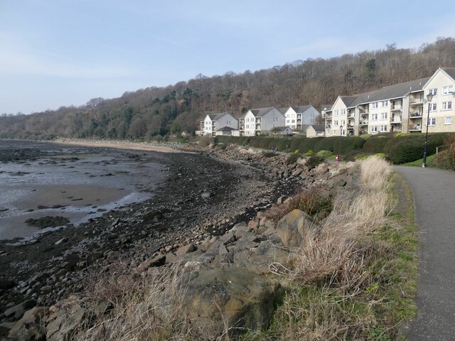
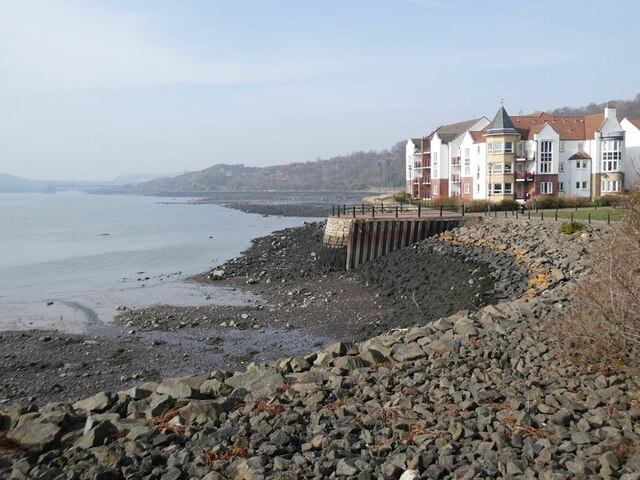
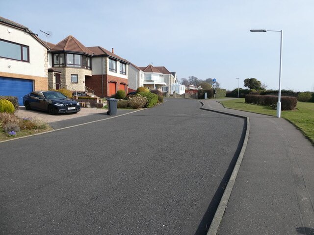
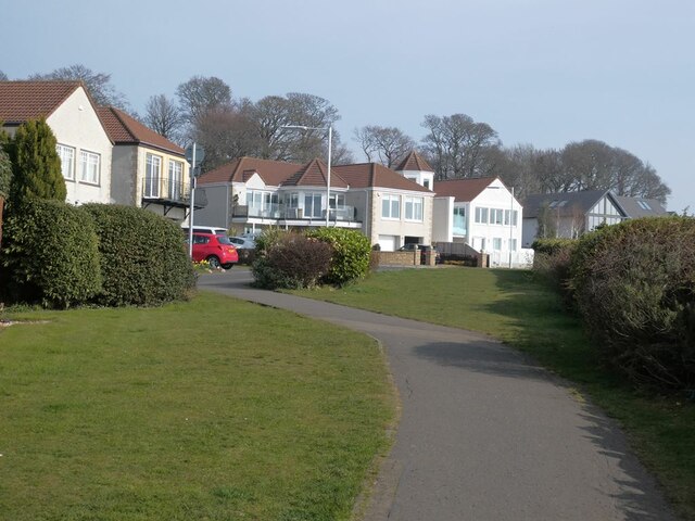
Dalgety Bay is a coastal town located on the northern shore of the Firth of Forth in Fife, Scotland. Situated approximately 10 miles northwest of Edinburgh, it is a popular residential area known for its beautiful views and serene environment.

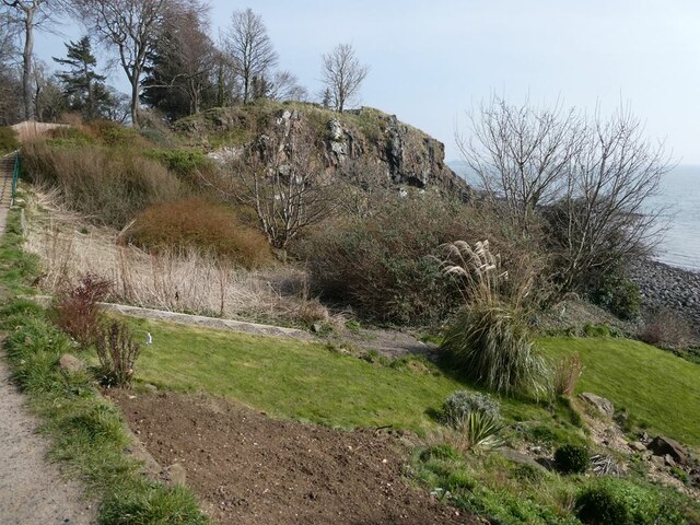
The town is named after the nearby Dalgety Bay, a sandy bay known for its picturesque beach and stunning sunsets. The bay offers a range of recreational activities such as sailing, windsurfing, and kayaking, attracting both locals and visitors alike.

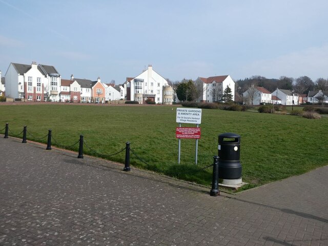
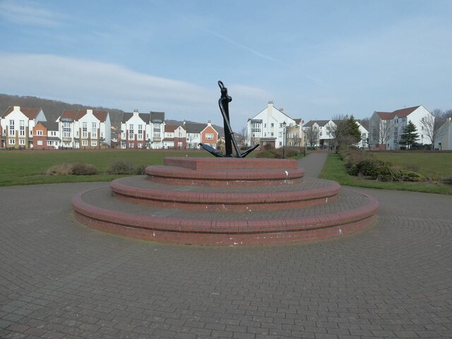
Dalgety Bay is also known for its strong sense of community and excellent amenities. The town boasts a variety of shops, restaurants, and cafes, providing residents with plenty of options for dining and shopping. Additionally, there are several primary schools and a secondary school, making it an ideal place for families.

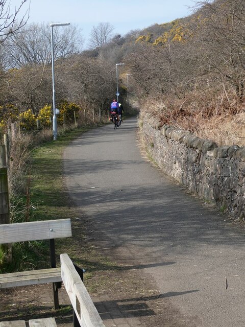
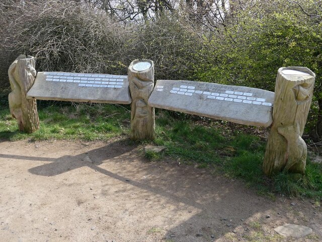
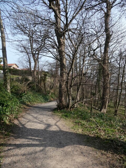
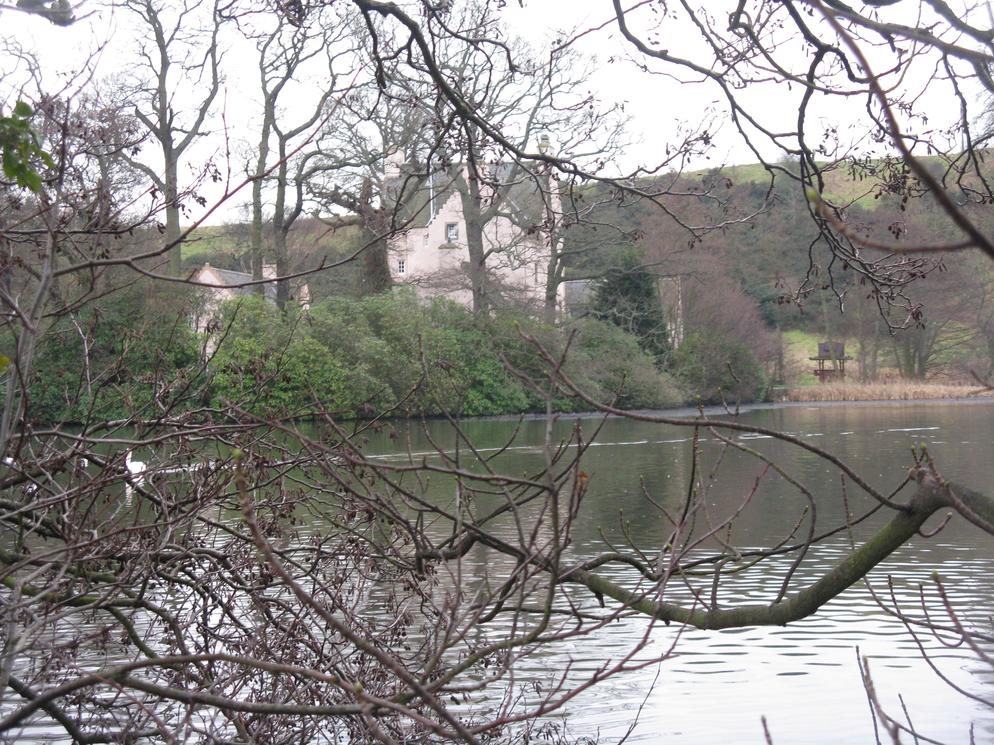
The area is rich in natural beauty, with many green spaces and parks for outdoor activities. The popular Donibristle Wood Country Park is located nearby, providing walking trails and picnic areas for people to enjoy. The park is also home to various wildlife, including birds and deer.

Dalgety Bay has good transport links, with regular bus services connecting the town to nearby areas and Edinburgh. The town is also well-connected by road, with easy access to major highways.

Overall, Dalgety Bay offers a peaceful and picturesque setting, with its stunning coastline, strong community spirit, and excellent amenities making it a desirable place to live.

If you have any feedback on the listing, please let us know in the comments section below.
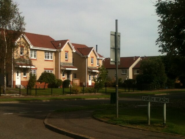
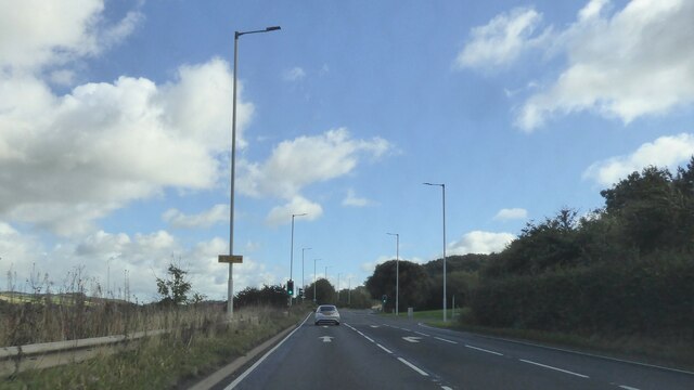
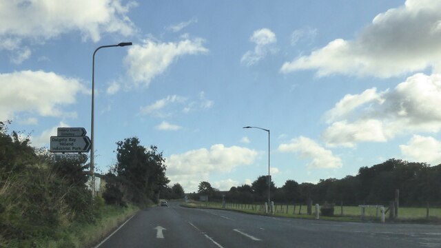
Dalgety Bay Images

Images are sourced within 2km of 56.03841/-3.357286 or Grid Reference NT1583. Thanks to Geograph Open Source API. All images are credited.

Footpath to Forth Reach The footpath from the main road, Harbour Drive, to Forth Reach.
Footpath to Forth Reach
The footpath from the main road, Harbour Drive, to Forth Reach.
Spinnaker Way and The Moorings junction The view of the junction with Spinnaker Way as seen from the Moorings.
Spinnaker Way and The Moorings junction
The view of the junction with Spinnaker Way as seen from the Moorings.
Junction between Link Road and Forth Reach The view of the junction with Link Road as seen from Forth Reach.
Junction between Link Road and Forth Reach
The view of the junction with Link Road as seen from Forth Reach.
A921 east of Inverkeithing
Junction on A921 at Dalgety Bay
Cyclists on the Fife Coastal Path Over this section just west of St David's Bay, the Fife Coastal Path doubles up as part of National Cycle Network, route 76. Note the dog waste bin strapped to the near lamppost (see <a href="https://www.geograph.org.uk/photo/7126370">NT1382 : Improvised dog waste bin</a>).
Cyclists on the Fife Coastal Path
Over this section just west of St David's Bay, the Fife Coastal Path doubles up as part of National Cycle Network, route 76. Note the dog waste bin strapped to the near lamppost (see NT1382 : Improvised dog waste bin).
Waterfront apartment blocks at St David's Harbour By the Fife Coastal Path (and National Cycle Network route 76).
Waterfront apartment blocks at St David's Harbour
By the Fife Coastal Path (and National Cycle Network route 76).
The Moorings, St David's Harbour Central green area by St David's Harbour ringed by apartment blocks. By the Fife Coastal Path (and National Cycle Network route 76)
The Moorings, St David's Harbour
Central green area by St David's Harbour ringed by apartment blocks. By the Fife Coastal Path (and National Cycle Network route 76)
The Moorings, St David's Harbour Centre piece of a central green area by St David's Harbour ringed by apartment blocks.
The Moorings, St David's Harbour
Centre piece of a central green area by St David's Harbour ringed by apartment blocks.
The Harbour at St David's Harbour Flanked by apartment blocks. The harbour does not show much signs of being used as such.
The Harbour at St David's Harbour
Flanked by apartment blocks. The harbour does not show much signs of being used as such.
An extreme gnome In front of a  house on the Bridges (so called for the view) at St David's Harbour.
An extreme gnome
In front of a house on the Bridges (so called for the view) at St David's Harbour.
Waterfront houses on the Bridges The Bridge at St David's Harbour are so named for the view. The Fife Coastal Path and National Cycle Network route 76 pass along the road at the front.
Waterfront houses on the Bridges
The Bridge at St David's Harbour are so named for the view. The Fife Coastal Path and National Cycle Network route 76 pass along the road at the front.
Seafront houses on Lumsdaine  Drive The Fife Coastal Path and National Cycle Network route 76 pass along the path at the front.
Seafront houses on Lumsdaine Drive
The Fife Coastal Path and National Cycle Network route 76 pass along the path at the front.
The Triangle on Lumsdaine Drive Part of a community project to improve the amenity value of the neighbourhood by planting flowers.
The Triangle on Lumsdaine Drive
Part of a community project to improve the amenity value of the neighbourhood by planting flowers.
Plaque at Hopeward Wood Self-explanatory.
Plaque at Hopeward Wood
Self-explanatory.
Tributes at Hopeward Wood Displaying the names of those who have contributed to the Dalgety Bay Community Woodlands Group. See also <a href="https://www.geograph.org.uk/photo/7126808">NT1582 : Plaque at Hopeward Wood</a>.
Tributes at Hopeward Wood
Displaying the names of those who have contributed to the Dalgety Bay Community Woodlands Group. See also NT1582 : Plaque at Hopeward Wood.
Fife Coastal Path at Hopeward Wood Here the path drops down to the shore.
Fife Coastal Path at Hopeward Wood
Here the path drops down to the shore.
Sloping lawn at Hopeward Wood A lawn has been cultivated on the steep slope above the shoreline immediately below the Fife Coastal Path at Hopeward Wood.
Sloping lawn at Hopeward Wood
A lawn has been cultivated on the steep slope above the shoreline immediately below the Fife Coastal Path at Hopeward Wood.
Show me another place!

Dalgety Bay is located at Grid Ref: NT1583 (Lat: 56.03841, Lng: -3.357286)

Unitary Authority: Fife

Police Authority: Fife

What 3 Words

///promoting.vibrates.wasp. Near Dalgety Bay, Fife

Nearby Locations

Bogend Wood Dalgety Bay

Related Wikis

RNAS Donibristle (HMS Merlin)

Royal Naval Air Station Donibristle or more simply RNAS Donibristle is a former Fleet Air Arm base located 2.7 miles (4.3 km) east of Rosyth, Fife, and...

Dalgety Bay railway station

Dalgety Bay railway station serves the town of Dalgety Bay in Fife, Scotland. Lying on the Fife Circle and EdinburghーDundee lines, it is managed by ScotRail...

Dalgety Bay

Dalgety Bay ( ) is a coastal town and parish in Fife, Scotland. According to Fife Council, the town is home to , making this the eighth-largest place...
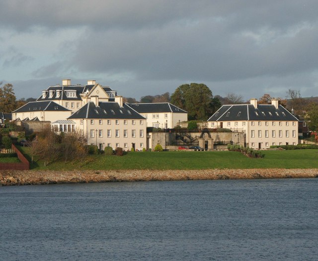
Donibristle

Donibristle (Scots: also Dunibirsle) was a house and estate in Fife, Scotland, on the coast of the Firth of Forth. Only the wings of the house remain,...

Hillend, Fife

Hillend is a small village in Fife, Scotland. It is located roughly to the north-west of Dalgety Bay. It is the location of Heil's manufacturing facilities...

St Bridget's Kirk

St. Bridget's Kirk is a ruined church on the outskirts of Dalgety Bay, Fife, Scotland. It is a shell of a medieval church, dating back at least as far...

Inverkeithing High School

Inverkeithing High School is a secondary school located in Inverkeithing, a historic former port town on the Fife coast. The existing building dates from...

Couston Castle

Couston Castle is an L-plan tower house dating from the late sixteenth or early seventeenth centuries, just north east of Dalgety Bay, at the edge of Otterston...

Nearby Amenities

Located within 500m of 56.03841,-3.357286
Dalgety Bay
Alt Name Sco: Deggity
Name Gd: Bàgh Dhealgadaidh
Name Sco: Dawgety
Place: town
Population: 10030
Source: npe
Wikidata: Q1984807
Wikipedia: en:Dalgety Bay
Lat/Long: 56.0370788/-3.3548735
Bus Stop
St David's Court
Bench: yes
Bin: yes
Bus: yes
Lit: yes
Naptan AtcoCode: 6500D0175
Naptan Bearing: N
Naptan CommonName: St David's Court
Naptan Indicator: adj
Naptan Landmark: Moray Park
Naptan NaptanCode: 34323493
Naptan Street: Moray Way
Public Transport: platform
Ref: 34323493
Shelter: yes
Source: naptan;bing
Tactile Paving: no
Lat/Long: 56.0355808/-3.3615861
Bus Stop
Moray Park
Bench: yes
Bin: yes
Bus: yes
Lit: yes
Naptan AtcoCode: 6500D0177
Naptan Bearing: SW
Naptan CommonName: Moray Park
Naptan Indicator: opp
Naptan Landmark: Moray Park
Naptan NaptanCode: 34323578
Naptan Street: Moray Way
Public Transport: platform
Ref: 34323578
Shelter: yes
Source: naptan;bing
Tactile Paving: no
Lat/Long: 56.0378854/-3.358985
Bus Stop
Shopping Centre
Bench: no
Bin: yes
Bus: yes
Lit: yes
Naptan AtcoCode: 6500D0184
Naptan Bearing: NW
Naptan CommonName: Shopping Centre
Naptan Indicator: adj
Naptan Landmark: Hope Tryst
Naptan NaptanCode: 34323569
Naptan Street: Regents Way
Public Transport: platform
Ref: 34323569
Shelter: yes
Source: naptan;bing
Tactile Paving: no
Lat/Long: 56.0375409/-3.3557511
Bus Stop
St David's Court
Bench: no
Bin: yes
Bus: yes
Lit: yes
Naptan AtcoCode: 6500D0789
Naptan Bearing: S
Naptan CommonName: St David's Court
Naptan Indicator: opp
Naptan Landmark: Moray Park
Naptan NaptanCode: 34323456
Naptan Street: Moray Way
Public Transport: platform
Ref: 34323456
Shelter: no
Source: naptan;bing
Tactile Paving: no
Lat/Long: 56.0352211/-3.3618955
Bus Stop
Moray Park
Bench: no
Bin: yes
Bus: yes
Lit: yes
Naptan AtcoCode: 6500D0788
Naptan Bearing: NE
Naptan CommonName: Moray Park
Naptan Indicator: adj
Naptan Landmark: Moray Park
Naptan NaptanCode: 34323575
Naptan Street: Moray Way
Public Transport: platform
Ref: 34323575
Shelter: no
Source: naptan;bing
Tactile Paving: no
Lat/Long: 56.0377458/-3.3594558
Bus Stop
Parish Church
Bench: no
Bin: no
Bus: yes
Lit: yes
Naptan AtcoCode: 6500D0794
Naptan Bearing: SE
Naptan CommonName: Parish Church
Naptan Indicator: opp
Naptan Landmark: Parish Church
Naptan NaptanCode: 34323579
Naptan Street: Regents Way
Public Transport: platform
Ref: 34323579
Shelter: no
Source: naptan;bing
Tactile Paving: no
Lat/Long: 56.0379953/-3.3561971
Bus Stop
Lade Braes
Bench: no
Bin: yes
Bus: yes
Lit: yes
Naptan AtcoCode: 6500D0185
Naptan Bearing: SE
Naptan CommonName: Lade Braes
Naptan Indicator: opp
Naptan Landmark: Lade Braes
Naptan NaptanCode: 34323525
Naptan Street: Regents Way
Public Transport: platform
Ref: 34323525
Shelter: no
Source: naptan;bing
Tactile Paving: no
Lat/Long: 56.0362434/-3.3535796
Crossing
Button Operated: yes
Crossing: traffic_signals
Crossing Island: no
Crossing Ref: toucan
Tactile Paving: yes
Lat/Long: 56.0357064/-3.3528967
Crossing
Button Operated: yes
Crossing: traffic_signals
Crossing Island: no
Crossing Ref: toucan
Tactile Paving: yes
Traffic Signals Sound: yes
Traffic Signals Vibration: yes
Lat/Long: 56.0381887/-3.3567674
Bus Stop
Parklands Crescent
Bench: no
Bin: no
Bus: yes
Lit: yes
Naptan AtcoCode: 6500D0795
Naptan Bearing: S
Naptan CommonName: Parklands Crescent
Naptan Indicator: adj
Naptan Landmark: Parklands Crescent
Naptan NaptanCode: 34323574
Naptan Street: Harbour Drive
Public Transport: platform
Ref: 34323574
Shelter: no
Source: naptan;bing
Tactile Paving: no
Lat/Long: 56.037498/-3.3649918
Bus Stop
Donibristle Link
Bench: yes
Bin: yes
Bus: yes
Lit: yes
Naptan AtcoCode: 6500D0183
Naptan Bearing: N
Naptan CommonName: Donibristle Link
Naptan Indicator: adj
Naptan Landmark: Garden Centre
Naptan NaptanCode: 34323623
Naptan Street: West Access
Public Transport: platform
Ref: 34323623
Shelter: yes
Source: naptan;bing
Tactile Paving: no
Lat/Long: 56.0395588/-3.3597516
Bus Stop
West Access Ridge Way
Bench: yes
Bin: yes
Bus: yes
Lit: yes
Naptan AtcoCode: 6500D0150
Naptan Bearing: N
Naptan CommonName: West Access Ridge Way
Naptan Indicator: opp
Naptan Landmark: Ridge Way
Naptan NaptanCode: 34323654
Naptan Street: West Access
Public Transport: platform
Ref: 34323654
Shelter: yes
Source: naptan;bing
Tactile Paving: yes
Lat/Long: 56.0405798/-3.3608117
Bus Stop
West Access Ridge Way
Bench: yes
Bin: yes
Bus: yes
Lit: yes
Naptan AtcoCode: 6500D0149
Naptan Bearing: S
Naptan CommonName: West Access Ridge Way
Naptan Indicator: adj
Naptan Landmark: Ridge Way
Naptan NaptanCode: 34323672
Naptan Street: West Access
Public Transport: platform
Ref: 34323672
Shelter: yes
Source: naptan;bing
Tactile Paving: no
Lat/Long: 56.0417632/-3.3616087
Bus Stop
Meadowfield
Bench: yes
Bin: yes
Bus: yes
Lit: yes
Naptan AtcoCode: 6500D0182
Naptan Bearing: NE
Naptan CommonName: Meadowfield
Naptan Indicator: adj
Naptan Landmark: Meadowfield
Naptan NaptanCode: 34323594
Naptan Street: Moray Way North
Public Transport: platform
Ref: 34323594
Shelter: yes
Source: naptan;bing
Tactile Paving: no
Lat/Long: 56.0392146/-3.3562964
Bus Stop
Forth Crescent
Bench: no
Bin: yes
Bus: yes
Lit: yes
Naptan AtcoCode: 6500D0180
Naptan Bearing: E
Naptan CommonName: Forth Crescent
Naptan Indicator: opp
Naptan Landmark: Forth Crescent
Naptan NaptanCode: 34323625
Naptan Street: Moray Way North
Public Transport: platform
Ref: 34323625
Shelter: no
Source: naptan;bing
Tactile Paving: no
Lat/Long: 56.0396158/-3.3543813
Bus Stop
Markfield Road
Bench: no
Bin: yes
Bus: yes
Lit: yes
Naptan AtcoCode: 6500D0178
Naptan Bearing: E
Naptan CommonName: Markfield Road
Naptan Indicator: adj
Naptan Landmark: Markfield Road
Naptan NaptanCode: 34323637
Naptan Street: Moray Way North
Public Transport: platform
Ref: 34323637
Shelter: no
Source: naptan;bing
Tactile Paving: no
Lat/Long: 56.0404064/-3.3505511
Bus Stop
Couston Drive
Bench: no
Bin: no
Bus: yes
Lit: yes
Naptan AtcoCode: 6500D0179
Naptan Bearing: SW
Naptan CommonName: Couston Drive
Naptan Indicator: adj
Naptan Landmark: Couston Drive
Naptan NaptanCode: 34323627
Naptan Street: Moray Way North
Public Transport: platform
Ref: 34323627
Shelter: no
Source: naptan;bing
Tactile Paving: no
Lat/Long: 56.0398426/-3.3528837
Bus Stop
Meadowfield
Bench: yes
Bin: yes
Bus: yes
Lit: yes
Naptan AtcoCode: 6500D0181
Naptan Bearing: W
Naptan CommonName: Meadowfield
Naptan Indicator: opp
Naptan Landmark: Meadowfield
Naptan NaptanCode: 34323595
Naptan Street: Moray Way North
Public Transport: platform
Ref: 34323595
Shelter: yes
Source: naptan;bing
Tactile Paving: no
Lat/Long: 56.0391113/-3.3563185
Crossing
Crossing: unmarked
Crossing Island: no
Tactile Paving: no
Lat/Long: 56.0390277/-3.3587652
Crossing
Button Operated: yes
Crossing: traffic_signals
Crossing Island: no
Crossing Ref: pelican
Tactile Paving: yes
Traffic Signals Sound: yes
Traffic Signals Vibration: yes
Lat/Long: 56.0389639/-3.3570038
Post Box
Brand: Royal Mail
Brand Wikidata: Q638098
Collection Plate Date: 2023-02-14
Collection Times: Mo-Fr 17:30; Sa 12:15
Mail Franked: only
Operator: Royal Mail
Operator Wikidata: Q638098
Post Box Type: meter
Ref: KY11 433P
Royal Cypher: no
Source: survey
Lat/Long: 56.0421345/-3.3576212
Bus Stop
Beech Way
Bench: yes
Bin: yes
Bus: yes
Lit: yes
Naptan AtcoCode: 6500D1167
Naptan Bearing: E
Naptan CommonName: Dalgety Bay ASDA
Naptan Indicator: adj
Naptan Landmark: ASDA Supermarket
Naptan NaptanCode: 34346547
Naptan Street: Ridge Way
Public Transport: platform
Ref: 34346547
Shelter: yes
Source: naptan;bing
Tactile Paving: no
Lat/Long: 56.0415909/-3.3593071
Bus Stop
Dalgety Bay ASDA
Bench: no
Bin: yes
Bus: yes
Lit: yes
Naptan AtcoCode: 6500D1168
Naptan Bearing: W
Naptan CommonName: Dalgety Bay ASDA
Naptan Indicator: opp
Naptan Landmark: ASDA Supermarket
Naptan NaptanCode: 34346567
Naptan Street: Ridge Way
Public Transport: platform
Ref: 34346567
Shelter: yes
Source: naptan;bing
Tactile Paving: no
Lat/Long: 56.0413489/-3.3597385
Bus Stop
Lade Braes
Bench: no
Bin: yes
Bus: yes
Lit: yes
Naptan AtcoCode: 6500D1153
Naptan Bearing: NW
Naptan CommonName: Lade Braes
Naptan Indicator: adj
Naptan Landmark: Lade Braes
Naptan NaptanCode: 34346287
Naptan Street: Regents Way
Public Transport: platform
Ref: 34346287
Shelter: no
Source: naptan;bing
Tactile Paving: no
Lat/Long: 56.0363958/-3.354027
Post Box
Brand: Royal Mail
Brand Wikidata: Q638098
Collection Times: Mo-Fr 18:30, Sa 12:15
Operator: Royal Mail
Operator Wikidata: Q638098
Post Box Type: pillar
Ref: KY11 171
Royal Cypher: scottish_crown
Source: GPS
Lat/Long: 56.0366561/-3.3563662
Recycling
Location: overground
Recycling Cans: yes
Recycling Clothes: yes
Recycling Glass Bottles: yes
Recycling Paper: yes
Recycling Plastic: yes
Recycling Shoes: yes
Recycling Type: container
Lat/Long: 56.0386087/-3.3646403
Crossing
Crossing: unmarked
Tactile Paving: no
Lat/Long: 56.0364388/-3.3560897
Tesco
Addr Postcode: KY11 9UY
Addr Street: Regents Way
Brand: Tesco
Brand Wikidata: Q487494
Fhrs Id: 131707
Ref: 2437
Shop: supermarket
Website: https://www.tesco.com/store-locator/dunfermline/regents-way
Wheelchair: yes
Lat/Long: 56.0367693/-3.3570188
Recycling
Location: overground
Recycling Cans: yes
Recycling Clothes: yes
Recycling Glass Bottles: yes
Recycling Paper: yes
Recycling Plastic: yes
Recycling Shoes: yes
Recycling Type: container
Lat/Long: 56.0371275/-3.3553087
Crossing
Button Operated: yes
Crossing: traffic_signals
Crossing Island: no
Crossing Ref: puffin
Segregated: no
Tactile Paving: yes
Traffic Signals Sound: yes
Traffic Signals Vibration: yes
Lat/Long: 56.041458/-3.3595183
Bicycle Parking
Bicycle Parking: stands
Capacity: 6
Covered: no
Source: GPS
Lat/Long: 56.0371377/-3.3561476
Created By: Merkaartor 0.10
Lat/Long: 56.0360735/-3.354232
Crossing
Crossing: unmarked
Tactile Paving: no
Lat/Long: 56.0363238/-3.3558999
Created By: Merkaartor 0.10
Lat/Long: 56.0367481/-3.3548892
Entrance: main
Lat/Long: 56.0362249/-3.3554727
Crossing
Crossing: unmarked
Crossing Island: no
Crossing Markings: no
Lat/Long: 56.037755/-3.3561557
Barnardo's
Brand: Barnardo's
Brand Wikidata: Q2884670
Brand Wikipedia: en:Barnardo's
Shop: charity
Lat/Long: 56.0366838/-3.35656
Your Move
Brand: Your Move
Brand Wikidata: Q81078416
Office: estate_agent
Source: survey
Lat/Long: 56.0370512/-3.3563725
Baykutz
Female: yes
Reservation: yes
Shop: hairdresser
Source: GPS
Lat/Long: 56.0370026/-3.3564823
Pharmacy
Numark Pharmacy
Addr Housename: The Bay Centre
Addr Housenumber: 12
Addr Postcode: KY11 9YD
Addr Street: Regents Way
Brand: Numark
Brand Wikidata: Q7069061
Healthcare: pharmacy
Lat/Long: 56.0370828/-3.3563056
Barnardo's
Addr City: Dalgety Bay
Addr Street: Regents Way
Addr Unit: 1
Branch: Children
Brand: Barnardo's
Brand Wikidata: Q2884670
Opening Hours: Mo-Sa 09:00-17:00; Su 10:00-16:00
Shop: charity
Lat/Long: 56.036483/-3.3562195
Crossing
Crossing: unmarked
Crossing Island: yes
Tactile Paving: yes
Lat/Long: 56.0383704/-3.3649507
Leisure: playground
Lat/Long: 56.0400104/-3.3557543
Addr Housenumber: Unit 2
Addr Postcode: KY11 9TD
Addr Street: Regents Way
Disused Shop: yes
Lat/Long: 56.0365325/-3.356308
Crossing
Crossing: zebra
Crossing Island: no
Crossing Markings: zebra
Crossing Ref: zebra
Tactile Paving: yes
Lat/Long: 56.0413766/-3.3591782
Crossing
Bicycle: yes
Button Operated: yes
Crossing: traffic_signals
Crossing Island: no
Crossing Ref: toucan
Segregated: no
Lat/Long: 56.0408294/-3.3608623
Post Box
Collection Times: Mo-Fr 16:15; Sa 12:30
Manufacturer: Broadwater Mouldings Limited
Operator: Royal Mail
Post Box Design: indoor_pillar
Post Box Material: plastic
Post Box Type: pillar
Ref: KY11 434
Royal Cypher: scottish_crown
Source: survey
Lat/Long: 56.0408296/-3.3585129
Dentist
Regent Dental Practice
Healthcare: dentist
Lat/Long: 56.0369008/-3.3567088
Crossing
Crossing: unmarked
Crossing Island: no
Crossing Markings: no
Tactile Paving: no
Lat/Long: 56.0416899/-3.3584031
Crossing
Crossing: marked
Source: Bing
Tactile Paving: yes
Lat/Long: 56.0368451/-3.3564638
Crossing
Crossing: marked
Source: Bing
Tactile Paving: yes
Lat/Long: 56.0368293/-3.3560801
Historic: memorial
Memorial: war_memorial
Lat/Long: 56.0382225/-3.3577707
Crossing
Crossing: unmarked
Crossing Island: no
Crossing Markings: no
Tactile Paving: yes
Lat/Long: 56.0412449/-3.3601592
Crossing
Crossing: zebra
Tactile Paving: yes
Lat/Long: 56.0408857/-3.3587024
Crossing
Crossing: unmarked
Crossing Island: no
Crossing Markings: no
Tactile Paving: no
Lat/Long: 56.0402408/-3.3642677
Crossing
Crossing: unmarked
Crossing Island: no
Lat/Long: 56.0359463/-3.3534324
Barrier: kerb
Lat/Long: 56.0359748/-3.3534718
Crossing
Crossing: unmarked
Crossing Island: no
Crossing Markings: no
Lat/Long: 56.036965/-3.3549805
Crossing
Crossing: unmarked
Lat/Long: 56.0383941/-3.3583434
Crossing
Crossing: unmarked
Lat/Long: 56.0383331/-3.3582203
Defibrillator
Emergency: defibrillator
Indoor: yes
Lat/Long: 56.0407644/-3.3585789
Addr City: Dalgety Bay
Addr Housename: Unit 8 Bay Centre
Addr Postcode: KY11 9YD
Addr Street: Regents Way
Shop: vacant
Lat/Long: 56.0369349/-3.3566319
Bench
Backrest: yes
Check Date: 2023-08-21
Lat/Long: 56.0357753/-3.3550524
Atm
Cash In: no
Check Date: 2023-12-21
Location: outdoor
Operator: Tesco Bank
Lat/Long: 56.0368604/-3.356734
Crossing
Crossing: unmarked
Crossing Island: no
Tactile Paving: no
Lat/Long: 56.0368876/-3.3605926
Crossing
Crossing: unmarked
Crossing Island: no
Tactile Paving: no
Lat/Long: 56.0361258/-3.3613416
Crossing
Crossing: unmarked
Crossing Island: no
Kerb: lowered
Tactile Paving: no
Lat/Long: 56.038116/-3.3587101
Addr City: Dalgety Bay
Addr Housenumber: 19
Addr Postcode: KY11 9SU
Addr Street: St. David's Court
Lat/Long: 56.0356036/-3.3610868
Addr Housenumber: 38
Addr Street: Briarhill Avenue
Lat/Long: 56.0355893/-3.3578959
Entrance: main
Lat/Long: 56.037383/-3.3559542
Addr City: Dalgety Bay
Addr Housenumber: 5
Addr Postcode: KY11 9PF
Addr Street: St David's Drive
Lat/Long: 56.0406291/-3.3619701
PowerPhotonic Ltd
Addr City: Dalgety Bay
Addr Housenumber: 5a
Addr Postcode: KY11 9PF
Addr Street: St David's Drive
Office: engineer
Lat/Long: 56.0403587/-3.3617559
Fast Food
Greggs
Addr City: Dalgety Bay
Addr Housenumber: 1
Addr Postcode: KY11 9AB
Addr Street: Ridge Way
Brand: Greggs
Brand Wikidata: Q3403981
Brand Wikipedia: en:Greggs
Contact Website: https://www.greggs.co.uk/shop-finder?shop-code=3688
Cuisine: sandwich;bakery
Fhrs Id: 1099502
Takeaway: yes
Lat/Long: 56.0417643/-3.3595471
Fast Food
Domino's
Addr City: Dalgety Bay
Addr Country: GB
Addr Housenumber: 2
Addr Postcode: KY11 9AB
Addr Street: Ridge Way
Brand: Domino's
Brand Wikidata: Q839466
Brand Wikipedia: en:Domino's Pizza
Contact Website: https://www.dominos.co.uk/pizza-near-me/fife/unit-2-ridge-way-hillend-industrial-park
Cuisine: pizza
Drive Through: no
Fhrs Id: 1099497
Takeaway: yes
Lat/Long: 56.0418288/-3.3596222
Screwfix
Addr City: Dalgety Bay
Addr Housename: The Gateway
Addr Postcode: KY11 9JN
Addr Street: Ridge Way
Brand: Screwfix
Brand Wikidata: Q7439115
Brand Wikipedia: en:Screwfix
Shop: doityourself
Website: https://www.screwfix.com/stores/KB5/dalgety-bay
Lat/Long: 56.0422258/-3.3600058
Crossing
Crossing: unmarked
Crossing Island: no
Crossing Markings: no
Tactile Paving: yes
Lat/Long: 56.0414377/-3.3598623
Crossing
Crossing: unmarked
Crossing Island: no
Crossing Markings: no
Tactile Paving: no
Lat/Long: 56.0416214/-3.3590443
Crossing
Button Operated: yes
Crossing: traffic_signals
Crossing Island: no
Tactile Paving: yes
Traffic Signals Sound: yes
Traffic Signals Vibration: yes
Lat/Long: 56.0415132/-3.3614958
Crossing
Crossing: unmarked
Crossing Island: no
Tactile Paving: no
Lat/Long: 56.0393482/-3.3557615
Crossing
Crossing: unmarked
Crossing Island: no
Tactile Paving: no
Lat/Long: 56.0399483/-3.3529232
Specsavers
Brand: Specsavers
Brand Wikidata: Q2000610
Brand Wikipedia: en:Specsavers
Contact Website: https://www.specsavers.co.uk/stores/dalgetybay
Shop: optician
Lat/Long: 56.0419826/-3.3597672
Fast Food
Subway
Addr City: Dalgety Bay
Addr Housenumber: 3
Addr Postcode: KY11 9AB
Addr Street: Ridge Way
Brand: Subway
Brand Wikidata: Q244457
Brand Wikipedia: en:Subway (restaurant)
Cuisine: sandwich
Fhrs Id: 1320856
Takeaway: yes
Lat/Long: 56.0419116/-3.3596997
Bicycle Parking
Bicycle Parking: stands
Capacity: 6
Covered: no
Lat/Long: 56.0419249/-3.3601523
Bathroom Centre Fife
Shop: bathroom_furnishing
Website: https://www.bathroomcentrefife.co.uk/
Lat/Long: 56.0420768/-3.3598888
Bicycle Parking
Bicycle Parking: stands
Capacity: 6
Covered: no
Lat/Long: 56.041668/-3.3596296
Bicycle Parking
Bicycle Parking: stands
Capacity: 6
Covered: yes
Lat/Long: 56.0368689/-3.3566496
Disused Shop: yes
Lat/Long: 56.0370312/-3.3564265
Barrier: kerb
Lat/Long: 56.0377288/-3.3561182
Crossing
Crossing: unmarked
Crossing Island: no
Tactile Paving: no
Lat/Long: 56.0355399/-3.3618191
Crossing
Crossing: unmarked
Crossing Island: no
Tactile Paving: no
Lat/Long: 56.0375431/-3.3598279
Give Way
Lat/Long: 56.0345107/-3.3548372
Give Way
Lat/Long: 56.0349677/-3.3543405
Give Way
Lat/Long: 56.0359699/-3.3533852
Crossing
Crossing: unmarked
Crossing Island: no
Tactile Paving: no
Lat/Long: 56.0399534/-3.3522144
Crossing
Crossing: unmarked
Crossing Island: no
Tactile Paving: no
Lat/Long: 56.0394173/-3.3547715
Addr Housenumber: 21
Addr Street: Moray Park
Lat/Long: 56.0372926/-3.3606366
Addr Housenumber: 13
Addr Street: Moray Park
Lat/Long: 56.0374626/-3.3610824
Addr Housenumber: 23
Addr Street: Moray Park
Lat/Long: 56.0372501/-3.3603993
Addr Housenumber: 35
Addr Street: Moray Park
Lat/Long: 56.0372859/-3.3613395
Addr Housenumber: 15
Addr Street: Moray Park
Lat/Long: 56.0374078/-3.3610043
Addr Housenumber: 37
Addr Street: Moray Park
Lat/Long: 56.0373106/-3.3613826
Addr Housenumber: 25
Addr Street: Moray Park
Lat/Long: 56.0369795/-3.3608297
Barrier: kerb
Kerb: lowered
Tactile Paving: no
Lat/Long: 56.0378817/-3.3644578
Entrance: main
Lat/Long: 56.0380117/-3.36435
Defibrillator
Defibrillator Location: Just outside entrance on wall
Emergency: defibrillator
Indoor: no
Lat/Long: 56.038143/-3.3573484
Crossing
Crossing: unmarked
Tactile Paving: no
Lat/Long: 56.0387527/-3.358378
Crossing
Crossing: unmarked
Tactile Paving: no
Lat/Long: 56.0388227/-3.3582866
Addr City: Dalgety Bay
Addr Housenumber: 12
Addr Postcode: KY11 9SU
Addr Street: St. David's Court
Lat/Long: 56.0352594/-3.3609045
Addr City: Dalgety Bay
Addr Housenumber: 11
Addr Postcode: KY11 9SU
Addr Street: St. David's Court
Lat/Long: 56.0352397/-3.3607392
Addr City: Dalgety Bay
Addr Housenumber: 10
Addr Postcode: KY11 9SU
Addr Street: St. David's Court
Lat/Long: 56.0352039/-3.3606344
Addr City: Dalgety Bay
Addr Housenumber: 9
Addr Postcode: KY11 9SU
Addr Street: St. David's Court
Lat/Long: 56.0351768/-3.3604864
Addr City: Dalgety Bay
Addr Housenumber: 8
Addr Postcode: KY11 9SU
Addr Street: St. David's Court
Lat/Long: 56.035106/-3.3603689
Addr City: Dalgety Bay
Addr Housenumber: 7
Addr Postcode: KY11 9SU
Addr Street: St. David's Court
Lat/Long: 56.0350936/-3.3602231
Addr City: Dalgety Bay
Addr Housenumber: 6
Addr Postcode: KY11 9SU
Addr Street: St. David's Court
Lat/Long: 56.0351395/-3.3598329
Addr City: Dalgety Bay
Addr Housenumber: 5
Addr Postcode: KY11 9SU
Addr Street: St. David's Court
Lat/Long: 56.0351806/-3.3598411
Addr City: Dalgety Bay
Addr Housenumber: 2
Addr Postcode: KY11 9SU
Addr Street: St. David's Court
Lat/Long: 56.0353323/-3.3602333
Addr City: Dalgety Bay
Addr Housenumber: 1
Addr Postcode: KY11 9SU
Addr Street: St. David's Court
Lat/Long: 56.0353582/-3.3602916
Addr City: Dalgety Bay
Addr Housenumber: 3
Addr Postcode: KY11 9SU
Addr Street: St. David's Court
Lat/Long: 56.0352661/-3.3600693
Addr City: Dalgety Bay
Addr Housenumber: 4
Addr Postcode: KY11 9SU
Addr Street: St. David's Court
Lat/Long: 56.0352528/-3.3600259
Addr City: Dalgety Bay
Addr Housenumber: 20
Addr Postcode: KY11 9SU
Addr Street: St. David's Court
Lat/Long: 56.035592/-3.3609683
Addr City: Dalgety Bay
Addr Housenumber: 22
Addr Postcode: KY11 9SU
Addr Street: St. David's Court
Lat/Long: 56.0355053/-3.3607196
Addr City: Dalgety Bay
Addr Housenumber: 21
Addr Postcode: KY11 9SU
Addr Street: St. David's Court
Lat/Long: 56.0355134/-3.3607904
Addr City: Dalgety Bay
Addr Housenumber: 18
Addr Postcode: KY11 9SU
Addr Street: St. David's Court
Lat/Long: 56.0356461/-3.3612756
Addr City: Dalgety Bay
Addr Housenumber: 17
Addr Postcode: KY11 9SU
Addr Street: St. David's Court
Lat/Long: 56.0356554/-3.3613464
Addr City: Dalgety Bay
Addr Housenumber: 16
Addr Postcode: KY11 9SU
Addr Street: St. David's Court
Lat/Long: 56.0353822/-3.3614623
Addr City: Dalgety Bay
Addr Housenumber: 15
Addr Postcode: KY11 9SU
Addr Street: St. David's Court
Lat/Long: 56.0353731/-3.3613888
Addr City: Dalgety Bay
Addr Housenumber: 14
Addr Postcode: KY11 9SU
Addr Street: St. David's Court
Lat/Long: 56.0353373/-3.3611425
Addr City: Dalgety Bay
Addr Housenumber: 13
Addr Postcode: KY11 9SU
Addr Street: St. David's Court
Lat/Long: 56.0353097/-3.3610718
Crossing
Crossing: unmarked
Crossing Island: no
Crossing Markings: no
Tactile Paving: no
Lat/Long: 56.0376999/-3.3558598
Grit Bin
Lat/Long: 56.0399816/-3.3528386
Crossing
Crossing: zebra
Crossing Island: no
Tactile Paving: no
Lat/Long: 56.0419741/-3.3615224
Crossing
Crossing: unmarked
Tactile Paving: no
Lat/Long: 56.0418809/-3.360103
Crossing
Crossing: unmarked
Crossing Island: no
Crossing Markings: no
Tactile Paving: no
Lat/Long: 56.0415746/-3.3598114
Bicycle Parking
Bicycle Parking: stands
Capacity: 6
Covered: no
Lat/Long: 56.0409556/-3.3580787
Bicycle Parking
Bicycle Parking: wall_loops
Capacity: 10
Covered: no
Lat/Long: 56.0380329/-3.3644597
Fire Hydrant
Emergency: fire_hydrant
Fire Hydrant Diameter: 100
Fire Hydrant Position: sidewalk
Fire Hydrant Type: underground
Lat/Long: 56.0389839/-3.3519459
Crossing
Crossing: unmarked
Crossing Island: no
Tactile Paving: no
Lat/Long: 56.0387496/-3.3499612
Barrier: kerb
Kerb: raised
Tactile Paving: no
Lat/Long: 56.0387765/-3.3499637
Barrier: kerb
Kerb: raised
Tactile Paving: no
Lat/Long: 56.038719/-3.3499584
Crossing
Crossing: unmarked
Crossing Island: no
Tactile Paving: no
Lat/Long: 56.0380099/-3.3495853
Barrier: kerb
Kerb: lowered
Tactile Paving: no
Lat/Long: 56.0380586/-3.349639
Barrier: kerb
Kerb: lowered
Tactile Paving: no
Lat/Long: 56.0379486/-3.3494899
Crossing
Crossing: zebra
Crossing Island: no
Crossing Markings: zebra
Tactile Paving: no
Lat/Long: 56.0419885/-3.3603867
Barrier: kerb
Lat/Long: 56.037786/-3.3561999
Crossing: informal
Lat/Long: 56.0413085/-3.3530071
Barrier: kerb
Kerb: lowered
Tactile Paving: no
Lat/Long: 56.0390483/-3.3651072
Barrier: kerb
Kerb: lowered
Tactile Paving: no
Lat/Long: 56.0389376/-3.3650083
Crossing
Crossing: unmarked
Crossing Island: yes
Crossing Markings: no
Tactile Paving: no
Lat/Long: 56.0390211/-3.3650955
Crossing
Crossing: unmarked
Crossing Island: yes
Crossing Markings: no
Tactile Paving: no
Lat/Long: 56.0389624/-3.3650451
Crossing
Crossing: unmarked
Crossing Island: yes
Crossing Markings: no
Kerb: lowered
Tactile Paving: no
Lat/Long: 56.0387398/-3.3652576
Crossing
Crossing: unmarked
Crossing Island: yes
Crossing Markings: no
Kerb: lowered
Tactile Paving: no
Lat/Long: 56.0387683/-3.3651383
Barrier: kerb
Kerb: lowered
Tactile Paving: no
Lat/Long: 56.0387295/-3.3653013
Barrier: kerb
Kerb: lowered
Tactile Paving: no
Lat/Long: 56.0387801/-3.3650894
Barrier: kerb
Lat/Long: 56.0383842/-3.3582918
Barrier: kerb
Lat/Long: 56.0383627/-3.3582475
Barrier: kerb
Lat/Long: 56.0383102/-3.3581989
Barrier: kerb
Lat/Long: 56.0384027/-3.3583881
Barrier: kerb
Kerb: lowered
Tactile Paving: yes
Lat/Long: 56.0382092/-3.3567397
Barrier: kerb
Kerb: lowered
Tactile Paving: yes
Lat/Long: 56.0381684/-3.3567947
Barrier: kerb
Kerb: lowered
Tactile Paving: yes
Lat/Long: 56.0408511/-3.3607906
Barrier: kerb
Kerb: lowered
Tactile Paving: yes
Lat/Long: 56.0408108/-3.3609238
Barrier: kerb
Lat/Long: 56.0357231/-3.3528594
Barrier: kerb
Lat/Long: 56.0356908/-3.3529314
Barrier: kerb
Kerb: lowered
Tactile Paving: no
Lat/Long: 56.0390545/-3.3587067
Barrier: kerb
Kerb: lowered
Tactile Paving: no
Lat/Long: 56.0390008/-3.358824
Barrier: kerb
Kerb: lowered
Tactile Paving: yes
Lat/Long: 56.0383631/-3.3650181
Barrier: kerb
Kerb: lowered
Tactile Paving: yes
Lat/Long: 56.0383777/-3.3648832
Barrier: kerb
Kerb: lowered
Tactile Paving: no
Lat/Long: 56.0380936/-3.358666
Barrier: kerb
Kerb: lowered
Tactile Paving: no
Lat/Long: 56.0381395/-3.3587564
Barrier: kerb
Kerb: lowered
Tactile Paving: yes
Lat/Long: 56.0368261/-3.3559902
Barrier: kerb
Kerb: lowered
Tactile Paving: yes
Lat/Long: 56.0368304/-3.356107
Barrier: kerb
Kerb: lowered
Tactile Paving: yes
Lat/Long: 56.0368471/-3.3564932
Barrier: kerb
Kerb: lowered
Tactile Paving: yes
Lat/Long: 56.0368414/-3.3563736
Barrier: kerb
Kerb: lowered
Tactile Paving: no
Lat/Long: 56.0376767/-3.3559096
Barrier: kerb
Kerb: lowered
Tactile Paving: no
Lat/Long: 56.0377271/-3.3557982
Barrier: kerb
Kerb: lowered
Tactile Paving: no
Lat/Long: 56.0389806/-3.365072
Barrier: kerb
Kerb: lowered
Tactile Paving: no
Lat/Long: 56.0389919/-3.365083
Barrier: kerb
Kerb: lowered
Tactile Paving: no
Lat/Long: 56.0388505/-3.3582744
Barrier: kerb
Kerb: lowered
Tactile Paving: no
Lat/Long: 56.0387966/-3.3582972
Barrier: kerb
Kerb: lowered
Tactile Paving: no
Lat/Long: 56.0387669/-3.3583339
Barrier: kerb
Kerb: lowered
Tactile Paving: no
Lat/Long: 56.0387358/-3.3584305
Barrier: kerb
Kerb: flush
Tactile Paving: yes
Lat/Long: 56.0413471/-3.3591534
Barrier: kerb
Kerb: flush
Tactile Paving: yes
Lat/Long: 56.0414036/-3.3592053
Barrier: kerb
Kerb: raised
Tactile Paving: no
Lat/Long: 56.0422327/-3.3604352
Barrier: kerb
Kerb: lowered
Tactile Paving: no
Lat/Long: 56.0415976/-3.3598333
Barrier: kerb
Kerb: raised
Tactile Paving: no
Lat/Long: 56.0418588/-3.360082
Barrier: kerb
Kerb: raised
Tactile Paving: no
Lat/Long: 56.0419087/-3.3601295
Barrier: kerb
Kerb: flush
Tactile Paving: no
Lat/Long: 56.0420562/-3.3601493
Barrier: kerb
Kerb: flush
Tactile Paving: no
Lat/Long: 56.042003/-3.360335
Barrier: kerb
Kerb: flush
Tactile Paving: no
Lat/Long: 56.0419735/-3.3604377
Barrier: kerb
Kerb: lowered
Tactile Paving: no
Lat/Long: 56.0364212/-3.3560638
Barrier: kerb
Kerb: lowered
Tactile Paving: no
Lat/Long: 56.0364592/-3.3561199
Barrier: kerb
Kerb: lowered
Tactile Paving: yes
Lat/Long: 56.0414873/-3.3595409
Barrier: kerb
Kerb: lowered
Tactile Paving: yes
Lat/Long: 56.041428/-3.3594951
Barrier: kerb
Kerb: flush
Tactile Paving: yes
Lat/Long: 56.0409096/-3.3587258
Barrier: kerb
Kerb: flush
Tactile Paving: yes
Lat/Long: 56.04086/-3.3586793
Barrier: kerb
Kerb: lowered
Tactile Paving: yes
Lat/Long: 56.0389337/-3.3569745
Barrier: kerb
Kerb: lowered
Tactile Paving: yes
Lat/Long: 56.0389926/-3.3570331
Barrier: kerb
Kerb: lowered
Tactile Paving: yes
Lat/Long: 56.0415356/-3.3614343
Barrier: kerb
Kerb: lowered
Tactile Paving: yes
Lat/Long: 56.0414933/-3.3615562
Barrier: kerb
Lat/Long: 56.0359205/-3.3533966
Barrier: kerb
Kerb: lowered
Tactile Paving: no
Lat/Long: 56.0387578/-3.3651823
Barrier: kerb
Kerb: lowered
Tactile Paving: no
Lat/Long: 56.0387506/-3.3652122
Entrance: main
Lat/Long: 56.042056/-3.3613664
Entrance: exit
Lat/Long: 56.0420236/-3.3614241
Charging Station
Capacity: 2
Motorcar: yes
Operator: Evolt
Lat/Long: 56.0371022/-3.3561087
Crossing
Crossing: unmarked
Crossing Island: no
Crossing Markings: no
Tactile Paving: yes
Lat/Long: 56.0407014/-3.3575128
Barrier: kerb
Kerb: lowered
Tactile Paving: yes
Lat/Long: 56.0407196/-3.3576217
Barrier: kerb
Kerb: lowered
Tactile Paving: yes
Lat/Long: 56.0406815/-3.3573943
Barrier: kerb
Kerb: raised
Tactile Paving: no
Lat/Long: 56.0416309/-3.3585309
Barrier: kerb
Kerb: raised
Tactile Paving: no
Lat/Long: 56.0417664/-3.3583031
Crossing
Crossing: unmarked
Crossing Island: no
Crossing Markings: no
Tactile Paving: no
Lat/Long: 56.0418779/-3.3603804
Barrier: kerb
Kerb: raised
Tactile Paving: no
Lat/Long: 56.0416503/-3.3588968
Barrier: kerb
Kerb: raised
Tactile Paving: no
Lat/Long: 56.041594/-3.359152
Barrier: kerb
Kerb: lowered
Tactile Paving: no
Lat/Long: 56.0415482/-3.3597861
Barrier: kerb
Kerb: lowered
Tactile Paving: yes
Lat/Long: 56.0414557/-3.3597751
Barrier: kerb
Kerb: lowered
Tactile Paving: yes
Lat/Long: 56.0414023/-3.360003
Barrier: kerb
Kerb: lowered
Tactile Paving: yes
Lat/Long: 56.0412642/-3.3600664
Barrier: kerb
Kerb: lowered
Tactile Paving: no
Lat/Long: 56.0412278/-3.3602414
Barrier: kerb
Kerb: lowered
Tactile Paving: yes
Lat/Long: 56.0414346/-3.3583265
Barrier: kerb
Kerb: lowered
Tactile Paving: yes
Lat/Long: 56.0413442/-3.3582551
Crossing
Crossing: unmarked
Crossing Island: no
Crossing Markings: no
Tactile Paving: yes
Lat/Long: 56.0413894/-3.3582908
Entrance: main
Lat/Long: 56.0408636/-3.3583554
Entrance: main
Lat/Long: 56.0407568/-3.3586995
Addr Housenumber: 104
Addr Street: Inchview Gardens
Entrance: yes
Lat/Long: 56.0375505/-3.3540085
Kerb: no
Lat/Long: 56.0368102/-3.3545055
Kerb: no
Lat/Long: 56.0367987/-3.3545323
Barrier: kerb
Kerb: lowered
Tactile Paving: no
Lat/Long: 56.0374303/-3.3553477
Barrier: kerb
Kerb: lowered
Tactile Paving: no
Lat/Long: 56.0374088/-3.3553989
Barrier: kerb
Kerb: lowered
Tactile Paving: no
Lat/Long: 56.0373986/-3.3554234
Barrier: kerb
Kerb: lowered
Tactile Paving: no
Lat/Long: 56.037381/-3.3554651
Crossing
Crossing: unmarked
Crossing Island: yes
Crossing Markings: no
Tactile Paving: no
Lat/Long: 56.0374031/-3.3554125
Crossing
Crossing: unmarked
Crossing Island: no
Crossing Markings: no
Tactile Paving: no
Lat/Long: 56.0362425/-3.3536906
Barrier: kerb
Kerb: flush
Tactile Paving: no
Lat/Long: 56.0362664/-3.3536329
Barrier: kerb
Kerb: lowered
Tactile Paving: no
Lat/Long: 56.0362202/-3.3537445
Barrier: kerb
Kerb: flush
Tactile Paving: no
Lat/Long: 56.0368277/-3.3544644
Barrier: kerb
Kerb: lowered
Tactile Paving: no
Lat/Long: 56.0367807/-3.3545743
Crossing
Crossing: unmarked
Crossing Island: yes
Crossing Markings: no
Tactile Paving: no
Lat/Long: 56.0368039/-3.3545201
Barrier: kerb
Kerb: raised
Tactile Paving: no
Lat/Long: 56.0400873/-3.3629835
Barrier: kerb
Kerb: raised
Tactile Paving: no
Lat/Long: 56.0400137/-3.3629577
Crossing
Crossing: unmarked
Crossing Island: no
Crossing Markings: no
Tactile Paving: no
Lat/Long: 56.0400514/-3.3629709
Barrier: kerb
Kerb: flush
Tactile Paving: no
Lat/Long: 56.0398163/-3.3639387
Barrier: kerb
Kerb: lowered
Tactile Paving: no
Lat/Long: 56.039819/-3.3640567
Crossing
Crossing: unmarked
Crossing Island: no
Crossing Markings: no
Tactile Paving: no
Lat/Long: 56.0398177/-3.3639986
Barrier: kerb
Kerb: lowered
Tactile Paving: no
Lat/Long: 56.040177/-3.363825
Barrier: kerb
Kerb: lowered
Tactile Paving: no
Lat/Long: 56.0402261/-3.3639994
Crossing
Crossing: unmarked
Crossing Island: no
Crossing Markings: no
Tactile Paving: no
Lat/Long: 56.0402042/-3.3639216
Crossing
Crossing: unmarked
Crossing Island: no
Crossing Markings: no
Tactile Paving: no
Lat/Long: 56.0397475/-3.3648525
Barrier: kerb
Kerb: lowered
Tactile Paving: no
Lat/Long: 56.0397665/-3.3647602
Barrier: kerb
Kerb: lowered
Tactile Paving: no
Lat/Long: 56.0397247/-3.3649638
Crossing
Crossing: unmarked
Crossing Island: yes
Crossing Markings: no
Tactile Paving: no
Lat/Long: 56.0398494/-3.3636849
Crossing
Crossing: unmarked
Crossing Island: yes
Crossing Markings: no
Tactile Paving: no
Lat/Long: 56.0399121/-3.3637446
Barrier: kerb
Kerb: lowered
Tactile Paving: no
Lat/Long: 56.0398228/-3.3636596
Barrier: kerb
Kerb: lowered
Tactile Paving: no
Lat/Long: 56.0398704/-3.3637049
Barrier: kerb
Kerb: lowered
Tactile Paving: no
Lat/Long: 56.0398857/-3.3637195
Barrier: kerb
Kerb: lowered
Tactile Paving: no
Lat/Long: 56.0399446/-3.3637755
Crossing
Crossing: unmarked
Crossing Island: yes
Crossing Markings: no
Tactile Paving: no
Lat/Long: 56.0400848/-3.3636396
Crossing
Crossing: unmarked
Crossing Island: yes
Crossing Markings: no
Tactile Paving: no
Lat/Long: 56.0400393/-3.3637288
Barrier: kerb
Kerb: lowered
Tactile Paving: no
Lat/Long: 56.0400216/-3.3637815
Barrier: kerb
Kerb: lowered
Tactile Paving: no
Lat/Long: 56.0401056/-3.3636147
Barrier: kerb
Kerb: lowered
Tactile Paving: no
Lat/Long: 56.0400643/-3.3636641
Barrier: kerb
Kerb: lowered
Tactile Paving: no
Lat/Long: 56.0400532/-3.3636874
Crossing
Crossing: unmarked
Crossing Island: no
Crossing Markings: no
Tactile Paving: no
Lat/Long: 56.0403211/-3.3645363
Barrier: kerb
Kerb: lowered
Tactile Paving: no
Lat/Long: 56.0402816/-3.3645106
Barrier: kerb
Kerb: lowered
Tactile Paving: no
Lat/Long: 56.0402654/-3.3642168
Barrier: kerb
Kerb: lowered
Tactile Paving: no
Lat/Long: 56.0402195/-3.3643117
Grit Bin
Lat/Long: 56.0395751/-3.3648647
Waste Basket
Waste: trash
Lat/Long: 56.0350102/-3.3580429
Barrier: kerb
Kerb: raised
Tactile Paving: no
Lat/Long: 56.0419065/-3.3604077
Barrier: kerb
Kerb: raised
Tactile Paving: no
Lat/Long: 56.0418429/-3.3603471
Barrier: kerb
Kerb: lowered
Tactile Paving: no
Lat/Long: 56.0369516/-3.3636617
Barrier: kerb
Kerb: lowered
Tactile Paving: no
Lat/Long: 56.036913/-3.3636247
Crossing
Crossing: unmarked
Crossing Island: no
Crossing Markings: no
Tactile Paving: no
Lat/Long: 56.0369341/-3.3636449
Barrier: kerb
Kerb: raised
Lat/Long: 56.0417668/-3.3558951
Waste Basket
Colour: red
Waste: trash
Lat/Long: 56.0369068/-3.3621365
Bicycle Parking
Bicycle Parking: stands
Capacity: 20
Covered: no
Lat/Long: 56.0394776/-3.3611874
Parking
Access: customers
Fee: no
Parking: surface
Lat/Long: 56.039309/-3.3610614
Barrier: kerb
Kerb: raised
Tactile Paving: no
Lat/Long: 56.0389167/-3.3538279
Barrier: bollard
Bollard: fixed
Colour: black
Lat/Long: 56.0350028/-3.3620285
Barrier: bollard
Bollard: fixed
Lat/Long: 56.0391555/-3.3586145
Entrance: main
Lat/Long: 56.0381072/-3.3573609
Barrier: cycle_barrier
Bicycle: yes
Cycle Barrier: double
Foot: yes
Material: metal
Motor Vehicle: no
Lat/Long: 56.0364868/-3.3578495
Barrier: kerb
Kerb: lowered
Tactile Paving: no
Lat/Long: 56.0378206/-3.3647944
Barrier: kerb
Kerb: lowered
Tactile Paving: no
Lat/Long: 56.0378616/-3.3645858
Entrance: yes
Lat/Long: 56.036833/-3.3566927
Trolley Bay
Lat/Long: 56.0368756/-3.3561227
Trolley Bay
Lat/Long: 56.037067/-3.3561549
Trolley Bay
Lat/Long: 56.0367883/-3.3562636
Trolley Bay
Lat/Long: 56.0371257/-3.3555954
Entrance: main
Lat/Long: 56.0360225/-3.3558837
Waste Basket
Waste: trash
Lat/Long: 56.0357681/-3.3550807
Waste Basket
Waste: trash
Lat/Long: 56.0351685/-3.3562247
Bench
Backrest: yes
Material: wood
Lat/Long: 56.0351902/-3.3563762
Bench
Backrest: yes
Material: wood
Lat/Long: 56.0352232/-3.3560316
Bench
Backrest: no
Material: wood
Lat/Long: 56.0353341/-3.3557888
Bench
Backrest: no
Material: wood
Lat/Long: 56.0353247/-3.3558103
Bench
Backrest: no
Material: wood
Lat/Long: 56.0353131/-3.355825
Bench
Backrest: no
Material: wood
Lat/Long: 56.0352992/-3.3558364
Bench
Backrest: no
Material: wood
Lat/Long: 56.0352835/-3.3558378
Bench
Backrest: no
Material: wood
Lat/Long: 56.0353232/-3.3557674
Bench
Backrest: no
Material: wood
Lat/Long: 56.0353127/-3.3557915
Bench
Backrest: no
Material: wood
Lat/Long: 56.0353015/-3.3558036
Bench
Backrest: no
Material: wood
Lat/Long: 56.0352846/-3.3558069
Bench
Backrest: no
Material: wood
Lat/Long: 56.0352925/-3.3557546
Waste Basket
Waste: trash
Lat/Long: 56.0359052/-3.3561083
Restaurant
Bay of Bengal
Addr City: Dalgety Bay
Addr Postcode: KY11 9UY
Addr Street: Regents Way
Addr Unit: 3
Cuisine: indian
Email: orders@bayofbengal-restaurant.co.uk
Opening Hours: Tu-Su 16:00-22:00
Outdoor Seating: no
Phone: +441383 825511
Takeaway: yes
Website: https://www.bayofbengal-restaurant.co.uk/
Lat/Long: 56.0365901/-3.3563923
Cafe
Sòlas
Addr City: Dalgety Bay
Addr Postcode: KY11 9UY
Addr Street: Regents Way
Addr Unit: 4
Lat/Long: 56.0366418/-3.3564768
Dalgety Bay Bronze Age Burials
Board Type: history
Information: board
Operator: Fife Council
Start Date: 1995
Tourism: information
Lat/Long: 56.0367977/-3.3556688
Waste Basket
Waste: trash
Lat/Long: 56.0368348/-3.3557499
Waste Basket
Waste: trash
Lat/Long: 56.0368505/-3.3561918
Waste Basket
Waste: trash
Lat/Long: 56.0368528/-3.3562669
Waste Basket
Waste: trash
Lat/Long: 56.0370711/-3.355821
Trolley Bay
Lat/Long: 56.0420981/-3.3612282
Addr Housenumber: 9
Addr Street: Couston Drive
Entrance: yes
Lat/Long: 56.0401364/-3.3504871
Addr Housenumber: 10
Addr Street: Couston Drive
Entrance: yes
Lat/Long: 56.040186/-3.3505156
Addr Housenumber: 13
Addr Street: Couston Drive
Entrance: yes
Lat/Long: 56.0401527/-3.3500657
Addr Housenumber: 4
Addr Street: Couston Drive
Entrance: yes
Lat/Long: 56.0400463/-3.3514164
Addr Housenumber: 19
Addr Street: Couston Drive
Entrance: yes
Lat/Long: 56.0393566/-3.3500964
Addr Housenumber: 7
Addr Street: Inchview Gardens
Entrance: yes
Lat/Long: 56.0368121/-3.3536914
Addr Housenumber: 54
Addr Street: Inchview Gardens
Entrance: yes
Lat/Long: 56.0372617/-3.353348
Addr Housenumber: 70
Addr Street: Inchview Gardens
Entrance: yes
Lat/Long: 56.0376699/-3.3533158
Addr Housenumber: 84
Addr Street: Inchview Gardens
Entrance: yes
Lat/Long: 56.0380814/-3.3530804
Addr Housenumber: 14
Addr Street: Couston Drive
Entrance: yes
Lat/Long: 56.0401822/-3.3499023
Addr Housenumber: 21
Addr Street: Couston Drive
Entrance: yes
Lat/Long: 56.0396108/-3.350446
Addr Housenumber: 7
Addr Street: Couston Drive
Entrance: yes
Lat/Long: 56.0399485/-3.3510064
Addr Housenumber: 23
Addr Street: Couston Drive
Entrance: yes
Lat/Long: 56.0397516/-3.3504994
Addr Housenumber: 2
Addr Street: Couston Drive
Entrance: yes
Lat/Long: 56.0399308/-3.3513751
Addr Housenumber: 2
Addr Street: Inchview Gardens
Entrance: yes
Lat/Long: 56.0372382/-3.3518343
Addr Housenumber: 14
Addr Street: Inchview Gardens
Entrance: yes
Lat/Long: 56.0368814/-3.3529559
Addr Housenumber: 17
Addr Street: Couston Drive
Entrance: yes
Lat/Long: 56.0394022/-3.3496765
Addr Housenumber: 6
Addr Street: Couston Drive
Entrance: yes
Lat/Long: 56.0400034/-3.3510378
Addr Housenumber: 12
Addr Street: Couston Drive
Entrance: yes
Lat/Long: 56.0401409/-3.3502212
Addr Housenumber: 8
Addr Street: Couston Drive
Entrance: yes
Lat/Long: 56.0400412/-3.3504325
Addr Housenumber: 22
Addr Street: Couston Drive
Entrance: yes
Lat/Long: 56.0396797/-3.3504893
Addr Housenumber: 20
Addr Street: Inchview Gardens
Entrance: yes
Lat/Long: 56.0371234/-3.3531723
Addr Housenumber: 1
Addr Street: Inchview Gardens
Entrance: yes
Lat/Long: 56.0365222/-3.3532316
Addr Housenumber: 40
Addr Street: Inchview Gardens
Entrance: yes
Lat/Long: 56.0375791/-3.3526616
Addr Housenumber: 106
Addr Street: Inchview Gardens
Entrance: yes
Lat/Long: 56.0374892/-3.3541194
Addr Housenumber: 116
Addr Street: Inchview Gardens
Entrance: yes
Lat/Long: 56.0379647/-3.3540404
Addr Housenumber: 34
Addr Street: Inchview Gardens
Entrance: yes
Lat/Long: 56.0374472/-3.3524817
Addr Housenumber: 80
Addr Street: Inchview Gardens
Entrance: yes
Lat/Long: 56.0378651/-3.3528974
Addr Housenumber: 86
Addr Street: Inchview Gardens
Entrance: yes
Lat/Long: 56.038037/-3.353174
Addr Housenumber: 12
Addr Street: Inchview Gardens
Entrance: yes
Lat/Long: 56.0369287/-3.3528045
Addr Housenumber: 5
Addr Street: Inchview Gardens
Entrance: yes
Lat/Long: 56.036693/-3.3535659
Addr Housenumber: 52
Addr Street: Inchview Gardens
Entrance: yes
Lat/Long: 56.0373054/-3.3532535
Addr Housenumber: 5
Addr Street: Couston Drive
Entrance: yes
Lat/Long: 56.0400836/-3.3510836
Addr Housenumber: 14
Addr Street: St. Bridgets Brae
Entrance: yes
Lat/Long: 56.0388743/-3.3496928
Addr Housenumber: 8
Addr Street: St. Bridgets Brae
Entrance: yes
Lat/Long: 56.0382221/-3.349367
Addr Housenumber: 11
Addr Street: Couston Drive
Entrance: yes
Lat/Long: 56.0402347/-3.3505436
Addr Housenumber: 4
Addr Street: Inchview Gardens
Entrance: yes
Lat/Long: 56.0371604/-3.3519989
Addr Housenumber: 18
Addr Street: Couston Drive
Entrance: yes
Lat/Long: 56.0393735/-3.3498333
Addr Housenumber: 20
Addr Street: Couston Drive
Entrance: yes
Lat/Long: 56.0393288/-3.3502459
Addr Housenumber: 3
Addr Street: Couston Drive
Entrance: yes
Lat/Long: 56.0399887/-3.3514081
Addr Housenumber: 1
Addr Street: Couston Drive
Entrance: yes
Lat/Long: 56.0398864/-3.3513498
Addr Street: St. Bridgets Brae
Entrance: yes
Lat/Long: 56.0388123/-3.3503019
Addr Housenumber: 10
Addr Street: St. Bridgets Brae
Entrance: yes
Lat/Long: 56.0385697/-3.3496097
Addr Housenumber: 9
Addr Street: Inchview Gardens
Entrance: yes
Lat/Long: 56.0369141/-3.3537562
Addr Housenumber: 28
Addr Street: Inchview Gardens
Entrance: yes
Lat/Long: 56.0373152/-3.3527621
Addr Housenumber: 66
Addr Street: Inchview Gardens
Entrance: yes
Lat/Long: 56.0375584/-3.3535525
Addr Housenumber: 6
Addr Street: St. Bridgets Brae
Entrance: yes
Lat/Long: 56.0381077/-3.3492503
Addr Housenumber: 3
Addr Street: Inchview Gardens
Entrance: yes
Lat/Long: 56.0366183/-3.3533822
Addr Housenumber: 22
Addr Street: Inchview Gardens
Entrance: yes
Lat/Long: 56.0371754/-3.353064
Addr Housenumber: 42
Addr Street: Inchview Gardens
Entrance: yes
Lat/Long: 56.037536/-3.3527514
Addr Housenumber: 19
Addr Street: Inchview Gardens
Entrance: yes
Lat/Long: 56.0373641/-3.3545231
Addr Housenumber: 58
Addr Street: Inchview Gardens
Entrance: yes
Lat/Long: 56.0371664/-3.3535486
Addr Housenumber: 72
Addr Street: Inchview Gardens
Entrance: yes
Lat/Long: 56.0377199/-3.35321
Addr Housenumber: 23
Addr Street: Inchview Gardens
Entrance: yes
Lat/Long: 56.0375671/-3.3547426
Addr Housenumber: 6
Addr Street: Inchview Gardens
Entrance: yes
Lat/Long: 56.0371279/-3.3522316
Addr Housenumber: 24
Addr Street: Inchview Gardens
Entrance: yes
Lat/Long: 56.0372175/-3.3529753
Addr Housenumber: 26
Addr Street: Inchview Gardens
Entrance: yes
Lat/Long: 56.0372687/-3.3528684
Addr Housenumber: 15
Addr Street: Inchview Gardens
Entrance: yes
Lat/Long: 56.0371447/-3.3543189
Addr Housenumber: 78
Addr Street: Inchview Gardens
Entrance: yes
Lat/Long: 56.0378176/-3.3530129
Addr Housenumber: 90
Addr Street: Inchview Gardens
Entrance: yes
Lat/Long: 56.0379166/-3.3533407
Addr Housenumber: 100
Addr Street: Inchview Gardens
Entrance: yes
Lat/Long: 56.037662/-3.3538141
Addr Housenumber: 38
Addr Street: Inchview Gardens
Entrance: yes
Lat/Long: 56.0375435/-3.35231
Addr Housenumber: 98
Addr Street: Inchview Gardens
Entrance: yes
Lat/Long: 56.0377169/-3.3536848
Addr Housenumber: 18
Addr Street: Inchview Gardens
Entrance: yes
Lat/Long: 56.0370789/-3.3532787
Addr Housenumber: 30
Addr Street: Inchview Gardens
Entrance: yes
Lat/Long: 56.0373518/-3.3526859
Addr Housenumber: 11
Addr Street: Inchview Gardens
Entrance: yes
Lat/Long: 56.0370111/-3.3539356
Addr Housenumber: 76
Addr Street: Inchview Gardens
Entrance: yes
Lat/Long: 56.0377759/-3.3531023
Addr Housenumber: 102
Addr Street: Inchview Gardens
Entrance: yes
Lat/Long: 56.0376212/-3.3539021
Addr Housenumber: 110
Addr Street: Inchview Gardens
Entrance: yes
Lat/Long: 56.0378494/-3.3544294
Addr Housenumber: 16
Addr Street: Inchview Gardens
Entrance: yes
Lat/Long: 56.0370354/-3.3533694
Addr Housenumber: 120
Addr Street: Inchview Gardens
Entrance: yes
Lat/Long: 56.0380694/-3.3537731
Addr Housenumber: 8
Addr Street: Inchview Gardens
Entrance: yes
Lat/Long: 56.0370641/-3.3524178
Addr Housenumber: 10
Addr Street: Inchview Gardens
Entrance: yes
Lat/Long: 56.037008/-3.3526155
Addr Housenumber: 32
Addr Street: Inchview Gardens
Entrance: yes
Lat/Long: 56.0373996/-3.3525808
Addr Housenumber: 50
Addr Street: Inchview Gardens
Entrance: yes
Lat/Long: 56.0373576/-3.3531532
Addr Housenumber: 92
Addr Street: Inchview Gardens
Entrance: yes
Lat/Long: 56.0378389/-3.353426
Addr Housenumber: 21
Addr Street: Inchview Gardens
Entrance: yes
Lat/Long: 56.0374685/-3.3545616
Addr Housenumber: 108
Addr Street: Inchview Gardens
Entrance: yes
Lat/Long: 56.0377889/-3.3545626
Addr Housenumber: 118
Addr Street: Inchview Gardens
Entrance: yes
Lat/Long: 56.0380306/-3.353861
Addr Housenumber: 25
Addr Street: Inchview Gardens
Entrance: yes
Lat/Long: 56.0376418/-3.3548562
Addr Housenumber: 27
Addr Street: Inchview Gardens
Entrance: yes
Lat/Long: 56.0377001/-3.3550008
Addr Housenumber: 36
Addr Street: Inchview Gardens
Entrance: yes
Lat/Long: 56.0374966/-3.3524079
Addr Housenumber: 40A
Addr Street: Inchview Gardens
Entrance: yes
Lat/Long: 56.037672/-3.3524964
Addr Housenumber: 44
Addr Street: Inchview Gardens
Entrance: yes
Lat/Long: 56.037488/-3.3528746
Addr Housenumber: 13
Addr Street: Inchview Gardens
Entrance: yes
Lat/Long: 56.0370947/-3.3540882
Addr Housenumber: 48
Addr Street: Inchview Gardens
Entrance: yes
Lat/Long: 56.0374029/-3.3530555
Addr Housenumber: 88
Addr Street: Inchview Gardens
Entrance: yes
Lat/Long: 56.0379582/-3.3532541
Addr Housenumber: 46
Addr Street: Inchview Gardens
Entrance: yes
Lat/Long: 56.0374517/-3.3529506
Addr Housenumber: 56
Addr Street: Inchview Gardens
Entrance: yes
Lat/Long: 56.0372108/-3.3534528
Addr Housenumber: 82
Addr Street: Inchview Gardens
Entrance: yes
Lat/Long: 56.0378899/-3.3528456
Addr Housenumber: 13
Addr Street: Forth View
Entrance: yes
Lat/Long: 56.0383401/-3.3542065
Addr Housenumber: 68
Addr Street: Inchview Gardens
Entrance: yes
Lat/Long: 56.0376139/-3.3534415
Addr Housenumber: 96
Addr Street: Inchview Gardens
Entrance: yes
Lat/Long: 56.0377516/-3.3536128
Addr Housenumber: 112
Addr Street: Inchview Gardens
Entrance: yes
Lat/Long: 56.0378848/-3.3542947
Addr Housenumber: 114
Addr Street: Inchview Gardens
Entrance: yes
Lat/Long: 56.0379233/-3.3542088
Addr Housenumber: 60
Addr Street: Inchview Gardens
Entrance: yes
Lat/Long: 56.0373809/-3.3539053
Addr Housenumber: 17
Addr Street: Inchview Gardens
Entrance: yes
Lat/Long: 56.0372874/-3.3543435
Addr Housenumber: 94
Addr Street: Inchview Gardens
Entrance: yes
Lat/Long: 56.0378044/-3.3534978
Restaurant
The Bay Fish Market
Lat/Long: 56.0367645/-3.3566715
Addr Housenumber: 31
Addr Street: Forth View
Entrance: yes
Lat/Long: 56.0384056/-3.3537007
Addr Housenumber: 29
Addr Street: Forth View
Entrance: yes
Lat/Long: 56.0384603/-3.353779
Addr Housenumber: 11
Addr Street: Forth View
Entrance: yes
Lat/Long: 56.0383875/-3.3543205
Addr Housenumber: 9
Addr Street: Forth View
Entrance: yes
Lat/Long: 56.0384611/-3.3544215
Addr Housenumber: 27
Addr Street: Forth View
Entrance: yes
Lat/Long: 56.038522/-3.3538673
Barrier: cycle_barrier
Cycle Barrier: double
Cycle Barrier Installation: fixed
Material: metal
Lat/Long: 56.0389552/-3.3499965
Addr Housenumber: 12
Addr Street: St. Bridgets Brae
Entrance: yes
Lat/Long: 56.0387026/-3.3496692
Fixme: Way continues into school grounds
Lat/Long: 56.0387958/-3.3520451
Addr Housenumber: 64
Addr Street: Inchview Gardens
Entrance: yes
Lat/Long: 56.0374865/-3.3536845
Addr Housenumber: 62
Addr Street: Inchview Gardens
Entrance: yes
Lat/Long: 56.0374394/-3.353783
Entrance: main
Lat/Long: 56.0381958/-3.3510767
Barrier: kerb
Kerb: lowered
Tactile Paving: no
Lat/Long: 56.0380499/-3.3647746
Barrier: kerb
Kerb: lowered
Tactile Paving: no
Lat/Long: 56.0381579/-3.3647819
Power: substation
Lat/Long: 56.0423071/-3.3595365
Barrier: kerb
Kerb: raised
Tactile Paving: no
Lat/Long: 56.0425102/-3.3599217
Barrier: kerb
Kerb: raised
Tactile Paving: no
Lat/Long: 56.0425371/-3.3598331
Crossing: informal
Lat/Long: 56.0425251/-3.3598727
Bus Bay: right
Lat/Long: 56.0417363/-3.3617088
Barrier: kerb
Kerb: lowered
Tactile Paving: yes
Lat/Long: 56.0403085/-3.350589
Barrier: kerb
Kerb: lowered
Tactile Paving: yes
Lat/Long: 56.0403727/-3.3506206
Crossing
Crossing: unmarked
Crossing Island: no
Crossing Markings: no
Tactile Paving: yes
Lat/Long: 56.0403413/-3.3506051
Barrier: kerb
Kerb: raised
Tactile Paving: no
Lat/Long: 56.0413188/-3.3529601
Barrier: kerb
Kerb: raised
Tactile Paving: no
Lat/Long: 56.0412983/-3.353054
Barrier: kerb
Kerb: lowered
Tactile Paving: no
Lat/Long: 56.0348435/-3.3527037
Barrier: kerb
Lat/Long: 56.0347247/-3.3526863
Barrier: kerb
Lat/Long: 56.034804/-3.3570756
Barrier: kerb
Lat/Long: 56.0347313/-3.3572469
Barrier: kerb
Lat/Long: 56.034156/-3.3569681
Barrier: kerb
Lat/Long: 56.0340657/-3.3571054
Barrier: kerb
Lat/Long: 56.0354453/-3.3533171
Barrier: kerb
Lat/Long: 56.0352961/-3.3530826
Barrier: kerb
Lat/Long: 56.0340726/-3.3557479
Barrier: kerb
Lat/Long: 56.0340358/-3.3556885
Barrier: kerb
Lat/Long: 56.0344742/-3.3547664
Barrier: kerb
Lat/Long: 56.0349796/-3.3544388
Barrier: kerb
Lat/Long: 56.0350478/-3.3543008
Barrier: kerb
Lat/Long: 56.0348955/-3.354354
Barrier: kerb
Lat/Long: 56.0344541/-3.3549553
Barrier: kerb
Lat/Long: 56.0345693/-3.3547512
Barrier: kerb
Kerb: lowered
Tactile Paving: no
Lat/Long: 56.0349801/-3.3622439
Colour: green
Man Made: street_cabinet
Operator: BT
Street Cabinet: telecom
Voltage: 230
Lat/Long: 56.0380968/-3.3650391
Colour: green
Man Made: street_cabinet
Operator: BT
Ref: 12
Street Cabinet: telecom
Lat/Long: 56.0381552/-3.3650438
Colour: green
Man Made: street_cabinet
Operator: BT
Street Cabinet: telecom
Lat/Long: 56.0355221/-3.3615569
Colour: green
Man Made: street_cabinet
Operator: BT
Ref: 4
Street Cabinet: telecom
Lat/Long: 56.0355097/-3.3615603
Colour: brown
Man Made: street_cabinet
Street Cabinet: power
Lat/Long: 56.0355562/-3.3615804
Colour: grey
Man Made: street_cabinet
Operator: Virgin
Street Cabinet: telecom
Lat/Long: 56.0364214/-3.3611277
Colour: grey
Man Made: street_cabinet
Operator: Virgin
Ref: AH0101
Street Cabinet: telecom
Lat/Long: 56.0364083/-3.3611381
Colour: grey
Man Made: street_cabinet
Lat/Long: 56.0366662/-3.3614305
Colour: grey
Man Made: street_cabinet
Street Cabinet: power
Lat/Long: 56.0378992/-3.3589417
Man Made: street_cabinet
Material: brick
Lat/Long: 56.0381972/-3.3583758
Man Made: street_cabinet
Material: brick
Street Cabinet: gas
Lat/Long: 56.0381824/-3.3584026
Man Made: street_cabinet
Material: concrete
Street Cabinet: water
Lat/Long: 56.0380904/-3.3585448
Man Made: street_cabinet
Operator: BT
Ref: 14
Street Cabinet: telecom
Lat/Long: 56.0393247/-3.3594732
Colour: grey
Man Made: street_cabinet
Manufacturer: Lucy
Note: In damaged condition, may not be working/in use.
Ref: CP49
Street Cabinet: traffic_monitoring
Lat/Long: 56.0397499/-3.3601705
Colour: grey
Man Made: street_cabinet
Street Cabinet: power
Lat/Long: 56.0405887/-3.3608324
Colour: grey
Man Made: street_cabinet
Lat/Long: 56.0411774/-3.3612759
Colour: grey
Man Made: street_cabinet
Street Cabinet: traffic_control
Lat/Long: 56.0414745/-3.3616164
Colour: grey
Man Made: street_cabinet
Manufacturer: PEEK
Street Cabinet: traffic_control
Lat/Long: 56.0414788/-3.3616204
Barrier: entrance
Lat/Long: 56.0418068/-3.3609392
Colour: grey
Man Made: street_cabinet
Manufacturer: Tofco Limited
Street Cabinet: power
Lat/Long: 56.0419746/-3.3604726
Colour: grey
Man Made: street_cabinet
Street Cabinet: traffic_control
Lat/Long: 56.0414004/-3.3594893
Colour: grey
Man Made: street_cabinet
Manufacturer: Siemens
Street Cabinet: traffic_control
Lat/Long: 56.0413994/-3.3594973
Waste Basket
Colour: black
Lat/Long: 56.0413699/-3.3596385
Colour: grey
Man Made: street_cabinet
Street Cabinet: traffic_control
Lat/Long: 56.0408699/-3.3607576
Colour: grey
Man Made: street_cabinet
Manufacturer: Siemens
Street Cabinet: traffic_control
Lat/Long: 56.0408646/-3.3607559
Colour: grey
Man Made: street_cabinet
Operator: Fife Council
Ref: CP34
Street Cabinet: traffic_monitoring
Lat/Long: 56.0391243/-3.3586548
Colour: grey
Man Made: street_cabinet
Operator: Virgin
Ref: AH0107
Street Cabinet: telecom
Lat/Long: 56.0386688/-3.3595426
Colour: grey
Man Made: street_cabinet
Operator: Virgin
Street Cabinet: telecom
Lat/Long: 56.0376743/-3.3610734
Barrier: entrance
Lat/Long: 56.0370103/-3.3628032
Colour: grey
Man Made: street_cabinet
Operator: Virgin
Ref: AH0110
Street Cabinet: telecom
Lat/Long: 56.0369578/-3.3636893
Colour: grey
Man Made: street_cabinet
Ref: CP48
Street Cabinet: traffic_monitoring
Lat/Long: 56.0368359/-3.3638673
Grit Bin
Colour: yellow
Lat/Long: 56.0368187/-3.3638629
Waste Basket
Colour: yellow
Lat/Long: 56.0392101/-3.3642277
Waste Basket
Colour: yellow
Lat/Long: 56.0397428/-3.363077
Waste Basket
Colour: yellow
Lat/Long: 56.0395476/-3.3616642
Grit Bin
Colour: yellow
Lat/Long: 56.0394139/-3.3611559
Colour: grey
Man Made: street_cabinet
Manufacturer: ABB
Power: transformer
Street Cabinet: power
Lat/Long: 56.0402509/-3.364616
Man Made: street_cabinet
Material: brick
Lat/Long: 56.0386726/-3.364734
Colour: grey
Man Made: street_cabinet
Street Cabinet: power
Lat/Long: 56.0370886/-3.3630177
Access: private
Entrance: yes
Lat/Long: 56.0370477/-3.3624893
The data included in this document is from www.openstreetmap.org. The data is made available under ODbL.

Have you been to Dalgety Bay?

Leave your review of Dalgety Bay below (or comments, questions and feedback).