Crowhill Plantation

Wood, Forest in Fife

Scotland

Crowhill Plantation

A921 east of Inverkeithing
A921 east of Inverkeithing Credit: Alpin Stewart

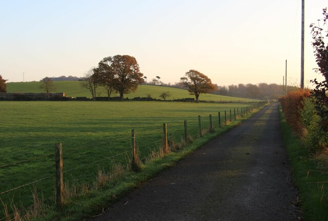
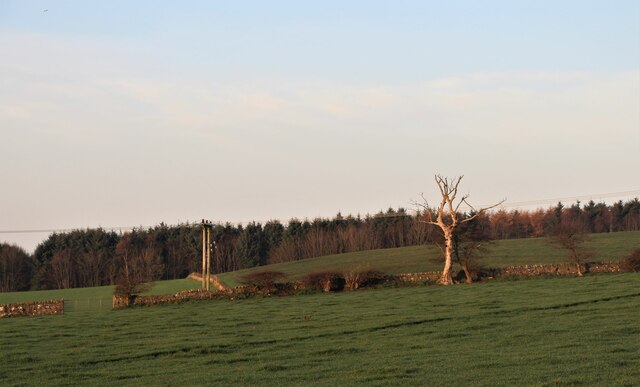
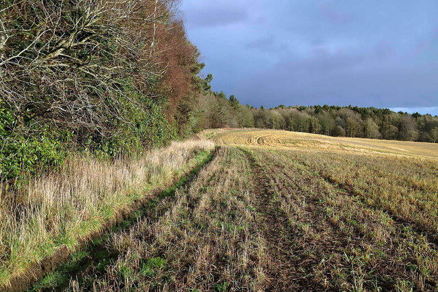
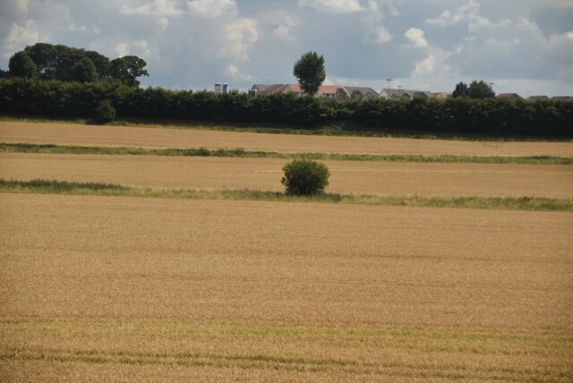
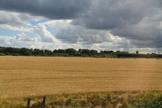
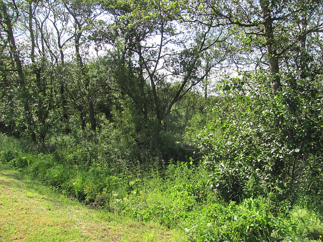
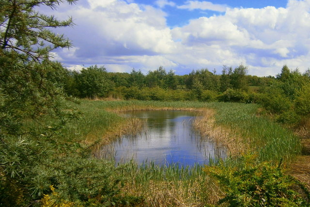
Crowhill Plantation is a sprawling woodland located in Fife, Scotland. Covering an area of approximately 500 acres, it is renowned for its rich biodiversity and natural beauty. The plantation is predominantly composed of dense woodlands and flourishing forests, making it a significant habitat for various flora and fauna.

The woodland boasts a diverse range of tree species, including oak, birch, beech, and conifers. These trees provide a lush canopy that creates a serene and tranquil environment within the plantation. The forest floor is adorned with an array of wildflowers, ferns, and mosses, adding to its aesthetic appeal.

Crowhill Plantation is home to an abundant wildlife population. Visitors may be fortunate enough to spot red squirrels, roe deer, and a variety of bird species such as woodpeckers, owls, and finches. The plantation also supports a thriving ecosystem of insects, including butterflies and bees, contributing to the overall ecological balance.

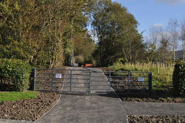
The plantation offers numerous walking trails and paths, enabling visitors to explore the enchanting woodland at their own pace. These trails provide opportunities for nature enthusiasts, hikers, and photographers to immerse themselves in the beauty of the natural surroundings.

Maintained by local authorities, Crowhill Plantation is accessible to the public throughout the year. It serves as a popular recreational destination, attracting visitors seeking a peaceful retreat amidst nature. The plantation's idyllic setting and diverse wildlife make it a prime location for nature lovers and those seeking a connection with the great outdoors.

If you have any feedback on the listing, please let us know in the comments section below.

Crowhill Plantation Images

Images are sourced within 2km of 56.054717/-3.3718126 or Grid Reference NT1485. Thanks to Geograph Open Source API. All images are credited.

A921 east of Inverkeithing
Daybreak over fields at Bankhead Farm
Daybreak over fields at Bankhead Farm Clinthill Plantation beyond.
Daybreak over fields at Bankhead Farm
Clinthill Plantation beyond.
A stubble field at Fordell Viewed in early January at a woodland edge.
A stubble field at Fordell
Viewed in early January at a woodland edge.
Isolated bush
Isolated bush
Large arable field
Large arable field
Under Construction Building a new distribution centre on the outskirts of the Dunfermline East expansion area. All this steelwork went up in the last four days.
Under Construction
Building a new distribution centre on the outskirts of the Dunfermline East expansion area. All this steelwork went up in the last four days.
Substation, Inverkeithing It's beside the (non electrified) railway.
Substation, Inverkeithing
It's beside the (non electrified) railway.
Damp woodland A small damp woodland beside the Keithing Burn. It was busy with whitethroats today.
Damp woodland
A small damp woodland beside the Keithing Burn. It was busy with whitethroats today.
Gates to Hillend Cemetery Hillend Cemetery in Fife.
Gates to Hillend Cemetery
Hillend Cemetery in Fife.
M90 near Duloch In the distance, on this alignment of the southbound carriageway, are the towers of the Forth bridge.
M90 near Duloch
In the distance, on this alignment of the southbound carriageway, are the towers of the Forth bridge.
M90 approaching Inverkeithing North Junction
Edinburgh bound A train on the Fife Circle line leaving Dalgety Bay station.
Edinburgh bound
A train on the Fife Circle line leaving Dalgety Bay station.
Suds pond at Calais Muir, Dunfermline. One of the many suds ponds in the Duloch estate.
Suds pond at Calais Muir, Dunfermline.
One of the many suds ponds in the Duloch estate.
Mail Order Warehouse The vast shed built on the outskirts of Dunfermline to accommodate a well-known mail-order distribution company. Even bigger than the nearby infamous Hyundai plant, this at least is going to provide jobs of a sort.
Mail Order Warehouse
The vast shed built on the outskirts of Dunfermline to accommodate a well-known mail-order distribution company. Even bigger than the nearby infamous Hyundai plant, this at least is going to provide jobs of a sort.
Footpath Revamp The signs on the gates inform us that 'This route will be temporarily closed to allow necessary work to be carried out', but doesn't indicate on whose authority it has been closed. The path runs alongside the new mail-order distribution centre being built on the western edge of the Dunfermline Expansion Area.
Footpath Revamp
The signs on the gates inform us that 'This route will be temporarily closed to allow necessary work to be carried out', but doesn't indicate on whose authority it has been closed. The path runs alongside the new mail-order distribution centre being built on the western edge of the Dunfermline Expansion Area.
View from the North Road (B981) Looking towards the Forth Bridge from the road between Inverkeithing and Crossgates (the old road to Perth).
View from the North Road (B981)
Looking towards the Forth Bridge from the road between Inverkeithing and Crossgates (the old road to Perth).
The Forth Bridge from the B981 The modern building (spoiling the view!) is Inverkeithing High School.
The Forth Bridge from the B981
The modern building (spoiling the view!) is Inverkeithing High School.
Show me another place!

Crowhill Plantation is located at Grid Ref: NT1485 (Lat: 56.054717, Lng: -3.3718126)

Unitary Authority: Fife

Police Authority: Fife

What 3 Words

///eyebrows.pesky.trending. Near Dalgety Bay, Fife

Related Wikis

Related Videos

Fife Walking Trail - Dalgety Bay

https://discoveringscotland.com/dalgety-bay-walk/

Sweet Chestnut Dunfermline by Marston - Review and Video Room Tour November 2023

Check out this video room tour of room 203 at the Sweet Chestnut Dunfermline by Marstons Inns. It's a great location right by ...

Donibristle Chapel, Dalgety Bay - Resting place of Earls of Moray | Fife, Scotland 2024

Donibristle Chapel, also known as the Mortuary Chapel of Earls of Moray, was an Episcopalian place of worship and a mortuary ...

Edinburgh’s World War 1 Defences | Downing Point

Discover the history of Downing Point, a WW1 coastal battery located in Fife, Scotland. In this video we explore the remains of the ...

Nearby Amenities

Located within 500m of 56.054717,-3.3718126
Bus Stop
Fordell Gardens
Bench: no
Bin: no
Bus: yes
Naptan AtcoCode: 6500D1099
Naptan Bearing: S
Naptan CommonName: Fordell Gardens
Naptan Indicator: Adj
Naptan Landmark: Fordell Gardens
Naptan NaptanCode: 34323895
Naptan Street: Clockluine Road
Public Transport: platform
Ref: 34323895
Shelter: yes
Source: naptan;bing
Tactile Paving: no
Lat/Long: 56.0530527/-3.3782465
Waterway: waterfall
Lat/Long: 56.0516963/-3.3692774
Waterway: waterfall
Lat/Long: 56.0560758/-3.3749113
Barrier: cycle_barrier
Cycle Barrier: double
Cycle Barrier Installation: fixed
Lat/Long: 56.0529739/-3.3784006
Post Box
Post Box Type: lamp
Ref: KY11 29
Lat/Long: 56.0540014/-3.3769722
Generator Method: photovoltaic
Generator Output Electricity: yes
Generator Source: solar
Generator Type: solar_photovoltaic_panel
Power: generator
Lat/Long: 56.0530976/-3.3767758
Power: pole
Lat/Long: 56.0515448/-3.3764122
Power: pole
Lat/Long: 56.0523047/-3.3764122
Power: pole
Lat/Long: 56.0538812/-3.3743672
Power: pole
Lat/Long: 56.0544249/-3.3708669
Power: pole
Lat/Long: 56.0542436/-3.3720344
Power: pole
Lat/Long: 56.0535088/-3.3753231
Power: pole
Lat/Long: 56.0531721/-3.3764326
Power: pole
Lat/Long: 56.0540441/-3.373319
Man Made: flagpole
Source: bing
Lat/Long: 56.0557892/-3.378194
Man Made: flagpole
Source: bing
Lat/Long: 56.0557847/-3.3782979
Man Made: flagpole
Source: bing
Lat/Long: 56.0557394/-3.3782349
Man Made: flagpole
Source: bing
Lat/Long: 56.0557618/-3.3782718
Man Made: flagpole
Source: bing
Lat/Long: 56.055788/-3.3782436
Access: private
Leisure: firepit
Lat/Long: 56.0562201/-3.3790295
Location: pole
Power: pole
Transformer: minor_distribution
Lat/Long: 56.0556854/-3.3661532
Power: pole
Lat/Long: 56.0545161/-3.3698301
Power: pole
Lat/Long: 56.0548422/-3.3655194
Power: pole
Lat/Long: 56.0558243/-3.3655775
Barrier: log
Description: Log requires one to crouch walk underneath across mud, tricky.
Lat/Long: 56.0520988/-3.3699846
The data included in this document is from www.openstreetmap.org. The data is made available under ODbL.

Have you been to Crowhill Plantation?

Leave your review of Crowhill Plantation below (or comments, questions and feedback).