Burn Strip

Wood, Forest in Peeblesshire

Scotland

Burn Strip

Lamb Rig Newly planted with trees.
Lamb Rig Credit: Richard Webb

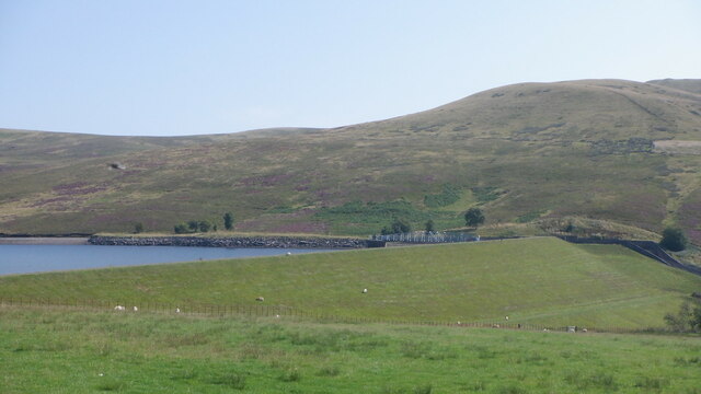
Burn Strip is a picturesque wood located in Peeblesshire, Scotland. Situated in the heart of the Scottish Borders, this woodland covers a vast area of approximately 200 hectares. It is known for its dense forest and vibrant wildlife, making it a popular destination for nature enthusiasts and hikers.

The wood is dominated by a variety of tree species, including oak, birch, and pine. The towering trees create a dense canopy, providing shade during the summer months and a stunning display of colors during autumn. The forest floor is covered in a thick carpet of moss, ferns, and wildflowers, adding to the natural beauty of the area.

Burn Strip is home to a diverse range of wildlife, making it a haven for animal lovers. Visitors may spot red squirrels scurrying through the branches, or catch a glimpse of roe deer gracefully bounding through the undergrowth. Birdwatchers will be delighted by the presence of various bird species, such as woodpeckers, buzzards, and owls.

The wood offers a network of walking trails, allowing visitors to explore its natural wonders at their own pace. These paths wind through the forest, leading to enchanting glens, babbling brooks, and hidden waterfalls. The tranquil atmosphere of Burn Strip provides a perfect escape from the hustle and bustle of everyday life.

Overall, Burn Strip in Peeblesshire is a captivating woodland that showcases the breathtaking beauty of the Scottish countryside. With its diverse flora and fauna, it offers an immersive experience for anyone seeking solace in nature.

If you have any feedback on the listing, please let us know in the comments section below.

Burn Strip Images

Images are sourced within 2km of 55.783343/-3.3993177 or Grid Reference NT1255. Thanks to Geograph Open Source API. All images are credited.

Lamb Rig Newly planted with trees.
Lamb Rig
Newly planted with trees.
Sawmill, Baddinsgill
The dam, Baddinsgill Reservoir
Log stacks, Thieves Road
Pentland Hills near Baddinsgill Reservoir A field almost surrounded by a shelter belt.
Pentland Hills near Baddinsgill Reservoir
A field almost surrounded by a shelter belt.
Thieves Road The track that crosses the pass at Cauldstane Slap with East Cairn Hill in the background.
Thieves Road
The track that crosses the pass at Cauldstane Slap with East Cairn Hill in the background.
Quarry on Muckle Knock A rather uncomfortable stony road runs to the quarry. After the quarry there is a lovely grassy track into the moors below West Cairn Hill.
Quarry on Muckle Knock
A rather uncomfortable stony road runs to the quarry. After the quarry there is a lovely grassy track into the moors below West Cairn Hill.
Byrehope Mount Pentland Hills.  Byrehope is the hollow just beneath the summit.
Byrehope Mount
Pentland Hills. Byrehope is the hollow just beneath the summit.
The Baddinsgill Burn, Pentland Hills 2009 view here: <a href="https://www.geograph.org.uk/photo/1209261">NT1155 : Valley of the Baddinsgill Burn</a>
The Baddinsgill Burn, Pentland Hills
Track on Muckle Knock A very enjoyable grassy track - it leads nowhere. The early part is horribly stony but pass the quarry and you are rewarded.
Track on Muckle Knock
A very enjoyable grassy track - it leads nowhere. The early part is horribly stony but pass the quarry and you are rewarded.
Summit, Muckle Knock I am still finding the odd Pentland summit that I have not visited. Good view through to The Kips.
Summit, Muckle Knock
I am still finding the odd Pentland summit that I have not visited. Good view through to The Kips.
Gathering ground of the Baddinsgill Burn The ruin is absent from the 1897 survey but appears on mid 20th century maps. It is surrounded by a small area of improved grassland.
Gathering ground of the Baddinsgill Burn
The ruin is absent from the 1897 survey but appears on mid 20th century maps. It is surrounded by a small area of improved grassland.
Ruin, Baddinsgill Burn The ruin is absent from the 1897 survey but appears on mid 20th century maps. It is surrounded by a small area of improved grassland
Ruin, Baddinsgill Burn
The ruin is absent from the 1897 survey but appears on mid 20th century maps. It is surrounded by a small area of improved grassland
Balloon litter, Pentland Hills A twentieth birthday somewhere.  The "2" balloon deflated and brought down the heart and "0" right in front of me.  I tied the two surviving balloons to my pack for amusement on the way out.

What is not funny is the litter and the waste of helium. It ends up in space and there is only so much down here on Earth. What there is is thanks to radioactive decay of thorium and uranium - it is spent alpha particles.
Balloon litter, Pentland Hills
A twentieth birthday somewhere. The "2" balloon deflated and brought down the heart and "0" right in front of me. I tied the two surviving balloons to my pack for amusement on the way out. What is not funny is the litter and the waste of helium. It ends up in space and there is only so much down here on Earth. What there is is thanks to radioactive decay of thorium and uranium - it is spent alpha particles.
Log pile with buried roadsign Baddinsgill, Pentland Hills.
Log pile with buried roadsign
Baddinsgill, Pentland Hills.
Sheep grazing near Baddinsgill Farm The smoke is coming from a chimney at a timber and firewood business that operates from this site.
Sheep grazing near Baddinsgill Farm
The smoke is coming from a chimney at a timber and firewood business that operates from this site.
Baddinsgill Reservoir spillway
The road to Baddinsgill Farm
Show me another place!

Burn Strip is located at Grid Ref: NT1255 (Lat: 55.783343, Lng: -3.3993177)

Unitary Authority: The Scottish Borders

Police Authority: The Lothians and Scottish Borders

What 3 Words

///constrain.political.clearly. Near West Linton, Scottish Borders

Related Wikis

Baddinsgill

Baddinsgill is a hamlet in the Scottish Borders area of Scotland. The Baddinsgill Reservoir is a few hundred metres north of the hamlet. == See also... ==

Baddinsgill Reservoir

Baddinsgill Reservoir is a small reservoir in the Scottish Borders area of Scotland close to Carlops, West Linton, and the boundary with Midlothian. It...

West Water Reservoir

West Water Reservoir (sometimes Westwater Reservoir) is an artificial reservoir in the Pentland Hills, Scottish Borders, 3 kilometres (1.9 mi) west of...

Pentland Hills

The Pentland Hills are a range of hills southwest of Edinburgh, Scotland. The range is around twenty miles (thirty kilometres) in length, and runs southwest...

Nearby Amenities

Located within 500m of 55.783343,-3.3993177
Power: pole
Lat/Long: 55.7796528/-3.3954946
Power: pole
Lat/Long: 55.7800784/-3.3956418
Power: pole
Lat/Long: 55.7805727/-3.3957785
Power: pole
Lat/Long: 55.781113/-3.3959614
Power: pole
Lat/Long: 55.781561/-3.3958773
Power: pole
Lat/Long: 55.7819926/-3.3958016
Power: pole
Lat/Long: 55.7824052/-3.395728
Power: pole
Lat/Long: 55.7828568/-3.3956649
Power: pole
Lat/Long: 55.783293/-3.3955892
Power: pole
Lat/Long: 55.783617/-3.3955409
The data included in this document is from www.openstreetmap.org. The data is made available under ODbL.

Have you been to Burn Strip?

Leave your review of Burn Strip below (or comments, questions and feedback).