Dormont Wood

Wood, Forest in Dumfriesshire

Scotland

Dormont Wood

Section of Annadale Way on a dull rainy day
Section of Annadale Way on a dull rainy day Credit: thejackrustles

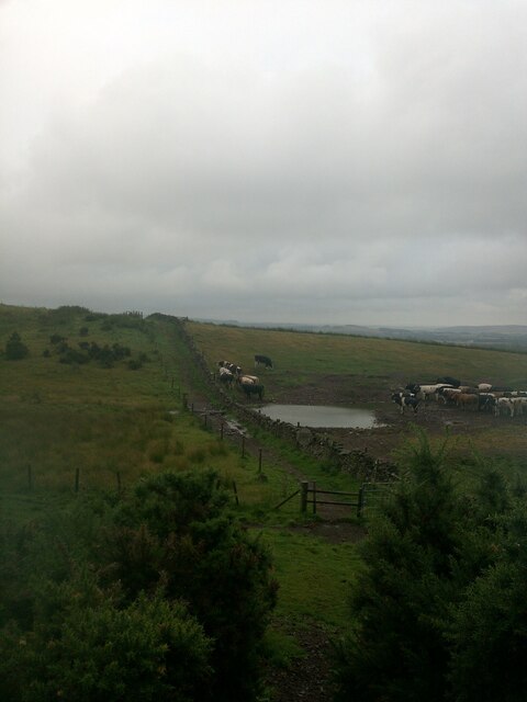
Dormont Wood, located in Dumfriesshire, is a serene and enchanting forest that covers an area of approximately 200 acres. Nestled in the picturesque countryside of southwest Scotland, it is a popular destination for nature lovers, hikers, and wildlife enthusiasts.

The wood boasts a diverse range of tree species, including oak, beech, and birch, which create a rich and vibrant canopy. The forest floor is adorned with an array of wildflowers, ferns, and mosses, adding to its natural beauty. The tranquil atmosphere and the soothing sound of birdsong make Dormont Wood a perfect retreat from the hustle and bustle of everyday life.

The wood is crisscrossed by a network of well-maintained trails, allowing visitors to explore its hidden gems at their own pace. These paths lead to charming spots such as a picturesque waterfall, a serene pond, and panoramic viewpoints that offer breathtaking vistas of the surrounding landscape.

Dormont Wood is also home to a diverse range of wildlife. Deer, foxes, and rabbits can often be spotted grazing amongst the trees, while birdwatchers can delight in the sight of various species, including woodpeckers, owls, and warblers. The forest's peaceful environment provides a sanctuary for these creatures, making it a haven for nature enthusiasts.

Managed by a local conservation group, Dormont Wood is dedicated to preserving its natural beauty and protecting its inhabitants. Regular maintenance and tree planting initiatives ensure the sustainability and growth of this precious woodland, enhancing its ecological value.

Whether one seeks solitude, a connection with nature, or simply a peaceful walk in the woods, Dormont Wood offers a delightful experience for all who venture within its leafy embrace.

If you have any feedback on the listing, please let us know in the comments section below.
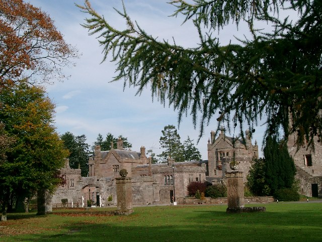
Dormont Wood Images

Images are sourced within 2km of 55.061155/-3.393687 or Grid Reference NY1174. Thanks to Geograph Open Source API. All images are credited.

Section of Annadale Way on a dull rainy day
Hallidayhill Farm A late-April view.
Hallidayhill Farm
A late-April view.
Gate on the road near Hallidayhill Farm
Bridge Marker on Williamwath Bridge, Dumfries and Galloway Bridge Marker rivetted to the northwest parapet of Williamwath Bridge, River Annan, northeast of Dalton. On the former boundary of Dalton and Dryfesdale parishes, Dumfriesshire, now Dumfries and Galloway. Category B Listed <span class="nowrap"><a title="http://portal.historicenvironment.scot/designation/LB3797" rel="nofollow ugc noopener" href="http://portal.historicenvironment.scot/designation/LB3797">Link</a><img style="margin-left:2px;" alt="External link" title="External link - shift click to open in new window" src="https://s1.geograph.org.uk/img/external.png" width="10" height="10"/></span>.

Milestone Society National ID: DF_DALDRY01br
Bridge Marker on Williamwath Bridge, Dumfries and Galloway
Bridge Marker rivetted to the northwest parapet of Williamwath Bridge, River Annan, northeast of Dalton. On the former boundary of Dalton and Dryfesdale parishes, Dumfriesshire, now Dumfries and Galloway. Category B Listed LinkExternal link. Milestone Society National ID: DF_DALDRY01br
Dalton Parish Church
OS Cut Mark - Dalton, Parish Church <span class="nowrap"><a title="https://www.bench-marks.org.uk/bm70196" rel="nofollow ugc noopener" href="https://www.bench-marks.org.uk/bm70196">Link</a><img style="margin-left:2px;" alt="External link" title="External link - shift click to open in new window" src="https://s1.geograph.org.uk/img/external.png" width="10" height="10"/></span>
OS Cut Mark - Dalton, Parish Church
Position of OS Cut Mark - Dalton, Parish Church <span class="nowrap"><a title="https://www.bench-marks.org.uk/bm70196" rel="nofollow ugc noopener" href="https://www.bench-marks.org.uk/bm70196">Link</a><img style="margin-left:2px;" alt="External link" title="External link - shift click to open in new window" src="https://s1.geograph.org.uk/img/external.png" width="10" height="10"/></span>
Position of OS Cut Mark - Dalton, Parish Church
Dalton Parish Church This 19th century building was sited next to the older church which was located in a very old religious place.
Dalton Parish Church
This 19th century building was sited next to the older church which was located in a very old religious place.
Dalton UF Church This church in Dalton village was "non-conformist", constructed during the 19th century for the breakaway United Free Kirk.
Dalton UF Church
This church in Dalton village was "non-conformist", constructed during the 19th century for the breakaway United Free Kirk.
This way to Little Dalton Kirk I had hoped to visit Little Dalton Kirk but the road was closed after storm Arwen had brought trees down during the previous evening. There's always another day to visit.
This way to Little Dalton Kirk
I had hoped to visit Little Dalton Kirk but the road was closed after storm Arwen had brought trees down during the previous evening. There's always another day to visit.
Williamwath Bridge Williamwath Bridge carries a minor road over the River Annan.
The western route of the Annandale Way long distance path crosses the bridge.
Williamwath Bridge
Williamwath Bridge carries a minor road over the River Annan. The western route of the Annandale Way long distance path crosses the bridge.
Field near Manse Bridge The road is the B7020 from Annan to Lochmaben and it is the route of the Annandale Way.
Field near Manse Bridge
The road is the B7020 from Annan to Lochmaben and it is the route of the Annandale Way.
B7020 road near Dormont The road is the B7020 from Annan to Lochmaben and it is the route of the Annandale Way.
B7020 road near Dormont
The road is the B7020 from Annan to Lochmaben and it is the route of the Annandale Way.
Minor road at Dormont This road leads from Williamwath Bridge to the B7020 road near Dalton; it is the route of the Annandale Way.
Minor road at Dormont
This road leads from Williamwath Bridge to the B7020 road near Dalton; it is the route of the Annandale Way.
Williamwath Lodge and gateway The gate lodge is on the drive from Williamwath Bridge to the former Dormont House.  The house no longer exists but the gate is used for access to part of the Dormont Estate.
Williamwath Lodge and gateway
The gate lodge is on the drive from Williamwath Bridge to the former Dormont House. The house no longer exists but the gate is used for access to part of the Dormont Estate.
Track near Williamwath Lodge The track is a former carriage drive from Williamwath Bridge to Dormont House.  The house no longer exists and the track is used for access to part of the Dormont Estate.
Track near Williamwath Lodge
The track is a former carriage drive from Williamwath Bridge to Dormont House. The house no longer exists and the track is used for access to part of the Dormont Estate.
Track near Sawmill Cottage The track is a former carriage drive from Williamwath Bridge to Dormont House. The house no longer exists and the track is used for access to part of the Dormont Estate.
Sawmill Cottage is in the background.
Track near Sawmill Cottage
The track is a former carriage drive from Williamwath Bridge to Dormont House. The house no longer exists and the track is used for access to part of the Dormont Estate. Sawmill Cottage is in the background.
Road near Manse Bridge The minor road from Dalton to Almagill near Manse Bridge.
This is the route of the Annandale Way long distance path.
Road near Manse Bridge
The minor road from Dalton to Almagill near Manse Bridge. This is the route of the Annandale Way long distance path.
Show me another place!

Dormont Wood is located at Grid Ref: NY1174 (Lat: 55.061155, Lng: -3.393687)

Unitary Authority: Dumfries and Galloway

Police Authority: Dumfries and Galloway

What 3 Words

///aliens.crusher.wanting. Near Lockerbie, Dumfries & Galloway

Related Wikis

Dalton, Dumfries and Galloway

The village of Dalton is a small settlement about 10 miles (16 km) southeast of Dumfries and 4 miles (6.4 km) south of Lockerbie, in Dumfries and Galloway...

Carrutherstown

Carrutherstown is a village in the civil parish of Dalton, in Dumfries and Galloway, Scotland. It is about 9 miles (14 km) east of Dumfries. == Demographics... ==

Hallmuir Ukrainian Chapel

The Hallmuir Ukrainian Chapel is a chapel built at a Hallmuir prisoner of war camp near Lockerbie in Scotland. After the Second World War, this camp housed...

Hoddom Castle

Hoddom Castle is a large tower house in Dumfries and Galloway, south Scotland. It is located by the River Annan, 4 kilometres (2.5 mi) south-west of Ecclefechan...

Nearby Amenities

Located within 500m of 55.061155,-3.393687
Dormont
Historic: ruins
Lat/Long: 55.0650455/-3.3952233
Power: pole
Lat/Long: 55.0570776/-3.3917295
Power: pole
Lat/Long: 55.0580159/-3.3927393
Power: pole
Lat/Long: 55.0588938/-3.3924457
Power: pole
Lat/Long: 55.0597096/-3.3921752
Power: pole
Lat/Long: 55.060552/-3.3918738
Power: pole
Lat/Long: 55.061297/-3.3914719
Power: pole
Lat/Long: 55.0616334/-3.3912916
Power: pole
Lat/Long: 55.0623046/-3.400596
Power: pole
Lat/Long: 55.0618148/-3.3992436
Power: pole
Lat/Long: 55.0616703/-3.3977161
Power: pole
Lat/Long: 55.061564/-3.3966419
The data included in this document is from www.openstreetmap.org. The data is made available under ODbL.

Have you been to Dormont Wood?

Leave your review of Dormont Wood below (or comments, questions and feedback).