Bad Raphain Mòr

Wood, Forest in Caithness

Scotland

Bad Raphain Mòr

The Greenshank Silhouetted against the morning light.
The Greenshank Credit: David Bremner

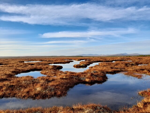
Bad Raphain Mòr is a wooded area located in Caithness, Scotland. Spanning over a vast expanse, it is known for its lush forests and captivating natural beauty. The name "Bad Raphain Mòr" translates to "Wood, Forest" in English, perfectly summarizing the essence of this enchanting destination.

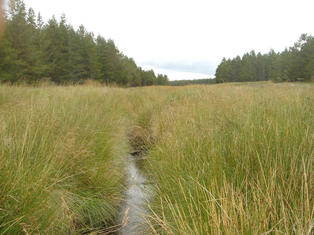
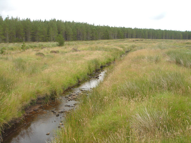
The woodland is characterized by its rich biodiversity, with a variety of tree species dominating the landscape. Ancient oaks, towering pines, and dense underbrush create a dense canopy that shelters a diverse range of flora and fauna. The forest floor is adorned with a carpet of wildflowers, adding splashes of color to the greenery.

The woodland is a haven for wildlife enthusiasts and nature lovers alike. It is home to a plethora of bird species, including owls, woodpeckers, and various songbirds. Other inhabitants of the forest include red squirrels, deer, and foxes, adding to the allure of the area.

Visitors to Bad Raphain Mòr can explore the forest through a network of well-maintained trails, allowing for a closer interaction with nature. The serene atmosphere offers a peaceful retreat, perfect for walking, hiking, or simply enjoying a picnic amidst the serene surroundings.

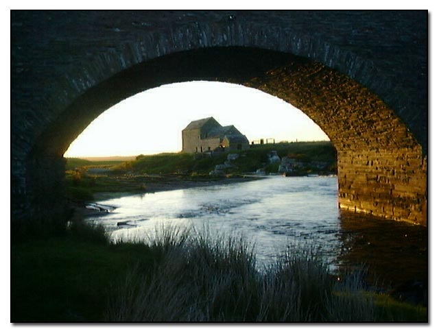
The woodland also has historical significance, with remnants of ancient settlements and archaeological sites scattered throughout the area. These artifacts provide a glimpse into the rich cultural heritage of the region.

Overall, Bad Raphain Mòr in Caithness is a captivating destination that showcases the natural beauty and cultural significance of Scotland. Its picturesque woodlands, diverse wildlife, and tranquil ambiance make it an ideal place for nature enthusiasts and history buffs alike.

If you have any feedback on the listing, please let us know in the comments section below.

Bad Raphain Mòr Images

Images are sourced within 2km of 58.430339/-3.5582602 or Grid Reference ND0950. Thanks to Geograph Open Source API. All images are credited.

The Greenshank Silhouetted against the morning light.
The Greenshank
Silhouetted against the morning light.
Caithness Dubhlochs An area of dubhlochs near Loch Gaineimh.
Caithness Dubhlochs
An area of dubhlochs near Loch Gaineimh.
Caithness Flow Country Dubhlochs on flat boggy peatland.
Caithness Flow Country
Dubhlochs on flat boggy peatland.
Loch Gaineimh Loch a' Chairn can just be seen beyond giving an indication how flat the landscape here is.
Loch Gaineimh
Loch a' Chairn can just be seen beyond giving an indication how flat the landscape here is.
Firebreak The forest has been felled but the firebreak is still apparent.
Firebreak
The forest has been felled but the firebreak is still apparent.
Loch a' Cherigal The area around this part of the loch was quite wet.
Loch a' Cherigal
The area around this part of the loch was quite wet.
Loch a' Cherigal Wet terrain indeed.
Loch a' Cherigal
Wet terrain indeed.
Braehour Forest A Forestry Commission Scotland plantation on peatland
Braehour Forest
A Forestry Commission Scotland plantation on peatland
Allt Loch Meadie This burn flows through Braehour Forest after leaving Loch Meadie. It is populated by Water Voles.
Allt Loch Meadie
This burn flows through Braehour Forest after leaving Loch Meadie. It is populated by Water Voles.
Allt Athain Shalaich, Braehour Forest This small burn flows through a conifer plantation from its source in Loch Meadie. It is populated by water voles.
Allt Athain Shalaich, Braehour Forest
This small burn flows through a conifer plantation from its source in Loch Meadie. It is populated by water voles.
Burn of Olgrinbeg The Burn of Olgrinbeg on the edge of Braehour Forest.
Burn of Olgrinbeg
The Burn of Olgrinbeg on the edge of Braehour Forest.
Braehour Forest A conifer forest planted on peatland. The trees at this point are Lodgepole Pine.
Braehour Forest
A conifer forest planted on peatland. The trees at this point are Lodgepole Pine.
Forest Fence with Watergate Forest fences crossing watercourses require 'watergates' that exclude deer while  being able to withstand spates. Timber construction is normally used but here a watergate has been constructed of modern materials
Forest Fence with Watergate
Forest fences crossing watercourses require 'watergates' that exclude deer while being able to withstand spates. Timber construction is normally used but here a watergate has been constructed of modern materials
Shieling, Braehour Forest Traces of a Shieling Hut, one of several at this location, can be seen on this knoll.
Shieling, Braehour Forest
Traces of a Shieling Hut, one of several at this location, can be seen on this knoll.
Shieling Site, Allt Loch a' Chairn There are the remains of several shieling huts at this location. The site is typical of many shielings: well-drained grassy knolls near to a burn.
Shieling Site, Allt Loch a' Chairn
There are the remains of several shieling huts at this location. The site is typical of many shielings: well-drained grassy knolls near to a burn.
Blanket Bog near Braehour Forest Much of the peatland in this area has been planted with conifers, but this area of bog remains undisturbed.
Blanket Bog near Braehour Forest
Much of the peatland in this area has been planted with conifers, but this area of bog remains undisturbed.
Braehour Forest The Western edge of Braehour Forest, here composed of Lodgepole Pines.
Braehour Forest
The Western edge of Braehour Forest, here composed of Lodgepole Pines.
Bad na Caorach trig
Bad na Caorach trig
Show me another place!

Bad Raphain Mòr is located at Grid Ref: ND0950 (Lat: 58.430339, Lng: -3.5582602)

Unitary Authority: Highland

Police Authority: Highlands and Islands

What 3 Words

///envisage.appendix.slap. Near Halkirk, Highland

Related Wikis

Caithness

Caithness (Scottish Gaelic: Gallaibh [ˈkal̪ˠɪv]; Scots: Caitnes; Old Norse: Katanes) is a historic county, registration county and lieutenancy area of...

Westerdale, Highland

Westerdale (Scottish Gaelic: An Dail Shuas) is a scattered crofting village which lies on the River Thurso, located five miles (eight kilometres) directly...

Olgrinmore

Olgrinmore is a small area in Halkirk, Northern Scotland, south of Thurso and John o' Groats. The B870 runs directly through the centre with Scotscalder...

Tormsdale

Tormsdale is a megalithic site on the banks of the River Thurso, in Caithness, Scotland. It is 3 kilometres (1.9 mi) south of Westerdale. The site consists...

Have you been to Bad Raphain Mòr?

Leave your review of Bad Raphain Mòr below (or comments, questions and feedback).