Archwood Plantation

Wood, Forest in Dumfriesshire

Scotland

Archwood Plantation

A74(M) northbound
A74(M) northbound Credit: Alpin Stewart

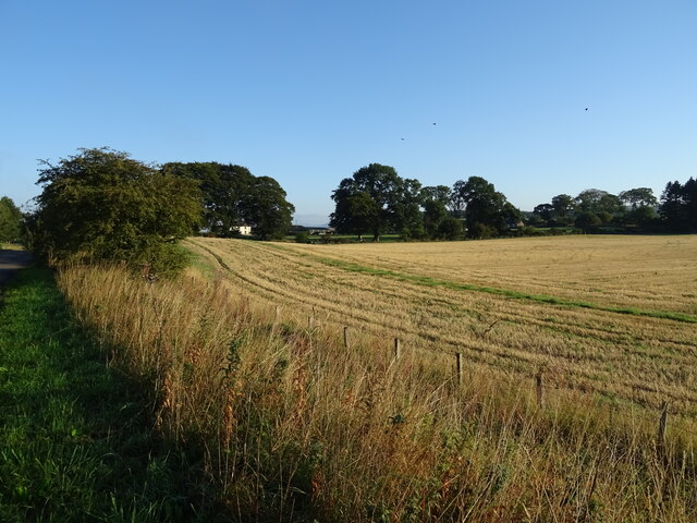
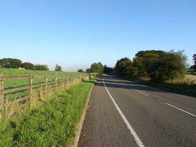
Archwood Plantation is a picturesque woodland area located in Dumfriesshire, Scotland. Covering an expansive area, it is known for its rich biodiversity and stunning natural beauty. The plantation is situated in a rural setting, surrounded by rolling hills and lush greenery.

The woodland consists primarily of native tree species, such as oak, beech, and birch, which thrive in the damp Scottish climate. These trees provide a dense canopy, creating a tranquil and serene atmosphere within the plantation. Visitors can explore the numerous walking trails that wind through the woods, offering opportunities to observe wildlife and enjoy the peaceful surroundings.

Archwood Plantation is home to a diverse range of wildlife. Birdwatchers will delight in the array of species that can be spotted here, including woodpeckers, owls, and various songbirds. The undergrowth of the forest provides a habitat for small mammals, such as squirrels and rabbits. Additionally, the nearby river attracts otters and waterfowl.

The plantation has been carefully managed to maintain its natural integrity, with conservation efforts in place to protect the delicate ecosystem. Visitors are encouraged to respect the environment and adhere to designated paths and trails.

In addition to its natural beauty, Archwood Plantation has historical significance. The remnants of an ancient fort can be found within the woodland, offering a glimpse into the area's past. Archaeological studies have unearthed artifacts dating back centuries, adding to the plantation's cultural value.

Overall, Archwood Plantation is a haven for nature lovers, offering a peaceful retreat and an opportunity to connect with the Scottish countryside.

If you have any feedback on the listing, please let us know in the comments section below.

Archwood Plantation Images

Images are sourced within 2km of 55.176815/-3.428766 or Grid Reference NY0987. Thanks to Geograph Open Source API. All images are credited.

A74(M) northbound
A74(M) northbound
Birch woodland beside the A74(M) From the parallel B7076.
Birch woodland beside the A74(M)
From the parallel B7076.
B7076 towards Johnstonebridge Runs parallel to the A74(M) at this point.
B7076 towards Johnstonebridge
Runs parallel to the A74(M) at this point.
Stubble field, Dinwoodie Green
B7076 towards Johnstonebridge Runs parallel to the A74(M) at this point.
B7076 towards Johnstonebridge
Runs parallel to the A74(M) at this point.
Bridge over the B7076, Dinwoodie Green Towards Johnstonebridge.
Bridge over the B7076, Dinwoodie Green
Towards Johnstonebridge.
Roundabout on the B7076
National Cycle Route 74 Heading north towards Johnstonebridge.
National Cycle Route 74
Heading north towards Johnstonebridge.
Arable land near Dinwoodie Mains 75% of the land of Dumfries and Galloway is given to agriculture
Arable land near Dinwoodie Mains
75% of the land of Dumfries and Galloway is given to agriculture
B7076 towards Lockerbie
B7076 towards Johnstonebridge
Bridge carrying a farm track over the M74 by Dinwoodie Green
Approaching Dinwoodie Green Access Bridge, A74(M) The A74(M) & M74  run over 80 miles from the M6 at the Scottish border near Gretna to the M8 at Glasgow. This is one of the two most important routeways into Scotland from the south. The last stretch of the M74 opened in 2011 (see <a title="https://www.geograph.org.uk/snippet/590" href="https://www.geograph.org.uk/snippet/590">Link</a> ).
Wikipedia: <span class="nowrap"><a title="http://en.wikipedia.org/wiki/A74(M)_and_M74_motorways" rel="nofollow ugc noopener" href="http://en.wikipedia.org/wiki/A74(M)_and_M74_motorways">Link</a><img style="margin-left:2px;" alt="External link" title="External link - shift click to open in new window" src="https://s1.geograph.org.uk/img/external.png" width="10" height="10"/></span>
Approaching Dinwoodie Green Access Bridge, A74(M)
The A74(M) & M74 run over 80 miles from the M6 at the Scottish border near Gretna to the M8 at Glasgow. This is one of the two most important routeways into Scotland from the south. The last stretch of the M74 opened in 2011 (see Link ). Wikipedia: LinkExternal link
Cattle grazing by the A74(M)
Farm track over A74(M) south at Dinwoodie Green
Sweeping curve, A74(M) The A74(M) & M74  run over 80 miles from the M6 at the Scottish border near Gretna to the M8 at Glasgow. This is one of the two most important routeways into Scotland from the south. The last stretch of the M74 opened in 2011 (see <a title="https://www.geograph.org.uk/snippet/590" href="https://www.geograph.org.uk/snippet/590">Link</a> ).
Wikipedia: <span class="nowrap"><a title="http://en.wikipedia.org/wiki/A74(M)_and_M74_motorways" rel="nofollow ugc noopener" href="http://en.wikipedia.org/wiki/A74(M)_and_M74_motorways">Link</a><img style="margin-left:2px;" alt="External link" title="External link - shift click to open in new window" src="https://s1.geograph.org.uk/img/external.png" width="10" height="10"/></span>
Sweeping curve, A74(M)
The A74(M) & M74 run over 80 miles from the M6 at the Scottish border near Gretna to the M8 at Glasgow. This is one of the two most important routeways into Scotland from the south. The last stretch of the M74 opened in 2011 (see Link ). Wikipedia: LinkExternal link
Dinwoodie Green Access Bridge, A74(M) The A74(M) & M74  run over 80 miles from the M6 at the Scottish border near Gretna to the M8 at Glasgow. This is one of the two most important routeways into Scotland from the south. The last stretch of the M74 opened in 2011 (see <a title="https://www.geograph.org.uk/snippet/590" href="https://www.geograph.org.uk/snippet/590">Link</a> ).
Wikipedia: <span class="nowrap"><a title="http://en.wikipedia.org/wiki/A74(M)_and_M74_motorways" rel="nofollow ugc noopener" href="http://en.wikipedia.org/wiki/A74(M)_and_M74_motorways">Link</a><img style="margin-left:2px;" alt="External link" title="External link - shift click to open in new window" src="https://s1.geograph.org.uk/img/external.png" width="10" height="10"/></span>
Dinwoodie Green Access Bridge, A74(M)
The A74(M) & M74 run over 80 miles from the M6 at the Scottish border near Gretna to the M8 at Glasgow. This is one of the two most important routeways into Scotland from the south. The last stretch of the M74 opened in 2011 (see Link ). Wikipedia: LinkExternal link
Farmland, Castle Knowle
Show me another place!

Archwood Plantation is located at Grid Ref: NY0987 (Lat: 55.176815, Lng: -3.428766)

Unitary Authority: Dumfries and Galloway

Police Authority: Dumfries and Galloway

What 3 Words

///quaking.rooster.cities. Near Johnstonebridge, Dumfries & Galloway

Nearby Locations

Archwood Plantation

Related Wikis

Annandale Way

The Annandale Way is a 90-kilometre (56 mi) hiking trail in Scotland, which is officially designated by NatureScot as one of Scotland's Great Trails. It...

Corncockle Quarry

Corncockle Quarry was a large and historically important sandstone quarry near Templand in Dumfries and Galloway, Scotland. Stone from here was used in...

Templand

Templand is a village in Dumfriesshire, Scotland, located around 4.5 miles (7.2 km) northwest of Lockerbie. Templand was built during the Industrial Revolution...

Millhousebridge

Millhousebridge (Scottish Gaelic: Drochaid a' Mhuilinn) is a village in Dumfries and Galloway, Scotland. == References ==

Nearby Amenities

Located within 500m of 55.176815,-3.428766
Power: pole
Lat/Long: 55.1728475/-3.4291807
Power: pole
Lat/Long: 55.1732565/-3.4277562
Power: pole
Lat/Long: 55.1736036/-3.4266408
Power: pole
Lat/Long: 55.1739273/-3.4255306
Power: pole
Lat/Long: 55.1745319/-3.4235317
Power: pole
Lat/Long: 55.1751247/-3.422491
Power: pole
Lat/Long: 55.1757102/-3.4214297
Power: pole
Lat/Long: 55.1752924/-3.4240494
Power: pole
Lat/Long: 55.1760368/-3.4245466
Power: pole
Lat/Long: 55.1767929/-3.4250515
Power: pole
Lat/Long: 55.1775387/-3.4255718
Power: pole
Lat/Long: 55.1782638/-3.4260612
Power: pole
Lat/Long: 55.1789331/-3.4265017
Power: pole
Lat/Long: 55.1796097/-3.4269654
Power: pole
Lat/Long: 55.1802731/-3.4274213
Power: pole
Lat/Long: 55.1782918/-3.4249098
Power: pole
Lat/Long: 55.1807132/-3.4275933
The data included in this document is from www.openstreetmap.org. The data is made available under ODbL.

Have you been to Archwood Plantation?

Leave your review of Archwood Plantation below (or comments, questions and feedback).